
This forecast update covers far southern Illinois, far southeast Missouri, and far western Kentucky. See the coverage map on the right side of the blog.
If you find value in this page and the other weather products on the Weather Observatory web-site then consider making a donation to keep everything up and running. It does cost quite a bit of money each month to run the radars, data feeds, hosting of sites, and more. You can give by visiting our donation page.
Tuesday – Mostly sunny sky conditions. Perhaps some high clouds from time to time. It will be chilly for this time of the year. High temperatures will be in the lower 40’s. Northwest/west winds at 10 mph.
Morning School Bus Stop Weather – Mostly sunny and chilly. Temperatures will be around 30 degrees. Light winds.
Afternoon School Bus Stop Weather – Mostly sunny. Chilly. Temperatures will be around 42 degrees. Light winds.
Tuesday night – Mostly clear sky conditions early. Some increase in clouds after midnight. Chilly. Low temperatures will be in the middle to upper 20’s. East winds at 5 mph.
Wednesday – Becoming cloudy. Cold. A chance for light rain. Rain may be mixed with sleet or snow. Temperatures will range from the upper 30’s to lower 40’s. Southwest winds at 5 mph.
Wednesday night – Cloudy with a few lingering light rain or snow showers. Cool. Low temperatures in the upper 20’s to lower 30’s. Light winds.
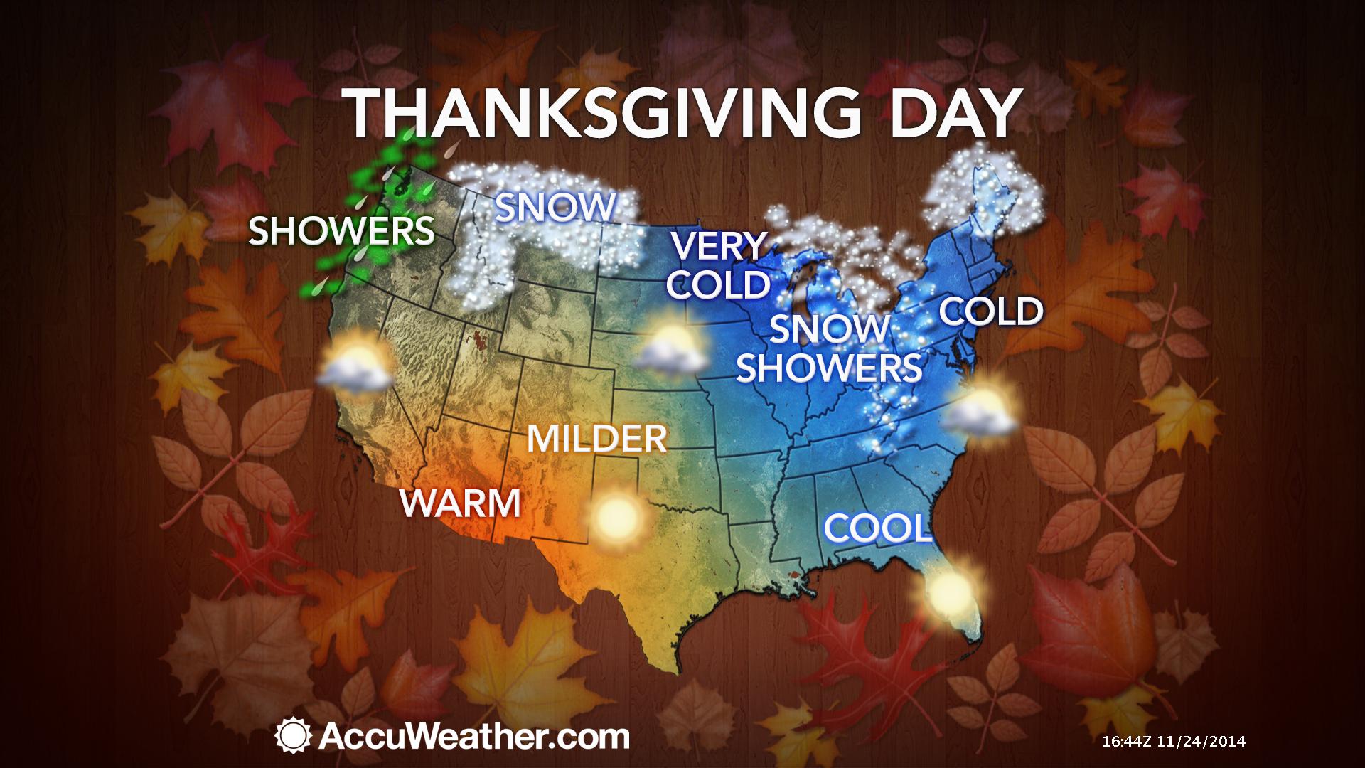
Thanksgiving Day – Partly sunny. Cold. High temperatures in the 38-42 degree range. Northwest at 15 mph.

An explanation of what is happening in the atmosphere over the coming days.
Items of interest in today’s blog…
1. Light precipitation possible Wednesday
2. Dry for Thanksgiving Thursday
3. Some rain chances around Saturday night into Monday
4. A mild and wet first week of December
A calm weather day for the region. Once again temperatures will be WELL below normal. The same song and dance pattern we have been in since last fall. Seems like we have a day or two of above normal temperatures for every 5 days of below normal temperature days.
Current temperatures

The weather will remain calm tonight. Not too cold, but still on the cool side of what we should normally expect for this time of the year.
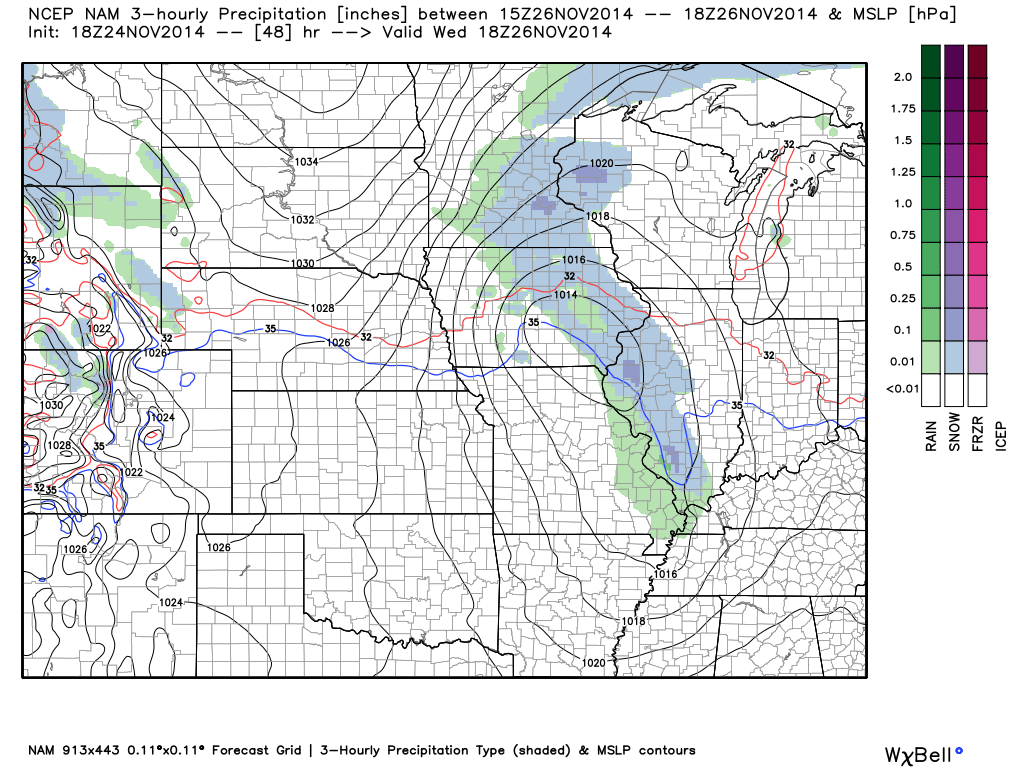
A weak weather system will push out of Canada and dive down into Illinois on Wednesday and Wednesday night. This system will help spark a band of light rain or rain/snow showers across parts of Missouri, Illinois, and Indiana on Wednesday. This band will move southeast and eventually move into parts of Kentucky, as well.
Right now it appears this system is a bit moisture starved. With that said, there should be enough moisture to allow the development of at least light precipitation. Temperatures will be borderline for snow. Perhaps the better chance for a rain/snow mix will be closer to Mt Vernon and then over towards the Indiana border. I will monitor and update. Either way, this does not look to be a significant weather event.
For those traveling on Wednesday – you might check the latest forecast if you are heading north towards central Illinois or central Indiana. This is in care that band of precipitation does produce some light snow.
Thanksgiving Day will bring chilly temperatures and partly sunny sky conditions.
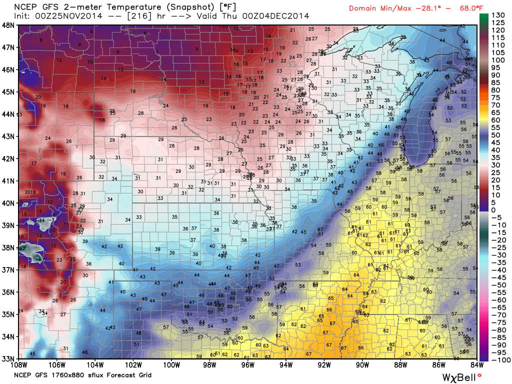
Here is the forecast weather map for Wednesday. This is the NAM model. You can see that weak weather system diving down out of Canada. The blue represents snow or a rain/snow mix. The green represents rain. This image time stamp is around 12 pm through 3 pm.
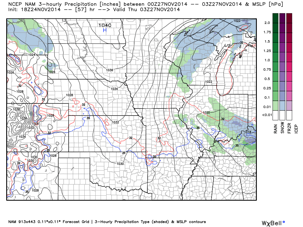
And here is the map a few hours later (Wednesday evening). Whatever precipitation moves into our region should push off to the east.
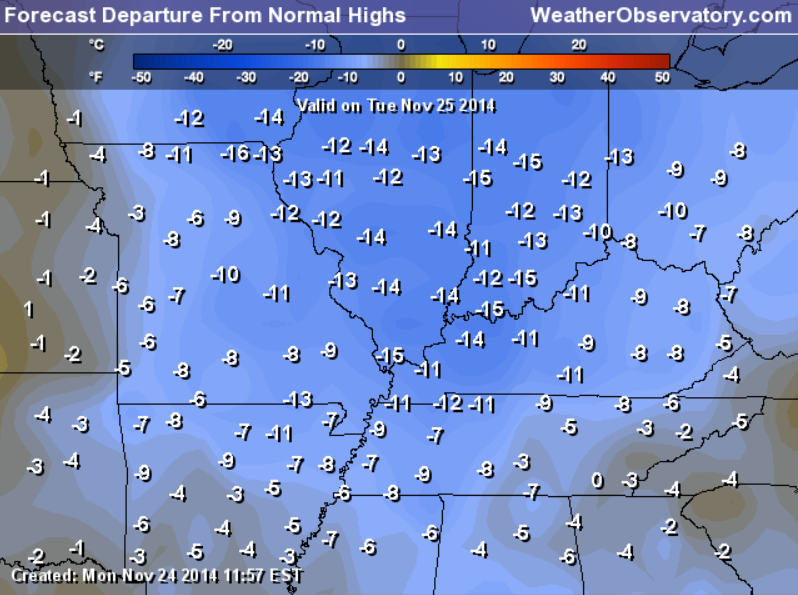
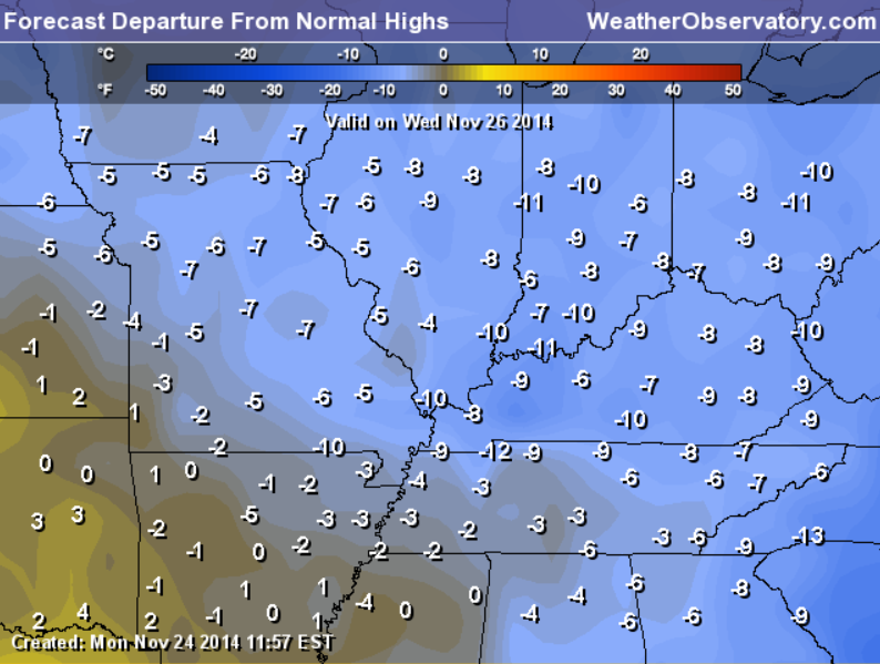
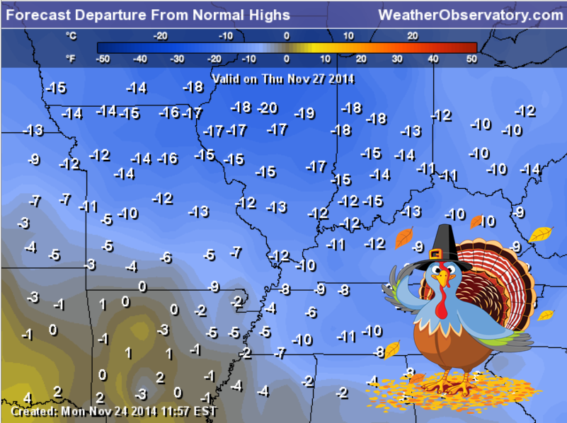
While we are viewing maps…let’s take a look at how many degrees below normal temperatures will be today through Thursday. We have been using these maps quite often over the past few weeks. November is going to go down as one of the colder Novembers on record (for our region and the nation)
REMEMBER, these are not temperature forecasts. These numbers represent how many degrees below normal temperatures will be on Tuesday, Wednesday, and Thursday.
Normal high temperatures for this time of the year are around 58 degrees.
Highs on Tuesday will be in the lower 40’s
Highs on Wednesday will be in the middle 40’sHighs on Thursday will be around 40 degrees.
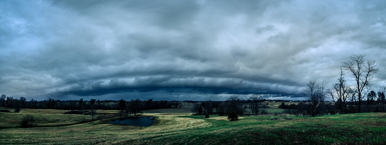
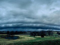
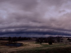
If you were up early enough on Monday morning then you might have witnessed some thunderstorms move through the area. This photograph was taken in Utica, Kentucky – Daviess County, Kentucky by Chris Conley.
A shelf cloud at the leading edge of the thunderstorms. Some of these storms produced 40-50 mph winds.

You can view a larger image(s) by clicking on one of these two thumbnails.

No major changes to the forecast. I did add the possibility of a rain/snow mixture on Wednesday. Iffy as to whether it will be cold enough for snow to mix in with the rain.

No major concerns!

The Wild Card gives you an idea of what might change that would cause the forecast to bust. A busted forecast means a forecast that does not verify. For example, if a winter storm (the area of low pressure) shifts its track 50 miles further south than expected, then that could cause a dramatic change in how much snow might or might not accumulate.
Wild card in this forecast – Whether or not we might see some snow mixed in with the rain on Wednesday. Appears the better chance of this will be north of my forecast counties.

Can we expect severe thunderstorms over the next 24 to 48 hours? Remember that a severe thunderstorm is defined as a thunderstorm that produces 58 mph winds or higher, quarter size hail or larger, and/or a tornado.
Thunderstorm threat level is ZERO.


Will I need to take action?
No.

Please visit your local National Weather Service Office by clicking here. The National Weather Service Office, for our region, is located in Paducah, Kentucky.

How much rain should this system produce over our region?
No rainfall is expected through tonight.
Some light totals possible on Wednesday (less than 0.10″)
Here is the official precipitation forecast that covers the Wednesday event. Some hints of 0.01″-0.05″ around the area.
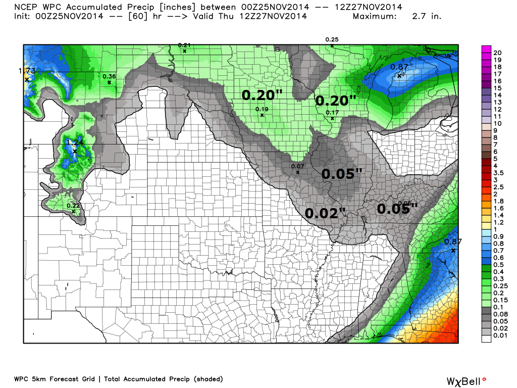

Small chance for a rain/snow mix on Wednesday and Wednesday evening. This does not appear to be a big deal. Novelty flakes for some locations? Perhaps.

What to monitor…
1. Precipitation chances around Saturday night into Monday – should be rain
2. Warmer and wetter weather the first week of December
A calm weather forecast for Thursday and Friday. Should not be any problems for Black Friday shoppers.
I am watching for the potential of rain on Sunday and Monday.
The longer range data continues to show a warming trend for the first week of December. This could also mean rain chances will go up. Long way off, but that is what I am watching.
The data is mixed on temperatures next Monday. Some of this depends on where the cold front ends up being placed. Warm to the south and cold to the north. Some data indicates falling temperatures on Monday.
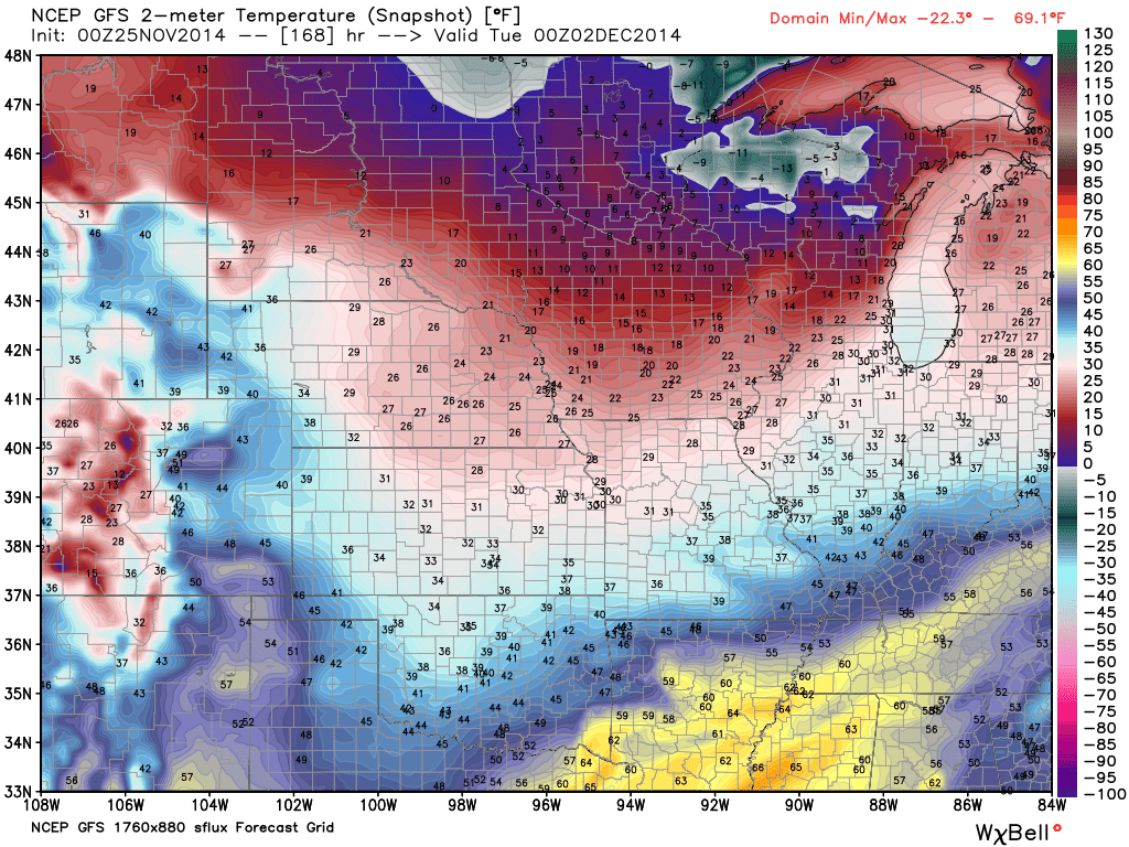
Here is the Monday evening temperature map – the map after this one is showing temperatures for next Wednesday. Some decent swings in temperatures as each storm system moves through the central United States.
Monday afternoon temperatures – those dark blue colors are temperatures in the 40’s (hard to read, I know)
Temperatures next Wednesday afternoon – the GFS is painting some 60’s over our region. Long way – we shall see.
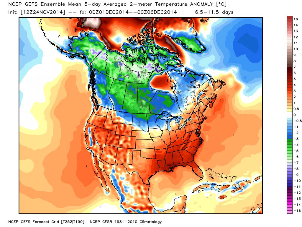
Here is the GFS ensembles for temperature anomaly’s spanning from December 1st through December 6th. All of that red means above normal temperatures. The green and blue colors are bottled up over Canada. That would be the below normal temperatures.
Surely nobody will complain if the first week of December is a bit warmer than normal? You did have all of November to enjoy the cold (and snow).
Here is the official 8-10 day temperature forecast. All of that red means above normal temperatures.

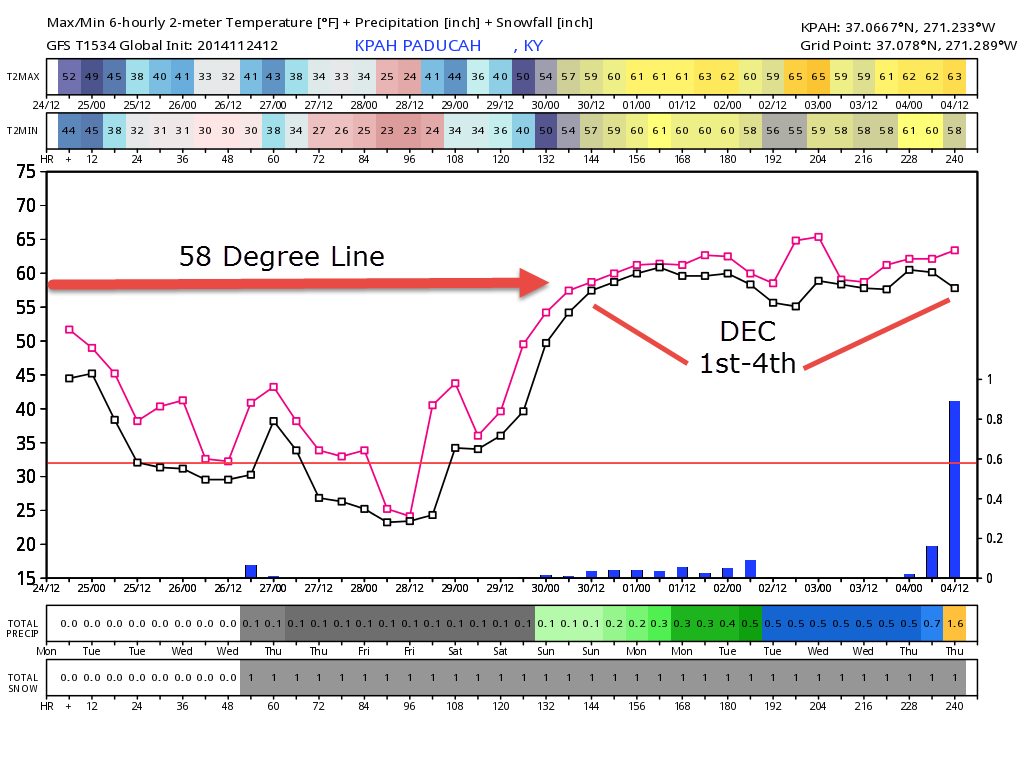
The GFS ensembles are showing above normal temperatures next week. Here is the Paducah, Kentucky graph. You can see the December 1st through 4th time stamps. I drew the 58 degree line in red. You can see temperatures may reach into the 60’s during the first week of December.
The pink line is the high temperature mark
The black line is the low temperature mark.
The little blue bars at the bottom of the graph represent some rain chances.
 ——
——
Many of my graphics are from www.weatherbell.com – a great resource for weather data, model data, and more


This blog was inspired by ABC 33/40’s Alabama Weather Blog – view their blog
Current tower cam view from the Weather Observatory- Click here for all cameras.

Southern Illinois Weather Observatory

The Weather Observatory

Southern Illinois Weather Observatory
WSIL TV 3 has a number of tower cameras. Click here for their tower camera page & Illinois Road Conditions

Marion, Illinois
WPSD TV 6 has a number of tower cameras. Click here for their tower camera page & Kentucky Road Conditions & Kentucky Highway and Interstate Cameras

Downtown Paducah, Kentucky
Benton, Kentucky Tower Camera – Click here for full view

Benton, Kentucky

I24 Paducah, Kentucky

I24 Mile Point 9 – Paducah, KY

I24 – Mile Point 3 Paducah, Kentucky

You can sign up for my AWARE email by clicking here I typically send out AWARE emails before severe weather, winter storms, or other active weather situations. I do not email watches or warnings. The emails are a basic “heads up” concerning incoming weather conditions.