
November 19, 2014: This forecast update covers far southern Illinois, far southeast Missouri, and far western Kentucky. See the coverage map on the right side of the blog.
Wednesday – A mix of sun and clouds. Periods of cloudy sky conditions. Not as cold as recent days. High temperatures from 42 to 46 degrees. Southwest winds at 10-15 mph. Gusts to 25 mph.
Morning School Bus Stop Weather – A few clouds. Temperatures at the bus stop will be around 25 degrees. South winds at 10 mph.
Afternoon School Bus Stop Weather – A few clouds. Cold for November. Temperatures from 2 pm to 4 pm will be in the 40’s. Southwest winds at 10-20 mph.
Wednesday night – Clearing and cold. Low temperatures will be from 18 to 24 degrees. Northwest winds at 10 mph.
Thursday – Mostly sunny. Cold. High temperatures will only be in the upper 30’s. West/northwest winds at 5-10 mph.
Thursday night – Increasing clouds through the night. Chilly. Low temperatures around 28 degrees. .
Friday – Increasingly cloudy. A chance for a light shower early and then a chance for showers. High temperatures will be near 42 degrees degrees.
Confidence in the above forecast:

An explanation of what is happening in the atmosphere over the coming days.
Another cold front will approach our region this afternoon and evening. Most of the moisture with this system will remain well to our north. No concerns for snow or ice! The front will, however, bring gusty winds and some clouds. Temperatures will remain cold into Friday morning. Although it will feel warmer than recent days.
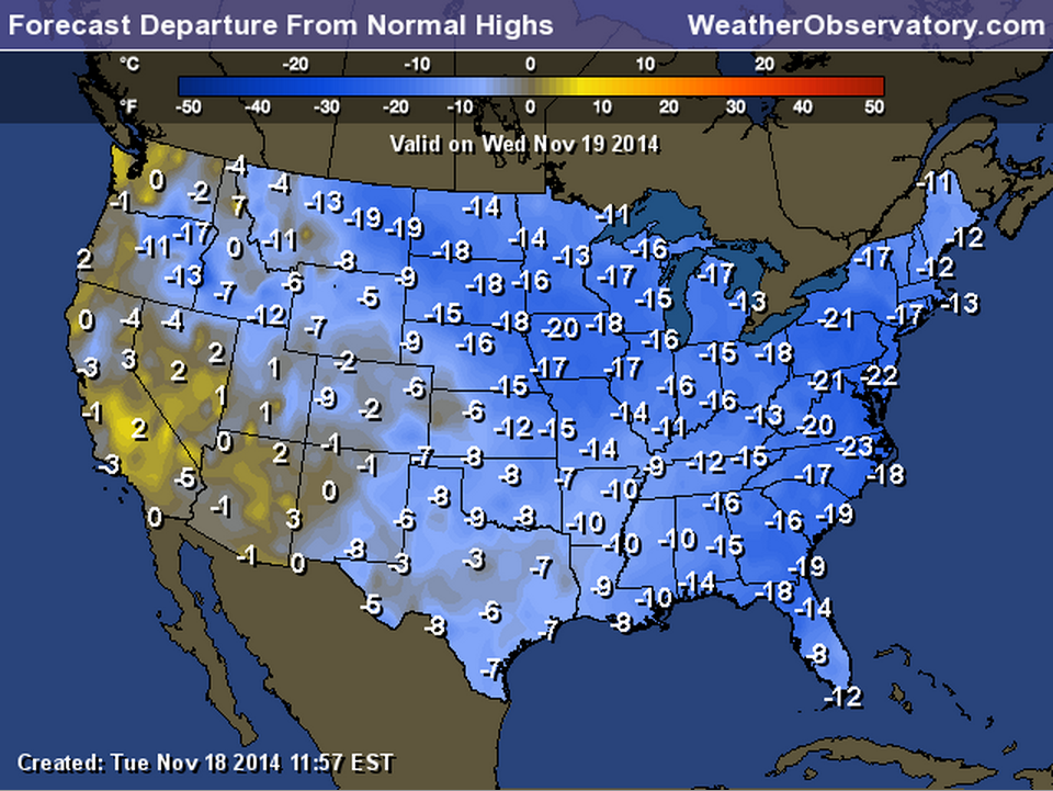
Temperatures will still be below normal today. How many degrees below? Well, let’s take a look. I guess this beats being 20 to 30 degrees below normal? We will take what we can get.
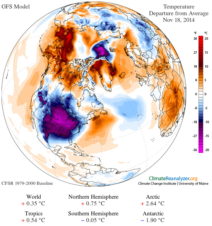
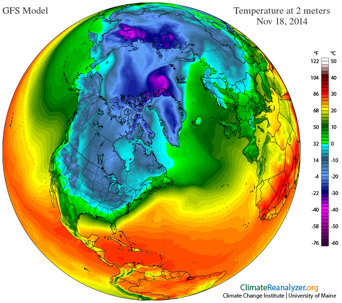
I know I keep telling you that it is cold. But, don’t take it from just me. Check out this image showing the world temperature anomaly map.
The blue and purple area represents WELL below normal temperatures. Scale is on the right side of the image. Some of the coldest anomalies in the world are centered over our region.
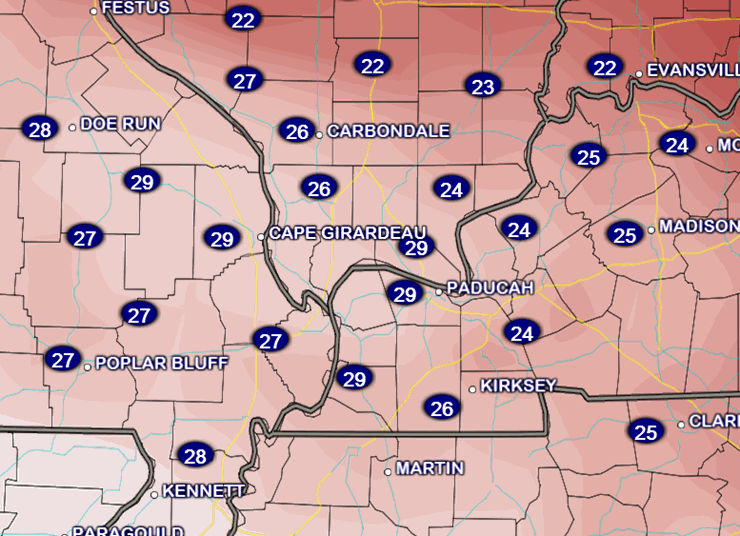
This next map shows you the actual temperatures. Check out how much of the United States is covered in cold air. This is amazing.
Okay, well enough about how cold it is. Not like I am telling you a secret.
Our next weather maker will approach the region from the south on Friday. This system will help trigger some light precipitation. At this time it appears the bulk of the precipitation will fall in the form of rain. There is a small window of opportunity for freezing rain early on Friday morning. This would be highly dependent on precipitation arriving before temperatures rose above freezing. Keep in mind, as well, that road temperatures will be quite cold on Friday morning. There could be a small delay in the time that road temperatures will rise above freezing vs surface temperatures.
It appears far southern Illinois, western Kentucky, and far southeast Missouri should rise above freezing by 10 am to 12 pm. If precipitation holds off until after that time then there won’t be any concerns. Stay tuned and monitor updates. Thermal profiles (temperatures aloft) favor freezing rain – not snow. But, again – that would need precipitation to actually move in early in the morning. That is not a given. Right now it appears precipitation will hold off long enough to prevent any problems.
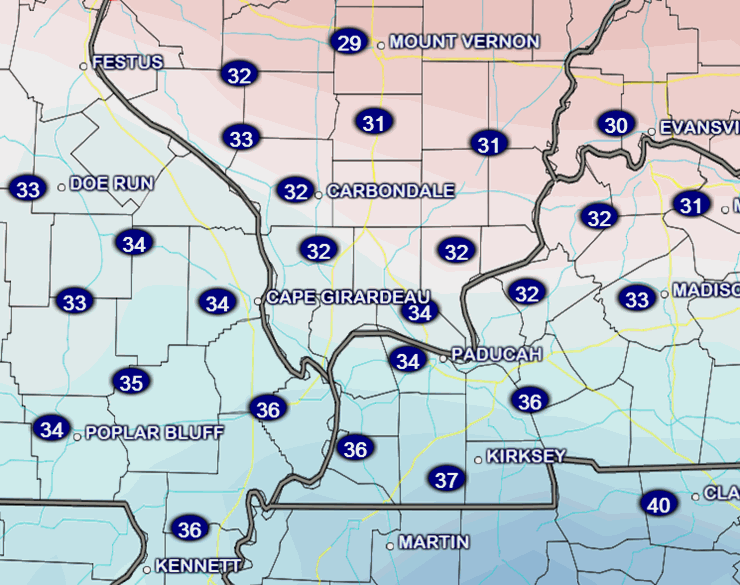
Here is the temperature forecast for 7 am Friday and 1 pm Friday – you can see the slow/gradual rise in temperatures.
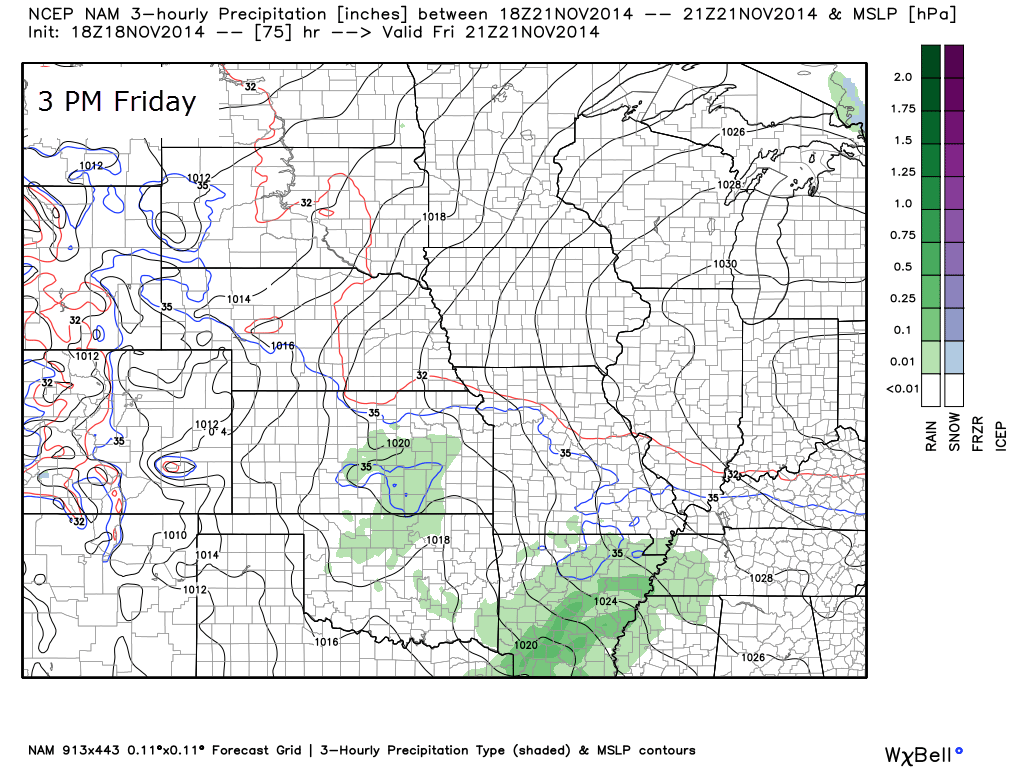
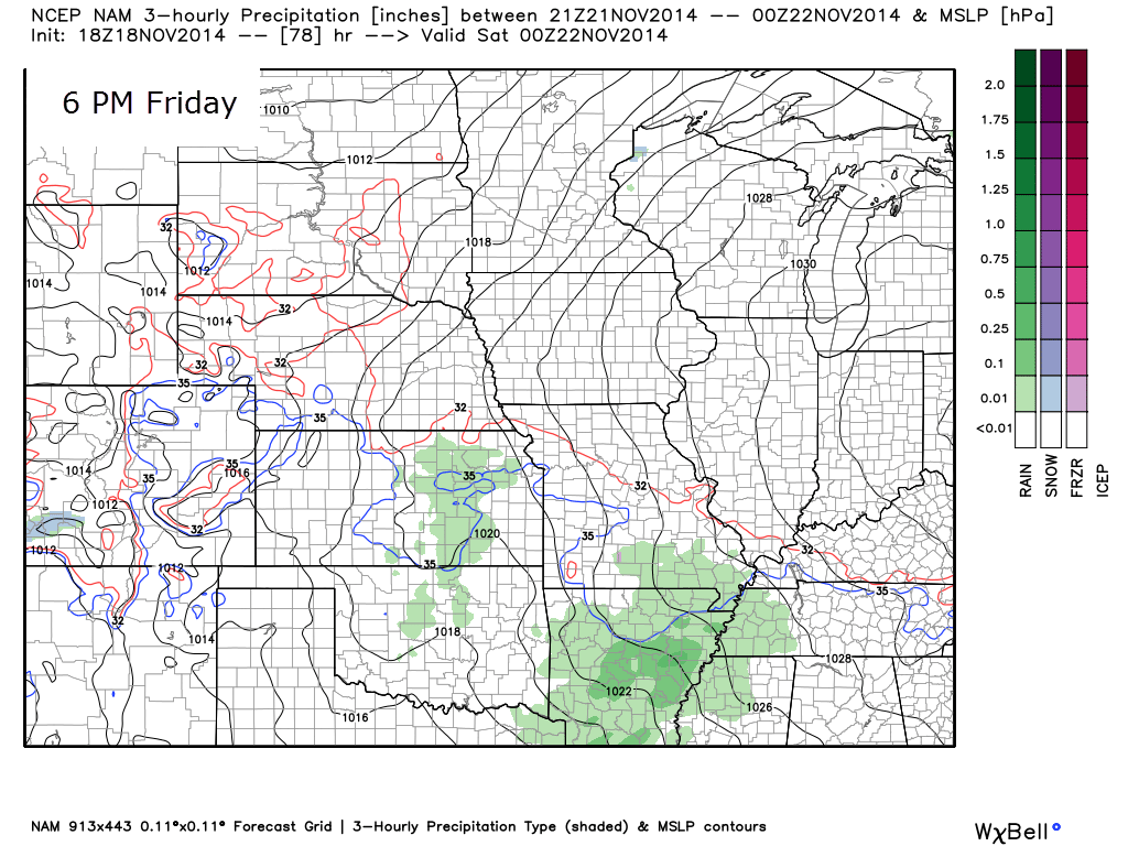
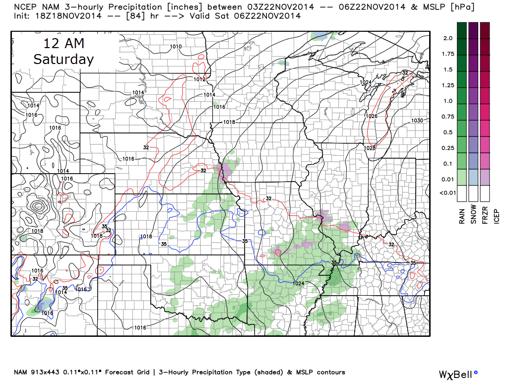
Let’s take a look at the NAM model and the future-cast radar (what radar might look like on Friday). The green area is rain. The purple would be freezing rain.
These three maps represent Friday afternoon into Friday night. If the precipitation does not move into the region until late morning or early afternoon then we should be okay. This will need monitoring.
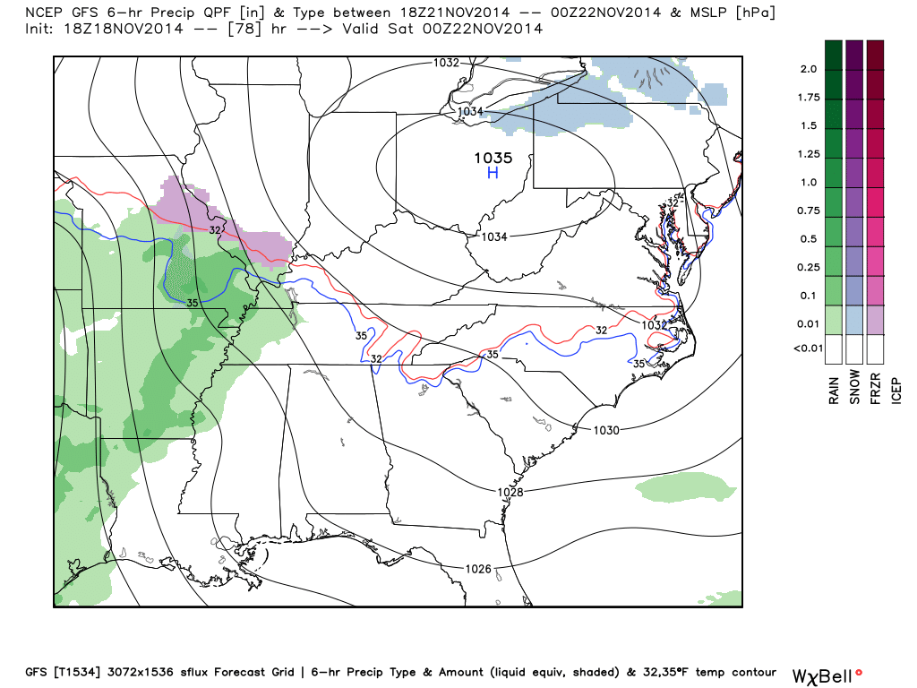
Our new friend, the high resolution GFS, also shows precipitation moving into our region on Friday. The GFS brings precipitation into southeast Missouri and western Kentucky between 2 pm and 5 pm.
You can see some mixed precipitation over parts of MO and IL. This is all really a matter of timing.
If the system spreads moisture into our region sooner than expected then there will be some concerns. For now, it appears temperatures should warm enough to prevent major travel problems. As always, I will keep an eye on it.
Keep in mind that the further north you travel the better chance that temperatures might still be below freezing when precipitation moves into the area. If you have travel plans north on Friday then monitor updates.
Either way, there will be a chance for some showers Friday into Saturday. Perhaps even some thunderstorms late Saturday night. Ride the wave?
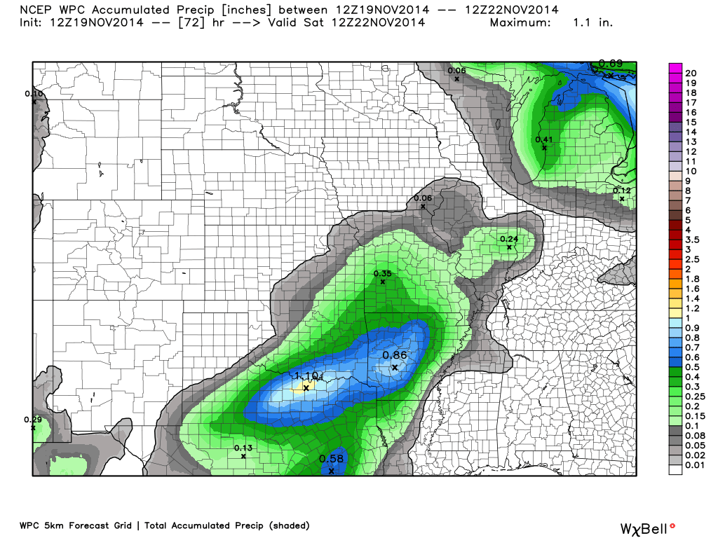
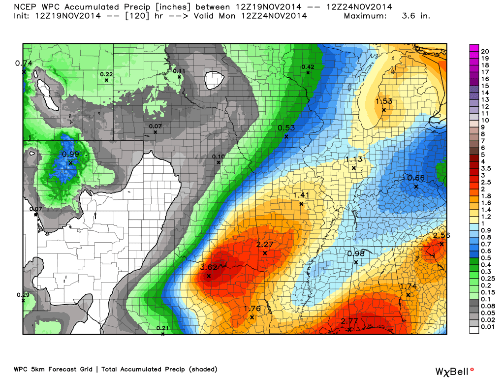
How about precipitation totals through Saturday moring? How much rain might fall? Well, that chart is not all that impressive. The heavier amounts will be to our west.
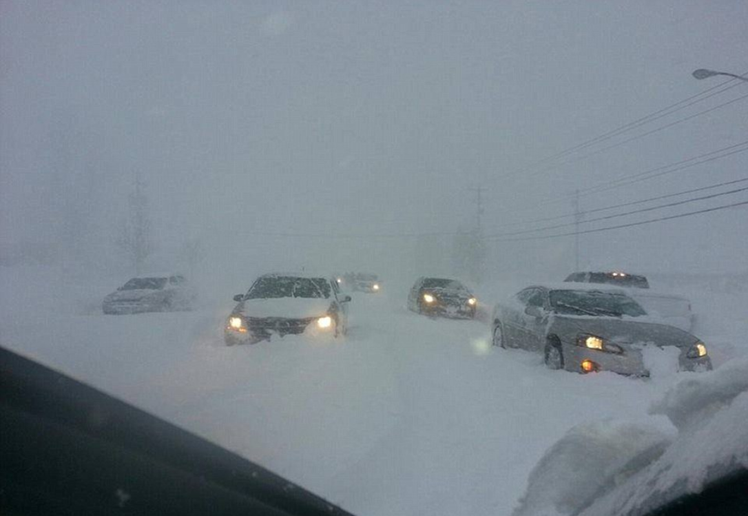
Conditions in our region could always be worse. Check out this photograph from Greenville, Michigan. Heavy lake effect snow has pummeled that area and many other areas near the Great Lakes. Portions of western New York are expecting 4 to 6 FEET of snow.
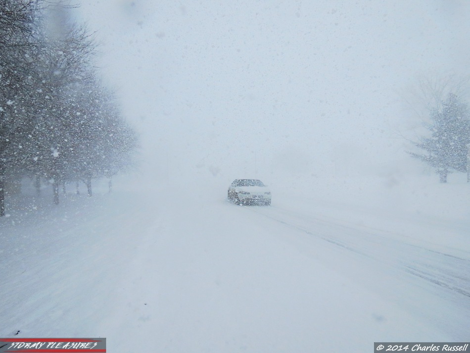
Massive Snow Storm – Western New York (photos and more information click here)
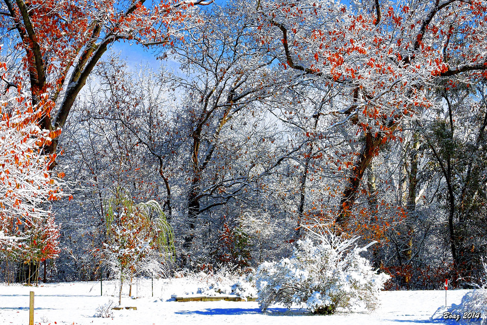
Another more peaceful photograph from New Albany, Indiana (below). This image was posted on Wunderground.com
Nature can be quite beautiful – yes, even the snow
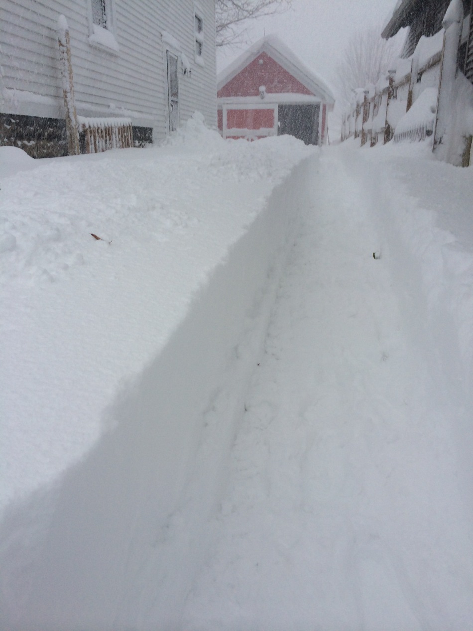
One more photograph to feed the snow enthusiasts among us (am I projecting)
This photograph was taken in western New York State (Blasdell, NY – posted on Wunderground) Lake effect snow. Cold air blowing over the warmer lakes. This produces heavy snow.
Back to our local weather…stop daydreaming about snow.
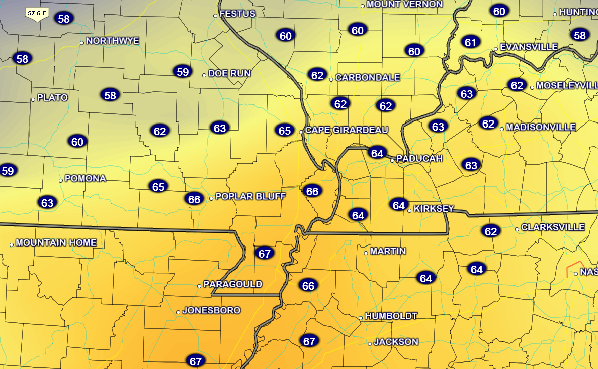
Let’s take a look at the current temperature map across the region.

Current National Temperature Map

IR Satellite Image – during cold weather there could be a lot of white on this map. That is not necessarily clouds. Cold temperatures can also show up on this satellite image.
Typically the brighter colors represent clouds.

Water Vapor Satellite Map – this satellite image gives you a good idea of when moisture is streaming into our region. Again, some of the milky white colors could represent cold temperatures.


Increased wording on rain chances for Friday into Saturday night. Also added the mention of thunderstorms for Saturday night.

I am keeping an eye on the timing of precipitation for Friday morning. Road temperatures will be cold during the morning hours. There is a small chance that precipitation will move in fast enough to cause a brief period of freezing rain. The overall risk appears small. But, will need to be closely monitored. Still 2 days out.
Temperatures will be on the rise Friday morning into the afternoon hours. If freezing rain were to occur then the timing would have to be fairly early in the day. At this point there isn’t even guarantee that precipitation will move in before temperatures rise above freezing.
What does that mean? Check back for updates is what that means.

Not over the next 24 hours. No significant weather to speak of. Cold.

The Wild Card gives you an idea of what might change that would cause the forecast to bust. A busted forecast means a forecast that does not verify.
Wild card in this forecast – the timing of precipitation on Friday will be the wild card. If precipitation moves in faster than anticipated then there could be a brief period of freezing rain. Temperatures will rise above freezing, for far southern Illinois and western Kentucky, by 9 am or 11 am (Friday morning).

Precipitation forecast for the next 24-48 hours…
No additional measurable precipitation is expected through Thursday.
Rainfall totals, however, do increase over the weekend. Let’s take a look at the rainfall forecast Friday through Monday morning. Some decent showers and perhaps thunderstorms by later in the weekend. Could be some locally heavier totals.
Most of this falls on Saturday night into Sunday evening.

No significant winter weather concerns through Thursday. I will be keeping an eye on the timing of precipitation late on Thursday night and into Friday morning.

1. Rain chances increase on Friday – small chance for freezing rain (check back for updates)
2. BRIEF warm-up for the weekend
3. Rain and thunderstorms possible by Saturday night/Sunday. Windy conditions ahead of the system.
4. Another cold blast for much of next week (go figure)
5. Another chance for precipitation along an arctic cold front around next Wednesday?
A stronger storm system will approach our region on Saturday night and Sunday. If this system would have deeper moisture to work with then I would be concerned about severe thunderstorms. The wind profiles will be strong. The area of low pressure will tighten up and move just to the west of our local counties. Warm air will surge northward from the Gulf of Mexico. This would normally be a bad combination for us.
It appears the higher dew points will remain a tad south of our area. This will, however, need to be closely monitored. The track of the storm, the time of year, and the wind fields associated with the system do favor severe thunderstorms It just appears that the current cold air mass may save us from serious problems. This cold air mass has pushed all the way to the Gulf of Mexico. This has scoured out the better moisture. (and reduced our chances that the Sunday system will produce severe weather).
Let’s take a look at the temperature departure map for Sunday. I have been showing you day after day how many degrees below normal we would be for daytime highs. Well, let’s look at Sunday. GASP – temperatures will be above normal!!!!! Yes, with a price (wind and rain).
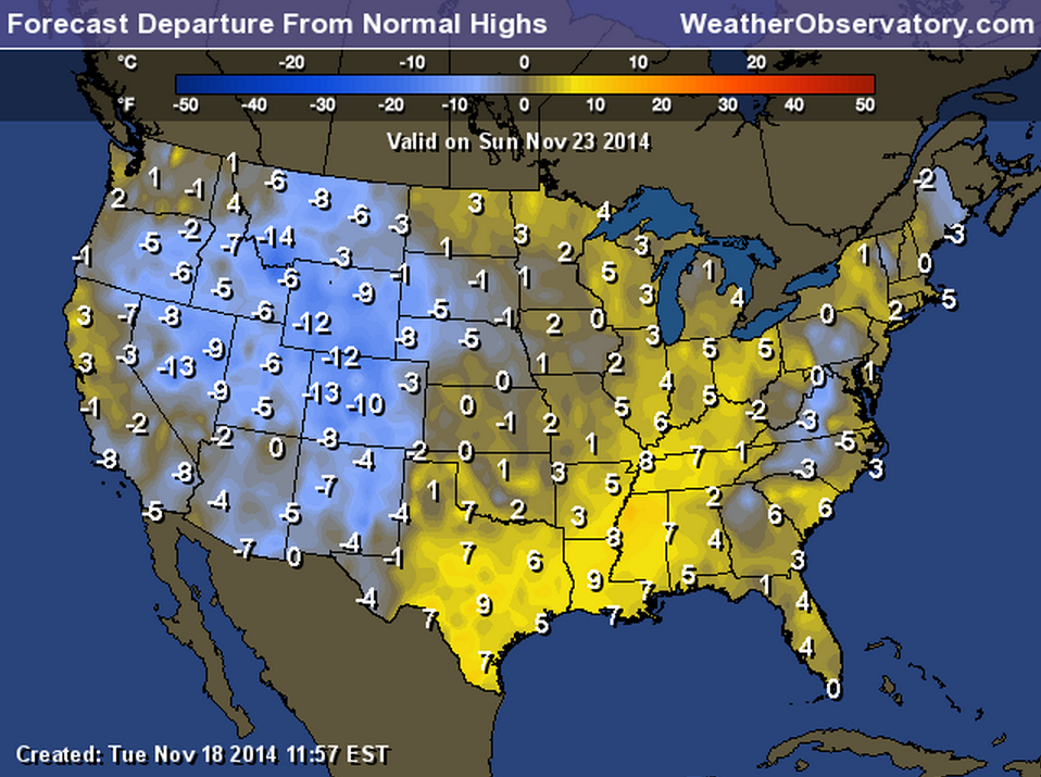
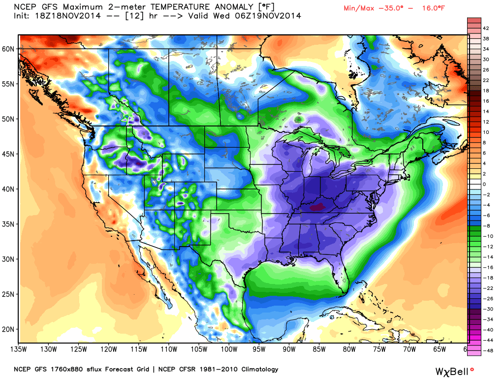
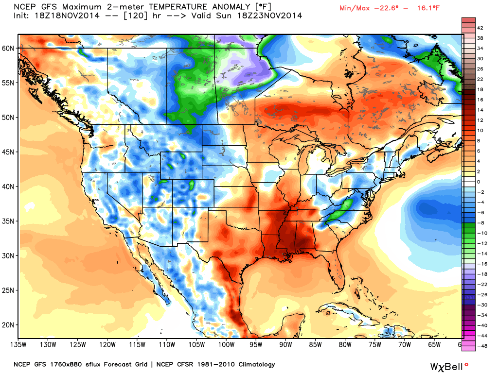
You can see the difference between today (Wednesday) and Sunday’s anomaly maps (the 2 images below). Again, an anomaly map tells you how much above or below normal temperatures are. Notice today’s anomaly maps shows temperatures WELL below normal. But, compare that to Sunday. See the warm surge of above normal temperatures?
This morning temperature anomaly map (cold air covers our region behind the storm system that brought our most recent winter storm)
Sunday’s temperature anomaly map (temperatures warm ahead of a deep area of low pressure that will track to our west and north on Sunday). Low pressure spins counter-clockwise. That means if it passes to our west that we are on the warm side of the system. It pulls warm and moist air northward. Thus, Sunday will bring mild air (briefly) into our local area.
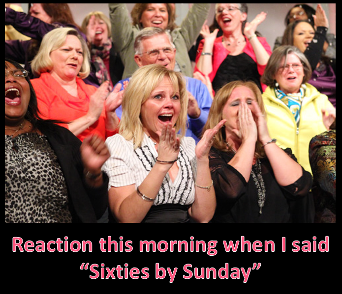
SIXTIES BY SUNDAY!!!!
As it stands, Saturday night and Sunday will bring windy conditions with an increasing chance of showers and thunderstorms. Some heavy downpours can’t be ruled out. Gusty winds, as well.
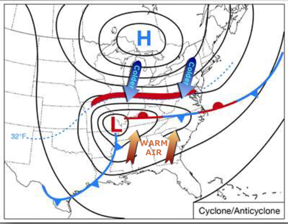
Here is a graphic example of how an area of low pressure pulls warm air northward into our region. Again, the area of low pressure (the big L) rotates counter-clockwise. This pulls warm air northward
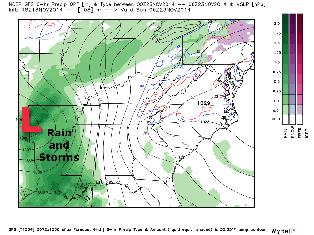
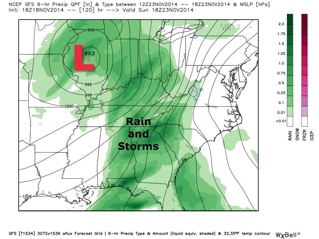
Let’s take a look at the future-cast precipitation maps for Sunday. You can see that area of low pressure pulling out of Arkansas and eventually into Missouri and Illinois. Again, this is a favorable track for rain and storms in our region.
First graphic – Midnight on Saturday night/Sunday morning. The low pressure is pulling out of Arkansas. Warm and moist air is spreading into our region. Those black lines packed closely together are isobars. Equal lines of barometric pressure. Tightly packed lines mean windy conditions.
Second graphic – 12 pm on Sunday afternoon. Deep area of low pressure is pushing through central Illinois. A cold front trails into our region. Widespread showers and thunderstorms along the front.
Let’s take a quick look at instability. These are the current forecasted CAPE values (CAPE is energy – Convective Available Potential Energy). You do not need high numbers during the winter months to raise concern. I will need to monitor Sunday. Right now it appears the severe weather risk is minimal (not zero). Check back.
This small blue ribbon indicates an area of instability ahead of the cold front and ahead of the area of low pressure (in the warm sector of the system).
This 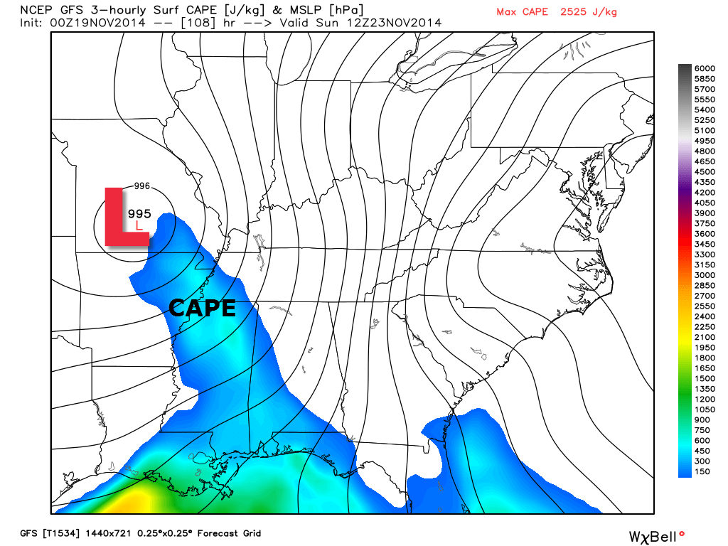
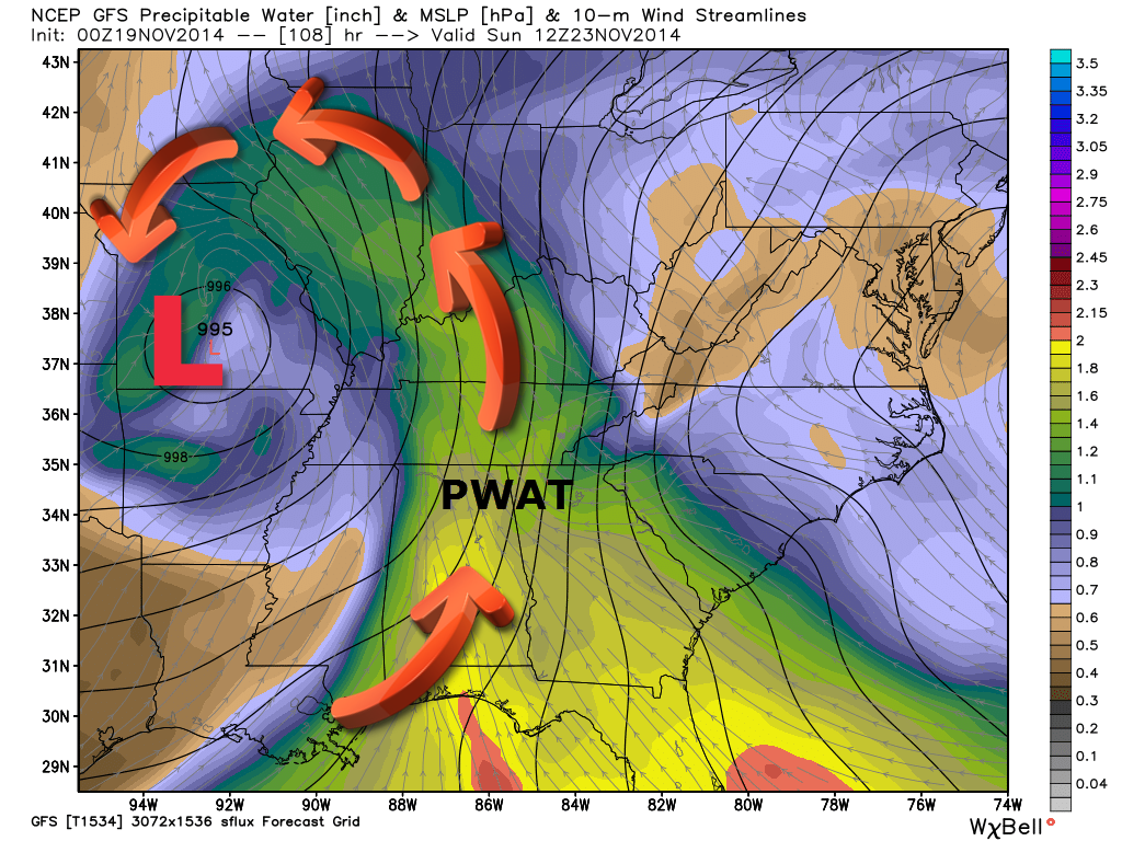
This next image shows you PWAT values. What in the world does PWAT mean? Glad you asked. Precipitable Water Values. This is used to determine that amount of moisture in the troposphere. Higher PWAT values equal more moisture the atmosphere. You can see the storm system to our west pulling moisture up from the Gulf of Mexico. According to this map, we could have some heavy downpours on Sunday. Perhaps some thunderstorms, as well.
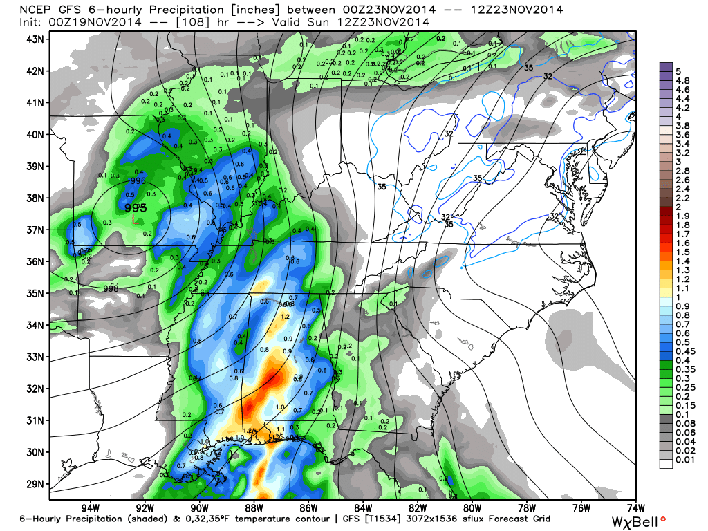
Here is a map (below) showing six hour rainfall totals for Sunday morning. We will have to see what time the cold front arrives and pushes through the area. Once the cold front moves through our local counties then we won’t have to concern ourselves with thunderstorms.
Rainfall totals centered on 6 am Sunday morning (six hour rainfall totals). The scale is on the right side of the page. Generally speaking the GFS model is showing 0.40″-0.70″ of rainfall with the Sunday system.
Check out Sunday’s high temperatures. This is around 1 pm. SURGE of warmer air briefly pushes back into our region. It won’t last long. A cold front moves through on Sunday afternoon with colder temperatures behind it.
I guess we will take what we can get.

Another storm system approaches our region next Wednesday and Thursday. A bit early for details on that one.
Another blast of cold air arrives early next week into Thanksgiving. I can’t rule out additional wintry precipitation. Plenty of time to monitor. This is going to be a long winter.
Some extended temperature and precipitation outlooks…


The latest 8-14 day temperature and precipitation outlook. Note the dates are at the top of the image. These maps DO NOT tell you how high or low temperatures or precipitation will be. They simply give you the probability as to whether temperatures or precipitation will be above or below normal.


Can we expect severe thunderstorms over the next 24 to 48 hours? Remember that a severe thunderstorm is defined as a thunderstorm that produces 58 mph winds or higher, quarter size hail or larger, and/or a tornado.
Severe weather is not going to be a concern through Saturday.
Thunderstorm threat level is zero.


Please visit your local National Weather Service Office by clicking here. The National Weather Service Office, for our region, is located in Paducah, Kentucky.
![]()
We have regional radars and local city radars – if a radar does not seem to be updating then try another one. Occasional browsers need their cache cleared. You may also try restarting your browser. That usually fixes the problem. Occasionally we do have a radar go down. That is why I have duplicates. Thus, if one fails then try another one.
If you have any problems then please send me an email beaudodson@usawx.com
WEATHER RADAR PAGE – Click here —
We also have a new national interactive radar – you can view that radar by clicking here.
Local interactive city radars include St Louis, Mt Vernon, Evansville, Poplar Bluff, Cape Girardeau, Marion, Paducah, Hopkinsville, Memphis, Nashville, Dyersburg, and all of eastern Kentucky – these are interactive radars. Local city radars – click here
NOTE: Occasionally you will see ground clutter on the radar (these are false echoes). Normally they show up close to the radar sites – including Paducah.

Regional Radar – Click on radar to take you our full radar page.


Regional Radar

Current WARNINGS (a warning means take action now). Click on your county to drill down to the latest warning information. Keep in mind that there can be a 2-3 minute delay in the updated warning information.
I strongly encourage you to use a NOAA Weather Radio or warning cell phone app for the most up to date warning information. Nothing is faster than a NOAA weather radio.


Missouri Warnings

Illinois Warnings

Kentucky Warnings
I have added a lot of new maps to the Southern Illinois Weather Observatory web-site. Check them out by clicking here.
Current tower cam view from the Weather Observatory- Click here for all cameras.

Southern Illinois Weather Observatory

The Weather Observatory

Southern Illinois Weather Observatory
WPSD TV 6 has a number of tower cameras. Click here for their tower camera page
& Kentucky Road Conditions & Kentucky Highway and Interstate Cameras

Downtown Paducah, Kentucky
Benton, Kentucky Tower Camera – Click here for full view

Benton, Kentucky
WSIL TV 3 has a number of tower cameras. Click here for their tower camera page
& Illinois Road Conditions

Marion, Illinois

I24 Paducah, Kentucky

I24 Mile Point 9 – Paducah, KY

I24 – Mile Point 3 Paducah, Kentucky

You can sign up for my AWARE email by clicking here I typically send out AWARE emails before severe weather, winter storms, or other active weather situations. I do not email watches or warnings. The emails are a basic “heads up” concerning incoming weather conditions.