

November 18, 2014: This forecast update covers far southern Illinois, far southeast Missouri, and far western Kentucky. See the coverage map on the right side of the blog.
Tuesday – Mostly sunny and cold. Just a few passing clouds. Temperatures holding steady in the 20’s. West/Northwest winds at 10 mph.
Morning School Bus Stop Weather – Mostly sunny and bitterly cold. Temperatures between 6 am and 8 am will be in the teens. West/northwest winds at 10 mph.
Afternoon School Bus Stop Weather – Mostly sunny. Cold. Temperatures from 2 pm to 4 pm will be in the 20’s. West winds at 10 mph.
Tuesday night – Clear and cold. Lows in the lower 20’s. Wind becoming southerly at 10-15 mph.
Wednesday – A mix of sun and clouds. Periods of cloudy sky conditions. Not as cold as recent days. High temperatures from 40 to 45 degrees. Southwest winds at 10-15 mph. Gusts to 25 mph. Winds turning westerly after 2 pm at speeds of 10 mph.
Wednesday night – A few clouds. Cold. Well below normal temperatures. Lows in the middle 20’s. West winds at 5-10 mph.
Thursday – Partly cloudy and a tad colder. High temperatures only in the upper 30’s to around 40. West winds at 5-10 mph.
Confidence in the above forecast:
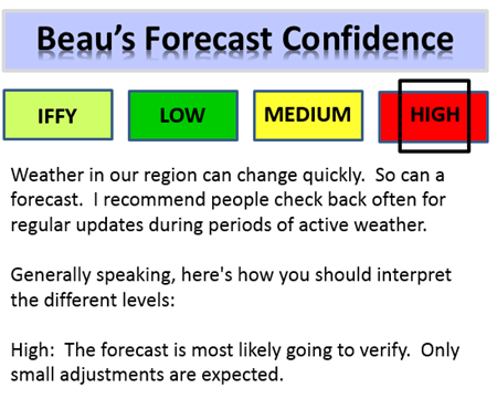

An explanation of what is happening in the atmosphere over the coming days.
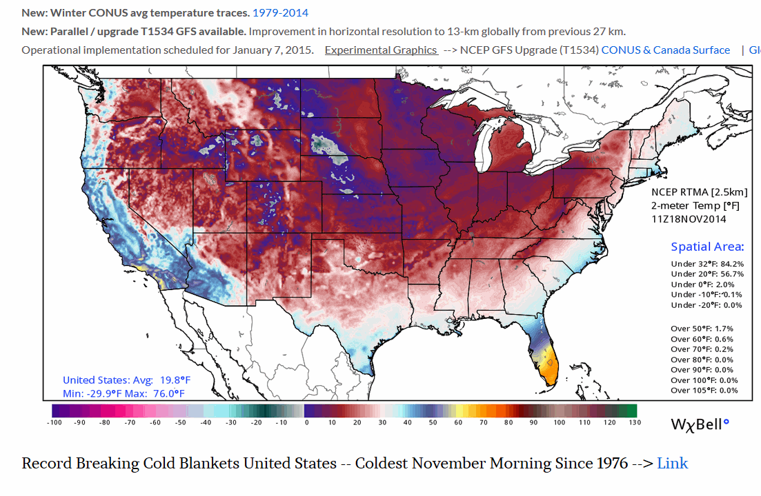
First off, I wanted to show you some information from Ryan Maue (weatherbell.com). I know you realize it is cold for November. But, you probably did not realize the stats.
Tuesday morning, America ‘as a whole’ awoke to the coldest it has been in November since 1976~ 38 years ago. The Lower-48 or CONUS spatially average tempearture plummeted overnight to only 20 degrees F typical of mid-winter not November 18th!
Now, back to our local region
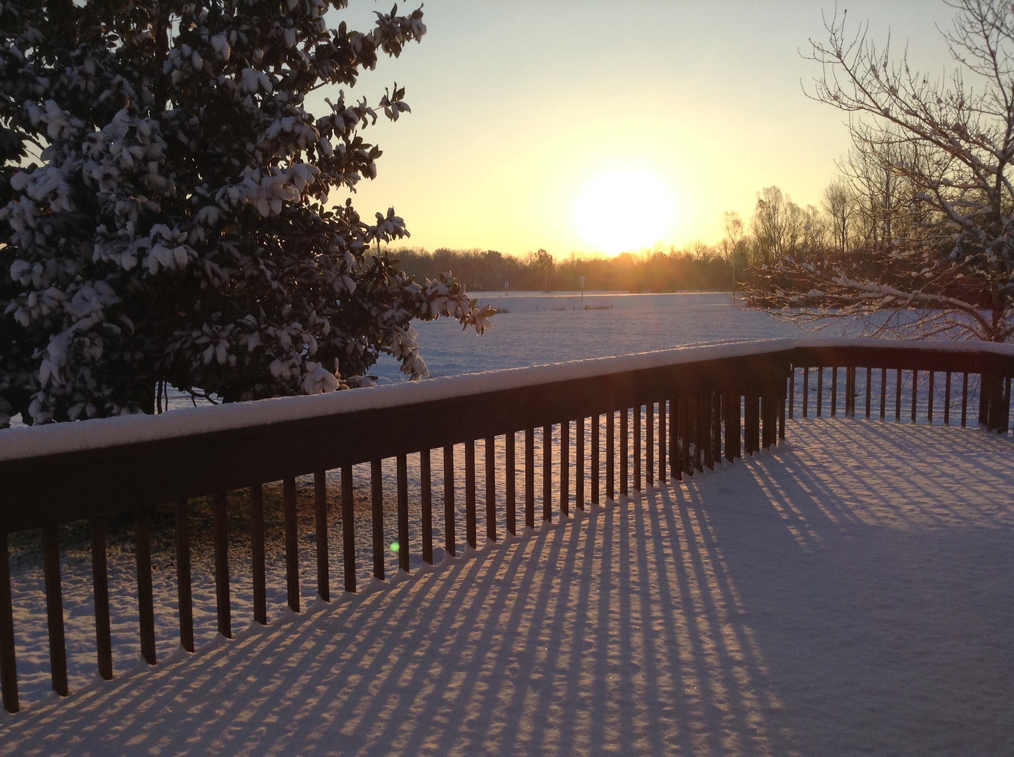
I hope everyone is keeping warm this morning. Hot cocoa? Hot coffee? A warm breakfast? An extra blanket, no doubt on the bed last night.
How does it feel to have January temperatures in November? A bit odd! This will likely go down as one of the colder November’s in the nations history.
I am guessing frozen turkey will be on the Thanksgiving menu. Perhaps by then we can thaw things out a bit. Let’s cross our fingers.
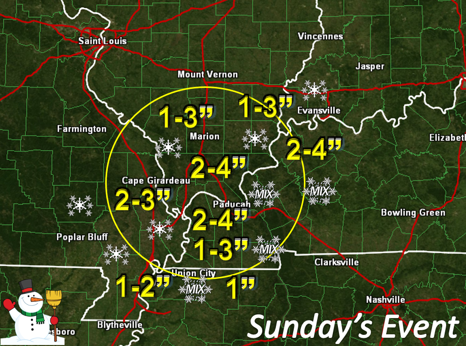
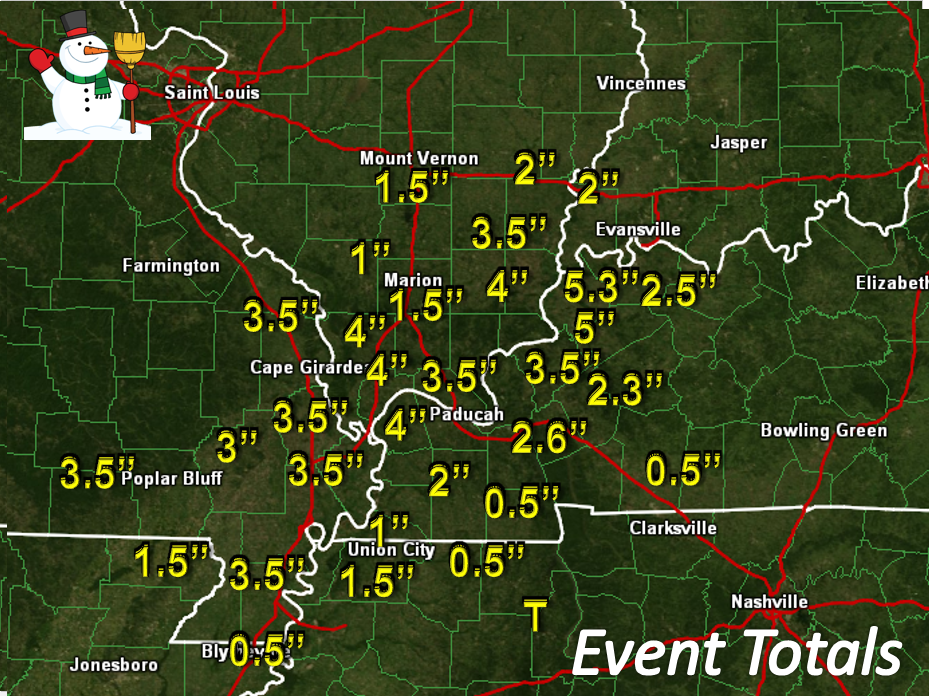
Let’s review our snow event. This first graphic is what I forecast to occur. Winter storms are fickle beasts. You win some and you lose some. This one behaved fairly well. The second graphic are the actual snowfall reports from spotters.
WHAT WAS FORECAST TO HAPPEN
WHAT ACTUALLY HAPPENED
The weather today will be calm and cold. No major weather concerns through Thursday. That is good news!
Our next weather system pushes towards our region on Thursday night and Friday. There are differences in opinion as to whether this system will produce a period of light wintry mix or rain over our local counties. Temperatures should be warming up as we move later into the work week. I think the potential for any mixed precipitation is fairly low. I will keep an eye on it.
A larger storm system will move into the region by the weekend. This system could bring rain and even thunderstorms back into the picture. Right now the risk for severe weather appears low. As always, I will keep an eye on the situation and update accordingly. Don’t forget to check back often as the weather evolves.
Here are a few maps concerning the late week precipitation potential…
This is the high resolution GFS model. It is my model of choice right now. You can see that it attempts to bring some light precipitation into our region late Thursday night and Friday. The green represents rain.
I suppose if the cold air lingered a bit longer on Friday morning we might have a small chance for a wintry mix. Confidence is low in that actually happening. At this point I will just leave it alone.
Weather map as it might appear at 6 am on Friday. Some light precipitation down in Arkansas. This precipitation would move north/northeast over the morning hours.
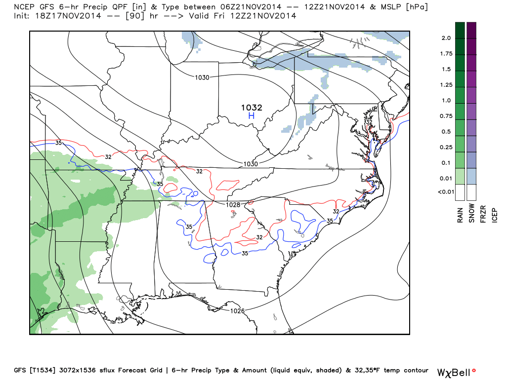
Weather map on Friday around 3 pm. You can see some light rain spreading into our region. Nothing heavy or significant. We will see how this plays out over the coming days. There is little agreement among the models on this one.
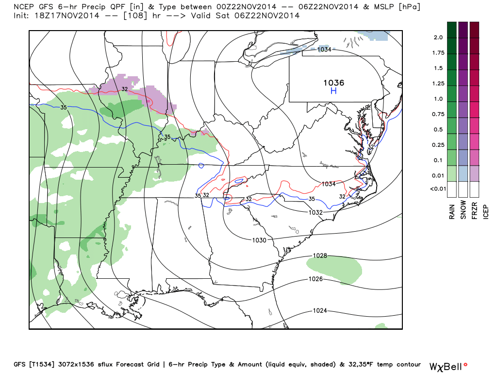
That thin blue line represents the 35 degree line. The thin red line represents the 32 degree mark.
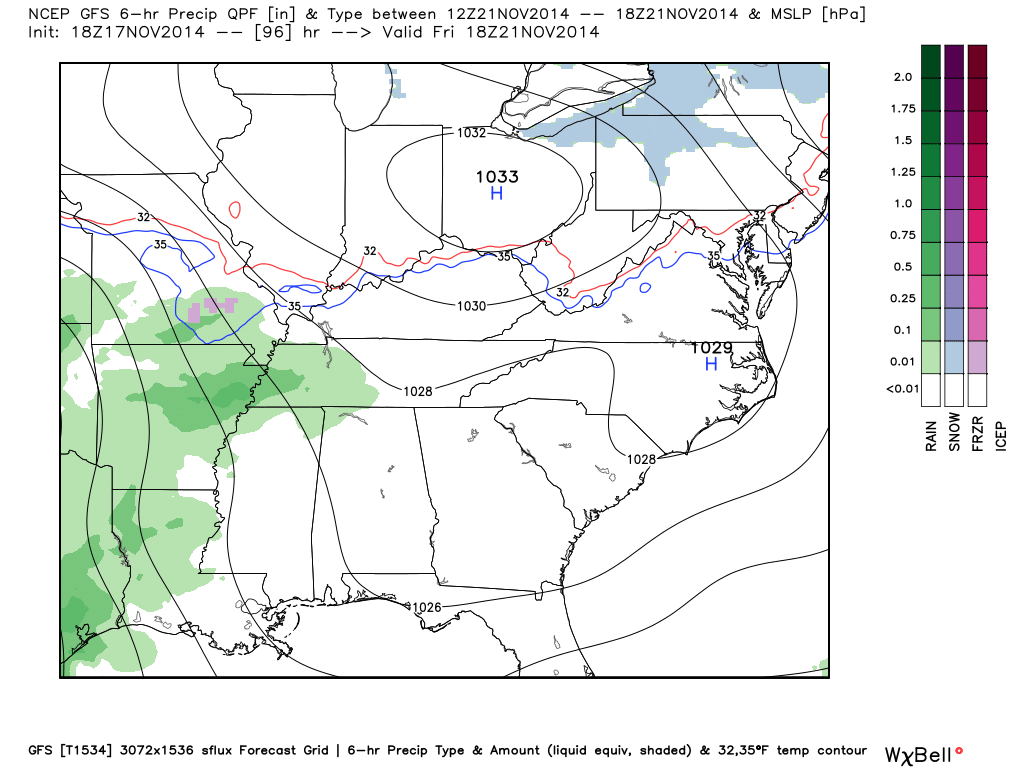
This is the GFS future-weather map for around 1 am on Saturday morning. It paints some light green over our counties. That represents rain. Again, low confidence on whether this occurs. The purple over central Illinois represents a wintry mix.
A much larger system is possible later this weekend. See the extended forecast discussion for those details.
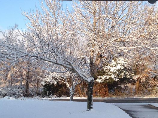
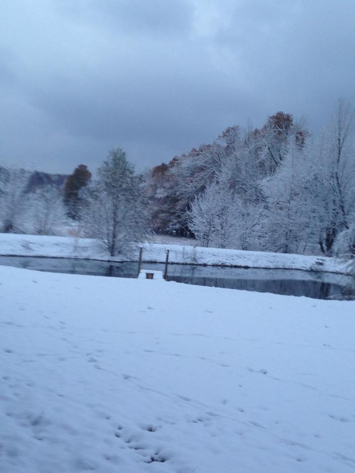
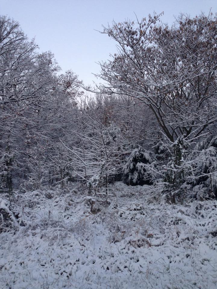
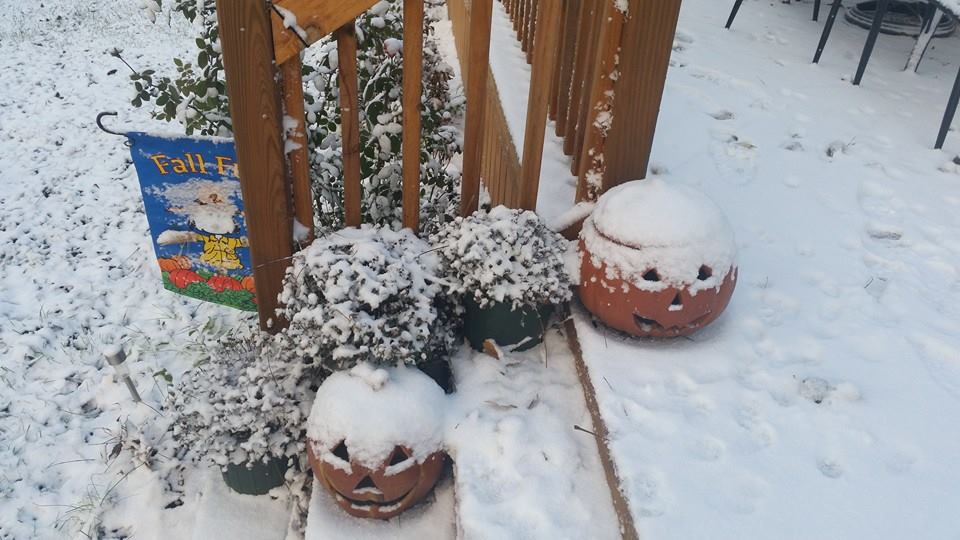
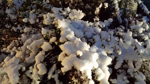
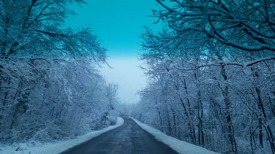
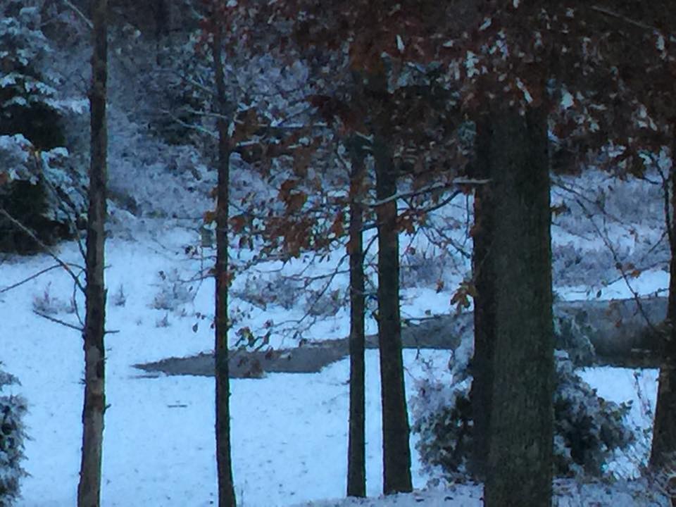
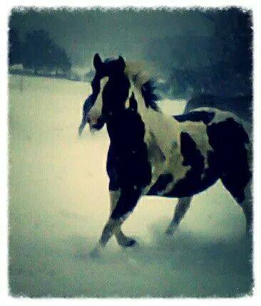
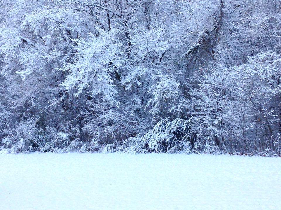
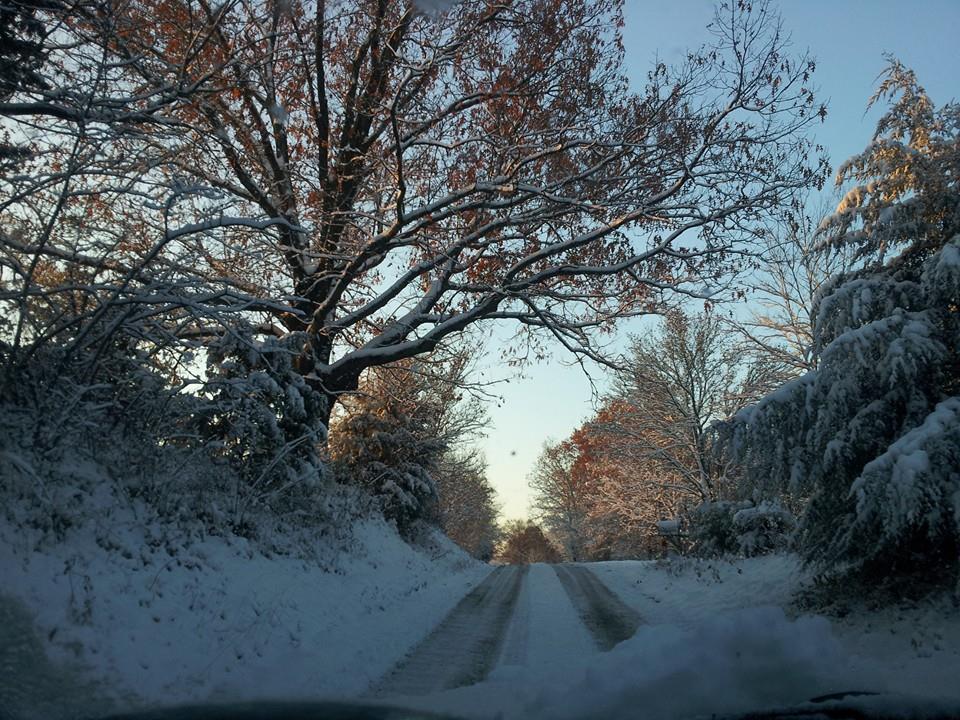
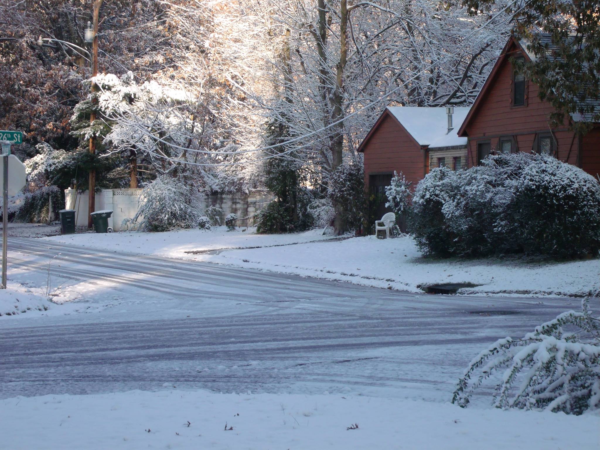
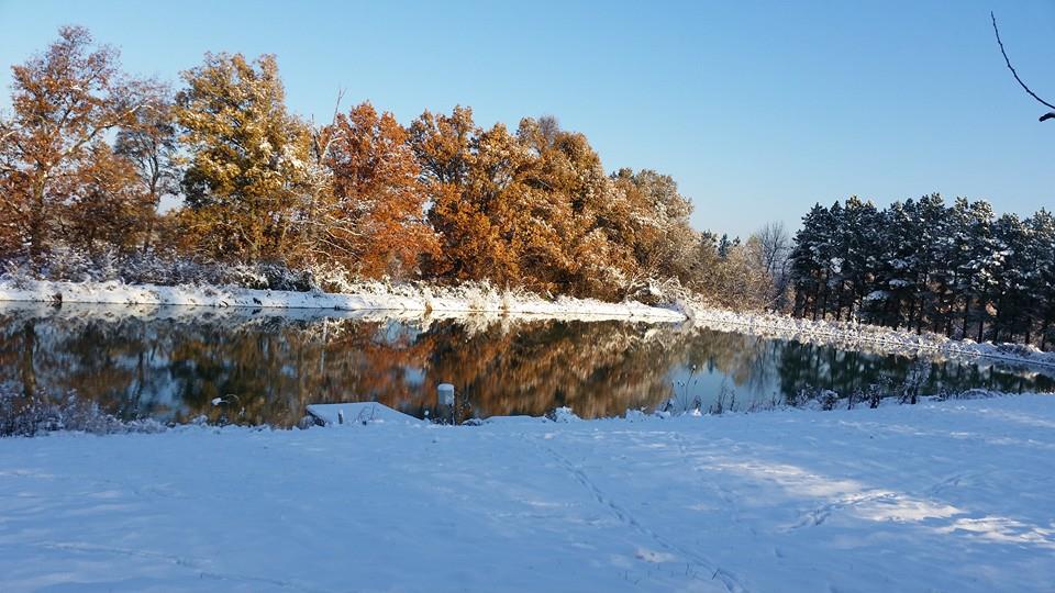
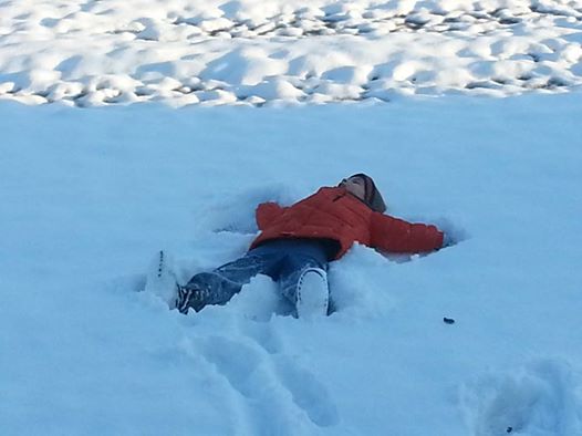
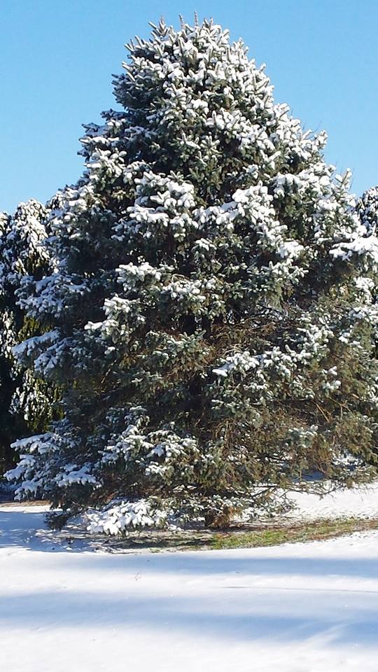
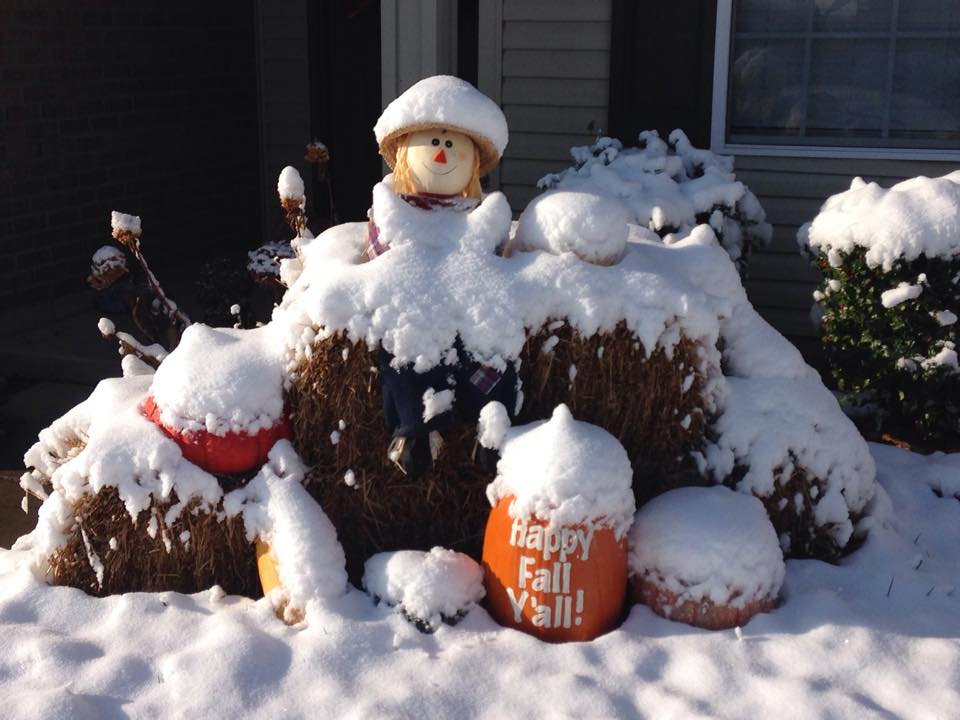
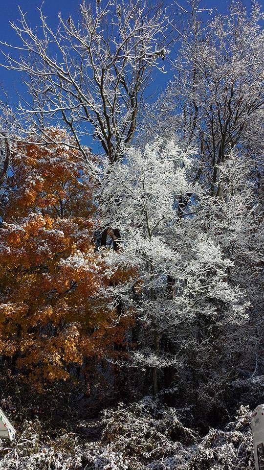
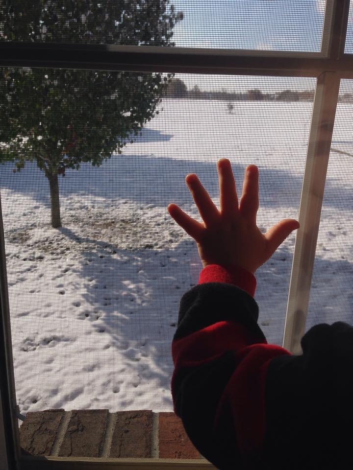
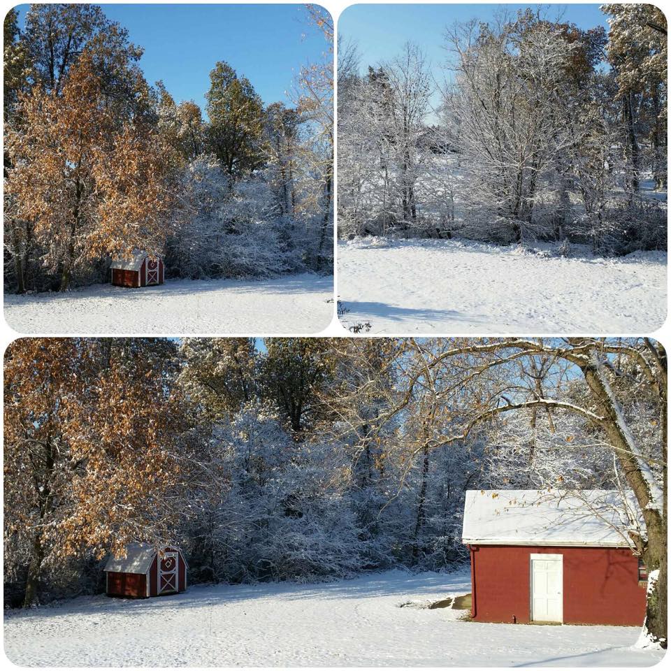
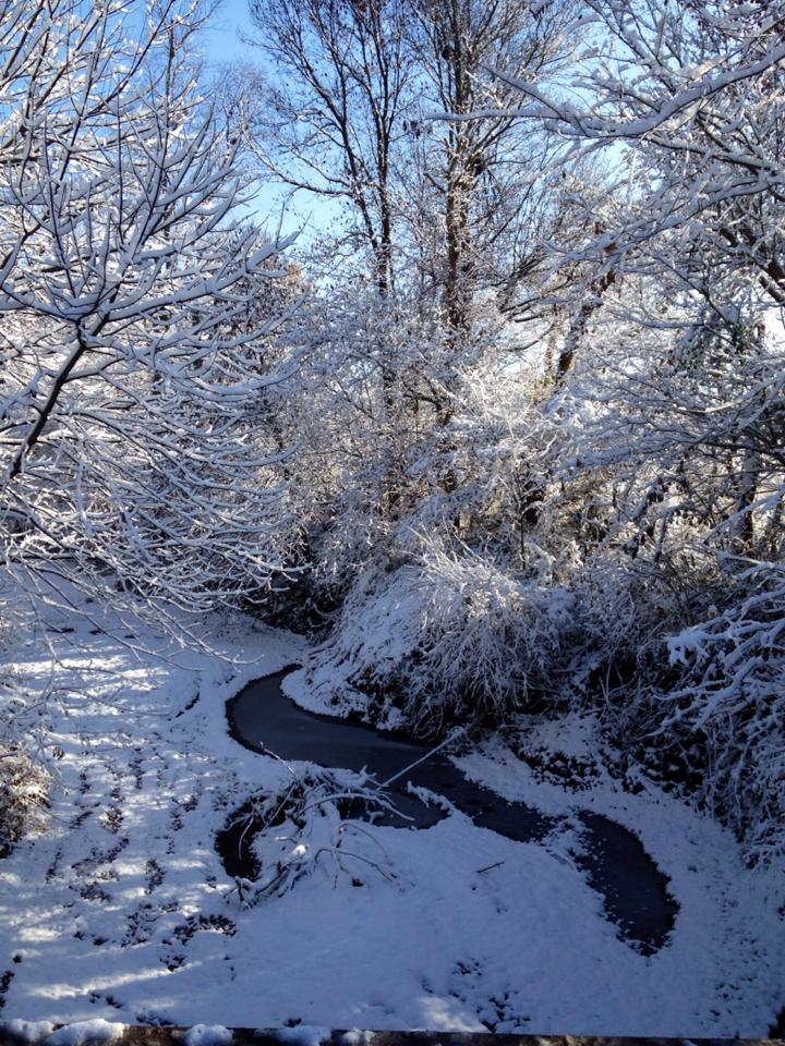
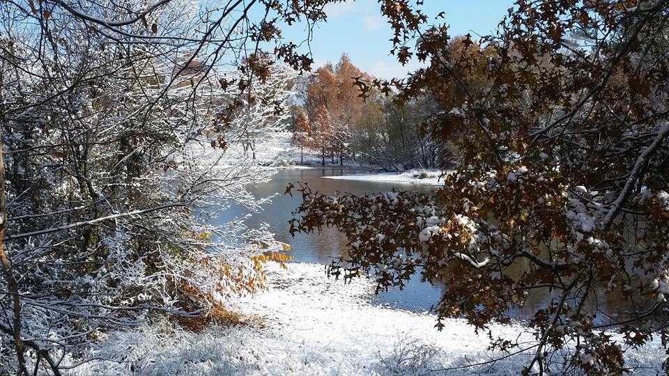
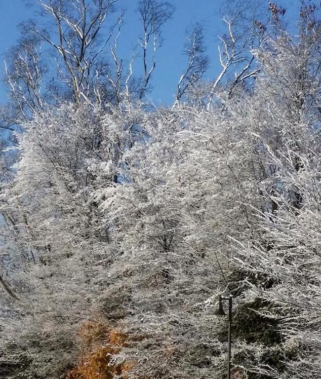
A bunch of you posted snow photographs on the Beau Dodson Weather Facebook page. WAY too many to re-post on here. I did grab a few of them. Here they are 🙂 You can see all the photos by clicking here
Tambi Sweet Photo
Carrie Crawford Photo
Dan Johnston Photo – Saline County, IL
Samantha Johnson Hall – Murray, KY
Terri McCarthy from Desoto, IL
Beth Miller,
Jonesboro, IL
David Woods
Santa Clause, Indiana
Debbie Wilson
Wingo, KY
Lindsay Marshall
Southern Illinois
Jaimee Devous
Evansville, IN
Jamie Conley
Tamara Maxwell
Paducah, KY
Lauren Williams
New Columbia, IL
Shelley Byrne
Paducah, KY
Brandi Jett
Bardwell, KY
Jaimee Devous
Amy Cobb
Smithland, KY
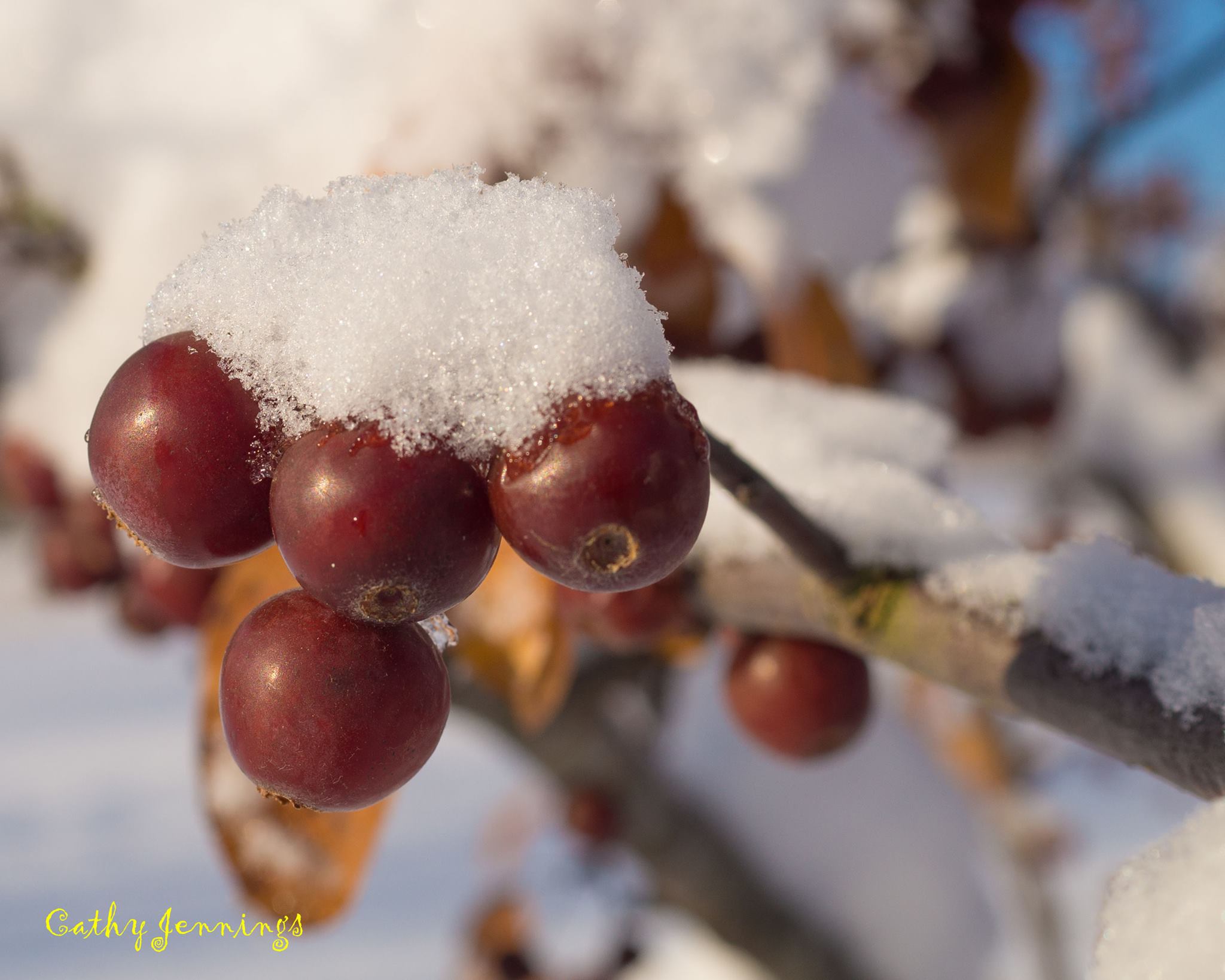
Cathy Jennings
Northern Pope County
Cheryl Jackson
Crystal Allen West
Paducah, KY
Mary Shine
J Johnson RD
Ballard County, KY
Alisa Marshall
Possum Trot, KY
Veronica and Todd Hansen
Smithland, KY
Okay – back to weather maps
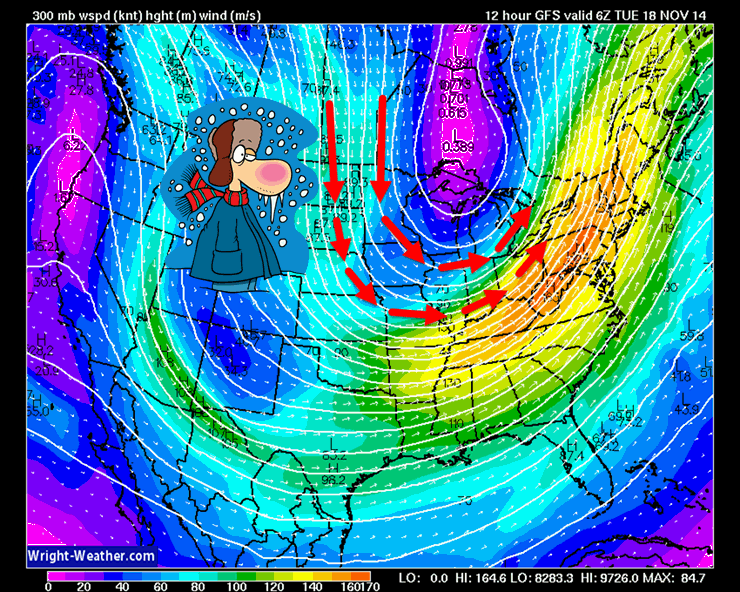
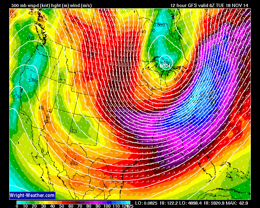
Let’s take a look at the jet stream this morning. See how it is DIVING down out of the north and northwest? Now, what kind of temperatures would you expect when the jet stream is diving southward like that? Yes, bingo 🙂 – COLD!!!!
I swear I am going to make weathermen and women out of you guys before all is said and done.
The bright colors represent different wind speeds. Strong jet stream.
Let’s take a look at the current temperature map across the region.

Current National Temperature Map

IR Satellite Image – during cold weather there could be a lot of white on this map. That is not necessarily clouds. Cold temperatures can also show up on this satellite image.
Typically the brighter colors represent clouds.

Water Vapor Satellite Map – this satellite image gives you a good idea of when moisture is streaming into our region. Again, some of the milky white colors could represent cold temperatures.

Expected High Temperatures For Today

Forecast Low Temperatures For Tonight


I have made no significant changes in the short term forecast. A cold day is on tap for the region.

Bitterly cold air this morning. Kids at the bus stop will need warm gloves.
Don’t forget about our outdoor pets.
No major concerns into Wednesday.
Use care if out and about this morning. Some refreezing of moisture on the roadways could cause a few slick spots.
Wind chill forecast for today

Wind chills for tomorrow


Other than dealing with the cold weather, no.

The Wild Card gives you an idea of what might change that would cause the forecast to bust. A busted forecast means a forecast that does not verify.
Wild card in this forecast – a calm day will bring little in the way of wild-cards. I supposed cloud cover on Wednesday might be a wild-card. Some of the data indicates quite a few clouds.

Precipitation forecast for the next 24-48 hours…
No additional measurable precipitation is expected through Wednesday

Bitterly cold air and a few flurries. No significant winter precipitation is forecast over the next 3 days.

If you stick around long enough you will experience a little bit of everything when it comes to our regions weather!
This comes to mind…
Instead of chocolate, insert the word WEATHER (at least in our region)

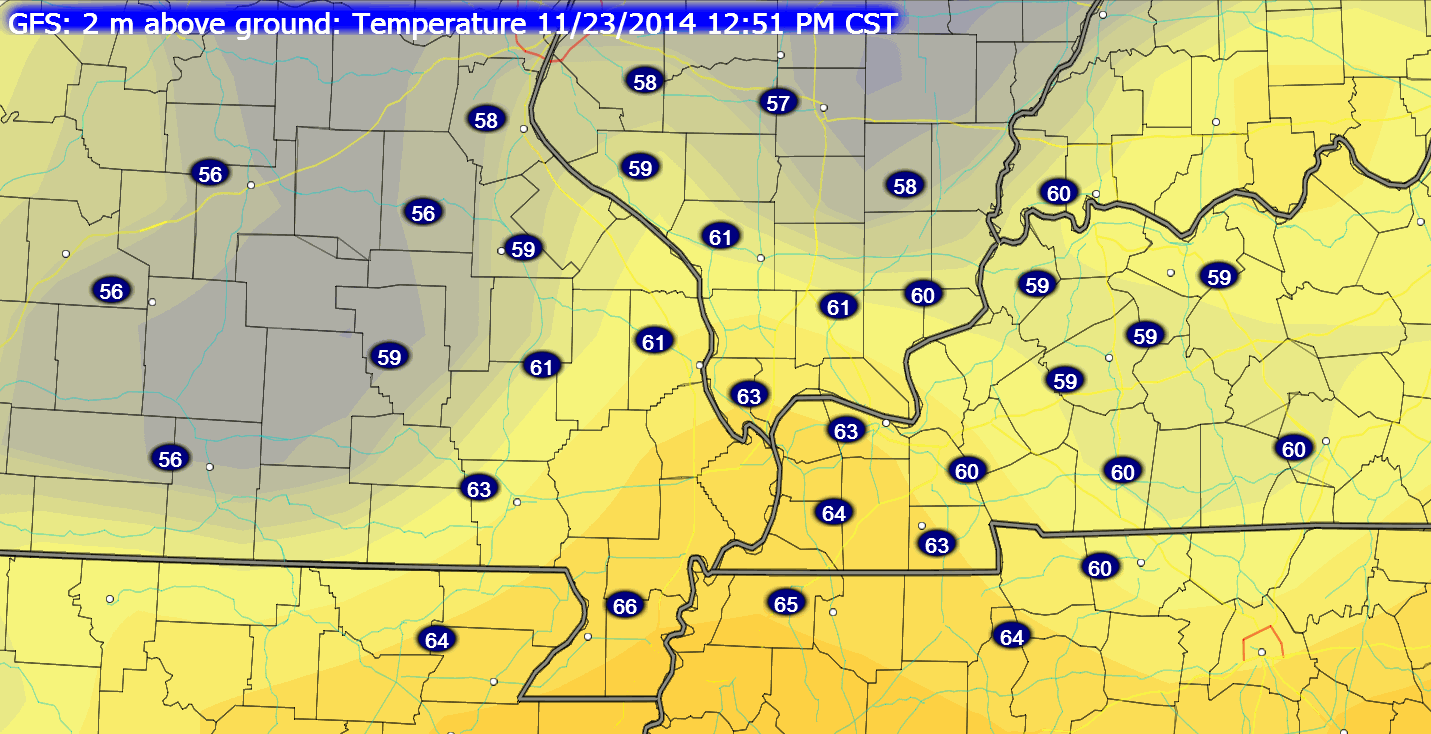
Temperatures in the lower teens this morning will give way to temperatures in the 60’s by Sunday. Go figure!
The main concern in the long range will be precipitation chances on Thursday night into the weekend. Right now it appears that a weak system will approach our region on Friday morning. This system might spread some light rain back into the region. Not sure it will be cold enough for a brief period of wintry mix. I will monitor and update accordingly.
Either way, this looks to be a light event on Thursday night or Friday.
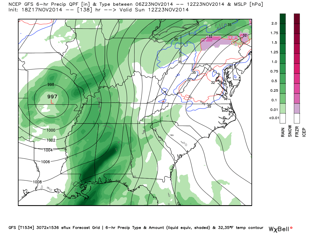
A strong system approaches the region this weekend. Let’s take a look at the GFS models future-cast weather map for Sunday. This map shows an area of low pressure moving through Missouri. This is a perfect track to keep our region in the warm sector. If there would be more moisture to work with on Sunday then I might be concerned about severe weather. However, the deeper moisture may remain to our south. Again, I will monitor in the event something changes.
Rain will likely accompany this storm system. Right now it appears that rain chances would be centered on Sunday..
This is the GFS depiction of the weather map at 6 am on Sunday. See the 997 mb low over southern Missouri? That low will track northeast during the day on Sunday. This will help spread moisture back into our region. It will also pull up warmer temperatures. We may experience high temps in the 60’s by Sunday. We shall see.
Note the 500 mb jet stream maps for the coming days. Notice how the winds are currently out of the north and northwest. Look at the next image and see how winds turn out of the southwest? Once winds turn out of the southwest then more moisture typically moves into the region. We call that a southwest flow. We are currently in northwest flow. Northwest flow equals cold temperatures (at least this time of the year). Southwest flows normally indicate somewhat warmer air.
Jet steam as it appears this morning (below). Notice how the lines are moving from the north and northwest towards our area. The winds are diving southeast out of the Northern and Central Plains. That is one impressive trough over the Eastern United States. Major surge of cold air.
The forecast position of the jet stream on Saturday. See the differences? Follow the lines – they are moving from the southwest and traveling northeast into our region. Thus, milder air is moving into the area.
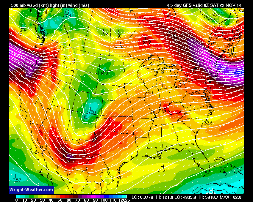
With the southwest flow later this weekend we should see temperatures start to rise. How warm will it be by Saturday and Sunday? Well, part of that depends on the storm track. If the area of low pressure winds up over Arkansas and Missouri then warm air would be drawn northward into our area. when a low tracks to our west, warmer air is usually drawn northward into our region. Remember that an area of low pressure rotates counter-clockwise. Thus, if it tracks to our west then it would draw warm air northward from the Gulf of Mexico.
Temperature forecast maps for Sunday (again this depends on the strength and track of the area of low pressure). Any warm up would be associated with clouds and increasing rain chances. Keep that in mind before you start breaking out the sunglasses and bathing suits.
It appears we might return to below normal temperatures for Thanksgiving week. Whether we get another storm system in here around Thanksgiving is still up in the air (no pun intended).
Some extended temperature and precipitation outlooks…


The latest 8-14 day temperature and precipitation outlook. Note the dates are at the top of the image. These maps DO NOT tell you how high or low temperatures or precipitation will be. They simply give you the probability as to whether temperatures or precipitation will be above or below normal.


Can we expect severe thunderstorms over the next 24 to 48 hours? Remember that a severe thunderstorm is defined as a thunderstorm that produces 58 mph winds or higher, quarter size hail or larger, and/or a tornado.
Severe weather is not going to be a concern through Thursday.
Thunderstorm threat level is zero.


Please visit your local National Weather Service Office by clicking here. The National Weather Service Office, for our region, is located in Paducah, Kentucky.
![]()
We have regional radars and local city radars – if a radar does not seem to be updating then try another one. Occasional browsers need their cache cleared. You may also try restarting your browser. That usually fixes the problem. Occasionally we do have a radar go down. That is why I have duplicates. Thus, if one fails then try another one.
If you have any problems then please send me an email beaudodson@usawx.com
WEATHER RADAR PAGE – Click here —
We also have a new national interactive radar – you can view that radar by clicking here.
Local interactive city radars include St Louis, Mt Vernon, Evansville, Poplar Bluff, Cape Girardeau, Marion, Paducah, Hopkinsville, Memphis, Nashville, Dyersburg, and all of eastern Kentucky – these are interactive radars. Local city radars – click here
NOTE: Occasionally you will see ground clutter on the radar (these are false echoes). Normally they show up close to the radar sites – including Paducah.

Regional Radar – Click on radar to take you our full radar page.


Regional Radar

Current WARNINGS (a warning means take action now). Click on your county to drill down to the latest warning information. Keep in mind that there can be a 2-3 minute delay in the updated warning information.
I strongly encourage you to use a NOAA Weather Radio or warning cell phone app for the most up to date warning information. Nothing is faster than a NOAA weather radio.


Missouri Warnings

Illinois Warnings

Kentucky Warnings
I have added a lot of new maps to the Southern Illinois Weather Observatory web-site. Check them out by clicking here.
Current tower cam view from the Weather Observatory- Click here for all cameras.

Southern Illinois Weather Observatory

The Weather Observatory

Southern Illinois Weather Observatory
WPSD TV 6 has a number of tower cameras. Click here for their tower camera page
& Kentucky Road Conditions & Kentucky Highway and Interstate Cameras

Downtown Paducah, Kentucky
Benton, Kentucky Tower Camera – Click here for full view

Benton, Kentucky
WSIL TV 3 has a number of tower cameras. Click here for their tower camera page
& Illinois Road Conditions

Marion, Illinois

I24 Paducah, Kentucky

I24 Mile Point 9 – Paducah, KY

I24 – Mile Point 3 Paducah, Kentucky

You can sign up for my AWARE email by clicking here I typically send out AWARE emails before severe weather, winter storms, or other active weather situations. I do not email watches or warnings. The emails are a basic “heads up” concerning incoming weather conditions.