
November 19, 2014: This forecast update covers far southern Illinois, far southeast Missouri, and far western Kentucky. See the coverage map on the right side of the blog.
Thursday – Some morning clouds giving way to sunshine. Cold. High temperatures will only be in the upper 30’s to near 40 degrees. West/northwest winds at 5-10 mph.
Morning School Bus Stop Weather – A few clouds. Temperatures at the bus stop will be around 25 degrees. South winds at 10 mph.
Afternoon School Bus Stop Weather – A few clouds. Cold for November. Temperatures from 2 pm to 4 pm will be in the 40’s. Southwest winds at 10-20 mph.
Thursday night – Some increase in clouds. Chilly. Low temperatures around 25 degrees. Northeast winds at 10 mph.
Friday – Clouds from time to time A shower or two possible during the afternoon. High temperatures will be near 42 degrees degrees. East winds at 10 mph.
Friday night – Cloudy with a couple of showers possible. Chilly. Low temperatures around 40 degrees. Southeast winds at 10 mph.
Saturday – Mostly cloudy and not as cold as recent days. A chance for a few showers. High temperatures will be near 52 degrees. South winds at 10-15 mph.
Confidence in the above forecast:

An explanation of what is happening in the atmosphere over the coming days.
If you enjoy the weather blog, the Weather Observatory web-site, the interactive weather radars, and everything else then consider giving a donation to keep the bills paid. For more information on how you can help – click here
Temperatures on Wednesday afternoon warmed a few degrees more than I thought they would. It was a tricky forecast with the snow cover. Much of that snow is now but a memory. A few spots reached 50 degrees on Wednesday. Just about a heat wave out there! Well, not quite. Still 🙂 – much better than a few days ago. The roller-coaster ride of weather.
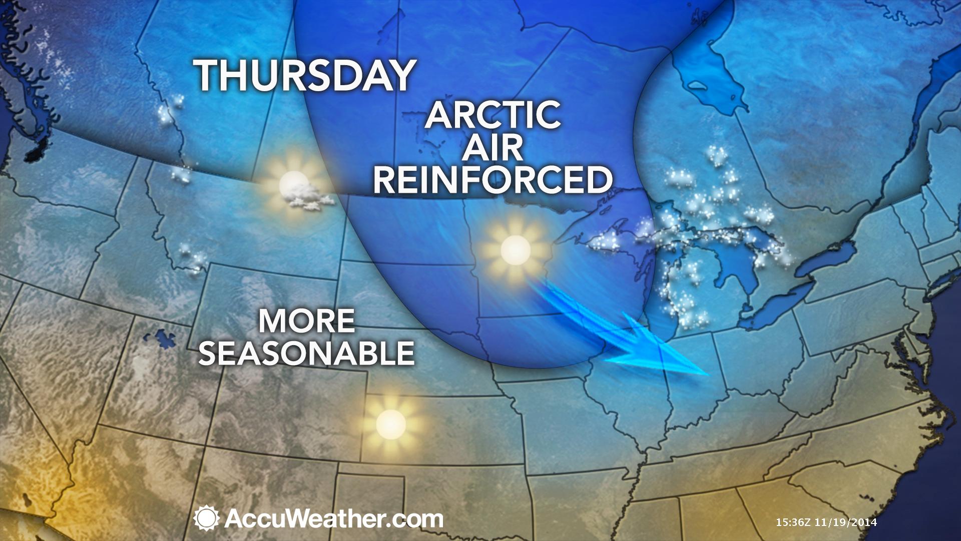
A reinforcing shot of cold air arrives today. Not as bad as over the past week. Still, however, it will be quite cold for this time of the year.
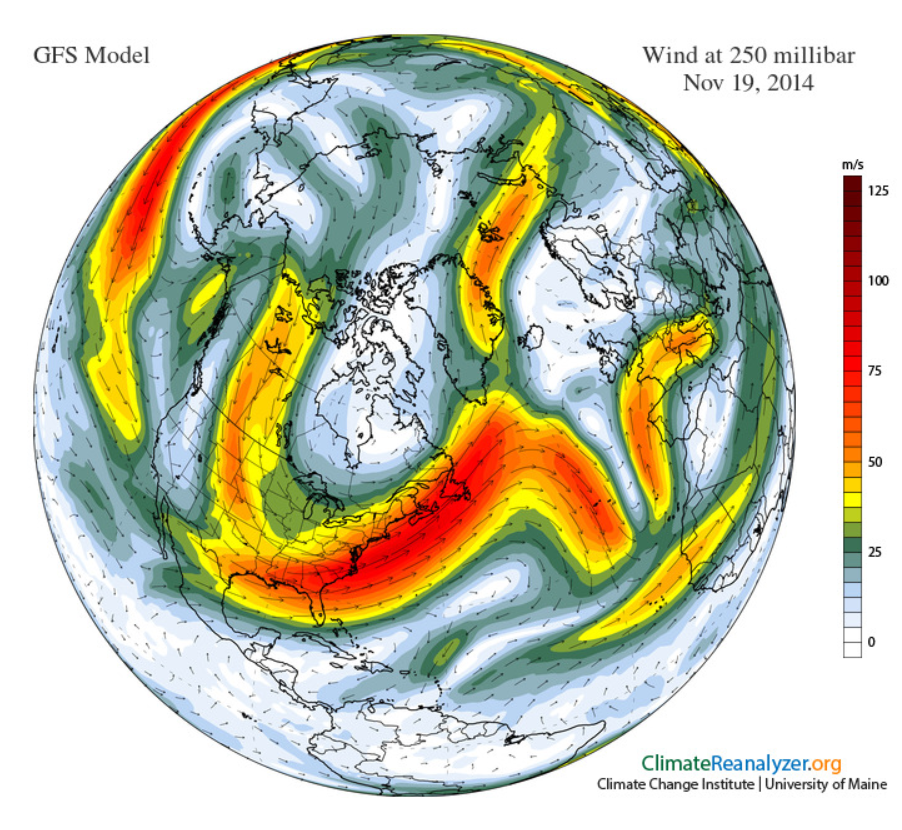
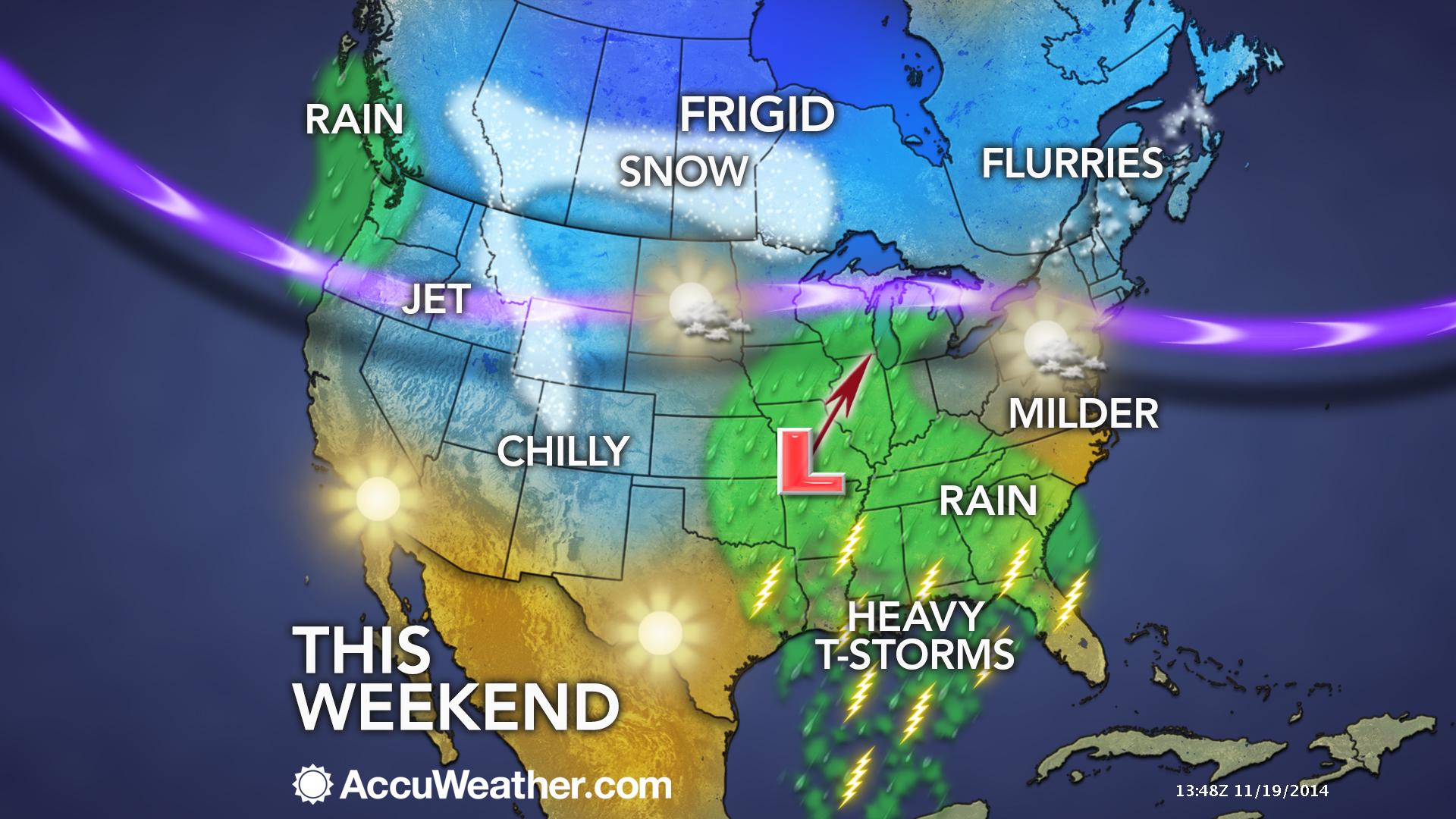
You can still see the BIG dip in the jet stream across the Eastern United States. Here is the global view. See how the jet dips into our region?
A weather system will approach from the south on Friday. This will bring some rain showers back into the region. Temperatures will be warm enough for this to be a rain event.
Here is the surface map for Friday evening. You can see some rain showers starting to move into our region. Light showers.
Rain showers will continue into Saturday. A more intense weather maker arrives by Sunday. That system should bring widespread showers and thunderstorms to our region.
The Sunday system will cover a large chunk of the United States.
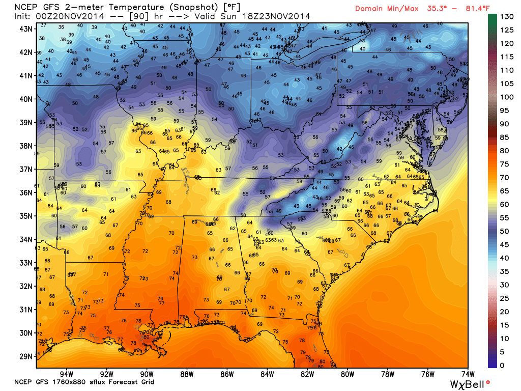
Let’s take a look at the current temperature map across the region.

Current National Temperature Map

IR Satellite Image – during cold weather there could be a lot of white on this map. That is not necessarily clouds. Cold temperatures can also show up on this satellite image.
Typically the brighter colors represent clouds.

Water Vapor Satellite Map – this satellite image gives you a good idea of when moisture is streaming into our region. Again, some of the milky white colors could represent cold temperatures.

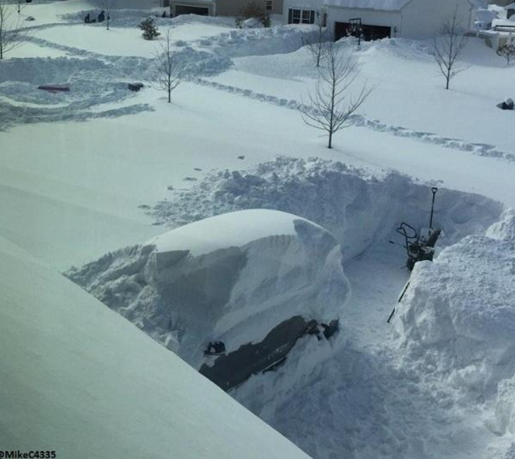
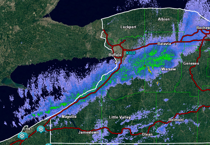
Have you been following the incredible lake lffectl now stories out of western New York? Buffalo, New York has had several FEET of snow over the past week.
Some places have now exceeded 6′ of snow. Incredible numbers
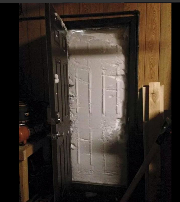
Yes, that is a doorway.
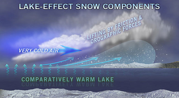
How does lake effect snow form?
This is what a band of snow looks like on radar

I increased the precipitation totals for the weekend system (Sat night into Sunday evening). Some places might pick up more than 1″ of rain.

No major concerns right now.

Nothing major.

The Wild Card gives you an idea of what might change that would cause the forecast to bust. A busted forecast means a forecast that does not verify.
Wild card in this forecast – the timing of precipitation on Friday will be the wild card. Appears most of the light rain will during the afternoon.

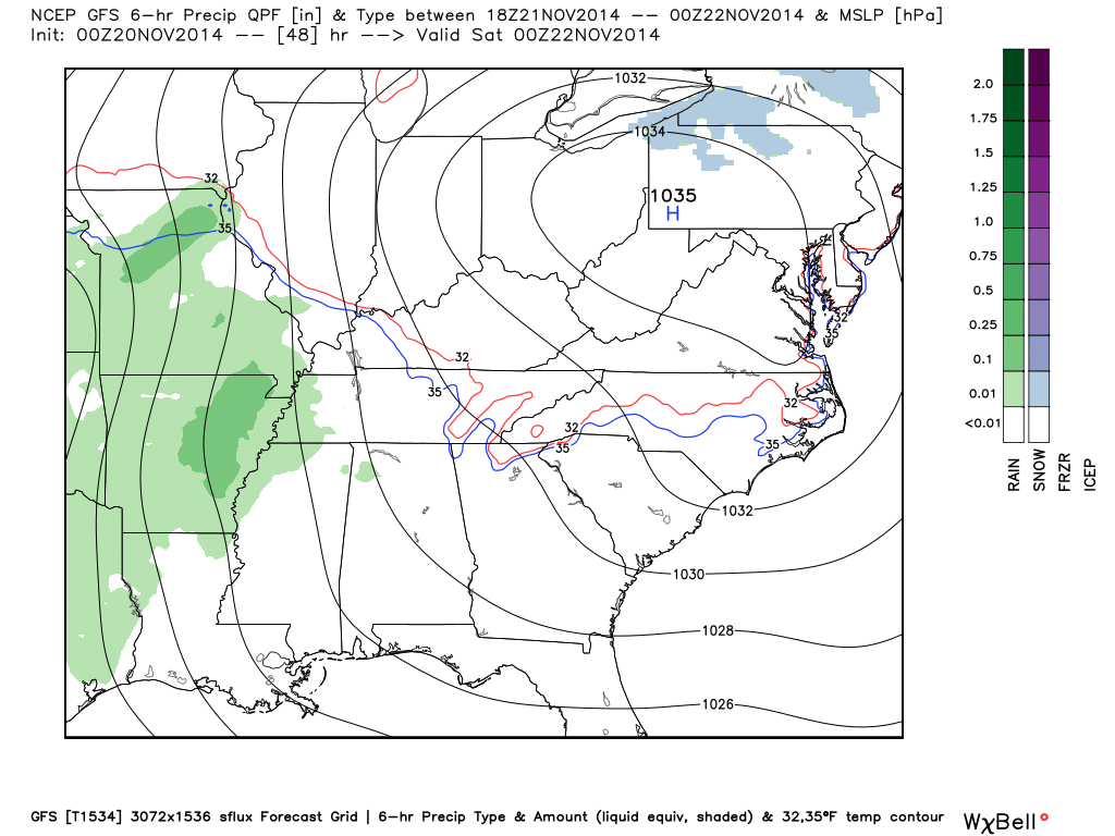
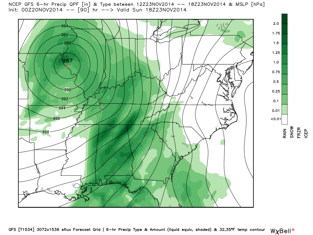
Precipitation forecast for the next 24-48 hours…
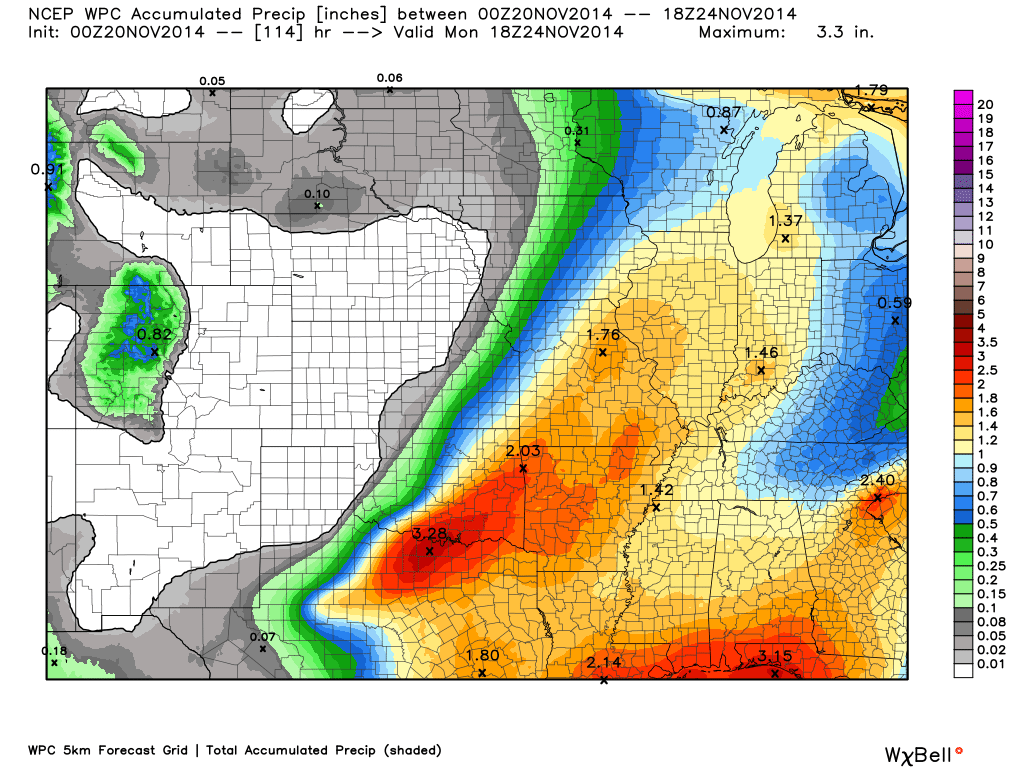
Rainfall totals increase over the weekend. Let’s take a look at the rainfall forecast Friday through Monday morning. Some decent showers and perhaps thunderstorms by later in the weekend. Could be some locally heavier totals.
Most of this falls on Saturday night into Sunday evening. Only small amounts are possible on Friday afternoon into Saturday afternoon (less than 0.20″)
The latest data shows widespread 0.40″-0.80″ with the potential for greater than 1″ of rain – again most of this falls on Saturday night and Sunday.

No significant winter weather concerns through Sunday.

1. Rain chances increase on Friday into Saturday.
2. BRIEF warm-up for the weekend
4. Rain and thunderstorms possible by Saturday night/Sunday.
5. Windy conditions ahead of the system on Sunday (gusts could exceed 40 mph).
6. Another cold blast for much of next week (go figure)
7. Another chance for precipitation along an arctic cold front around next Wednesday?
A stronger storm system will approach our region on Saturday night and Sunday. If this system would have deeper moisture to work with then I would be concerned about severe thunderstorms. The wind profiles will be strong. The area of low pressure will tighten up and move just to the west of our local counties. Warm air will surge northward from the Gulf of Mexico. This would normally be a bad combination for us.
It appears the higher dew points will remain a tad south of our area. This will, however, need to be closely monitored. The track of the storm, the time of year, and the wind fields associated with the system do favor severe thunderstorms
Winds will be gusty on Sunday out of the south. Expect frequent gusts above 30-35 mph.
Rainfall totals in the 0.04″-0.80″ are a good bet with the weekend system. Some places will pick up more than 1″ of rain.
Here are the latest CAPE values for Sunday. Remember that CAPE is energy the atmosphere can tap into for severe thunderstorms. We do see an increase in CAPE numbers on Sunday. Again, something I will be monitoring.
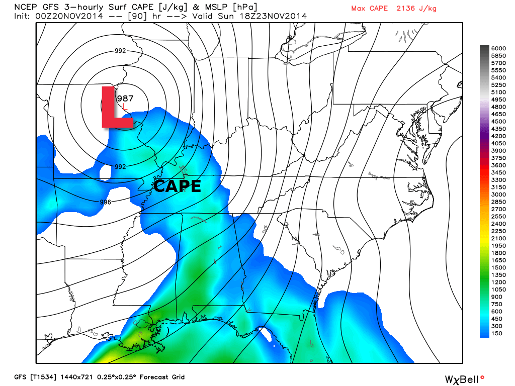
Here is the deep area of low pressure pulling off to our northeast on Sunday. Strong system. The green area represents rain and thunderstorms
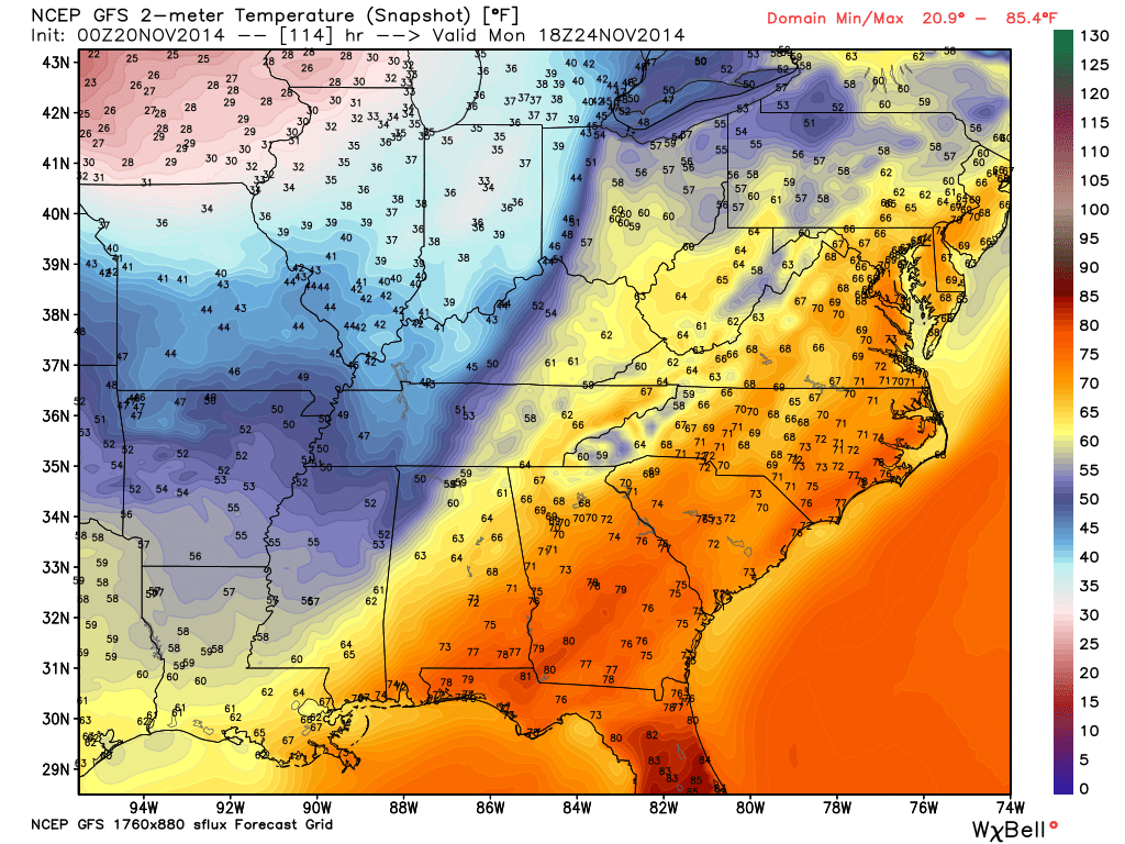
Check out the warm surge of air on Sunday! This is the new high resolution GFS model.
But, don’t get too excited. Here are the Monday afternoon temperatures. Back into the refrigerator.
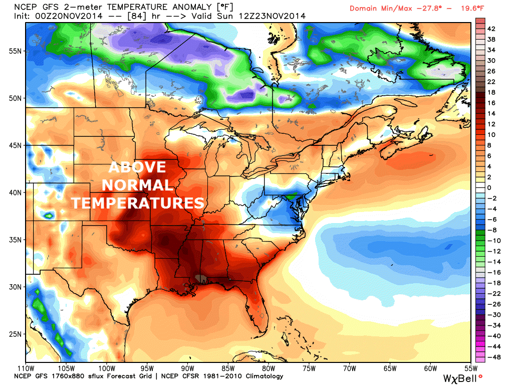
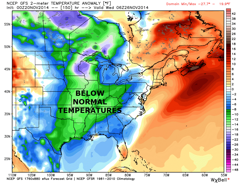
Here are the anomaly maps for Sunday and then next Wednesday. Looks good on Sunday 🙂 – above normal temperatures. Not so good by next week. Below normal temperatures (once again). Seems like we have been stuck in this pattern for over a year.

Some extended temperature and precipitation outlooks…


The latest 8-14 day temperature and precipitation outlook. Note the dates are at the top of the image. These maps DO NOT tell you how high or low temperatures or precipitation will be. They simply give you the probability as to whether temperatures or precipitation will be above or below normal.


Can we expect severe thunderstorms over the next 24 to 48 hours? Remember that a severe thunderstorm is defined as a thunderstorm that produces 58 mph winds or higher, quarter size hail or larger, and/or a tornado.
Severe weather is not going to be a concern through Saturday.
Thunderstorm threat level is zero.
Thunderstorm chances increase by Saturday night into Sunday.


Please visit your local National Weather Service Office by clicking here. The National Weather Service Office, for our region, is located in Paducah, Kentucky.
![]()
We have regional radars and local city radars – if a radar does not seem to be updating then try another one. Occasional browsers need their cache cleared. You may also try restarting your browser. That usually fixes the problem. Occasionally we do have a radar go down. That is why I have duplicates. Thus, if one fails then try another one.
If you have any problems then please send me an email beaudodson@usawx.com
WEATHER RADAR PAGE – Click here —
We also have a new national interactive radar – you can view that radar by clicking here.
Local interactive city radars include St Louis, Mt Vernon, Evansville, Poplar Bluff, Cape Girardeau, Marion, Paducah, Hopkinsville, Memphis, Nashville, Dyersburg, and all of eastern Kentucky – these are interactive radars. Local city radars – click here
NOTE: Occasionally you will see ground clutter on the radar (these are false echoes). Normally they show up close to the radar sites – including Paducah.

Regional Radar – Click on radar to take you our full radar page.


Regional Radar

Current WARNINGS (a warning means take action now). Click on your county to drill down to the latest warning information. Keep in mind that there can be a 2-3 minute delay in the updated warning information.
I strongly encourage you to use a NOAA Weather Radio or warning cell phone app for the most up to date warning information. Nothing is faster than a NOAA weather radio.


Missouri Warnings

Illinois Warnings

Kentucky Warnings
I have added a lot of new maps to the Southern Illinois Weather Observatory web-site. Check them out by clicking here.
Current tower cam view from the Weather Observatory- Click here for all cameras.

Southern Illinois Weather Observatory

The Weather Observatory

Southern Illinois Weather Observatory
WPSD TV 6 has a number of tower cameras. Click here for their tower camera page
& Kentucky Road Conditions & Kentucky Highway and Interstate Cameras

Downtown Paducah, Kentucky
Benton, Kentucky Tower Camera – Click here for full view

Benton, Kentucky
WSIL TV 3 has a number of tower cameras. Click here for their tower camera page
& Illinois Road Conditions

Marion, Illinois

I24 Paducah, Kentucky

I24 Mile Point 9 – Paducah, KY

I24 – Mile Point 3 Paducah, Kentucky

You can sign up for my AWARE email by clicking here I typically send out AWARE emails before severe weather, winter storms, or other active weather situations. I do not email watches or warnings. The emails are a basic “heads up” concerning incoming weather conditions.