

This forecast update covers far southern Illinois, far southeast Missouri, and far western Kentucky. See the coverage map on the right side of the blog.
Sunday – Mostly cloudy this morning with some fog and drizzle. Then mostly cloudy sky conditions the rest of the day. There is a small chance of some breaks in the clouds during the afternoon. High temperatures will be in the 50’s. South/southeast winds at 5-10 mph.
Sunday night – Mostly cloudy. A chance for a shower after midnight. Low temperatures will be in the 40’s. South/southeast winds at 5-10 mph.
Monday – A period of rain showers likely. Otherwise, cloudy. As the front moves in we will see temperatures warm into the 50’s. South/southeast winds at 10-15 mph. Winds may gust to 20 mph.
Monday night – A few showers possible. Turning cooler. Low temperatures will be in the 30’s. Northwest winds at 5-15 mph.
Tuesday – A mix of sun and clouds. Cooler. High temperatures only in the 40’s. West/Northwest winds at 10-15 mph.

Current Temperatures Around The Local Area


An explanation of what is happening in the atmosphere over the coming days.
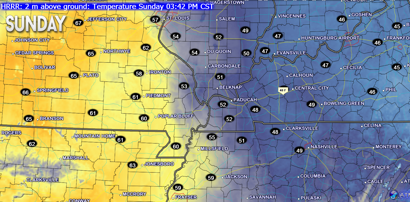
The mildest day of the past seven days will occur TODAY! YAY 🙂 – but, the clouds will likely stick around. BOO? These clouds are stubborn.
Here are the afternoon high temperatures.
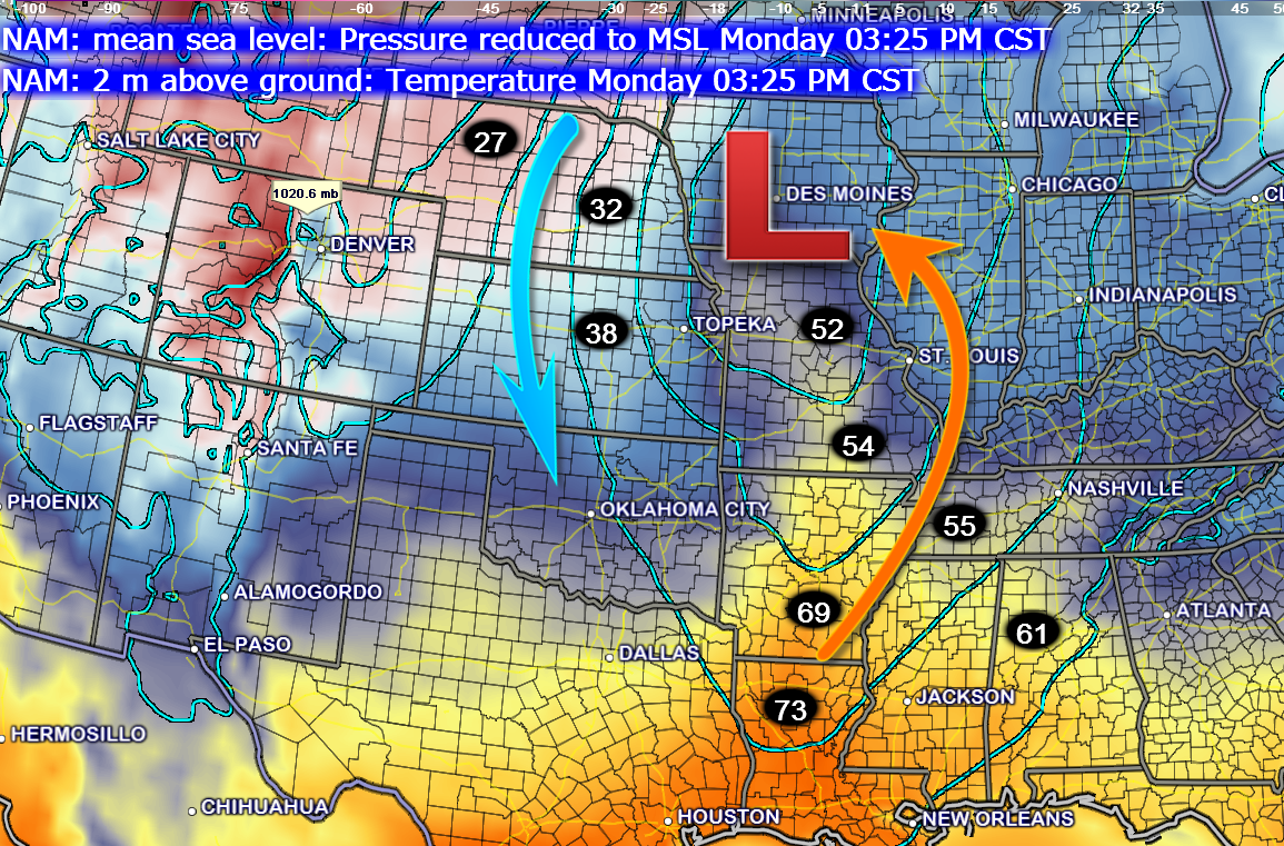
Note the surge of warmer air to our west. That is ahead of our next storm system that will bring rain to our region. Guess where the low will track? WELL to our northwest, thus the warmer air surge. Why is this? Because air around an area of low pressure rotates in what direction? If you said counter-clockwise then you are a winner! Yes, counter-clockwise. If the low passes to our west or northwest then that places us on the warmer side of the system.
Example from Monday’s storm. The L represents the area of low pressure winding up well to our northwest. Milder air ahead of the cold front. Colder air wraps in behind the area of low pressure.
Note, I added the temperatures (those are the numbers). 🙂
This next image also shows the area of low pressure. The green represents precipitation.
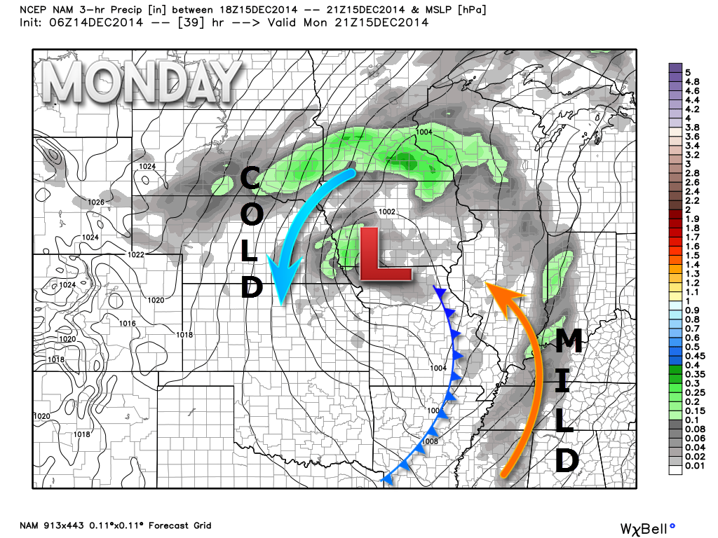
I want you to learn how these systems work. In the winter months the track of the low is EXTREMELY important in forecasting where the rain, snow, freezing rain, and sleet line ends up being placed. Typically our region is usually on that line! If the low tracks to our south then normally we have winter precipitation. This may come into play later this week.
A cold front approaches our region on Monday. This front will be accompanied by showers and cooler temperatures. The front won’t actually pass through the area until evening or Monday night.
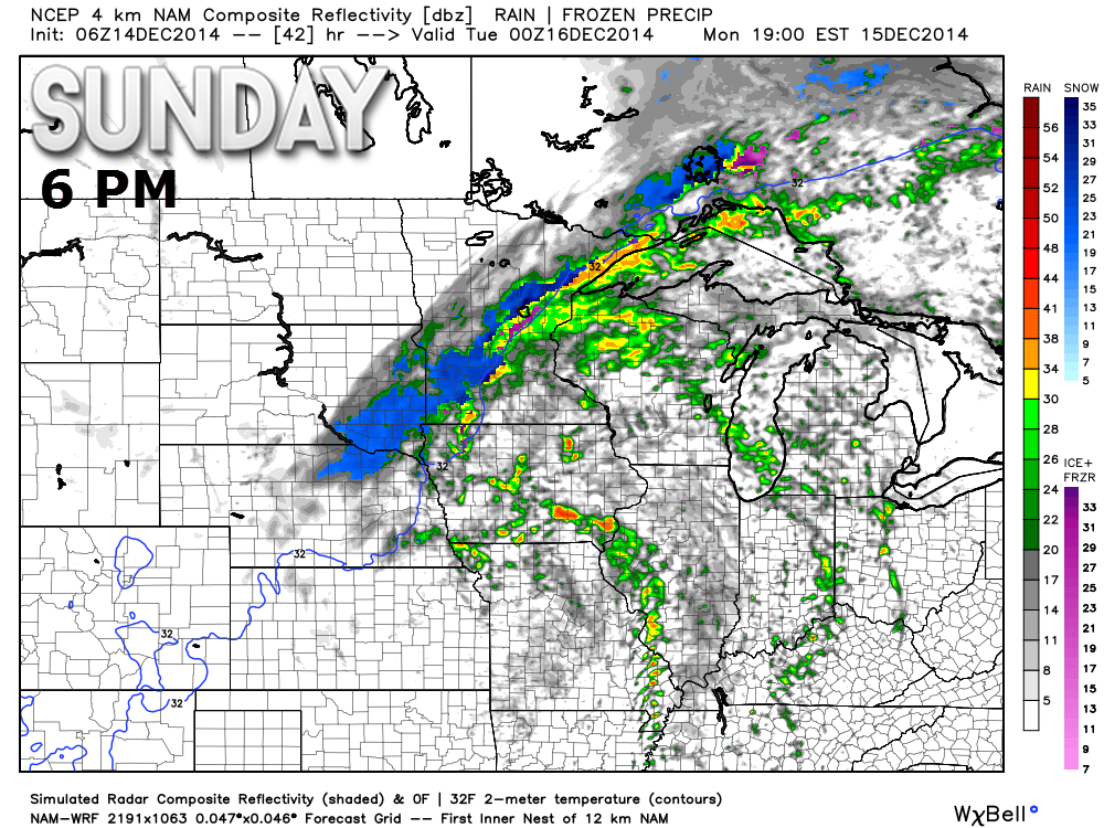
Let’s take a look at the future-cast radar (what radar might look like on Monday morning into Monday evening).
You see two bands of showers (maybe a rumble of thunder) along the front. The first band moves through during the morning hours and early afternoon. The second band forms along the cold front towards evening. I am a little less confident on that second band forming. We will see how it goes.
Rainfall totals should be on the light side.
These images are from the high resolution NAM model (one computer model that forecasters use to determine weather conditions). Images are from weatherbell.com
Time stamps are in the upper left hand corner of the image. These are approximate times for the radar depiction.
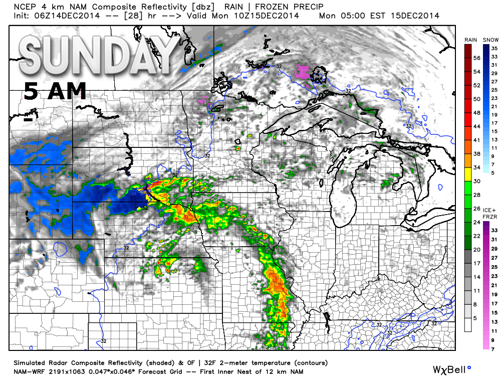
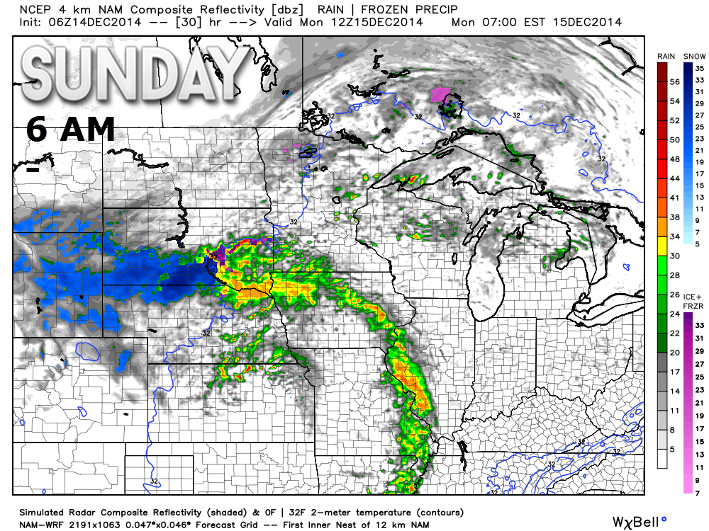
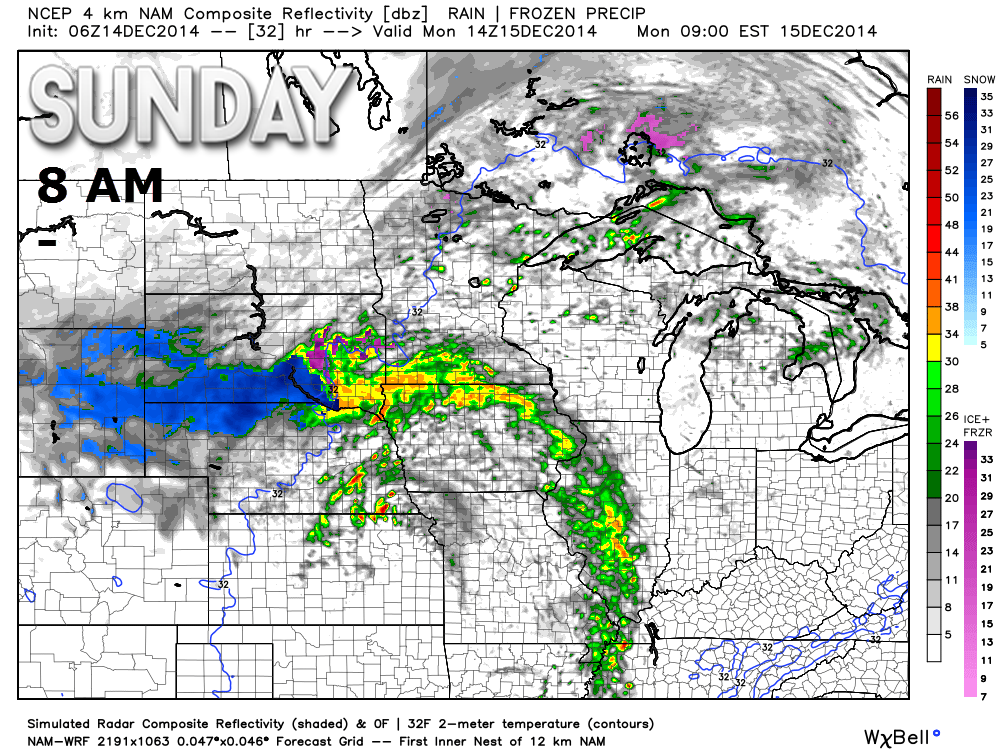
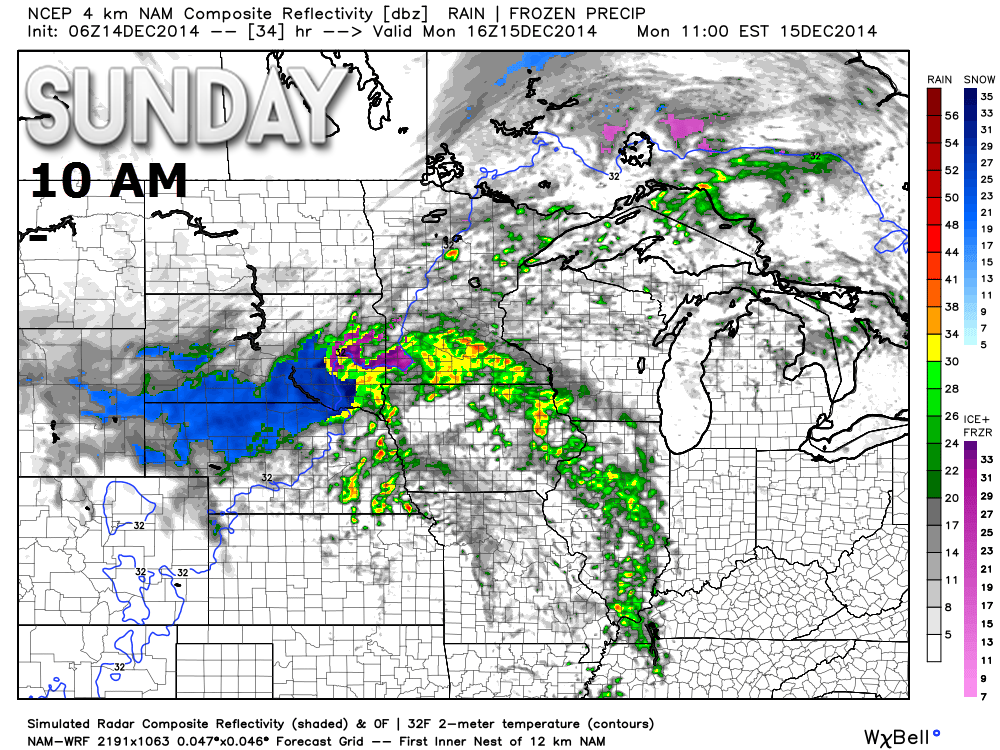
That first band moves off to the east as we push into late morning and early afternoon. Then there is a lull. But, look at the evening radar. Another band forms along the front. Again, light precipitation for the most part.
A mix of sun and clouds on Tuesday with cooler temperatures.
Our much anticipated “active weather pattern” will arrive later this week into Christmas week. A lot of weather to track. I have a feeling meteorologists will be quite busy as we move forward.
I am watching a possible system around Wednesday night or Thursday.
I am watching another system towards Friday or Saturday.
I am watching a system for the week of Christmas.
Short update today – longer updates will be coming later tonight or Monday morning.
Enjoy your Sunday!
Many of my graphics are from www.weatherbell.com – a great resource for weather data, model data, and more


This blog was inspired by ABC 33/40’s Alabama Weather Blog – view their blog
Current tower cam view from the Weather Observatory- Click here for all cameras.

Southern Illinois Weather Observatory

The Weather Observatory

Southern Illinois Weather Observatory
WSIL TV 3 has a number of tower cameras. Click here for their tower camera page & Illinois Road Conditions

Marion, Illinois
WPSD TV 6 has a number of tower cameras. Click here for their tower camera page & Kentucky Road Conditions & Kentucky Highway and Interstate Cameras

Downtown Paducah, Kentucky
Benton, Kentucky Tower Camera – Click here for full view

Benton, Kentucky

I24 Paducah, Kentucky

I24 Mile Point 9 – Paducah, KY

You can sign up for my AWARE email by clicking here I typically send out AWARE emails before severe weather, winter storms, or other active weather situations. I do not email watches or warnings. The emails are a basic “heads up” concerning incoming weather conditions.