I am tracking two weather makers.
The first one arrives late tonight into Sunday. This one will bring showers to the region. Some thunderstorms can’t be ruled out late tonight in southeast Missouri. No severe weather anticipated.
A widespread light rain event is likely Sunday. Rain totals of 0.10″ to 0.40″ are anticipated. This is slightly higher than previous forecasts.
Here is the Hrrr future-cast radar. The time-stamp is located in the upper left corner.
Click image to enlarge
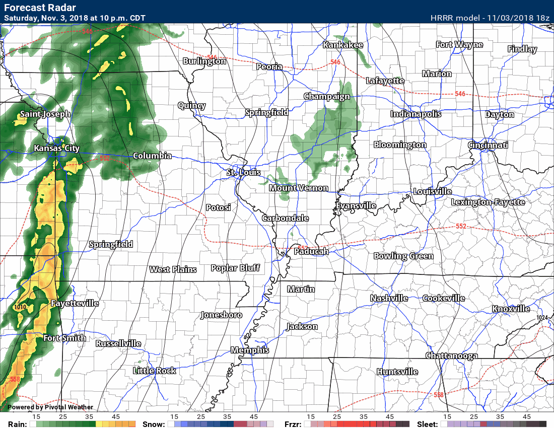
The highest totals will be across southeast Missouri.
The system will be weakening as it moves further east.
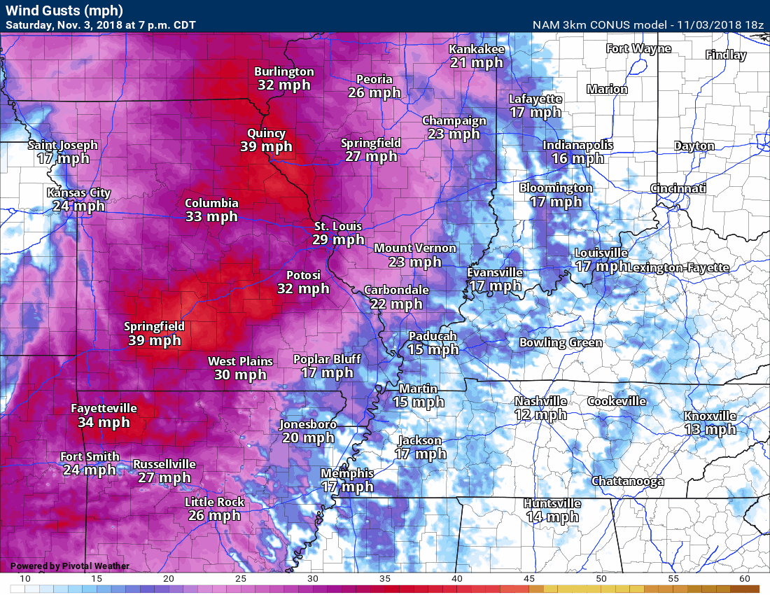
Winds will be strong and gusty from the south and southwest on Sunday. Winds of 15 to 30 mph will be common. There will be some gusts above 40 mph.
These will be gradient winds. Gradient winds are caused by rising and falling barometric pressure readings.
Here is the NAM 3K model wind gust forecast. The time-stamp is located in the upper left corner of the animation.
Several models are showing winds above 40 mph. It appears a good bet as the cold front moves through the area.
The next weather system arrives Monday into Monday night. This one will bring additional showers and possibly thunderstorms to the region.
There is some chatter about potentially severe weather. The problem with forecasting severe weather days in advance is the amount of uncertainty. This is a potent system. It has potential. Potential does not, however, always equal reality.
Yes, there is certainly some potential of severe thunderstorms in or near our region. With that said, today’s model guidance backed over the north and northwest extent of the severe weather.
The main concern appears to be across Kentucky and Tennessee (and then south from there). Whether the threat extends into southeast Missouri and southern Illinois will be dependent on the track of the area of low pressure. This remains a question.
The best advice is to monitor updates on Sunday. The time-frame of concern will be late Monday afternoon into Monday night.
The main concern will be damaging wind and QLCS tornadoes. QLCS tornadoes are normally short-lived and difficult to issue warnings on.
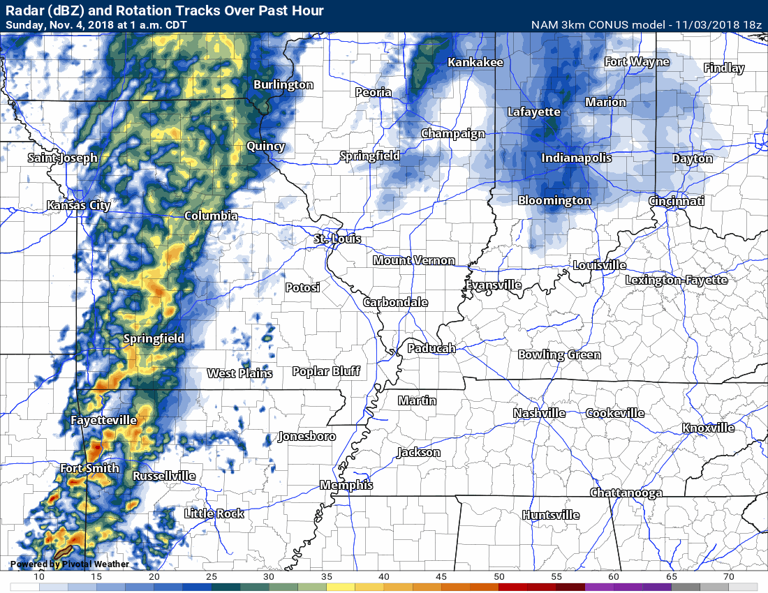
Here is the NAM 3K model future-cast radar. What it believes radar will look like into Monday night.
You can see at the end of the loop the line of showers and storms with the more potent system.
Occasionally, these systems can produce severe weather without much lightning. Keep that in mind.
Rainfall totals of 0.75″ to 1.50″ are anticipated from the Monday event. Locally higher totals are certainly possible. Most of us do not need rain.
Another system will bring additional rain chances around Wednesday/Thursday. That system will bring colder air behind it. Perhaps the coldest air of the season, thus far.
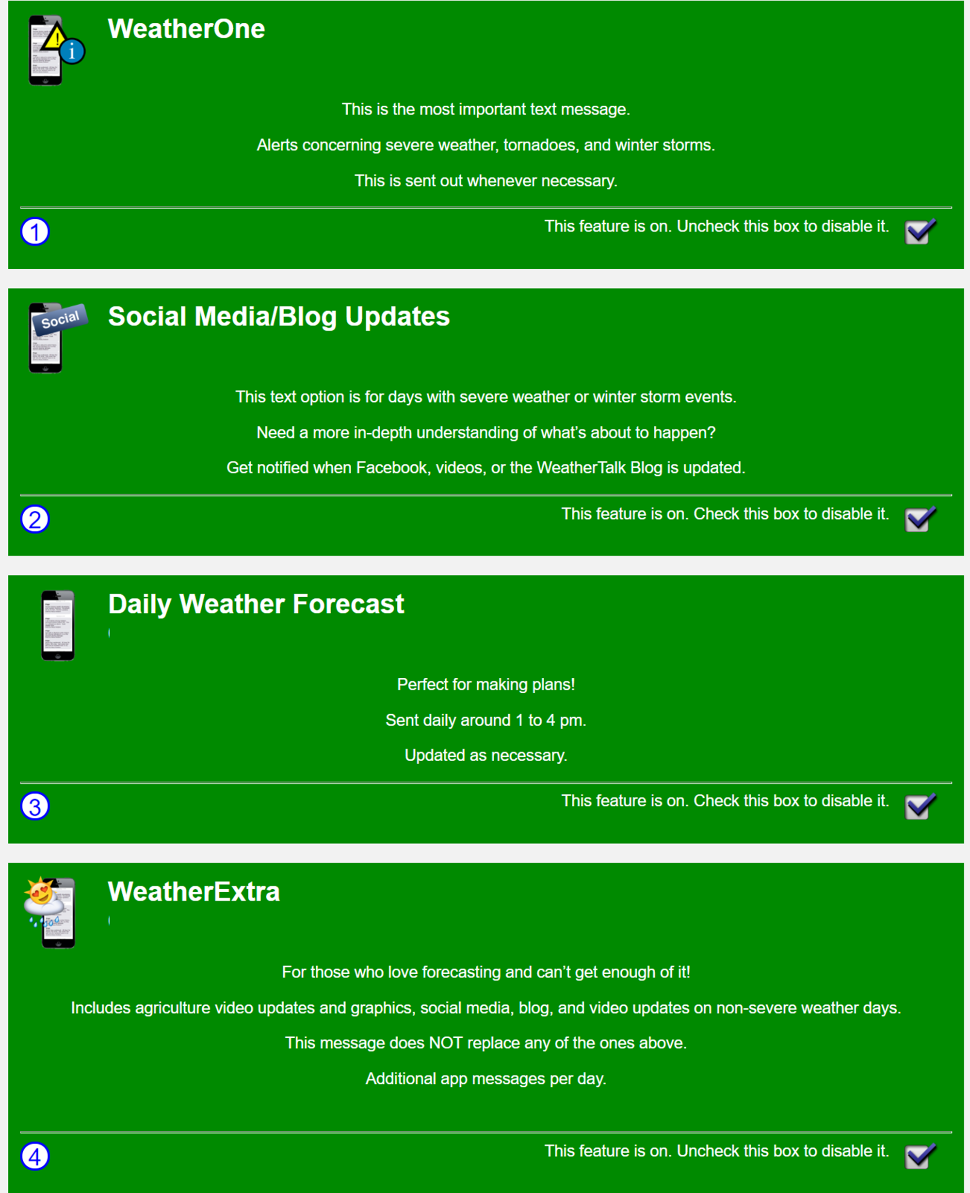
Be sure and turn WeatherOne on in your WeatherTalk accounts. That is the first app/text option.
Also, be sure and use the app to receive your messages. It receives the texts faster.
WeatherOne looks like this (number 1 is WeatherOne)
Green is on.
You can find these under your personal notification settings (within your www.weathertalk.com account).
WeatherTalk monthly operating costs can top $2000.00. Your $5 subscription helps pay for those costs. I work for you.
The $5 will allow you to register up to seven phones!
For $5 a month you can receive the following. You may choose to receive these via your WeatherTalk app or regular text messaging.
Severe weather app/text alerts from my keyboard to your app/cell phone. These are hand typed messages from me to you. During tornado outbreaks, you will receive numerous app/text messages telling you exactly where the tornado is located.
- Daily forecast app/texts from my computer to your app/cell phone.
- Social media links sent directly to your app/cell phone. When I update the blog, videos, or Facebook you will receive the link.
- AWARE emails. These emails keep you well ahead of the storm. They give you several days of lead time before significant weather events.
- Direct access to Beau via text and email. Your very own personal meteorologist. I work for you!
- Missouri and Ohio Valley centered video updates
- Long-range weather videos
- Week one, two, three and four temperature and precipitation outlooks.
Monthly outlooks. - Your subscription also will help support several local charities.
Would you like to subscribe? Subscribe at www.beaudodsonweather.com
Typical progression on a severe weather day for subscribers.


I encourage subscribers to use the app vs regular text messaging. We have found text messaging to be delayed during severe weather. The app typically will receive the messages instantly. I recommend people have three to four methods of receiving their severe weather information.
Remember, my app and text alerts are hand typed and not computer generated. You are being given my personal attention during significant weather events.

WWW.WEATHERTALK.COM subscribers, here is my day to day schedule for your weather products.