WeatherTalk monthly operating costs can top $2000.00. Your $5 subscription helps pay for those costs. I work for you.
The $5 will allow you to register up to seven phones!
For $5 a month you can receive the following. You may choose to receive these via your WeatherTalk app or regular text messaging.
Severe weather app/text alerts from my keyboard to your app/cell phone. These are hand typed messages from me to you. During tornado outbreaks, you will receive numerous app/text messages telling you exactly where the tornado is located.
- Daily forecast app/texts from my computer to your app/cell phone.
- Social media links sent directly to your app/cell phone. When I update the blog, videos, or Facebook you will receive the link.
- AWARE emails. These emails keep you well ahead of the storm. They give you several days of lead time before significant weather events.
- Direct access to Beau via text and email. Your very own personal meteorologist. I work for you!
- Missouri and Ohio Valley centered video updates
- Long-range weather videos
- Week one, two, three and four temperature and precipitation outlooks.
Monthly outlooks. - Your subscription also will help support several local charities.
Would you like to subscribe? Subscribe at www.beaudodsonweather.com
Typical progression on a severe weather day for subscribers.


I encourage subscribers to use the app vs regular text messaging. We have found text messaging to be delayed during severe weather. The app typically will receive the messages instantly. I recommend people have three to four methods of receiving their severe weather information.
Remember, my app and text alerts are hand typed and not computer generated. You are being given my personal attention during significant weather events.

WWW.WEATHERTALK.COM subscribers, here is my day to day schedule for your weather products.
These are bonus videos and maps for subscribers. I bring these to you from the BAMwx team. I pay them to help with videos.
The Ohio and Missouri Valley videos cover most of our area. They do not have a specific Tennessee Valley forecast but may add one in the future.
The long-range video is technical. Over time, you can learn a lot about meteorology from the long range video. Just keep in mind, it is a bit more technical.


.
![]()

November 2, 2018
Friday forecast: A mix of sun and clouds today. A few light showers or sprinkles possible. Greatest chance will be over southeast Missouri and southern Illinois. New rain totals will be less than 0.10″.
Temperatures: MO ~ 54 to 58 IL ~ 54 to 58 KY ~ 56 to 60 TN ~ 58 to 62
What is the chance of precipitation? MO ~ 30% IL ~ 30% KY ~ 20% TN ~ 20%
Coverage of precipitation: Isolated
Wind: Variable wind at 5 to 10 mph
What impacts are anticipated from the weather? Patchy fog and a few wet roadways.
My confidence in the forecast verifying: High
Is snow or ice expected? No
Is severe weather expected? No
The NWS defines severe weather as 58 mph wind or great, 1″ hail or larger, and/or tornadoes
Should I cancel my outdoor plans? No, but check radars
UV Index: 3 to 4 Low to moderate
Sunrise: 7:21 AM
Friday Night Forecast Details:
Forecast: Quite a few clouds. Chilly. An isolated shower possible. Light winds. Patchy fog may develop (esp if we clear out a bit)
Temperatures: MO ~ 36 to 40 IL ~ 36 to 40 KY ~ 36 to 42 TN ~ 38 to 44
What is the chance of precipitation? MO ~ 20% IL ~ 20% KY ~ 20% TN ~ 20%
Coverage of precipitation: Isolated
Frost Risk: Possible
Is snow or ice anticipated? No
Wind: Winds becoming west and northwest at 5 to 10 mph with gusts to 14 mph
What impacts are anticipated from the weather? A few wet roadways. Lower visibility in areas with fog.
My confidence in the forecast verifying: High
Is severe weather expected? No
The NWS defines severe weather as 58 mph wind or great, 1″ hail or larger, and/or tornadoes
Should I cancel my outdoor plans? No, but check radars
Sunset: 5:56 PM
Moonrise: 1:41 AM Waning Crescent
Moonset: 3:26 PM
November 3, 2018
Saturday forecast: Morning fog likely. A mix of sun and clouds. A bit warmer.
Temperatures: MO ~ 60 to 64 IL ~60 to 64 KY ~ 60 to 64 TN ~60 to 64
What is the chance of precipitation? MO ~ 0% IL ~ 0% KY ~ 0% TN ~ 0%
Coverage of precipitation: None
Is snow or ice anticipated? No
Wind: West at 6 to 12 mph
What impacts are anticipated from the weather? Morning fog could lower visibility in some areas. Monitor river crest forecasts over the coming days.
My confidence in the forecast verifying: High
Is severe weather expected? No
The NWS defines severe weather as 58 mph wind or great, 1″ hail or larger, and/or tornadoes
Should I cancel my outdoor plans? No
UV Index: 4 to5 Moderate
Sunrise: 7:22 AM
Saturday Night Forecast Details:
Forecast: Increasing clouds. A few showers may dot radar. Rainfall totals will be less than 0.15″.
Temperatures: MO ~ 46 to 52 IL ~ 46 to 52 KY ~ 48 to 52 TN ~ 48 to 52
What is the chance of precipitation? MO ~ 0% IL ~ 0% KY ~ 0% TN ~ 0%
Coverage of precipitation: None
Frost Risk: No
Is snow or ice anticipated? No
Wind: Becoming east and southeast at 5 to 10 mph with gusts to 14 mph
What impacts are anticipated from the weather? None
My confidence in the forecast verifying: Medium
Is severe weather expected? No
The NWS defines severe weather as 58 mph wind or great, 1″ hail or larger, and/or tornadoes
Should I cancel my outdoor plans? No
Sunset: 5:55 PM
Moonrise: 2:49 AM Waning Crescent
Moonset: 4:03 PM
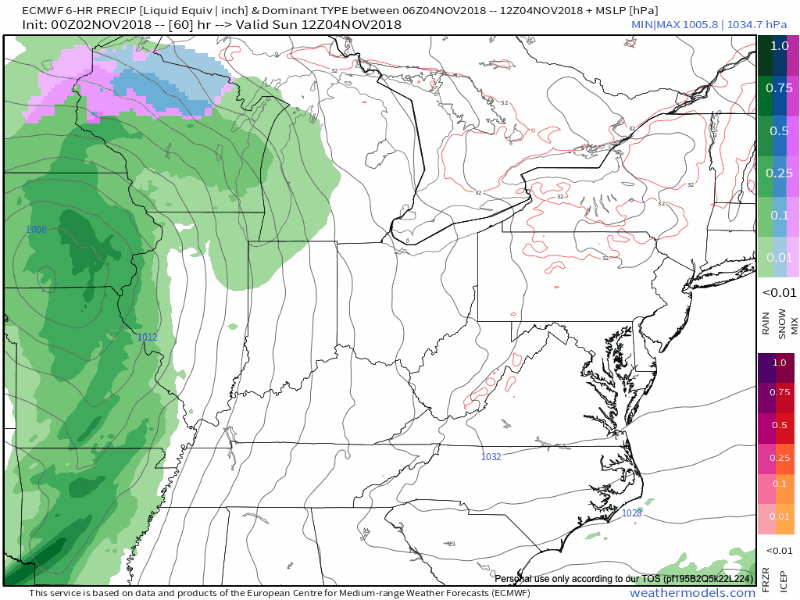
November 4, 2018
Sunday forecast: Cloudy with showers again possible. Breezy. New rain totals 0.10″ to 0.30″.
Temperatures: MO ~ 62 to 66 IL ~ 62 to 66 KY ~ 63 to 66 TN ~ 63 to 66
What is the chance of precipitation? MO ~ 50% to 60% IL ~ 50% to 60% KY ~ 50% to 60% TN ~ 50% to 60%
Coverage of precipitation: Scattered to perhaps numerous
Is snow or ice anticipated? No
Wind: South at 8 to 16 mph with gusts to 25 mph
What impacts are anticipated from the weather? Wet roadways
My confidence in the forecast verifying: Medium
Is severe weather expected? No
The NWS defines severe weather as 58 mph wind or great, 1″ hail or larger, and/or tornadoes
Should I cancel my outdoor plans? No, but check radars
UV Index: 3 to 5 Moderate
Sunrise: 6:23 AM
Sunday Night Forecast Details:
Forecast: Mostly cloudy. A shower again possible. The best chance of rain will be during the AM hours.
Temperatures: MO ~ 45 to 50 IL ~ 45 to 50 KY ~ 45 to 50 TN ~ 46 to 52
What is the chance of precipitation? MO ~ 40% IL ~ 40% KY ~ 40% TN ~ 40%
Coverage of precipitation: Scattered
Frost Risk: None
Is snow or ice anticipated? No
Wind: South 5 to 10 mph
What impacts are anticipated from the weather? Wet roadways.
My confidence in the forecast verifying: Medium
Is severe weather expected? No
The NWS defines severe weather as 58 mph wind or great, 1″ hail or larger, and/or tornadoes
Should I cancel my outdoor plans? Monitor updates
Sunset: 4:54 PM
Moonrise: 2:56 AM Waning Gibbous
Moonset: 3:37 PM
November 5, 2018
Monday forecast: Partly cloudy. A chance of a shower or thunderstorm. Becoming breezy. I am closely monitoring a new storm system that will track into the region Monday into Tuesday. This system could bring heavy rain and strong thunderstorms. The track of the system is key to our severe weather chances. Remember, severe weather can occur during the autumn months. Monitor updates.
Temperatures: MO ~ 62 to 64 IL ~ 62 to 64 KY ~ 62 to 64 TN ~ 62 to 66
What is the chance of precipitation? MO ~ 20% IL ~ 20% KY ~ 20% TN ~ 20%
Coverage of precipitation: Scattered
Is snow or ice anticipated? No
Wind: South at 10 to 20 mph
What impacts are anticipated from the weather? Wet roadways. Lightning. Monitor river crest forecasts over the coming days.
My confidence in the forecast verifying: Medium
Is severe weather expected? Monitor updates.
The NWS defines severe weather as 58 mph wind or great, 1″ hail or larger, and/or tornadoes
Should I cancel my outdoor plans? Monitor updates
UV Index: 3 to 5 Moderate
Sunrise: 6:24 AM
Monday Night Forecast Details:
Forecast: Cloudy with showers and thunderstorms increasing. Monitor the risk of heavy rain and strong thunderstorms. A bit early to know for sure on the severe weather threat.
Temperatures: MO ~ 50 to 55 IL ~ 50 to 55 KY ~ 50 to 55 TN ~ 50 to 55
What is the chance of precipitation? MO ~ 40% IL ~ 40% KY ~ 40% TN ~ 40%
Coverage of precipitation: Scattered to perhaps numerous
Frost Risk: No
Is snow or ice anticipated? No
Wind: Southerly winds at 10 to 20 mph and gusty
What impacts are anticipated from the weather? Wet roadways. Lightning. Monitor the risk of heavy rain and strong thunderstorms.
My confidence in the forecast verifying: Medium
Is severe weather expected? Monitor updates
The NWS defines severe weather as 58 mph wind or great, 1″ hail or larger, and/or tornadoes
Should I cancel my outdoor plans? Have a plan B.
Sunset: 4:53 PM
Moonrise: 4:02 AM Waning Gibbous
Moonset: 4:09 PM
November 6, 2018
Tuesday forecast: Cloudy with a chance of showers and thunderstorms.
Temperatures: MO ~ 63 to 66 with falling temperatures IL ~ 63 to 66 with falling temperatures KY ~ 63 to 66 with falling temperatures TN ~ 63 to 66 with falling temperatures
What is the chance of precipitation? MO ~ 40% IL ~ 40% KY ~ 40% TN ~ 40%
Coverage of precipitation: Scattered to perhaps numerous
Is snow or ice anticipated? No
Wind: Southwest becoming west/northwest at 10 to 20 mph. Higher gusts possible.
What impacts are anticipated from the weather? Wet roadways. Lightning. Monitor the risk of heavy rain and strong thunderstorms.
My confidence in the forecast verifying: Low
Is severe weather expected? Monitor updates
The NWS defines severe weather as 58 mph wind or great, 1″ hail or larger, and/or tornadoes
Should I cancel my outdoor plans? Have a plan B.
UV Index: 1 to 3 Low
Sunrise: 6:23 AM
Tuesday Night Forecast Details:
Forecast: Partly cloudy. Cool. Patchy fog possible. Rain should have come to an end.
Temperatures: MO ~ 35 to 40 IL ~ 35 to 40 KY ~ 35 to 40 TN ~ 35 to 40
What is the chance of precipitation? MO ~ 0% IL ~ 0% KY ~ 20% TN ~ 20%
Coverage of precipitation: Ending
Frost Risk: Monitor
Is snow or ice anticipated? No
Wind: North and northwest at 6 to 12 mph
What impacts are anticipated from the weather? Lower visibility if fog develops.
My confidence in the forecast verifying: Medium
Is severe weather expected? No
The NWS defines severe weather as 58 mph wind or great, 1″ hail or larger, and/or tornadoes
Should I cancel my outdoor plans? No
Sunset: 4:51 PM
Moonrise: 5:06 AM Waning Gibbous
Moonset: 4:42 PM
I am monitoring a potent storm system next Thursday, Friday, and Saturday. This could bring colder air into the region.
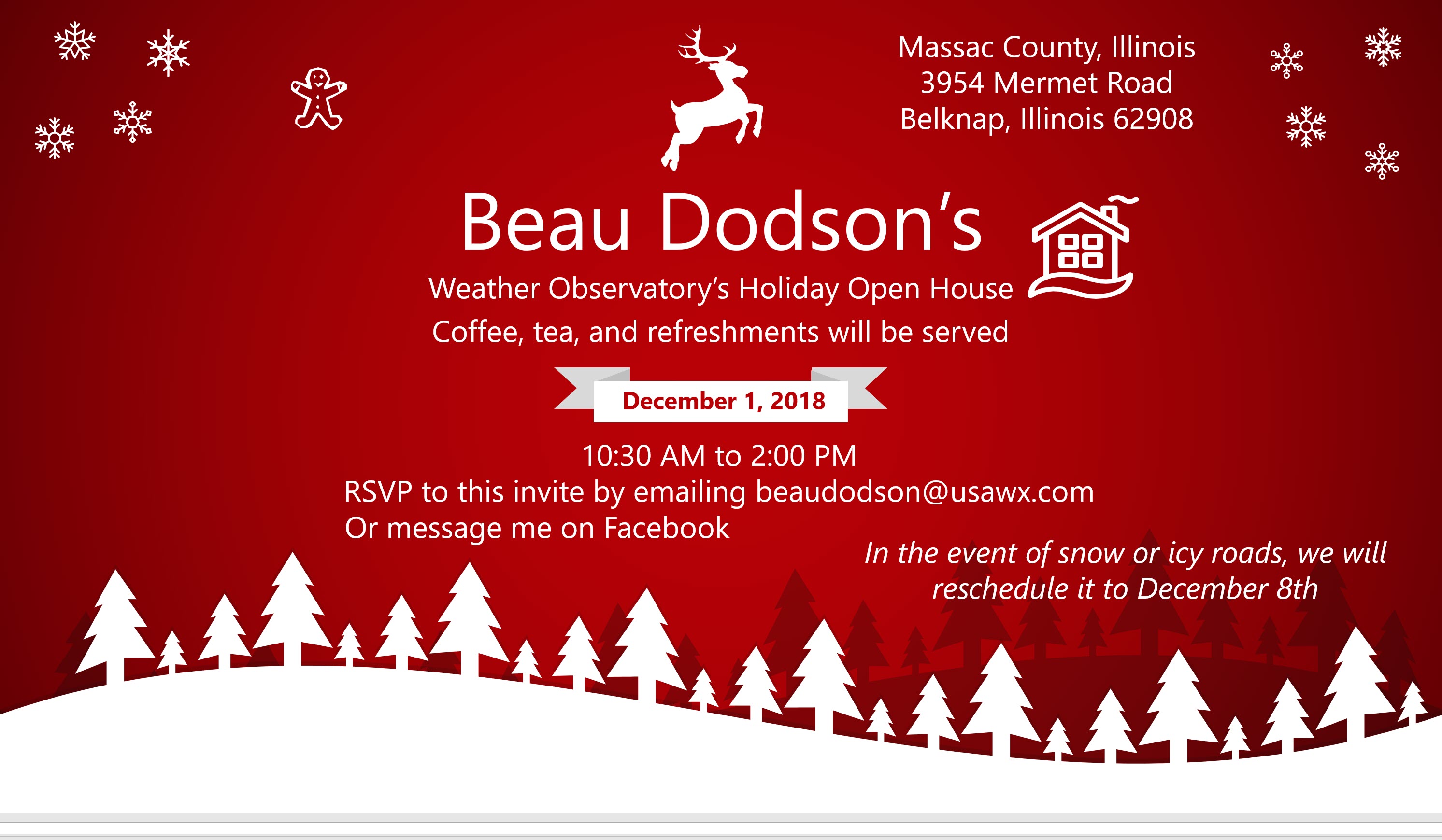
The Weather Observatory will be holding an open house for adults and children. Weather permitting, the open house will be Saturday, December 1st.
Learn more about the UV index readings. Click here.

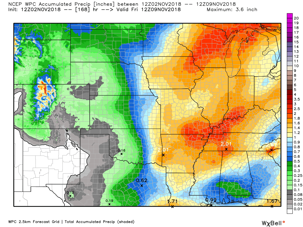
Here is the WPC/NOAA rainfall outlook
The first map is today through Sunday night
Rain totals will be light.
Click all the maps on this page to enlarge

The second map is from today through next Thursday night
Locally heavy rain is possible Monday/Tuesday

Subscribers, do you need a forecast for an outdoor event?


We offer interactive local city live radars and regional radars.
If a radar does not update then try another one. If a radar does not appear to be refreshing then hit Ctrl F5 on your keyboard.
You may also try restarting your browser. The local city view radars also have clickable warnings.
During the winter months, you can track snow and ice by clicking the winterize button on the local city view interactive radars.

Questions? Broken links? Other questions?
You may email me at beaudodson@usawx.com

The National Weather Service defines a severe thunderstorm as one that produces quarter size hail or larger, 58 mph winds or greater, and/or a tornado.
Today through Sunday night. Severe weather is not anticipated.
Monday into Tuesday: Thunderstorms are possible. Depending on the track of an area of low pressure, there could be strong thunderstorms. Monitor the severe weather risk.
Interactive live weather radar page. Choose the city nearest your location. If one of the cities does not work then try a nearby one. Click here.
National map of weather watches and warnings. Click here.
Storm Prediction Center. Click here.
Weather Prediction Center. Click here.

Live lightning data: Click here.

Interactive GOES R satellite. Track clouds. Click here.

Here are the latest local river stage forecast numbers Click Here.
Here are the latest lake stage forecast numbers for Kentucky Lake and Lake Barkley Click Here.

- Unsettled weather
- Saturday should be dry. The pick day of the weekend.
- Rain chances today, Saturday night, and Sunday.
- Strong storm system likely Monday and Tuesday. Monitor the heavy rain and thunderstorm risk.
We still have ongoing flooding in some of our counties. Avoid flooded roadways. There will be sharp rises on area rivers over the coming weeks. Additional heavy rain could increase the concern.
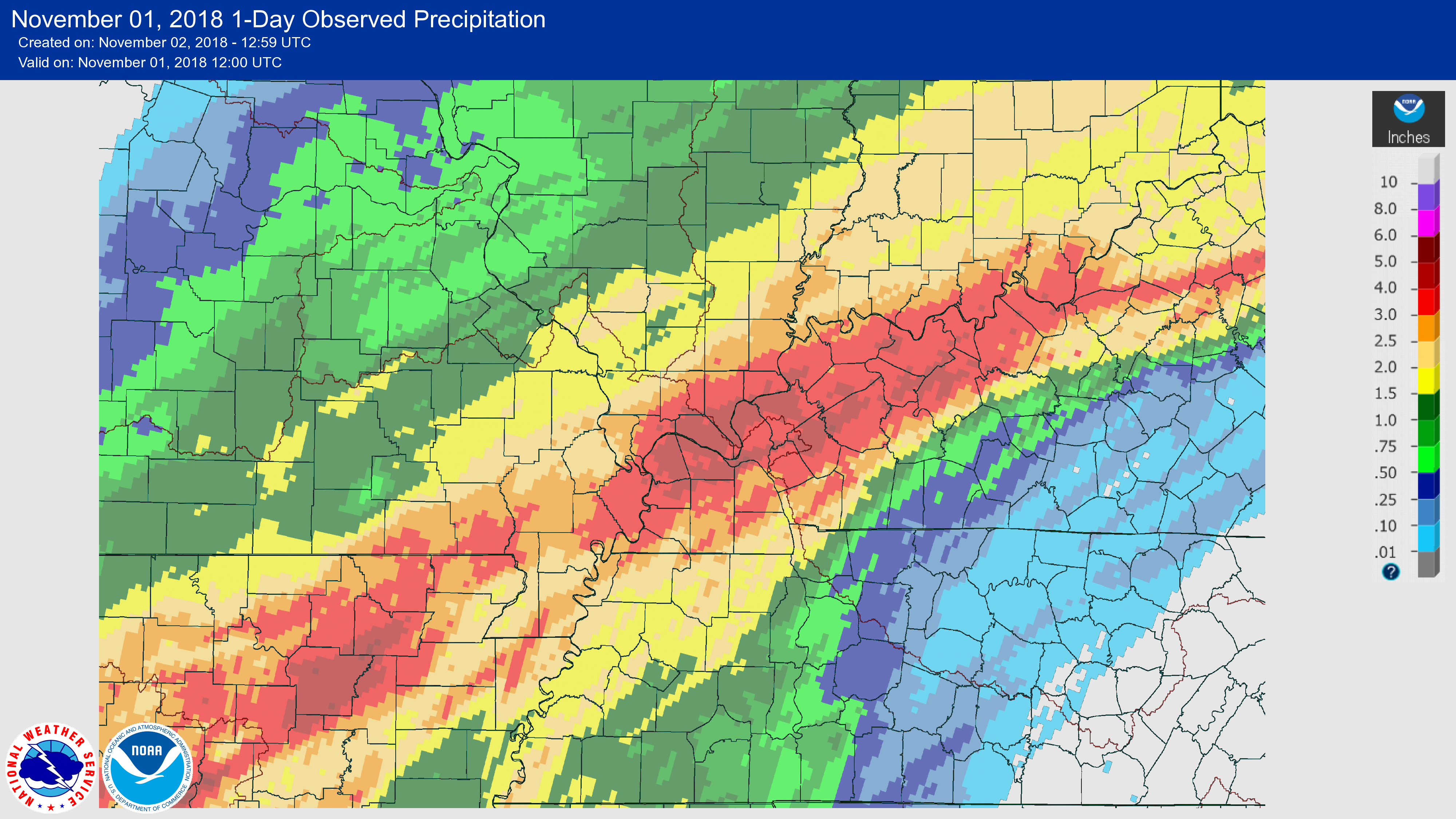
Here are radar estimated rainfall totals from the event. The radars were underestimating rain totals. In some cases greater than an inch of rain was missed by the radars.
The radar algorithms aren’t perfect.
Again, this image shows you what fell during yesterday’s event (WED/THU)
Click image to enlarge
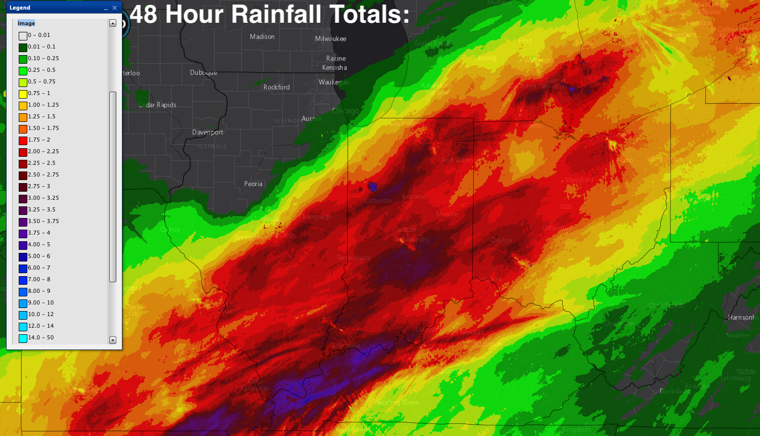
What has already fallen
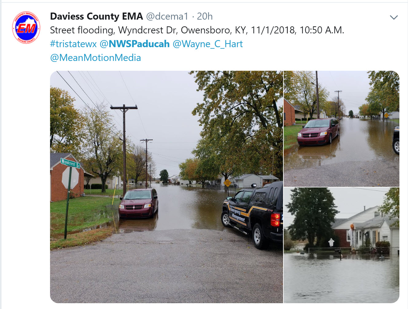
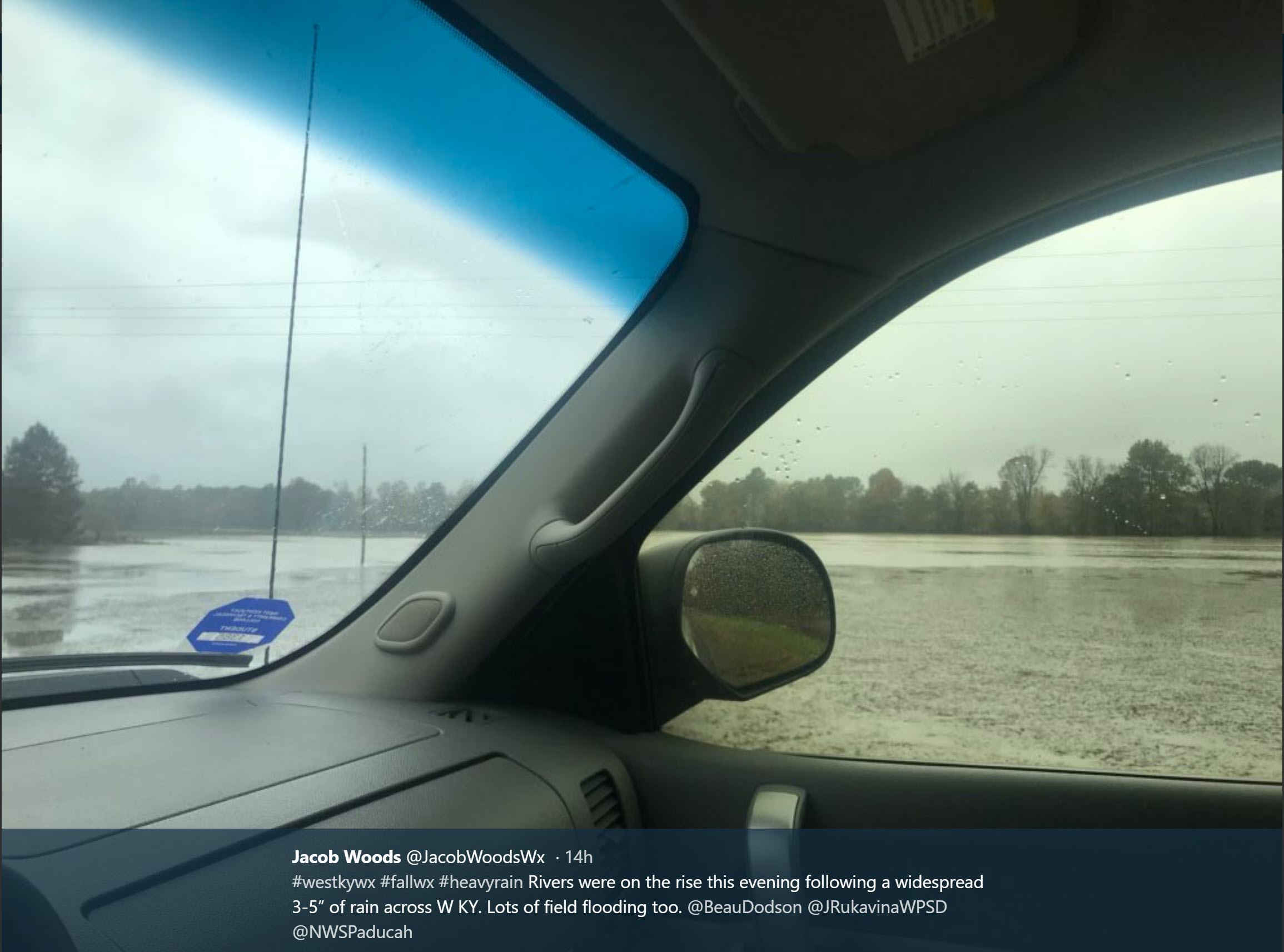
Here are a couple of photographs from Twitter. One is from the Daviess County Emergency Management team. The other one is from Jacob Woods (western Kentucky).
The photograph below is from Jacob Woods.
Today through Sunday
The good news is that heavy rain is not in the cards today through Sunday night.
Unfortunately, some light rain and clouds, however, will linger.
We do have two weak systems to monitor.
The first system will pass through the region today. A few spotty light showers are likely. Cool temperatures today, as well.
Another weak system arrives on Sunday. This system will produce better chances of precipitation. It is forecast to remain on the light side.
The pick day of the weekend will be Saturday. Clouds may linger into Saturday. Patchy morning fog, as well. I am hoping that the clouds will clear Saturday. This is not a certainty. It is our best bet to see the sun over the coming days.
 ]
]
Monday and Tuesday
A larger storm system is possible during Monday and Tuesday. As a matter of fact, if the area of low pressure passes to our west then we are looking at additional moderate to heavy rain chances. There is also a significant risk of severe thunderstorms south and east of the low’s track.
The risk of strong thunderstorms will need to be monitored. If the models are correct, then this event could produce intense thunderstorms.
Autumn is typically our second severe weather season (I don’t like that word, because we can have severe weather all twelve months). We do normally see an event or two during the Month of November.
It is important to monitor updated forecasts.
Additional moderate to heavy rain would cause some flooding concerns. The ground is saturated from recent rains.
THe GFS depicts this as a severe weather threat for our local area.
You can see the red L in Missouri. That is the area of low pressure. If that is the correct track then that places us on the warm and moist side. The atmosphere would likely unstable. The end result would be heavy rain and strong thunderstorms.
The track of the low is key, as always.
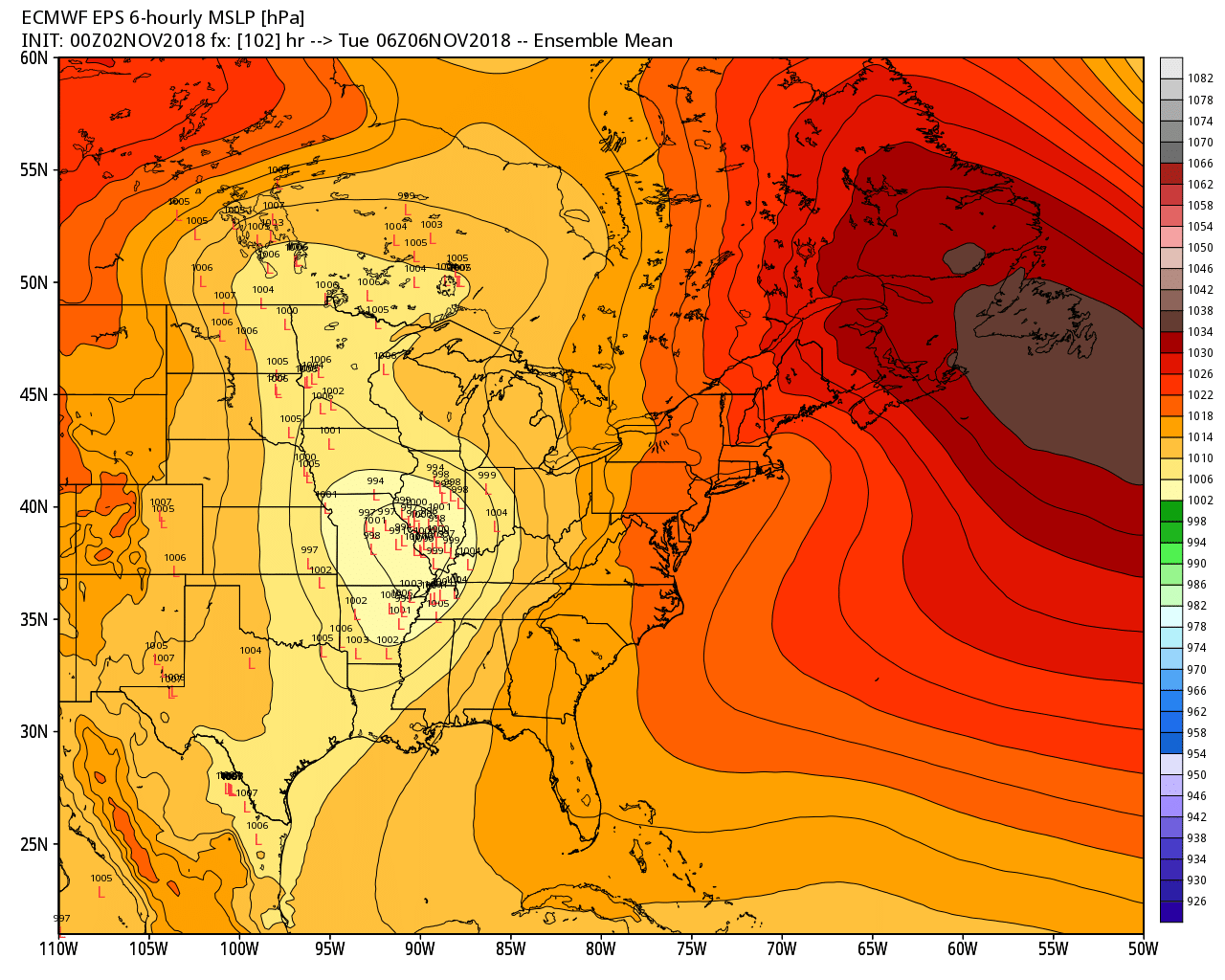
The EC and GFS track the low to our west.
Check out the EC ensembles.

The EC ensembles track the low over us or to our west. Again, this places us in the thunderstorm zone.
PWAT values will surge ahead of the cold front. That could mean heavy rain.
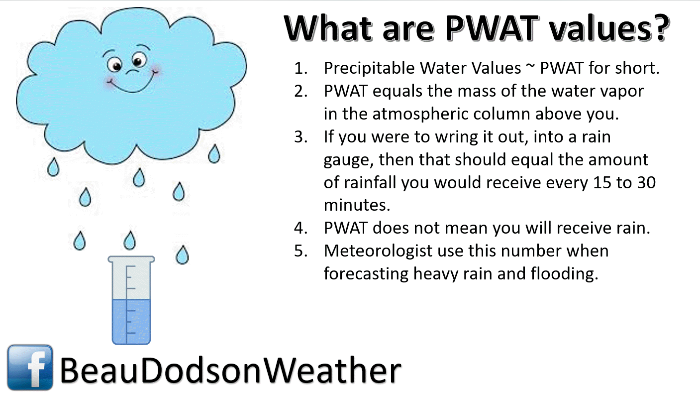
Here are the forecast PWAT values. That is in the top of the range for this time of the year.
Notice how it comes out of the Gulf of Mexico?
The low spins counter-clockwise. As the low spins counter-clockwise it pulls moisture northward.

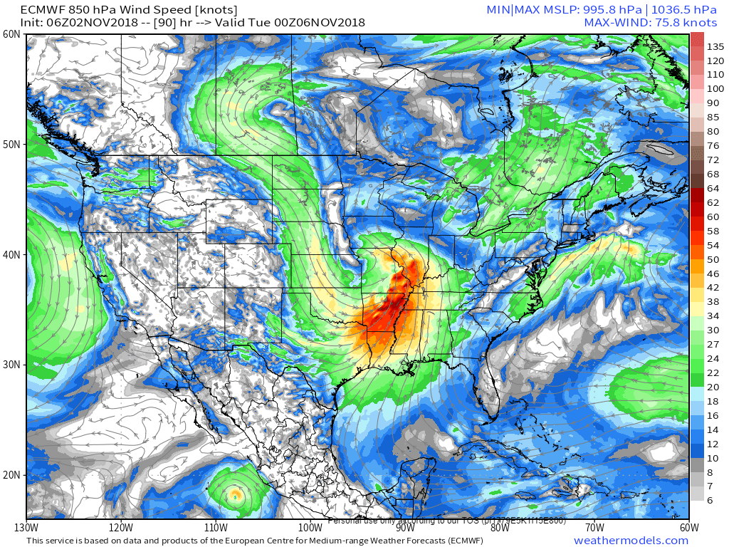
The model guidance is showing strong jet stream winds. That would be a concern if true.
Here is the 850 mb wind map. Those red and orange colors represent strong winds at about 5000′. More than sufficient for concern.
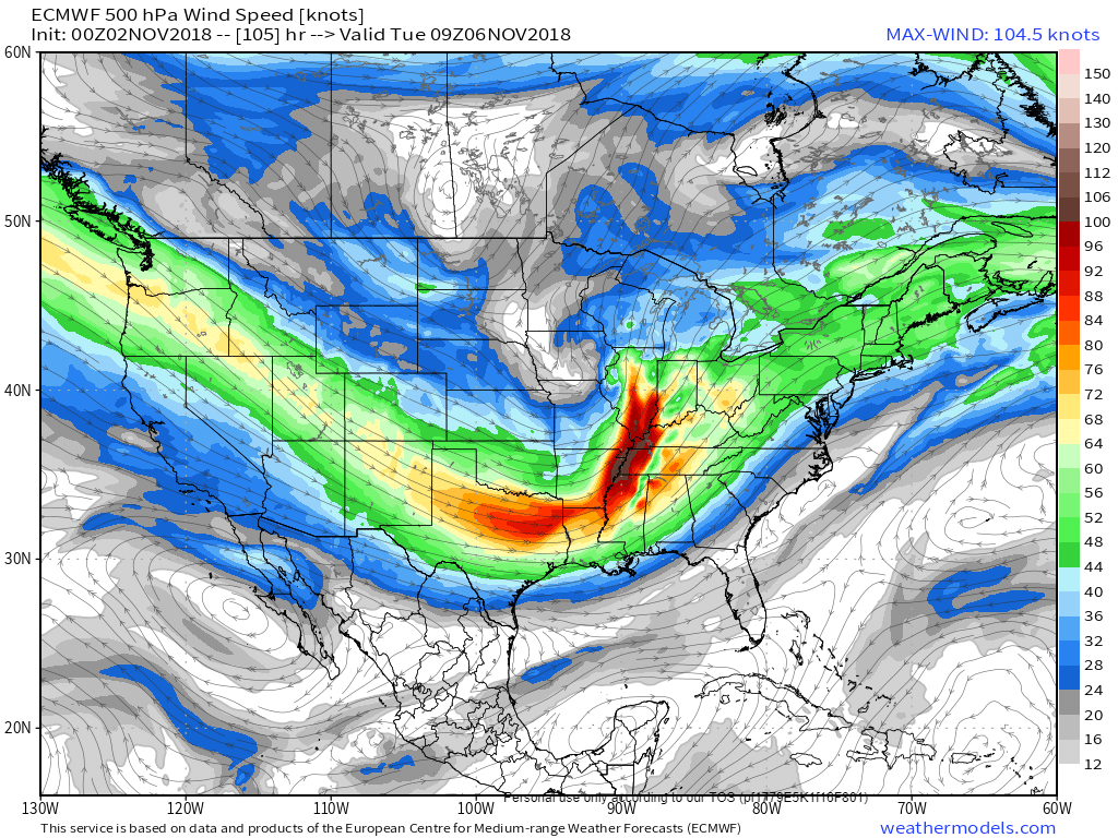
The 500 mb map is quite impressive. This is the jet stream.
It shows 100+ knots over our region (aloft). That is a lot of energy to work with.
This shows the potential of severe weather. Those red colors to dark red colors are the strongest jet stream winds.
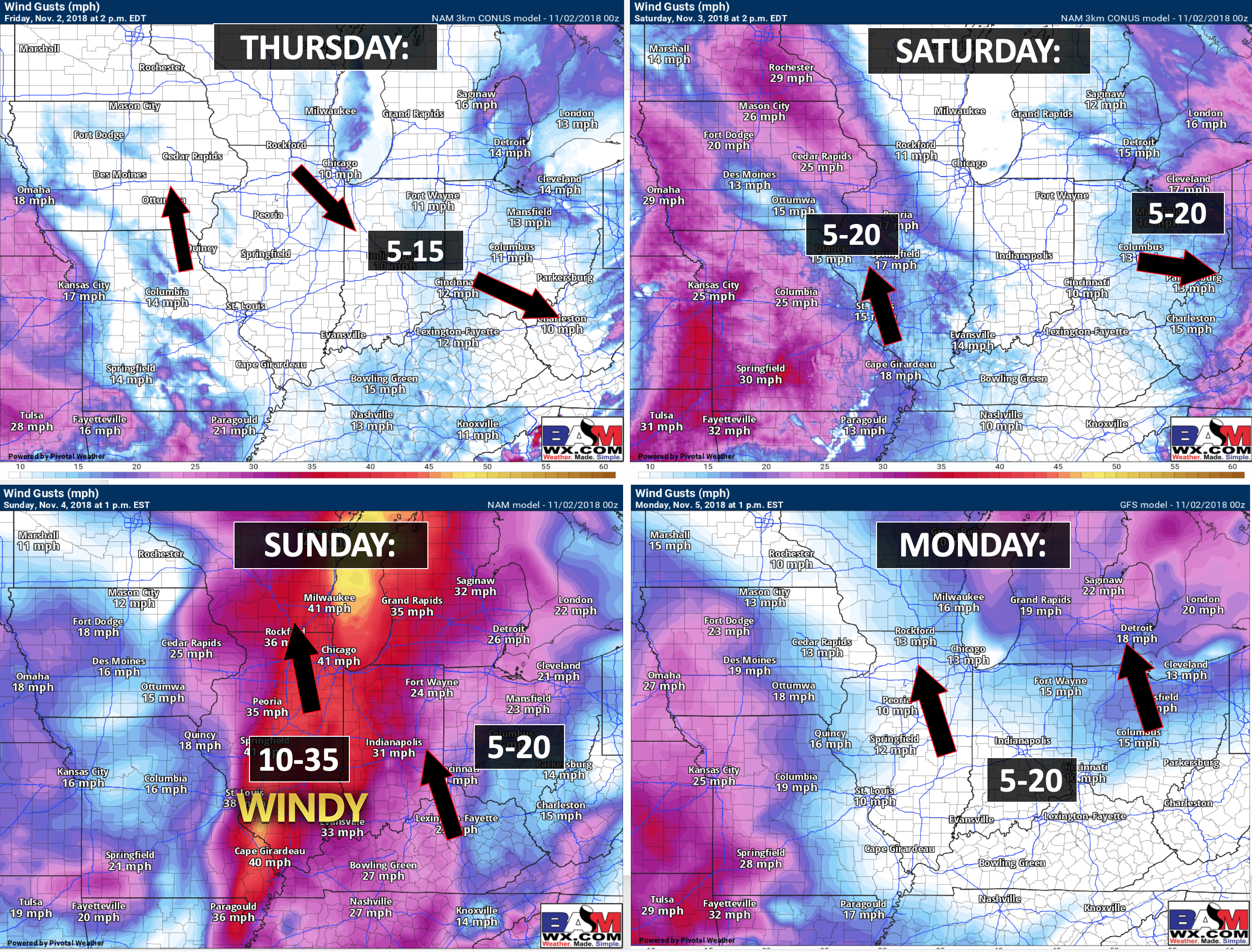
The system is quite wound up. Windy weather would also likely occur.

The system pulls away from our local area and creates a blizzard well to our north and northeast. Tight pressure gradient. The black lines are equal lines of pressure. Tight isobars produce strong and gusty wind conditions.
The EC model shows a severe weather threat locally, as well.
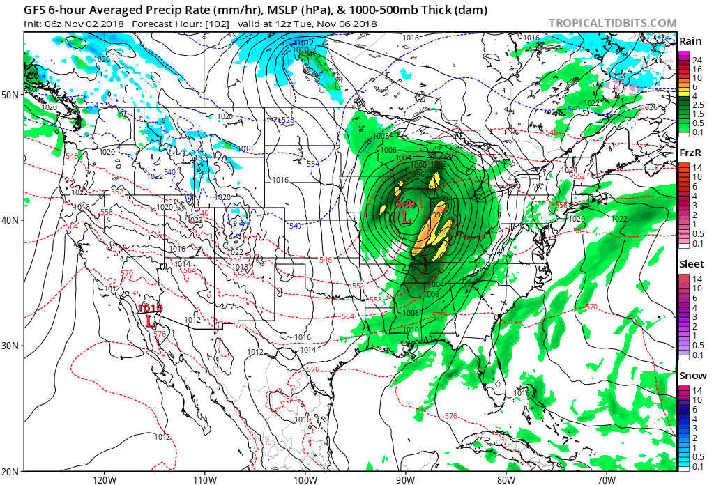
Here is the EC animation. You are watching a storm system coming out of the southwest Monday/Tuesday.
The green colors represent rain. Darker colors are heavier rain.
The EC tracks the low through Missouri, as well. That places us on the warm and moist side of the storm.
Colder weather would follow that system.
Rain chances Wednesday into Friday will be lower, but perhaps not zero. A weak system could bring a few clouds and showers during this time period. For now, I am not overly concerned. I will monitor trends.
Again, rivers will be on the rise.
Updated November outlook for subscribers!
Temperatures
Precipitation
![]()

I bring these to you from the BAMwx team. They are excellent long-range forecasters.
Remember, long-range outlooks are a bit of skill, understanding weather patterns, and luck combined. It is not an exact science.

This product is for subscribers.
Subscribe at www.weathertalk.com
Subscriber graphics can be viewed on this page CLICK HERE

This product is for subscribers.

This product is for subscribers.
Subscribe at www.weathertalk.com
Subscriber graphics can be viewed on this page CLICK HERE
![]()
.
Fall Outlook!
Preliminary October precipitation outlook
.
Here is the preliminary November temperature and precipitation outlook
.
Preliminary November temperature outlook
Preliminary November precipitation outlook
.These products are for subscribers.
![]()

A new weather podcast is now available! Weather Geeks (which you might remember is on The Weather Channel each Sunday)
To learn more visit their website. Click here.
![]()

WeatherBrains Episode 667
This week’s Guest WeatherBrain studied climatology at McGill University. She received her Bachelor’s degree in Climatology and her Master’s of Science in Atmospheric and Oceanic Sciences. She studied at the climatic research unit in the UK, and her phD is in Historical Climatology and Atmospheric Circulations from the University of East Anglia. She’s also worked as a researcher in residence at McGill University. Dr. Victoria Slonosky, welcome to WeatherBrains!
Other discussions in this weekly podcast include topics like:
- Discussion on social media’s security issues/concerns
- Possible severe weather on Halloween across the Mississippi Valley
- Recent tornadoes in Oregon and New York State
- Astronomy Outlook with Tony Rice
- and more!
Link to their website https://weatherbrains.com/
Previous episodes can be viewed by clicking here.

We offer interactive local city live radars and regional radars. If a radar does not update then try another one. If a radar does not appear to be refreshing then hit Ctrl F5. You may also try restarting your browser.
The local city view radars also have clickable warnings.
During the winter months, you can track snow and ice by clicking the winterize button on the local city view interactive radars.
You may email me at beaudodson@usawx.com
Find me on Facebook!

Find me on Twitter!

Did you know that a portion of your monthly subscription helps support local charity projects?
You can learn more about those projects by visiting the Shadow Angel Foundation website and the Beau Dodson News website.

I encourage subscribers to use the app vs regular text messaging. We have found text messaging to be delayed during severe weather. The app typically will receive the messages instantly. I recommend people have three to four methods of receiving their severe weather information.
Remember, my app and text alerts are hand typed and not computer generated. You are being given personal attention during significant weather events.
