

November 4, 2014: This forecast update covers far southern Illinois, far southeast Missouri, and far western Kentucky. See the coverage map on the right side of the blog.
Tuesday – Mostly cloudy sky conditions. An increasing chance for showers as the day wears on. Precipitation will move in from the west. High temperatures will be in the lower 60’s. Temperatures may fall a few degrees during the late afternoon hours. South/southwest winds at 5-10 mph – occasional gust to 15 mph during the afternoon hours. Chance of rain 40%-60% by early afternoon increasing to 60%+ by late afternoon and evening.
Morning School Bus Stop Weather – Mostly cloudy. A small chance for a shower. Temperatures will be in the 46-52 degree range. South winds at 5 mph.
Afternoon School Bus Stop Weather – Mostly cloudy with showers possible. Temperatures will be in the upper 50’s and lower 60’s. South winds at 5-10 mph.
Tuesday Night – Showers likely. Low temperatures will be in the upper 40’s. Winds will be from the west/southwest at 5-10 mph then out of the north late in the evening into Wednesday morning. Chance of rain 80%.
Wednesday – Mostly cloudy with a good chance for rain. A heavy downpour possible, especially over western Kentucky. Rain will end from west to east through the afternoon hours. High temperatures will be in the 55-60 degree range. Temperatures may fall during the afternoon. Winds will be from the northeast/east at 5-10 mph. Chance of rain 80%.
Morning School Bus Stop Weather – Mostly cloudy. Showers. Temperatures will be around 50 degrees. Northeast winds at 5 mph.
Afternoon School Bus Stop Weather – Mostly cloudy. A chance for showers. Temperatures will be in the 55-60 degree range. East winds at 5-10 mph.
Wednesday Night – Decreasing clouds. Cool. Low temperatures will be in the middle 40’s. Southwest winds at 5 mph.
Thursday – Partly cloudy. Windy at times. High temperatures in the 50’s. Winds from the northwest at 10-15 mph. Gusty in the afternoon. Some gusts above 20 mph possible.
TRACK THE RAIN TODAY:
We have regional radars and local city radars – if a radar does not seem to be updating then try another one. Occasional browsers need their cache cleared. You may also try restarting your browser. That usually fixes the problem. Occasionally we do have a radar go down. That is why I have duplicates. Thus, if one fails then try another one.

An explanation of what is happening in the atmosphere over the coming days.
Our much anticipated rain maker is knocking on the door. Rain is spreading across portions of Illinois, Missouri, and Arkansas. This rain will spread east/southeast across our region as the day wears on. Rain will first move into southeast Missouri and southwest Illinois. Rain should approach far southeast Missouri, far southern Illinois, and western Kentucky later this afternoon.
Here is the 6 am radar image. Check out the band of rain that extends all the way from Texas into Michigan. The entire area is moving northeast and slowly shifting east.
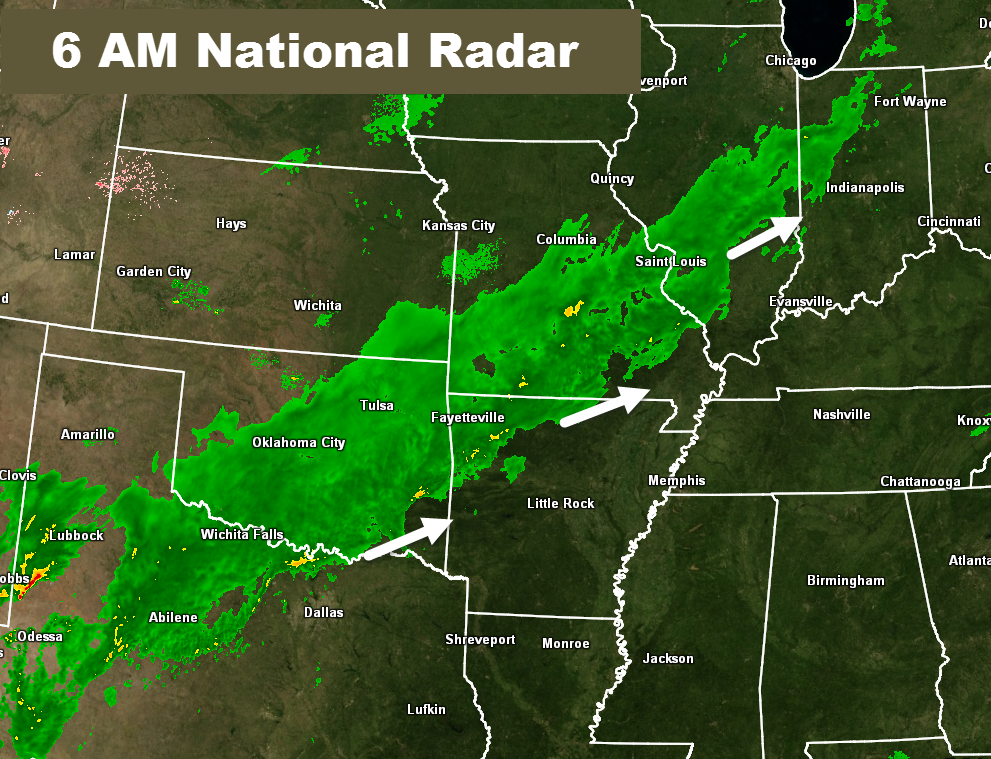
Still some minor disagreements on exactly what time the rain will reach the Cape Girardeau, Missouri – Carbondale, Illinois line. As of 6 am this morning showers are already spreading pretty far southeast over parts of southeast Missouri and southern Illinois. Precipitation will overspread the rest of the area as we push through the day.
It does not appear that thunderstorms are a concern with this particular system. Rainfall totals should range from 0.50″ to 1.00″ across most of the region. Pockets of greater than 1″ of rain will likely occur in a band stretching across far southeast Missouri into far southern Illinois and western Kentucky. Latest data continues to indicate a few spots may pick up 1.5″-2.0″ of rain.
There might (although this is not a given) be a lull in the precipitation later tonight and early Wednesday morning before another slug of precipitation pushes northeast out of Arkansas. Rain will exit moist of southeast Missouri and southern Illinois during the afternoon hours. Rain will linger longer over western Kentucky.
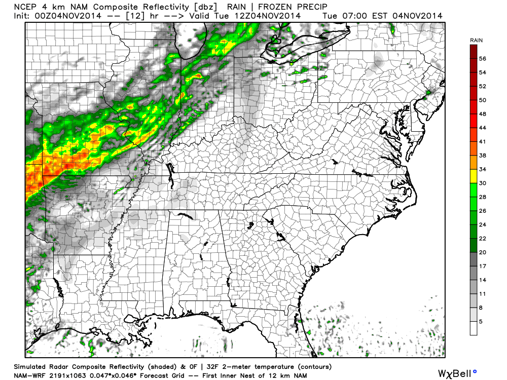
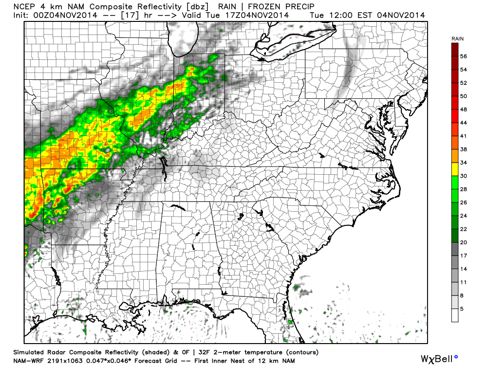
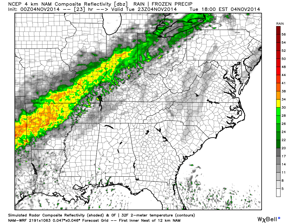
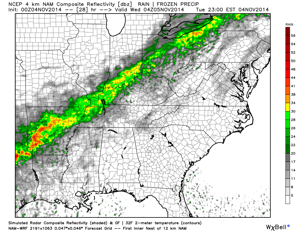
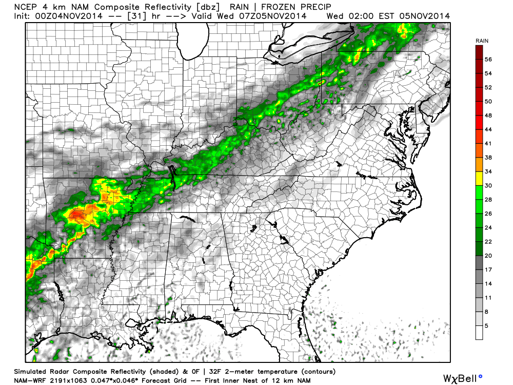
Let’s take a look at a series of future-cast radar images (from weatherbell.com). These maps will give you a general idea of the placement of precipitation as we move through today. Again, this is the models interpretation of how the rain should propagate through the area.
The bright colors represent rain. Light to moderate rain. These bright colors do not represent thunderstorms or severe weather.
Future-cast radar for the 6 am to 8 am time frame. You can see rain spreading into the region. You can also pull up real-time radar to see this precipitation.
Future-cast radar for the 11 am to 12 pm time frame.
Future-cast radar for the 4 pm to 6 pm time frame.
Future-cast radar for the 9 pm to 11 pm time frame – Tuesday night.
Future-cast radar for the 12 am to 2 am time frame – Wednesday morning.
Future-cast radar for the 8 am to 10 am time frame – Wednesday morning.
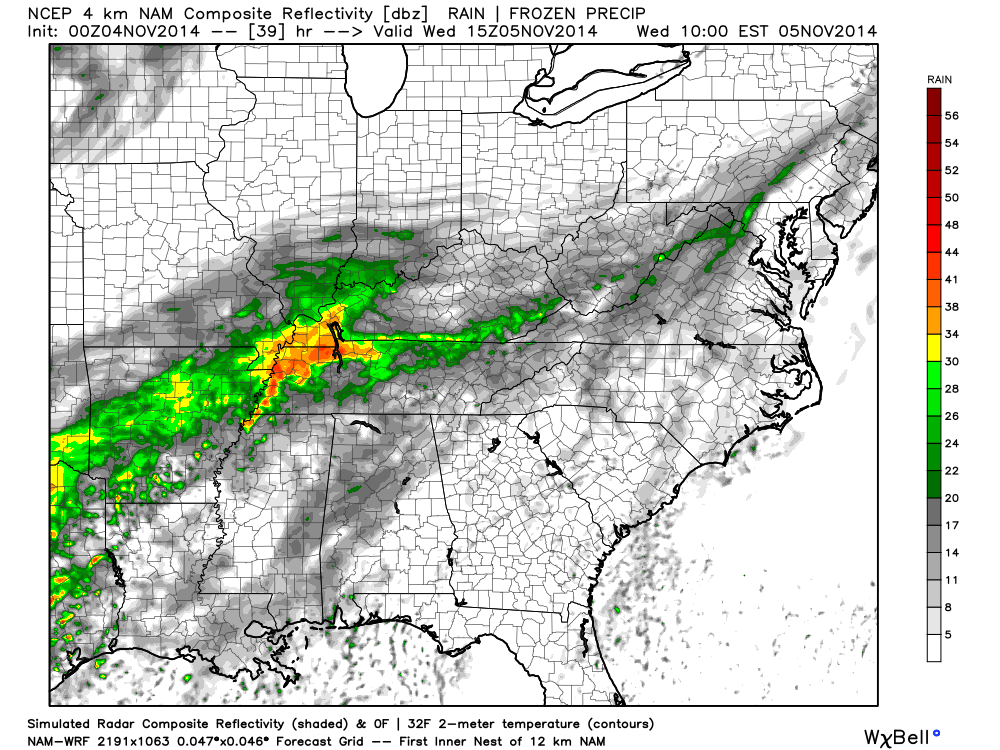
As you can see from the future-cast radar shots…quite a bit of rain is heading our way.
Current temperatures around the area

National Temperature Map. Note the warmer air moving northward ahead of the cold front. This is a good indication of the warm/moist air streaming back into the region. Also note the cold air behind the system back over Nebraska and Kansas.

You can also see the dew point temperatures. Dew point is an indicator that meteorologists use to determine how much moisture is in the air. You can see the higher dew points being pulled northward ahead of our cold front. Readings drop off behind the cold front.

Infrared satellite image shows all of the clouds over the region. You can see the clouds extend all the way back into the Pacific Ocean. That is quite the moisture fetch.

Zoomed in view of the infrared satellite view. Lots of clouds this morning.


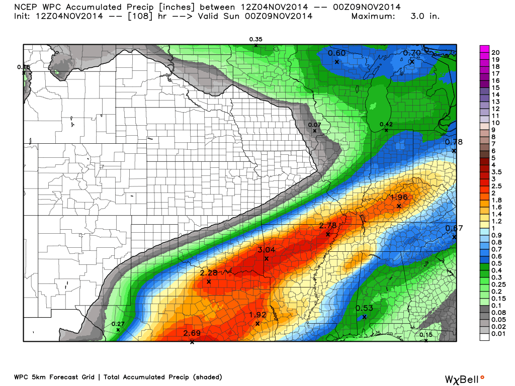
I have increased rainfall totals. Previous thinking was most areas would pick up 0.40″-0.80″ with pockets of greater than 1″. It now appears that widespread 0.50″-1.00″ will fall. A few places may pick up a bit more. Here is the latest rainfall forecast -hot off the presses. This gives you a general idea of how much rain is expected. You can see the increase in totals from previous forecasts.
This might be a bit overdone, but you get the general idea.

There could be a few spots where water ponds on roadways. Areas where leaves are clogging drainage systems could also experience a few problems. Keep this in mind as you are out and about.

The Wild Card gives you an idea of what might change that would cause the forecast to bust. A busted forecast means a forecast that does not verify. For example, if a winter storm (the area of low pressure) shifts its track 50 miles further south than expected, then that could cause a dramatic change in how much snow might or might not accumulate.
Wild card in this forecast will be the exact timing of the precipitation for areas along and east/southeast of Sikeston to Cape Girardeau, Missouri to Carbondale, Illinois to Vienna, Illinois. I have covered this topic in the analysis at the top of the page.
Rainfall totals continue to be a bit of a wild card, as well. Some places may pick up more than 1.5″ of rain. The second wave of precipitation on Wednesday will be key in achieving some of the higher rainfall totals. It does appear the bulk of the second wave of precipitation would fall over the Missouri Bootheel into Western Kentucky (perhaps far southern Illinois).
Otherwise, most areas should pick up 0.50″-1.00″ of rain. There are always a few spots that end up with a bit less and bit more. Typical for a system like this.
Bottom line – quite a bit of rain is forecast over the coming 24-36 hours.

Can we expect severe thunderstorms over the next 24 to 48 hours? Remember that a severe thunderstorm is defined as a thunderstorm that produces 58 mph winds or higher, quarter size hail or larger, and/or a tornado.
Severe weather is not going to be a concern through Thursday.
Thunderstorm threat level is zero.


Live Lightning Data – zoom and pan: Click here
Live Lightning Data with sound (click the sound button on the left side of the page): Click here

Umbrellas will be in order for today, tonight, and part of Wednesday.

Please visit your local National Weather Service Office by clicking here. The National Weather Service Office, for our region, is located in Paducah, Kentucky.
![]()
We have regional radars and local city radars – if a radar does not seem to be updating then try another one. Occasional browsers need their cache cleared. You may also try restarting your browser. That usually fixes the problem. Occasionally we do have a radar go down. That is why I have duplicates. Thus, if one fails then try another one.
If you have any problems then please send me an email beaudodson@usawx.com
WEATHER RADAR PAGE – Click here —
We also have a new national interactive radar – you can view that radar by clicking here.
Local interactive city radars include St Louis, Mt Vernon, Evansville, Poplar Bluff, Cape Girardeau, Marion, Paducah, Hopkinsville, Memphis, Nashville, Dyersburg, and all of eastern Kentucky – these are interactive radars. Local city radars – click here

Regional Radar – Click on radar to take you our full radar page.


Regional Radar

Current WARNINGS (a warning means take action now). Click on your county to drill down to the latest warning information. Keep in mind that there can be a 2-3 minute delay in the updated warning information.
I strongly encourage you to use a NOAA Weather Radio or warning cell phone app for the most up to date warning information. Nothing is faster than a NOAA weather radio.


I have added a lot of new maps to the Southern Illinois Weather Observatory web-site. Check them out by clicking here.

How much rain should this system produce over our region?
Once again, here is the latest rainfall forecast. This gives you a general idea of what can be expected through Wednesday afternoon.

A chilly weekend is on tap for the region.
Another clipper system (area of low pressure that dives out of Canada) will move out of Canada by the end of the week. This will once again spread rain into parts of the Ohio Valley. The system should be far enough northeast of our local area to prevent widespread precipitation. It will, however, cause a bit of a squeeze play between the low pressure (over Wisconsin) and the high pressure (over the Midwest). The tight isobars (see those light blue lines that are closely packed together over Illinois/Missouri) on this map indicate windy conditions.
Expect windy and cooler temperatures as this system moves southeast through Illinois and Indiana on Thursday and Friday.
The purple and pink colors on this map indicate rainfall (or perhaps snowfall if you go far enough north into Wisconsin).
The current thinking is that this system will remain far enough northeast of our region to prevent precipitation chances from being added to the forecast. If it were to produce precipitation then it would be on the light side. I will monitor for any changes. It will, however, be responsible for ushering in some additional cool air for the upcoming weekend.
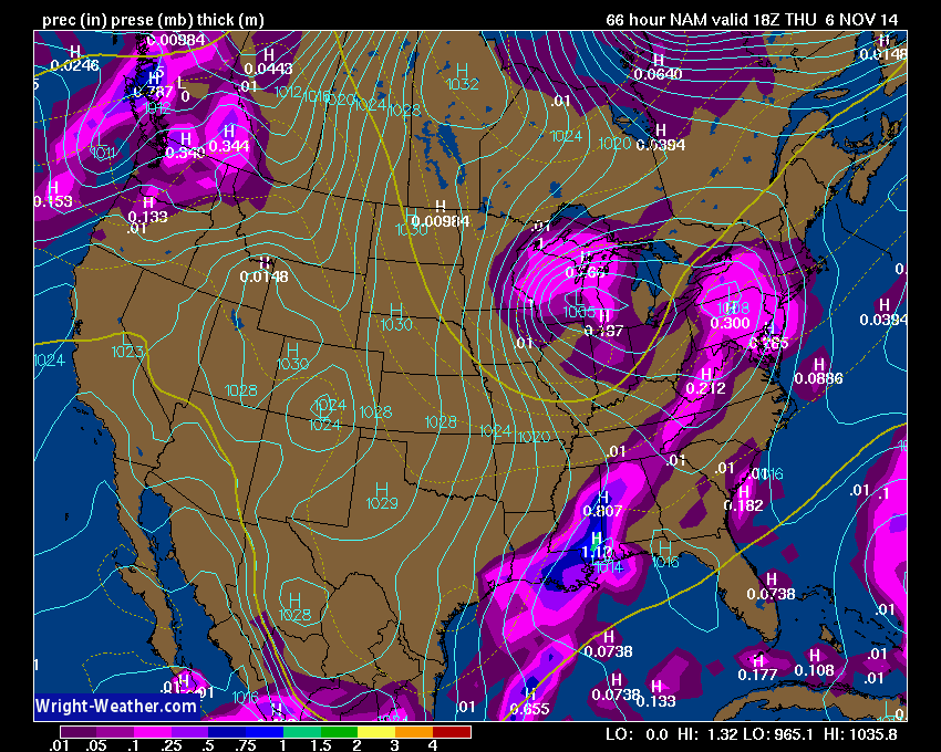
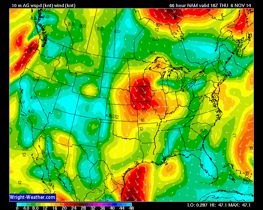
The wind map (below) shows you the gusty winds expected on Thursday. Winds should gust above 20 mph over our local counties. This is in response to the tight pressure gradient that will set up over the Missouri and Ohio Valleys. Again, note the tight isobars on the map above – the light blue lines that squiggle through Missouri and Illinois. When those lines are packed close together we normally experience gusty winds.
Here is the wind forecast map – scale is at the bottom of the map. Nothing “extreme” for our local counties, but still windy. Perhaps windy enough to blow some of those fall leaves around.
The 6-10 day temperature outlook is showing below normal temperatures for our region. this covers Sunday, November 9th through Thursday, November 13th. Seems to be the same pattern we have been in since last October.
The numbers at the top of the scale represent the % chance of temperatures being below normal. The darker the color of blue the better chance for below normal temperatures. You can see that we currently have a 60% chance for below normal temperatures. Normal high temperatures for this time of the year are around 64 degrees. Normal low temperatures for this time of the year are around 42 degrees.
The 6-10 precipitation map (second map) indicates that odds favor below normal precipitation. This map covers Sundau, November 9th through Thursday, November 13th.


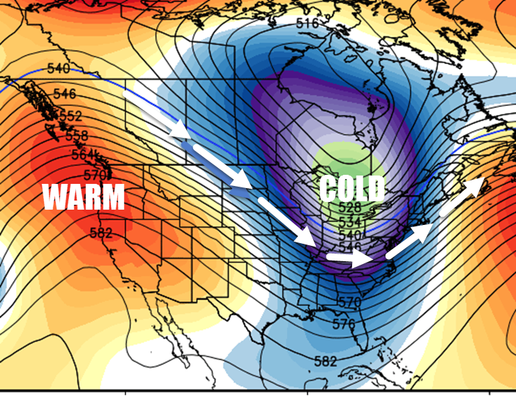
The long range GEFS data indicates several cool/cold shots over the coming 7-14 day period. Here are two maps that give you an idea of what the upper level flow will look like. You can see a trough over our region. Typically this type of upper level pattern is associated with a storm system diving in from Canada. That will be the case this time. You can also see the ridge in the west. A ridge typically indicates warmer temperatures. A trough typically indicates cooler temperatures.
Ridge goes up and a trough goes down. Best way to remember the two. They correlate with each other. When there is a ridge in the west we usually have a trough in the east. When it is warm in Alaska it is usually cold on our region (during the winter months).
When we see the lines on this map diving down from the north or northwest then we can just assume temperatures will be below normal. This is because of the source of that air is up in Canada.
The first map is for Sunday and the second map is for next Wednesday. The third image is the map for next Thursday. You can see the trough lingering. We will have to see how long it actually sticks around. Click on the images to view the full size.
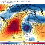
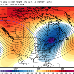
First map is for Friday the 6th. Second map is for Sunday the 9th. The last map above is for Thursday the 13th. All three images indicate a lot of blue for the eastern United States. A good indicator of below normal temperatures.
Here is a blown up view of the ridge in the west and the trough in the east. This is the map for Sunday. Do you get the general idea of the upper level flow? Winds are diving down from Canada into our region. That indicates cooler temperatures. The core of the cold air will be up over Ontario and Michigan (the green area embedded in the blue/purple).
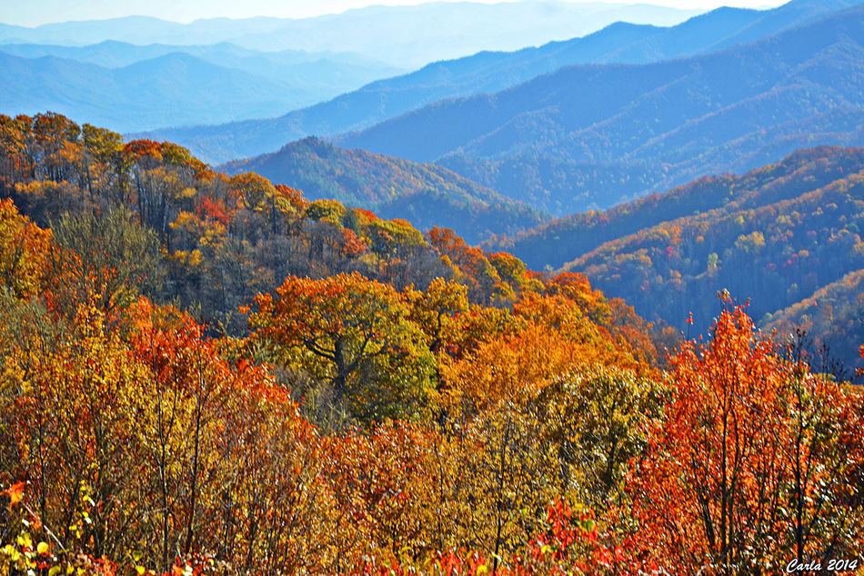
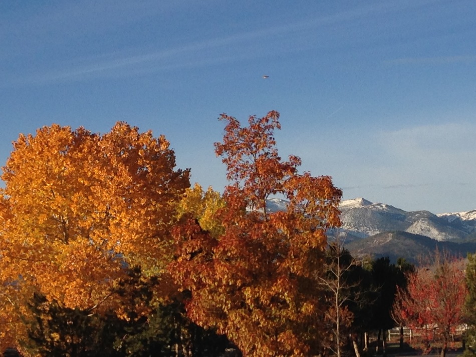
Speaking of fall and cooler temperatures! Here are some photographs from the www.wunderground.com web-site. Always some beautiful photographs on their site.
This first one is from Cherokee, North Carolina. Looks like fall is certainly in full swing!
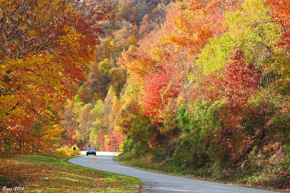
This next photograph is also from Cherokee, North Carolina.
This last photograph is from Reno, Nevada. Who doesn’t love fall?
Current tower cam view from the Weather Observatory- Click here for all cameras.

Southern Illinois Weather Observatory

The Weather Observatory
WPSD TV 6 has a number of tower cameras. Click here for their tower camera page
& Kentucky Road Conditions & Kentucky Highway and Interstate Cameras

Downtown Paducah, Kentucky
Benton, Kentucky Tower Camera – Click here for full view

Benton, Kentucky
WSIL TV 3 has a number of tower cameras. Click here for their tower camera page
& Illinois Road Conditions

Marion, Illinois

You can sign up for my AWARE email by clicking here I typically send out AWARE emails before severe weather, winter storms, or other active weather situations. I do not email watches or warnings. The emails are a basic “heads up” concerning incoming weather conditions.