
November 14, 2014: This forecast update covers far southern Illinois, far southeast Missouri, and far western Kentucky. See the coverage map on the right side of the blog.
Friday – Partly cloudy and cold. WELL below normal temperatures. North winds at 5-10 mph. Highs only around 35-38 degrees (normal highs this time of the year are around 62 degrees). This is January type cold.
Morning School Bus Stop Weather – Partly sunny and cold. Temperatures around 25 degrees with a north wind of 5 mph.
Afternoon School Bus Stop Weather – A mix of sun and clouds. Cold. Temperatures will be around 35-38 degrees. North winds at 5 mph.
Friday night – Mostly clear with well below normal temperatures – January type temps. Low temperatures in the 15-20 degree range. Northeast winds at 5-10 mph.
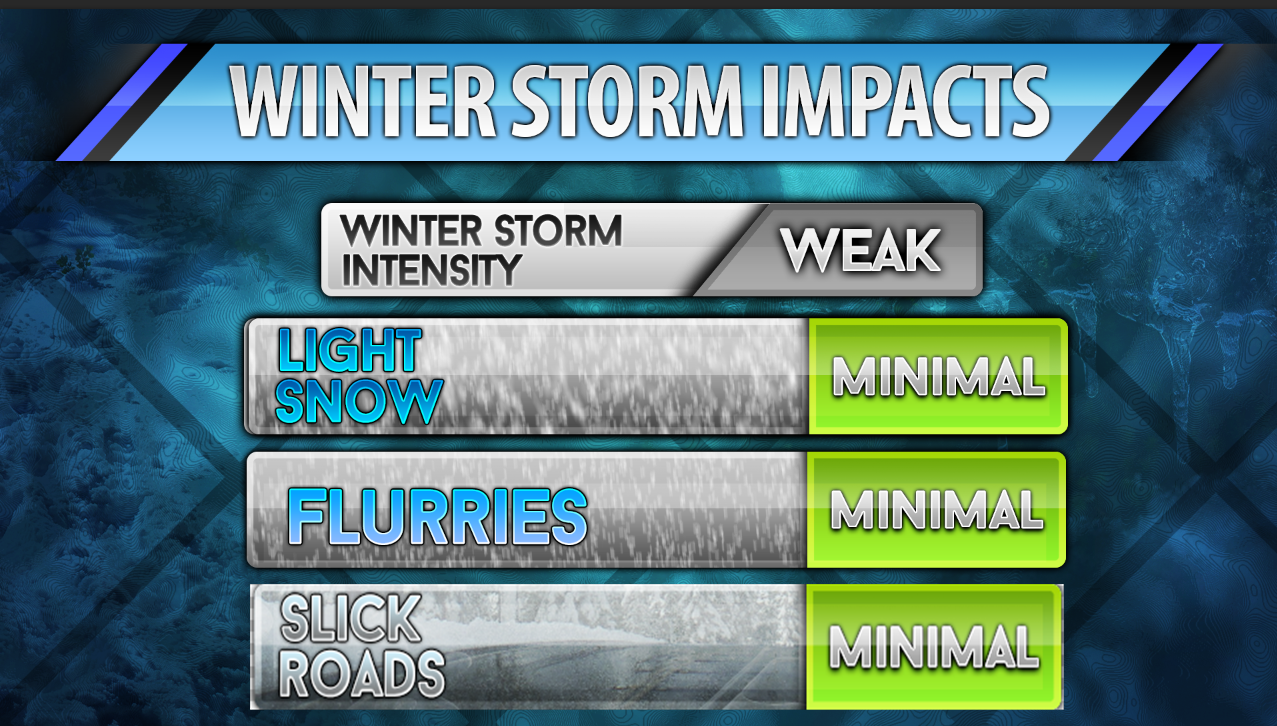
Saturday – Increasing clouds through the day. A small chance for light snow late in the day. Cold. High temperatures will likely not rise out of the 30’s. Southeast winds at 5-10 mph.
Saturday night – A chance for snow flurries or a period of light snow. Best chance for light snow will be along and north of a line from Farmington, Missouri towards Mt Vernon, Illinois. The rest of the area may see very little in the way of precipitation – where precipitation does fall it will be light. Cold for November. Lows will be in the 26-30 degree range. East winds at 5-10 mph.
Sunday – Mostly cloudy. A small chance for a wintry mix towards the evening hours. Better chances for a period of precipitation will arrive Sunday night. Chilly. High temperatures around 38-40 degrees. East winds at 5-10 mph.

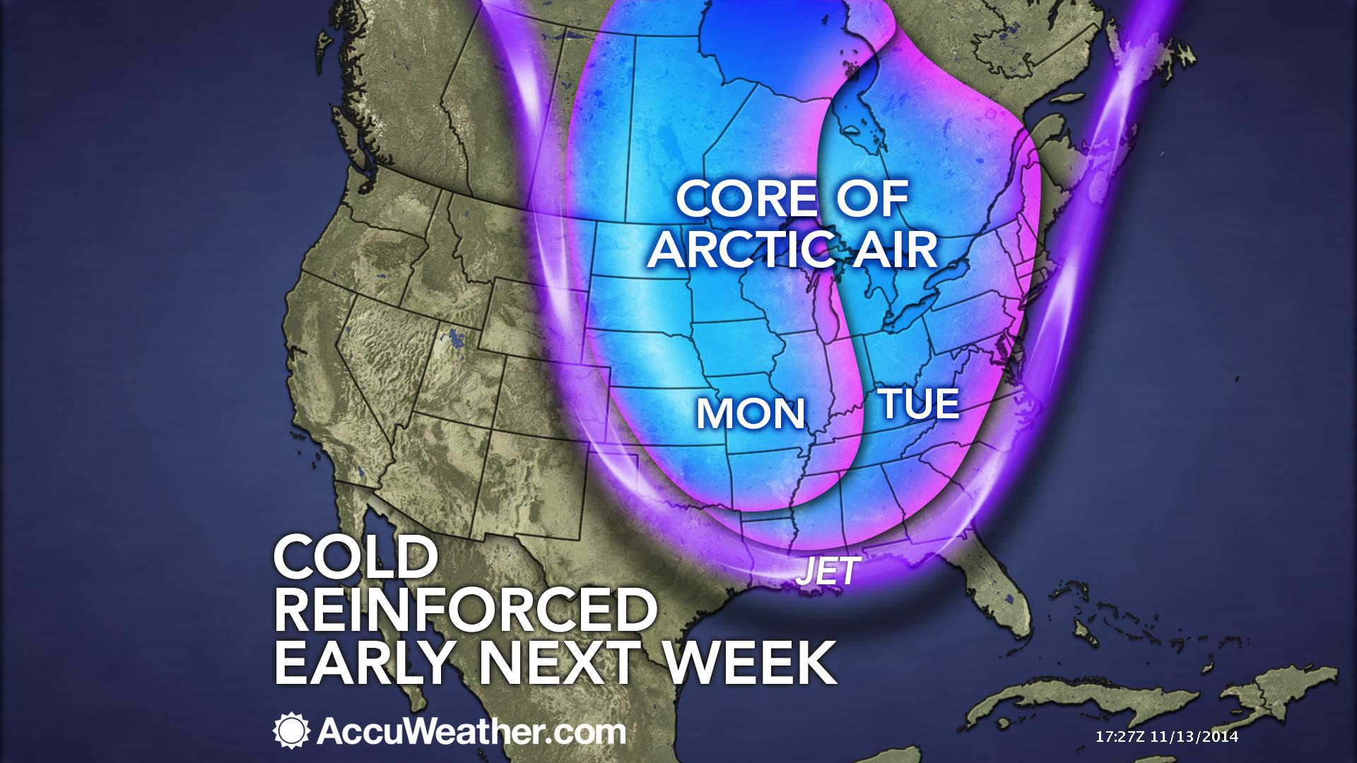
An explanation of what is happening in the atmosphere over the coming days.
Welcome to the weekend! I hope you grabbed the long johns this morning? You are waking up to temperatures in the teens and lower twenties. Remember all of that cold air I told you was on the way? Well, it’s here. Nature does what nature does. Never dull.
Today’s weather will be calm for the region. We did have some snow flurries on Thursday and Thursday night. A novelty event for this time of the year. Flakes in the air. Just a reminder that Old Man Winter is knocking (or did he just break the door down).
Does this guy come to mind?
The weather will once again be cold tonight and Saturday. Lows tonight will likely dip back down into the teens. Cold weather will continue into the middle of next week. Did someone say November? Maybe we can have November weather in January? Seems fair enough.
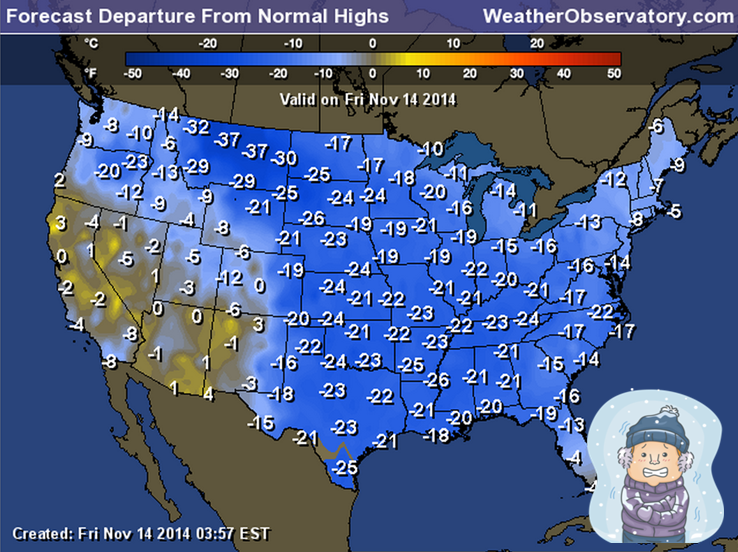
Check out the departure map for today’s high temperatures. This map shows you HOW MANY DEGREES BELOW NORMAL temperatures will be today across the nation. For example: If the normal high is 65 degrees and you are 20 degrees below normal then your high would only be 45 degrees. That is what these numbers represent. Just look at how huge this cold outbreak is.
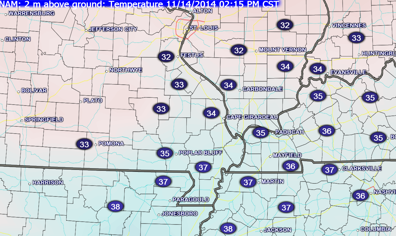
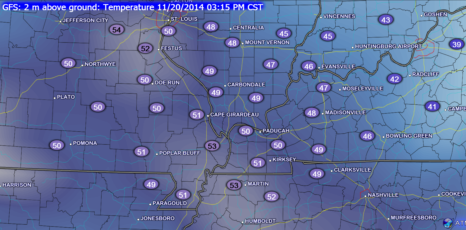
Here are the forecast temperatures for 2 pm this afternoon. Keep in mind that normal highs are around 62 degrees. This really is quite amazing from a meteorological point of view.

A weak weather system is still forecast to approach and move through the region on Saturday night. This will bring a period of snow flurries and light snow to some of our counties. Best chance of snow on Saturday night will be up towards Farmington, Missouri over to Mt Vernon, Illinois. Along and north of that line. The rest of us may experience a few snowflakes. Nothing of significance.
A stronger weather system approaches the region on Sunday evening and night. That system will be discussed in the long range part of the blog. See below.
Let’s take a look at current temperatures.

The current national temperature map

Your latest IR Satellite. Clouds lingering over the region. Should see some clearing later today.


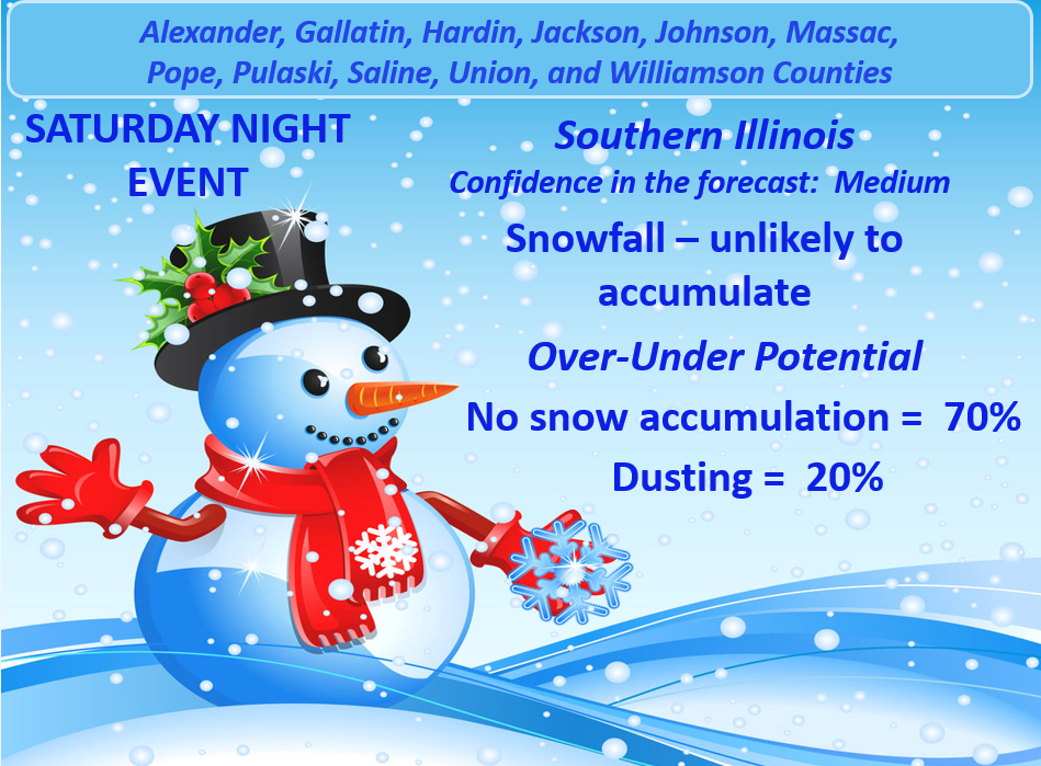
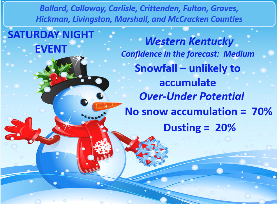
No real changes in the ongoing forecast. I have added my thoughts on snowfall accumulations for Saturday night. First call map. Again, that particular event is mainly for our northern counties. Some flurries or a period of light snow might occur elsewhere. Again, not expecting any significant accumulations.
Remember this year I am using probability graphics. They express my level of confidence (low, medium, or high). They then express the most likely scenario as far as accumulations. Then you will see the Over/Under probabilities.

No major concerns for today or tonight. Cold temperatures. Change those outdoor water bowls for the pets.

The Wild Card gives you an idea of what might change that would cause the forecast to bust. A busted forecast means a forecast that does not verify. For example, if a winter storm (the area of low pressure) shifts its track 50 miles further south than expected, then that could cause a dramatic change in how much snow might or might not accumulate.
Wild card in this forecast will be snowfall accumulations for Saturday night (mainly our northern counties – not the rest of us). Appears a light dusting or light accumulation is possible up towards Farmington, Missouri over towards Mt Vernon, Illinois. Elsewhere, the chance for accumulating snow is small.

Can we expect severe thunderstorms over the next 24 to 48 hours? Remember that a severe thunderstorm is defined as a thunderstorm that produces 58 mph winds or higher, quarter size hail or larger, and/or a tornado.
Severe weather is not going to be a concern through next Monday.
Thunderstorm threat level is zero.


Will I need to take action?
Not today or tonight. If you are traveling north on Saturday night then keep an eye out for a few slick spots. This would be more towards Farmington, MO to Mt Vernon, Illinois – northward.

Please visit your local National Weather Service Office by clicking here. The National Weather Service Office, for our region, is located in Paducah, Kentucky.

Some light snow is possible on Saturday night. I believe the bulk of this activity will be over our far northern counties – closer to Farmington, Missouri over towards Mt Vernon, Illinois. Not expecting anything significant in my forecast counties. That includes western Kentucky. If a period of flurries or light snow does develop as far south as southeast Missouri and western Kentucky then perhaps a dusting in a spot or two. Chances appear small.
Always keep in mind, that if road temperatures are cold and a little bit of moisture falls on untreated roads then there could be a few slick spots. This is especially true for bridges and overpasses.
Here is the Saturday afternoon/night Winter Storm Matrix. I will make a Sunday graphic on Saturday.
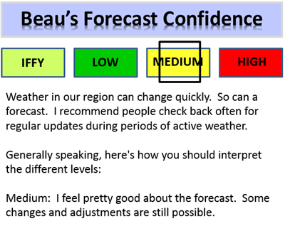
Here is my first call graphic for far southern Illinois (counties listed at the top of the graphic). The definition of “medium” is below the graphic.
My graphic for western Kentucky (for the Saturday night event)
Another chance for light snow or a wintry mix will arrive late on Sunday or Sunday night. Still some time to work on whether or not that system will produce some light accumulations of snow and/or a mixture of precipitation. I will try to have my first call forecast map for the Sunday event by Saturday morning or afternoon.
I am not a huge fan of forecasting snowfall amounts more than 24 hours in advance. Those who do forecast numbers ahead of that time frame often bust. Bust means a failed forecast. I am hoping to have a better handle of the systems by late by tonight and tomorrow morning.
Thus, I recommend you check back for updated information. A forecast typically evolves and become more accurate as the event time approaches.
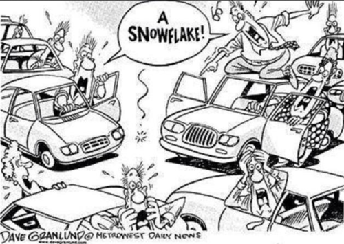
No matter what, let’s not be like these people!

The long range forecast includes another BIG shot of cold air early next week. As a matter of fact, that cold outbreak may be colder than the one that currently covers the area. At least equal to it. Amazing for the middle of November. These are impressive cold shots. January temperatures in November.
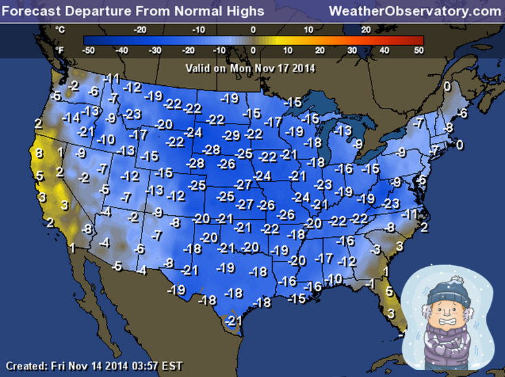
Check out the departure map for Monday’s high temperatures. This map shows you HOW MANY DEGREES BELOW NORMAL temperatures will be today across the nation. For example: If the normal high is 65 degrees and you are 20 degrees below normal then your high would only be 45 degrees. That is what these numbers represent. Just look at how large this cold outbreak is.
I know it is hard for you to get excited about cold temperatures, but these are pretty amazing numbers.
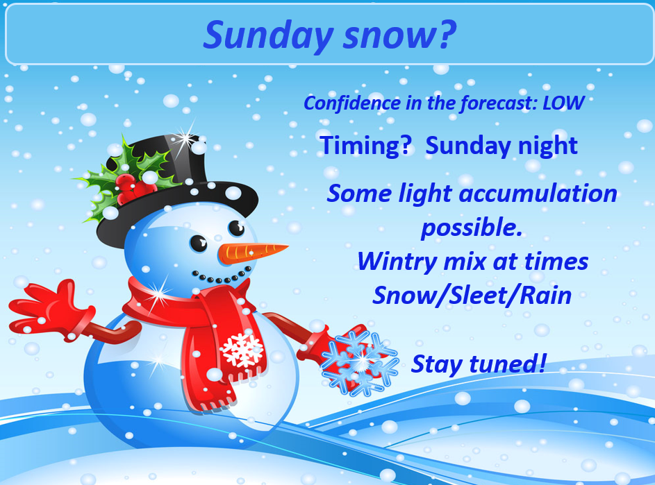
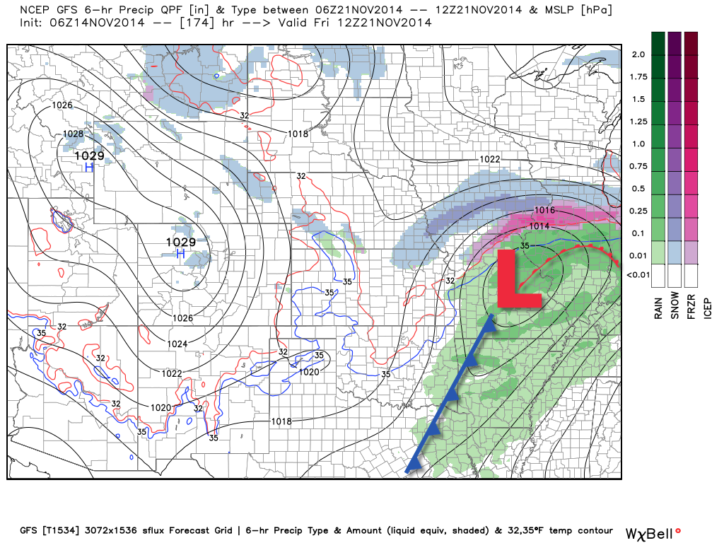
A weak weather system will push through our region on Sunday afternoon into Sunday evening and night (ahead of the next cold shot). This precipitation maker should bring a mix of rain/snow to most of the area. The rain will change to all snow by late Sunday night. Still some question as to whether we can squeeze out some minor accumulations in our local counties. I am not ready to call it one way or another. I don’t like to make snowfall forecasts more than 24 hours in advance. There are way too many variables involved.
I am a bit concerned about sharply falling temperatures late Sunday night and Monday morning. This could cause whatever moisture on the roadways to freeze. Expect to see some treated roadways over the coming 24-48 hours.
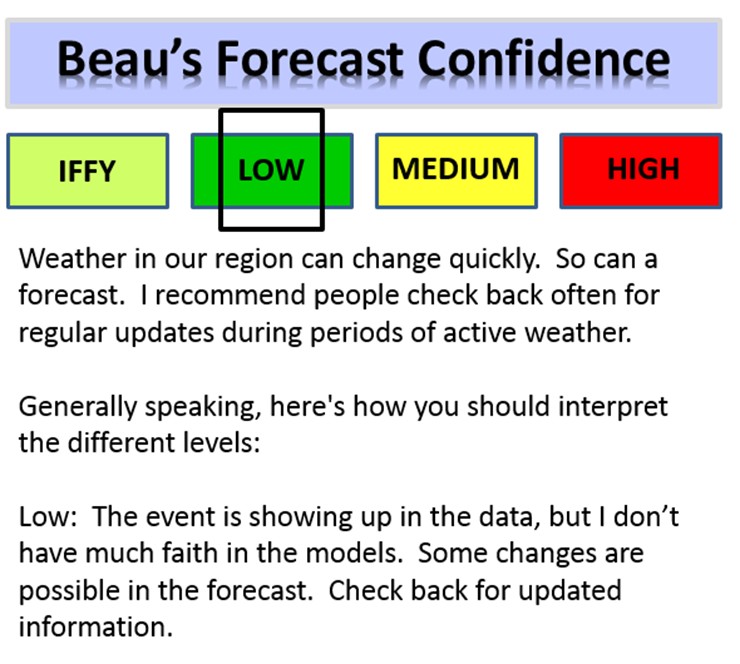
For now, confidence in the Sunday forecast remains low.
Again, check out the advancing cold air behind the Sunday night system. Temperatures fall quickly. Any moisture left on roadways could freeze. This would especially be true if precipitation falls over southeast Missouri and southern Illinois. It only takes a little bit of moisture to cause problems.
This first image is for the 11 pm Sunday night into the 1 am hour on Monday morning – note the big drop off in MO and IL.
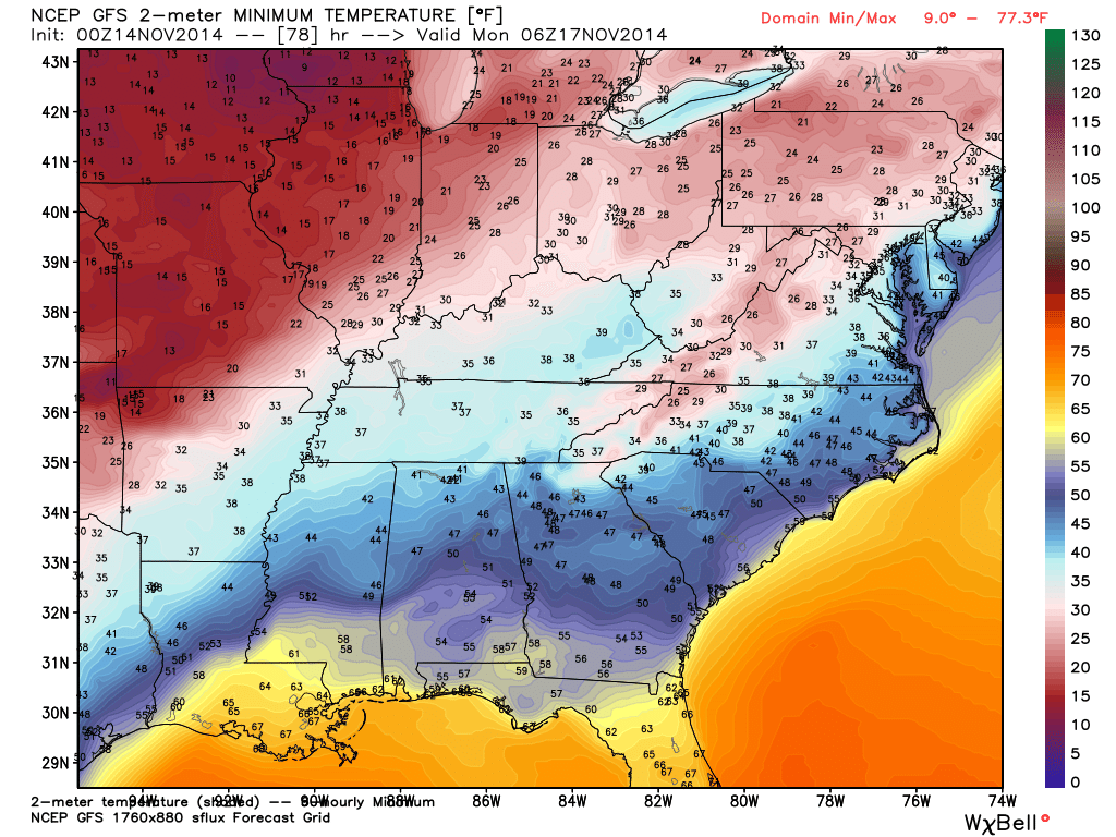
This next image is for Monday morning around 6 am. Obviously temperatures in the teens would cause roadways to become slick (assuming there is some moisture still on the roadways). This will need to be closely monitored.
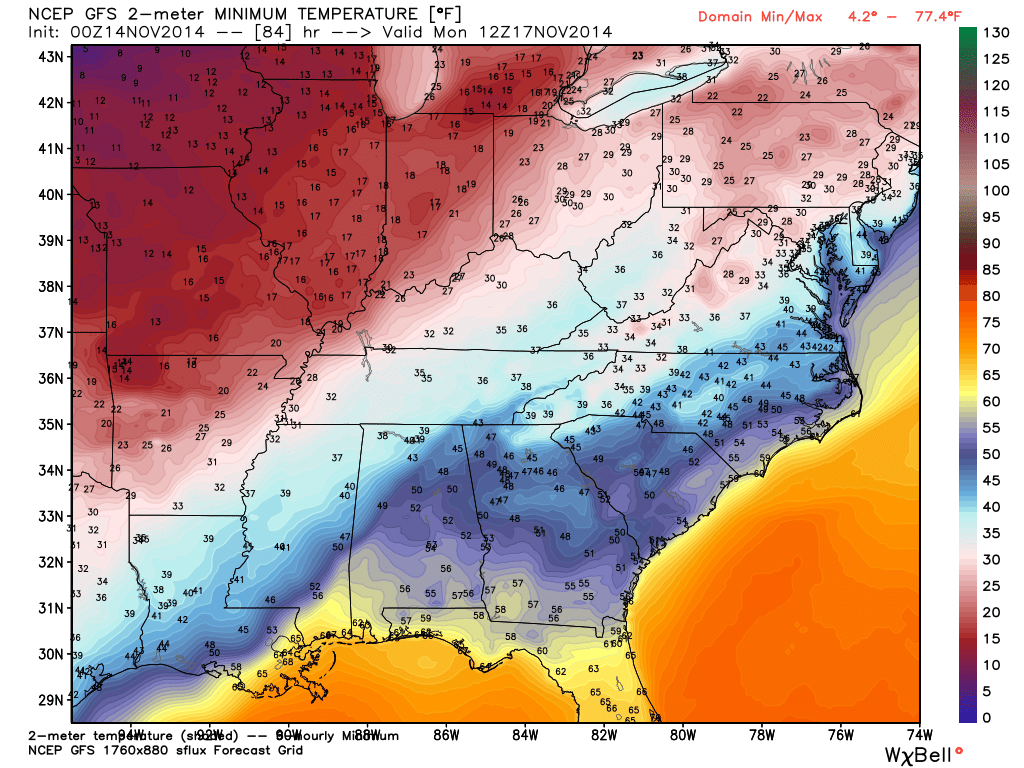
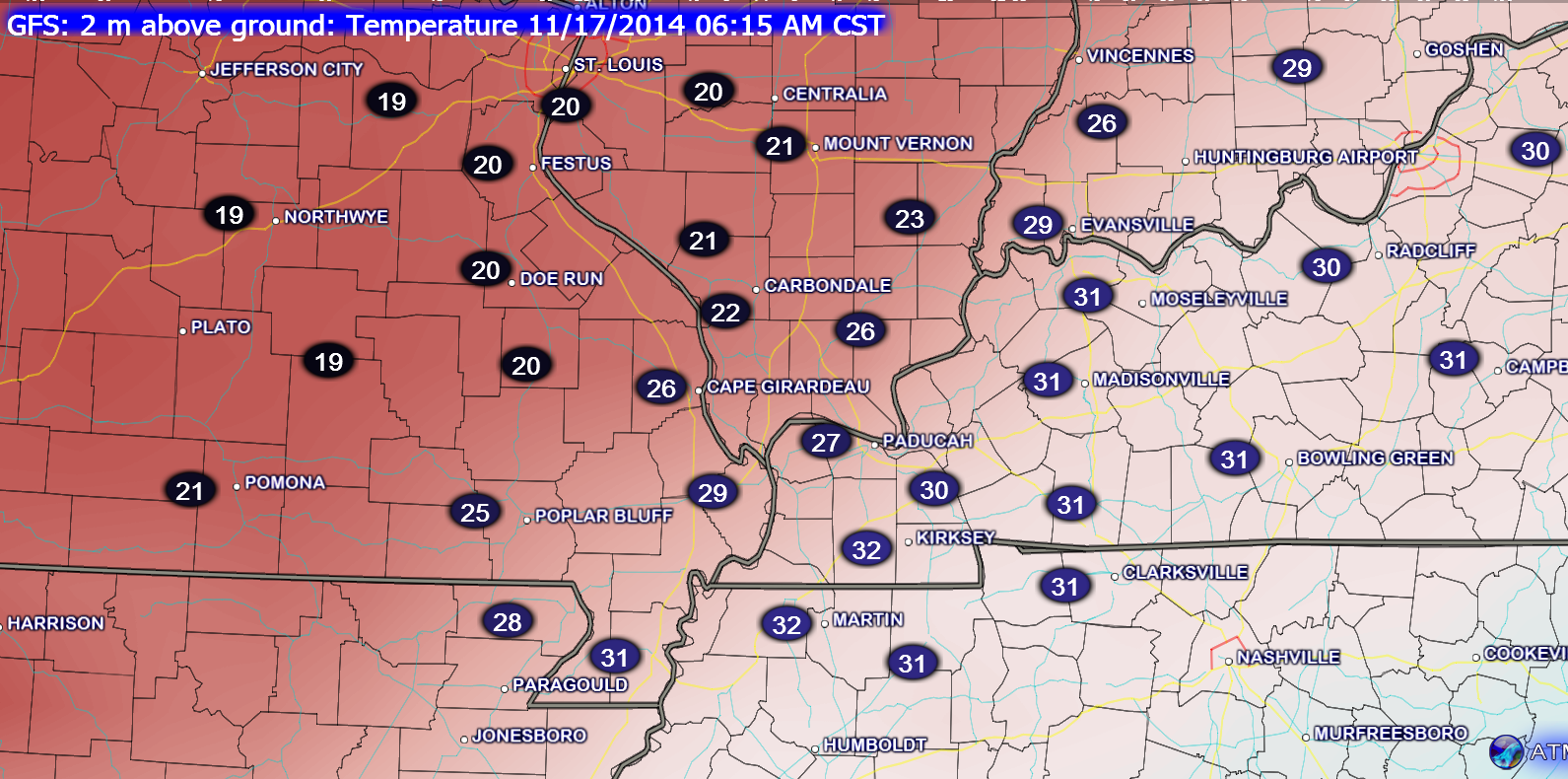
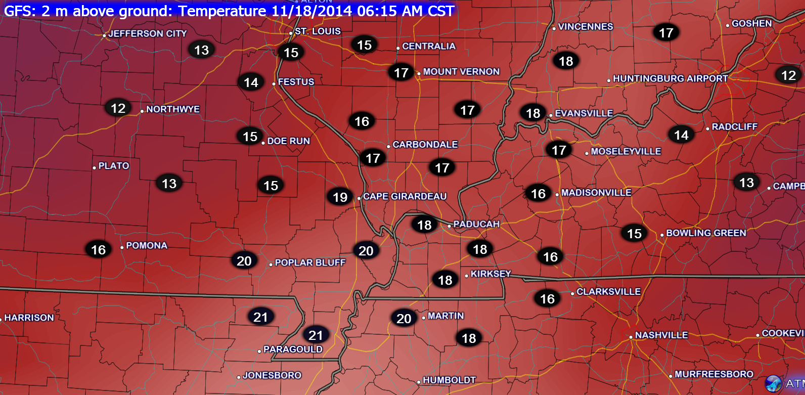
Let me zoom in for you…
Monday morning temperatures
Tuesday morning temperatures
Next Thursday!!! A warm up of sorts? Perhaps. Okay, let’s hope.
A warm up next week could mean a chance for showers and thunderstorms. Still a bit early to nail down the exact track of the area of low pressure. Just remember that when a low tracks to our northwest then we end up on the warm side of the storm. This can mean thunderstorms.
Here is the high resolution GFS model f0r next Thursday. You can see the area of low pressure moving through Missouri. Snow and ice to the north of the low. Rain in our region (green color represents rain).
Long range off for a forecast. But, something I will be watching.
The latest 6-10 day temperature and precipitation outlook. Will temperatures be ABOVE or BELOW normal?


The latest 8-14 day temperature and precipitation outlook. Note the dates are at the top of the image. These maps simply give you the probability as to whether temperatures or precipitation will be above or below normal.


Current tower cam view from the Weather Observatory- Click here for all cameras.

Southern Illinois Weather Observatory

The Weather Observatory

Southern Illinois Weather Observatory
WPSD TV 6 has a number of tower cameras. Click here for their tower camera page
& Kentucky Road Conditions & Kentucky Highway and Interstate Cameras

Downtown Paducah, Kentucky
Benton, Kentucky Tower Camera – Click here for full view

Benton, Kentucky
WSIL TV 3 has a number of tower cameras. Click here for their tower camera page
& Illinois Road Conditions

Marion, Illinois

You can sign up for my AWARE email by clicking here I typically send out AWARE emails before severe weather, winter storms, or other active weather situations. I do not email watches or warnings. The emails are a basic “heads up” concerning incoming weather conditions.