
November 12, 2014: This forecast update covers far southern Illinois, far southeast Missouri, and far western Kentucky. See the coverage map on the right side of the blog.
Wednesday – Lot of clouds this morning. Clouds giving away to sunrise as we push into the late morning and afternoon hours. Cold. High temperatures will be in 38 to 44 degree range. North winds at 5-10 mph.
Morning School Bus Stop Weather – Some clouds. Cold. Temperatures around 30 degrees with a north wind of 5 mph.
Afternoon School Bus Stop Weather – A mix of sun and clouds. Cold. Temperatures will be around 40 degrees. North winds at 5 mph.
Wednesday night – Increasing clouds. Cold. Low temperatures in the middle to upper 20’s. North winds at 5-10 mph.
Thursday – A few clouds. Cold. High temperatures will likely not rise out of the 30’s. Northwest winds at 5-10 mph.
Thursday night – Mostly clear sky conditions. Cold for November. Lows will be in the 18-22 degree range. Northwest winds at 5 mph.
Friday – Mostly sunny and cold. High temperatures around 38 degrees. Northwest winds at 5 mph.

An explanation of what is happening in the atmosphere over the coming days.
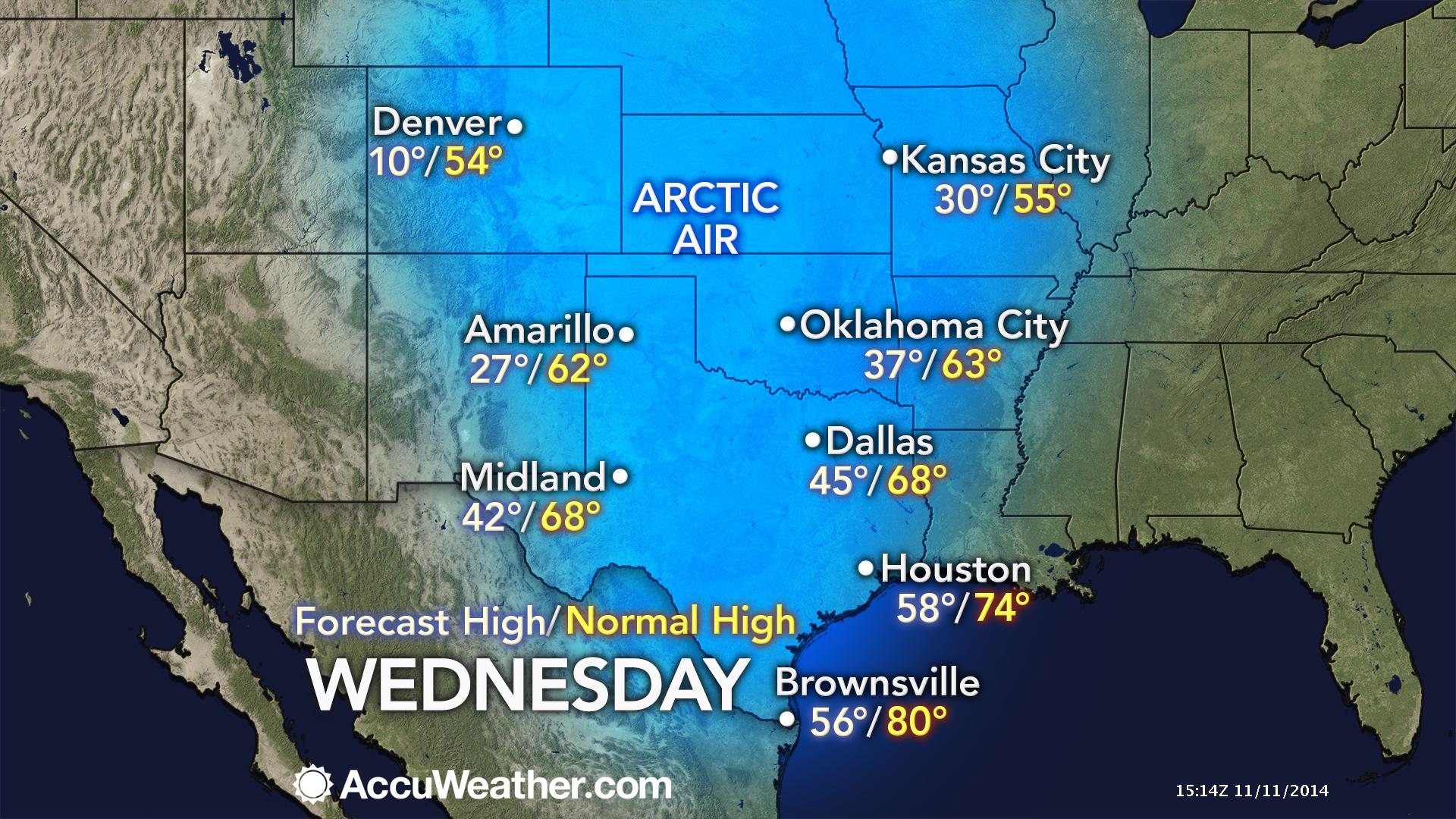
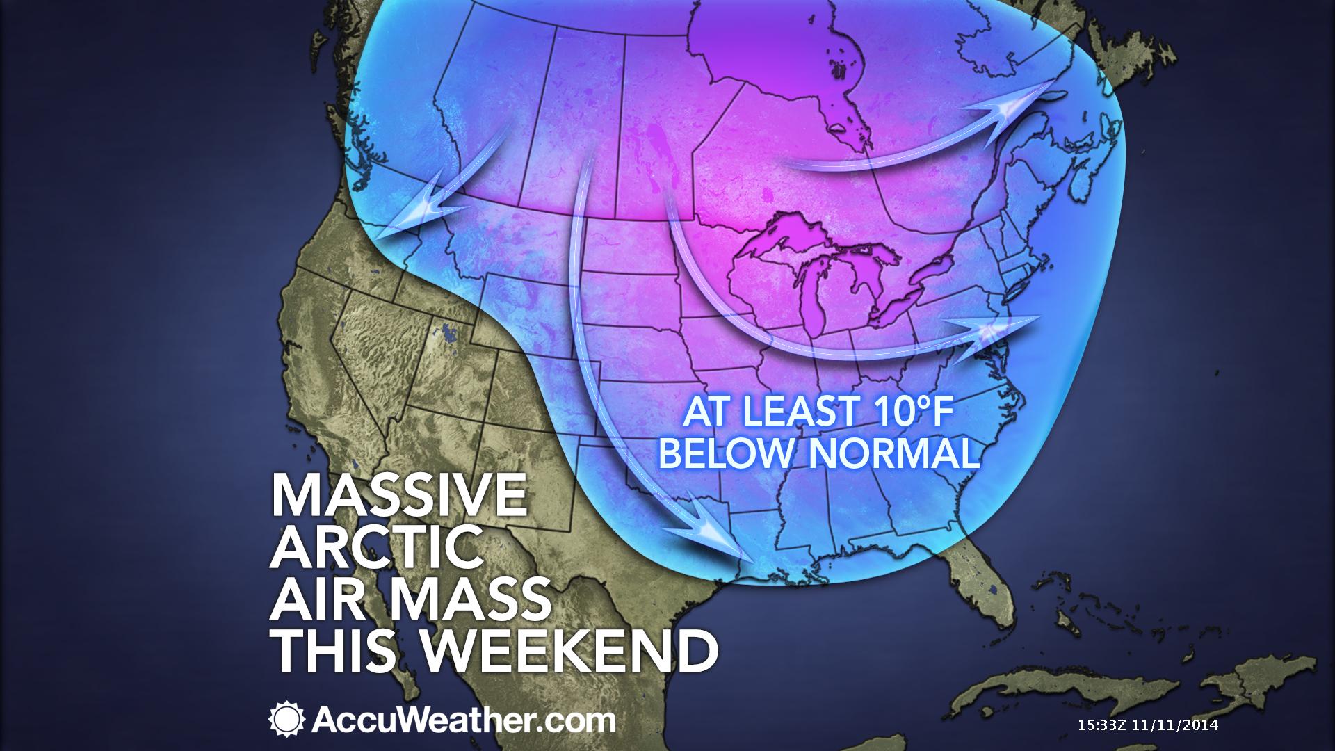
Well, you knew it was coming. An early winter blast of cold air has invaded our region. Highs will struggle to get out of the 30’s both today and tomorrow. This is quite unusual for the middle of November.
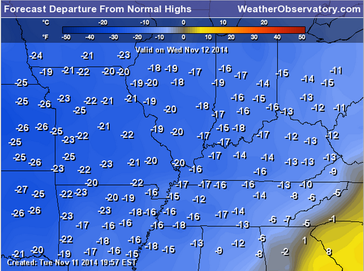
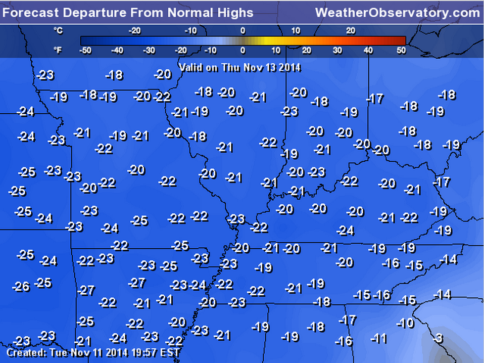
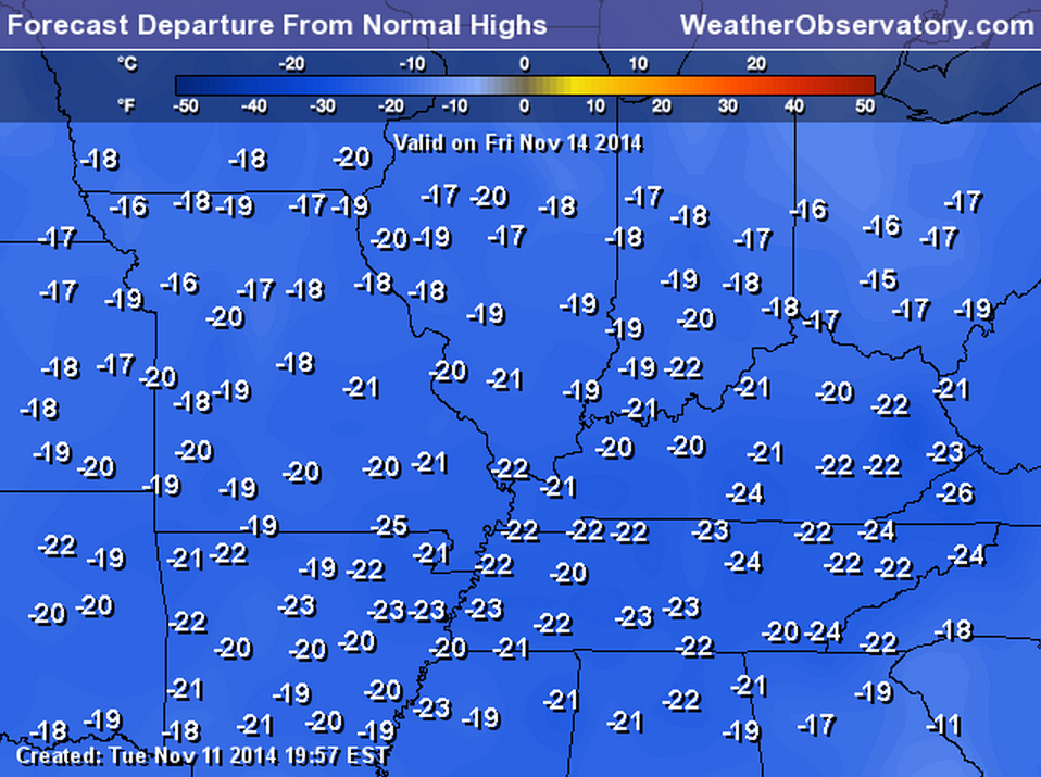
Let’s just take a look at how many degrees below normal temperatures will be today into Friday. Keep in mind that normal high temperatures are around 60 degrees for this time of the year.
These are some crazy anomalies.
WEDNESDAY DEPARTURES
THURSDAY DEPARTURES
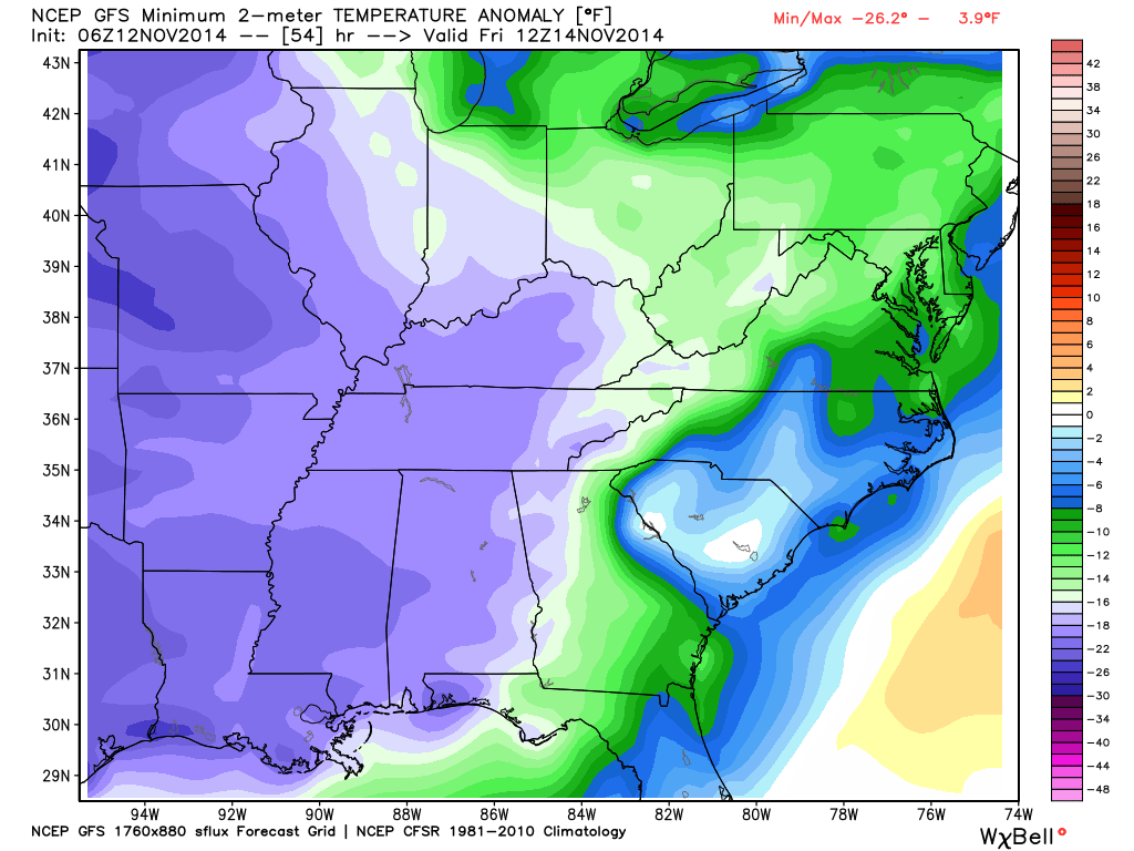
FRIDAY DEPARTURES
Let’s check out some other comparisons from different cities over the Midwest.
Overnight lows by Thursday morning will dip well into the 20’s. I suspect a few spots will dip into the teens on Friday morning. Double brrr?
The weather will be calm through Friday.
Winds won’t be too strong today. That is the good news. Here is the forecast windchill numbers.

Let’s take a look at current temperatures.

The current national temperature map

Your latest IR Satellite. Clouds lingering over the region. Should see some clearing later today.


No big changes since the last update!

No major concerns in the short term. Cold temperatures, obviously, are going to be an issue. Don’t forget to change the frozen water bowls for your outdoor pets.
This morning’s temperatures are just the beginning of several nights of sub-freezing temperatures.


The Wild Card gives you an idea of what might change that would cause the forecast to bust. A busted forecast means a forecast that does not verify. For example, if a winter storm (the area of low pressure) shifts its track 50 miles further south than expected, then that could cause a dramatic change in how much snow might or might not accumulate.
Wild card in this forecast will be whether or not a few spots dip into the teens by Friday morning. I have been thinking it would at least be a possibility. We shall see.

Can we expect severe thunderstorms over the next 24 to 48 hours? Remember that a severe thunderstorm is defined as a thunderstorm that produces 58 mph winds or higher, quarter size hail or larger, and/or a tornado.
Severe weather is not going to be a concern through next Monday.
Thunderstorm threat level is zero.


Will I need to take action?
Nothing of significance.

Please visit your local National Weather Service Office by clicking here. The National Weather Service Office, for our region, is located in Paducah, Kentucky.

No winter weather concerns through Friday night!

Cold air will last into next week. An unusual cold snap. You don’t see a cold snap like this in the middle of November – not for the duration this one is going to last. Well, I shouldn’t say you don’t see one :). You are now!
High confidence that cold weather will last through much of next week.
I like to remind everyone that it is not uncommon to experience severe thunderstorms and tornadoes during the Month of November. We aren’t out of the woods just yet. Yes, the cold weather helps dampen the severe thunderstorm threat. However, the weather can change quickly in our region. I know it is easy to get caught up in the cold weather and holidays, but keep one eye on the weather over the coming weeks.
OKAY – NOW let’s talk about some of the white gold. Will it? Won’t it? Might it SNOW this weekend!
Forecast confidence is….drum roll, please
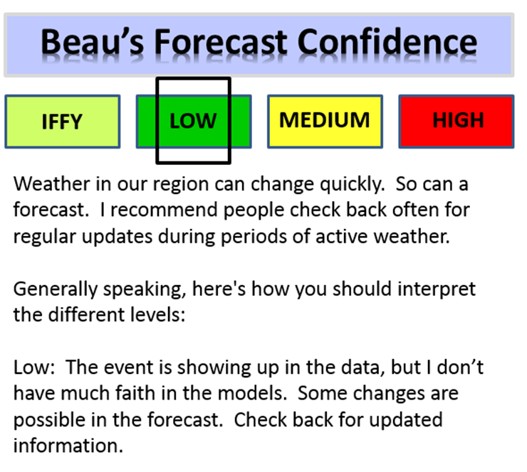
I am placing the confidence meter at LOW. This will change as we move closer to the event. This is only Wednesday. The snow potential is still 4-5 days away. Snow is difficult to forecast days in advance. As we pull closer to the event then you would expect to see the confidence meter rise.
It does appear it will snow this weekend. The question is more on the specific placement of the snow and whether or not it might accumulate.
Current thoughts and details…
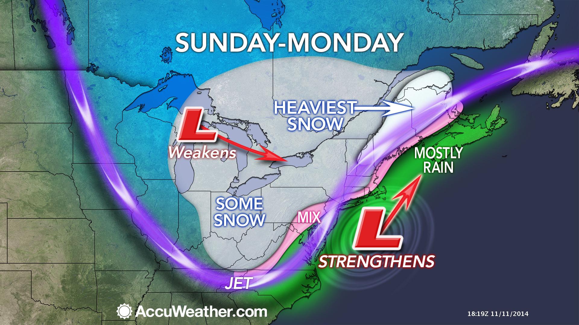
The main subject of the extended forecast is the possibility of some light snow on Saturday night and Sunday. Right now it appears a weak disturbance will move into the region from the west. This system will spread some light precipitation over our local counties.
It appears if precipitation were to occur it would be after sunset on Saturday and then on/off chances into Sunday evening.
Temperatures should be cold enough for mostly snow. Can’t rule out a snow/rain mix on Sunday. Accumulations, if any at all, should be light. Light meaning a dusting to perhaps an inch in spots. Again, confidence is low since this storm is still several days away.
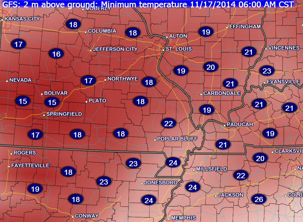
Check out these temperatures for Monday morning. The cold weather is going to stick around for awhile.
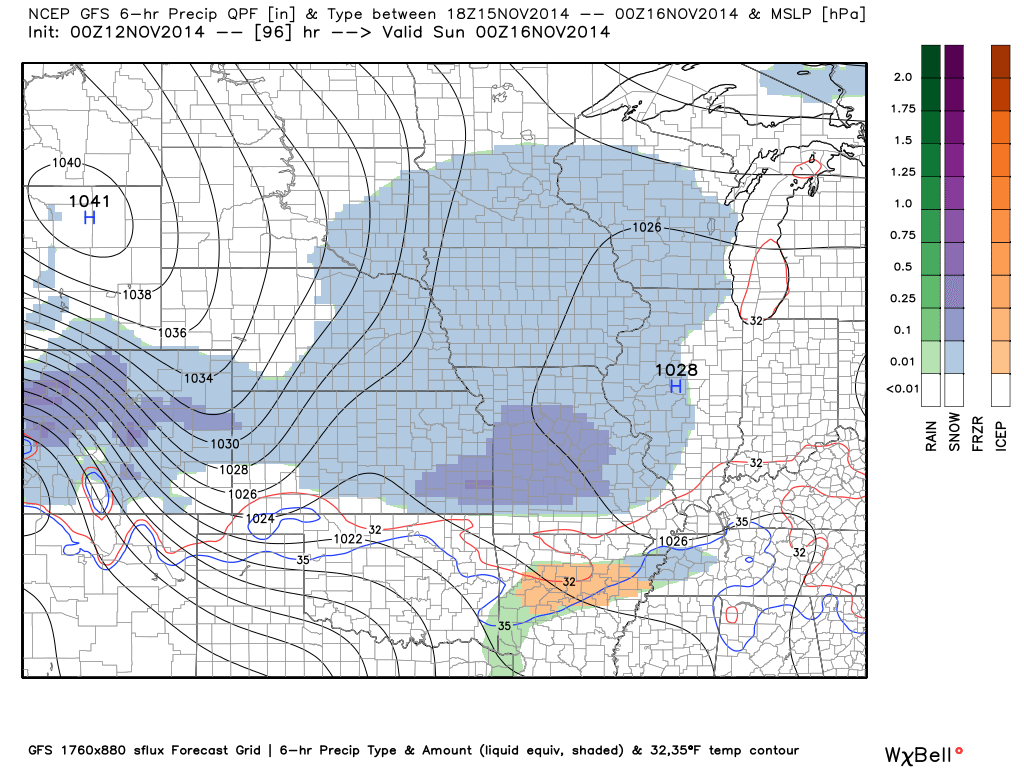
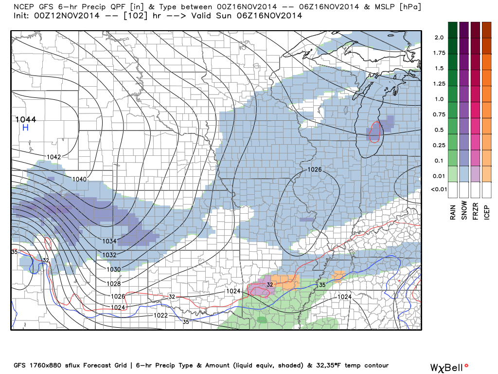
Let’s take a look at the GFS forecast maps (one model that forecasters use) for Saturday night into Sunday night. You can see a small band of light snow moving across the area. There appears to be a split in the energy. A bit to the north and a bit to the south. Again, still several days away to get too specific with the exact placement of precipitation. Either way it should be light.
This first forecast map is for 6 pm on Saturday evening. The blue represents light snow. Radar may show up on the radar for a bit on Saturday, but not be reaching the ground. This is called virga. Virga occurs when dry air aloft evaporates falling precipitation. It can take time to moisten up the entire column of the atmosphere. When the column moistens up then precipitation reaches the ground.
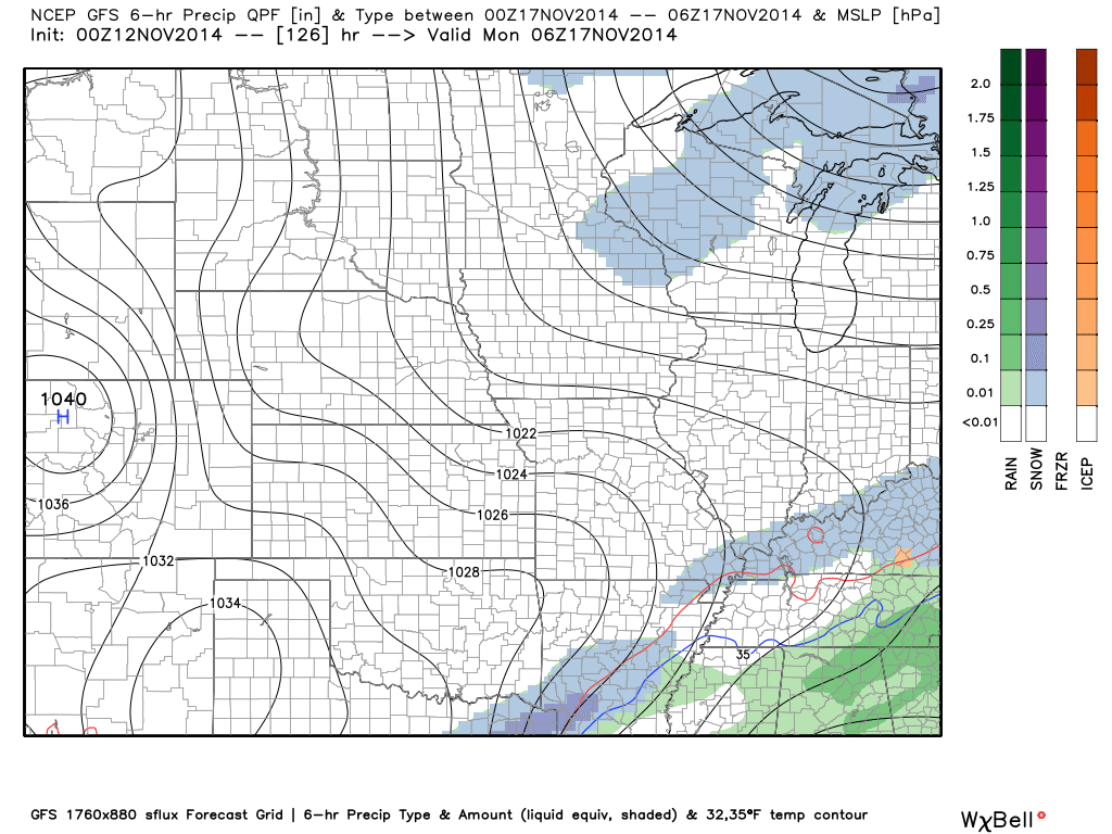
This second image is the forecast map for around 1 am on Sunday morning
Finally, here is the forecast map for Sunday night. Still some light snow showers in the area.
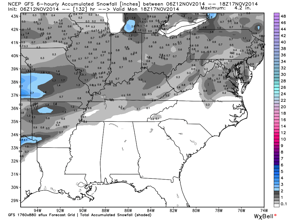
So, how much does all of this add up to? Well, let’s take a look. The GFS indicates that only small amounts of measurable snow might fall. Normally, in a situation like this, you would not expect much accumulation (if any at all).
The scale is on the right side of the image. All of that gray area indicates trace amounts (pr 1″ or less of snow).
Don’t get too excited about this event. I will continue to monitor for changes.
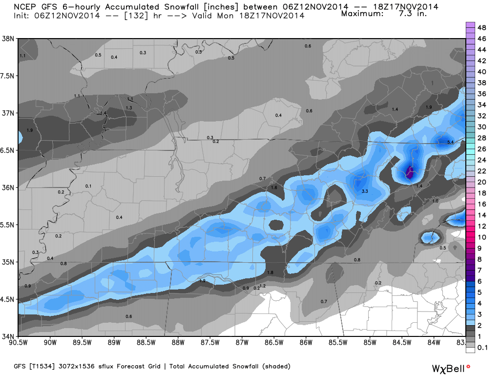
Let’s zoom in on that map and tweak it just a bit. This is the brand new GFS model (the upgraded version). It shows accumulations of 1″ or less over our area.
Again, subject to change as we move forward. If the system were to have a bit more moisture to work with then these numbers might change a bit. Time will tell.
Confidence probably won’t be great until we get within 24 hours of the system moving into the region.
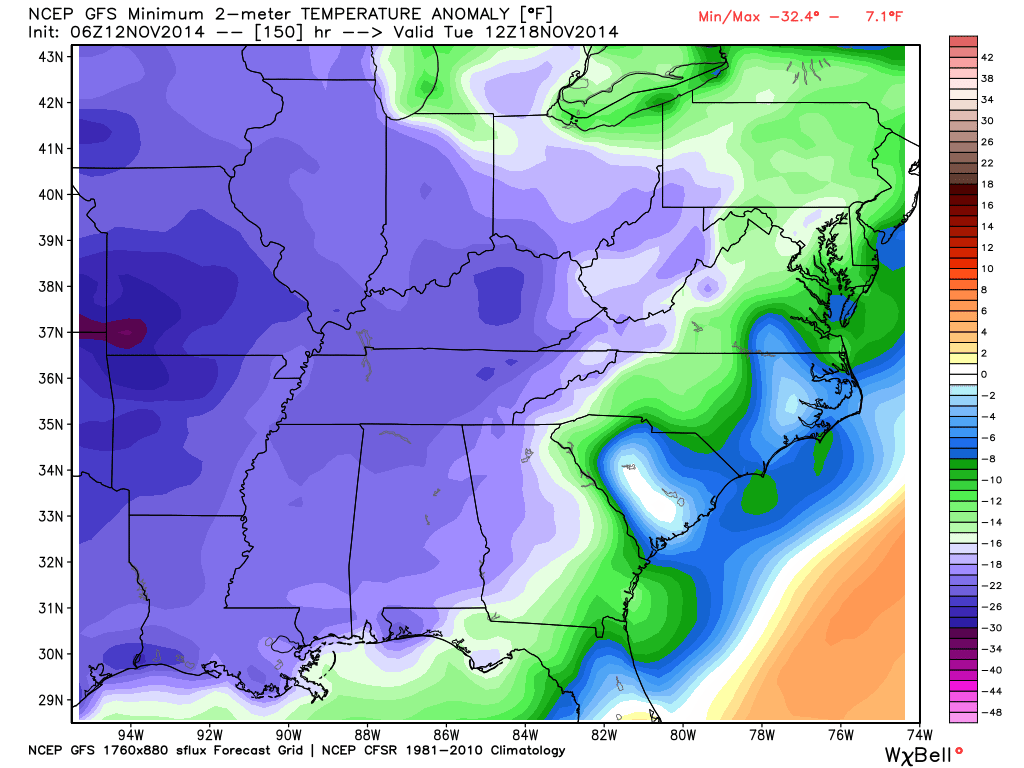
Check out these anomalies and compare Friday and Tuesday. These two maps show you how many degrees below normal this cold air mass will be. Remember when I said this will be a long duration event. Days and days of cold weather.
Here is the Friday morning departures (I know I showed you this above already – but I want to show you that next weeks air mass may be even colder)
Scale is on the right hand side of the page.
Now, let’s look at next Tuesday mornings departures. An even colder air mass moves into the region. Temperatures will be WAY below normal.
I don’t know about you but I am impressed!
The latest 6-10 day temperature and precipitation outlook. Will temperatures be ABOVE or BELOW normal?


The latest 8-14 day temperature and precipitation outlook. Note the dates are at the top of the image. These maps simply give you the probability as to whether temperatures or precipitation will be above or below normal.


Current tower cam view from the Weather Observatory- Click here for all cameras.

Southern Illinois Weather Observatory

The Weather Observatory

Southern Illinois Weather Observatory
WPSD TV 6 has a number of tower cameras. Click here for their tower camera page
& Kentucky Road Conditions & Kentucky Highway and Interstate Cameras

Downtown Paducah, Kentucky
Benton, Kentucky Tower Camera – Click here for full view

Benton, Kentucky
WSIL TV 3 has a number of tower cameras. Click here for their tower camera page
& Illinois Road Conditions

Marion, Illinois

You can sign up for my AWARE email by clicking here I typically send out AWARE emails before severe weather, winter storms, or other active weather situations. I do not email watches or warnings. The emails are a basic “heads up” concerning incoming weather conditions.