
.

🌪️ Seven-Day Tornado Outlook ⛈️
May 8th through May 14th
Current risk: None
Current confidence level: High.
Comments: Tornadoes are not in the forecast.

Seven-Day Hazardous Weather Outlook
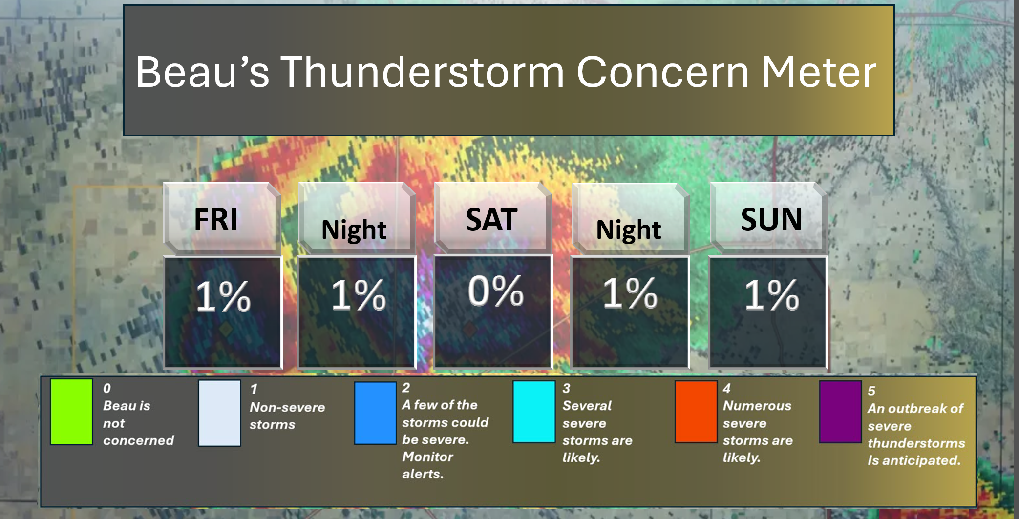
1. Is lightning in the forecast? Possible. A chance tonight, Saturday night, and on Sunday/Sunday night. I will monitor Tuesday night, as well.
2. Are organized severe thunderstorms. NOT AT THIS TIME.
3. Is significant or widespread flash flooding in the forecast? NO.
4. Will non-thunderstorm winds top 40 mph? NO.
5. Will the temperature rise above 90 degrees? NO.
6. Is the heat index forecast to rise above 100 degrees? NO.
.
⛈️ Here is the short-range thunderstorm concern meter.
.
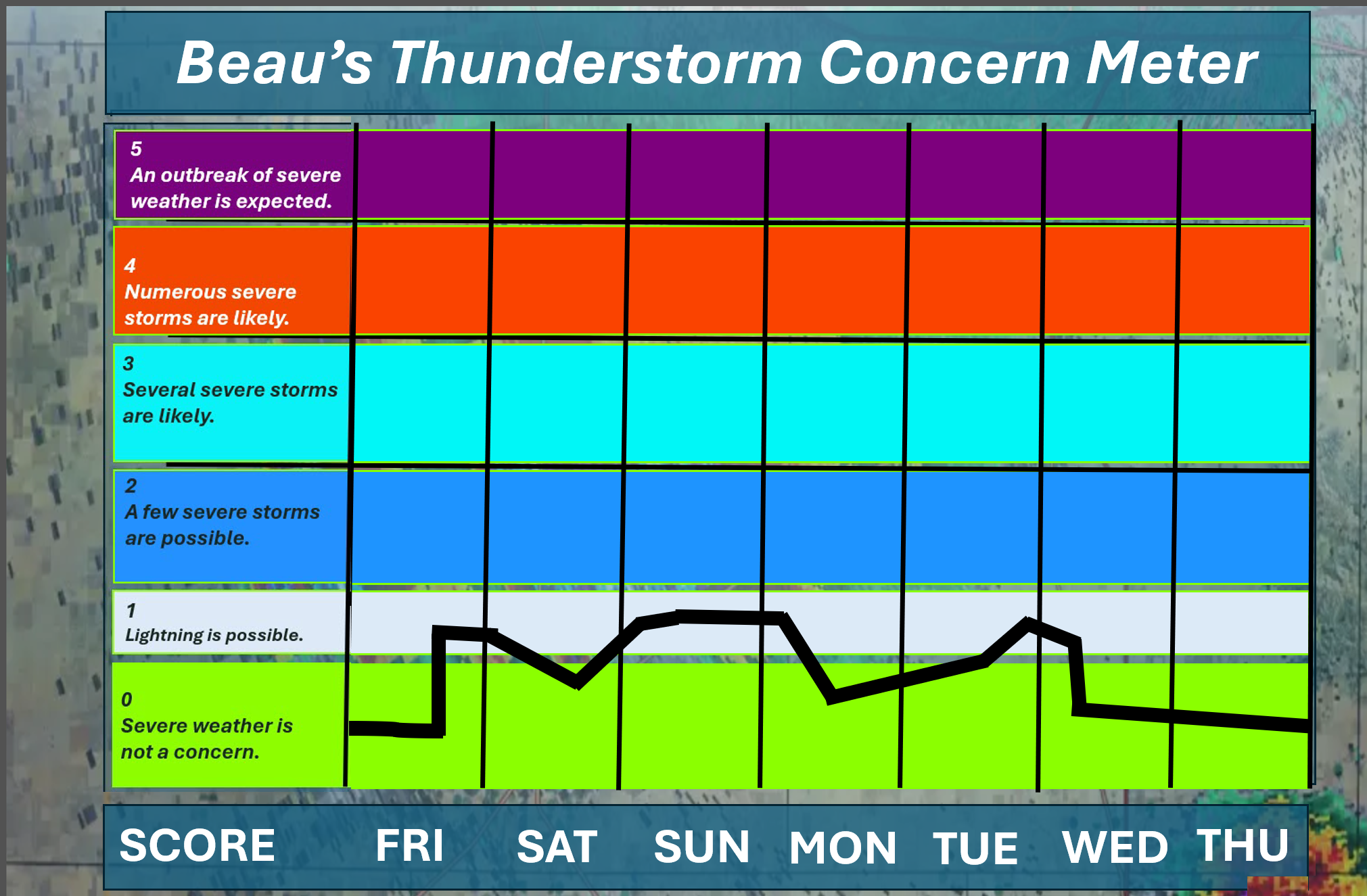
⛈️ Here is the extended thunderstorm concern meter.
.


.
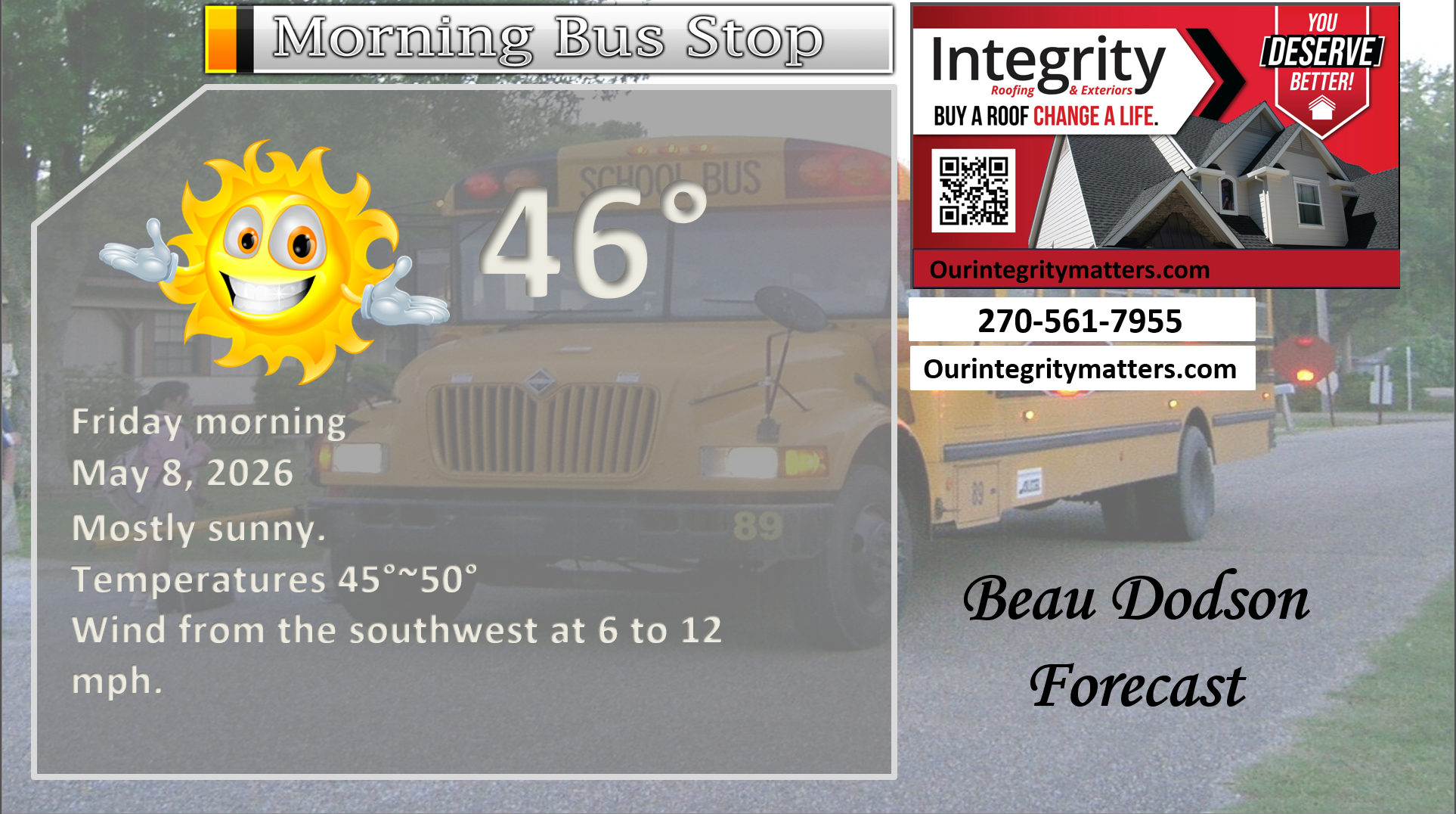
Here is your bus stop forecast
This morning
.
.
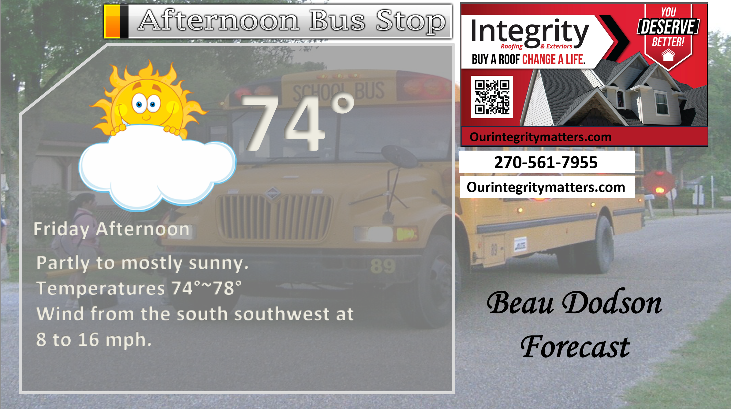
This afternoon
.
.
Tomorrow morning
.
Tomorrow afternoon
.
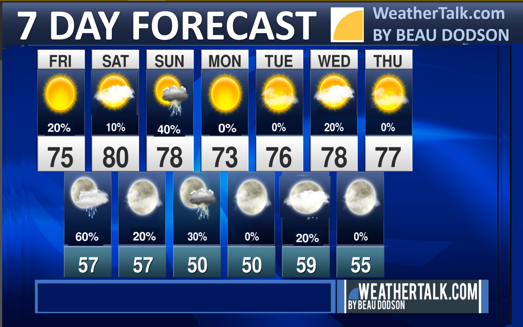
Seven-day outlook graphic.
See the video and graphics below for more details specific to your county. This is a broad-brush overview of the entire region.
See the rainfall probability graphic below.
.


Forecast discussion
- A nice day ahead of us. A chance of widely scattered showers and thunderstorms over the northern portions of the region late this afternoon and evening (after 5 PM).
- Warmer this weekend.
- A chance of scattered showers and thunderstorms tonight.
- Another chance of showers and thunderstorms on Saturday night and Sunday. Another chance on Tuesday night/Wednesday.
- The warmest day will likely be Saturday.
- A strong warming trend also arrives towards the middle/end of next week.
 .
.
.
What is the primary weather concern today and tonight?
A nice day ahead of us. Scattered showers and thunderstorms are possible late this afternoon and evening over the northern portions of southeast Missouri and the northern portions of southern Illinois.
A chance of scattered showers and thunderstorms area-wide tonight. Chances are higher over the northern half of the region. See graphics below.
No severe weather concerns, thankfully.
.
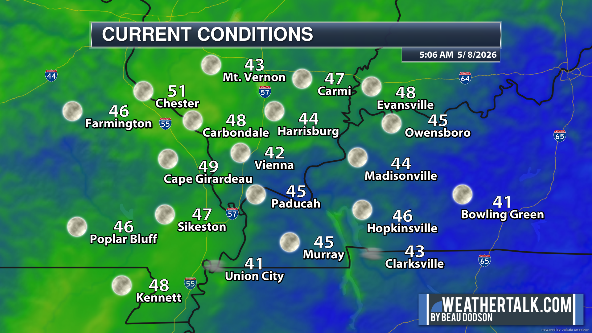
Here are the early morning current conditions. These are the 4 AM readings.
.
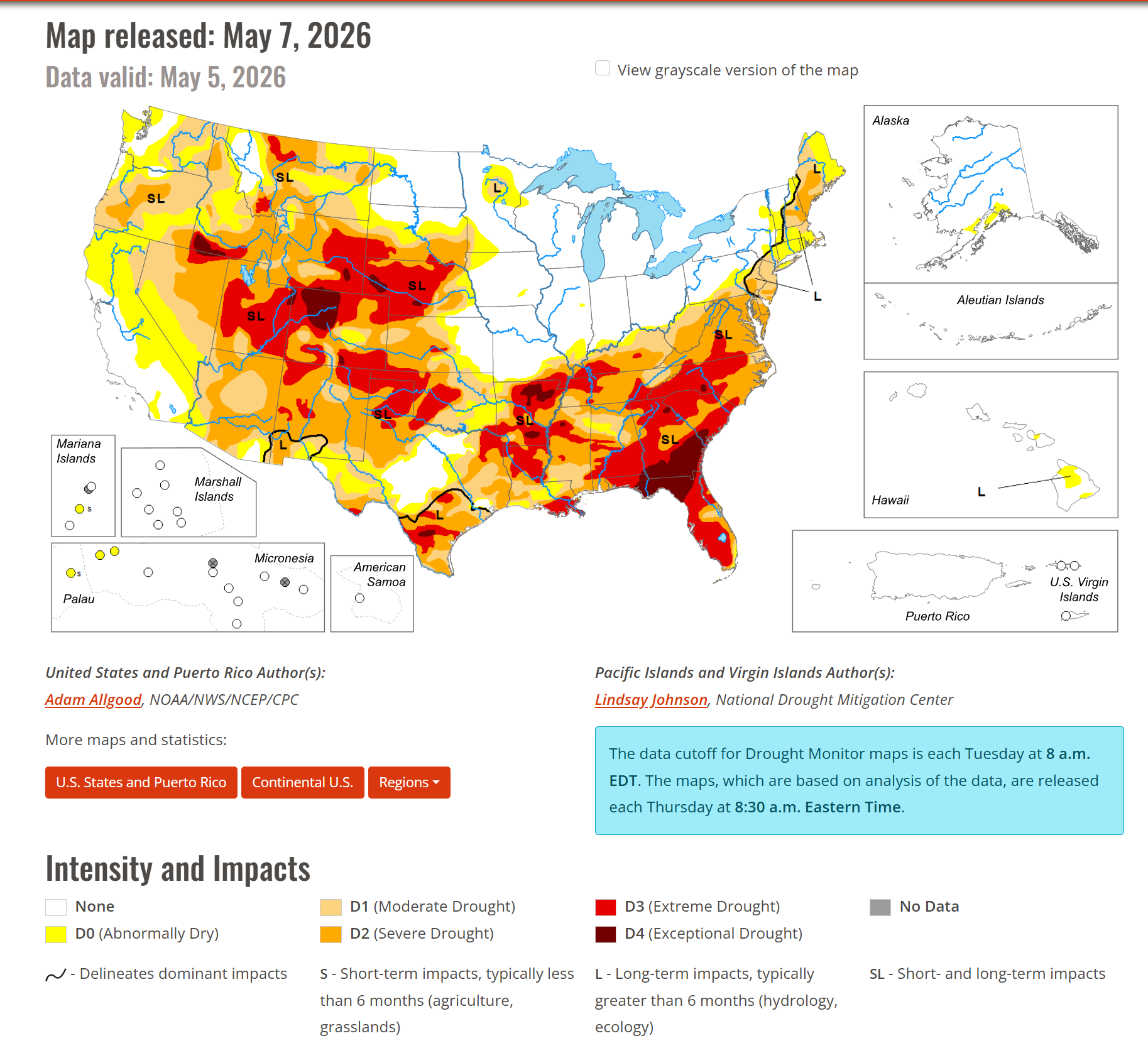
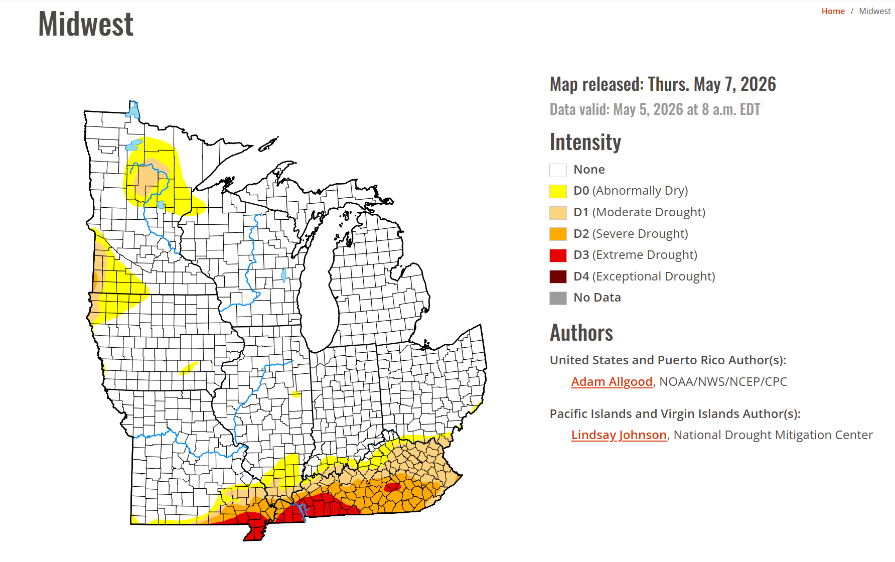
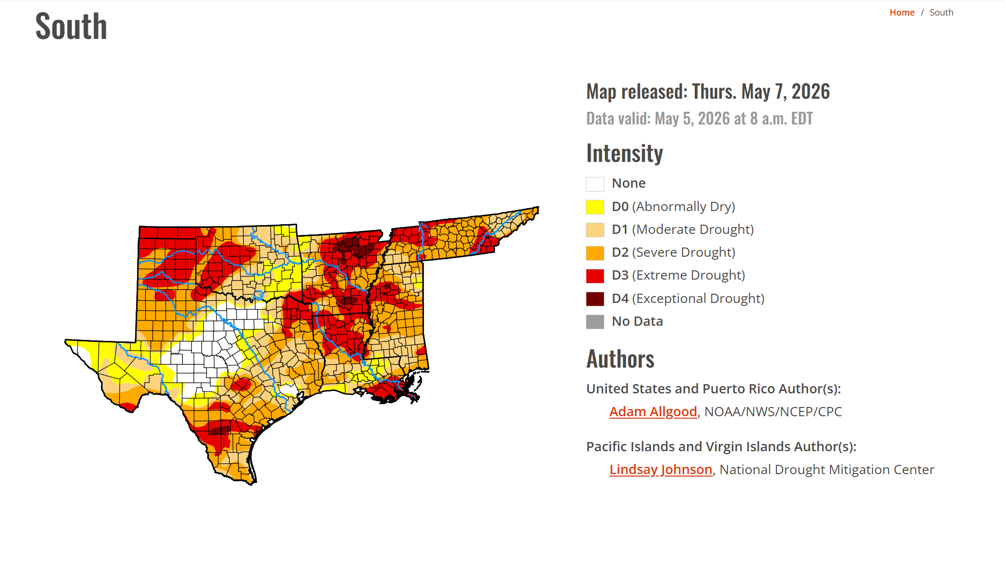
The latest drought monitor maps have been published.
We still have drought in the region. There was some improvement north.
Double-click images to enlarge them.
.
.
Weather Forecast
Good morning, everyone! A nice day ahead of us. A bit windy, at times. Boaters should use care on area lakes and rivers.
High pressure will sit to our east today while a cold front forms to our north and west. This will cause south winds to increase to around 10–15 mph, with some gusts near 20 mph, especially across southeast Missouri. The warmer winds will help push afternoon temperatures into the mid-70s.
Late this afternoon and evening, there will be a few showers and thunderstorms moving southeast out of eastern Missouri and central Illinois. Mainly after 5 pm.
The cold front will move toward the area tonight.
Humidity will increase as dew points rise into the low 50s later today, but the main energy of this system will stay well to our east. Because of that, only general (non-severe) thunderstorms are expected, and the line of showers will likely weaken as it moves into our area.
There is about a chance that the showers hold together enough to bring 0.10″ to 0.50″ of rain, mainly along and north of the I-64 corridor in southeast Illinois and southwest Indiana.
Elsewhere, less than 0.25″ of rain is anticipated. Not much.
Saturday will be nice, with dry weather returning between weather systems.
Saturday will also be the warmest day of the weekend, with many areas having a good chance of reaching around 75° to 80°.
Another weather system will bring a chance of rain late late Saturday night into Sunday. The highest rain chances will be in southeast Missouri. The rest of our area will see lower rain coverage/chances.
Rainfall totals from Saturday night into Sunday night will range from 0.00″ to 0.30″. Some areas may miss out on the rain event. We aren’t expecting much. Not enough to significantly impact the drought.
Severe thunderstorms are not anticipated this weekend. That is the good news!!
It is a bit odd for May. Typically, May is peak tornado season in our region. Let’s enjoy the lack of severe weather. Last year was brutal. We deserve a break.
Temperatures will cool again on Monday. High temperatures will be near 70°, and lows will be in the 40s.
We could reach the 80s again by the end of next week. It will feel a bit more like May.
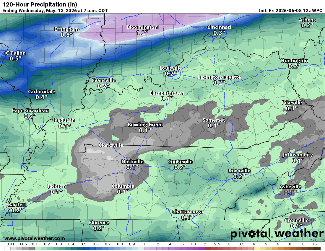
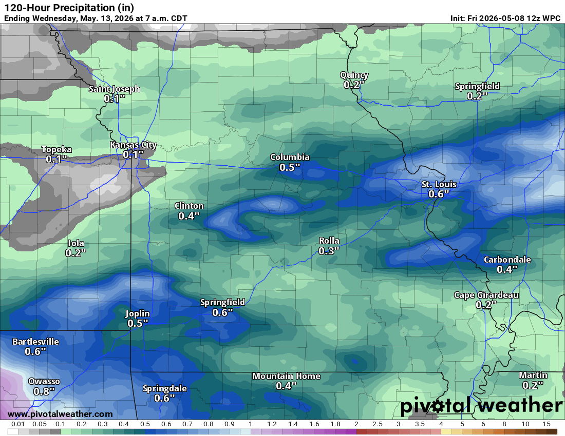
Rainfall total maps through Sunday. Not much. The highest totals will be across my northern counties.
Double-click on images to enlarge them.
.
.
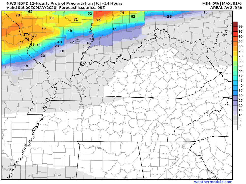
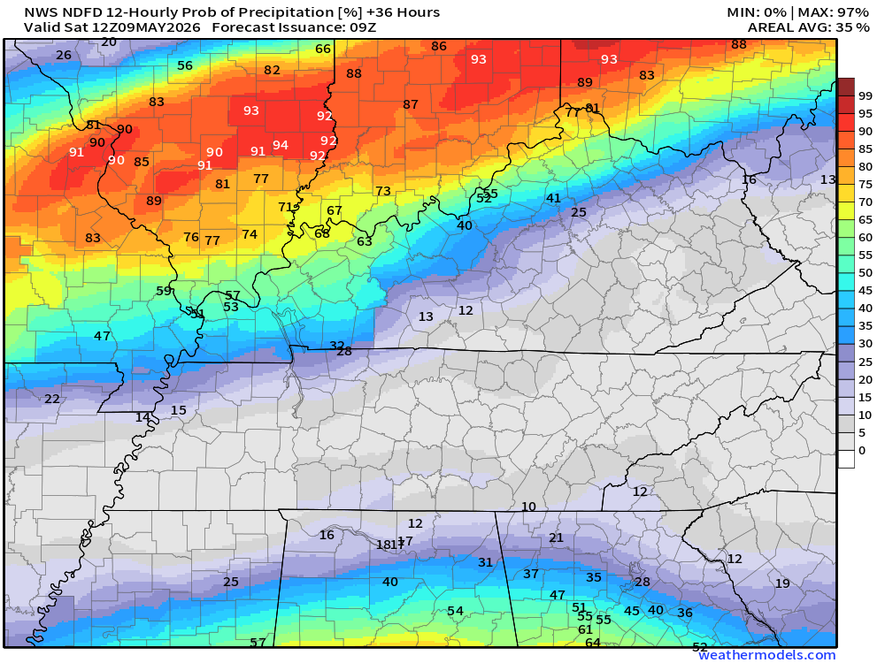
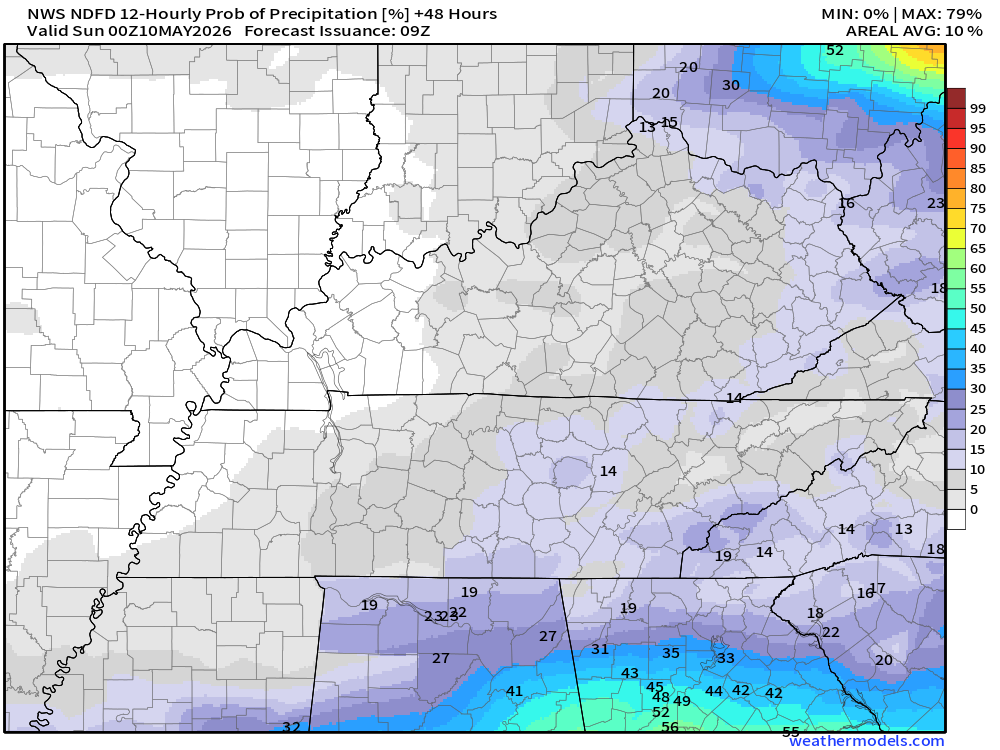
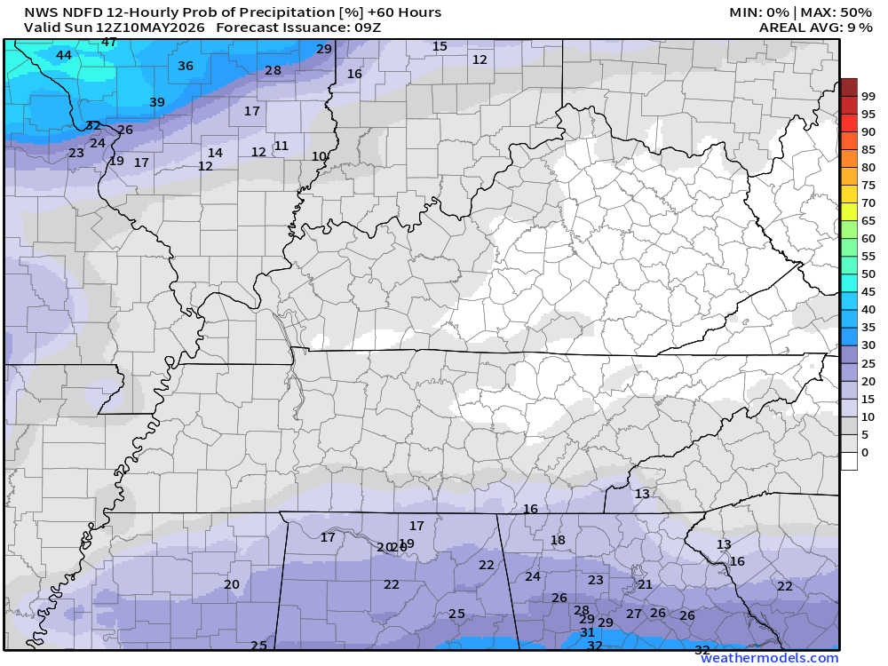
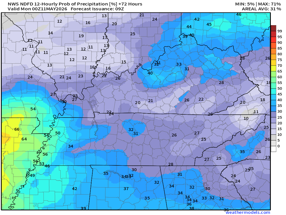
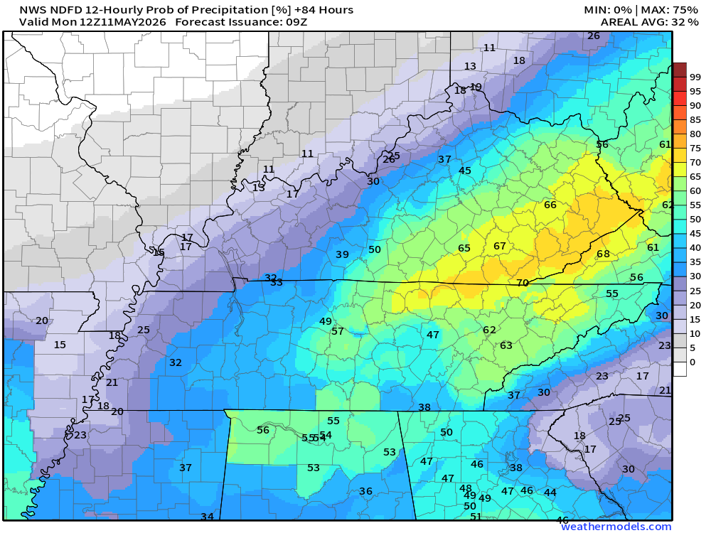
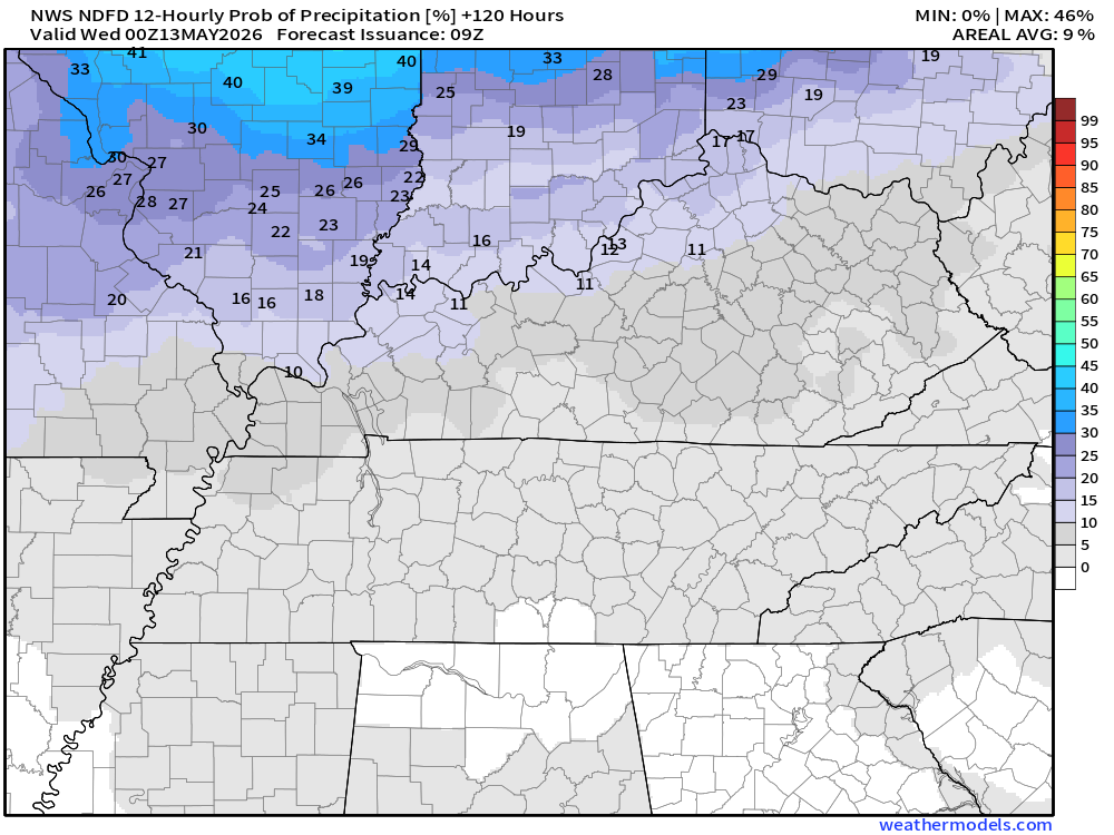
Let’s look at the rain probability maps. What is the % chance of rain?
Double-click maps to enlarge them.
7 AM today to 7 PM tonight
.
7 PM tonight to 7 AM Saturday
.
7 AM Saturday to 7 PM Sunday
.
7 PM Saturday to 7 AM Sunday
.
7 AM Sunday to 7 PM Sunday

.
The timestamp (upper left) is in Zulu. 12z=7 am. 18z=1 pm. 00z=7 pm.
Green is rain. Yellow is moderate rain. Orange indicates locally heavy rain.
Double-click the animation to enlarge it.
Hrrr Model
.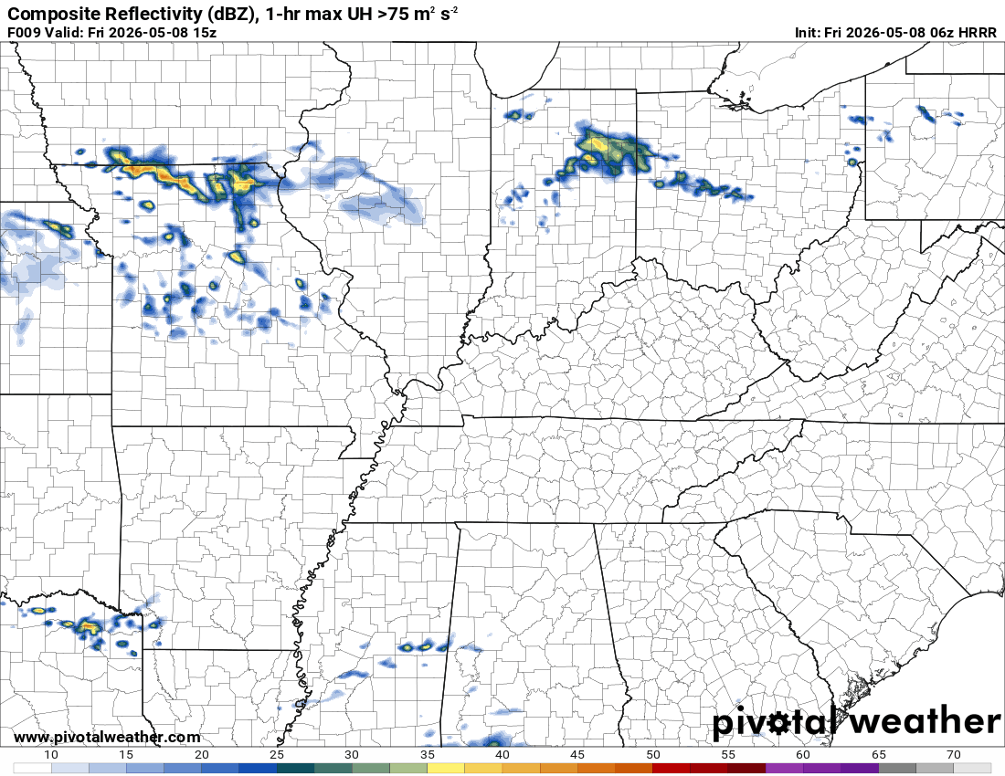
.
The timestamp (upper left) is in Zulu. 12z=7 am. 18z=1 pm. 00z=7 pm.
Green is rain. Yellow is moderate rain. Orange indicates locally heavy rain.
Double-click the animation to enlarge it.
EC Model
.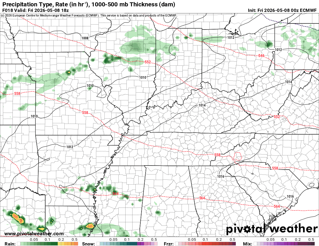
.
The timestamp (upper left) is in Zulu. 12z=7 am. 18z=1 pm. 00z=7 pm.
Green is rain. Yellow is moderate rain. Orange indicates locally heavy rain.
Double-click the animation to enlarge it.
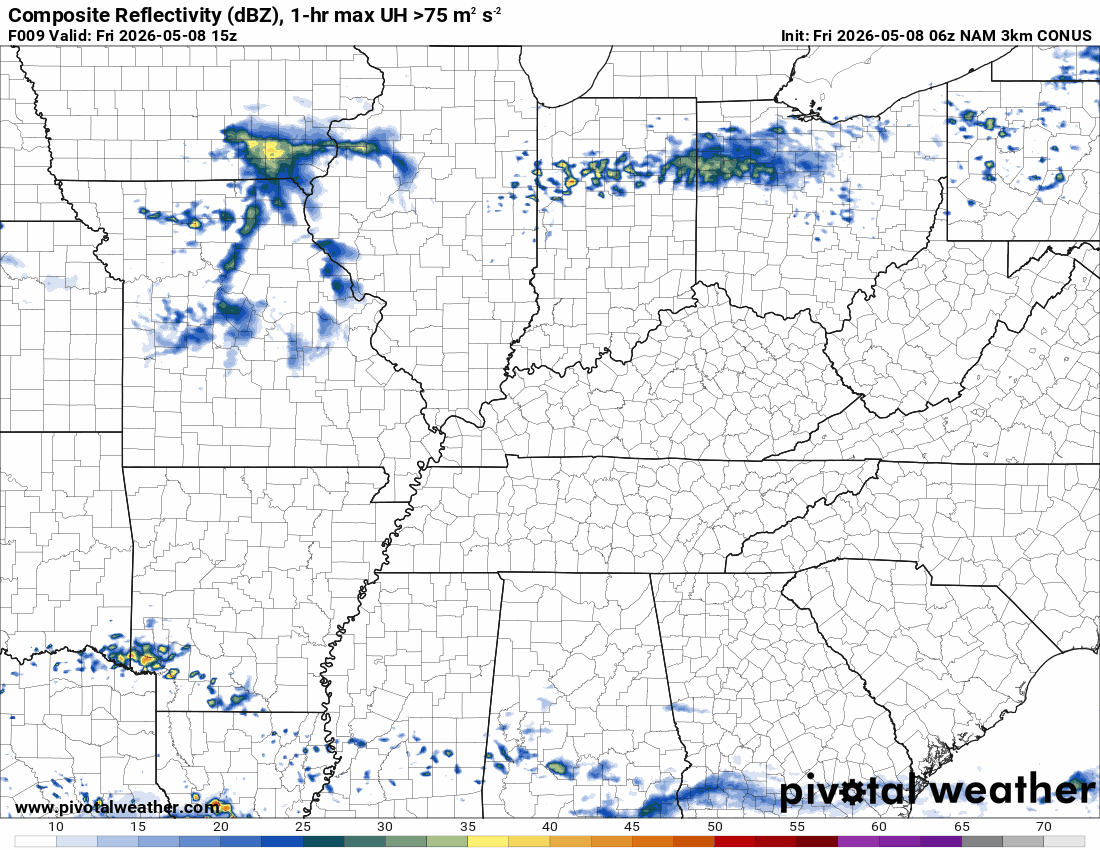
NAM 3K Model
.
..
.
Click here if you would like to return to the top of the page.
.Average high temperatures for this time of the year are around 76 degrees.
Average low temperatures for this time of the year are around 53 degrees.
Average precipitation during this time period ranges from 1.00″ to 1.20″
Six to Ten Day Outlook.
Blue is below average. Red is above average. The no color zone represents equal chances.
Average highs for this time of the year are in the lower 60s. Average lows for this time of the year are in the lower 40s.

Green is above average precipitation. Yellow and brown favors below-average precipitation. Average precipitation for this time of the year is around one inch per week.

.

Average low temperatures for this time of the year are around 59 degrees.
Average precipitation during this time period ranges from 1.00″ to 1.30″
.
Eight to Fourteen Day Outlook.
Blue is below average. Red is above average. The no color zone represents equal chances.

Green is above average precipitation. Yellow and brown favors below average precipitation. Average precipitation for this time of the year is around one inch per week.

.
.
.
We have a new service to complement your www.weathertalk.com subscription. This does NOT replace www.weathertalk.com It is simply another tool for you to receive severe weather information.
.
https://weathercallservices.com/beau-dodson-weather


Want to receive the daily forecast/other products on your Beau Dodson Weather app?
Did you know you have four options in your www.weathertalk.com account
You will then receive these via your Beau Dodson Weather app.
Just log into your www.weathertalk.com account
Click the NOTIFICATION SETTINGS TAB
Then, turn them on (green) and off (red)
🌪️ Number 1 is the most important one. Severe alerts, tornado alerts, and so on.
Number 2 is the daily video, blog, livestream alerts, and severe weather Facebook threads on severe days or winter storm days.
Number 3 is the daily forecast. I send that out every day during the afternoon hours. It is the seven-day forecast, hazardous weather outlook, fire outlook, and more.
Number 4 is to receive the daily video, blog, and other content on NON-severe weather days (every day without severe threats in other words)
GREEN IS ON
RED IS OFF


Radars and Lightning Data
Interactive-city-view radars. Clickable watches and warnings.
https://wtalk.co/B3XHASFZ
Old legacy radar site (some of you like it better)
https://weatherobservatory.com/weather-radar.htm
If the radar is not updating then try another one. If a radar does not appear to be refreshing then hit Ctrl F5. You may also try restarting your browser.
Backup radar site in case the above one is not working.
https://weathertalk.com/morani
Regional Radar
https://imagery.weathertalk.com/prx/RadarLoop.mp4
** NEW ** Zoom radar with chaser tracking abilities!
ZoomRadar
If the radar is not working, then email me: Email me at beaudodson@usawx.com
.
We do have some sponsors! Check them out.
Roof damage from recent storms? Link – Click here
INTEGRITY ROOFING AND EXTERIORS!
⛈️ Roof or gutter damage from recent storms? Today’s weather is sponsored by Integrity Roofing. Check out their website at this link https://www.ourintegritymatters.com/

![]()
![]()
![]()
Make sure you have three to five ways of receiving your severe weather information.
Weather Talk is one of those ways! Now, I have another product for you and your family.

.
Want to add more products to your Beau Dodson Weather App?
Receive daily videos, weather blog updates on normal weather days and severe weather and winter storm days, your county by county weather forecast, and more!
Here is how to do add those additional products to your app notification settings!
Here is a video on how to update your Beau Dodson Weather payment.
The app is for subscribers. Subscribe at www.weathertalk.com/welcome then go to your app store and search for WeatherTalk
Subscribers, PLEASE USE THE APP. ATT and Verizon are not reliable during severe weather. They are delaying text messages.
The app is under WeatherTalk in the app store.

Apple users click here

Android users click here
.
Radars and Lightning Data
Interactive-city-view radars. Clickable watches and warnings.
https://wtalk.co/B3XHASFZ
Old legacy radar site (some of you like it better)
https://weatherobservatory.com/weather-radar.htm
If the radar is not updating then try another one. If a radar does not appear to be refreshing then hit Ctrl F5. You may also try restarting your browser.
Backup radar site in case the above one is not working.
https://weathertalk.com/morani
Regional Radar
https://imagery.weathertalk.com/prx/RadarLoop.mp4
** NEW ** Zoom radar with chaser tracking abilities!
ZoomRadar
Lightning Data (zoom in and out of your local area)
https://wtalk.co/WJ3SN5UZ
Not working? Email me at beaudodson@usawx.com
National map of weather watches and warnings. Click here.
Storm Prediction Center. Click here.
Weather Prediction Center. Click here.
.

Live lightning data: Click here.
Real time lightning data (another one) https://map.blitzortung.org/#5.02/37.95/-86.99
Our new Zoom radar with storm chases
.
.

Interactive GOES R satellite. Track clouds. Click here.
GOES 16 slider tool. Click here.
College of DuPage satellites. Click here
.

Here are the latest local river stage forecast numbers Click Here.
Here are the latest lake stage forecast numbers for Kentucky Lake and Lake Barkley Click Here.
.
.
Find Beau on Facebook! Click the banner.


 .
.