
Good afternoon, everyone. I hope you are having a nice day. I am!
We will have some shower chances tonight. A rumble of thunder possible. A small chance of a little sleet mixed in with the rain over southern Illinois and northwest Kentucky. Nothing to write home about.
Here is the Hrrr guidance future-cast weather radar. This takes us into Saturday morning.
Quite a bit of coverage on the Hrrr guidance. We will have to see if this is overdone just a bit. Perhaps not. Either way, some rain chances as we move into tonight.
Time stamp upper left.

Weekend:
I made some adjustments to the Saturday night and Sunday forecast. Starting to feel a bit more confident about rain chances. It may be cold enough for wet snow, as well.
The snow chances would likely be Sunday afternoon and evening. Let’s keep an eye on it. Wet snow.
An area of low pressure will pass just to our south Sunday into Sunday evening. This system will spread rain into our region.
Colder air will work into the area behind the low-pressure center. As that colder air wraps into the region the rain may change over to wet snow.
Here is the NAM future-cast radar. This shows you Saturday night into Sunday night. Green would be rain. Blue would be snow.
The models are still not in agreement as to the exact details during the Sunday time frame. Monitor updates. I am positive there will be adjustments necessary before all is said and done.
Here is the GFS model guidance. Future-cast radar, as well.
Again, not a slam dunk forecast. Monitor updates.
Most of next week is shaping up to be dry. Monday through at least Thursday! Dry will be the word. Temperatures will slowly warm through the week. Nothing major, but better than nothing.
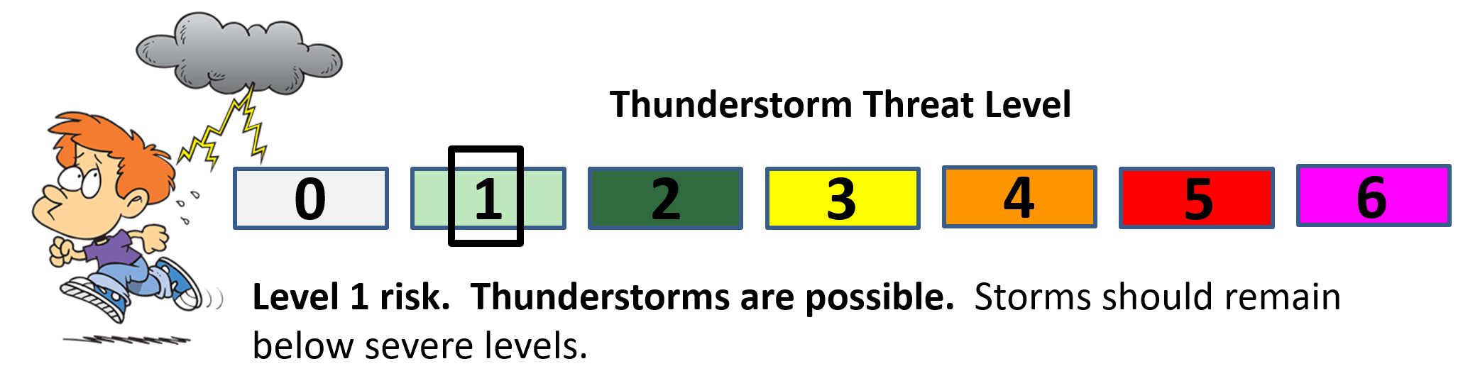
I continue to monitor March 16th through the 18th for a thunderstorm event.
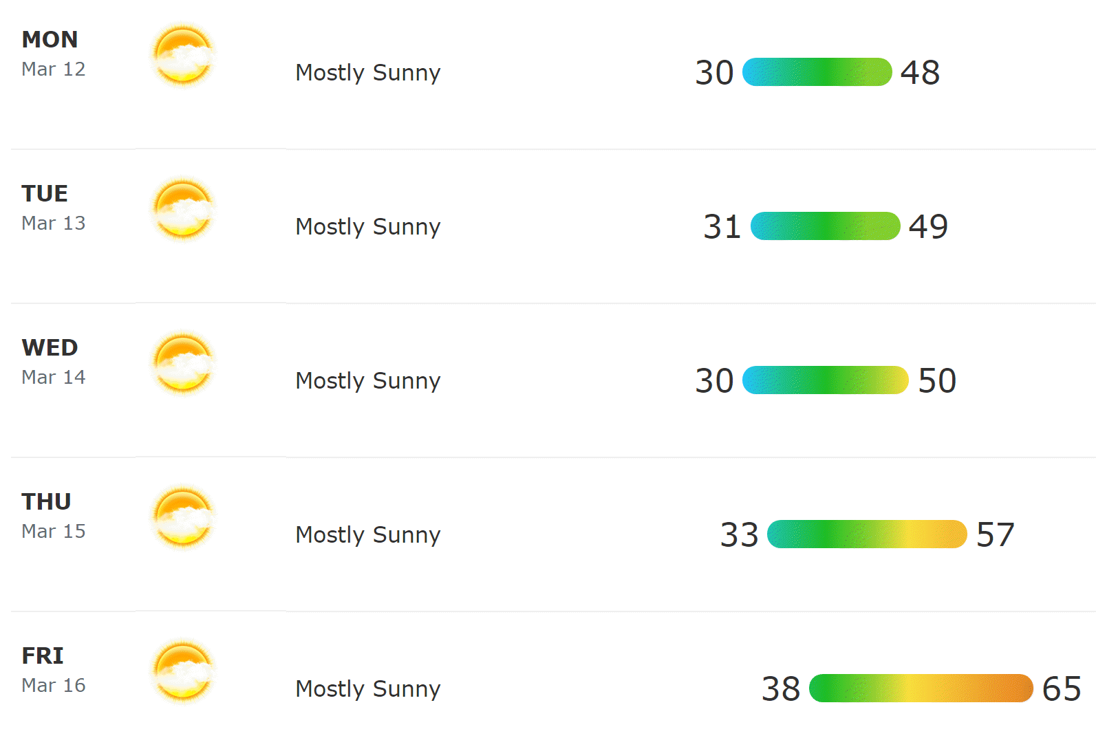
Here are the forecast numbers for next week.

March 9, 2018
Friday Forecast Details
Forecast: A mix of sun and clouds. Increasing clouds. Isolated afternoon light showers possible.
Temperatures: A range from upper 50’s near Poplar Bluff, MO to upper 40’s near Mt Vernon, IL.
MO ~ 48 to 56 IL ~ 48 to 55 KY ~ 52 to 56 TN ~ 54 to 58
What is the chance of precipitation? MO ~ 20% IL ~ 30% KY ~ 30% TN ~ 20%
Coverage of precipitation: Isolated
Winds: South and southeast winds at 6 to 12 mph with gusts to 18 mph
What impacts are anticipated from the weather? Perhaps wet roadways
My confidence in the forecast verifying: High
Is severe weather expected? No
The NWS defines severe weather as 58 mph wind or great, 1″ hail or larger, and/or tornadoes
Should I cancel my outdoor plans? No, but monitor radars
Sunrise 6:14 AM
Friday Night Forecast Details:
Forecast: Mostly cloudy. Scattered rain showers before 1 AM and then widely scattered showers after 1 AM. A rumble of thunder possible. A slight chance of rain and sleet mix over southern Illinois and northwest Kentucky. Further north and northeast you travel the better chance of a mix. No accumulation. No travel issues.
Temperatures: Temperature range from 45 near Poplar Bluff, Missouri, to 34 degrees near Mt Vernon, Illinois.
MO ~ 36 to 45 IL ~ 34 to 42 KY ~ 38 to 44 TN ~ 44 to 48
What is the chance of precipitation? MO ~ 40% north and 60% south IL ~ 40% north and 60% southern seven counties KY ~ 60% TN ~ 60%
Coverage of precipitation: Numerous
Winds: East and southeast winds at 6 to 12 mph
What impacts are anticipated from the weather? Wet roadways. Perhaps lightning.
My confidence in the forecast verifying: High
Is severe weather expected? No
The NWS defines severe weather as 58 mph wind or great, 1″ hail or larger, and/or tornadoes
Should I cancel my outdoor plans? Have a plan B and monitor updates
Sunset 5:56 PM
March 10, 2018
Saturday Forecast Details
Forecast: Mostly cloudy. Perhaps a few breaks in the clouds. Dry for the most part. Isolated showers possible.
Temperatures: MO ~ 55 to 58 IL ~ 54 to 56 KY ~ 52 to 58 TN ~ 56 to 60
What is the chance of precipitation? MO ~ 20% IL ~ 20% KY ~ 30% TN ~ 30%
Coverage of precipitation: Isolated
Winds: Variable winds at 6 to 12 mph
What impacts are anticipated from the weather? Wet roadways
My confidence in the forecast verifying: High
Is severe weather expected? No
The NWS defines severe weather as 58 mph wind or great, 1″ hail or larger, and/or tornadoes
Should I cancel my outdoor plans? No, but monitor updates and radars.
Sunrise 6:12 AM
Saturday Night Forecast Details:
Clocks spring forward tonight!
Forecast: Mostly cloudy. Showers likely. Rain chances increase as you move through the night. A chance of thunderstorms over far southeast Missouri and then along the Kentucky and Tennessee border. Colder.
Temperatures: MO ~ 36 to 44 IL ~ 35 to 42 KY ~ 40 to 45 TN ~ 43 to 46
What is the chance of precipitation? MO ~ 40% before 12 AM. 50% after 12 AM IL ~ 40% before 12 AM. 50% after 12 AM KY ~ 40% before 12 AM. 50% after 12 AM TN ~ 40% before 12 AM. 50% after 12 AM
Coverage of precipitation: Scattered to perhaps numerous (esp late)
Winds: East and northeast winds at 6 to 12 mph with gusts to 16 mph. Gusts above 20 mph possible late tonight.
What impacts are anticipated from the weather? Wet roadways
My confidence in the forecast verifying: High
Is severe weather expected? No
The NWS defines severe weather as 58 mph wind or great, 1″ hail or larger, and/or tornadoes
Should I cancel my outdoor plans? Have a plan B and monitor updates.
Sunset 5:57 PM
March 11, 2018
Sunday Forecast Details
A burst of heavy wet snow possible late in the afternoon, but more likely Sunday night.
Forecast: Cloudy. Rain likely. Becoming breezy. A rumble of thunder possible. Turning colder northwest to southeast. Late in the day the rain may mix with or change to wet snow. I can’t rule out slushy accumulation in some areas, but odds would be more towards Sunday evening or night for that to occur. Ground temperatures are warm. It would have to be moderate to heavy snow to actually stick on grassy surfaces.
Temperatures: MO ~ 48 to 56 Temperatures may fall into the 30’s late in the day. IL ~ 46 to 54 Temperatures may fall into the 30’s late in the day. KY ~ 50 to 55 Turning colder late in the day. TN ~ 52 to 55
What is the chance of precipitation? MO ~ 70% IL ~ 70% KY ~ 70% TN ~ 70%
Coverage of precipitation: Scattered to perhaps numerous.
Winds: North and northeast 6 to 12 mph with gusts to 30 mph
What impacts are anticipated from the weather? Wet roadways. Gusty winds. Monitor snow chances. Roads are warm. There would not likely be any travel problems during the daylight hours.
My confidence in the forecast verifying: Medium
Is severe weather expected? No
The NWS defines severe weather as 58 mph wind or great, 1″ hail or larger, and/or tornadoes
Should I cancel my outdoor plans? Have a plan B and monitor updates
Sunday Night Forecast Details:
Forecast: Cloudy. Rain likely. Rain may mix with or change to wet snow. A burst of heavy wet snow possible. Turning colder. Windy. Precipitation ending northwest to southeast across the region. Slushy accumulation possible across some counties. Low confidence on the snow portion of this forecast update.
Temperatures: MO ~ 28 to 34 IL ~ 28 to 34 KY ~ 28 to 34 TN ~ 30 to 35
What is the chance of precipitation? MO ~ 70% IL ~ 70% KY ~ 80% TN ~ 80%
Coverage of precipitation: Numerous the first half of the night. Ending as the night wears on.
Winds: Becoming north and northwest winds at 8 to 16 mph with gusts to 30 mph
What impacts are anticipated from the weather? Perhaps wet roadways. Monitor the snow chances.
My confidence in the forecast verifying: High on the precipitation forecast. LOW confidence on the snow forecast.
Is severe weather expected? No
The NWS defines severe weather as 58 mph wind or great, 1″ hail or larger, and/or tornadoes
Should I cancel my outdoor plans? Have a plan B and monitor updates.
Sunset 6:58 PM
March 12, 2018
Monday Forecast Details
Forecast: Mostly sunny with a few passing clouds. Cooler. Breezy.
Temperatures: MO ~ 45 to 50 IL ~ 45 to 50 KY ~ 46 to 52 TN ~ 46 to 52
What is the chance of precipitation? MO ~ 0% IL ~ 0% KY ~ 0% TN ~ 0%
Coverage of precipitation: None
Winds: North and northwest at 10 to 20 mph
What impacts are anticipated from the weather? None
My confidence in the forecast verifying: Medium
Is severe weather expected? No
The NWS defines severe weather as 58 mph wind or great, 1″ hail or larger, and/or tornadoes
Should I cancel my outdoor plans? No
Sunrise 7:09 AM
Monday Night Forecast Details:
Forecast: Mostly clear and cool.
Temperatures: MO ~ 28 to 34 IL ~ 28 to 34 KY ~ 28 to 34 TN ~ 30 to 35
What is the chance of precipitation? MO ~ 0% IL ~ 0% KY ~ 0% TN ~ 0%
Coverage of precipitation: None
Winds: North and northwest at 6 to 12 mph
What impacts are anticipated from the weather? None
My confidence in the forecast verifying: High
Is severe weather expected? No
The NWS defines severe weather as 58 mph wind or great, 1″ hail or larger, and/or tornadoes
Should I cancel my outdoor plans? No
Sunset 6:58 PM
March 13, 2018
Tuesday Forecast Details
Forecast: Mostly sunny.
Temperatures: MO ~ 45 to 50 IL ~ 45 to 50 KY ~ 46 to 52 TN ~ 46 to 52
What is the chance of precipitation? MO ~ 0% IL ~ 0% KY ~ 0% TN ~ 0%
Coverage of precipitation: None
Winds: North 5 to 10 mph
What impacts are anticipated from the weather? None
My confidence in the forecast verifying: High
Is severe weather expected? No
The NWS defines severe weather as 58 mph wind or great, 1″ hail or larger, and/or tornadoes
Should I cancel my outdoor plans? No
Sunrise 7:08 AM
Tuesday Night Forecast Details:
Forecast: Mostly clear and cool.
Temperatures: MO ~ 28 to 34 IL ~ 28 to 34 KY ~ 28 to 34 TN ~ 30 to 35
What is the chance of precipitation? MO ~ 0% IL ~ 0% KY ~ 0% TN ~ 0%
Coverage of precipitation: None
Winds: North 4 to 8 mph
What impacts are anticipated from the weather? None
My confidence in the forecast verifying: High
Is severe weather expected? No
The NWS defines severe weather as 58 mph wind or great, 1″ hail or larger, and/or tornadoes
Should I cancel my outdoor plans? No
Sunset 6:59 PM
March 14, 2018
Wednesday Forecast Details
Forecast: Mostly sunny.
Temperatures: MO ~ 46 to 52 IL ~ 46 to 52 KY ~ 48 to 54 TN ~ 48 to 54
What is the chance of precipitation? MO ~ 0% IL ~ 0% KY ~ 0% TN ~ 0%
Coverage of precipitation: None
Winds: West 5 to 10 mph
What impacts are anticipated from the weather? None
My confidence in the forecast verifying: High
Is severe weather expected? No
The NWS defines severe weather as 58 mph wind or great, 1″ hail or larger, and/or tornadoes
Should I cancel my outdoor plans? No
Sunrise 7:06 AM
Wednesday Night Forecast Details:
Forecast: Mostly clear and cool.
Temperatures: MO ~ 32 to 36 IL ~ 30 to 35 KY ~ 33 to 36 TN ~ 34 to 38
What is the chance of precipitation? MO ~ 0% IL ~ 0% KY ~ 0% TN ~ 0%
Coverage of precipitation: None
Winds: West 5 mph
What impacts are anticipated from the weather? None
My confidence in the forecast verifying: High
Is severe weather expected? No
The NWS defines severe weather as 58 mph wind or great, 1″ hail or larger, and/or tornadoes
Should I cancel my outdoor plans? No
Sunset 7:00 PM
March 15, 2018
Thursday Forecast Details
Forecast: Mostly sunny. Mild.
Temperatures: MO ~ 56 t0 62 IL ~ 56 to 62 KY ~ 56 to 62 TN ~ 56 to 62
What is the chance of precipitation? MO ~ 0% IL ~ 0% KY ~ 0% TN ~ 0%
Coverage of precipitation: None
Winds: West 5 to 10 mph
What impacts are anticipated from the weather? None
My confidence in the forecast verifying: High
Is severe weather expected? No
The NWS defines severe weather as 58 mph wind or great, 1″ hail or larger, and/or tornadoes
Should I cancel my outdoor plans? No
Sunrise 7:05 AM
Thursday Night Forecast Details:
Forecast: Mostly clear and cool.
Temperatures: MO ~ 35 to 40 IL ~ 35 to 40 KY ~ 35 to 40 TN ~ 35 to 40
What is the chance of precipitation? MO ~ 0% IL ~ 0% KY ~ 0% TN ~ 0%
Coverage of precipitation: None
Winds: West 5 mph
What impacts are anticipated from the weather? None
My confidence in the forecast verifying: High
Is severe weather expected? No
The NWS defines severe weather as 58 mph wind or great, 1″ hail or larger, and/or tornadoes
Should I cancel my outdoor plans? No
Sunset 7:01 PM

Questions? Broken links? Other?
You may email me at beaudodson@usawx.com

The National Weather Service defines a severe thunderstorm as one that produces quarter size hail or larger, 58 mph winds or greater, and/or a tornado.
Today and tonight: Severe weather is not anticipated. I can’t rule out a few reports of lightning.
Tomorrow through Saturday: Severe weather is not anticipated. I will monitor lightning chances Saturday night.
Sunday through Thursday: Severe weather is not anticipated.
![]()
Interactive live weather radar page. Choose the city nearest your location. If one of the cities does not work then try a nearby one. Click here.
National map of weather watches and warnings. Click here.
Storm Prediction Center. Click here.
Weather Prediction Center. Click here.

Live lightning data: Click here.

Interactive GOES R satellite. Track clouds. Click here.

Here are the latest local river stage forecast numbers Click Here.
Here are the latest lake stage forecast numbers for Kentucky Lake and Lake Barkley Click Here.

The spring and preliminary summer outlooks have been posted for subscribers. Scroll down to see the outlook.
Not a subscriber? Learn more at this link.

WEATHER HIGHLIGHTS
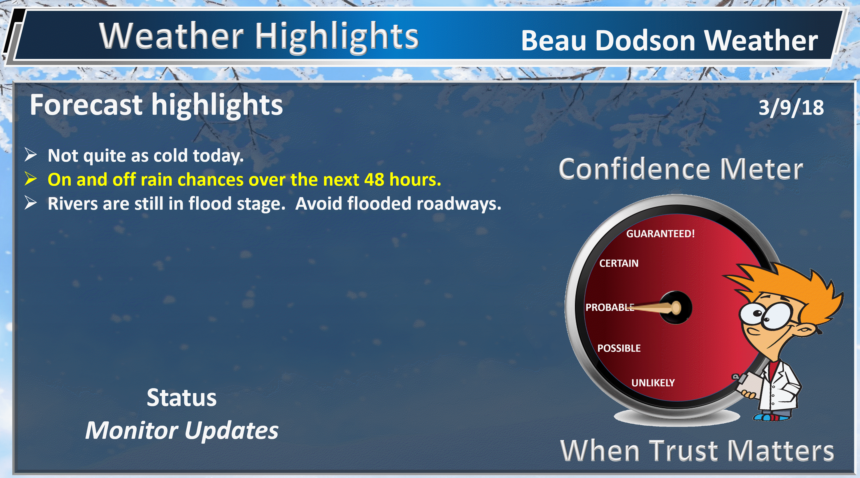
- Not quite as cold today. Quite a few clouds and isolated showers late in the day.
- Rain chances increase tonight and on/off rain chances into the weekend.
- A lot of questions remain about Saturday night and Sunday’s forecast. Track of the low is questionable, at best.
- Cool temperatures begin the new work week. A slow warming trends as we move towards the middle/end of the week.
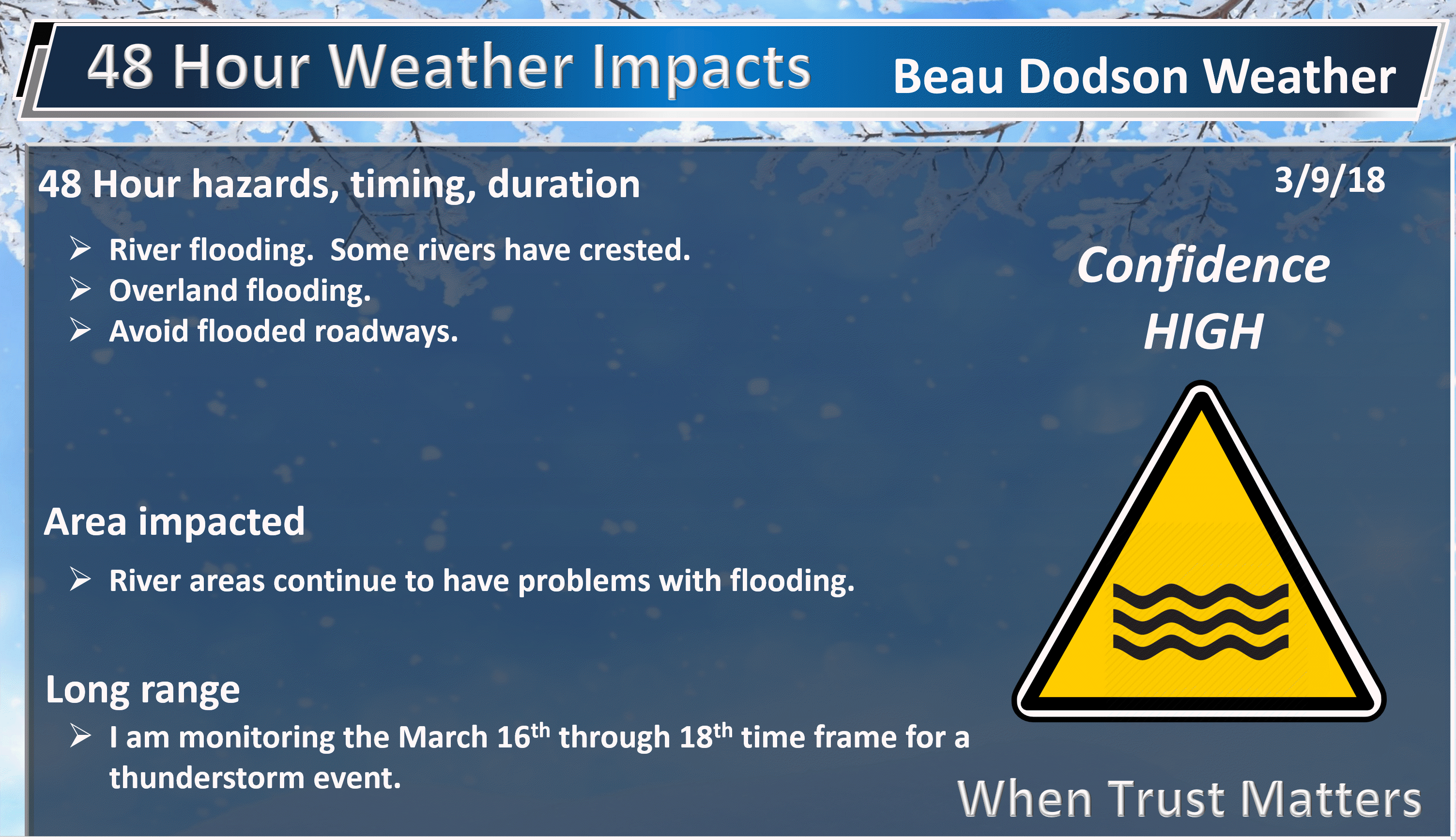
- Flooding will continue to be an issue in some areas. Avoid flooded roadways.
- In case you missed it! Here is the Facebook thread with some exciting new announcements concerning Weather Talk. Click here to read that.
Highlights
What has changed over the last 24 hours?

Weather Hazards.
Friday and Friday night
Clouds will be on the increase today. We already have quite a few clouds in the area. A few light showers are a possibility over southern Illinois into northwest Kentucky, especially later this afternoon. Odds favor a mostly dry day.
Rain chances ramp tonight. I am not anticipating heavy rain. Scattered showers will be the general rule. It should be warm enough for mostly rain. I can’t rule out a sleet/rain mix over portions of southern Illinois and northwest Kentucky. No accumulation.
Temperatures today will rise into the 50’s across most of the area. Perhaps a few remaining upper 40’s across northern parts of southern Illinois and then into southwest Indiana. I can’t rule out a 60 degree reading over southeast Missouri (towards Poplar Bluff).
Lows tonight will dip into the 30’s and lower 40’s. Chilly.
Here is the future-cast radar from the GFS model guidance.
You can see some rain spreading across the region as we move through
Timestamp upper left
Green represents rain. Blue represents snow.

Here is the future-cast radar from the high-resolution 3K NAM model guidance
Timestamp upper left
Green represents rain. Blue represents snow.
Saturday into Sunday
Saturday is a transition day. One system will pull away from the region and then we will be monitoring the second system to our southwest. The movement of the second system will control what happens Saturday night and Sunday.
The Saturday night and Sunday forecast have been nothing but a headache.
Models can’t seem to agree on the eventual track of an area of low pressure. My forecast has been for the low to track through Arkansas and into Tennessee. Some models track is well south of there.
The track is key because the rain will be hugging the low. If the low tracks too far south then we would likely miss out on the rain. If it were to track further north then rain chances would increase area-wide.
Here is the full run of the future-cast radar from the NAM model guidance
Timestamp upper left
Here is the GFS future-cast radar
Green is rain. Blue is snow.
We will need to closely monitor the track of the Saturday night and Sunday precipitation event. There are some guidance packages that bring enough cold air into the area to change the rain to wet snow.
Windy conditions are possible Saturday night and Sunday. This will depend on the strength of the area of low pressure.
Monday through Thursday
A dry spell is anticipating. We have earned some dry weather.
I am monitoring a potential system towards next Saturday, Sunday, and Monday. The exact date of the system will need to be monitored. Thunderstorms are a possibility. Another one the following week.
We are edging ever so close to spring.
Don’t forget we push the clouds forward Saturday night. Collective yay? 🙂

Weather Brains is a weekly podcast/video for those who love weather and want more!
Weather Brains episode number 633
Previous episodes can be viewed by clicking here.
t’s a full house for this episode of WeatherBrains with representatives from a number of weather-related podcasts. Joining us are Becky DePodwin, Ice Station Housman, Scotty Powell from Carolina Weather Gang, Castle Williams,
WeatherHype
, Mark Jelinek, What is it About the Weather, and Phil Johnson of Storm Front Freaks Podcast. This show marks National Weather Podcast Month.
Other discussions in this weekly podcast include topics like:
- Extremes: 98 at Rio Grande Village, TX, and -7 at Cut Bank, MT
- The creative outlet that is podcasts and how they have changed over time
- The importance of providing good content in podcasting
- 25th Anniversary of Blizzard of 1993
- Astronomy Outlook with Tony Rice
- and more!

We offer interactive local city live radars and regional radars. If a radar does not update then try another one. If a radar does not appear to be refreshing then hit Ctrl F5. You may also try restarting your browser.
The local city view radars also have clickable warnings.
During the winter months, you can track snow and ice by clicking the winterize button on the local city view interactive radars.
You may email me at beaudodson@usawx.com
Find me on Facebook!

Find me on Twitter!

Did you know that a portion of your monthly subscription helps support local charity projects?
You can learn more about those projects by visiting the Shadow Angel Foundation website and the Beau Dodson News website.

I encourage subscribers to use the app vs regular text messaging. We have found text messaging to be delayed during severe weather. The app typically will receive the messages instantly. I recommend people have three to four methods of receiving their severe weather information.
Remember, my app and text alerts are hand typed and not computer generated. You are being given personal attention during significant weather events.
