
Good afternoon, it has been a chilly day with a mix of sun and clouds. There have been a few flurries reported, as well.
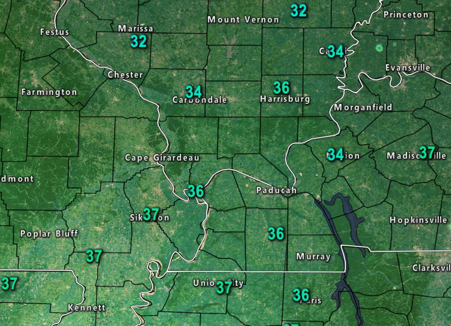
12 PM temperature map
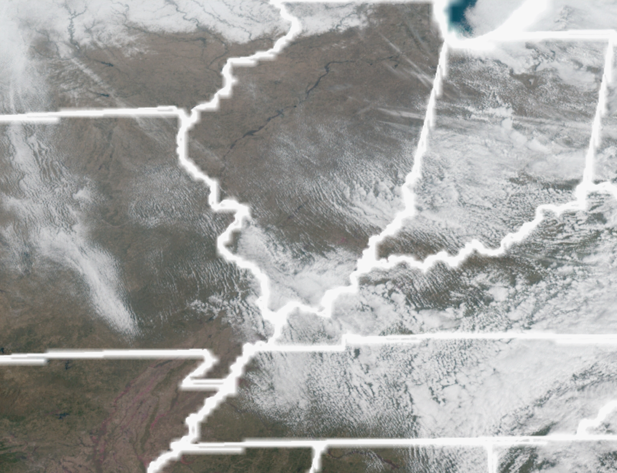
Satellite showed a few clouds around the region.
The latest weather guidance indicates very little change from model run to run.
The GFS continues to believe the area of low pressure is going to track across central and northern Arkansas into Tennessee.
Ensembles (multi-model runs) are mixed.
EC model is way south. NAM guidance is way south.
Not making for the easiest forecast.
Climo would suggest the low would track through Arkansas and then into Tennessee. Just not overly
confidence on how this plays out Saturday night into Sunday.
I am going to update the rain probabilities and add some differences north vs south.
The best chance of rain through the next three days will likely be across the southern half of the region. That would include areas from Poplar Bluff, MO to Cape Girardeau, MO to Madisonville, KY. Along and south of that line.
North of that line there will be rain chances, but perhaps not as great. See the daily forecast for details.
Severe weather or heavy rain is currently not anticipated.
Rain totals on Friday and Friday night will likely range from 0.05″ to 0.25″.
Rain totals on Saturday will likely range from 0.00″ to 0.20″.
Rain totals Saturday night and Sunday will range from 0.00″ to 0.30″ north and 0.25″ to 0.50″ south.
If the system takes the EC and NAM model guidance track then very little rain will occur Saturday night or Sunday in our area. Perhaps the Bootheel into western Tennessee would still have rain.
Next week is shaping up dry Sunday night through Thursday.
I continue to monitor March 16th through the 18th for a thunderstorm event. Long way off.
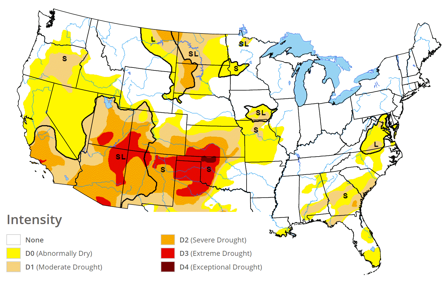
The latest drought monitor map indicates conditions have improved in our region. No surprise.

March 8, 2018
Thursday Forecast Details
Forecast: A mix of sun and clouds. Cold. Some morning flurries.
Temperatures: MO ~ 42 to 46 (warmer near Poplar Bluff vs Farmington) IL ~ 38 (coldest over our north and northeastern counties) to 45 KY ~ 40 to 45 TN ~ 43 to 46
What is the chance of precipitation? MO ~ 20% IL ~ 30% KY ~ 20% TN ~ 20%
Coverage of precipitation: Isolated
Winds: West and northwest winds at 8 to 16 mph and gusty.
What impacts are anticipated from the weather? None
My confidence in the forecast verifying: High
Is severe weather expected? No
The NWS defines severe weather as 58 mph wind or great, 1″ hail or larger, and/or tornadoes
Should I cancel my outdoor plans? No
Sunrise 6:15 AM
Thursday Night Forecast Details:
Forecast: Mostly clear early. A few clouds. Some increase in clouds late.
Temperatures: MO ~ 24 to 28 IL ~ 24 to 28 KY ~ 25 to 30 TN ~ 25 to 30
What is the chance of precipitation? MO ~ 20% IL ~ 0% KY ~ 0% TN ~ 10%
Coverage of precipitation: None
Winds: West and northwest winds at 5 to 10 mph with gusts to 12
What impacts are anticipated from the weather? Most likely none
My confidence in the forecast verifying: High
Is severe weather expected? No
The NWS defines severe weather as 58 mph wind or great, 1″ hail or larger, and/or tornadoes
Should I cancel my outdoor plans? No
Sunset 5:55 PM
March 9, 2018
Friday Forecast Details
Forecast: A mix of sun and clouds. Increasing clouds. Isolated showers possible.
Temperatures: MO ~ 48 to 56 IL ~ 48 to 55 KY ~ 52 to 56 TN ~ 54 to 58
What is the chance of precipitation? MO ~ 20% IL ~ 30% KY ~ 30% TN ~ 20%
Coverage of precipitation: Isolated
Winds: South and southeast winds at 6 to 12 mph with gusts to 18 mph
What impacts are anticipated from the weather? Perhaps wet roadways
My confidence in the forecast verifying: High
Is severe weather expected? No
The NWS defines severe weather as 58 mph wind or great, 1″ hail or larger, and/or tornadoes
Should I cancel my outdoor plans? No, but monitor radars
Sunrise 6:14 AM
Friday Night Forecast Details:
Forecast: Mostly cloudy. Scattered rain showers before 1 AM and then widely scattered showers after 1 AM. A slight chance of rain and snow mix near Mt Vernon towards Owensboro.
Temperatures: MO ~ 36 to 45 IL ~ 34 to 42 KY ~ 38 to 44 TN ~ 43 to 46
What is the chance of precipitation? MO ~ 40% IL ~ 40% KY ~ 50% TN ~ 50%
Coverage of precipitation: Scattered
Winds: East and southeast winds at 6 to 12 mph
What impacts are anticipated from the weather? Wet roadways
My confidence in the forecast verifying: Medium
Is severe weather expected? No
The NWS defines severe weather as 58 mph wind or great, 1″ hail or larger, and/or tornadoes
Should I cancel my outdoor plans? Have a plan B and monitor updates
Sunset 5:56 PM
March 10, 2018
Saturday Forecast Details
Forecast: Cloudy. Widely scattered showers possible.
Temperatures: MO ~ 55 to 58 IL ~ 54 to 56 KY ~ 52 to 58 TN ~ 56 to 60
What is the chance of precipitation? MO ~ 20% IL ~ 20% KY ~ 30% TN ~ 30%
Coverage of precipitation: Widely scattered
Winds: Variable winds at 6 to 12 mph
What impacts are anticipated from the weather? Wet roadways
My confidence in the forecast verifying: Medium
Is severe weather expected? No
The NWS defines severe weather as 58 mph wind or great, 1″ hail or larger, and/or tornadoes
Should I cancel my outdoor plans? No, but monitor updates and radars.
Sunrise 6:12 AM
Saturday Night Forecast Details:
Clocks spring forward tonight!
Forecast: Mostly cloudy. Showers possible. A chance of thunderstorms over far southeast Missouri and then along the Kentucky and Tennessee border. Cool.
Temperatures: MO ~ 36 to 44 IL ~ 36 to 44 KY ~ 42 to 46 TN ~ 43 to 46
What is the chance of precipitation? MO ~ 40% to 60% IL ~ 40% to 60% KY ~ 40% to 60% TN ~ 40% to 60%
Coverage of precipitation: Scattered to perhaps numerous
Winds: East and northeast winds at 6 to 12 mph with gusts to 16 mph
What impacts are anticipated from the weather? Wet roadways
My confidence in the forecast verifying: Medium
Is severe weather expected? No
The NWS defines severe weather as 58 mph wind or great, 1″ hail or larger, and/or tornadoes
Should I cancel my outdoor plans? Have a plan B and monitor updates.
Sunset 5:57 PM
March 11, 2018
Sunday Forecast Details
Forecast: Low confidence in the Sunday forecast. Cloudy. A chance of showers. Temperatures may fall during the day.
Temperatures: MO ~ 52 to 56 IL ~ 48 to 54 KY ~ 50 to 55 TN ~ 52 to 55
What is the chance of precipitation? MO ~ 40% north and 50% Bootheel IL ~ 30% KY ~ 40% north and 50% along the KY/TN border TN ~ 60%
Coverage of precipitation: Scattered to perhaps numerous. Low confidence.
Winds: North and northeast 6 to 12 mph with gusts to 25 mph
What impacts are anticipated from the weather? Wet roadways. Gusty winds.
My confidence in the forecast verifying: LOW
Is severe weather expected? No
The NWS defines severe weather as 58 mph wind or great, 1″ hail or larger, and/or tornadoes
Should I cancel my outdoor plans? Have a plan B and monitor updates.
Sunday Night Forecast Details:
Forecast: Mostly cloudy. Turning colder. Scattered rain or snow showers possible before midnight.
Temperatures: MO ~ 30 to 35 IL ~ 30 to 35 KY ~ 32 to 36 TN ~ 32 to 36
What is the chance of precipitation? MO ~ 30% IL ~ 30% KY ~ 30% TN ~ 30%
Coverage of precipitation: Ending
Winds: Becoming north and northwest winds at 8 to 16 mph with gusts to 20 mph
What impacts are anticipated from the weather? Perhaps wet roadways
My confidence in the forecast verifying: LOW
Is severe weather expected? No
The NWS defines severe weather as 58 mph wind or great, 1″ hail or larger, and/or tornadoes
Should I cancel my outdoor plans? No, but check radars
Sunset 6:58 PM
March 12, 2018
Monday Forecast Details
Forecast: Mostly sunny with a few passing clouds. Cooler. Breezy.
Temperatures: MO ~ 45 to 50 IL ~ 45 to 50 KY ~ 46 to 52 TN ~ 46 to 52
What is the chance of precipitation? MO ~ 0% IL ~ 0% KY ~ 0% TN ~ 0%
Coverage of precipitation: None
Winds: North and northwest at 10 to 20 mph
What impacts are anticipated from the weather? None
My confidence in the forecast verifying: Medium
Is severe weather expected? No
The NWS defines severe weather as 58 mph wind or great, 1″ hail or larger, and/or tornadoes
Should I cancel my outdoor plans? No
Sunrise 7:09 AM
Monday Night Forecast Details:
Forecast: Mostly clear and cool.
Temperatures: MO ~ 28 to 34 IL ~ 28 to 34 KY ~ 28 to 34 TN ~ 30 to 35
What is the chance of precipitation? MO ~ 0% IL ~ 0% KY ~ 0% TN ~ 0%
Coverage of precipitation: None
Winds: North and northwest at 6 to 12 mph
What impacts are anticipated from the weather? None
My confidence in the forecast verifying: High
Is severe weather expected? No
The NWS defines severe weather as 58 mph wind or great, 1″ hail or larger, and/or tornadoes
Should I cancel my outdoor plans? No
Sunset 6:58 PM
March 13, 2018
Tuesday Forecast Details
Forecast: Mostly sunny.
Temperatures: MO ~ 45 to 50 IL ~ 45 to 50 KY ~ 46 to 52 TN ~ 46 to 52
What is the chance of precipitation? MO ~ 0% IL ~ 0% KY ~ 0% TN ~ 0%
Coverage of precipitation: None
Winds: North 5 to 10 mph
What impacts are anticipated from the weather? None
My confidence in the forecast verifying: High
Is severe weather expected? No
The NWS defines severe weather as 58 mph wind or great, 1″ hail or larger, and/or tornadoes
Should I cancel my outdoor plans? No
Sunrise 7:08 AM
Tuesday Night Forecast Details:
Forecast: Mostly clear and cool.
Temperatures: MO ~ 28 to 34 IL ~ 28 to 34 KY ~ 28 to 34 TN ~ 30 to 35
What is the chance of precipitation? MO ~ 0% IL ~ 0% KY ~ 0% TN ~ 0%
Coverage of precipitation: None
Winds: North 4 to 8 mph
What impacts are anticipated from the weather? None
My confidence in the forecast verifying: High
Is severe weather expected? No
The NWS defines severe weather as 58 mph wind or great, 1″ hail or larger, and/or tornadoes
Should I cancel my outdoor plans? No
Sunset 6:59 PM
March 14, 2018
Wednesday Forecast Details
Forecast: Mostly sunny.
Temperatures: MO ~ 46 to 52 IL ~ 46 to 52 KY ~ 48 to 54 TN ~ 48 to 54
What is the chance of precipitation? MO ~ 0% IL ~ 0% KY ~ 0% TN ~ 0%
Coverage of precipitation: None
Winds: West 5 to 10 mph
What impacts are anticipated from the weather? None
My confidence in the forecast verifying: High
Is severe weather expected? No
The NWS defines severe weather as 58 mph wind or great, 1″ hail or larger, and/or tornadoes
Should I cancel my outdoor plans? No
Sunrise 7:06 AM
Wednesday Night Forecast Details:
Forecast: Mostly clear and cool.
Temperatures: MO ~ 32 to 36 IL ~ 30 to 35 KY ~ 33 to 36 TN ~ 34 to 38
What is the chance of precipitation? MO ~ 0% IL ~ 0% KY ~ 0% TN ~ 0%
Coverage of precipitation: None
Winds: West 5 mph
What impacts are anticipated from the weather? None
My confidence in the forecast verifying: High
Is severe weather expected? No
The NWS defines severe weather as 58 mph wind or great, 1″ hail or larger, and/or tornadoes
Should I cancel my outdoor plans? No
Sunset 7:00 PM
March 15, 2018
Thursday Forecast Details
Forecast: Mostly sunny. Mild.
Temperatures: MO ~ 56 t0 62 IL ~ 56 to 62 KY ~ 56 to 62 TN ~ 56 to 62
What is the chance of precipitation? MO ~ 0% IL ~ 0% KY ~ 0% TN ~ 0%
Coverage of precipitation: None
Winds: West 5 to 10 mph
What impacts are anticipated from the weather? None
My confidence in the forecast verifying: High
Is severe weather expected? No
The NWS defines severe weather as 58 mph wind or great, 1″ hail or larger, and/or tornadoes
Should I cancel my outdoor plans? No
Sunrise 7:05 AM
Thursday Night Forecast Details:
Forecast: Mostly clear and cool.
Temperatures: MO ~ 35 to 40 IL ~ 35 to 40 KY ~ 35 to 40 TN ~ 35 to 40
What is the chance of precipitation? MO ~ 0% IL ~ 0% KY ~ 0% TN ~ 0%
Coverage of precipitation: None
Winds: West 5 mph
What impacts are anticipated from the weather? None
My confidence in the forecast verifying: High
Is severe weather expected? No
The NWS defines severe weather as 58 mph wind or great, 1″ hail or larger, and/or tornadoes
Should I cancel my outdoor plans? No
Sunset 7:01 PM

Questions? Broken links? Other?
You may email me at beaudodson@usawx.com

The National Weather Service defines a severe thunderstorm as one that produces quarter size hail or larger, 58 mph winds or greater, and/or a tornado.
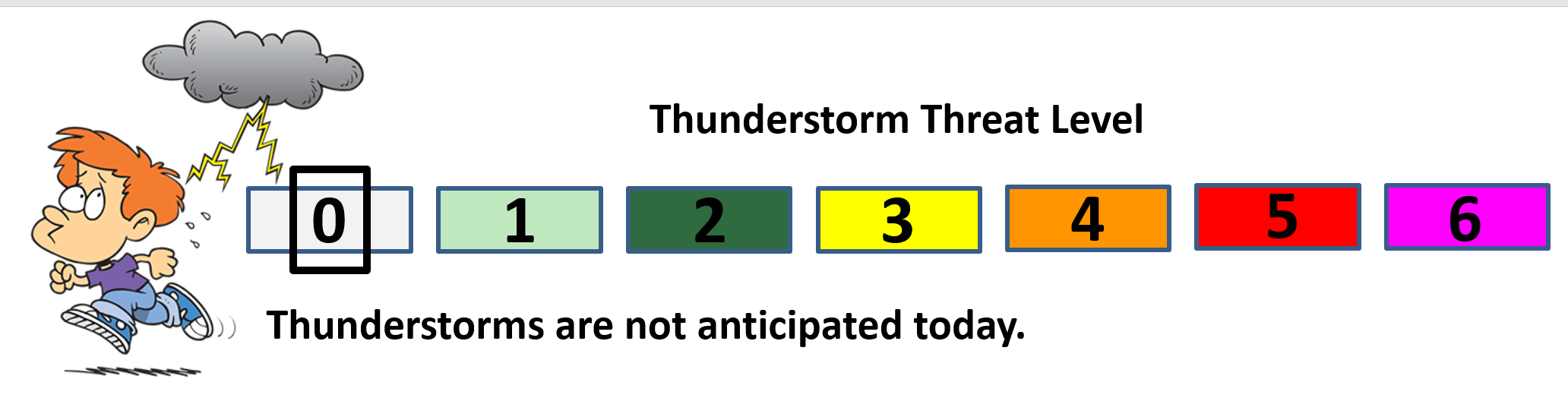
Today and tonight: Severe weather is not anticipated.
Tomorrow through Saturday: Severe weather is not anticipated. Lightning is possible Saturday afternoon into Saturday night. Monitor updates.
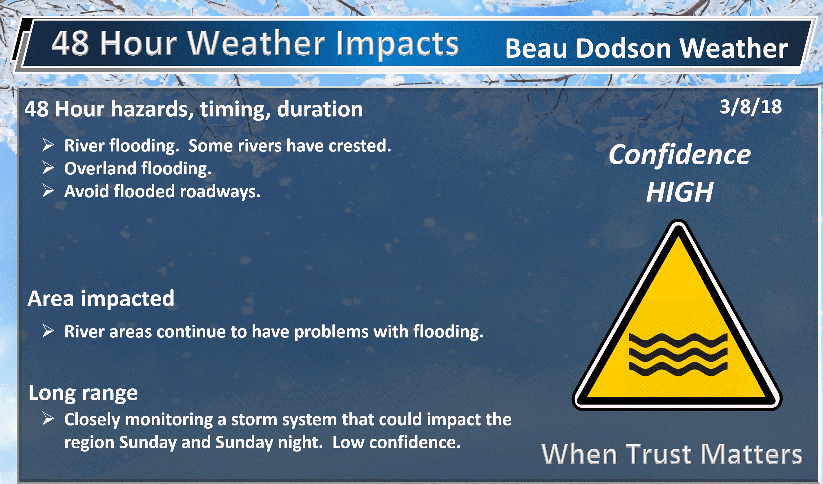
Sunday and Sunday night: Low confidence. Monitor updates. I can’t rule out thunderstorms in or near our region. The track of an area of low pressure will be key to the eventual forecast.
![]()
Interactive live weather radar page. Choose the city nearest your location. If one of the cities does not work then try a nearby one. Click here.
National map of weather watches and warnings. Click here.
Storm Prediction Center. Click here.
Weather Prediction Center. Click here.

Live lightning data: Click here.

Interactive GOES R satellite. Track clouds. Click here.

Here are the latest local river stage forecast numbers Click Here.
Here are the latest lake stage forecast numbers for Kentucky Lake and Lake Barkley Click Here.

The spring and preliminary summer outlooks have been posted for subscribers. Scroll down to see the outlook.
Not a subscriber? Learn more at this link.

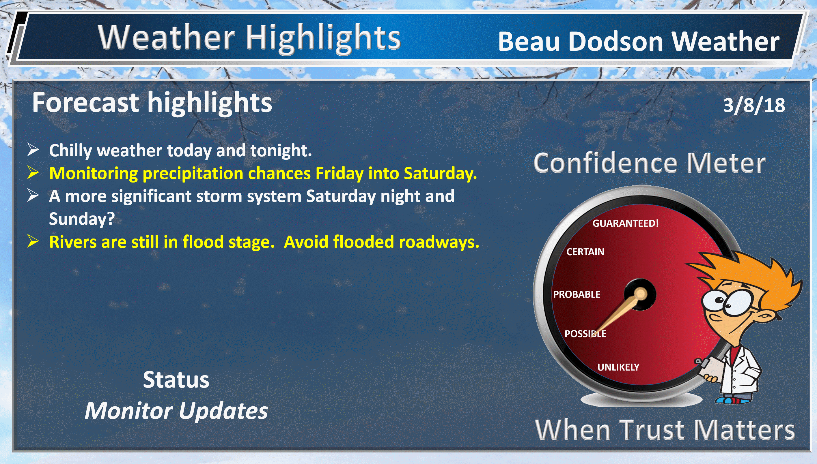
WEATHER HIGHLIGHTS
- Cold today into tonight. A few flurries this morning.
- Somewhat milder Friday into the weekend.
- Monitoring rain chance Friday into Saturday night.
- A more significant storm system may impact the region late Saturday night into Sunday night. Confidence remains low.
- Cool weather much of next week.
- Flooding will continue to be an issue in many areas. Avoid flooded roadways.
- In case you missed it! Here is the Facebook thread with some exciting new announcements concerning Weather Talk. Click here to read that.
Highlights
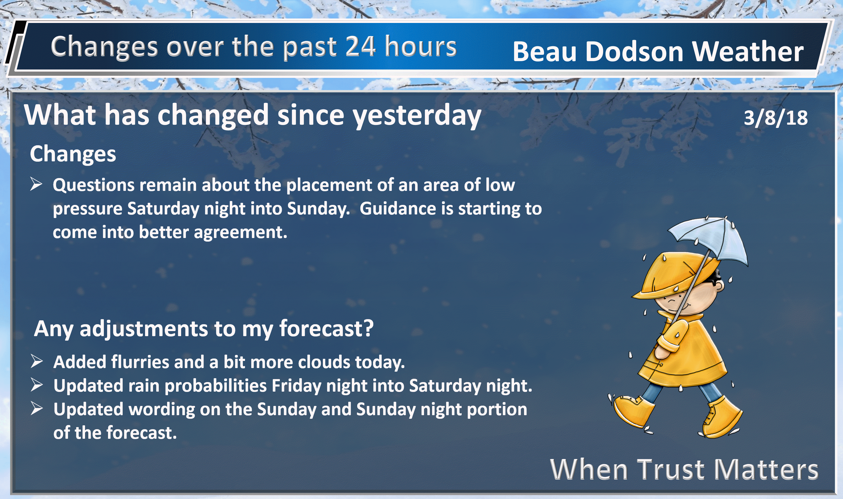
What has changed over the last 24 hours?
Weather Hazards.
Today into Friday
Our chilly temperatures will be with us into tonight. Some clouds today, as well. A mix of sun and clouds. There are even a few patchy flurries on weather radar.
Just a reminder that spring has not arrived, just yet.
You can expect highs mainly in the 40’s today. The Mt. Vernon, Illinois area may remain in the lower 40’s.
Lows tonight will dip back down into the 20’s. Below normal temperatures.
The good news is that a slow warming trend will begin on Friday and continue into the weekend. We aren’t talking about 70’s. We are talking about 50’s. It could be worse.
A warm front will develop Friday and Friday afternoon over our region. This front will then become the focus of scattered showers.
Shower activity will increase a bit on Friday night. Rain chances Friday night will peak in the 40% to 50% range across the region.
Shower chances on Saturday will peak in the 20% to 40% range.
Here is the future-cast radar through Saturday 12 AM.
Here are the forecast rain totals through Saturday 5 PM. Not much.
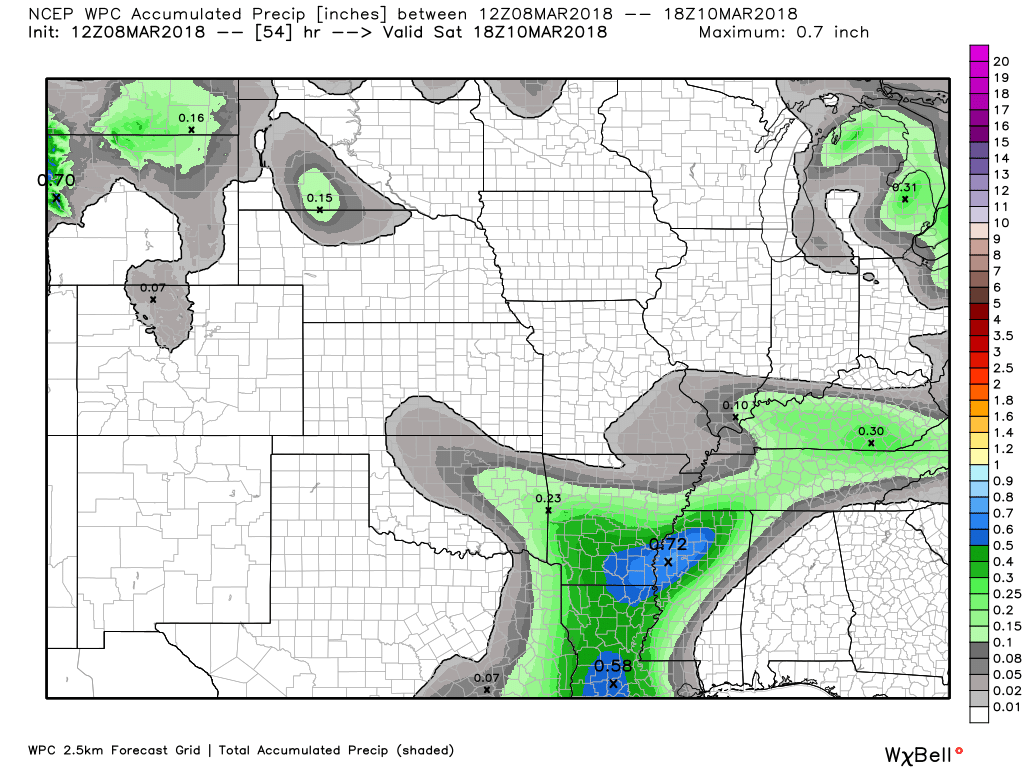
Rain chances will likely increase Saturday night in response to an area of low pressure that will track through Arkansas. This system will likely bring widespread rain to the Tennessee Valley.
Saturday night may end up being the greatest chance of rain. This is especially true over the southern half of the region. That would include areas along and south of a line from Cape Girardeau, Missouri towards Madisonville, Kentucky. Rain chances may climb into the 50% to 60% range in those areas. A bit less of a chance further north.
How far north that rain will push is still a bit of a question. This will need to be monitored. Areas north of the above-mentioned line will likely have rain chances, but perhaps not as great as to the south.
Here is the future-cast radar through Sunday night. Green is rain. Blue is snow. The GFS even has a few snow showers at the end of the event. This seems unlikely, but I will keep an eye on it.
The track of the area of low pressure is key to the eventual rain probability numbers and amounts.
The heaviest rain totals will likely be across the Missouri Bootheel and then along the Kentucky/Tennessee border.
Lighter totals north. Again, all of this is highly dependent on the track of the low-pressure center.
Here are the rain totals from now through Sunday night. As you can see, the heavier totals are south vs north.

Severe weather chances should remain to our south. That is good news.
The system will pull away from our region by Sunday afternoon and evening. That will leave us colder and perhaps windy. Winds will depend on the intensity of the area of low pressure. A deeper low would mean stronger winds.
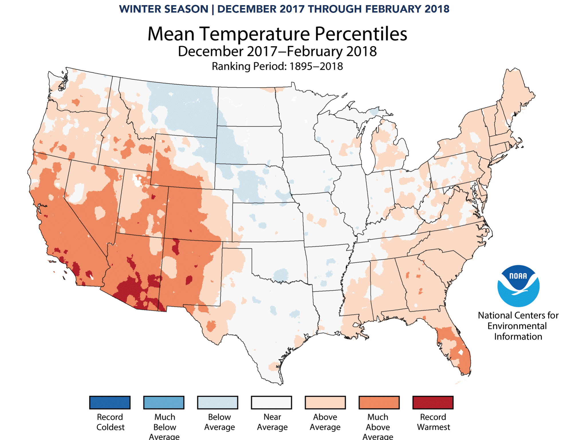
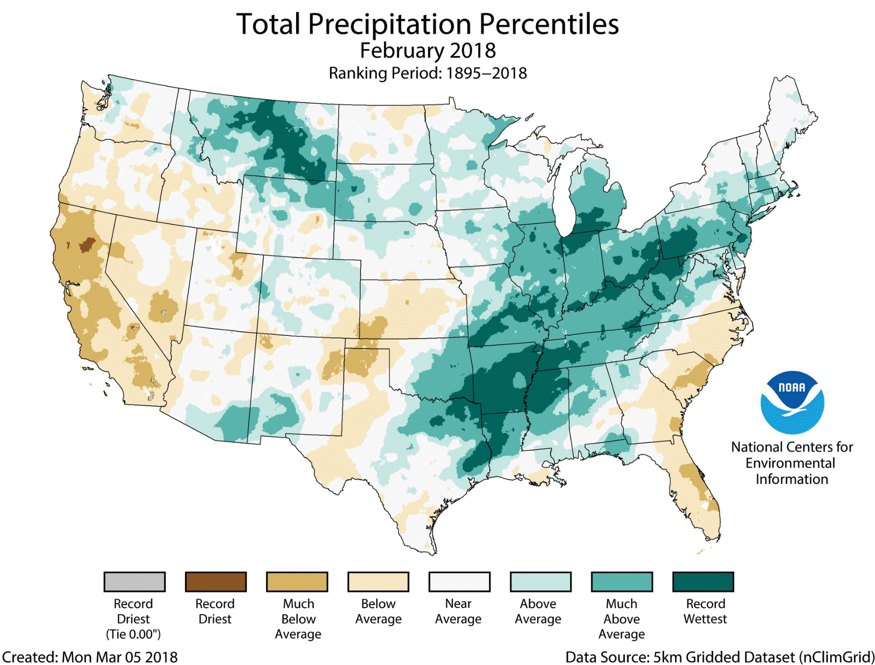
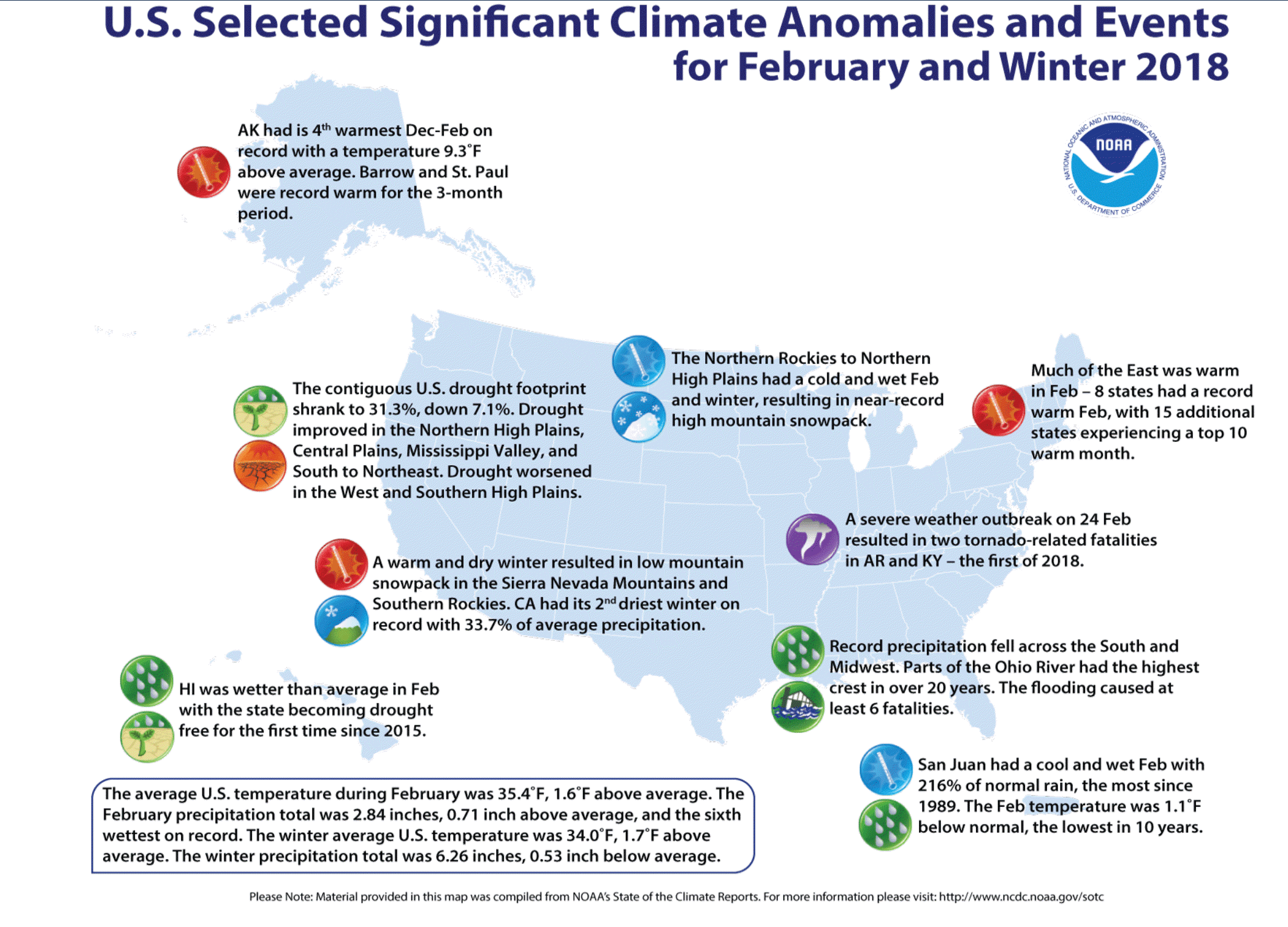
Looking back over the winter months. Here are the precipitation and temperature anomalies.
We did have plenty of cold snaps, but when everything was added together, you get a map like this. Near normal temperatures.
Precipitation:
It was a wetter than normal winter for portions of the region. Near normal elsewhere.
We had two significant snow and ice events (most of us).
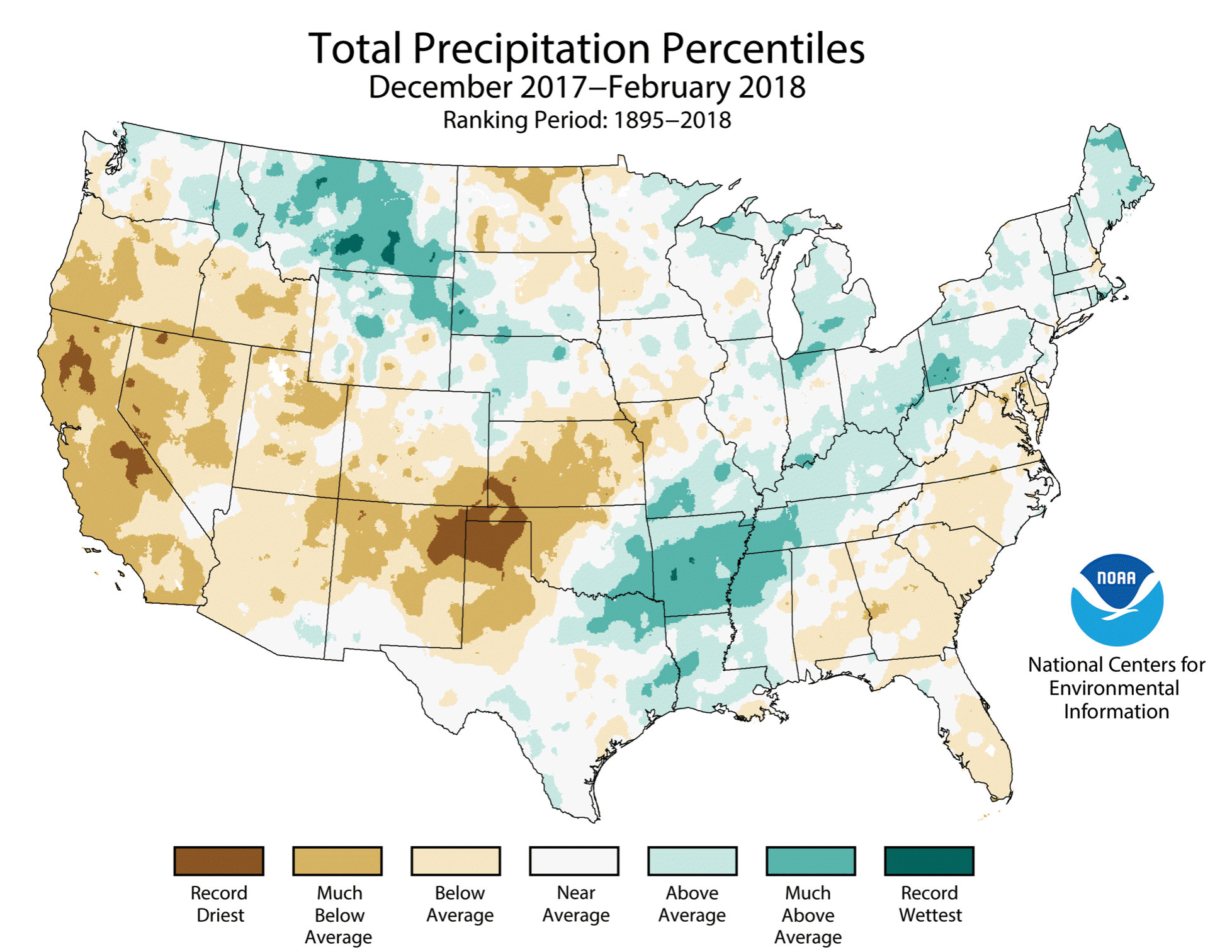
Looking back at February precipitation. It was very wet. Some areas had the wetter February since records have been kept. A LARGE area of above normal precipitation. That is one reason we have experienced flooding.
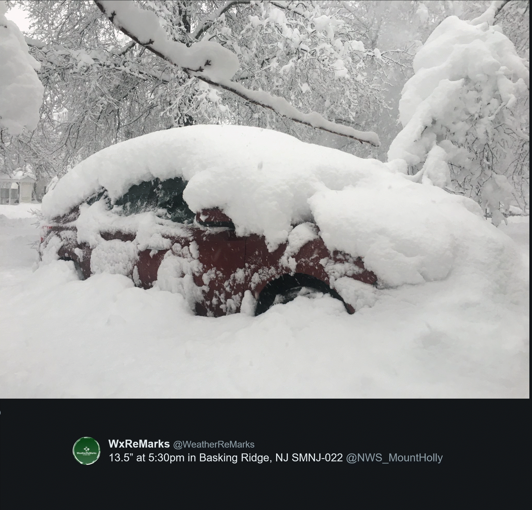
Winter events that made the news.
Check out this snow photograph from the northeast on Wednesday. Wow.
This was in New Jersey. Shaving cream!
Some areas reported six inches of snow per hour. That is incredible and almost unheard of.
![]()

Weather Brains is a weekly podcast/video for those who love weather and want more!
Weather Brains episode number 633
Previous episodes can be viewed by clicking here.
t’s a full house for this episode of WeatherBrains with representatives from a number of weather-related podcasts. Joining us are Becky DePodwin, Ice Station Housman, Scotty Powell from Carolina Weather Gang, Castle Williams,
WeatherHype
, Mark Jelinek, What is it About the Weather, and Phil Johnson of Storm Front Freaks Podcast. This show marks National Weather Podcast Month.
Other discussions in this weekly podcast include topics like:
- Extremes: 98 at Rio Grande Village, TX, and -7 at Cut Bank, MT
- The creative outlet that is podcasts and how they have changed over time
- The importance of providing good content in podcasting
- 25th Anniversary of Blizzard of 1993
- Astronomy Outlook with Tony Rice
- and more!

We offer interactive local city live radars and regional radars. If a radar does not update then try another one. If a radar does not appear to be refreshing then hit Ctrl F5. You may also try restarting your browser.
The local city view radars also have clickable warnings.
During the winter months, you can track snow and ice by clicking the winterize button on the local city view interactive radars.
You may email me at beaudodson@usawx.com
Find me on Facebook!

Find me on Twitter!

Did you know that a portion of your monthly subscription helps support local charity projects?
You can learn more about those projects by visiting the Shadow Angel Foundation website and the Beau Dodson News website.

I encourage subscribers to use the app vs regular text messaging. We have found text messaging to be delayed during severe weather. The app typically will receive the messages instantly. I recommend people have three to four methods of receiving their severe weather information.
Remember, my app and text alerts are hand typed and not computer generated. You are being given personal attention during significant weather events.
