We have some great sponsors for the Weather Talk Blog. Please let our sponsors know that you appreciate their support for the Weather Talk Blog.
Milner and Orr Funeral Home and Cremation Services located in Paducah, Kentucky and three other western Kentucky towns – at Milner and Orr they believe in families helping families. You can find Milner and Orr on Facebook, as well.
![]()
.

For all of your families eye care needs. Visit their web-site here. Or, you can also visit their Facebook page.
.

Best at Enabling Body Shop Profitability since 1996. Located In Paducah Kentucky and Evansville Indiana; serving all customers in between. They provide Customer Service, along with all the tools necessary for body shops to remain educated and competitive. Click the logo above for their main web-site. You can find McClintock Preferred Finishes on Facebook, as well

Expressway Carwash and Express Lube are a locally owned and operated full service Carwash and Lube established in 1987. We have been proudly serving the community for 29 years now at our Park Avenue location and 20 years at our Southside location. We have been lucky enough to partner with Sidecar Deli in 2015, which allows us to provide our customers with not only quality service, but quality food as well. . If you haven’t already, be sure to make Expressway your one stop shop, with our carwash, lube and deli. For hours of operation and pricing visit www.expresswashlube.com or Expressway Carwash on Facebook.
I have launched the new weather texting service! I could use your help. Be sure and sign up and fully support all of the weather data you see each day.
This is a monthly subscription service. Supporting this helps support everything else. The cost is $3 a month for one phone, $5 a month for three phones, and $10 a month for seven phones.
For more information visit BeauDodsonWeather.com
Or directly sign up at Weathertalk.com


This forecast update covers far southern Illinois, far southeast Missouri, and far western Kentucky. See the coverage map on the right side of the blog.
Remember that weather evolves. Check back frequently for updates, especially during active weather.

Weather Radars
WEATHER RADAR PAGE – Click here
Thursday Night – Mostly clear. Cooler.
Temperatures: Lows in the 38 to 44 degree range.
Winds: West winds at 4-8 mph.
What is the chance for precipitation? 0%
Coverage of precipitation? None
My confidence in this part of the forecast verifying is High
Should I be concerned about snow or ice? No
Should I cancel my outdoor plans? No
Is severe weather expected? No
What impact is expected? None.
Friday Night – Becoming cloudy. A good chance for showers. Small chance for a snowflake.
Temperatures: Lows in the 36 to 44 degree range.
Winds: North/northeast winds at 8-16 mph. Gusts to 15 mph.
What is the chance for precipitation? 60%-70%
Coverage of precipitation? Scattered to numerous
My confidence in this part of the forecast verifying is High
Should I be concerned about snow or ice? No
Should I cancel my outdoor plans? No, but some showers possible
Is severe weather expected? No
What impact is expected? Wet roadways.
Saturday – Quite a few clouds. Cool. A 40% chance for a morning shower. Perhaps a rain/snow mix. Precipitation ending from west to east.
Temperatures: High temperatures will range from 48-54 degrees.
Winds: North and northeast winds at 5-10 mph with gusts to 15 mph.
What is the chance for precipitation? 40% mainly morning. Then a 20% chance for a shower during the afternoon.
Coverage of precipitation? Scattered during the morning and isolated in the afternoon
My confidence in this part of the forecast verifying is High
Should I be concerned about snow or ice? No
Should I cancel my outdoor plans? No.
Is severe weather expected? No
What impact is expected? Maybe some wet roadways.
Saturday Night – Partly cloudy. A chance for a shower or rain/snow shower. No accumulation.
Temperatures: Lows in the 34-38 degree range.
Winds: West and northwest winds at 4-8 mph.
What is the chance for precipitation? 30%-40%
Coverage of precipitation? Scattered
My confidence in this part of the forecast verifying is High
Should I be concerned about snow or ice? Small chance for snow shower mixed in with the rain. No accumulation. Novelty.
Should I cancel my outdoor plans? No
Is severe weather expected? No
What impact is expected? Wet roadways possible.
Sunday – A morning rain rain/snow shower possible. Then a slight chance for a shower in the afternoon.
Temperatures: High temperatures will range from 48-52 degrees.
Winds: Northwest winds at 8-16 mph with gusts to 20 mph.
What is the chance for precipitation? 20%
Coverage of precipitation? None to isolated
My confidence in this part of the forecast verifying is High
Should I be concerned about snow or ice? No
Should I cancel my outdoor plans? No.
Is severe weather expected? No
What impact is expected? None
Sunday Night – Clearing and cold. Frost possible if winds die down.
Temperatures: Lows in the 28-35 degree range.
Winds: West and northwest winds at 3-6 mph.
What is the chance for precipitation? 0%
Coverage of precipitation? None
My confidence in this part of the forecast verifying is High
Should I be concerned about snow or ice? No
Should I cancel my outdoor plans? No
Is severe weather expected? No
What impact is expected? Frost possible.
Monday – Mostly sunny. Cool.
Temperatures: High temperatures will range from 52-56 degrees.
Winds: West winds at 10 mph.
What is the chance for precipitation? 0%
Coverage of precipitation? None
My confidence in this part of the forecast verifying is High
Should I be concerned about snow or ice? No
Should I cancel my outdoor plans? No.
Is severe weather expected? No
What impact is expected? None
Windy on Tuesday. Partly cloudy on Tuesday. Winds of 20-30 mph possible. Gusty.
Watching Wednesday and Thursday of next week for some more showers and storms. Then another system towards the end of the month.
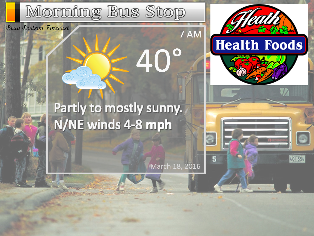
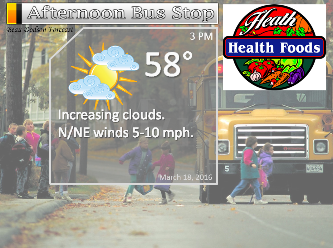
The School Bus Stop Forecast is sponsored by Heath Health and Wellness. Located next to Crowell Pools in Lone Oak.

Heath Health Foods is a locally owned and operated retail health and wellness store. Since opening in February 2006; the store has continued to grow as a ministry with an expanding inventory which also offers wellness appointments and services along with educational opportunities. Visit their web-site here. And. visit Heath Health Foods on Facebook!
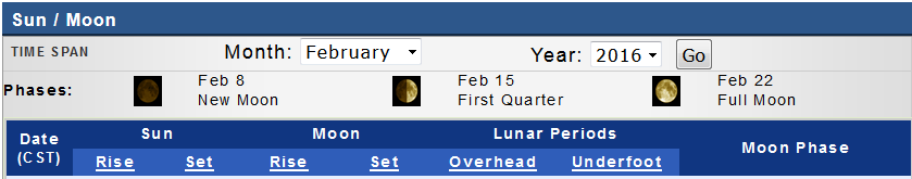
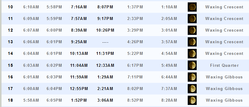
These numbers are off by one hour starting Sunday. I have submitted a ticket to fix them.

Don’t forget to check out the Southern Illinois Weather Observatory web-site for weather maps, tower cams, scanner feeds, radars, and much more! Click here

An explanation of what is happening in the atmosphere over the coming days…
- A few showers over the coming days
- Cooler weather
- Frost possible Sunday night?
- Bigger system next Wednesday or Thursday
The main weather story over the next few days will be cooler temperatures. We will also have a couple of weak disturbances moving through the area.
Temperatures will be a bit cooler on Friday, Saturday, and Sunday. We will stair step down into the cooler air. Saturday and Sunday will deliver highs only in the upper 40s to lower 50s. Chilly compared to what we have experienced over the past week.
We have two disturbances that will zip through our region. One of those disturbances will arrive on Friday afternoon and evening. Scattered showers/light rain will accompany it. Best chances would be Friday night and Saturday morning.
A few showers are possible on Saturday, as well.
The second disturbance arrives on Saturday night and Sunday. A few light showers will be possible as it passes through the area. Temperatures might be cold enough for a few snowflakes to mix in with the rain. Novelty flakes. No accumulation. Most will sleep through it. But, it is an indication of the colder temperatures that are moving our way.
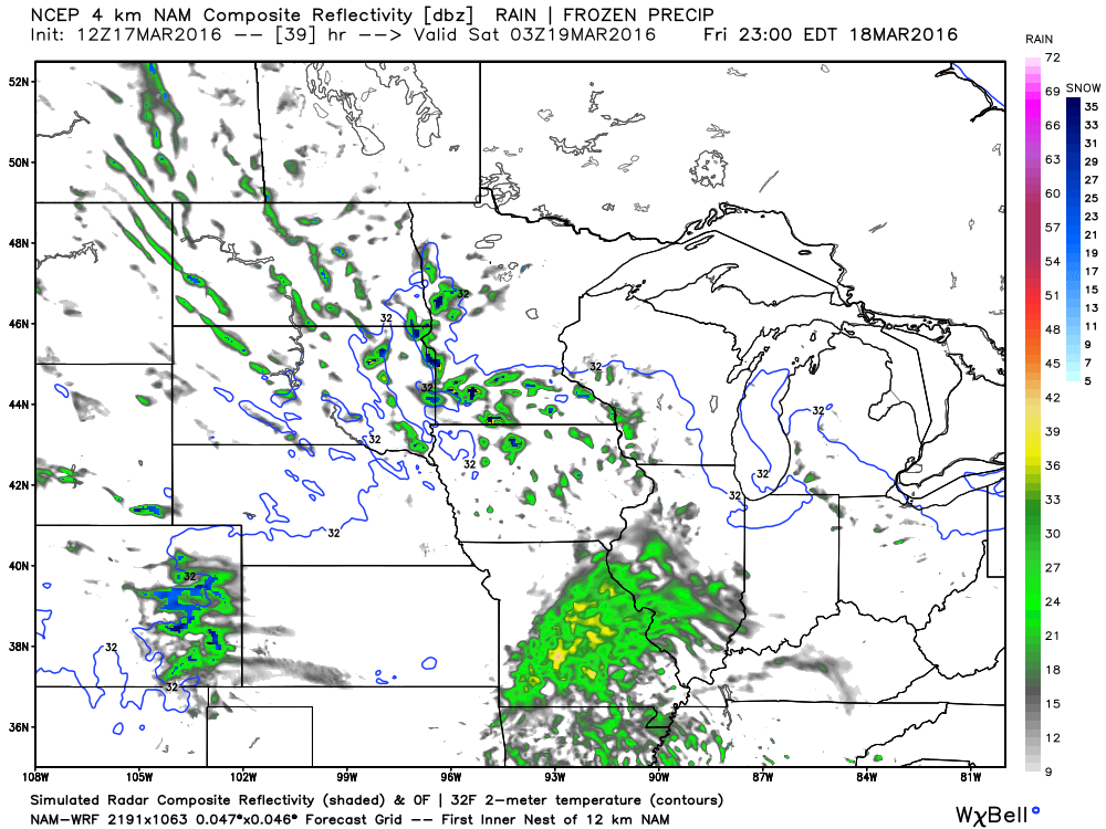
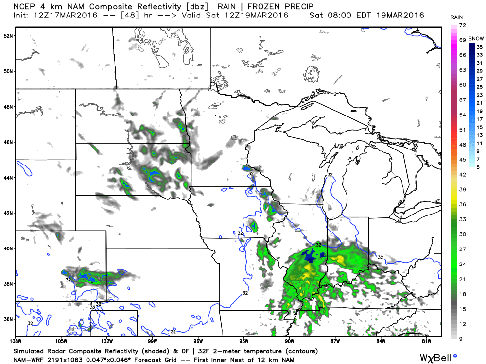
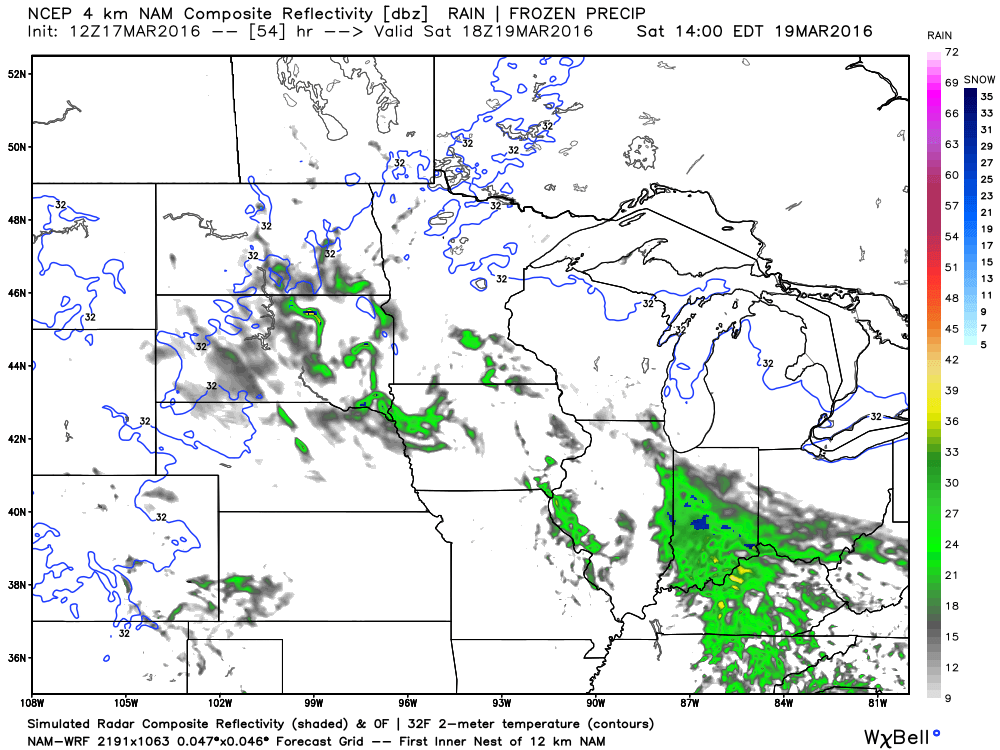
Let’s take a look at some future-cast radar maps from weatherbell.com These maps show you what radar MIGHT look like over the coming days. This is guidance and not gospel. One models opinion.
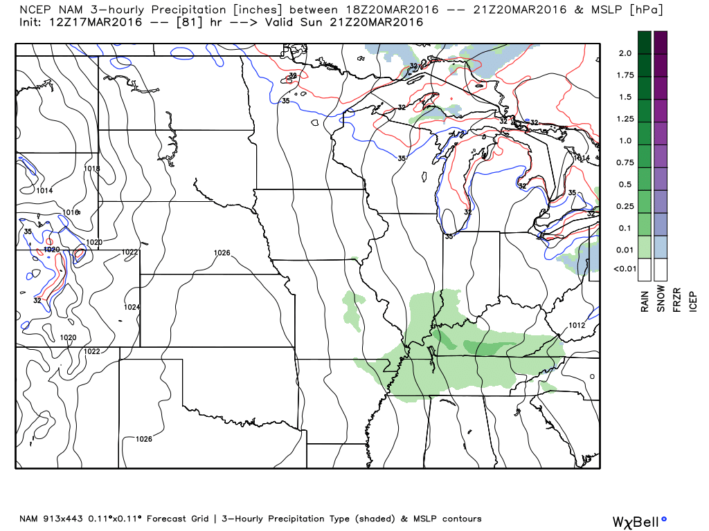
This first map is for Friday evening around 10 pm. You can see a large area of showers to our west. And, a few showers over our region. Generally light in nature.
We pull ahead to Saturday morning at 7 am. Showers in our area. A few snowflakes over central Illinois (the blue color). If it does rain then it will be a chilly rain.
Moving ahead to Saturday at 1 pm. You can see some scattered light showers still in the area, but pushing off to the east. I can’t rule out a shower late Saturday morning and afternoon. The best chances, however, will be Friday night and Saturday morning.
Moving ahead to Sunday at 10 am. Another disturbance is moving through our area. Some light showers will be possible with it, as well. You can see the light green and blue over our area. That is light rain and snow.
Moving ahead to Sunday afternoon. Still some green over our area. Light showers are possible on Sunday, as well.
Temperatures on Sunday night should dip into the lower to middle 30s. This is a concern. We could have some frost in the area and I can’t rule out a few hours of below freezing temperatures. Sensitive plants might need covering. Monitor updates.
Let’s look at a few temperature maps
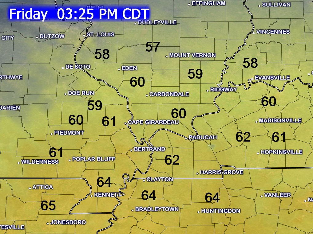
This first map is for Friday afternoon. Temperatures will be cooler than Thursday, but still mostly above normal. Again, we stair step down into this cooler air.
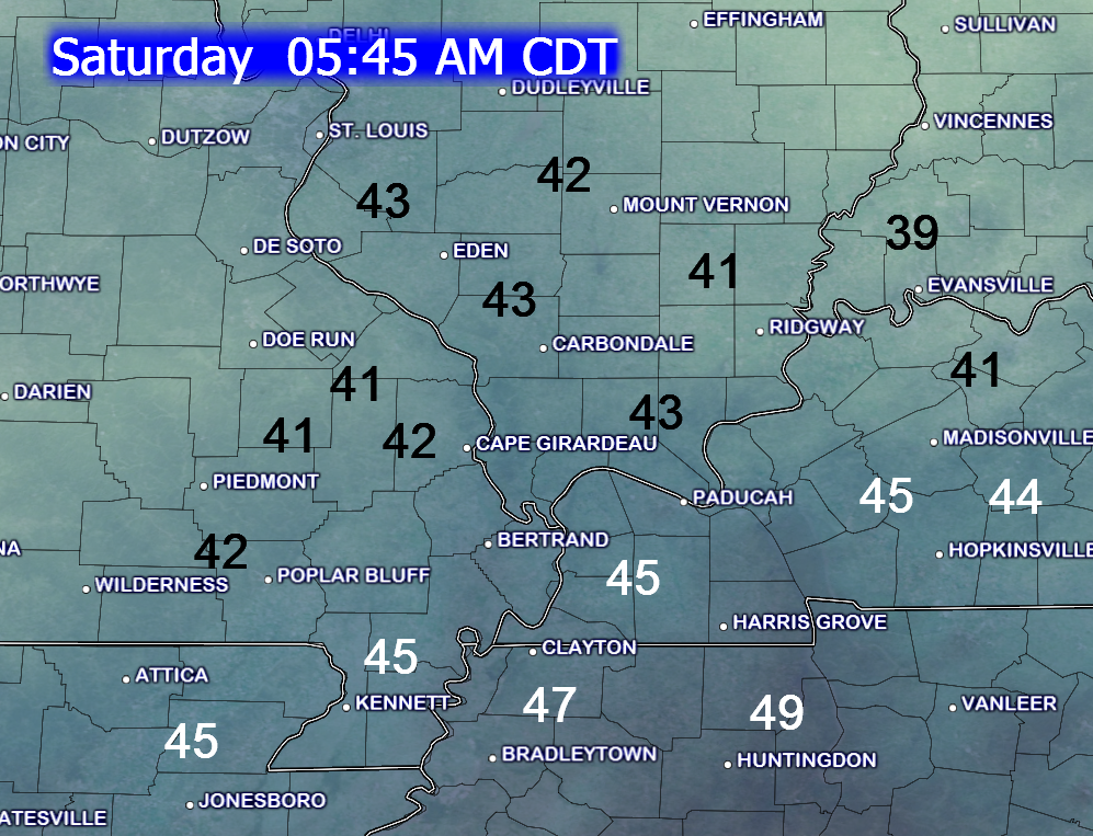
Saturday morning temperatures. Cooler.
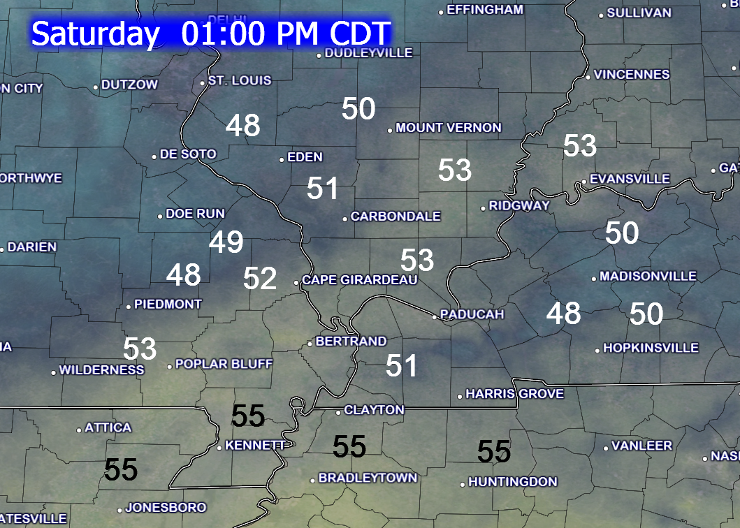
Saturday at 1 pm. Noticeably cooler in the area.
Another storm system may impact the region next Wednesday and Thursday. We may see a chance for showers and thunderstorms. Too early to know if severe weather will be a concern.
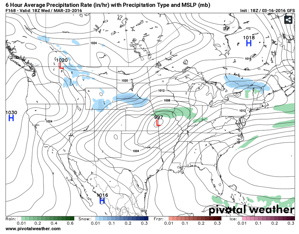
Here is the Wednesday weather map. You can see an area of low pressure over Missouri.
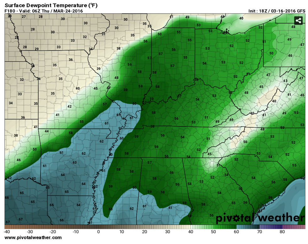
Let’s take a look at the GFS dew point maps. It does show moisture returning. Dew points into the 60s. That would be sufficient for thunderstorms. I usually look for 58 degrees and above (for dew points).
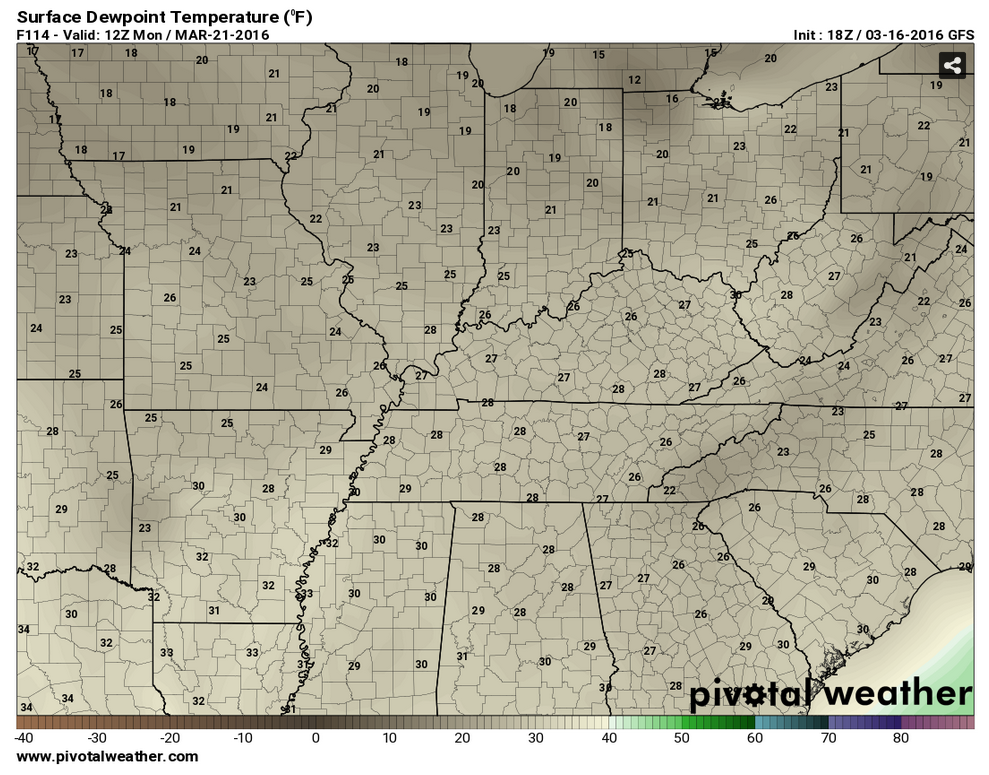
Let’s start out on Monday morning. Look how dry it is. Low dew points. Not a lot of moisture in the atmosphere. Dew points into the 20s Sunday night and Monday morning. That also is an indicator that it will be cold Sunday night.
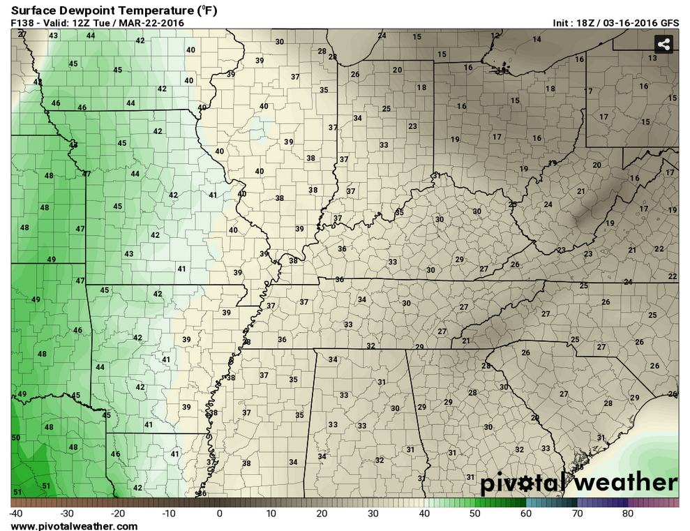
Now, look at Tuesday morning. Moisture is returning from the south and west. This would be ahead of our next storm system. Note the green to our west. Increasing moisture.
Moving ahead to Wednesday morning. Now you can really see the moisture returning. This would happen because of an area of low pressure moving into Missouri. The low rotates counter-clockwise. That means it would pull southerly winds into our area. Moisture would return from the Gulf of Mexico.
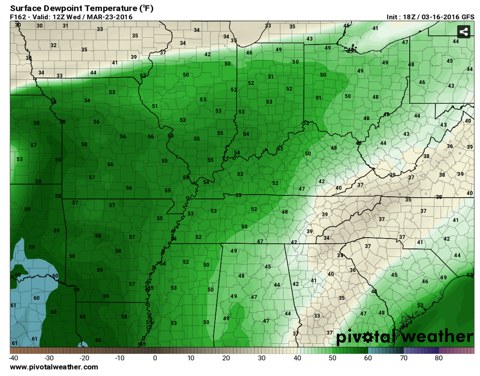
The dew points peak on Wednesday night (according to the GFS model guidance). Still a bit early to have confidence on how this plays out. Days away. But, this would be a concern. If this does verify then some heavy storms can’t be ruled out.
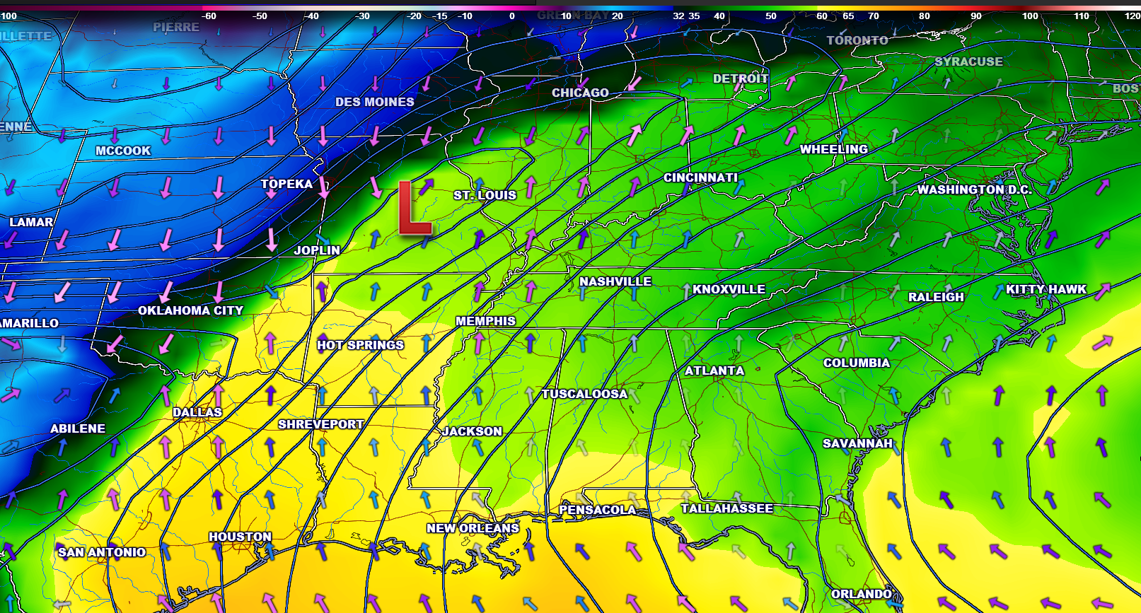
Zooming out on the dew point map. This is another view. You can see the low pressure over Missouri. The arrows represent southerly winds ahead of the low. The colors represent the dew points.

Here are the current river stage forecasts. You can click your state and then the dot for your location. It will bring up the full forecast and hydrograph.

Can we expect severe thunderstorms over the next 24 to 48 hours? Remember that a severe thunderstorm is defined as a thunderstorm that produces 58 mph winds or higher, quarter size hail or larger, and/or a tornado.
.
Thunderstorms are not expected through the weekend.
.

Updated precipitation probabilities.
.

Frost is possible Sunday night. Small risk for a freeze.

No

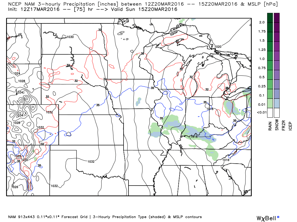
How much precipitation should we expect over the next few days?
A few light showers Friday afternoon. More likely Friday night into Saturday. Two disturbances moving into the area this weekend. Both could produce a few light showers. Temperatures will be cold enough on Saturday night to have a rain/snow mix over our northern and northeastern counties. No accumulation. Light showers are possible on Sunday, as well.
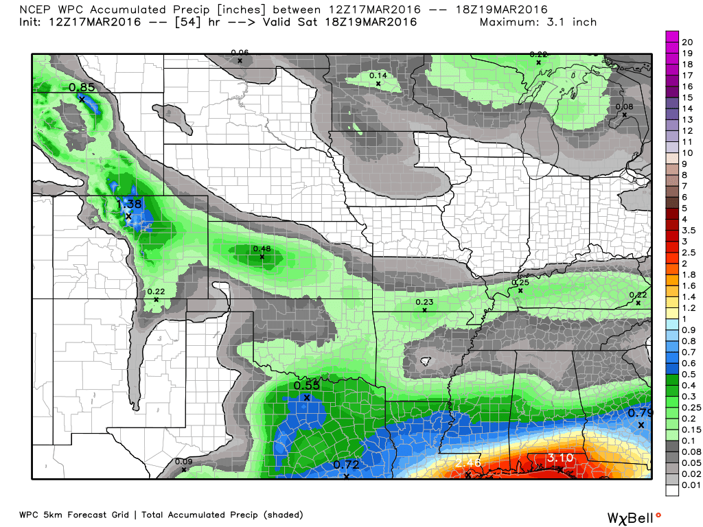
Rainfall totals over the coming three days will be light. Less than 0.25″ is the current forecast.

Here is the official 6-10 day and 8-14 day temperature and precipitation outlook. Check the date stamp at the top of each image (so you understand the time frame).
The forecast maps below are issued by the Weather Prediction Center (NOAA).


The latest 8-14 day temperature and precipitation outlook. Note the dates are at the top of the image. These maps DO NOT tell you how high or low temperatures or precipitation will be. They simply give you the probability as to whether temperatures or precipitation will be above or below normal.


Who do you trust for your weather information and who holds them accountable?
I have studied weather in our region since the late 1970’s. I have 37 years of experience in observing our regions weather patterns. My degree is in Broadcast Meteorology from Mississippi State University and an Associate of Science (AS). I am currently working on my Bachelor’s Degree in Geoscience.
My resume includes:
Member of the American Meteorological Society.
NOAA Weather-Ready Nation Ambassador.
Meteorologist for McCracken County Emergency Management. I served from 2005 through 2015.
I own and operate the Southern Illinois Weather Observatory.
Recipient of the Mark Trail Award, WPSD Six Who Make A Difference Award, Kentucky Colonel, and the Caesar J. Fiamma” Award from the American Red Cross.
In 2009 I was presented with the Kentucky Office of Highway Safety Award.
Recognized by the Kentucky House of Representatives for my service to the State of Kentucky leading up to several winter storms and severe weather outbreaks.
I am also President of the Shadow Angel Foundation which serves portions of western Kentucky and southern Illinois.
There is a lot of noise on the internet. A lot of weather maps are posted without explanation. Over time you should learn who to trust for your weather information.
My forecast philosophy is simple and straight forward.
- Communicate in simple terms
- To be as accurate as possible within a reasonable time frame before an event
- Interact with you on Twitter, Facebook, and the blog
- Minimize the “hype” that you might see on television or through other weather sources
- Push you towards utilizing wall-to-wall LOCAL TV coverage during severe weather events
I am a recipient of the Mark Trail Award, WPSD Six Who Make A Difference Award, Kentucky Colonel, and the Caesar J. Fiamma” Award from the American Red Cross. In 2009 I was presented with the Kentucky Office of Highway Safety Award. I was recognized by the Kentucky House of Representatives for my service to the State of Kentucky leading up to several winter storms and severe weather outbreaks.
If you click on the image below you can read the Kentucky House of Representatives Resolution.

Many of my graphics are from www.weatherbell.com – a great resource for weather data, model data, and more


You can sign up for my AWARE email by clicking here I typically send out AWARE emails before severe weather, winter storms, or other active weather situations. I do not email watches or warnings. The emails are a basic “heads up” concerning incoming weather conditions.