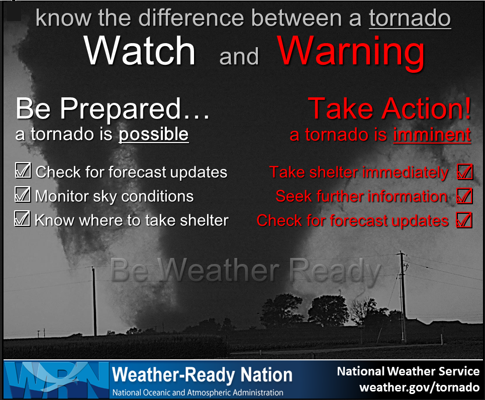
What you need to know.
.
Key Points
- Tropical Storm Cristobal is moving northward into our local area.
- Locally heavy rain is likely across portions of our region.
- There are concerns that a few thunderstorms could produce wind damage and short-lived tornadoes.
.
Call to action.
Monitor updated weather forecasts.
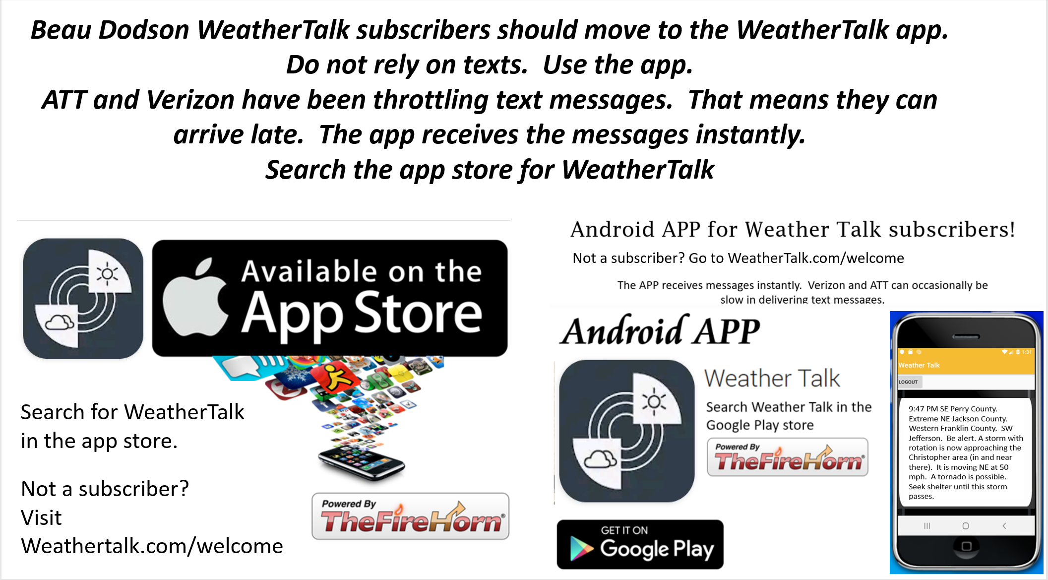
Make sure you are using the Weather Talk app. Download it from the app store. It is under Weather Talk.
TURN ON YOUR BEAU DODSON WEATHER TALK APP. Make sure it is on. Make sure you have not accidentally logged out of the app.
The app is for subscribers (please log into your account and make sure your payment has been updated. We have a large number of declined cards and PayPal payments.
Subscribe at www.weathertalk.com/welcome then go to your app store and search for WeatherTalk. Apple users click here. Android users click here
.
Tuesday, June 9, 2020
10 PM
No further concerns
1:46 PM.
Northern Pope, Southeast Saline, Hardin, and Gallatin Counties.
A band of thunderstorms extended from Gallatin County southwest into northern Pope County.
Some of these storms have produced wind gusts to 50 mph. Occasionally, the storms also have some rotation.
The storms are moving northeast at 50 mph. They will continue to produce pockets of high wind that could bring down tree limbs. The actual wind damage area, within the thunderstorm, is rather small.
Torrential rain is also falling with these storms. Some roadways may flood.
Radars
Interactive-city-view radars. Clickable watches and warnings.
https://wtalk.co/B3XHASFZ
Backup radar site in case the above one is not working.
https://weathertalk.com/morani
.
1:10 PM
Johnson and Pope Counties.
At 1:10 PM radar showed a possible severe thunderstorm near Vienna, Illinois. It is moving northeast at 50 mph. This storm may produce damaging wind. It is also showing signs of rotation. Be weather aware as this storm passes through the area. See radars.
Interactive-city-view radars. Clickable watches and warnings.
https://wtalk.co/B3XHASFZ
Backup radar site in case the above one is not working.
https://weathertalk.com/morani
.
1:05 PM
Johnson, Saline, Gallatin, and Pope Counties.
An area of thunderstorms is pushing through the area. Although they are currently below severe levels, they could increase in intensity and produce pockets of wind damage.
Movement is northeast (see radars).
As mentioned previously, there is also quite a bit of spin in the atmosphere today and short-lived tornadoes can’t be ruled out.
Be weather aware over the coming hour.
Interactive-city-view radars. Clickable watches and warnings.
https://wtalk.co/B3XHASFZ
Backup radar site in case the above one is not working.
https://weathertalk.com/morani
..
12:11 PM
Southeast Williamson and Saline Counties. A storm west of Carrier Mills was moving north and northeast at 50 mph. The storm has some rotation. Storms could produce short-lived tornadoes. It will pass in or near Galatia and Harrisburg (perhaps in between those areas). Either way, be weather aware as this storm moves through the county.
11:40 AM.
Hardin and northern Pope County.
A thunderstorm, with some rotation, was in northern Pope County near the town of Lusk and Gowins. It is moving NE at 50 mph. The storm could produce isolated damaging wind gusts and even a tornado.
Seek shelter until the storm passes.
.
11:31 AM Massac County. The storm has left your county and is in Pope County.
.
11:13 AM
Radar shows rotation near New Columbia. Movement is N NE at 50 mph. This storm could produce a brief tornado.
The area of concern will be far northern/northeast Massac County and then from there into southwest and central Pope County.
Interactive-city-view radars. Clickable watches and warnings.
https://wtalk.co/B3XHASFZ
Backup radar site in case the above one is not working.
https://weathertalk.com/morani
.
Tuesday, June 9, 2020
11:09 AM
Northern Massac, eastern Johnson, Gallatin, Pope, Saline, Hamilton, White, and Hardin Counties in southern Illinois. Union County in western Kentucky.
A line of storms is moving northward at 50 mph. Some of these storms are showing indications that they could produce isolated wind damage. There is also a lot of spin in the atmosphere today.
Short-lived tornadoes are part of today’s forecast. Be weather aware from now into the afternoon hours.
Interactive-city-view radars. Clickable watches and warnings.
https://wtalk.co/B3XHASFZ
Backup radar site in case the above one is not working.
https://weathertalk.com/morani
.
Tuesdsay, June 9, 2020
9 AM Update

.
Tuesday, June 9, 2020
8 AM update
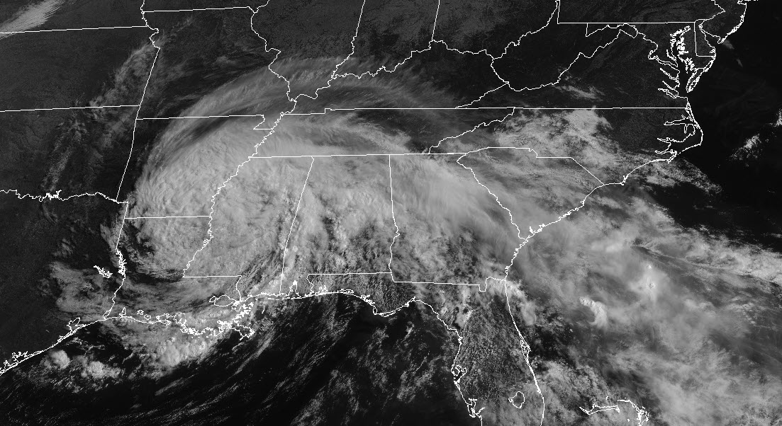
The main weather story remains Tropical Depression Cristobal.
You can see Cristobal on this satellite image. Click on the image to enlarge it.
Want to see the live view of Cristobal? Go here (once there hit refresh) https://col.st/ht6z3

.
The remnants have been moving northward over the last few days. Locally heavy rain occurred yesterday and overnight across portions of the area. Some of you received little or no rain. That was the forecast. It would vary considerably.
As you can see on radar, there are bands of precipitation spinning around Cristobal. A counter-clockwise spin. That is because of the area of low pressure. Low pressure spins counter-clockwise.
DATED radar. This is from 7 AM (this will be an old image as you move through the day).
See the live radar page here –> Radar Link: Interactive local city-view radars & regional radars.
.

.
This spiraling helps to create wind shear. Wind shear is when the wind turns a different direction as you move higher up into the atmosphere. It can also mean an increase in wind speed with height.
This equals rotation. Thus, we will have to monitor today’s showers and thunderstorms. Keep in mind, during tropical systems. there does not have to be lightning and thunder in order for there to be tornadoes. In other words, a non-thunderstorm can even produce tornadoes.
The showers and thunderstorms will move rapidly south to north and southeast to northwest. The showers and storms can move in excess of 55 mph.
It is not uncommon for tornadoes to form from the remnants of tropical systems. They tend to be fast-moving and short-lived. This makes it difficult to issue tornado warnings. By the time a warning has been issued, the tornado is over.
My suggestion is to pay attention to your weather surroundings today. If you feel threatened from a shower or thunderstorm then seek shelter until that storm passes. I will send out an app message if something stands out.
Otherwise, avoid flooded roadways if that develops.
Some areas will receive little in the way of rainfall. Other areas will receive two or three inches of rain. It will vary greatly. Rain totals will come down to where the rain-bands form.
If showers and thunderstorms train over the same area then there will be excessive rainfall.
PWAT values are above two-inches. That is an extreme amount of moisture in the atmosphere. Showers and thunderstorms could produce an inch of rain in less than twenty minutes.
Gusty wind will also be with us today into Wednesday. Wind gusts above 40 mph will occur because of the pressure gradient.
Time-stamp upper left.

.
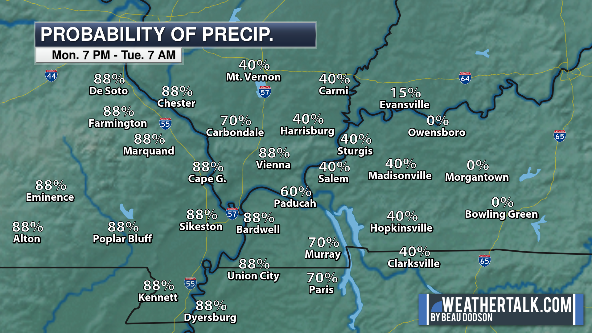
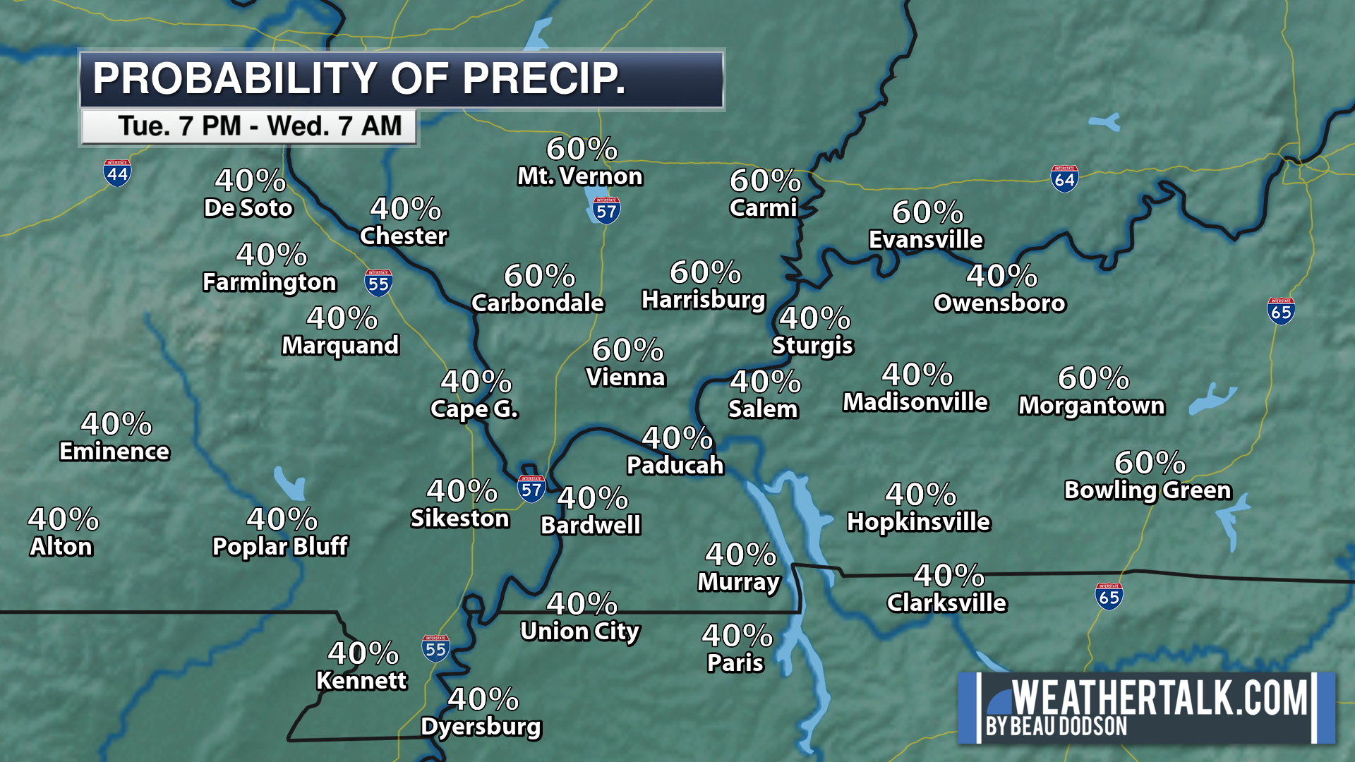
Let’s take a look at rain probabilities. As you can see, rain chances peak today and tonight. A small chance of a few showers Wednesday. Mostly dry.
7 AM Tuesday into 7 PM Tuesday

7 PM Tuesday into 7 AM Wednesday

7 AM Wednesday into 7 PM Wednesday

 .
.
Again, as a reminder, these are models. They are never 100% accurate. Take the general idea from them.
What should I take from these?
- The general idea and not specifics. Models usually do well with the generalities.
- The time-stamp is located in the upper left corner.
.
What am I looking at?
You are looking at different models. Meteorologists use many different models to forecast the weather. All models are wrong. Some are more wrong than others. Meteorologists have to make a forecast based on the guidance/models.
I show you these so you can see what the different models are showing as far as precipitation. If most of the models agree, then the confidence in the final weather forecast increases.
.
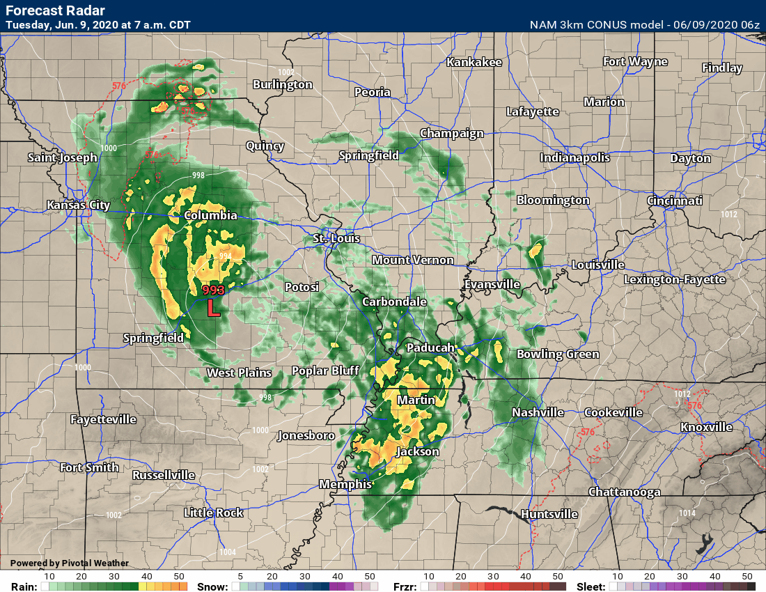
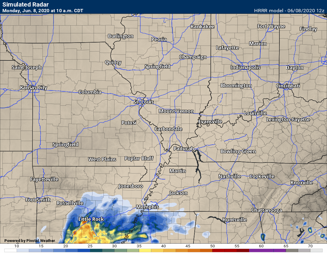
This animation is the Hrrr model.
This animation shows you what radar might look like as the next system pulls through the region. It is a future-cast radar.
Green is rain. Blue is snow. Pink and red represent sleet and freezing rain.
Time-stamp upper left. Click the animation to enlarge it.

.
This animation is the 3K American Model.
This animation shows you what radar might look like as the next system pulls through the region. It is a future-cast radar.
Green is rain. Blue is snow. Pink and red represent sleet and freezing rain.
Time-stamp upper left. Click the animation to enlarge it.
.
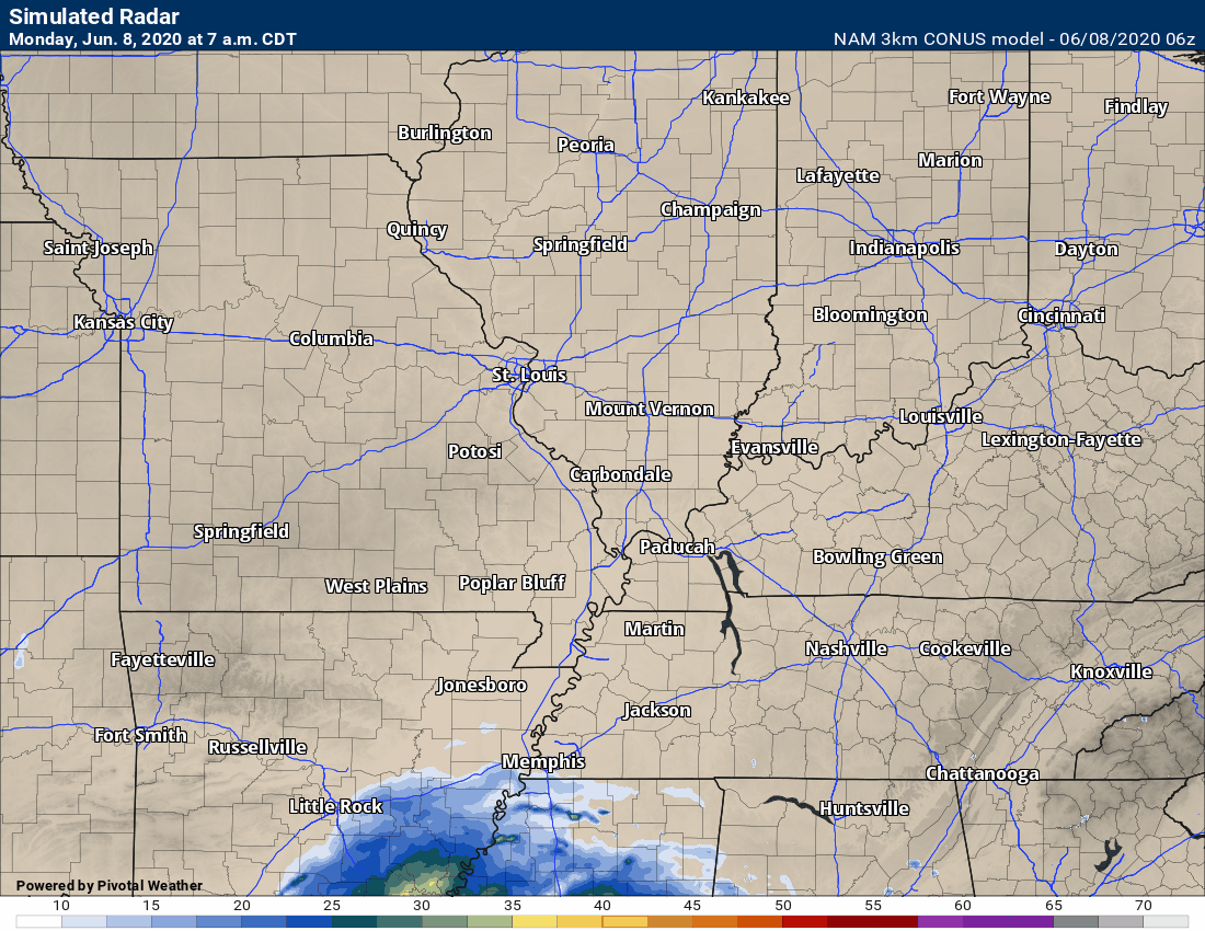
This next animation is the NAM American Model.
This animation shows you what radar might look like as the system pulls through the region. It is a future-cast radar.
Green is rain. Blue is snow. Pink and red represent sleet and freezing rain.
Time-stamp upper left. Click the animation to enlarge it.

.
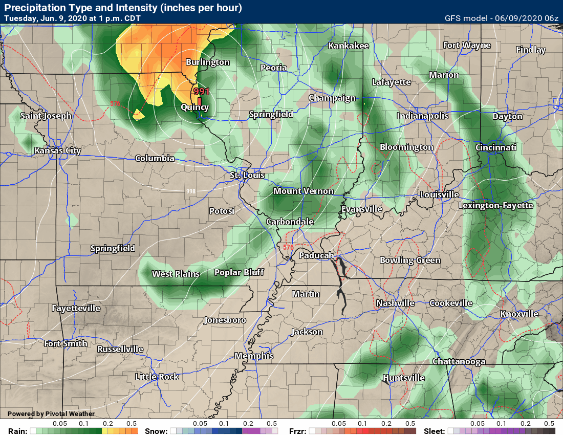
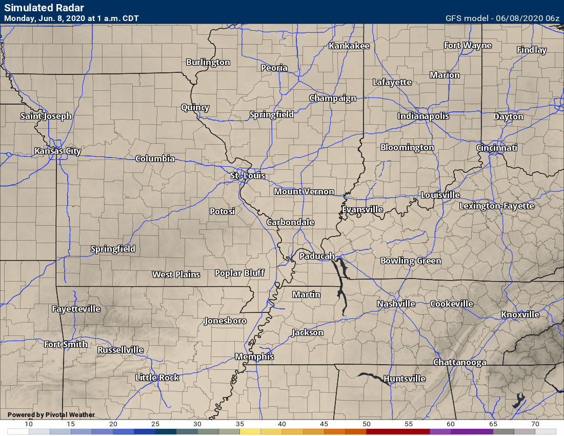
This next animation is the GFS American Model.
This animation shows you what radar might look like as the system pulls through the region. It is a future-cast radar.
Green is rain. Blue is snow. Pink and red represent sleet and freezing rain.
Time-stamp upper left. Click the animation to enlarge it.
.
Monday, June 8, 2020
8 PM
The remains of Tropical Storm Cristobal continues to push into our region. Feeder bands of rain are visible on our local radar.
Occasionally, tropical storms produce short-lived tornadoes. These tornadoes tend to last seconds to a few minutes. This makes it extremely difficult to issue tornado warnings.
If I see something obvious then I will send out an app alert. Let this message just be a heads up of the potential.
Over the next 24 to 36 hours be weather aware. If you feel threatened by a storm then seek shelter until it passes.
These types of storms move in odd directions. They can move south to north and southeast to northwest. A spiral, if you will.
.
Monday, June 8, 2020.
11:30 AM Update
Check back for updates.
The main weather topic over the coming days will be Tropical Storm Cristobal.
You can see Cristobal on this satellite view. The swirling mass of clouds is the tropical storm. It does cover quite a bit of real estate.
Here is a link to view the animation (hit refresh once on the page).
.
We have a chance of strong and gusty winds this afternoon into Tuesday afternoon.
Any thunderstorms that develop could produce pockets of wind damage and even a tornado.
Tropical storms often times produce short-lived tornadoes. They usually only last a few minutes. This makes it trick when issuing tornado warnings.
Be weather aware over the next 48 hours. Until the system pulls away from the region.
The tropical storm is moving northward into the Tennessee, Missouri, and Ohio Valleys. It will eventually be absorbed into another system pushing across the region.
Rain will arrive as early as late Monday afternoon across the Missouri Bootheel and western Tennessee. Perhaps far western Kentucky and extreme southern Illinois, as well. See the storm tracking links below.
The rain will push northward and overspread the region late Monday afternoon and especially Monday night into Tuesday evening.
Let’s break down the probability numbers for each 12-hour period of time.
7 AM today into 7 PM tonight

7 PM tonight into 7 AM Tuesday
7 AM Tuesday into 7 PM Tuesday

7 PM Tuesday into 7 AM Wednesday
.
Locally heavy rain will be possible. PWAT values will be very high. PWAT is a measure of moisture in the entire atmospheric column.
High PWAT values usually equal heavy rain.
Check out the PWAT animation. You can make out the spiral of the tropical storm moving northward. These are very high PWAT numbers. You could pick up an inch of rain in less than 15 minutes from these types of numbers.
Click to enlarge the animation

.
Tropical systems are known for producing torrential downpours. This is tropical moisture.
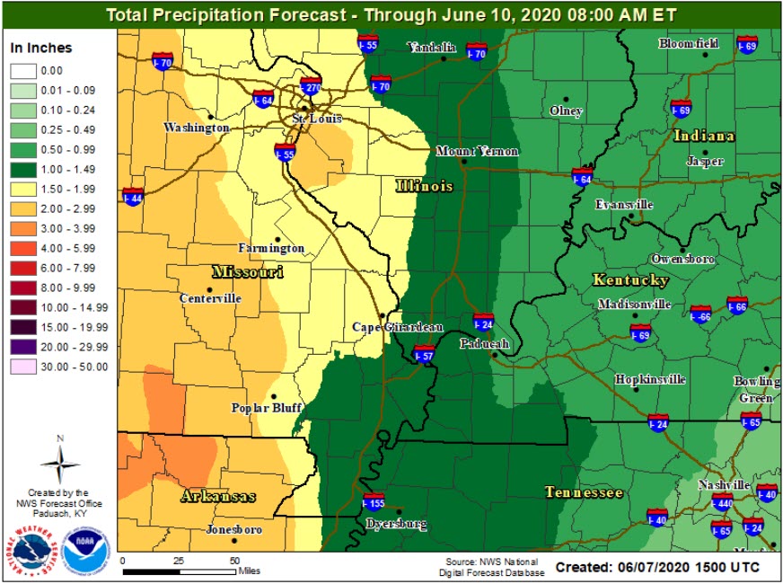
The heaviest rain will occur over southeast Missouri where several inches will be possible. As you move further east, the rain totals will decrease. Everyone should receive at least some rain.
Current rain projections. Of course, totals will vary. Thunderstorms can always produce higher amounts of rain.
Here are the latest forecast numbers

Let’s compare that to the previous update. Notice the shift westward?
.
Another consequence of the tropical storm will be gusty winds. Winds will begin to pick up Monday and that will continue into Tuesday night.
Wind gusts above 40 mph will be possible as the low passes across our region.
Here is the wind gust animation map. Time-stamp upper left.

.
Future-cast Radars
This animation is the Hrrr model.
This animation shows you what radar might look like as the next system pulls through the region. It is a future-cast radar.
Green is rain. Blue is snow. Pink and red represent sleet and freezing rain.
Time-stamp upper left. Click the animation to enlarge it.
.
This animation is the NSSL WRF model
This animation shows you what radar might look like as the next system pulls through the region. It is a future-cast radar.
Green is rain. Blue is snow. Pink and red represent sleet and freezing rain.
Time-stamp upper left. Click the animation to enlarge it.
No precip in this time range.

.
This animation is the 3K American Model.
This animation shows you what radar might look like as the next system pulls through the region. It is a future-cast radar.
Green is rain. Blue is snow. Pink and red represent sleet and freezing rain.
Time-stamp upper left. Click the animation to enlarge it..
.
This next animation is the NAM American Model.
This animation shows you what radar might look like as the system pulls through the region. It is a future-cast radar.
Green is rain. Blue is snow. Pink and red represent sleet and freezing rain.
Time-stamp upper left. Click the animation to enlarge it.

.
This next animation is the GFS American Model.
This animation shows you what radar might look like as the system pulls through the region. It is a future-cast radar.
Green is rain. Blue is snow. Pink and red represent sleet and freezing rain.
Time-stamp upper left. Click the animation to enlarge it.
.
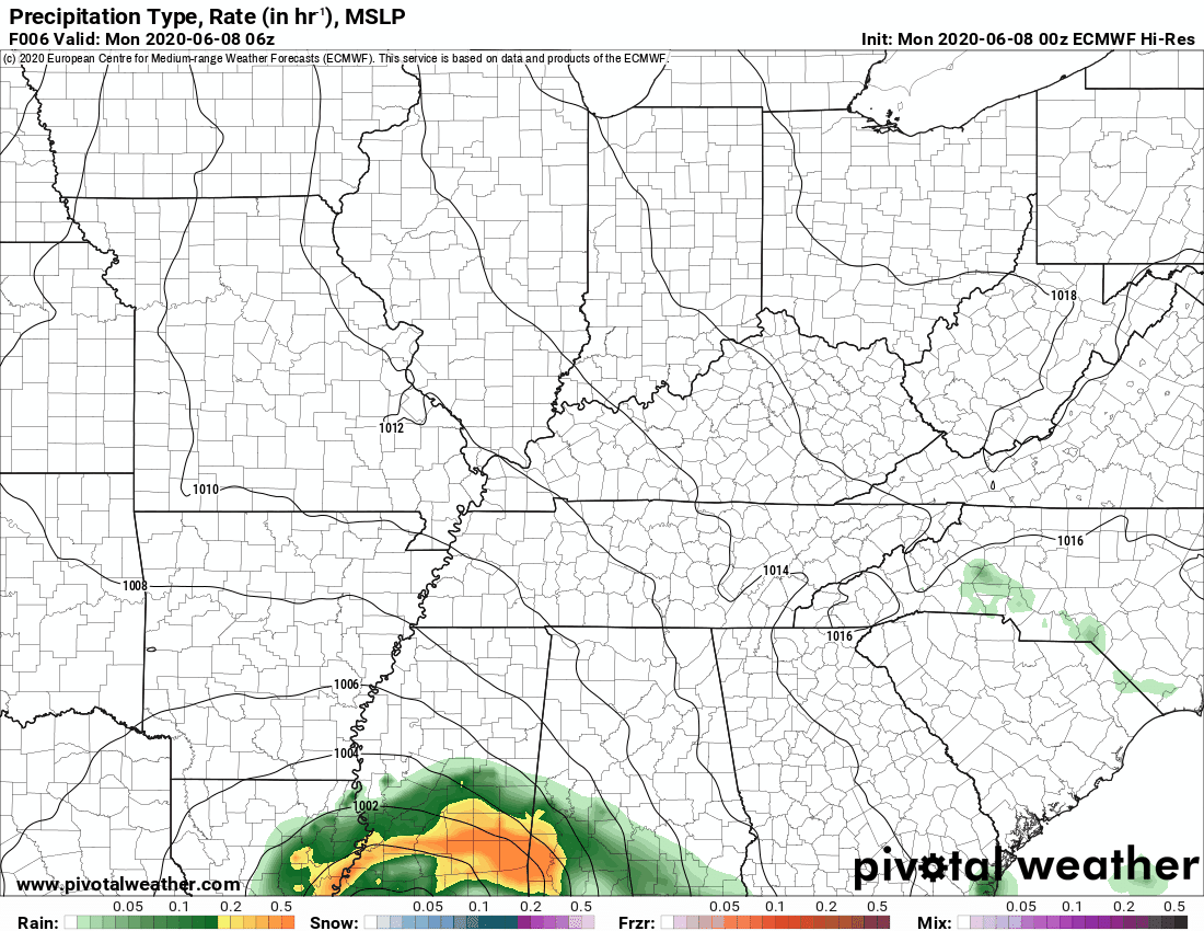
This next animation is the EC Model.
This animation shows you what radar might look like as the system pulls through the region. It is a future-cast radar.
Green is rain. Blue is snow. Pink and red represent sleet and freezing rain.
This is in Zulu time. 12z = 7 AM. 18z = 1 PM. 00z = 7 PM.
Time-stamp upper left. Click the animation to enlarge it.
I am watching Tropical Storm Christobal. It will push northward next week.
.
.
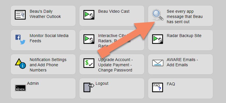
Note: We added a “see all” button on the website. This allows you to see every message that I have sent out (to all my forecast counties).
Here is the link. Click here.
To view the live radars, visit these links.
Radars
Interactive city-view radars
http://weatherobservatory.com/weather-radar.htm
A third backup radar
https://weathertalk.com/morani
Clickable watches and warnings can be viewed on the local city-view interactive radars (link above). Be sure and turn on the warnings above the local radars.
A new regional radar we offer
https://imagery.weathertalk.com/prx/RadarLoop.mp4
Lightning data
https://wtalk.co/7QT7WHKU
.
Storm Prediction Center severe weather outlook.
Here is the latest Storm Prediction Center outlook. Remember, don’t pay too much attention to the different colors. Focus on the actual forecast. The forecast is for a few severe thunderstorms.
The black outline is our local area.
Light green is where thunderstorms may occur but should be below severe levels.
Dark green is a level one risk. Yellow is a level two risk. Orange is a level three (enhanced) risk. Red is a level four (moderate) risk. Pink is a level five (high) risk.
One is the lowest risk. Five is the highest risk.
A severe storm is one that produces 58 mph wind or higher, quarter size hail, and/or a tornado.

.
Tomorrow’s severe weather outlook.

Not receiving app/text messages?
USE THE APP. ATT and Verizon are slowing or stopping the text messages.
Make sure you have the correct app/text options turned on. Find those under the personal notification settings tab at www.weathertalk.com. Red is off. Green is on.
Subscribers, PLEASE USE THE APP. ATT and Verizon are not reliable during severe weather. They are delaying text messages.
The app is under WeatherTalk in the app store.

Apple users click here

Android users click here
.

Live lightning data: Click here.