We have our first sponsor for the blog. Milner and Orr Funeral Home and Cremation Services located in Paducah, Kentucky and three other western Kentucky towns – at Milner and Orr they believe in families helping families.
![]()

This forecast update covers far southern Illinois, far southeast Missouri, and far western Kentucky. See the coverage map on the right side of the blog.
Remember that weather evolves. Check back frequently for updates, especially during active weather.
Tuesday – Mostly sunny sky conditions – just a few clouds. Milder with highs in the 40’s. Northeast winds at 5-10 mph. My confidence in this part of the forecast verifying is high
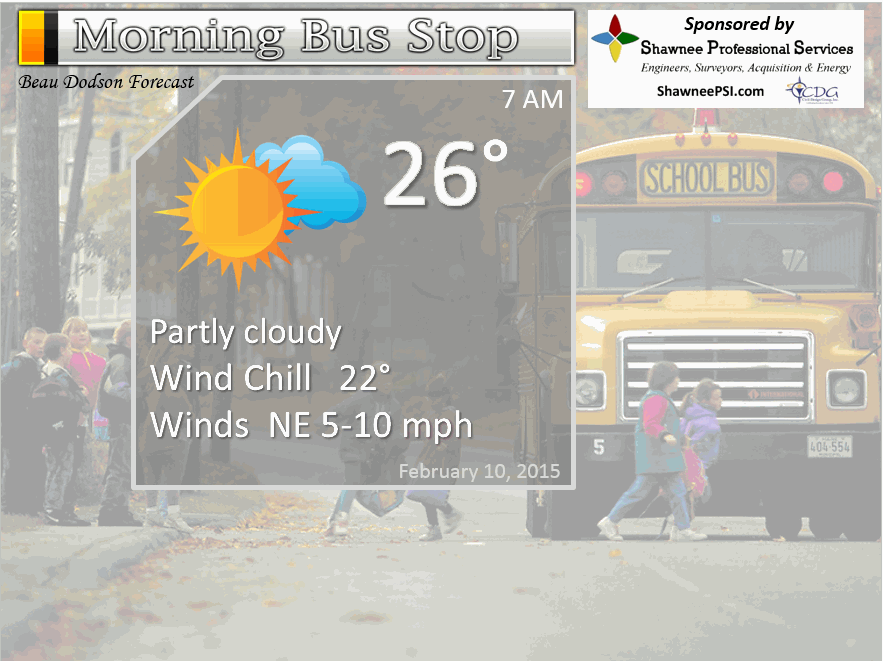
Morning School Bus Stop Weather – Just a few clouds. Chilly with temperatures in the 20’s. Light winds. Chances of schools being delayed because of the weather 0%
—————————————————————————————-
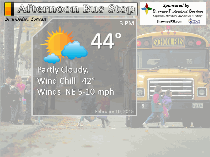
Afternoon School Bus Stop Weather – Sunny with only a few clouds. Temperatures will be in the 40’s with light winds
Tuesday night – Mostly clear and cool. Lows in the upper 20’s and lower 30’s. Light easterly winds. My confidence in this part of the forecast verifying is high
Wednesday – Mild. Mostly sunny during the morning with an increase in clouds late in the day. Highs in the 50’s. West winds at 10-15 mph. Winds my shift to the NW towards evening. Temperatures may fall towards evening over northern counties as a cold front passes through the area. My confidence in this part of the forecast verifying is high
Wednesday night – A period of clouds. A flurry possible. Turning colder and breezy. Northwest winds at 10-20 mph with temperatures falling into the 20’s by Thursday morning. My confidence in this part of the forecast verifying is high
Thursday – Much colder. A few clouds. Temperatures won’t get out of the upper 20’s and lower 30’s. Northwest winds at 10-15 mph. My confidence in this part of the forecast verifying is high

The School Bus Stop Forecast is brought to your by Shawnee Professional Services. For more information click here

Shawnee Professional Services & Civil Design Group have been providing Land Surveying, Engineering, Grant Administration and Acquisition services for the past 20 years.
Currently Licensed in Illinois, Kentucky, Missouri, Indiana, and Tennessee; please contact Shawnee for any Land Surveying or Engineering needs.
Shawnee’s company size allows them to devote individual attention to each client and to approach each project with the required thoroughness to successfully complete the project, large or small.
Shawnee combines innovative thinking and proven techniques, completing projects cost-effectively for their clients. Visit Shawnee’s website at shawneepsi.com for more information. Shawnee has offices in Paducah, KY, Vienna, IL and Benton, IL.
Current Temperatures Around The Local Area


An explanation of what is happening in the atmosphere over the coming days…
Don’t forget to check out our sponsors on the page. Local businesses that are helping to keep the weather information flowing.
Folks we are about to have a roller-coaster ride with temperatures. Wednesday we will be in the 50’s! Not bad…not bad. Especially considering it is the middle of February. BUT, it won’t last.
Temperatures will fall behind a cold front on Wednesday evening and night. Highs on Thursday may not get out of the 20’s or lower 30’s. But, that is not the coldest air we will deal with. Just wait and see what the weekend is going to bring.
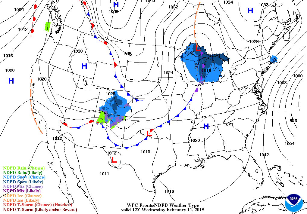
Let’s take a look at the weather map for Tuesday morning and afternoon. Then let’s take a look at that cold front for Wednesday.
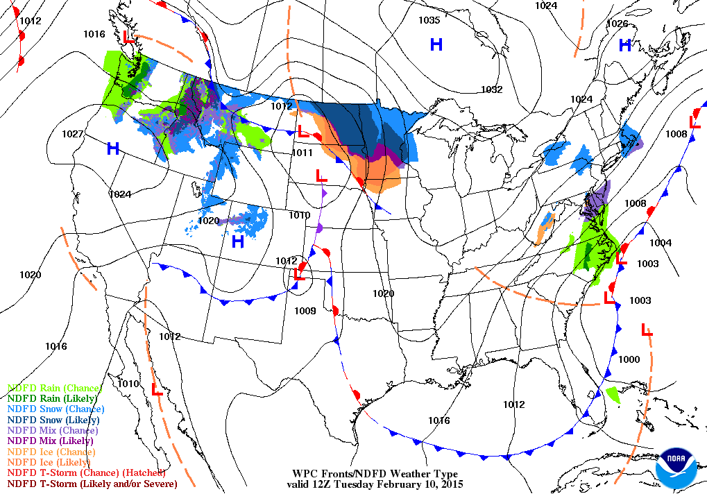
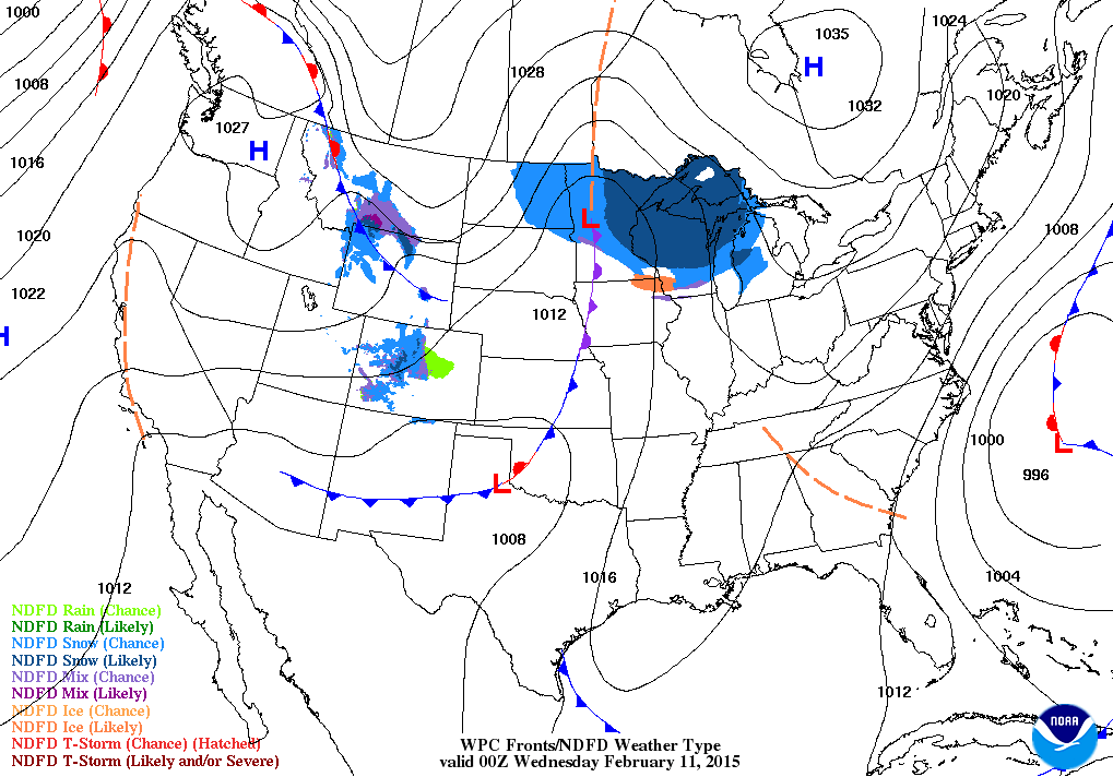
Now, let’s take a look at Wednesdays weather map. See that cold front (the blue line with the triangles)? That will usher in much colder air for Thursday into Friday. Yet another front arrives for the weekend – it ushers in the coldest air of the month.
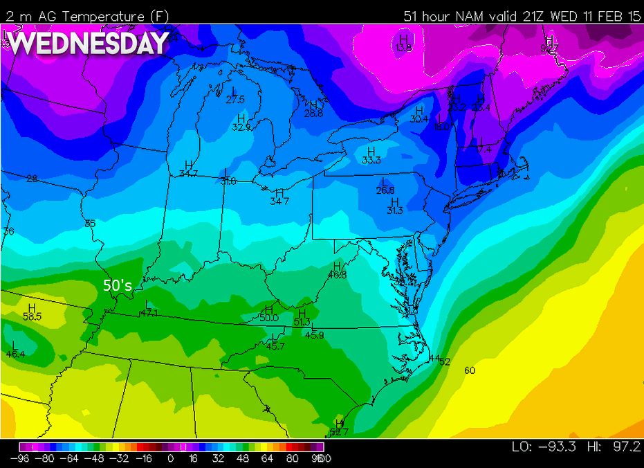
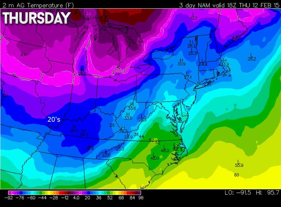
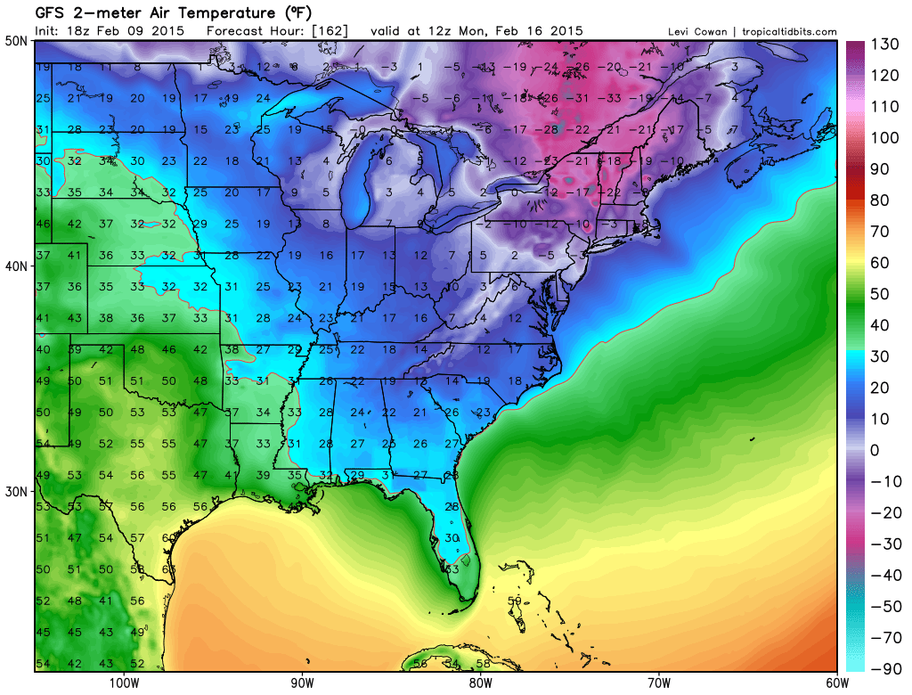
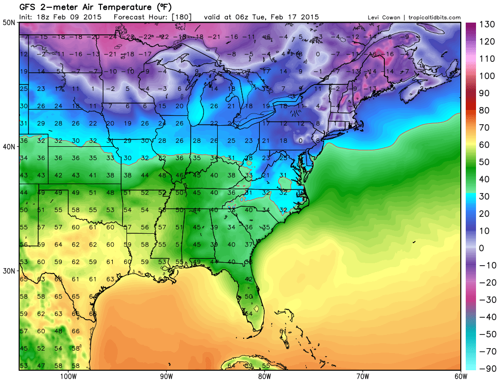
Let’s take a look at actual temperature forecasts for Wednesday and Thursday
You can compare before the front and after. Here are the afternoon temperatures for each of those days.
This weekend a powerful cold front with arctic air will push into our region. By Sunday morning some of our local counties will be down into the single digits. Highs won’t get out of the teens and twenties on Saturday and Sunday.
It will be dry through the period. No shocker there. Just a small chance for a sprinkle or flurry with each cold front.
Active weather arrives next week. But will it be rain or snow or ice or all three?
WANT TO HELP SUPPORT THIS BLOG AND COVER EXPENSES?
Did you know that the Weather Observatory is funded by people like you? I rely on ad’s on this blog and individual donations. PayPal also allows you to set up a monthly recurring donation. I have had several people give $5, $10, and $20 a month. A recurring donation helps keep the weather information flowing. If you enjoy this blog, the Twitter account, the Facebook interaction, the weather radars, and all of the other information then consider making a donation or setting up a recurring donation (if you don’t use PayPal then contact me through email about how you can mail a donation) beaudodson@usawx.com
Or mail a check to
Beau Dodson
3954 Mermet Road
Belknap, IL
62908
Thank you for your support!

Updated wind and temperatures. No major changes, small ones.

No concerns today. Concerned about bitterly cold air for the weekend. Single digits? Appears that may be the case for some of our counties.
Check out our newest sponsors $5 meal! The DQ Grill and Chill (located across from Noble Park in Paducah, Kentucky) is the newest WeatherTalk Blog sponsor! A local business helping to sponsor the weather information that you have come to love so much.
They have a Facebook Page and I encourage you to check it out. DQ Grill and Chill on Facebook


The wild card tells you where the uncertainties are in the forecast
Wild card in this forecast – The wild card in this forecast will be temperatures on Wednesday. Appears some 50’s will be possible. Let’s see how high the thermometer can reach. Don’t get used to it. Colder weather behind Wednesday’s cold front. Brrr the rest of the week.

Can we expect severe thunderstorms over the next 24 to 48 hours? Remember that a severe thunderstorm is defined as a thunderstorm that produces 58 mph winds or higher, quarter size hail or larger, and/or a tornado.
Thunderstorm threat level is ZERO (we have had a long streak without thunderstorms or severe weather)


Will I need to take action?
No action will be required. Calm Tuesday.

How much precipitation should we expect over the next few days?
No rain today or tomorrow. More dry weather. Par for the course.
We have a new sponsor! G&C Multi-Services out of Paducah, Kentucky. G & C Multi-Services is a service provider in Western Kentucky that provides industrial and commercial equipment fabrication, machine troubleshooting, repair and maintenance, and installation. They can custom fabricate steel, stainless, and aluminum products per customer specifications.
Visit their web-site here. Or click the ad below! They have a Facebook page and it can be viewed here.


No winter precipitation in the forecast. Very cold air arrives this weekend. It is going to feel like winter, again. Watching active weather next week and the following week. But, will it snow? See the extended forecast for the latest on the storm next week.
Also
Meteorologist Jim Rasor has a new blog. Check it out when you have time http://mylocalweather.net/forum/home

This section of the blog is speculative forecast information. Because it is past the range of what meteorologists can forecast accurately, it should be considered speculation. Anything past day 5 is considered a long range forecast.
Highlights…
1. Cold and dry Thursday through Sunday
2. BITTER cold for the weekend with single digits by Sunday morning
3. Rain or snow possible with a precipitation maker coming out of the southwest U.S. and northern U.S. on Monday night into Tuesday
4. Colder behind the storm system as it pulls away
5. A more active southern jet might mean several precipitation makers to track between the 16th and the end of the month.
My forecast for an active pattern developing next week appears to be showing up more and more on the model data. But, what isn’t clear is whether or not this is going to be a rain event or snow event (or a little of both).
There are also some questions on the placement of a strong high pressure area on Monday and one coming in right behind it on Tuesday and Wednesday. How this interacts with a system coming out of Oklahoma and Texas is definitely on my mind.
It will be bitterly cold on Sunday – highs may not get out of the teens and twenties over much of the region.
Forecast eyes then turn to a possible precipitation event early next week (Monday night into Tuesday). The track of the low is very much in play. North – south – way south. All on the table of possibilities. It is too soon to make a call on the track of the system (or the strength of the system)
Remember, if you want snow then you want the low to pass to your south. Right now it is too early to determine where the low will track. Models show it going well to our south – models show it going well to our north. There is no consistent signal, yet. And that is what we have to watch for as we move forward.
Time will tell. Rain or snow appears a good bet early next week. Then another shot of cold air.
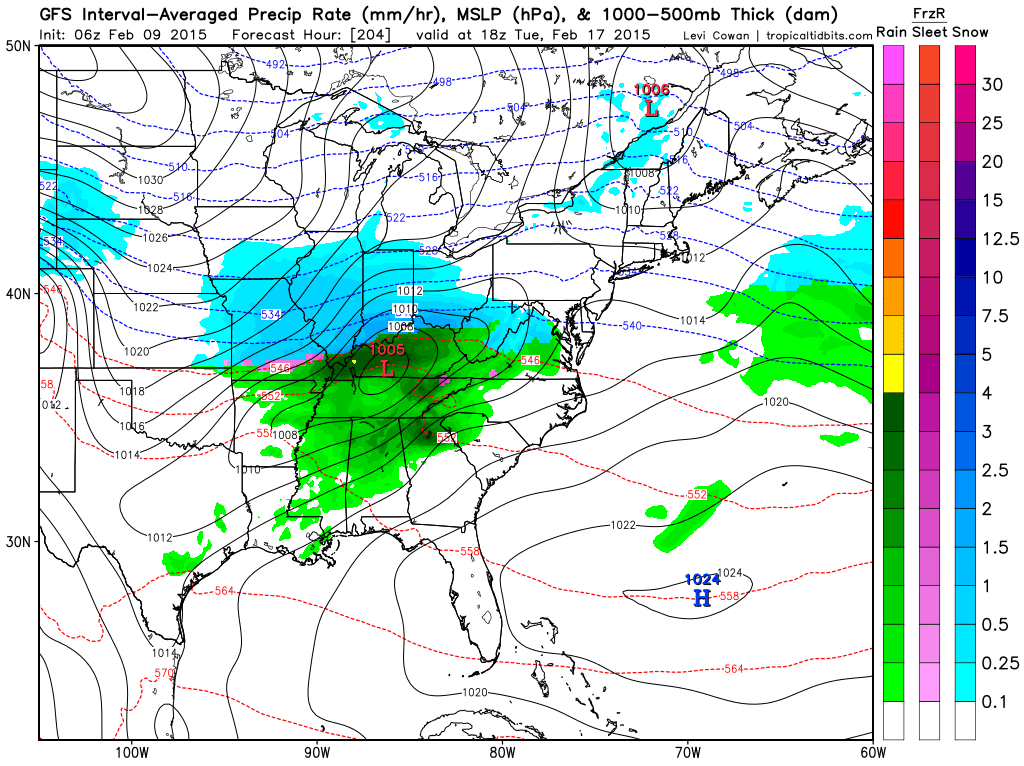
The GFS model has been the one I have been posting on here. It is going back and forth between rain and snow. Some model runs show rain and some show snow.
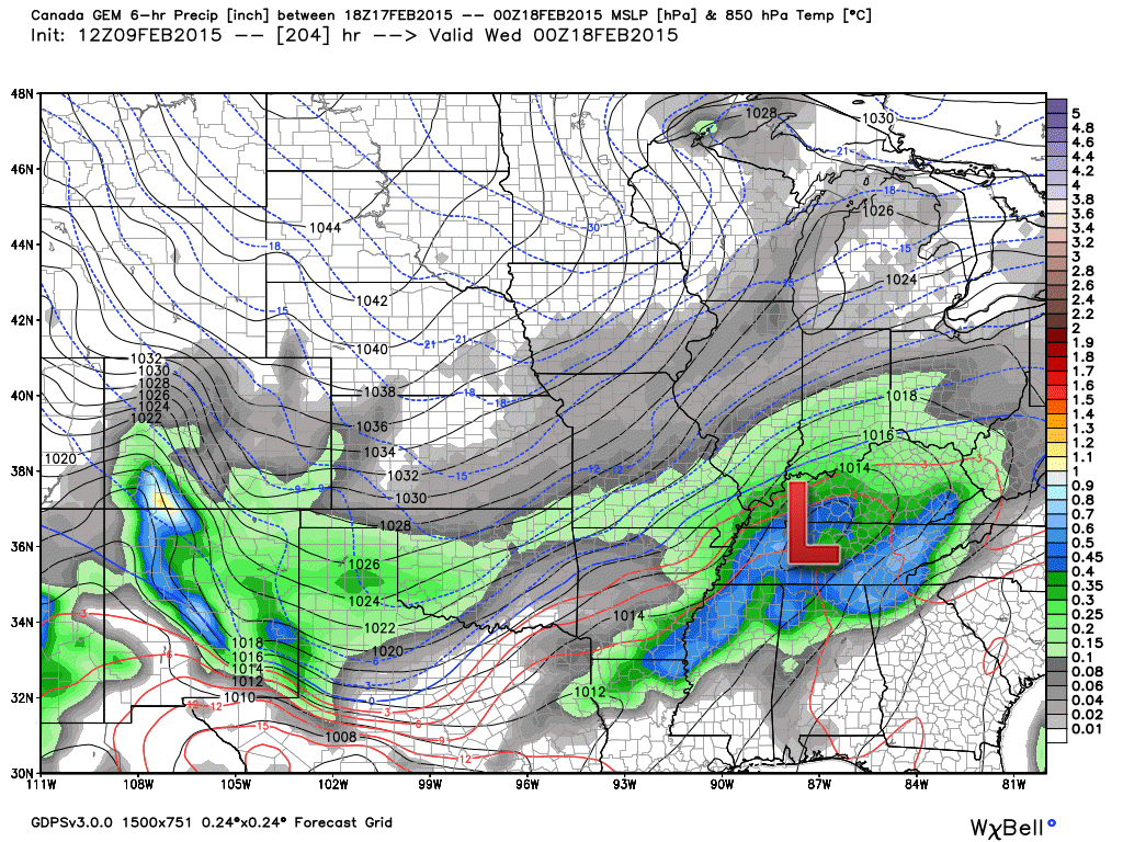
For example – here is one run from yesterday. It showed snow in our area. Rain for parts of Kentucky. Snow elsewhere.
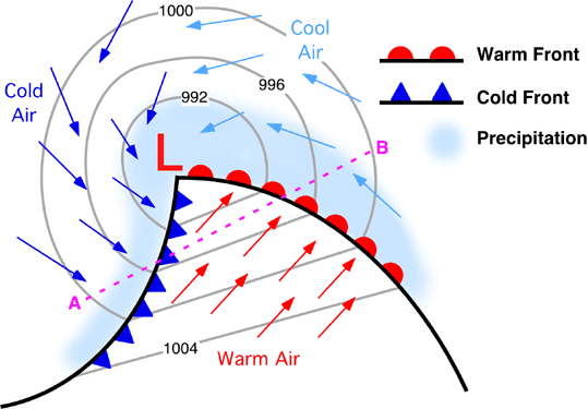
See the red L? That is the area of low pressure. Again, remember it is cold to the north of the red L and it is warm to the south of the red L.
Here is a diagram of what a winter storm looks like (compare that to the forecast maps below)
Now, here is the GFS forecast maps for the precipitation maker next week.
A few hours later – another run of the same model clearly shows rain for our counties. Snow well to the north.
Each run of the model changes the track. This is how computer models are (days in advance of a storm). What will it actually look like once it arrives in our area early next week? Well, that is the million dollar question. Too soon to make a forecast. All we can do is wait and watch.
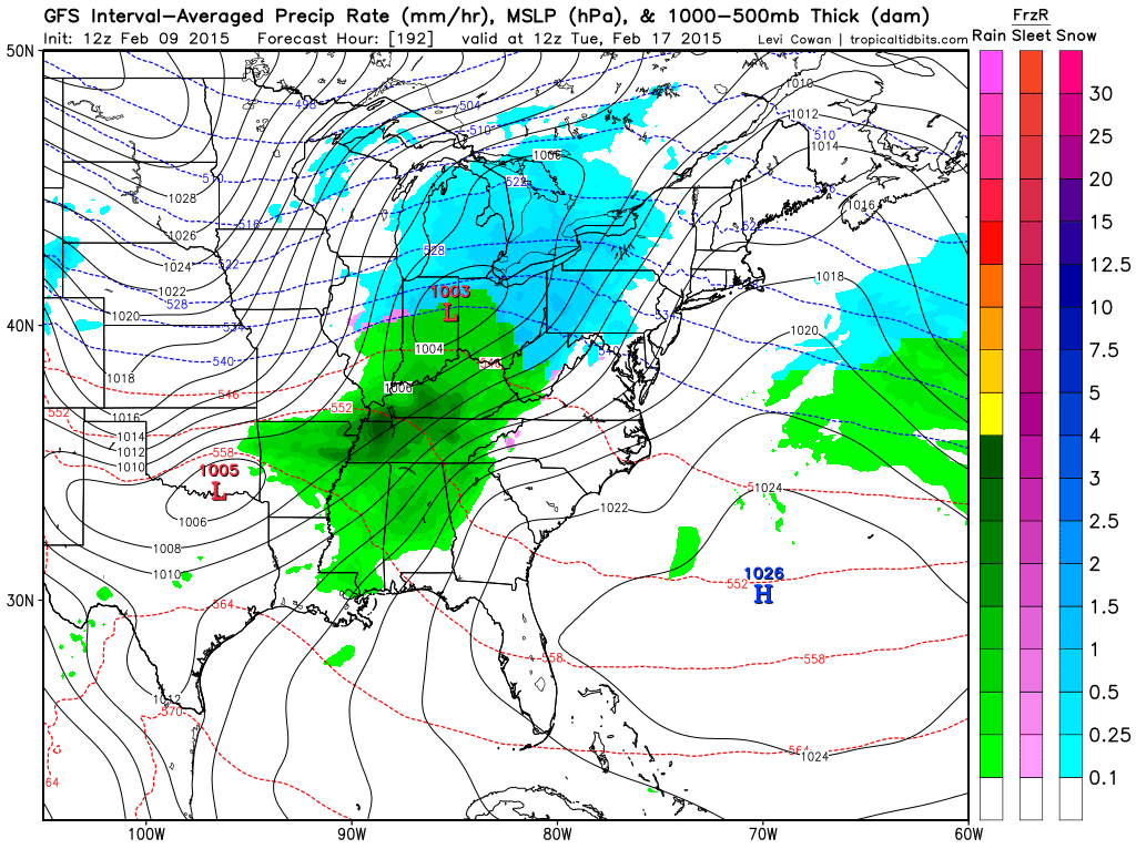
This is the way the models will be over the coming days. Our weather will depend on the track of the low.
Here is the Canadian model. Guess where it places the area of low pressure? To our south. That means snow and ice in our region. Different models come up with different solutions.
Stay tuned…I will keep posting updated maps. We will see if we can find some trends as move towards the end of the week.
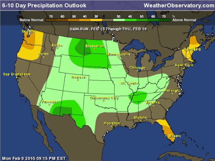
The latest 6-10 day precipitation outlook has now flipped towards wetter than normal. This is in response to a more active pattern and southern jet trying to pump up some moisture and some northern stream energy.
The other story of the week is going to be BITTERLY cold air for Saturday into Sunday. Lows on Sunday morning will likely be in the single digits over most of our area. Brrr!
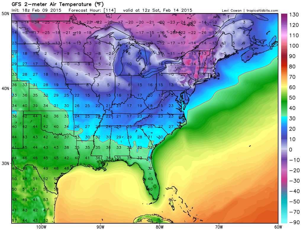
Here are Saturday mornings forecast lows (could be a little colder than this)
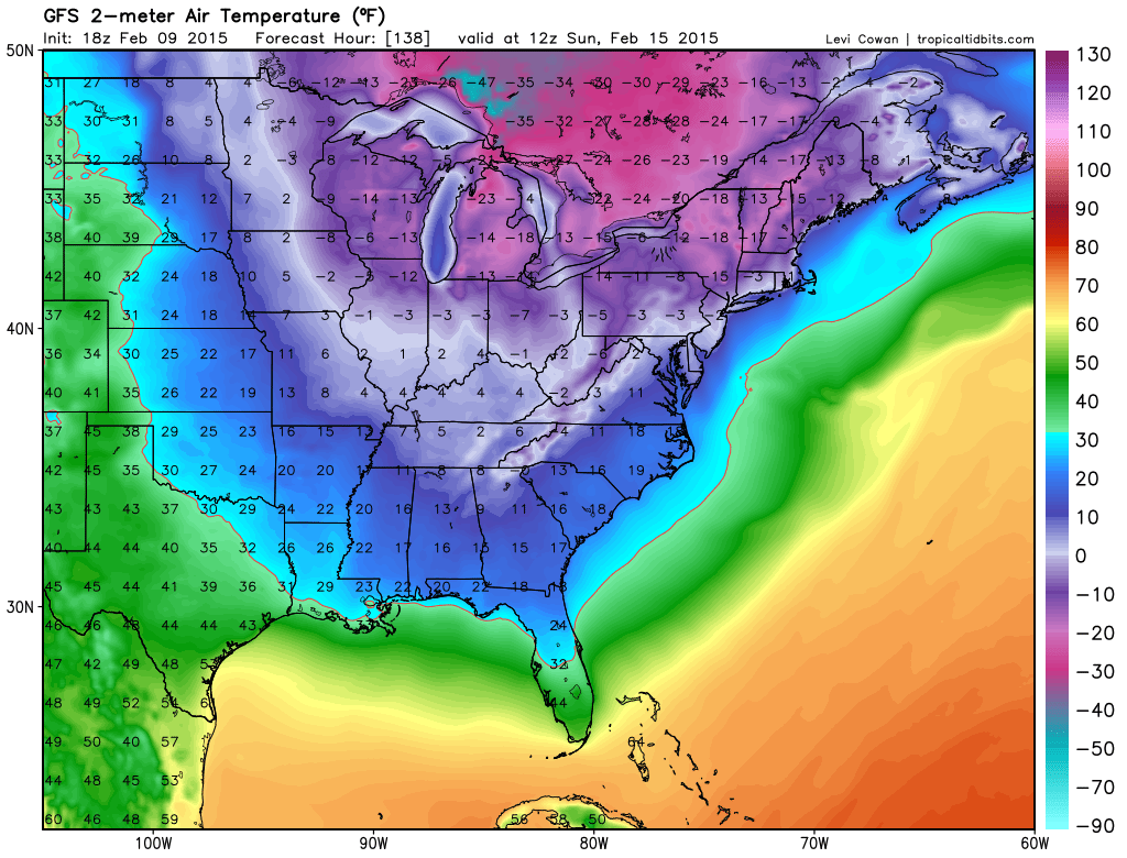
Sunday morning lows
![]()
Now check out Monday’s lows below – not quite as cold as Sunday morning
Now – here comes our storm. Does it warm up or cool down? On this particular run it warms up and rains on Monday night/Tuesday.
These temperatures will be dependent on the track of the area of low pressure. A wait and see – long long way to go before I will know how this will turn out.
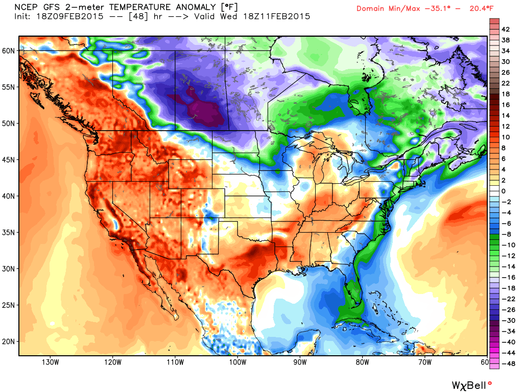
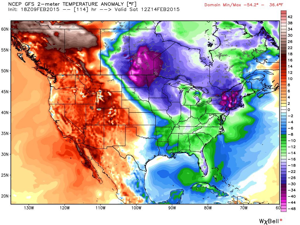
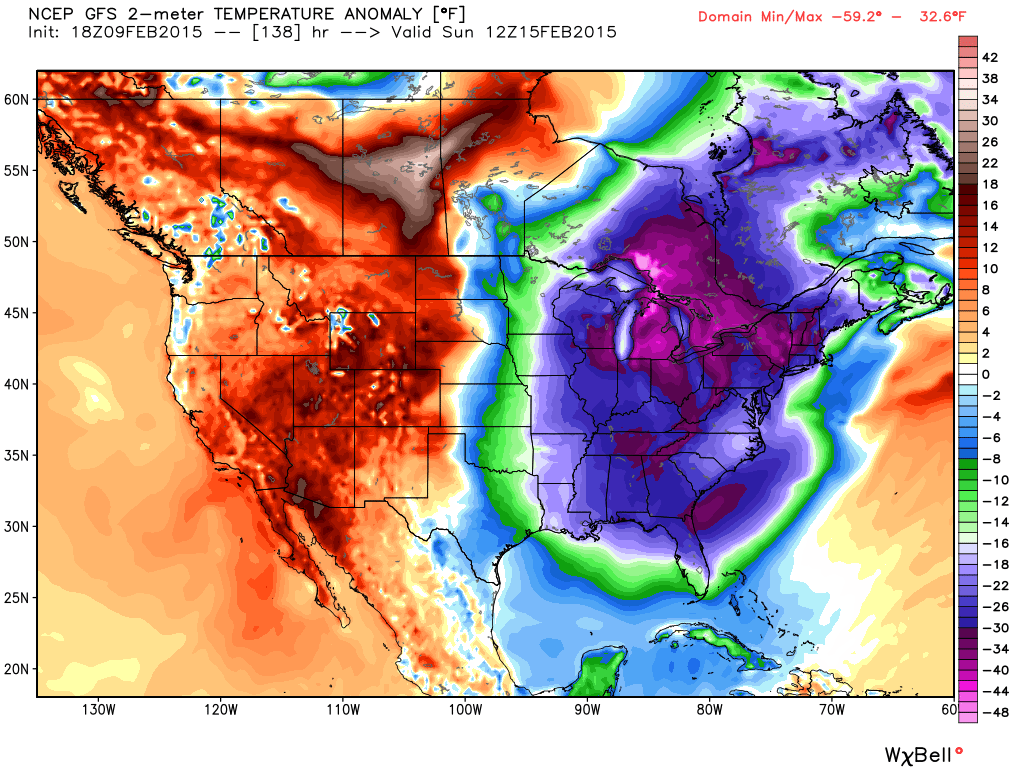
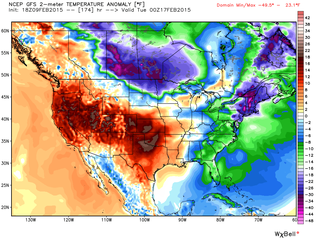
Let’s check out temperature anomalies. I love showing you how fluid the atmosphere can be.
How much ABOVE or BELOW normal will temperatures be over the coming week?
Let’s start with Wednesday, when temperatures will be above normal. Then look how everything crashes by Saturday and Sunday. Then look at how fast temperatures recover by Monday night and Tuesday. Roller-coaster ride!
The anomalies for next Tuesday will entirely depend on the track of the area of low pressure. If the storm goes south of us then we will be colder. If the area of low pressure goes to the north then we will be on the warm side of the storm.
Images are from weatherbell.com
Click image for larger view
Starting with Wednesday (Then Saturday, Sunday, and next Tuesday)
I can see the change of seasons starting to show up in the models. A bit more of the UP and DOWN when it comes to temperatures – quick changes. Southern jet becoming more active. These are things I look for as we move towards March.
More active. We need precipitation. Hopefully we start seeing some regular rain and/or snow.
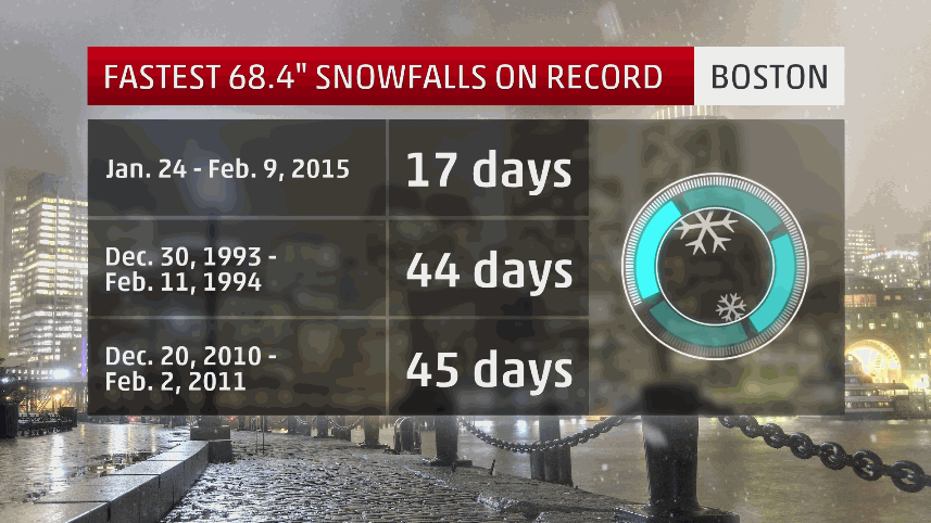
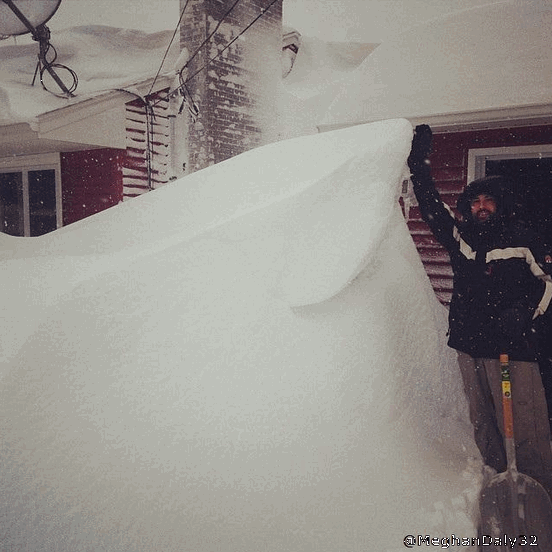
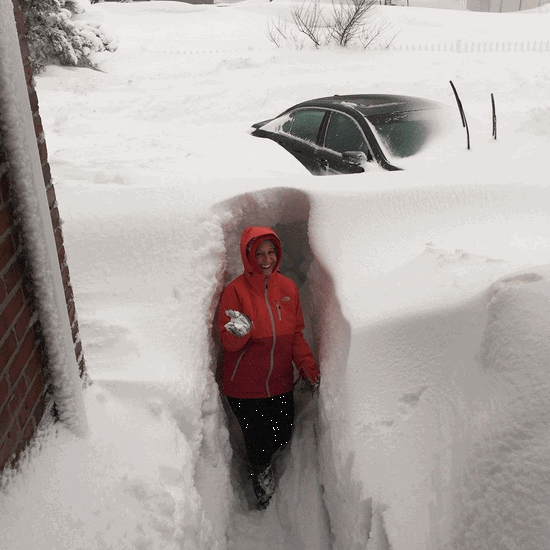
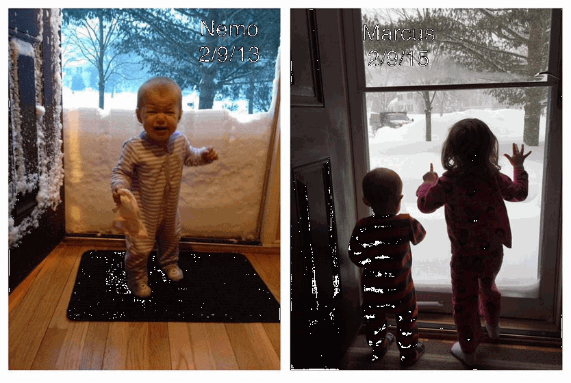
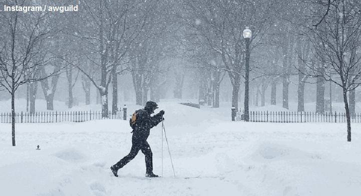
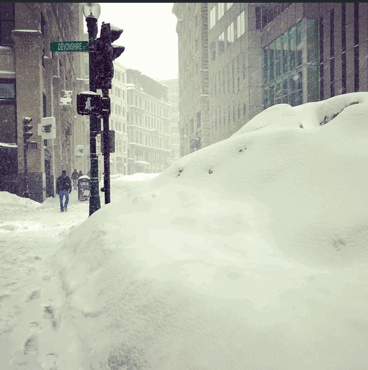
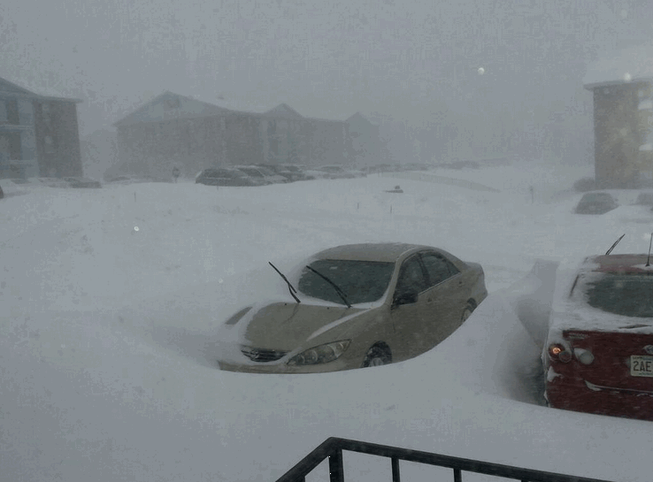
Here are some more photograph from Boston – as seen on Twitter
Just amazing

Who do you trust for your weather information and who holds them accountable?
I have studied weather in our region since the late 1970’s. I have 37 years of experience in observing our regions weather patterns. My degree is in Broadcast Meteorology from Mississippi State University and an Associate of Science (AS). I am currently working on my Bachelor’s Degree in Geoscience. Just need to finish two Spanish classes!
I am a member of the American Meteorological Society. I am a NOAA Weather-Ready Nation Ambassador. And, I am the Meteorologist for McCracken County Emergency Management.
I own and operate the Southern Illinois Weather Observatory.
There is a lot of noise on the internet. A lot of weather maps are posted without explanation. Over time you should learn who to trust for your weather information.
My forecast philosophy is simple and straight forward.
- Communicate in simple terms
- To be as accurate as possible within a reasonable time frame before an event
- Interact with you on Twitter, Facebook, and the blog
- Minimize the “hype” that you might see on television or through other weather sources
- Push you towards utilizing wall-to-wall LOCAL TV coverage during severe weather events
I am a recipient of the Mark Trail Award, WPSD Six Who Make A Difference Award, Kentucky Colonel, and the Caesar J. Fiamma” Award from the American Red Cross. In 2009 I was presented with the Kentucky Office of Highway Safety Award. I was recognized by the Kentucky House of Representatives for my service to the State of Kentucky leading up to several winter storms and severe weather outbreaks.
If you click on the image below you can read the Kentucky House of Representatives Resolution.

I am also President of the Shadow Angel Foundation which serves portions of western Kentucky and southern Illinois.

We have regional radars and local city radars – if a radar does not seem to be updating then try another one. Occasional browsers need their cache cleared. You may also try restarting your browser. That usually fixes the problem. Occasionally we do have a radar go down. That is why I have duplicates. Thus, if one fails then try another one.
If you have any problems then please send me an email beaudodson@usawx.com
WEATHER RADAR PAGE – Click here —
We also have a new national interactive radar – you can view that radar by clicking here.
Local interactive city radars include St Louis, Mt Vernon, Evansville, Poplar Bluff, Cape Girardeau, Marion, Paducah, Hopkinsville, Memphis, Nashville, Dyersburg, and all of eastern Kentucky – these are interactive radars. Local city radars – click here
NOTE: Occasionally you will see ground clutter on the radar (these are false echoes). Normally they show up close to the radar sites – including Paducah.

Regional Radar – Click on radar to take you our full radar page.


Regional Radar
![]()
Current WARNINGS (a warning means take action now). Click on your county to drill down to the latest warning information. Keep in mind that there can be a 2-3 minute delay in the updated warning information.
I strongly encourage you to use a NOAA Weather Radio or warning cell phone app for the most up to date warning information. Nothing is faster than a NOAA weather radio.


Color shaded counties are under some type of watch, warning, advisory, or special weather statement. Click your county to view the latest information.

Missouri Warnings

Illinois Warnings

Kentucky Warnings

Please visit your local National Weather Service Office by clicking here. The National Weather Service Office, for our region, is located in Paducah, Kentucky. They have a lot of maps and information on their site. Local people…local forecasters who care about our region.


Here is the official 6-10 day and 8-14 day temperature and precipitation outlook. Check the date stamp at the top of each image (so you understand the time frame).
The forecast maps below are issued by the Weather Prediction Center (NOAA).


The latest 8-14 day temperature and precipitation outlook. Note the dates are at the top of the image. These maps DO NOT tell you how high or low temperatures or precipitation will be. They simply give you the probability as to whether temperatures or precipitation will be above or below normal.


St Louis

Many of my graphics are from www.weatherbell.com – a great resource for weather data, model data, and more


This blog was inspired by ABC 33/40’s Alabama Weather Blog – view their blog
Current tower cam view from the Weather Observatory- Click here for all cameras.

Southern Illinois Weather Observatory

The Weather Observatory

Southern Illinois Weather Observatory
WSIL TV 3 has a number of tower cameras. Click here for their tower camera page & Illinois Road Conditions

Marion, Illinois
WPSD TV 6 has a number of tower cameras. Click here for their tower camera page & Kentucky Road Conditions & Kentucky Highway and Interstate Cameras

Downtown Paducah, Kentucky
Benton, Kentucky Tower Camera – Click here for full view

Benton, Kentucky

I24 Paducah, Kentucky

I24 Mile Point 9 – Paducah, KY

I24 – Mile Point 3 Paducah, Kentucky

You can sign up for my AWARE email by clicking here I typically send out AWARE emails before severe weather, winter storms, or other active weather situations. I do not email watches or warnings. The emails are a basic “heads up” concerning incoming weather conditions.