
This forecast update covers far southern Illinois, far southeast Missouri, and far western Kentucky. See the coverage map on the right side of the blog.
Thursday – A mix of sun and clouds (we will see how this goes – it has been hard to shake the clouds over the last few days). Unseasonably chilly. Highs in the upper 30’s. Northwest winds at 5-10 mph.
Morning School Bus Stop Weather – A mix of sun and clouds. Chilly. Temperatures will be around the freezing mark.
Afternoon School Bus Stop Weather – A mix of sun and clouds. Temperatures in the upper 30’s.
Thursday night – An increase of clouds through the night. Low temperatures will be in the 22 to 28 degree range. Southwest winds at 5 mph.
Friday – More clouds than sun. Unseasonably chilly. Highs in the upper 30’s and lower 40’s. West/southwest winds at 5-10 mph.
Friday night – Mostly cloudy. A small chance for a sprinkle. Low temperatures will be in the 30’s. Winds will become southerly at 5-10 mph.
Saturday – Morning clouds giving way to some afternoon sun. Near normal temperatures in the upper 40’s to lower 50’s. South winds at 5-10 mph – occasional gust to 15 mph possible.

Current Temperatures Around The Local Area


An explanation of what is happening in the atmosphere over the coming days.
Hello…hello…hello! I took a couple of days off to explain some of the products that you might see this winter. Also to let you know about the AWARE email. Hopefully you took advantage of the information. I am sure we will have a long winter ahead of us and both the graphics and the AWARE email will be put to good use.
The weather has been cold this week. WELL below normal temperatures and clouds have been the rule day in and day out.
Not much change today. A mix of sun and clouds with cold temperatures.
Those cold temperatures are going to continue right on into Friday. The good news is that we will see a slow rise in temperatures as we push into Saturday and Sunday. We may even go slightly ABOVE normal (gasp) in the temperature department by Sunday.
There will be just small chances, from time to time, of a light sprinkle. If temperatures are cold enough at night there could even be a very light freezing drizzle in a few spots. Right now this does not look likely, but I will at least mention it.
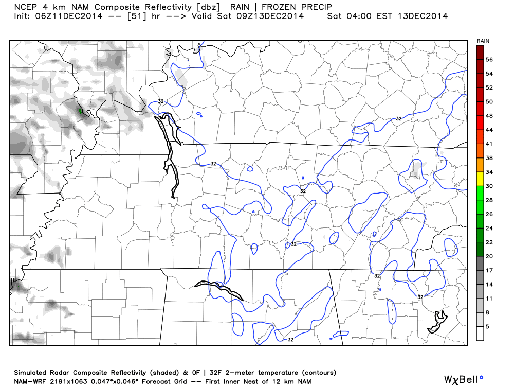
There are hints of precipitation Friday night on the NAM model. See those patchy grey areas? That is precipitation. The question would be – what is the temperature at the surface if precipitation occurs? At or below freezing? Monitor updates.
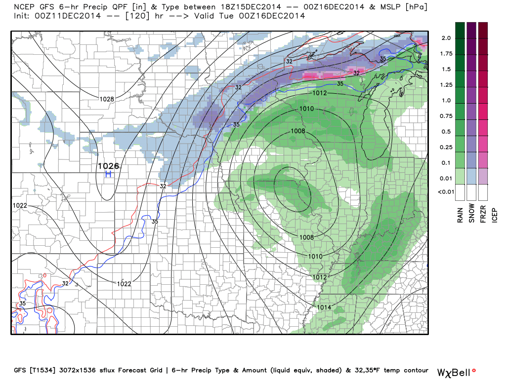
Many of you are wondering when it is going to rain or snow again. It does appear that an area of low pressure will push out of the Central United States on Monday and Tuesday. This system will spread rain back into our region! No snow. Sorry snow fans.
Keep an eye on next weekend. A larger system may impact the southern U.S. into our region.
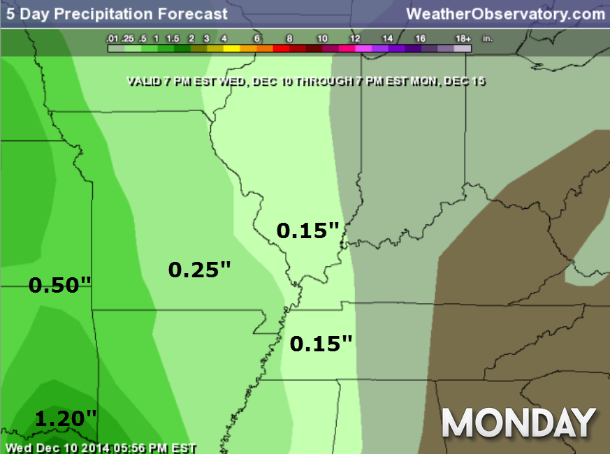
Rainfall totals with the Monday system will likely be on the light side (less than 0.50″). Still several days out to tweak the numbers.
Here is what the GFS model is showing for Monday’s rain maker. You can see the low pulling into Missouri and Illinois. The green represents rain

No forecast changes since I was off for two days.

There is just a small chance of drizzle or perhaps even freezing drizzle during the overnight hours tonight and Friday night. The chances of this appear small at any given location, but I thought I would mention it

The Wild Card gives you an idea of what might change that would cause the forecast to bust.
Wild card in this forecast – The wild card in this forecast will be just how much sun we will manage to squeeze out today and on Friday. Still appears quite a few clouds will be possible from time to time. The opportunity for sun is greater today than Friday.
Another wild card will be the possibility of drizzle or even perhaps freezing drizzle in a few locations tonight and again Friday night.

Can we expect severe thunderstorms over the next 24 to 48 hours? Remember that a severe thunderstorm is defined as a thunderstorm that produces 58 mph winds or higher, quarter size hail or larger, and/or a tornado.
Thunderstorm threat level is ZERO!


Will I need to take action?
Probably not – I will be watching to see if any drizzle or freezing drizzle develops tonight and Friday night. There are hints of this on some of the data. Keep this in mind. The chances appear small, but does deserve monitoring because freezing drizzle can be a big problem if it were to form.

Please visit your local National Weather Service Office by clicking here. The National Weather Service Office, for our region, is located in Paducah, Kentucky.

How much rain should this system produce over our region?
A light rain event is possible on Monday. This does not appear to be a big deal. Light rainfall totals.

A small chance for freezing drizzle tonight and again Friday night. Hints of this on some data.
Sorry snow fans. I keep looking for some snow, but I keep coming up empty handed. I will keep an eye on a system towards the end of next week.
I am watching some systems for the week of Christmas. Too soon to know whether they will be warm or cold systems. Stay tuned.

Next week will likely bring more cold weather with below normal temperatures. We may see some moderation of temperatures ahead of our storm system on Monday. Then several shots of cold weather appear on tap.
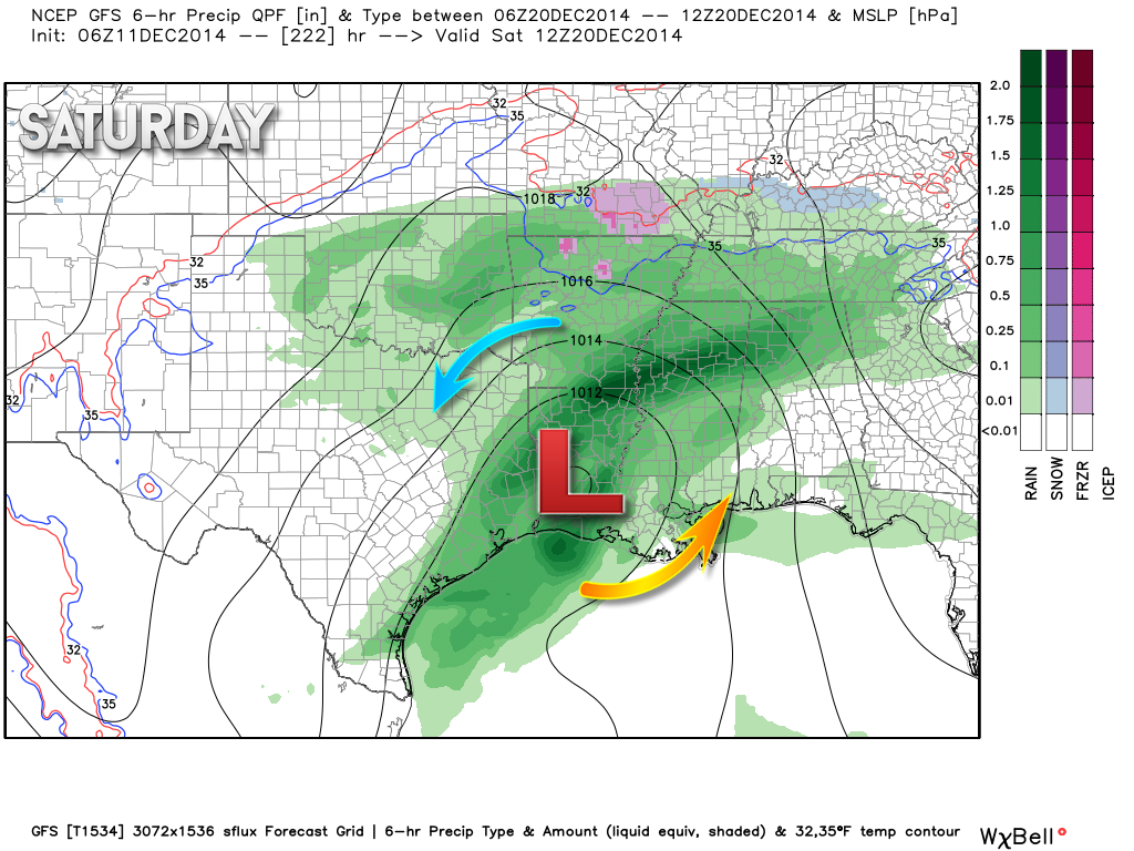
I am watching another system around December 17th-20th. A bit too far out, again, for much detail. Charts indicate at least the possibility of a system coming out of the Central U.S. and perhaps even a southern track system. Usually when storms track to our south that means we are on the cold side. Again, just too far out for any details.
Look at this baby on the GFS model. It winds up the storm and tracks it to our south. That puts us on the cold side. This is in model lala land. That means it is so far out that there would be no real confidence in whether or not it happens.
Of some interest is that most of the major models are showing this storm. That is something I always look for when forecasting long range events. Eh, something to watch at least for you winter weather fans. Just remember – never county your snowflakes before they hatch!
NEXT SATURDAY (not this Saturday)
An active weather pattern is likely to take shape the week of Christmas. December 22nd through December 30th. We could see several rounds of precipitation. The big question is going to be whether it will be warm enough for rain or cold enough for wintry precipitation. Still a long way off. I am keeping a weather eye on the data!
I have been zeroing in on Christmas week for active weather. Only time will tell if that verifies.
We will just have to wait and see if we can pull off a white Christmas this year. At least the pattern does lend itself to being active around that time frame.
Many of my graphics are from www.weatherbell.com – a great resource for weather data, model data, and more


This blog was inspired by ABC 33/40’s Alabama Weather Blog – view their blog
Current tower cam view from the Weather Observatory- Click here for all cameras.

Southern Illinois Weather Observatory

The Weather Observatory

Southern Illinois Weather Observatory
WSIL TV 3 has a number of tower cameras. Click here for their tower camera page & Illinois Road Conditions

Marion, Illinois
WPSD TV 6 has a number of tower cameras. Click here for their tower camera page & Kentucky Road Conditions & Kentucky Highway and Interstate Cameras

Downtown Paducah, Kentucky
Benton, Kentucky Tower Camera – Click here for full view

Benton, Kentucky

I24 Paducah, Kentucky

I24 Mile Point 9 – Paducah, KY

You can sign up for my AWARE email by clicking here I typically send out AWARE emails before severe weather, winter storms, or other active weather situations. I do not email watches or warnings. The emails are a basic “heads up” concerning incoming weather conditions.