WeatherTalk monthly operating costs can top $2000.00. Your $5 subscription helps pay for those costs. I work for you.
The $5 will allow you to register up to seven phones!
For $5 a month you can receive the following. You may choose to receive these via your WeatherTalk app or regular text messaging.
Severe weather app/text alerts from my keyboard to your app/cell phone. These are hand typed messages from me to you. During tornado outbreaks, you will receive numerous app/text messages telling you exactly where the tornado is located.
- Daily forecast app/texts from my computer to your app/cell phone.
- Social media links sent directly to your app/cell phone. When I update the blog, videos, or Facebook you will receive the link.
- AWARE emails. These emails keep you well ahead of the storm. They give you several days of lead time before significant weather events.
- Direct access to Beau via text and email. Your very own personal meteorologist. I work for you!
- Missouri and Ohio Valley centered video updates
- Long-range weather videos
- Week one, two, three and four temperature and precipitation outlooks.
Monthly outlooks. - Your subscription also will help support several local charities.
Would you like to subscribe? Subscribe at www.beaudodsonweather.com

I encourage subscribers to use the app vs regular text messaging. We have found text messaging to be delayed during severe weather. The app typically will receive the messages instantly. I recommend people have three to four methods of receiving their severe weather information.
Remember, my app and text alerts are hand typed and not computer generated. You are being given my personal attention during significant weather events.

WWW.WEATHERTALK.COM subscribers, here is my day to day schedule for your weather products.


September 4, 2018
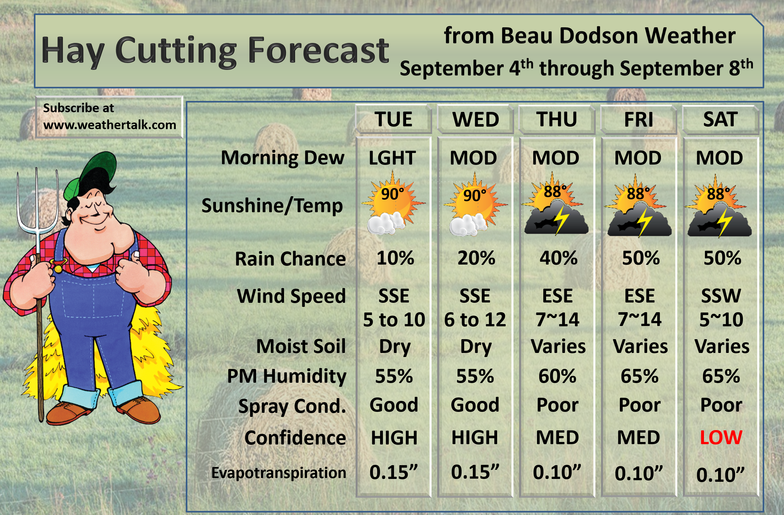
Tuesday Forecast Details
Forecast: Mostly sunny with some cumulus clouds. A stray thunderstorm possible over southeast Illinois into the Pennyrile area of western Kentucky (eastern counties of my forecast area). Warm. Humid.
Temperatures: MO ~ 88 to 92 IL ~ 88 to 93 KY ~ 88 to 94 TN ~ 88 to 94
What is the chance of precipitation? MO ~ 10% IL ~ 10% KY ~ 20% TN ~ 10%
Coverage of precipitation: None to isolated.
Wind: South and southeast at 5 to 10 mph
What impacts are anticipated from the weather? Isolated wet roadways and lightning (if anything at all)
My confidence in the forecast verifying: High
Is severe weather expected? No
The NWS defines severe weather as 58 mph wind or great, 1″ hail or larger, and/or tornadoes
Should I cancel my outdoor plans? No
UV Index: 8 to 10 High
Sunrise: 6:28 AM
Tuesday Night Forecast Details:
Forecast: Mostly clear. Warm. A few passing clouds. Patchy fog possible.
Temperatures: MO ~ 68 to 74 IL ~ 68 to 72 KY ~ 70 to 75 TN ~ 70 to 75
What is the chance of precipitation? MO ~ 10% IL ~ 10% KY ~ 10% TN ~ 10%
Coverage of precipitation: Most likely none. Isolated if anything at all.
Wind: South and southeast at 4 to 8 mph
What impacts are anticipated from the weather? None for most areas. Isolated wet roadways. Lightning.
My confidence in the forecast verifying: High
Is severe weather expected? No
The NWS defines severe weather as 58 mph wind or great, 1″ hail or larger, and/or tornadoes
Should I cancel my outdoor plans? No
Sunset: 7:18 PM
Moonrise: 1:38 AM Waning Crescent
Moonset: 4:27 PM


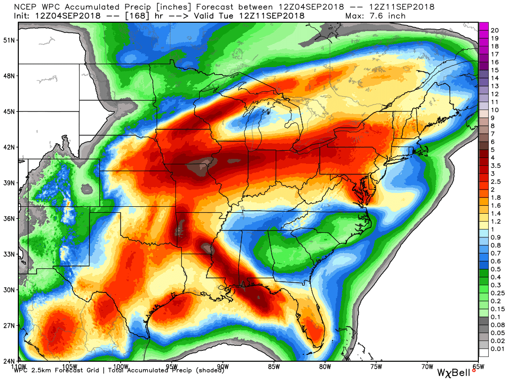
Here is the latest WPC/NOAA rainfall outlook.
Keep in mind, this graphic won’t capture those locally heavy thunderstorms that we often have during the summer months. Those storms can easily drop an inch or more of rain in less than an hour.
Here is the seven-day rainfall forecast. This takes us into next Tuesday morning
Remember, this is never exact. Take the general idea of how much rain could fall. Some will receive more and some less, as always is the case in our region.
National view. You can see where the tropical system tracks. If the track of the tropical system shifts then this would need updating.
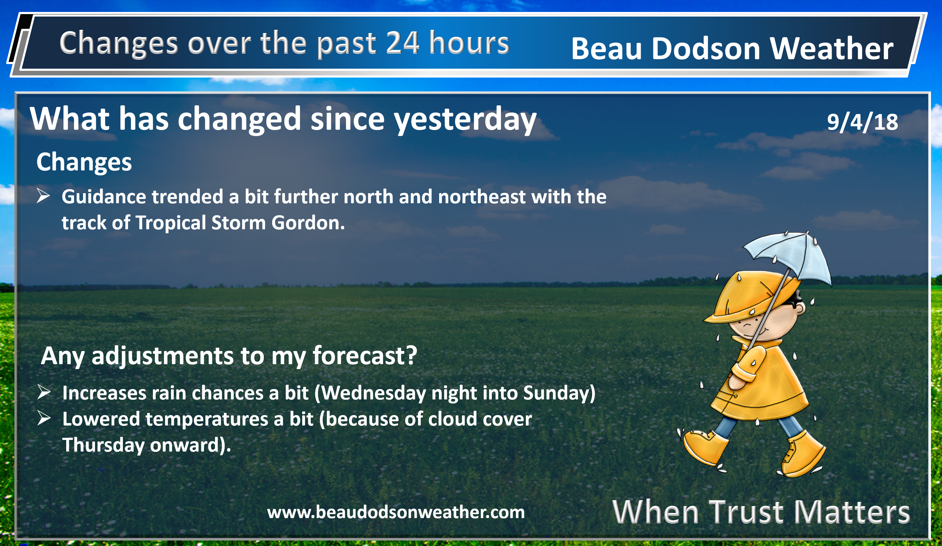
Over the last 24 hours, there was a bit of an eastward shift. Thus, the WPC/NOAA forecasted rain totals have increased a bit.
The best chance of rain will be across southeast Missouri and southern Illinois. There will be precipitation elsewhere, as well. Perhaps not as widespread.
Click to enlarge
.
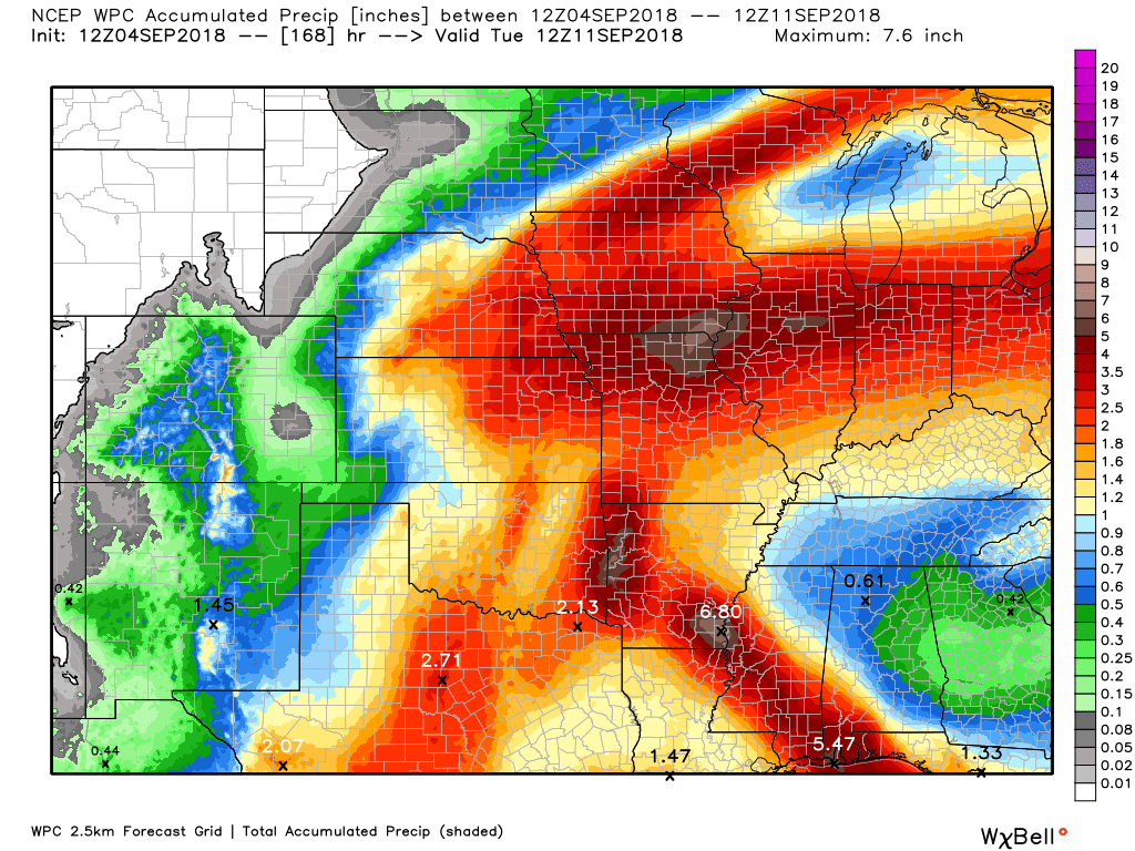
Here is the zoomed version of the above centered on southeast Missouri and southern Illinois
Notice the sharp gradient. This graphic takes us from now through 7 AM next Tuesday
Click to enlarge the graphics.
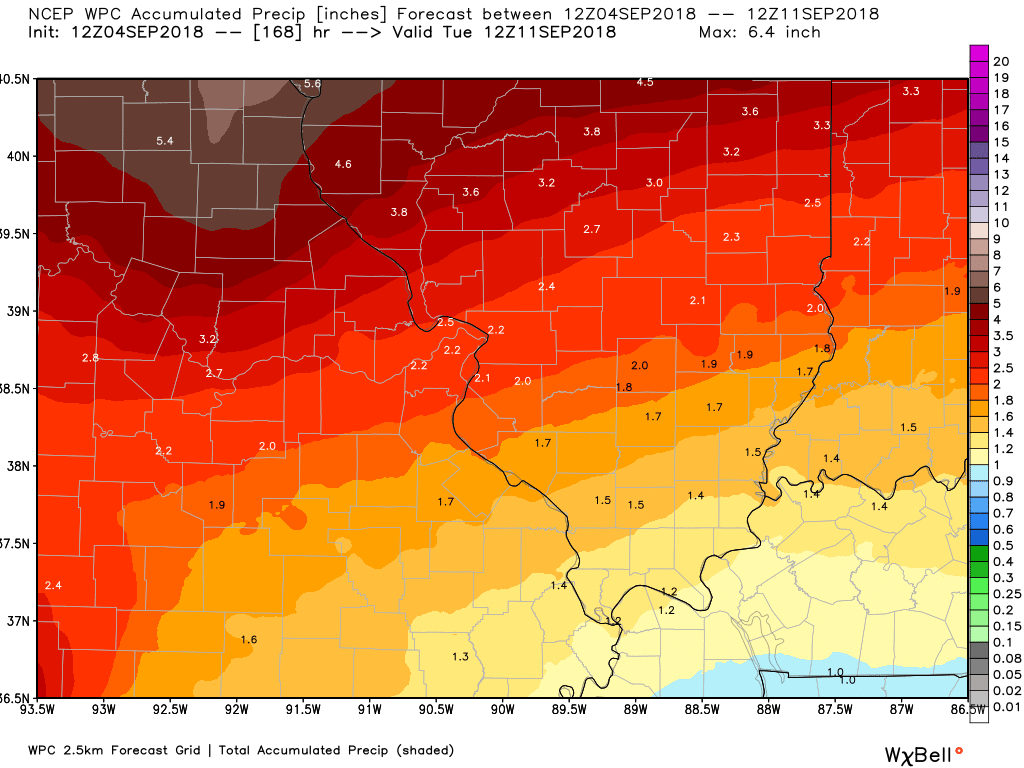
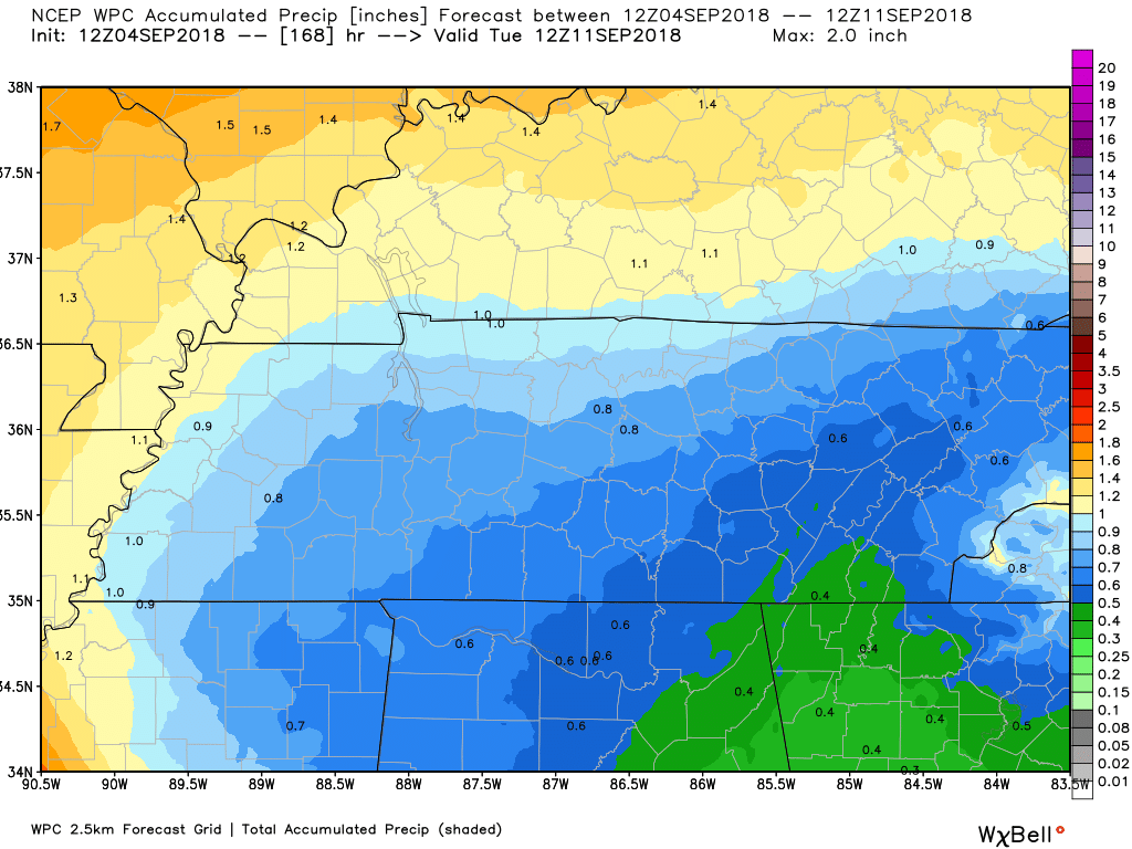
Zooming in on Kentucky and Tennessee.
This is through 7 AM next Tuesday

We offer interactive local city live radars and regional radars.
If a radar does not update then try another one. If a radar does not appear to be refreshing then hit Ctrl F5 on your keyboard.
You may also try restarting your browser. The local city view radars also have clickable warnings.
During the winter months, you can track snow and ice by clicking the winterize button on the local city view interactive radars.

Questions? Broken links? Other questions?
You may email me at beaudodson@usawx.com

The National Weather Service defines a severe thunderstorm as one that produces quarter size hail or larger, 58 mph winds or greater, and/or a tornado.
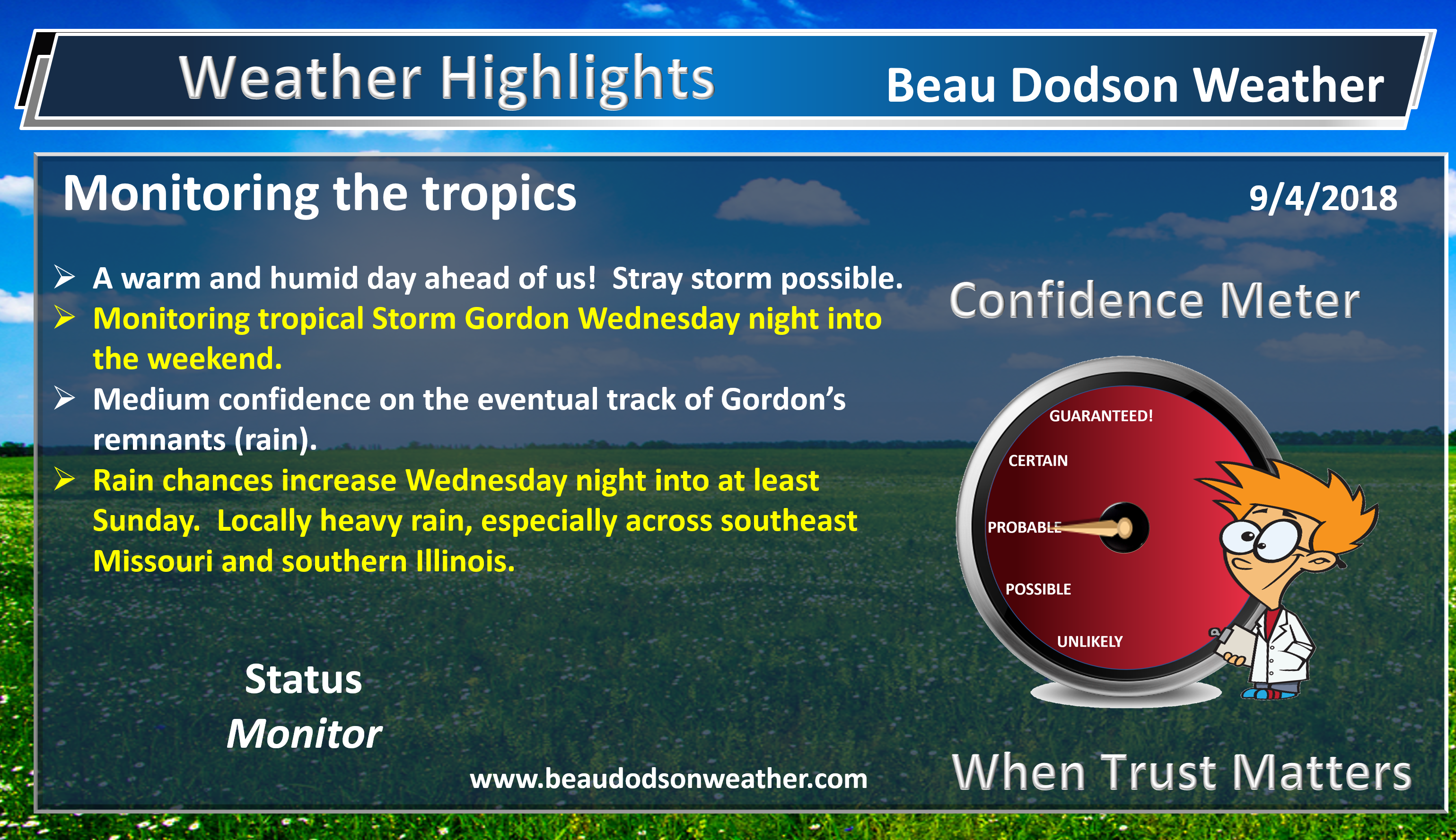
Today through Sunday: Severe weather is not anticipated. I will be monitoring each afternoon for a few thunderstorms. There is a lot of moisture in the atmosphere. If thunderstorms form then they would produce heavy rain.
At this time, the severe weather risk appears limited.
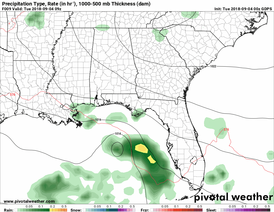
I am monitoring the eventual track of Gordon. Gordon will move ashore later today along the Louisiana, Mississippi, Alabama, and Florida Panhandle’s coastlines. This system will help increase moisture into our local area. Rain is the primary concern. A few lightning bolts possible. Severe weather currently appears unlikely.
Summer thunderstorms can produce isolated microbursts.
microburst winds can exceed 50 mph.
What are microbursts?

Interactive live weather radar page. Choose the city nearest your location. If one of the cities does not work then try a nearby one. Click here.
National map of weather watches and warnings. Click here.
Storm Prediction Center. Click here.
Weather Prediction Center. Click here.

Live lightning data: Click here.

Interactive GOES R satellite. Track clouds. Click here.

Here are the latest local river stage forecast numbers Click Here.
Here are the latest lake stage forecast numbers for Kentucky Lake and Lake Barkley Click Here.

- A look at the week ahead.
- Tropics have become a bit more active.
- Tropical rain potential in our region.
- Clouds and temperatures.
.
We will have another warm day across the region. A few cumulus clouds. There is a bit of lift in our eastern counties. I can’t rule out a stray shower or thunderstorm over southeast Illinois and the Pennyrile area of western Kentucky. Otherwise, conditions will be fairly quiet today.
Rain chances elsewhere will be low.
We have a tropical system in the Gulf of Mexico. This system will help push clouds and moisture into our region as early as tomorrow. Precipitation chances and clouds will linger into the weekend. Some of the guidance shows rain chances into early next week.
Cloud cover will be on the increase as we move into tomorrow. The clouds will be with us into the weekend. This will help shave several degrees off the thermometer. Areas with rain and clouds will remain in the lower to middle 80’s.
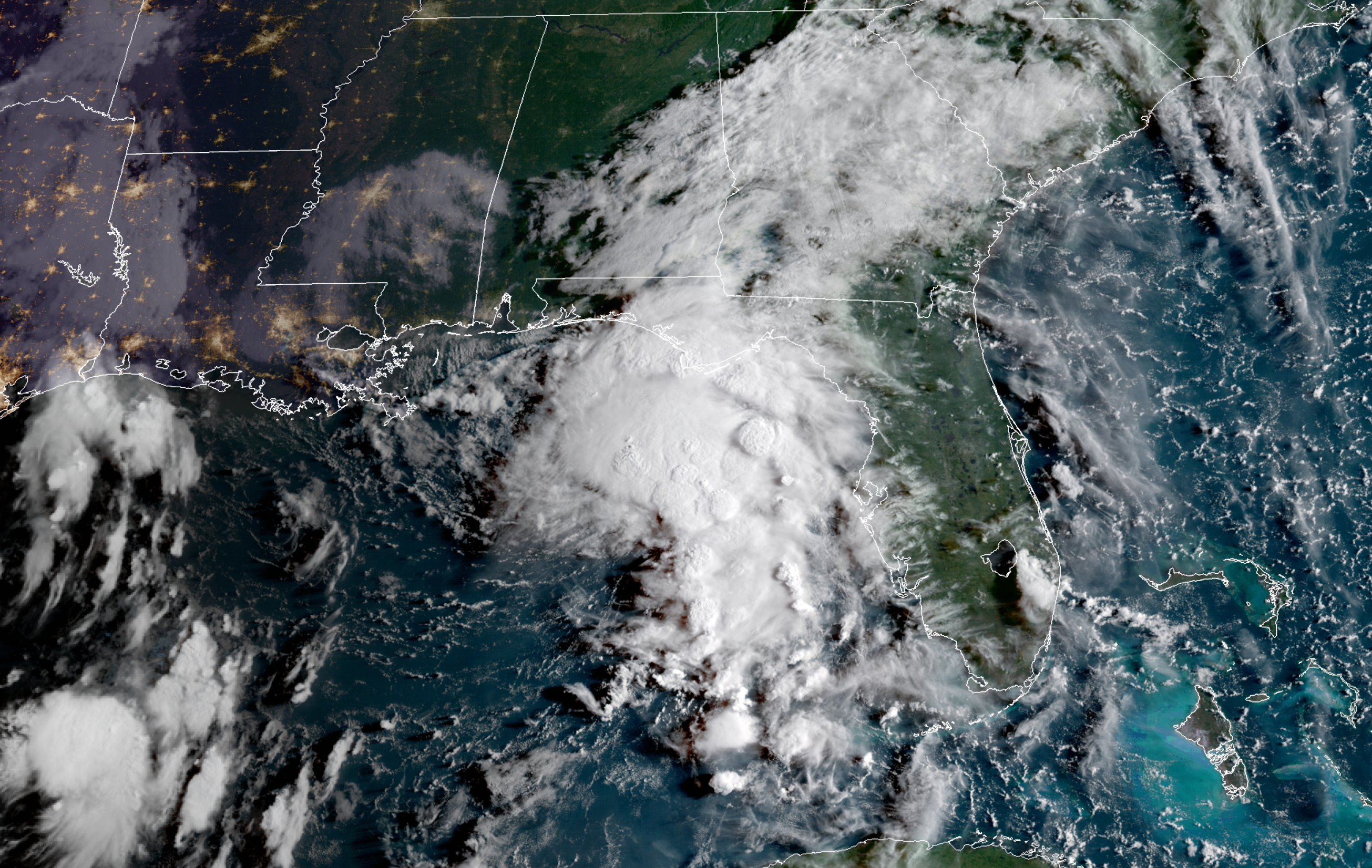
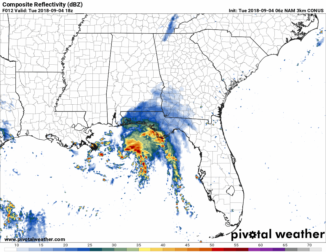
This is the morning satellite view of Gordon. A mass of showers and a few thunderstorms in the Gulf of Mexico.
Want to view this satellite? Be sure and hit refresh once you land on the satellite page. Here is the link. Click here.
Click image to enlarge
The biggest question is the track of the lift (upward motion) associated with Gordon. Model guidance has been shifting further east and southeast over the last 24 hours.
This equals greater rain chances locally.
Let’s look at some model animations.
This first model is the NAM 3 KM. You can see how it brings Gordon ashore and then moves it northeast.
This is a bit more east than previous runs. Earlier model runs took the system over southwest Arkansas. This one takes it into central Arkansas.
These little shifts are important.
This next model is the GDFS. You can see that it takes the core of the system into Arkansas, as well. It would then turn north and eventually northeast.
This model run is a bit further southeast vs the one above.
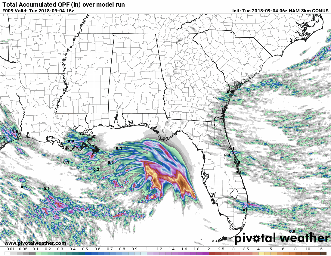
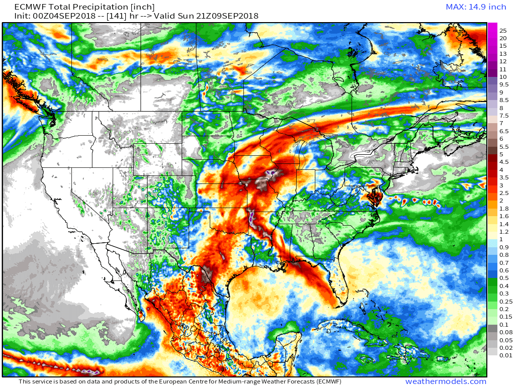
This is a nice graphic. This shows you how much rain will fall along the path of Gordon. You can see how tightly packed the rain is as it moves into Arkansas.
Let me show you the EC model guidance. Typically, the EC model does fairly well.
This first graphic shows rainfall totals through Thursday afternoon. You can see Gordon and you can see a cold front to our north (enhanced rain totals).
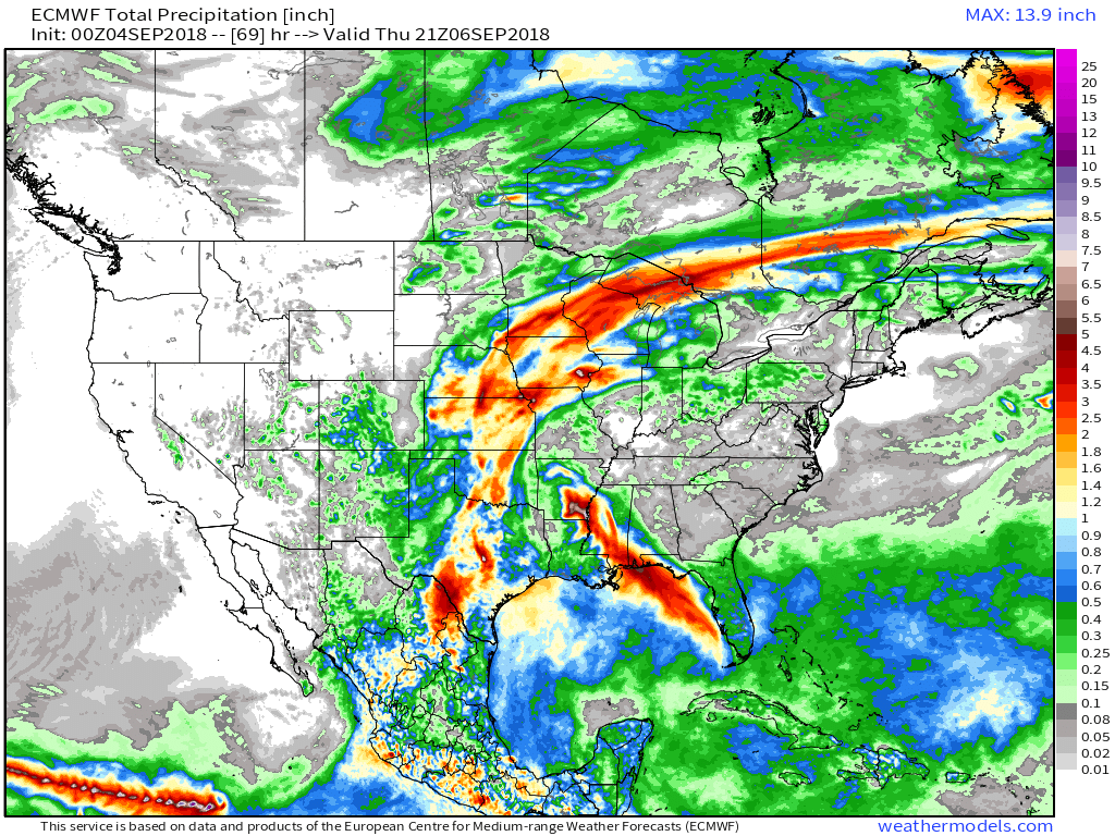
Now, this next graphic is through Sunday afternoon. The front sags south a bit and Gordon moves north/northeast.
There is a fairly sharp gradient on radar totals in our region. This seems likely. West and northwest counties could receive the most rain. Lesser totals as you move south and southeast.
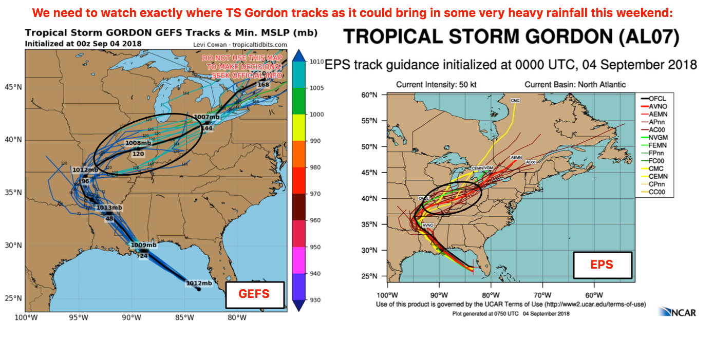
Here are two models. Both of these show the track of the center of Gordon.
The exact track isn’t as important as where lift occurs.
Model guidance has been taking the system into Arkansas and then Missouri.
This is close enough to our region that showers and thunderstorms will occur. The only question is coverage.
These will be tropical rains. Tropical rains are more efficient rain producers. I can rule out flash flooding in areas with training precipitation. Training means that the showers and thunderstorms move repeatedly over the same areas. This can enhance rain totals.
The highest rain totals are anticipated to be across southeast Missouri and southern Illinois. It is possible that some locations pick up an inch or two of rain (locally higher).
This is a model spaghetti plot. Each black line or line is one run of that particular model or models. Confidence increases when the lines agree with each other.
These are fairly tightly packed around a track into Arkansas and eventually turning north/northeast.
Click graphic to enlarge.
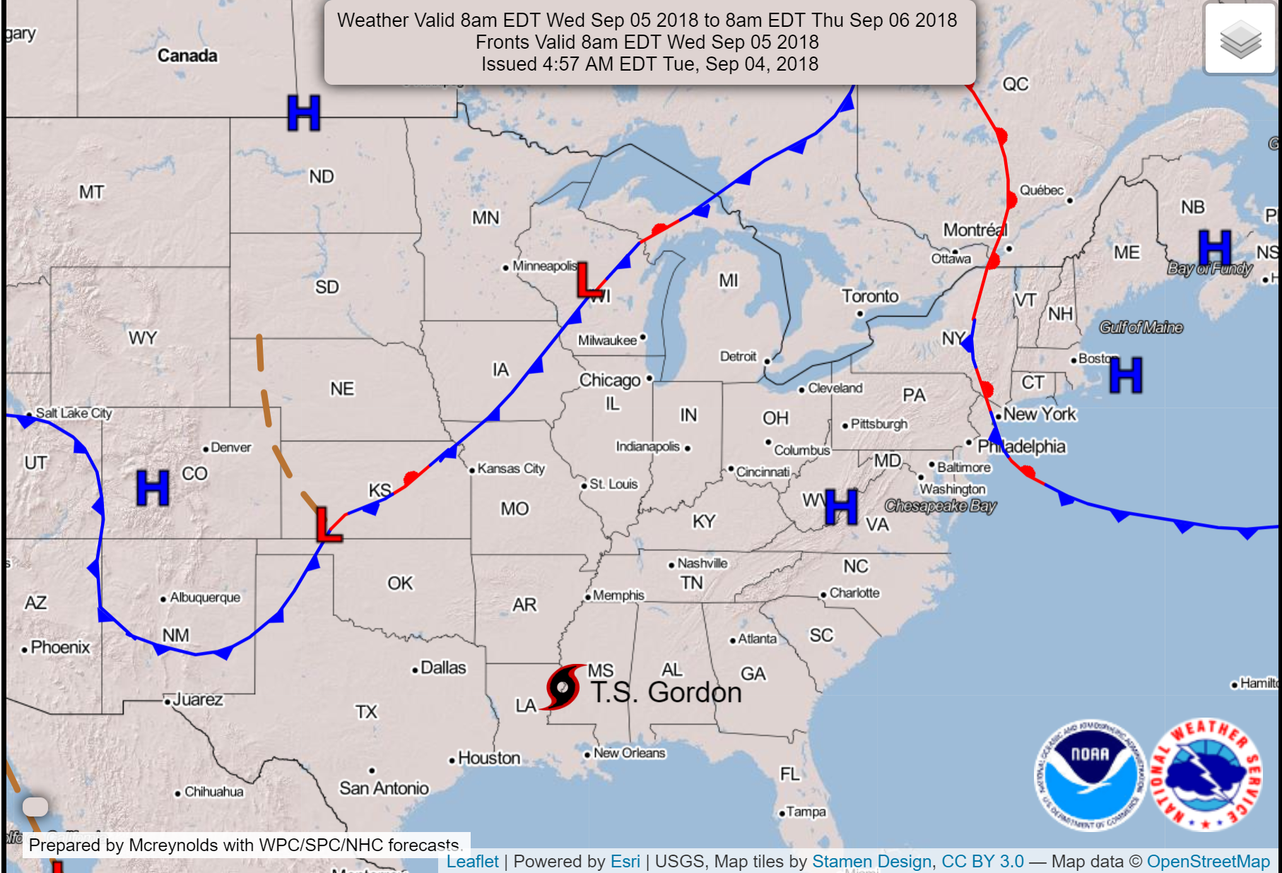
Part of our problem will be an incoming cold front. This front will push into the region from the north later this week.
You can see it here on this map.
This front will help focus the moisture from Gordon. As the front bumps into the warm and moist air, it will help produce precipitation.
Under the right conditions, this can lead to flash flooding. This will need to be monitored over the coming days.
Unsettled weather is likely from Wednesday night into at least Sunday.
Again, it appears the threat of severe weather is minimal. Occasionally, these tropical systems can produce brief tornadoes. This appears to be a low risk. I can’t rule out some tropical funnel clouds. These rarely touch down and are more of a novelty than anything.
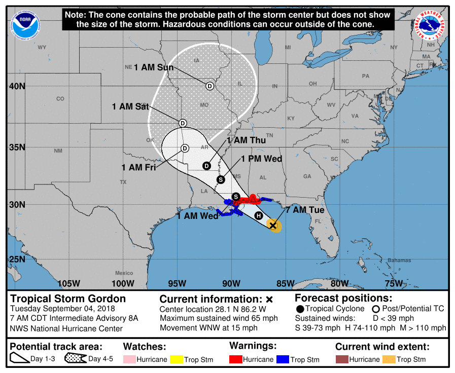
Here is the National Hurricane Center’s track forecast.
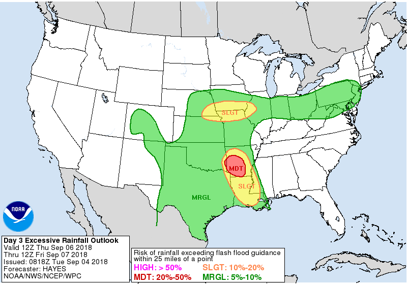
Today/tomorrow’s excessive rainfall outlook. Obviously, the track of Gordon is the cause of this.
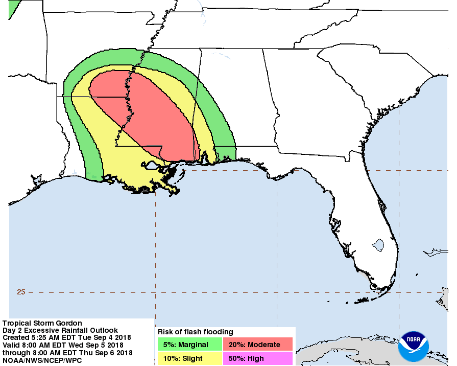
The WPC moves the excessive rainfall further north and west by Thursday.
I would not be surprised to see portions of our region placed in a marginal or slight risk later this week.
Basically, this just means some areas could see enough rain to cause flash flooding.
If you have outdoor plans Wednesday night into Sunday, then monitor updated forecasts. Adjustments are possible.
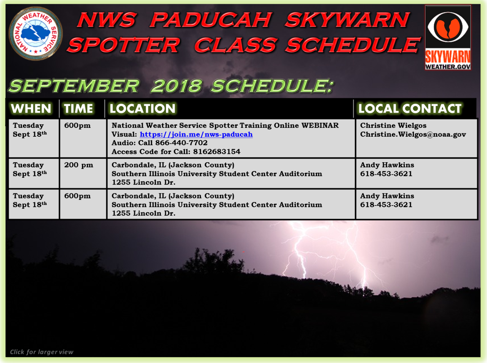
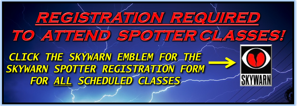
Spotter classes
![]()
Here is the preliminary fall outlook from the long range meteorology team.
Click to enlarge this graphic.
.
![]()
The September forecast has been updated.
These are bonus videos and maps for subscribers. I bring these to you from the BAMwx team. I pay them to help with videos.
The Ohio and Missouri Valley videos cover most of our area. They do not have a specific Tennessee Valley forecast but may add one in the future.
The long-range video is technical. Over time, you can learn a lot about meteorology from the long range video. Just keep in mind, it is a bit more technical.
NOTE: THESE ARE USUALLY NOT UPDATED ON SATURDAY OR SUNDAY.


![]()

I bring these to you from the BAMwx team. They are excellent long-range forecasters.
Remember, long-range outlooks are a bit of skill, understanding weather patterns, and luck combined. It is not an exact science.

This product is for subscribers.
Subscribe at www.weathertalk.com
Subscriber graphics can be viewed on this page CLICK HERE

This product is for subscribers.

Subscriber graphics can be viewed on this page CLICK HERE
![]()
.
First glance at fall!
Preliminary October precipitation outlook
Here is the preliminary November temperature and precipitation outlook
Preliminary November temperature outlook
Preliminary November precipitation outlook
.
![]()

![]()

A new weather podcast is now available! Weather Geeks (which you might remember is on The Weather Channel each Sunday)
To learn more visit their website. Click here.
![]()

WeatherBrains Episode 657
St Louis, Missouri, National Weather Association
This episode of WeatherBrains is coming directly from the NWA annual meeting in St. Louis, MO. Lots of discussion on various topics from the NWA conference. Joining us tonight from the meeting are Dr. John Scala, Bill Murray, Aubrey Urbanowicz, Scott Martin, James Spann, Greg Stumpf, Alis Smith, Kevin Laws (BHM), Fred Glass, Dr. Pam Heinselman (NSSL), and Dr. Chuck Graves (St. Louis University).
Other discussions in this weekly podcast include topics like:
- Extremes: 114 at Death Valley, CA, and 29 at Bodie State Park, CA
- Severe thunderstorm watches tonight North Central US
- MCS from MN into WI Monday night
- Severe weather stays north from Great Lakes to New England next 2 days
- One year anniversary of Hurricane Harvey
- 25th anniversary of 1993 Flood in St. Louis area
- and more!
Link to web-site https://weatherbrains.com/
Previous episodes can be viewed by clicking here.

We offer interactive local city live radars and regional radars. If a radar does not update then try another one. If a radar does not appear to be refreshing then hit Ctrl F5. You may also try restarting your browser.
The local city view radars also have clickable warnings.
During the winter months, you can track snow and ice by clicking the winterize button on the local city view interactive radars.
You may email me at beaudodson@usawx.com
Find me on Facebook!

Find me on Twitter!

Did you know that a portion of your monthly subscription helps support local charity projects?
You can learn more about those projects by visiting the Shadow Angel Foundation website and the Beau Dodson News website.

I encourage subscribers to use the app vs regular text messaging. We have found text messaging to be delayed during severe weather. The app typically will receive the messages instantly. I recommend people have three to four methods of receiving their severe weather information.
Remember, my app and text alerts are hand typed and not computer generated. You are being given personal attention during significant weather events.
