
November 9, 2014: This forecast update covers far southern Illinois, far southeast Missouri, and far western Kentucky. See the coverage map on the right side of the blog.
Sunday – Mostly sunny sky conditions – just a few periods of clouds from time to time. Below normal temperatures. Highs will be in the middle 50’s. Southwest winds at 5-10 mph.
Morning Church Services – Mostly sunny with temperatures in the upper 30’s. Southwest winds at 5 mph.
Evening Church Services – Just a few clouds. Temperatures by Sunday evening will be in the upper 40’s. Southwest winds at 5 mph.
Sunday night – A few clouds from time to time. Low temperatures in the upper 30’s and lower 40’s. Southwest winds at 5 mph.
Monday – A mix of sun and clouds. Warmer. High temperatures will be in the 60’s. Winds will pick up from the south at 10-20 mph.
Morning School Bus Stop Weather – Mostly sunny. Temperatures will be in the middle 40’s. South winds at 10 mph.
Afternoon School Bus Stop Weather – Just a few clouds. Temperatures will be in the lower 60’s. South winds at 10-20 mph.
Monday night – Increasing clouds. A few showers possible. Low temperatures will be in the lower 50’s. South winds at 10-15 mph.

An explanation of what is happening in the atmosphere over the coming days.
A calm day across the region. Temperatures will remain below normal today. We will see temperatures rise a bit on Monday. This will be ahead of a cold front. Southerly winds will also pick up on Monday.
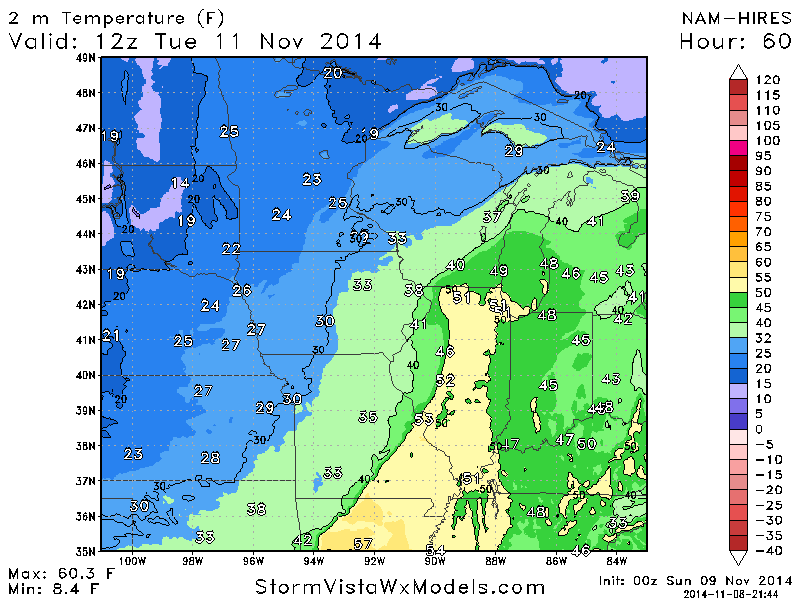
Rain showers will be possible along the cold front on Tuesday. Dramatic temperature changes as we move into Tuesday afternoon and Wednesday. Temperatures will feel more like January than the middle of November.
Here is the cold front Tuesday morning at 7 am. See the temperature shift over Missouri? There is your front. 55 degrees over the Missouri Bootheel and below freezing in Kansas City, Missouri.
Short update today. It is the weekend!
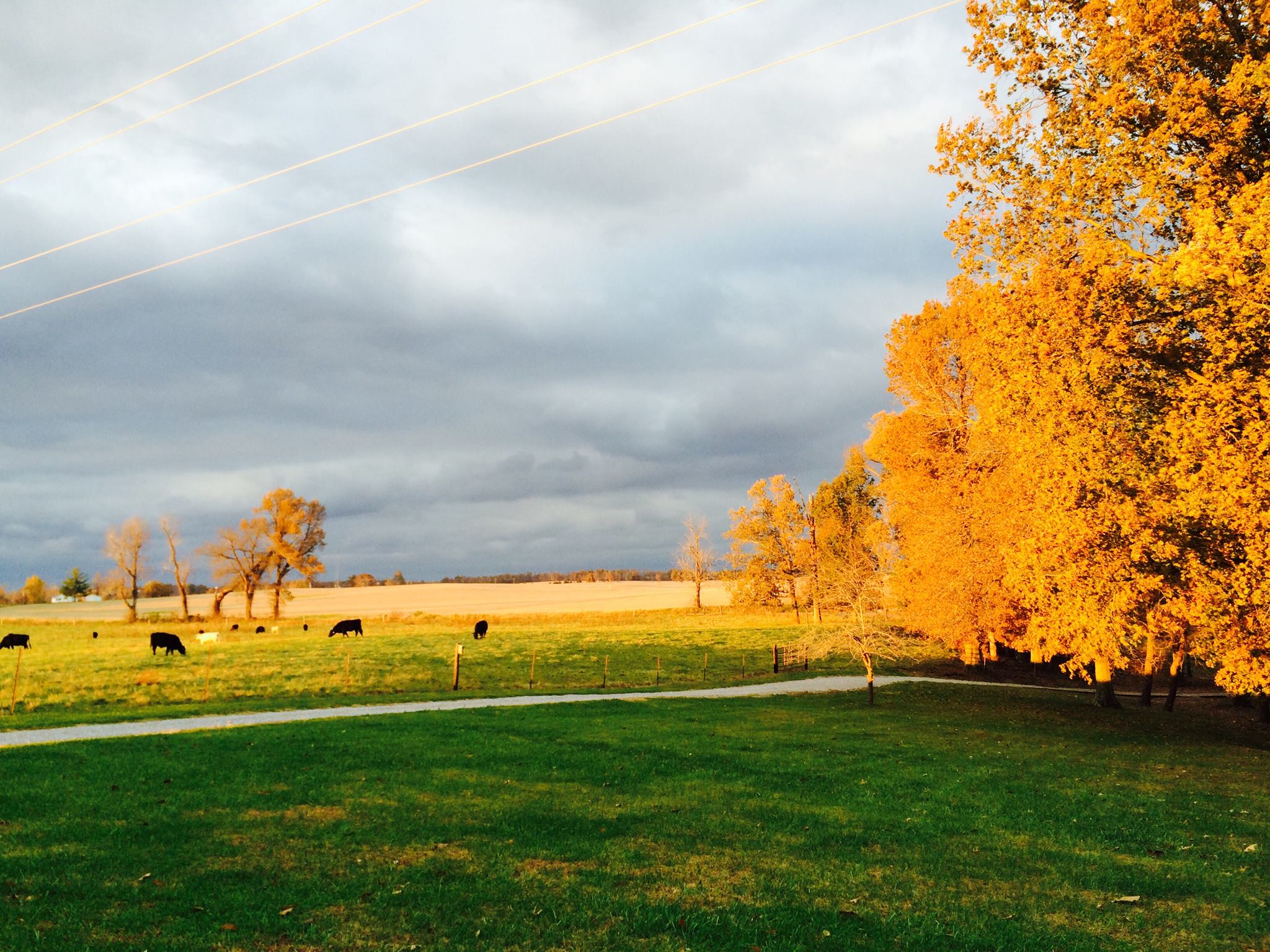
Great weather photo today from Natalie McPherson. Got to love the fall colors. Photograph taken in Crittenden Co, KY on Tabor Farms.


No major changes to the ongoing forecast.

No major concerns in the short range forecast. Cold weather arrives on Tuesday and will last into next weekend.

No winter weather concerns!

Cold air arrives Tuesday. WELL below normal temperatures on Wednesday into next weekend. Still some indications we may see some precipitation by next weekend. This is far from certain. The storm track may end up pretty far south. Just a wait and see at this point.
Short update today 🙂 – it is the weekend!

Please visit your local National Weather Service Office by clicking here. The National Weather Service Office, for our region, is located in Paducah, Kentucky.
Current tower cam view from the Weather Observatory- Click here for all cameras.

Southern Illinois Weather Observatory

The Weather Observatory

Southern Illinois Weather Observatory
WPSD TV 6 has a number of tower cameras. Click here for their tower camera page
& Kentucky Road Conditions & Kentucky Highway and Interstate Cameras

Downtown Paducah, Kentucky
Benton, Kentucky Tower Camera – Click here for full view

Benton, Kentucky
WSIL TV 3 has a number of tower cameras. Click here for their tower camera page
& Illinois Road Conditions

Marion, Illinois

You can sign up for my AWARE email by clicking here I typically send out AWARE emails before severe weather, winter storms, or other active weather situations. I do not email watches or warnings. The emails are a basic “heads up” concerning incoming weather conditions.