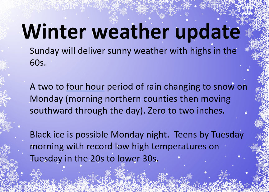
Overnight update
No change to the going forecast. I am sticking by my one to three inch forecast. Sleet changing to snow. Snow may be moderate to heavy briefly.
Some counties are not officially in the winter weather advisory but I believe most areas have some travel problems.
Icy road conditions overnight into Tuesday morning will be an issue.
Winds will gust over 30 mph tonight into the morning hours. That will mean wind chill temperatures in the single digits. Bundle up.
There will be numerous school closings.
The cold weather will last into Friday.
Bitterly cold Tuesday night. Low temperatures in the teens.
This is our seasons first winter storm. Use care on area roads. There will be numerous accidents.
Updated at 11 AM
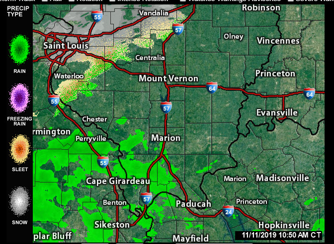
Radars are starting to show snow and ice developing. Ice = sleet.
Regional radar live link can be found here at the bottom
It is called the regional radar
http://weatherobservatory.com/weather-radar.htm
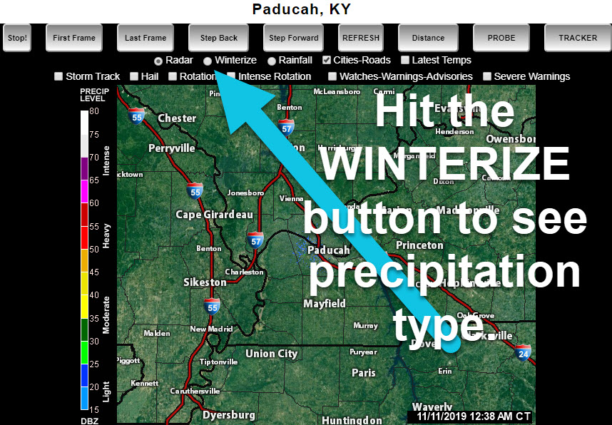
On the local city radars, you must click the winterize button above each radar to see precipitation type.
Link to all the local city radars
http://weatherobservatory.com/weather-radar.htm
If you are not a subscriber then you may subscribe at this link. WWW.WEATHERTALK.COM/WELCOME
Rain and snow tracking links below
One to three inches of snow possible. There is uncertainty about accumulation because of warm ground and road temperatures.
Future-cast radar
Green is rain. Blue is snow. Purple is sleet.
Time-stamp upper left.
This is a model. Use it as guidance. It won’t be perfect.

.
.
.

.
.
PRECIPITATION TRACKING TOOLS
Interactive city-view radars (city-view ones have a winterize button)
http://weatherobservatory.com/weather-radar.htm
Here is a backup site for the same radars
Current conditions (track the cold temperatures)
https://imagery.weathertalk.com/prx/CurrentConditions.png
Current wind chill temperature
https://imagery.weathertalk.com/prx/CurrentFeelsLike.png
Wind speed map
https://imagery.weathertalk.com/prx/CurrentWindSpeed.png
Wind gust map
https://imagery.weathertalk.com/prx/CurrentWindGust.png
A new regional radar we offer
Infrared satellite
Visible satellite
Don’t forget to subscribe to JP’s Traffic App, as well
https://jpstraffic.com/welcome
Beau Dodson Weather App!
WWW.WEATHERTALK.COM/WELCOME
Have you downloaded the Beau Dodson Weather app?
Move to the app and do not depend on the text messages.
The app receives the exact same messages but faster.
ATT and Verizon have been throttling the speed of texts.
The app receives them instantly.
Apple users: Beau Dodson Weather App
https://itunes.apple.com/us/app/id1190136514
Android users: Beau Dodson Weather App
https://play.google.com/store/apps/details?id=com.weathertalk.beaudodsonweather.android
Updated at 4 PM
It is possible that a burst of snow tomorrow could put down an inch or two of snow.
Confidence in accumulation is lower than normal because of warm ground conditions.
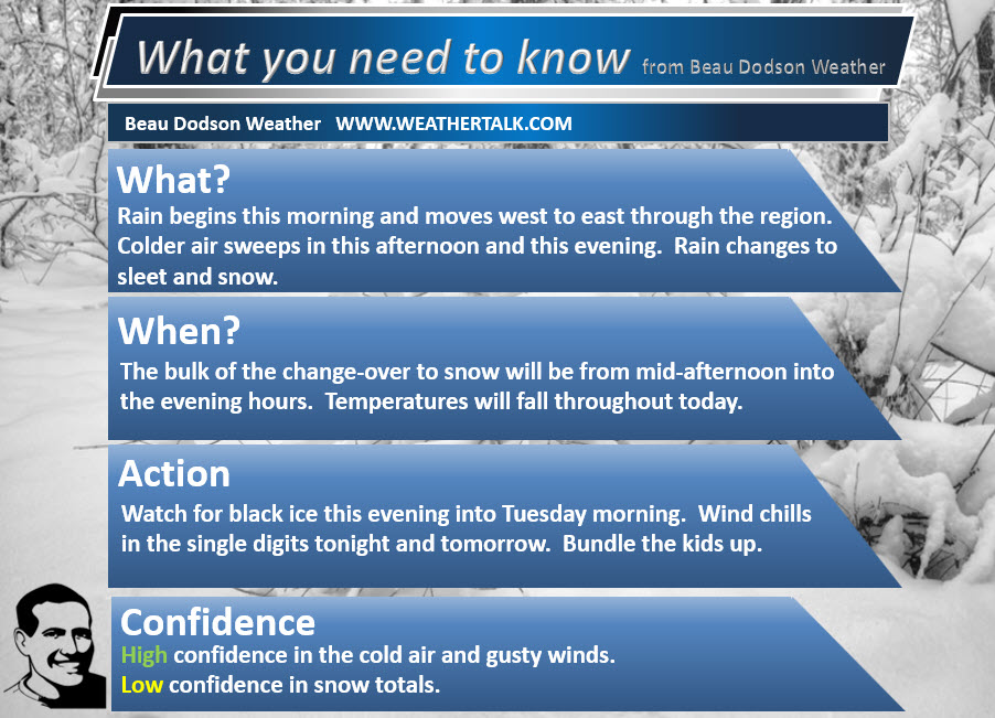
Either way, the main concern will be black ice or icy patches on roadways late Monday into Tuesday morning.
Use caution.
Temperatures will rapidly fall into the 20s behind the cold front.
Updated at 11:15 AM
If you are not a subscriber then you may subscribe at this link. WWW.WEATHERTALK.COM/WELCOME
I just sent this blog update out to my app subscribers. Be sure and turn on the social media option for severe weather and winter weather.
.
** I am in Italy today. I have been updating the blog and Facebook **
.
I have abbreviated the WeatherTalk blog. I have covered all of the important elements of the upcoming cold wave.
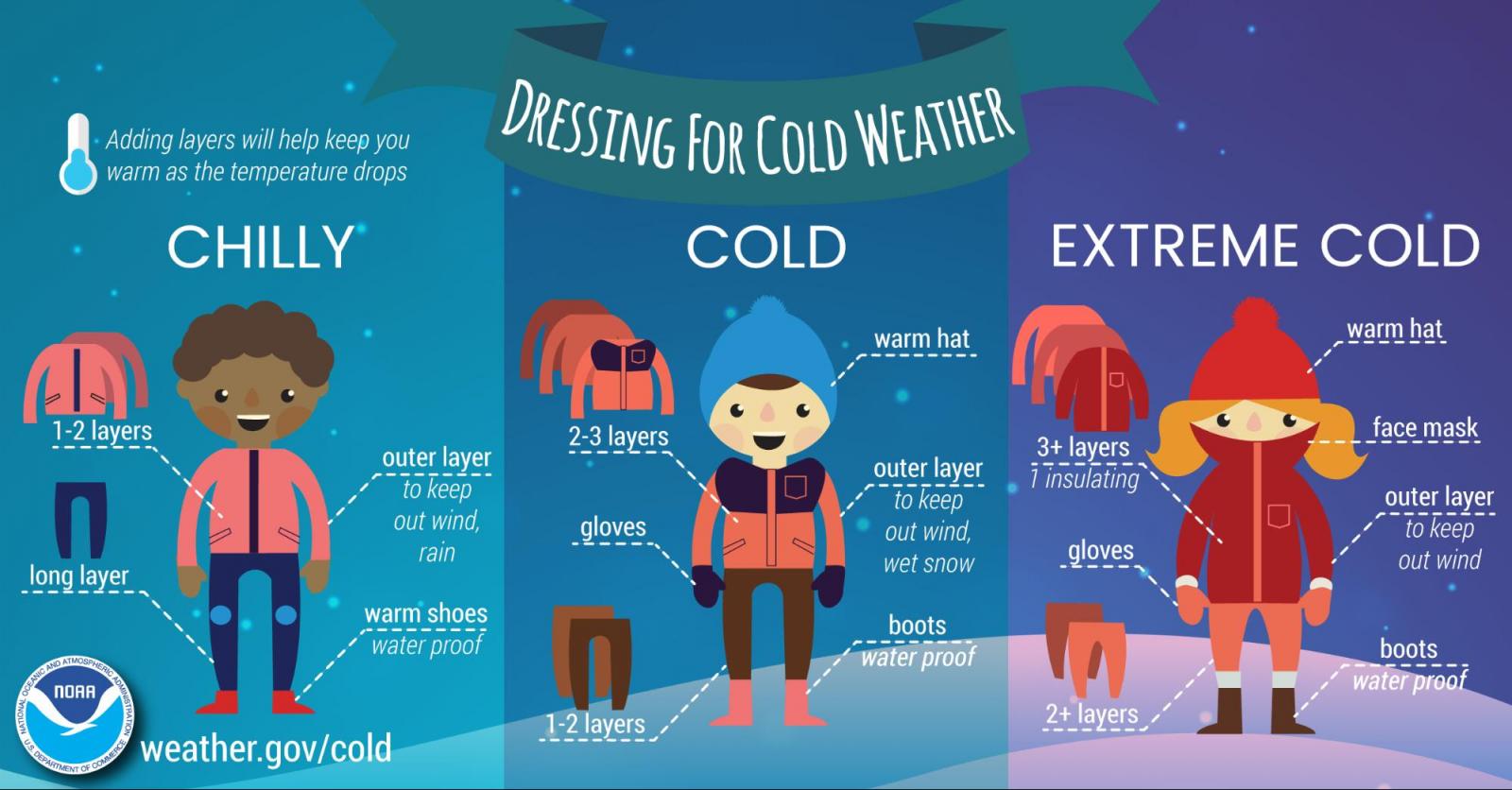
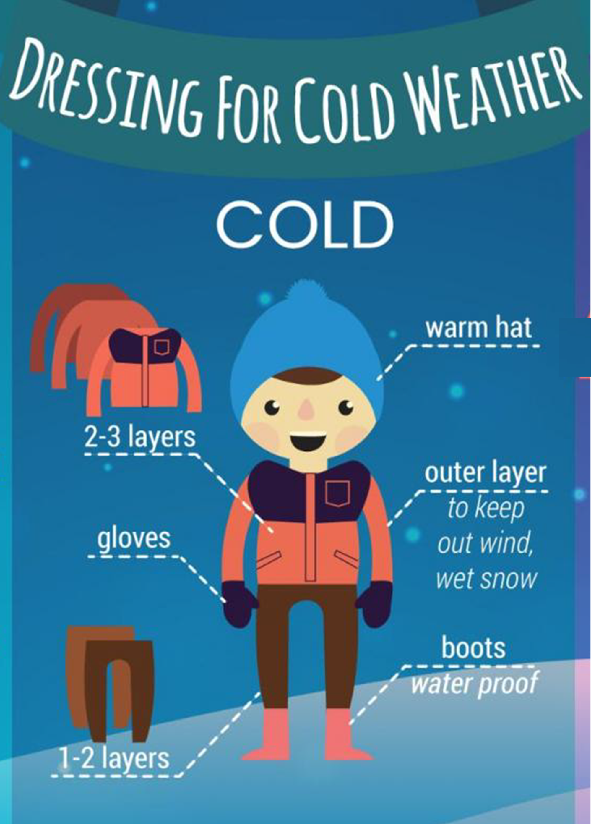
** I added some information for teachers and parents **
.
I realize that most people know how to dress their children. With that said, I have had teachers tell me that new people move to our region from the Gulf Coast region. They do not know how to prepare for this type of cold weather.
There are also widespread issues with children not having coats or gloves. I know many teachers that try to help remedy this situation on bitterly cold days. Thus, I added some information for them.
.
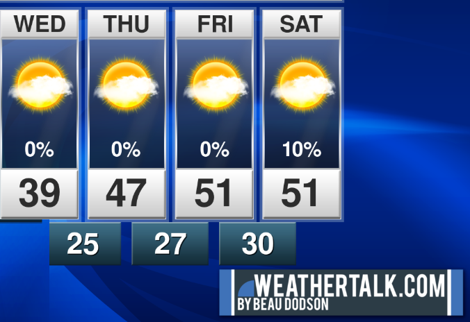
A quick Sunday update. The forecast is on track.
Forecast details…
Sunday night Forecast: Increasing clouds overnight. A chance of late night showers over southeast Missouri and southern Illinois. Lesser chances over Kentucky and Tennessee. Coldest temperatures over northern parts of southeast Missouri and northern portions of southern Illinois.
What is the chance of precipitation? MO ~ 30% IL ~ 30% KY ~ 20% TN ~ 20%
How confident am I that this forecast will verify: Medium (40% confidence in the forecast)
Temperature range: MO Bootheel 38° to 44° SE MO 34° to 42° South IL 34° to 42° Northwest KY (near Indiana border) 38° to 42° West KY 40° to 44° NW TN 40° to 44°
Wind direction and speed: South wind 5 to 10 mph. Wind becoming northwest over northern portions of southeast Missouri and northern portions of southern Illinois late tonight. Winds there will increase to 8 to 16 mph and gusty.
Wind chill or heat index (feels like) temperature forecast: 30° to 40°
Coverage of precipitation: Widely scattered over southeast Missouri and southern Illinois.
What impacts are anticipated from the weather? Wet roadways late tonight.
What action is required: None.
Should I cancel my outdoor plans? No
Sunset: 4:48 PM
Moonrise: 4:12 PM
The phase of the moon: Waxing Gibbous
Moonset: 4:25 AM
.
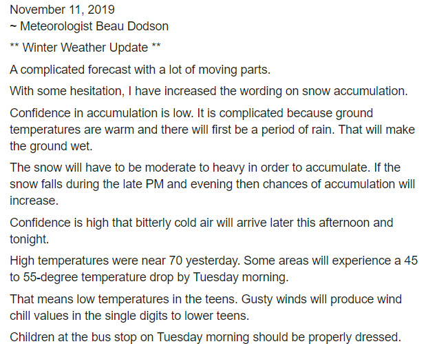
November 11, 2019
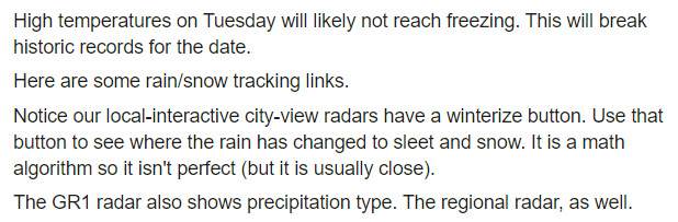
Monday’s Forecast: Cloudy with rain developing from west to east across the region. Turning sharply colder as the cold front moves east/southeast. Temperatures falling during the day. Rain changing to sleet and snow from west to east. Windy. Snow accumulation Monday into Monday night of 0″ to 3″. Black ice may form late in the afternoon and into the overnight hours.
What is the chance of precipitation? MO ~ 80% IL ~ 90% KY ~ 100% TN ~ 100%
How confident am I that this forecast will verify: High (70% confidence in the forecast)
Temperature range: MO Bootheel 36° to 40° SE MO 36° to 40° South IL 35° to 40° Northwest KY (near Indiana border) 36° to 40° West KY 36° to 40° NW TN 38° to 42°
Wind direction and speed: North 10 to 20 mph with gusts to 25 mph.
Wind chill or heat index (feels like) temperature forecast: 15° to 35°
Coverage of precipitation: Numerous.
What impacts are anticipated from the weather? Wet roadways. Monitor afternoon temperatures. Black ice is possible.
What action is required: Slow your vehicle down on wet roadways. Monitor the chance of black ice forming late in the day and into the overnight hours.
Should I cancel my outdoor plans? Have a plan B.
UV Index: 2 Low.
Sunrise: 6:30 AM
.
Monday night Forecast: Cloudy early. A chance of snow and sleet in the evening. Rain is possible over our eastern counties. Changing to sleet and snow. Sharply colder. Bitterly cold wind chills will dip into the single digits late Monday night. Gusty winds. Black ice possible if moisture remains on roadways. Total snow accumulation of 1″ to 3″. There is some concern that ground temperatures are too warm for much accumulation. Either way, the main concern will be black ice and some icy patches on roadways, sidewalks, and parking lots.
What is the chance of precipitation? MO ~ 30% IL ~ 50% KY ~ 60% TN ~ 60%
How confident am I that this forecast will verify: Medium (60% confidence in the forecast)
Temperature range: MO Bootheel 16° to 20° SE MO 14° to 18° South IL 14° to 18° Northwest KY (near Indiana border) 15° to 20° West KY 15° to 20° NW TN 15° to 20°
Wind direction and speed: North to northwest 15 to 20 mph with gusts to 30 mph.
Wind chill or heat index (feels like) temperature forecast: 5° to 10°
Coverage of precipitation: Ending west to east.
What impacts are anticipated from the weather? Slick roads if snow or black ice develops.
What action is required: Black ice is possible. Use care on bridges, sidewalks, and parking lots. Bitterly cold wind chills will require layered clothing.
Should I cancel my outdoor plans? Have a plan B.
Sunset: 4:48 PM
Moonrise: 4:41 PM
The phase of the moon: Waxing Gibbous
Moonset: 5:24 AM
.
Tuesday: High confidence. Low wind chill values. Wind chill 5 to 10 degrees above zero. Mostly sunny. Sharply colder. High 25 to 30. Wind chill Tuesday morning of 5 to 10. Tuesday night: Mostly clear and cold. Low 15 to 20. Locally colder. Northwest wind 8 to 16 mph.
.
.
Today’s analysis and updated comments.
.
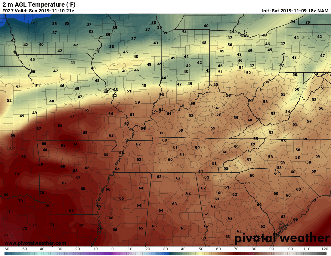
We will have high temperatures in the sixties today. Hard to believe we are about to experience a sharp intrusion of cold air.
Highs on Tuesday may not get out of the twenties across most of the area.
Some areas will experience a 40 to 50 degree temperature drop from Sunday’s highs to Tuesday mornings low. Quite amazing.
Wind chill values Monday night and Tuesday in the 5 to 10 degree range. Wind chill values on Wednesday morning in the teens.
Rain changing to snow is likely on Monday. Perhaps a little sleet mixed in, as well.
.
Details.
Sunday temperature graphic (below). Quite the change on the way.
Temperatures will be thirty degrees below average by Tuesday morning!
.
Here is the 6 AM Monday to 6 AM Tuesday temperature change. How many degrees colder will it be?

.
We will have a mixture of rain and snow on Monday moving northwest to southeast.
The precipitation will last into the afternoon and perhaps the evening hours (esp our eastern counties). It will end west to east through the late afternoon and evening hours. Black ice is likely to be an issue in some areas. See the black ice graphic.
Snowfall totals of 0″ to 2″ will be possible.
.
Here are the Sunday temperatures. Upper 50s to middle 60s in the region.
.
.
.
.
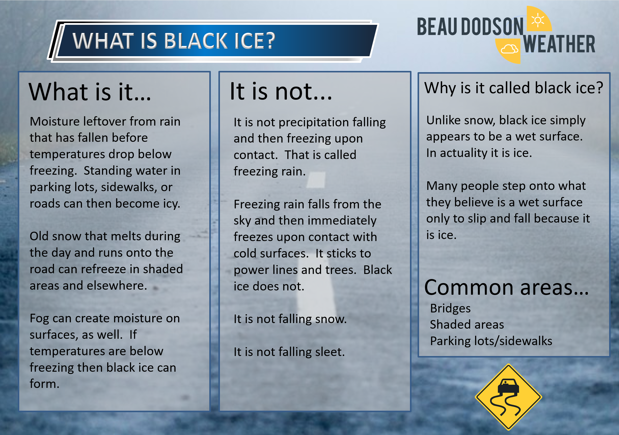
What is black ice? Click to enlarge the graphics.
.
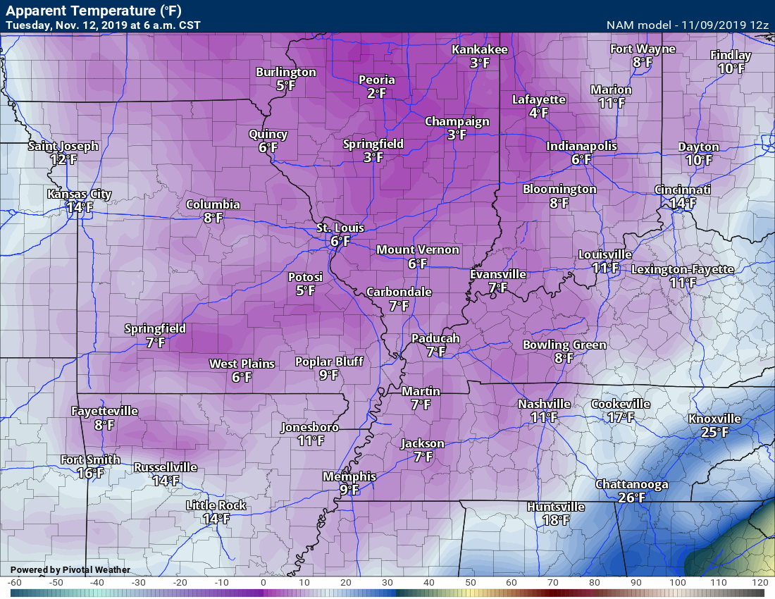
6 AM Tuesday wind chill values.
.
9 AM Tuesday wind chill values.

.
.Let me throw in some probability graphics.
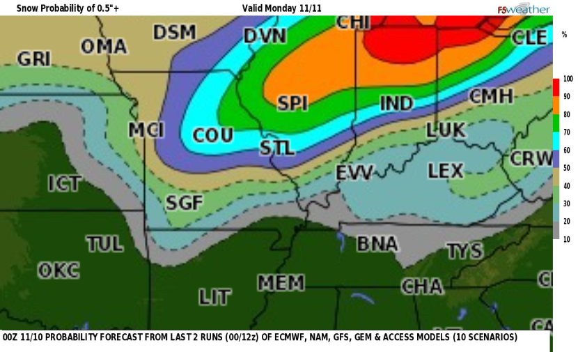
This is the chance of 0.5″ of snow on Monday. This particular model blend shows low chances.
I actually think the chance may be higher than this. We will see. Again, let’s focus on the black ice concern as temperatures rapidly fall behind the cold front.
This takes us into Monday morning. The second graphic takes us into the afternoon and overnight hours.
.
This is the chance of 0.5″ of snow and it takes use through Monday afternoon and night.
As you can see, the chances are a bit higher during that time frame.

.
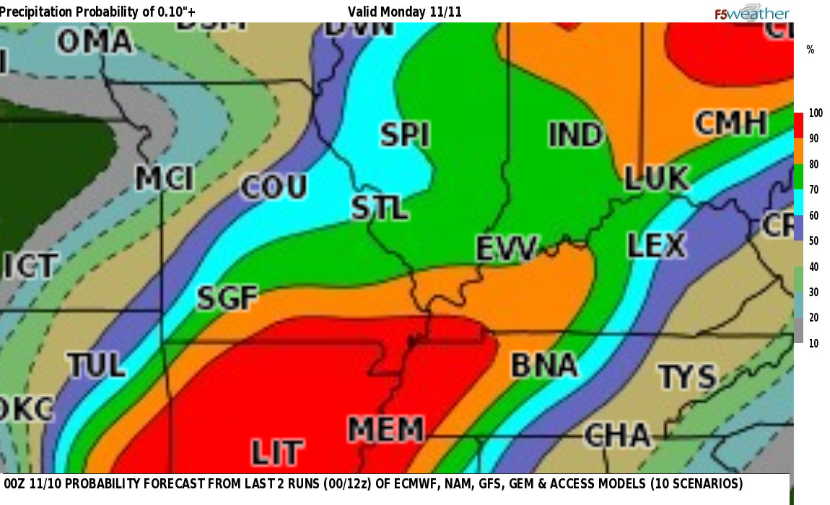
What is the chance of at least 0.10″ of liquid precipitation (melted).
.
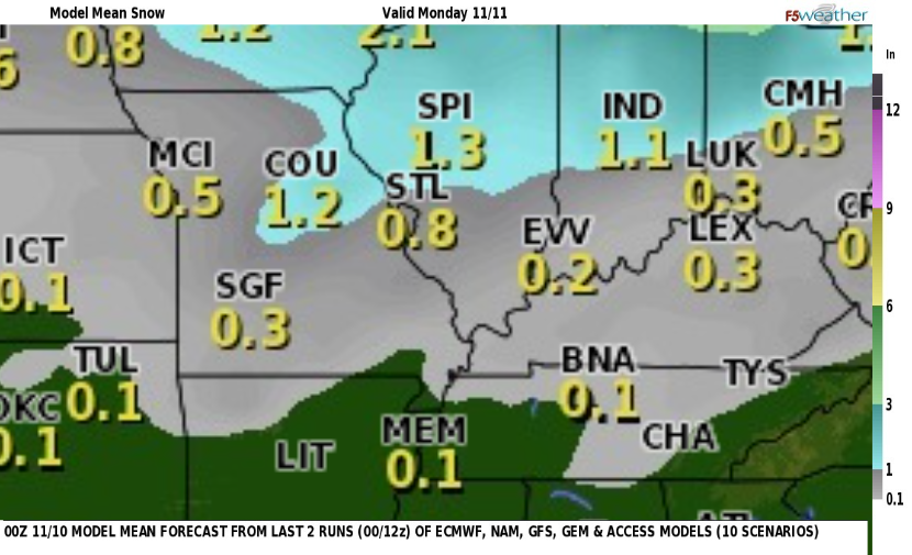
Here is the model blend. This is the mean snow totals. That means it is combined with all of the models. These are the numbers
that the models are spitting out.
As you can see, perhaps some light accumulation locally.
.
My forecast is for 1″ to 3″ of snow.
.
Let’s look at some future-cast models.
Please do not focus on snow totals. Yes, it may snow. There could even be a burst of heavy snow. Ground temperatures are not that cold. It will take time for ground temperatures to cool.
If the snow burst is heavy enough then there may be some light accumulation.
I am more concerned about black ice (as mentioned above).
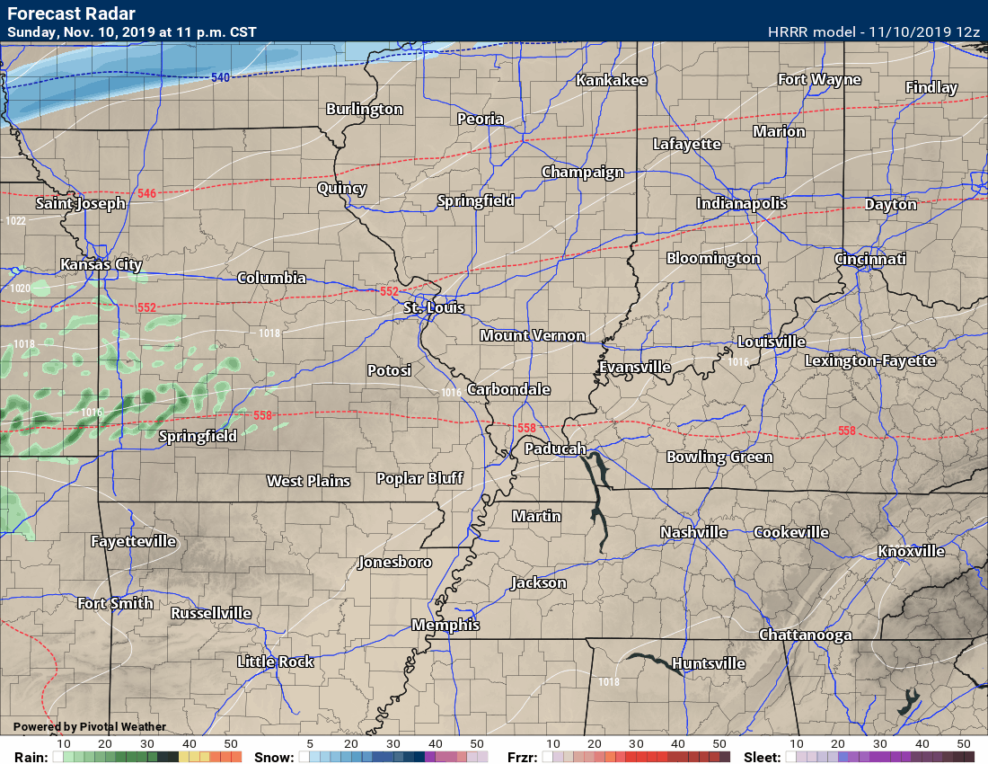
The Hrrr high-resolution model.
Green is rain. Blue is snow. Purple is a wintry mix of snow and sleet.
Time-stamp upper left (this goes for all the animations below).
.
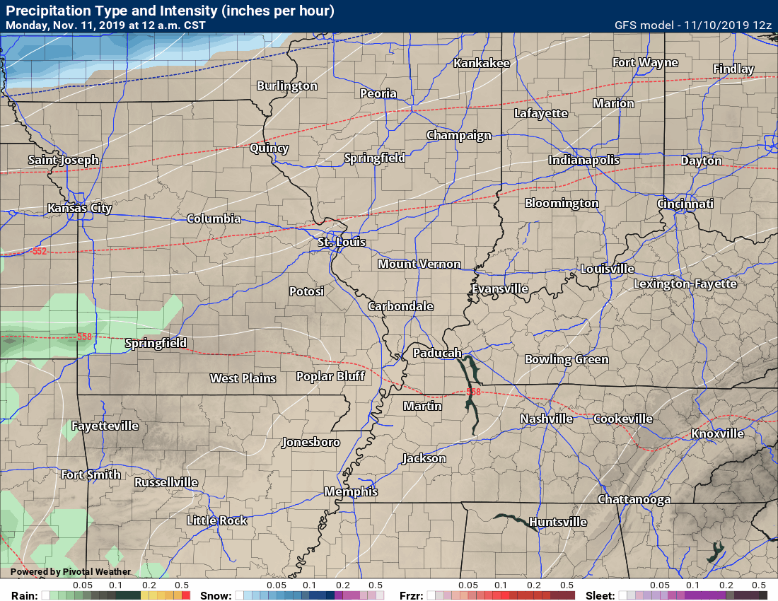
This is the lower-resolution GFS model.
.
the BAMwx team has posted this video for Illinois and touches on Ohio Valley.
.
.

Radar Link: Interactive local city-view radars & regional radars.
You will find clickable warning and advisory buttons on the local city-view radars.
If the radar is not updating then try another one. If a radar does not appear to be refreshing then hit Ctrl F5. You may also try restarting your browser.
Not working? Email me at beaudodson@usawx.com
National map of weather watches and warnings. Click here.
Storm Prediction Center. Click here.
Weather Prediction Center. Click here.
.

Live lightning data: Click here.
.

Interactive GOES R satellite. Track clouds. Click here.
GOES 16 slider tool. Click here.
College of Dupage satellites. Click here
.

Here are the latest local river stage forecast numbers Click Here.
Here are the latest lake stage forecast numbers for Kentucky Lake and Lake Barkley Click Here.
.
Did you know that you can find me on Twitter? Click here to view my Twitter weather account.

.

.
Who do you trust for your weather information and who holds them accountable?
I have studied the weather in our region since the late 1970s. I have 40 years of experience in observing our regions weather patterns.
My degree is in Broadcast Meteorology from Mississippi State University and a Bachelor of Science (BS).
I am an NOAA Weather-Ready Nation Ambassador. I am the Meteorologist for McCracken County rescue squad. When asked, I assist Ballard and Massac Counties, as well.
I own and operate the Southern Illinois Weather Observatory and WeatherTalk LLC.
There is a lot of noise on the internet. Over time you should learn who to trust for your weather information.
My forecast philosophy is simple and straight forward.
- Communicate in simple terms
- To be as accurate as possible within a reasonable time frame before an event
- Interact with you on Twitter, Facebook, and the blog
- Minimize the “hype” that you might see on television or through other weather sources
- Push you towards utilizing wall-to-wall LOCAL TV coverage during severe weather events
I am a recipient of the Mark Trail Award, WPSD Six Who Make A Difference Award, Kentucky Colonel, and the Caesar J. Fiamma” Award from the American Red Cross.
In 2009 I was presented with the Kentucky Office of Highway Safety Award.
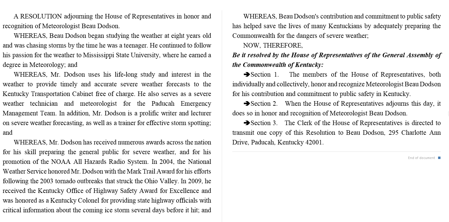
I was recognized by the Kentucky House of Representatives for my service to the State of Kentucky leading up to several winter storms and severe weather outbreaks.
If you click on the image below you can read the Kentucky House of Representatives Resolution.
.
.
Find Beau on Facebook! Click the banner.

.
Find Beau on Twitter! Share your weather photos! @beaudodson

.
Did you know that a portion of your monthly subscription helps support local charity projects? Not a subscriber? Becoming one at www.weathertalk.com
You can learn more about those projects by visiting the Shadow Angel Foundation website and the Beau Dodson News website.
