.
January 13, 2018
Saturday Forecast Details
Forecast: A mix of sun and clouds. Cold. Breezy during the morning.
Temperatures: MO ~ 22 to 26 IL ~ 22 to 25 KY ~ 22 to 25
What is the chance of precipitation? MO ~ 10% IL ~ 10% KY ~ 10% TN ~ 10%
Coverage of precipitation: Most likely none.
Wind chill values: 5 to 15 degrees
Accumulating snow or ice: No
Winds: North at 10 to 15 mph with gusts before 12 pm in the 20 to 25 mph range.
What impacts are anticipated from the weather? Icy roads will remain. Low wind chill values.
My confidence in the forecast verifying: High
Is severe weather expected? No
The NWS defines severe weather as 58 mph wind or great, 1″ hail or larger, and/or tornadoes
Should I cancel my outdoor plans? Have a plan B
.
Saturday Night Forecast Details:
Forecast: Mostly clear. A few clouds. Bitterly cold. Temperatures will vary based on snow and ice cover.
Temperatures: MO ~ 5 to 10 IL ~ 4 below to 5 above KY ~ 5 below to 6 above
What is the chance of precipitation? MO ~ 0% IL ~ 0% KY ~ 0% TN ~ 0%
Coverage of precipitation: Most likely none. Small chance of flurries.
Wind chill values: -5 to 5
Accumulating snow or ice: No
Winds: North at 6 to 12 mph
What impacts are anticipated from the weather? Icy roads will remain. Low wind chill values.
My confidence in the forecast verifying: High
Is severe weather expected? No
The NWS defines severe weather as 58 mph wind or great, 1″ hail or larger, and/or tornadoes
Should I cancel my outdoor plans: Have a plan B
.
January 14, 2018
Sunday Forecast Details
Forecast: Partly to occasionally mostly cloudy. Cold. Snow flurries or snow showers possible. Little or no accumulation.
Temperatures: MO ~ 20 to 25 IL ~ 18 to 24 KY ~ 18 to 24
What is the chance of precipitation? MO ~ 20% IL ~ 20% KY ~ 20% TN ~ 20%
Coverage of precipitation: Spotty snow showers possible.
Wind chill values: -8 to 8 above during the morning. 8 to 16 during the afternoon.
Accumulating snow or ice: Most likely no
Winds: North at 10 to 15 mph
What impacts are anticipated from the weather? Icy roads will remain. Low wind chill values.n
My confidence in the forecast verifying: Medium
Is severe weather expected? No
The NWS defines severe weather as 58 mph wind or great, 1″ hail or larger, and/or tornadoes
Should I cancel my outdoor plans? Have a plan B
.
Sunday Night Forecast Details:
Forecast: Quite a few clouds. Snow flurries possible.
Temperatures: MO ~ 18 to 24 IL ~ 16 to 22 KY ~ 16 to 22
What is the chance of precipitation? MO ~ 10% IL ~ 10% KY ~ 10% TN ~ 10%
Coverage of precipitation: Scattered flurries
Wind chill values: 8 to 16
Accumulating snow or ice: Monitor
Winds: Variable at 5 to 10 mph
What impacts are anticipated from the weather? Roads may still be icy
My confidence in the forecast verifying: Medium
Is severe weather expected? No
The NWS defines severe weather as 58 mph wind or great, 1″ hail or larger, and/or tornadoes
Should I cancel my outdoor plans: Have a plan B
.
January 15, 2018
Monday Forecast Details
Winter weather alert for late morning into the evening hours. Snow likely.
Forecast: Increasing clouds. Cold. A band of snow developing from the north. Snow may be mixed with sleet or rain near the KY/TN border and across the Missouri Bootheel. Most likely time period would be after 11 am. I will need to fine tune that part of the forecast. Some accumulation possible.
Temperatures: MO ~ 32 to 36 IL ~ 28 to 34 KY ~ 28 to 24
What is the chance of precipitation? MO ~ 40% IL ~ 70% KY ~ 60% TN ~ 50%
Coverage of precipitation: A band of precipitation possible moving north to south.
Wind chill values: 18 to 24
Accumulating snow or ice: Yes. One to three inches of snow will be possible.
Winds: Variable at 8 to 16 becoming north at 10 to 20 mph and gusty
What impacts are anticipated from the weather? Icy roads possible. Blowing snow possible late.
My confidence in the forecast verifying: Medium
Is severe weather expected? No
The NWS defines severe weather as 58 mph wind or great, 1″ hail or larger, and/or tornadoes
Should I cancel my outdoor plans? Have a plan B
.
Monday Night Forecast Details:
Winter weather alert for the evening hours. Snow possible early.
Wind chill alert for the overnight hours into Tuesday morning
Forecast: Cloudy with snow showers possible. Bitterly cold. Blowing snow possible.
Temperatures: MO ~ 3 to 8 IL ~ 2 below to 6 above KY ~ 2 below to 8 above
What is the chance of precipitation? MO ~ 30% IL ~ 40% KY ~ 50% early TN ~ 50% early
Coverage of precipitation: Scattered early
Wind chill values: -12 to 8 above
Accumulating snow or ice: Yes, but ending
Winds: North at 10 to 20 mph. Gusty winds.
What impacts are anticipated from the weather? Icy roads possible. Bitterly cold air. Low wind chill values. Blowing snow possible.
My confidence in the forecast verifying: Medium
Is severe weather expected? No
The NWS defines severe weather as 58 mph wind or great, 1″ hail or larger, and/or tornadoes
Should I cancel my outdoor plans: Have a plan B
.
January 16, 2018
Tuesday Forecast Details
Wind chill alert
Tuesday morning
Forecast: Partly cloudy. Bitterly cold.
Temperatures: MO ~ 15 to 20 IL ~ 14 to 18 KY ~ 14 to 18
What is the chance of precipitation? MO ~ 10% IL ~ 10% KY ~ 10% TN ~ 10%
Coverage of precipitation: Most likely none
Wind chill values: -10 to 10
Accumulating snow or ice: No
Winds: North at 10 to 15 mph
What impacts are anticipated from the weather? Icy roads possible. Bitterly cold air. Low wind chill values.
My confidence in the forecast verifying: Medium
Is severe weather expected? No
The NWS defines severe weather as 58 mph wind or great, 1″ hail or larger, and/or tornadoes
Should I cancel my outdoor plans? Have a plan B
.
Tuesday Night Forecast Details:
Wind chill alert
Forecast: Mostly clear. Bitterly cold.
Temperatures: MO ~ 0 to 6 IL ~ 3 below to 6 above KY ~ 4 below to 6 above
What is the chance of precipitation? MO ~ 0% IL ~ 0% KY ~ 0% TN ~ 0%
Coverage of precipitation: None
Wind chill values: -10 to 10
Accumulating snow or ice: No
Winds: North at 5 to 10 mph
What impacts are anticipated from the weather? Icy roads possible. Bitterly cold air. Low wind chill values.
My confidence in the forecast verifying: Medium
Is severe weather expected? No
The NWS defines severe weather as 58 mph wind or great, 1″ hail or larger, and/or tornadoes
Should I cancel my outdoor plans: Have a plan B
.
January 17, 2018
Wednesday Forecast Details
Wind chill alert Wednesday morning
Forecast: Partly cloudy. Bitterly cold.
Temperatures: MO ~ 16 to 24 IL ~ 16 to 24 KY ~ 16 to 24
What is the chance of precipitation? MO ~ 0% IL ~ 0% KY ~ 0% TN ~ 0%
Coverage of precipitation: Most likely none
Wind chill values: -5 to 12
Accumulating snow or ice: No
Winds: North at 10 to 15 mph
What impacts are anticipated from the weather? Low wind chill values.
My confidence in the forecast verifying: Medium
Is severe weather expected? No
The NWS defines severe weather as 58 mph wind or great, 1″ hail or larger, and/or tornadoes
Should I cancel my outdoor plans? Have a plan B
.
Wednesday Night Forecast Details:
Forecast: Mostly clear. Bitterly cold.
Temperatures: MO ~ 6 to 10 IL ~ 4 to 8 KY ~ 5 to 10
What is the chance of precipitation? MO ~ 0% IL ~ 0% KY ~ 0% TN ~ 0%
Coverage of precipitation: None
Wind chill values: -8 to 12
Accumulating snow or ice: No
Winds: North at 5 to 10 mph
What impacts are anticipated from the weather? Low wind chill values.
My confidence in the forecast verifying: Medium
Is severe weather expected? No
The NWS defines severe weather as 58 mph wind or great, 1″ hail or larger, and/or tornadoes
Should I cancel my outdoor plans: Have a plan B
.

.
Saturday through Monday night: Flurries are possible from time to time into Sunday night. No accumulation. Most areas will remain dry.
Bitterly cold temperatures will continue.
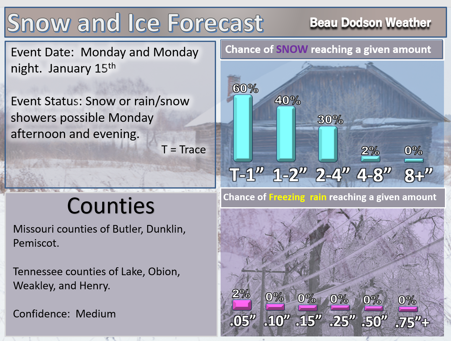
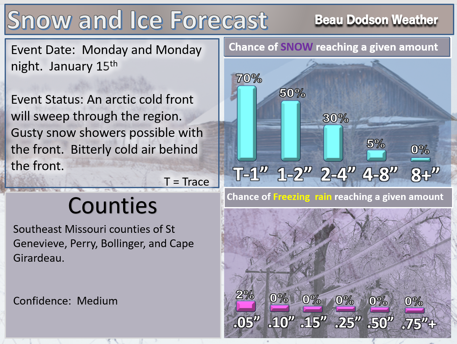
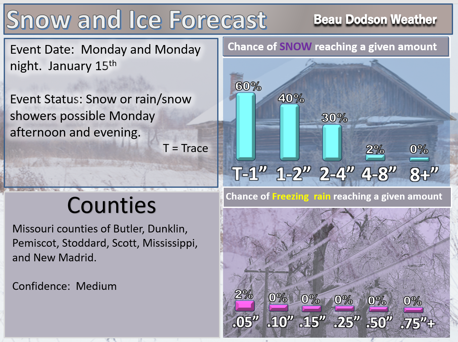
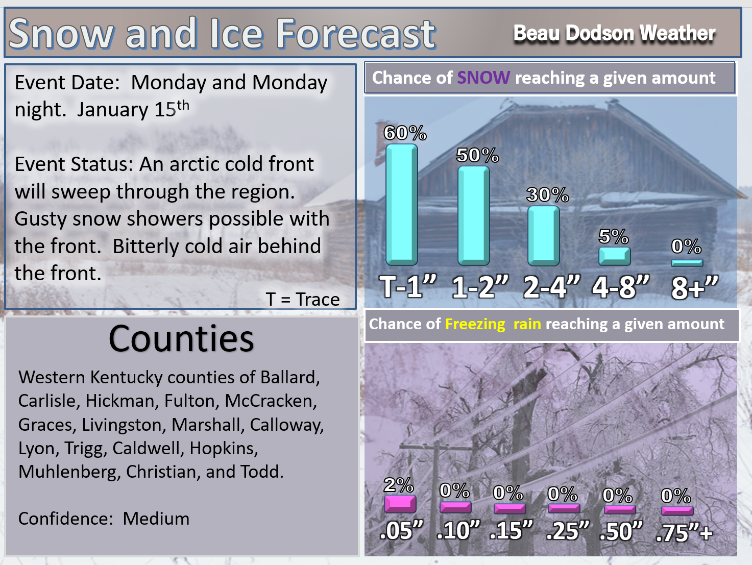
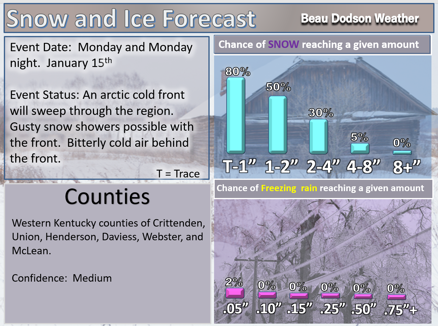
Another strong cold front sweeps through the region on Monday and Monday night. A band of gusty snow showers will accompany the front. One to two inches of snow will be possible. I can’t rule out a few reports of two to three inches. This will compound the hazardous road conditions. Some school closings are likely on Tuesday.
Tuesday through Friday: At this time, winter precipitation appears unlikely.
.

.
The National Weather Service definition of a severe thunderstorm is one that produces quarter size hail or larger, 58 mph winds or greater, and/or a tornado.
Now through next Saturday: Severe storms are not anticipated.
.

Interactive Weather Radar Page. Choose the city nearest your location: Click this link
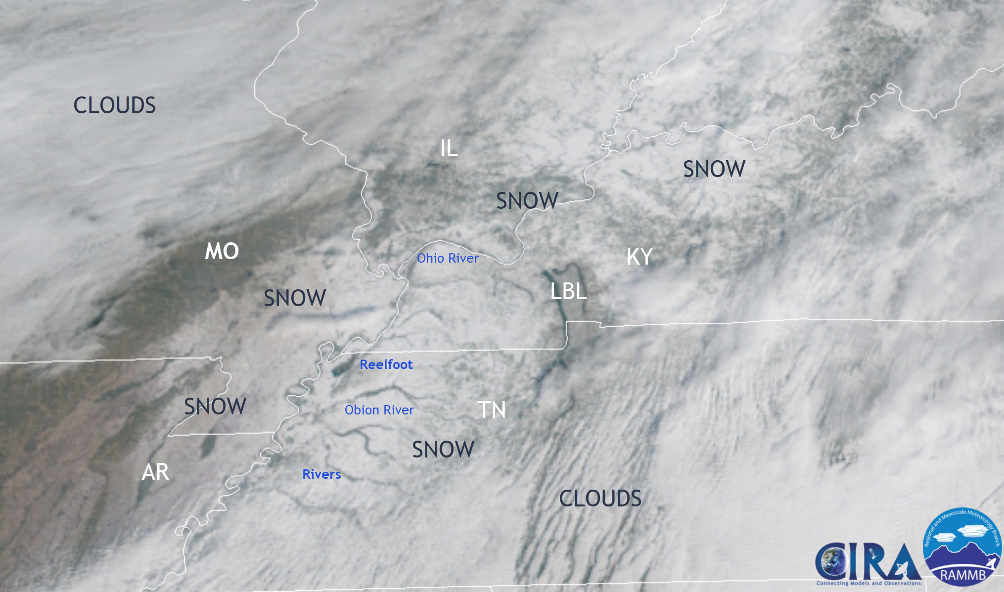
Check out the GOES 16 satellite imagery from Saturday morning. You can see the snow across our region.
Click to enlarge
.
.
The big weather story over the coming days will be the bitterly cold air temperatures, even colder wind chills, icy roads, and another snow event.
This winter actually feels like winter, for once.
The rest of today into Sunday night will deliver a mix of sun and clouds. More clouds on Sunday. A few snow flurries, but nothing of consequence.
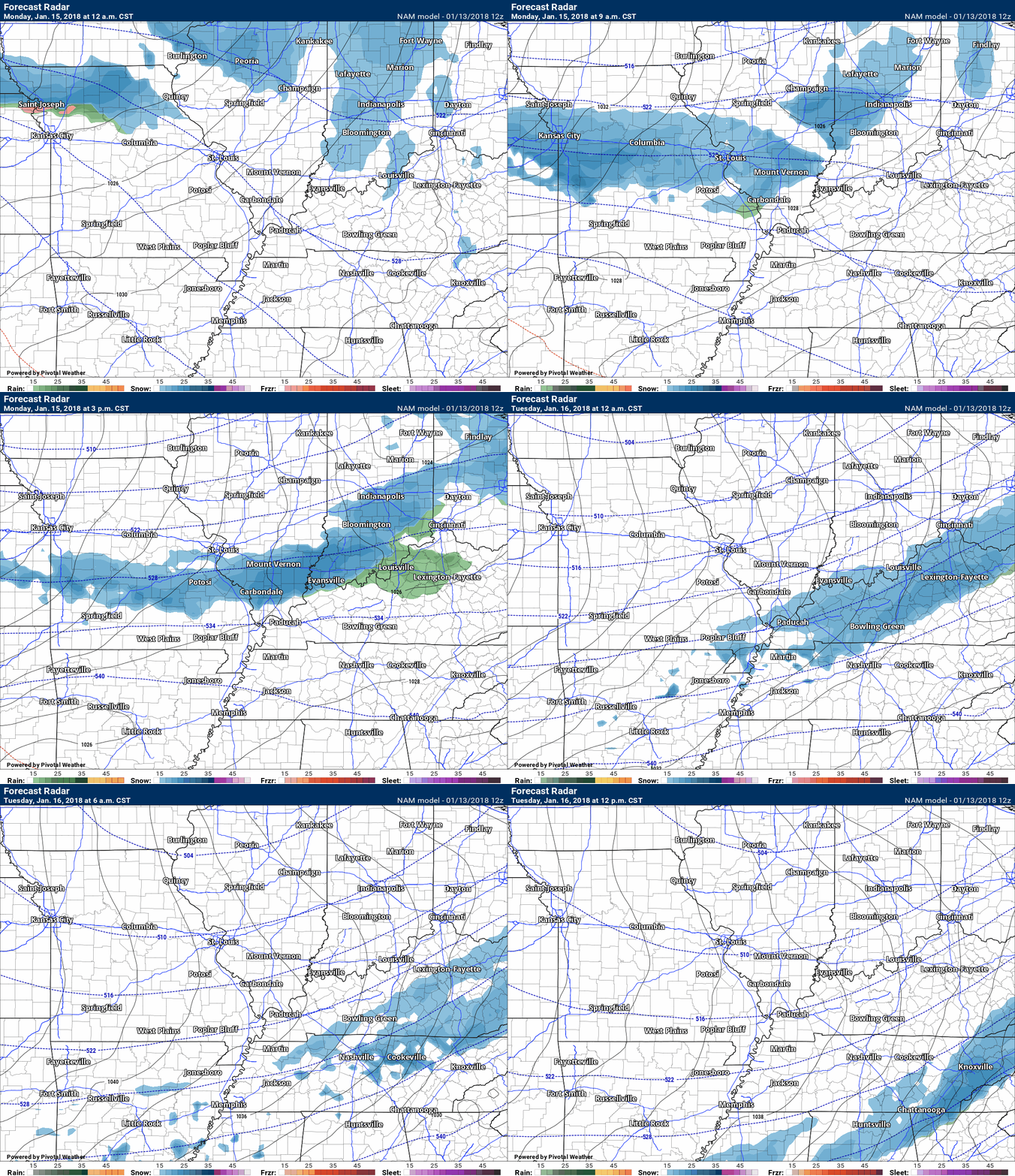
A stronger system will arrive on Monday and Monday night. This system will spread a band of snow from north to south across our region.
Gusty winds will accompany the cold front. Bitterly cold air, as well.
Snow totals of one to two inches will likely occur with this event. A few higher totals possible. Either way, this will only compound the icy road conditions.
Blowing snow is also possible.
See the snow probability maps further down in this winter weather update.
Here is the future-cast radar from the NAM guidance. This is for Monday into Monday night. Blue would be snow. Green would be rain. There remains some questions about the possibility of a brief period of rain ahead of the snow showers. This would be more likely near the Missouri and Arkansas border and the Kentucky and Tennessee border.
.
.
Plan on some school closings Tuesday.
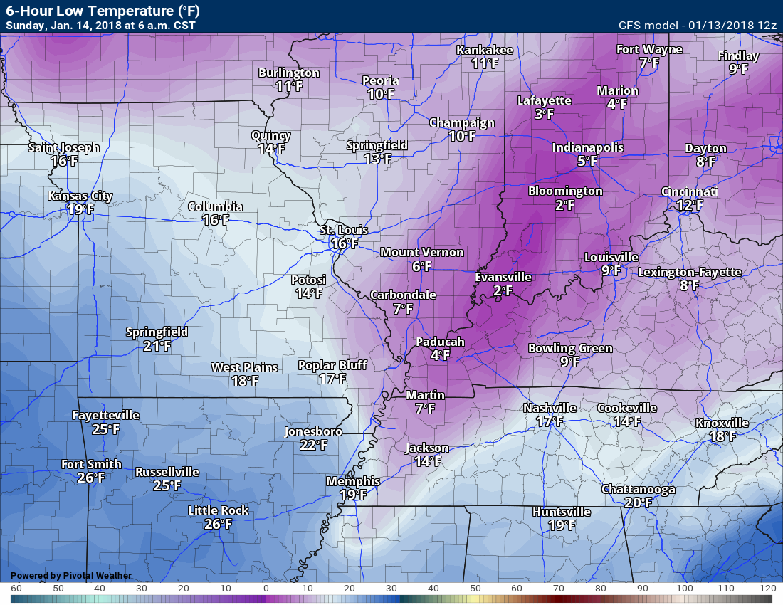
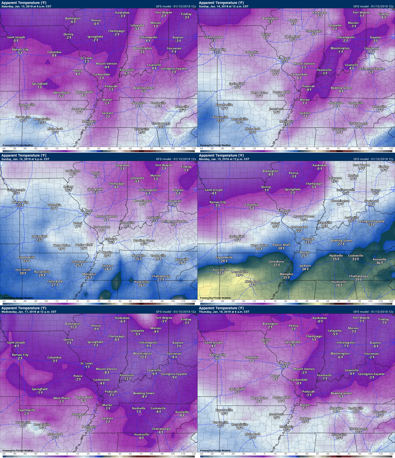
Temperatures will drop into the single digits Sunday morning, Tuesday morning, Wednesday morning, and perhaps Thursday morning. Wind chills of -15 to 10 above will be possible over the coming days. The coldest wind chills may end up being tonight and Sunday morning, Monday night and Tuesday morning, and Tuesday night and Wednesday morning.
Sunday morning lows. Some areas will be colder than this. It is not out of the question that areas with deeper snow end up ranging from -3 to 3 above.
.
.
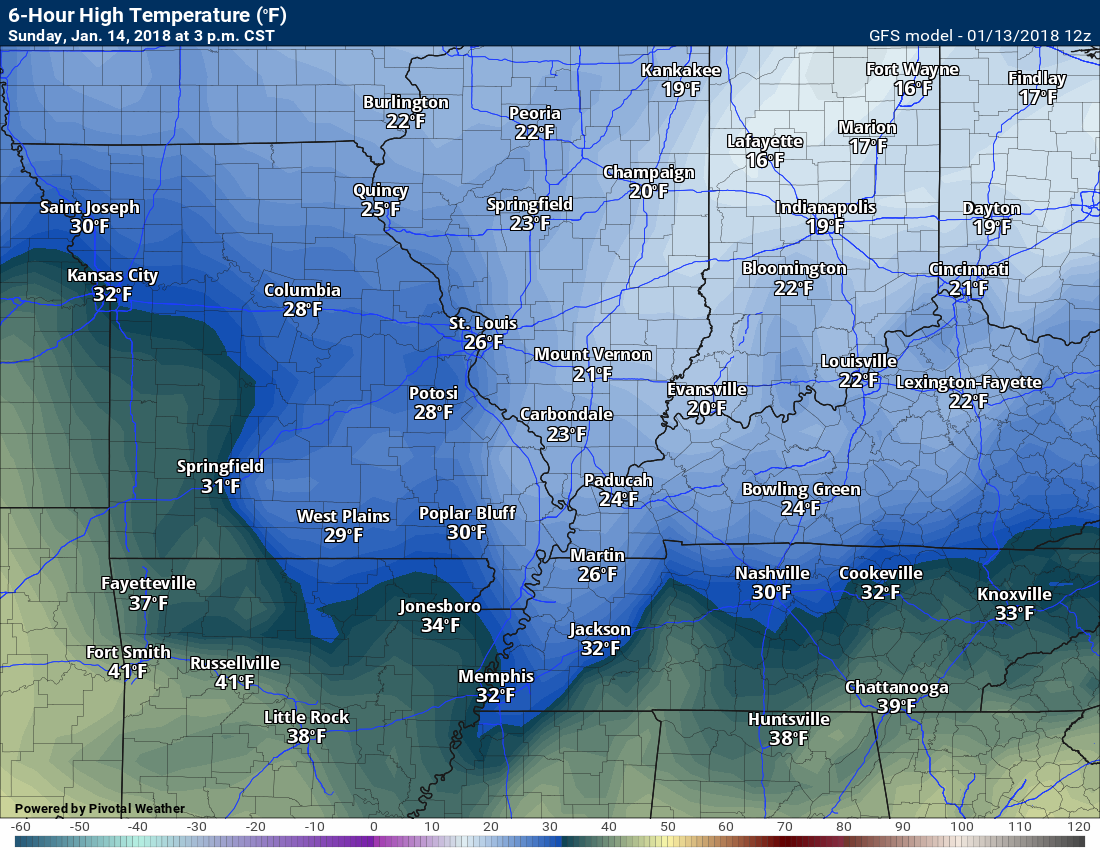
Sunday afternoon highs
.
.
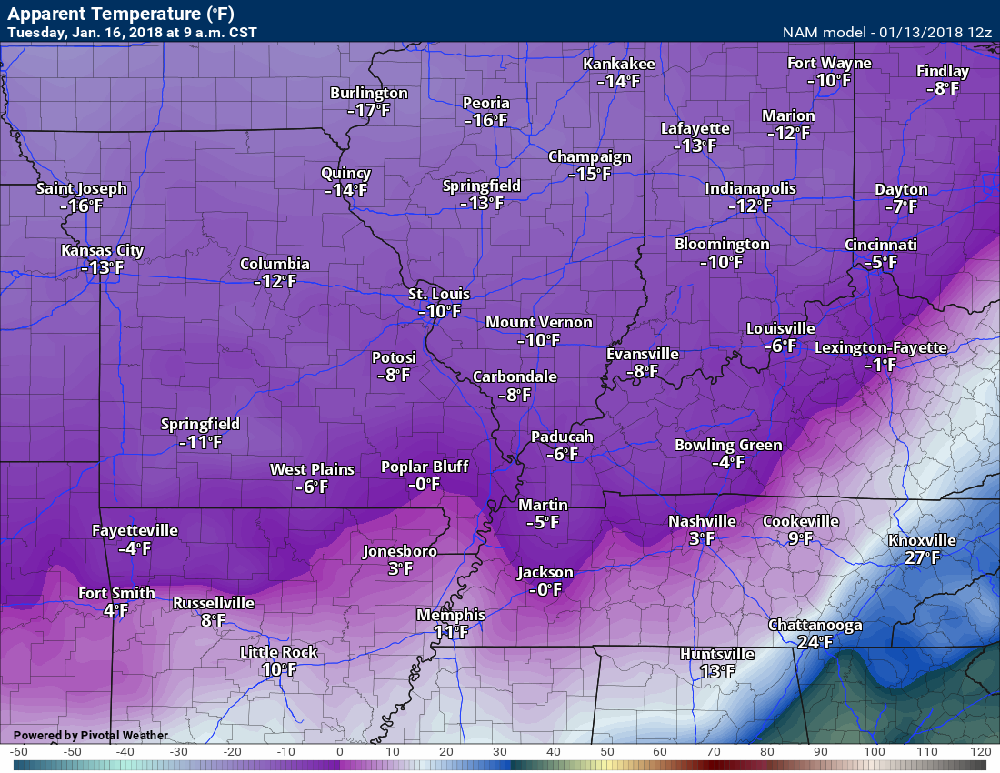
Check out the Tuesday morning wind chills. Bitterly cold.
.
.
Wind chill animation map for the coming week
.
.
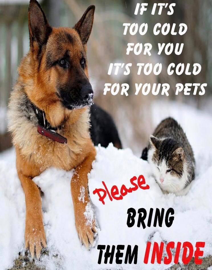
Please remember your outdoor pets. If it is cold for you it is cold for them.
.
.
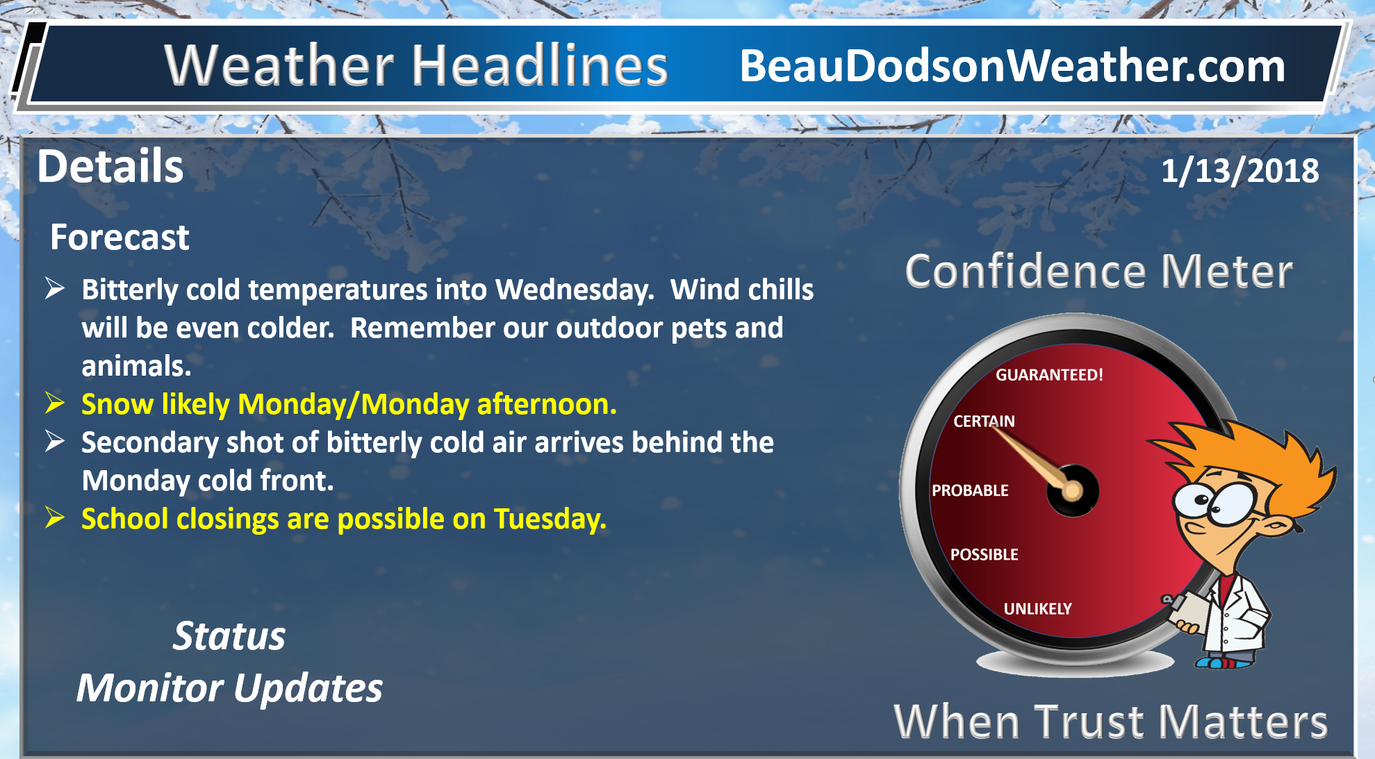
Beau’s Winter Weather Outlook
.
.
Monday and Monday evening
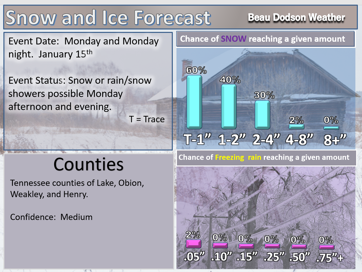
Currently this appears to be a late morning and afternoon event. It will move from north to south. Arriving first in Mt Vernon and ending first in Mt Vernon. Arriving last along the Kentucky/Tennessee border.
This will need updating. These are my best forecast thoughts, for the time being
.
Southeast Missouri zone one and zone two
Western Kentucky zone one and zone two
Northwest Tennessee
.
Here is the EC model guidance snow forecast. This is for the Monday event.
.

.
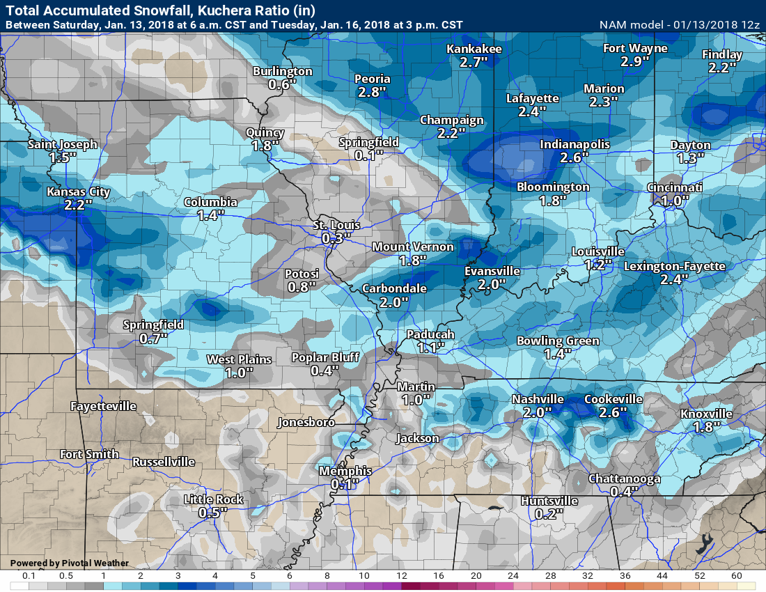
Here is the NAM model guidance. Some differences. Still time for adjustments.
These are the snow forecast totals from the NAM for Monday and Monday evening.
.
.
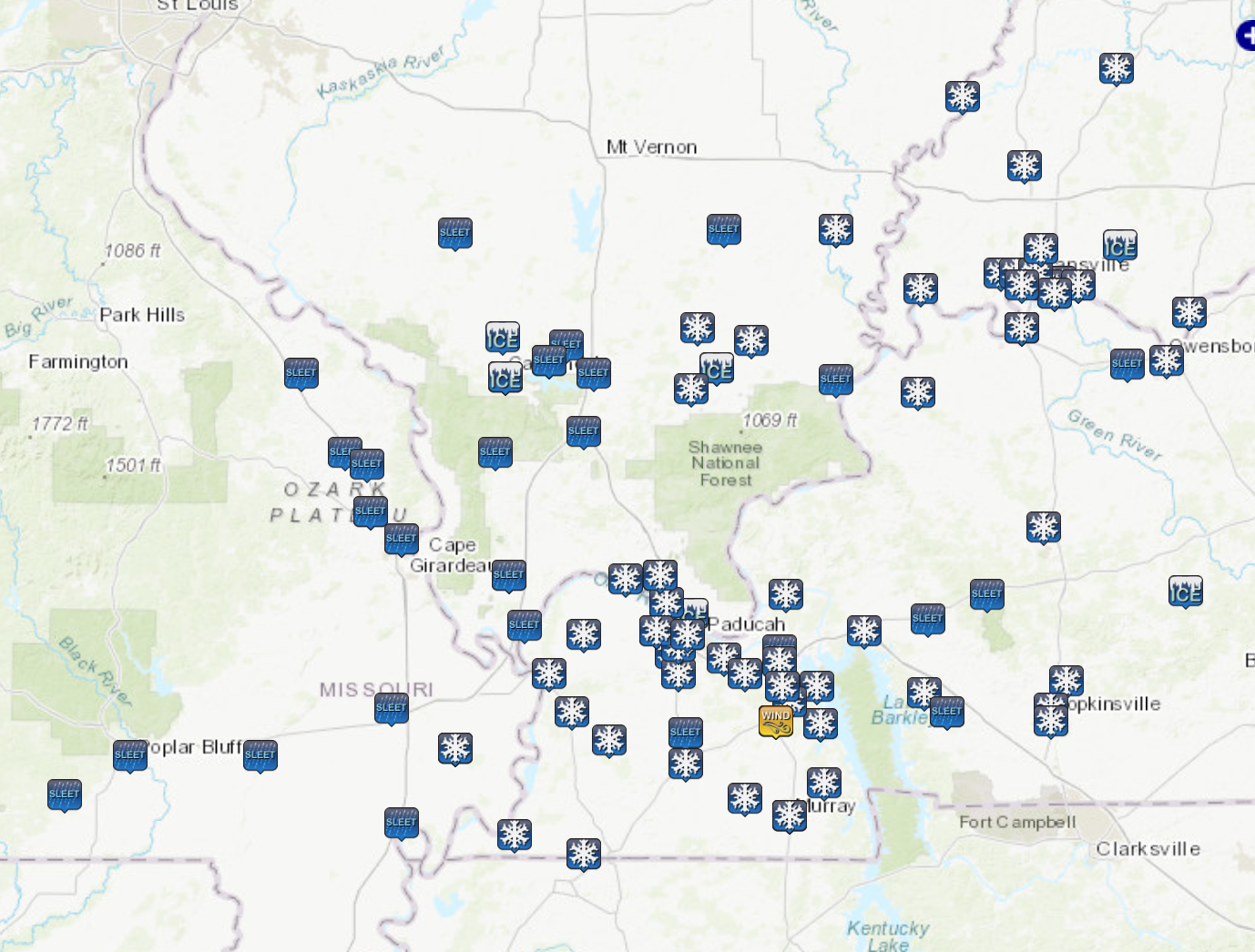
Here is an interactive map of the snow totals from the last two days.
Here is the link to take you to the map. Click here.
This map is just a static image. You will need to load the link to interact with it.
.
.
I will be hosting another Mild and Cookies with Beau on Facebook. It will be Sunday evening at 7 PM. A Q&A session concerning our upcoming snow chances.
.
 .
.
.
Have you subscribed to Weather Talk? If not, here is your chance!
Normal monthly operating costs, for Weather Talk, ranges from $1500 to $2000.
Here are my monthly out of pocket expenses
.
.
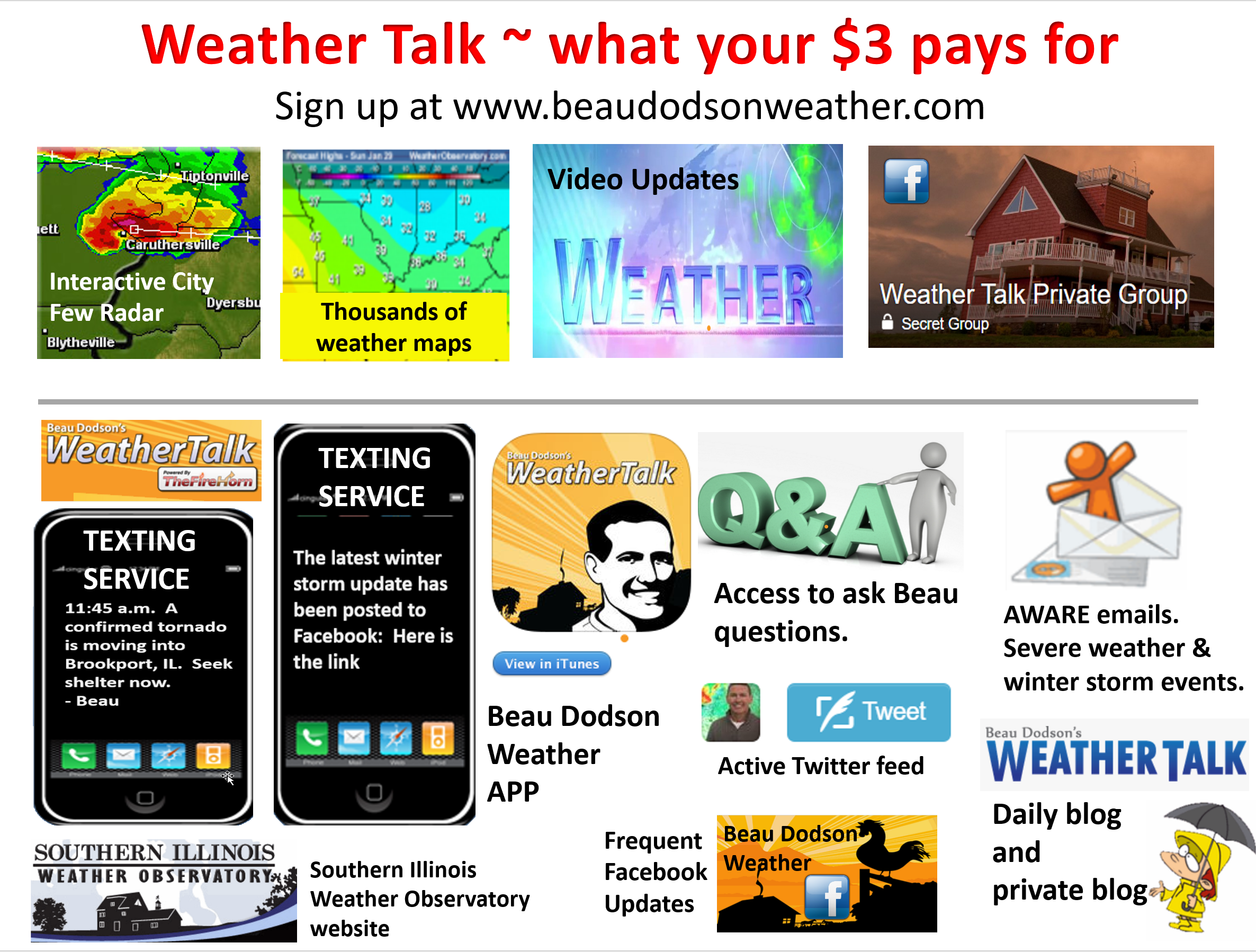
Your $3 subscription allows you access to these products
.
.
If you would like to support this data, then please subscribe. Your $3 a month helps cover the costs of the weather graphics, videos, and my time.
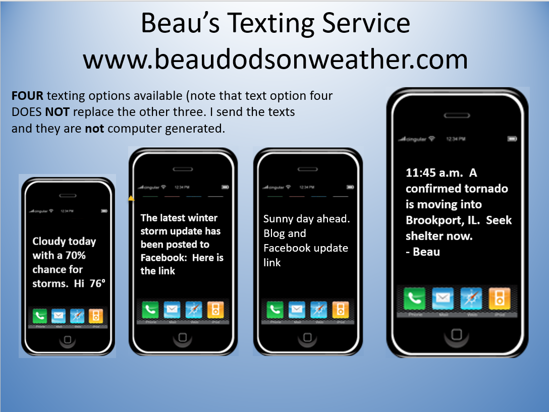
You may choose app/text notifications for my Facebook and blog updates. I will send you a link to the latest updates via the app/text.
You may subscribe at www.beaudodsonweather.com
Once you subscribe you can choose from four different app/text options.
.
Here are the four options.
.

We offer regional radars and local city radars – if a radar does not update then try another one. Occasional browsers need their cache cleared. You may also try restarting your browser. This will usually fix any problems.
During the winter you can track snow and ice by clicking the winterize button on the local city view interactive radars.
You may email me at beaudodson@usawx.com
Interactive Weather Radar Page. Choose the city nearest your location: Click this link
National interactive radar: Click this link.


