
Radar Link: Interactive local city-view radars & regional radars.
The blog today will be covering the heavy rain concerns and severe weather.
4 PM
The severe weather risk has ended.
A few storms could still form.
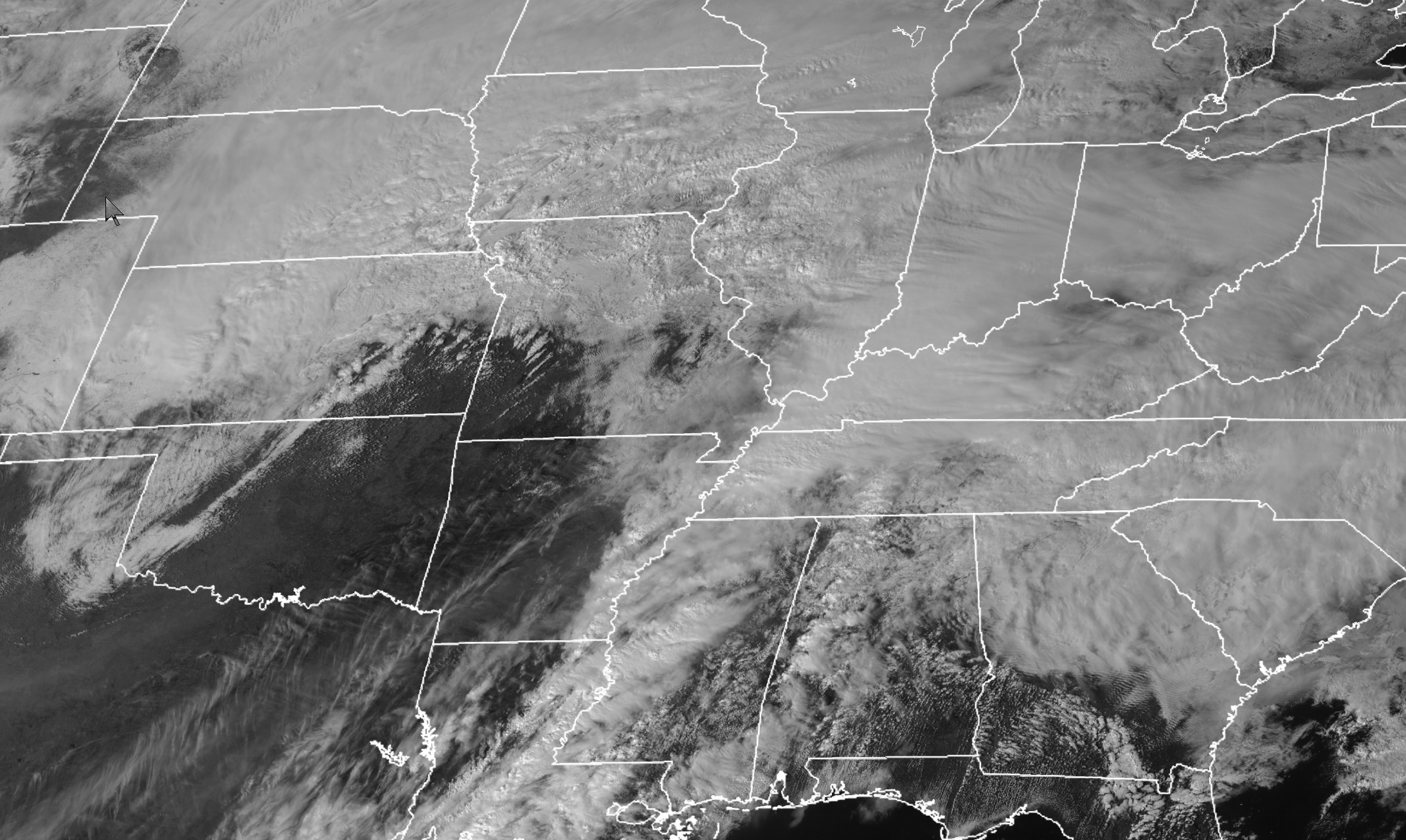
The sun has come out over the western half of the region. The current thinking is that any storms that form will stay below severe levels.
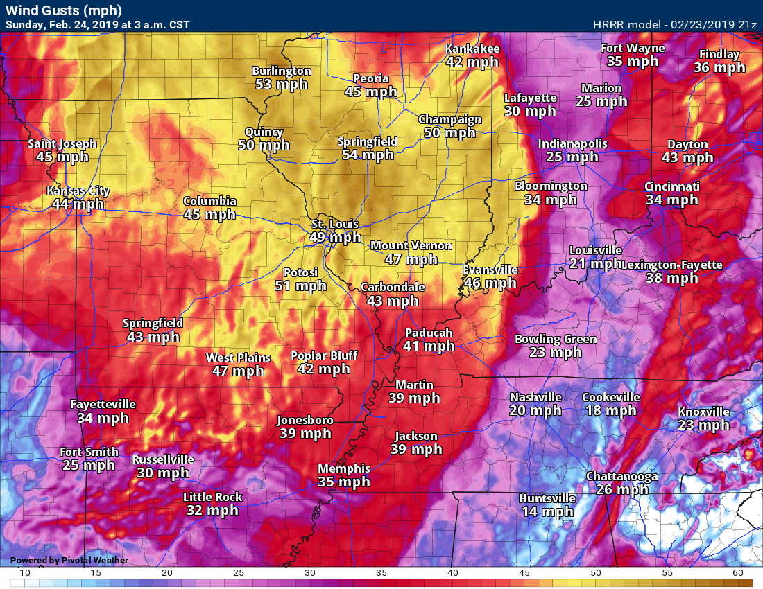
Strong and gusty winds will develop this evening and tonight as the deep area of low pressure moves northeast.
Wind gusts of 20 to 40 mph will be possible.
Hrrr model guidance wind gust forecast.
Satellite shows the clearing that I mentioned above.
I will keep an eye on radars.
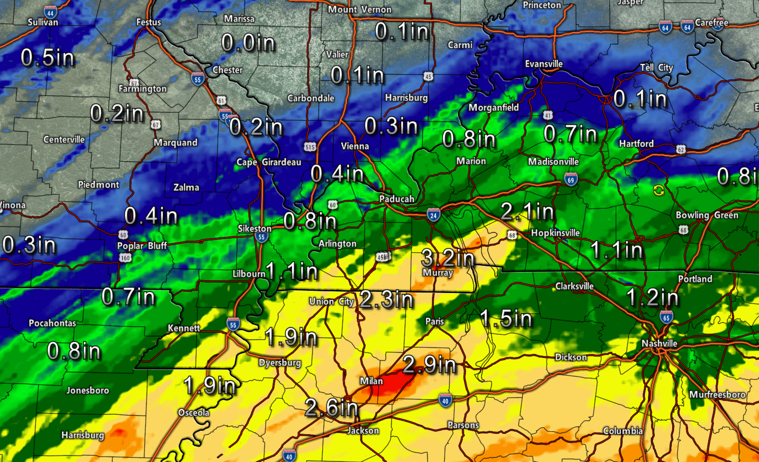
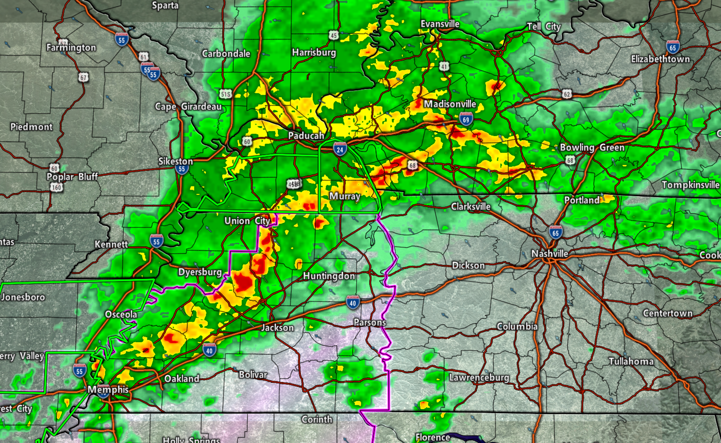
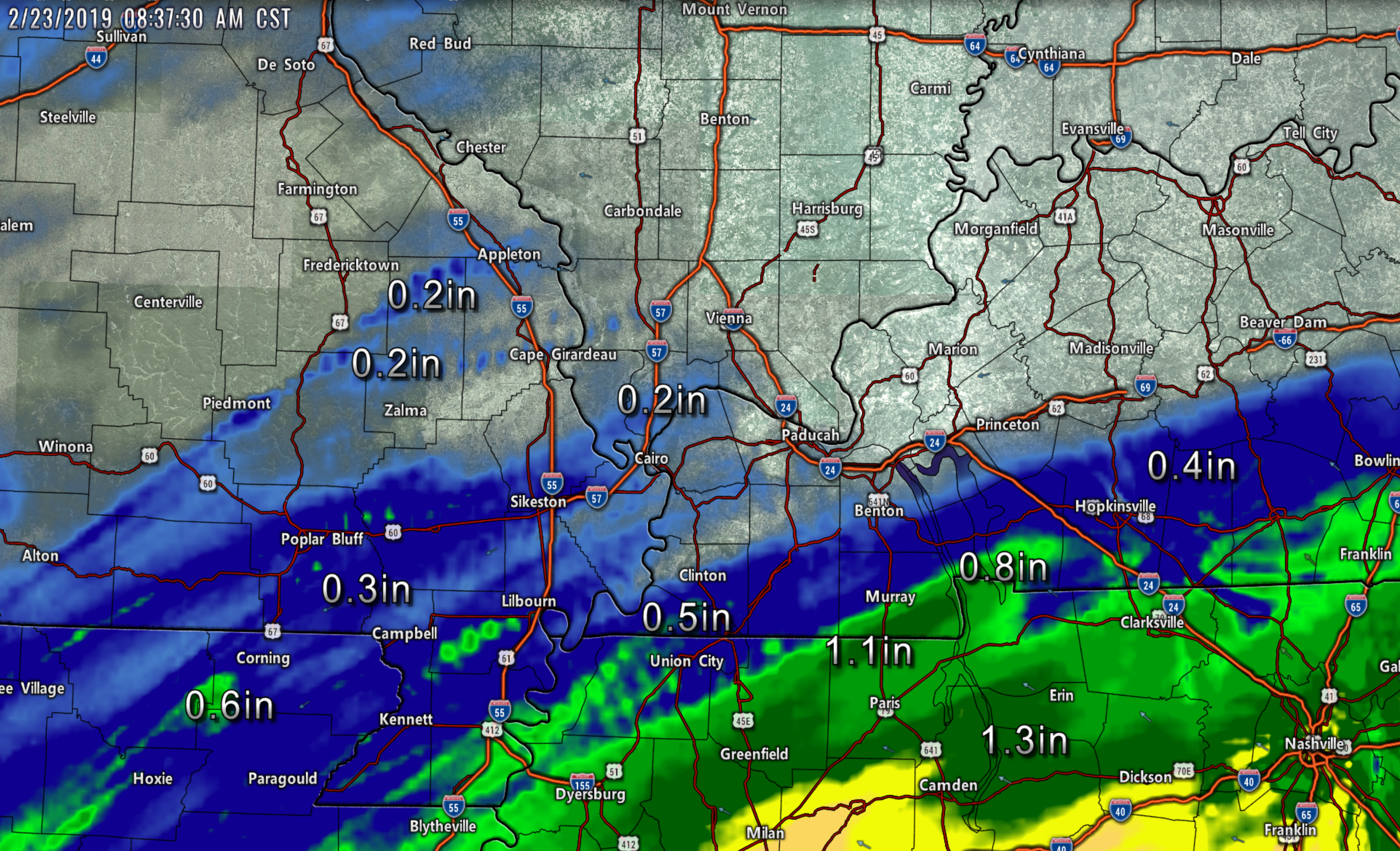
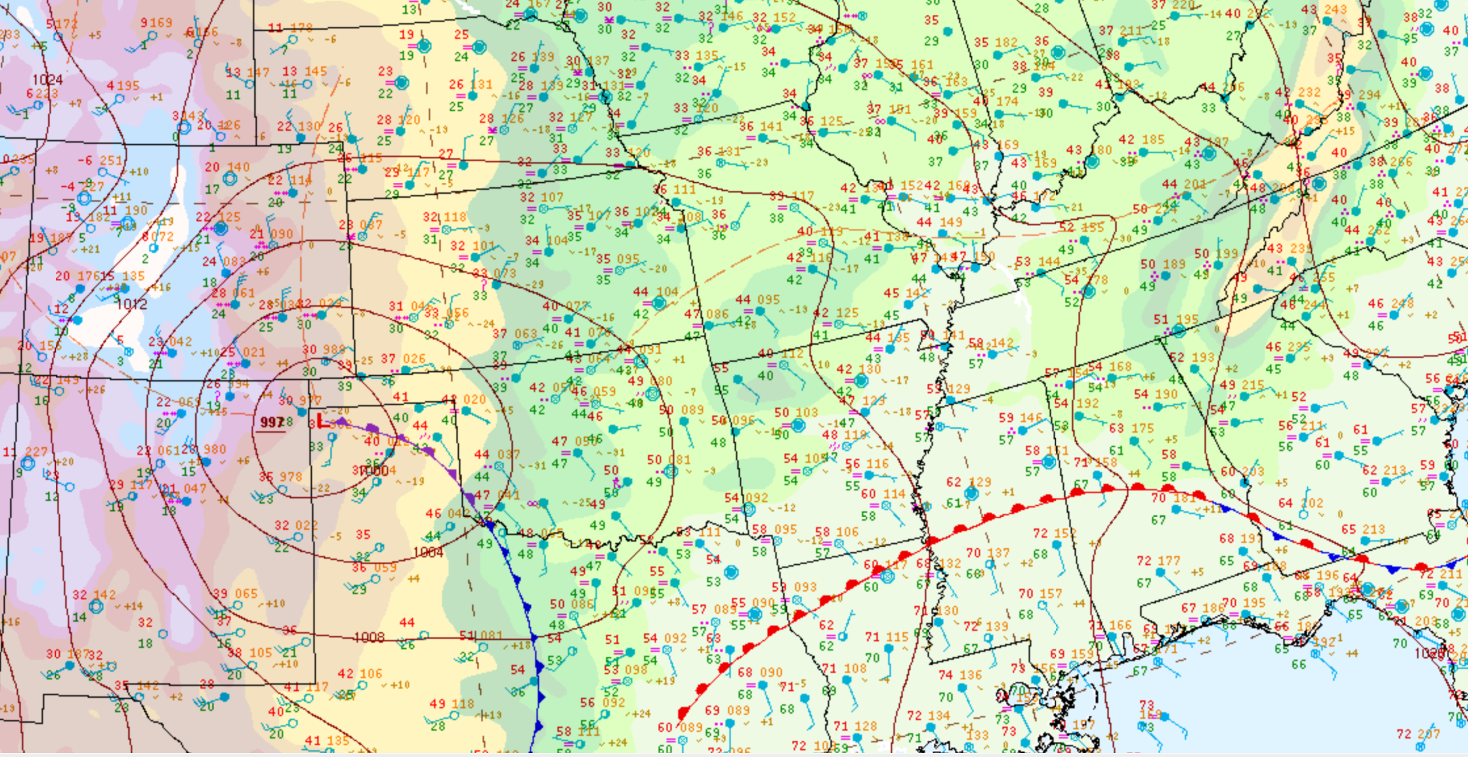
Radar estimated rain totals.
Rainfall totals range from nothing to 3+ inches.
Click to enlarge.
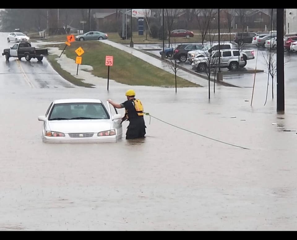
Murray, Kentucky. Eric Pologruto sent these photos in.
1:45 PM
Afternoon Facebook thread
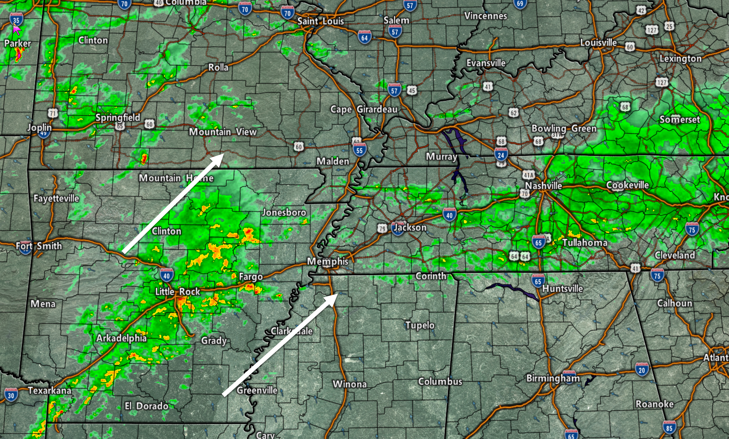
Main storm line continues to track east/northeast at 55 mph.
It is moving out of Tennessee. A few of these storms could produce strong winds. The tornado risk is not zero but it is not all that great.
Areas ahead of this line should monitor updates. Some warnings are possible.
There is a lot of wind shear today. That means the atmosphere is turning. It could produce short-lived tornadoes along some of the storm line segments (where storms are broken into segments).
If new storms do not form to the west then the severe weather threat is over once we push this east/northeast.
Most models do not show new storms. Hopefully, that will be the case. I am closely monitoring satellites and radars.
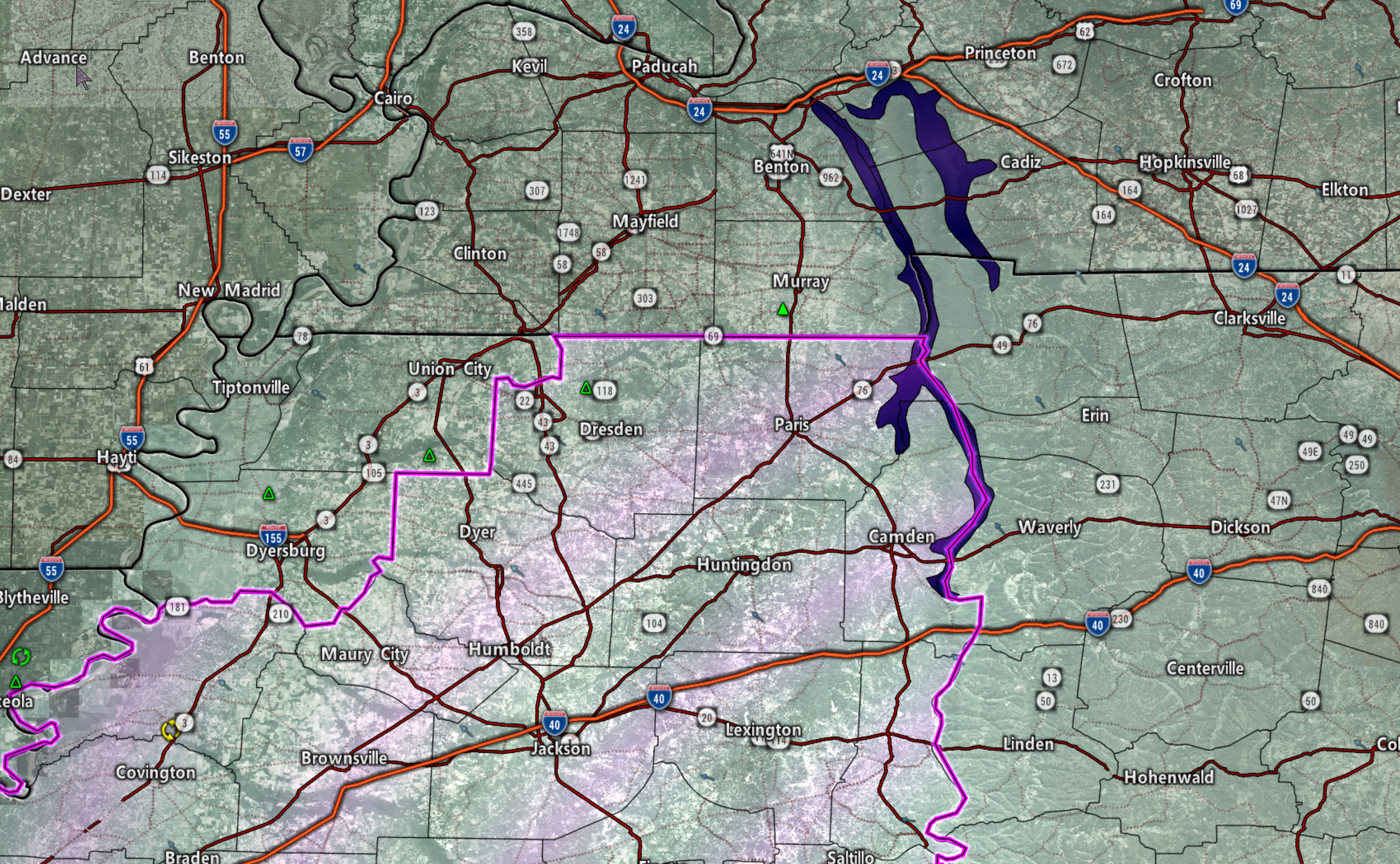
Tornado watch in pink. Watch means to monitor updates. Warning means to seek shelter or take action.
Flash flood warning in green outline.
Click to enlarge image.
The colors represent precipitation intensity. Red is heaviest.
See live radar link at the top of this page (above)
12:35 PM
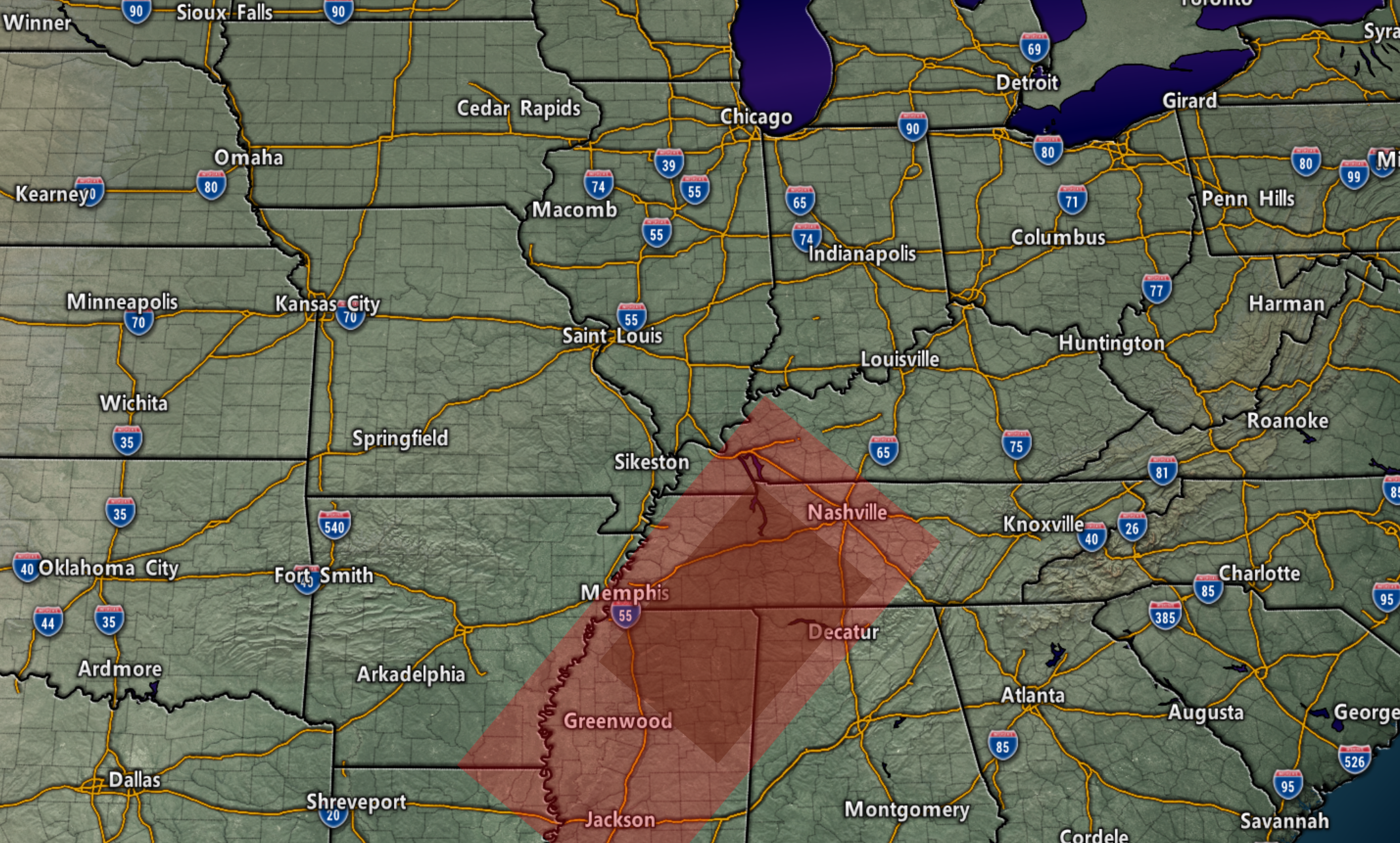
Tornado watch in the pink zone for this afternoon.
Conditions in and near the watch are favorable for severe weather.
A watch means to monitor updates. A warning means to seek shelter.
The threat of severe weather may be over for southeast MO and southern IL. New storms may not form.
I will continue to monitor the radars.
12 PM
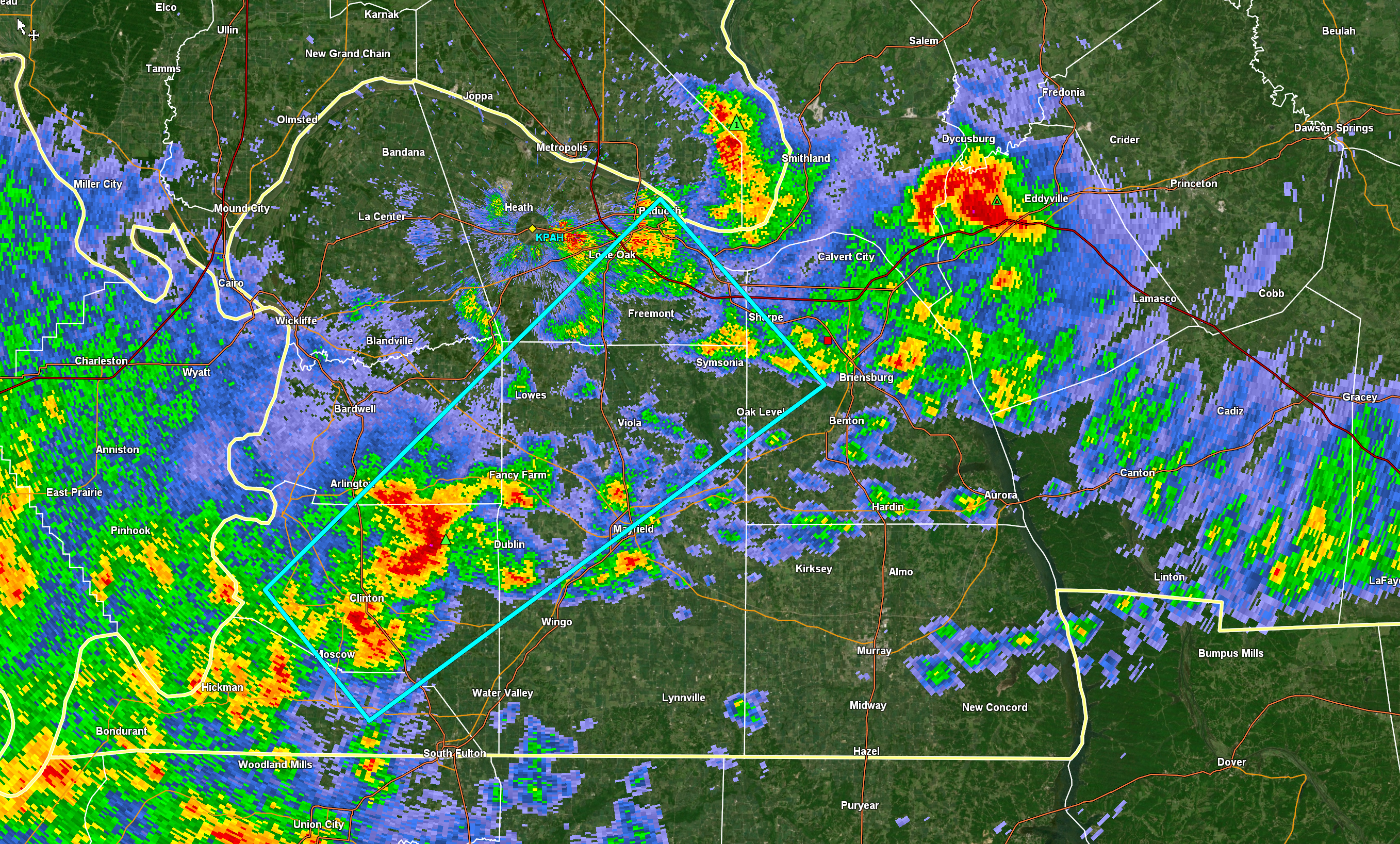
Storms racing northeast out of far southeast MO into west KY and west TN.
These storms could produce dime size hail, strong winds, and torrential rain.
They are currently sub-severe but monitor updates and radars
12 PM radar
I will post updates at the top of this page. Check back every so often for the latest information.
The normal blog will return tomorrow.
If you want to see what the daily blog normally looks like – click here.
The main concern today will be heavy rain and severe weather.
Nothing has changed in the severe weather forecast. It is a conditional risk.
Today is a pay a little more attention to the weather forecast, monitor updates, and go about your business day. Avoid flooded roadways.
If severe weather develops then I will send out app messages. Please use the app since texts can be delayed by ATT and Verizon.
Find it under Beau Dodson Weather in the app store.
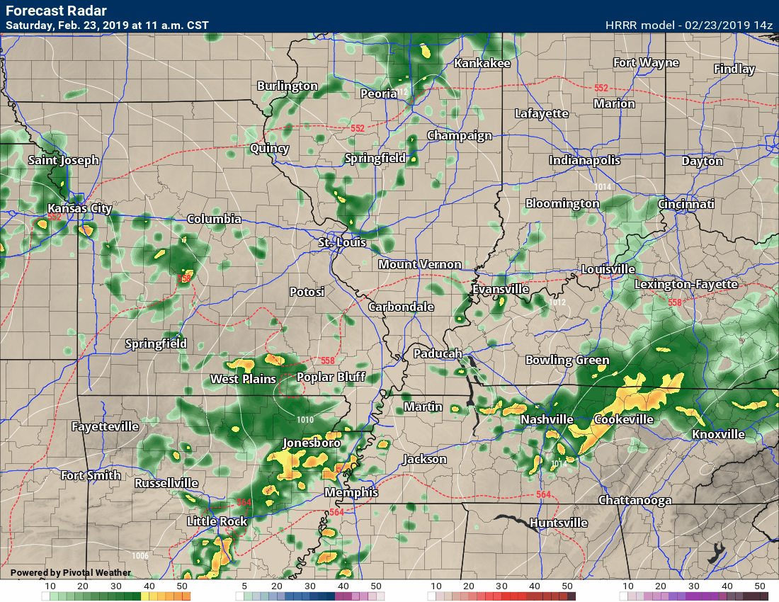
Widespread rain and storm area are moving into our region from the southwest. This should help keep instability down. If true, that would be good news.
Instability is energy for thunderstorms. Clouds and ongoing precipitation can keep instability lower.
You can see that area of showers and storms on this 10 AM radar shot. Movement northeast at 50+ mph.
View regional radar. Click here
Whether new storms can form behind this first batch is one of the big weather questions on the table.
If so, then they could be intense. Confidence is not all that great as to whether new storms will form.
Again, monitor updates today. Don’t walk away with just one forecast.
Here is the Hrrr model guidance future-cast radar. You can see how it handles the Arkansas precipitation.
What does a conditional risk mean?
It means that if we don’t have CAPE then we don’t have severe weather.
What is CAPE? CAPE is basically energy that builds in the atmosphere. It is what thunderstorms tap into to become severe.
IF CAPE does develop then we will have severe storms.
Damaging wind is a concern. Tornadoes would also be a concern.
Again, a conditional risk.
I have the highest risk of severe weather in the area in red. Dark red the higher of the two.
Severe weather may occur outside of the red zone, as well. The risk isn’t as great in areas outside the red zone.
Rain totals from last night.
We thought there would be a sharp gradient. There was. Some areas received no rain. Others picked up 0.50″ to 1.00″.
Radar estimated even higher totals near the KY/TN border.
Click to enlarge. Again, these are radar estimated totals.
The warm front is still well to our south.
The higher instability can be found near the warm front. Along and south of the warm front is where the greatest tornado risk will be.
The warm front barely moved last night. That was good news for us as it kept the extreme rainfall totals well to our south.
The warm front is the red half-moon line.
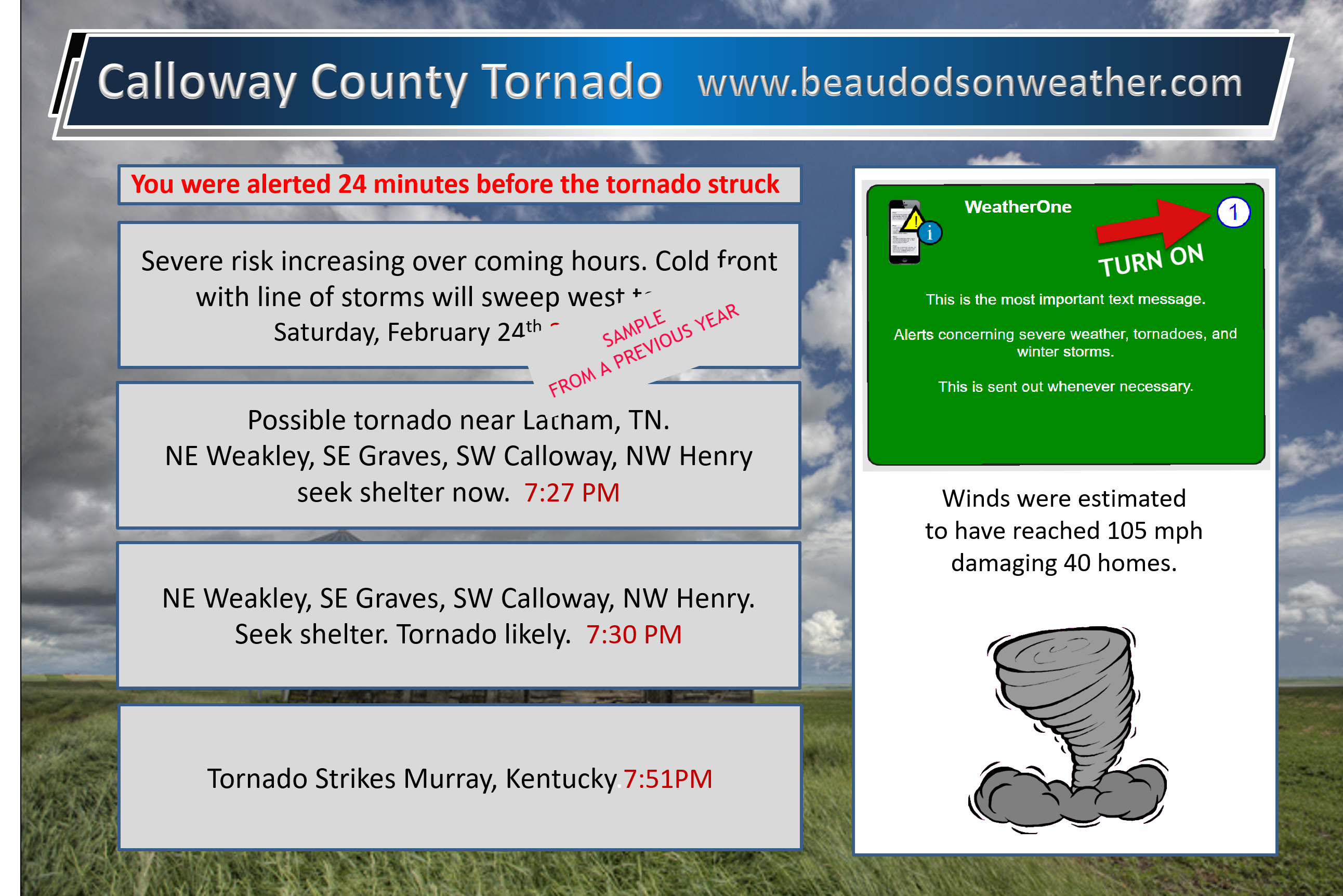
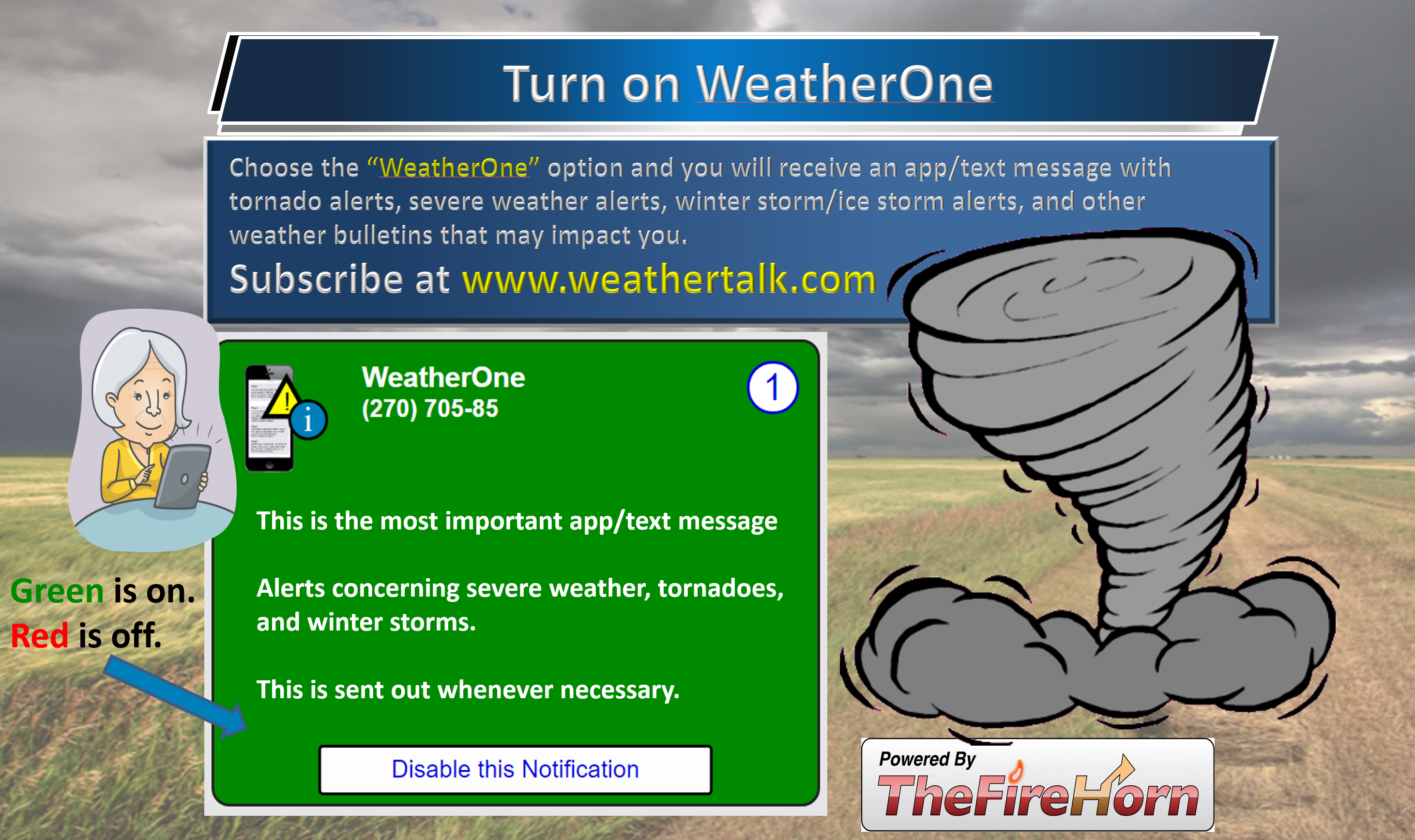
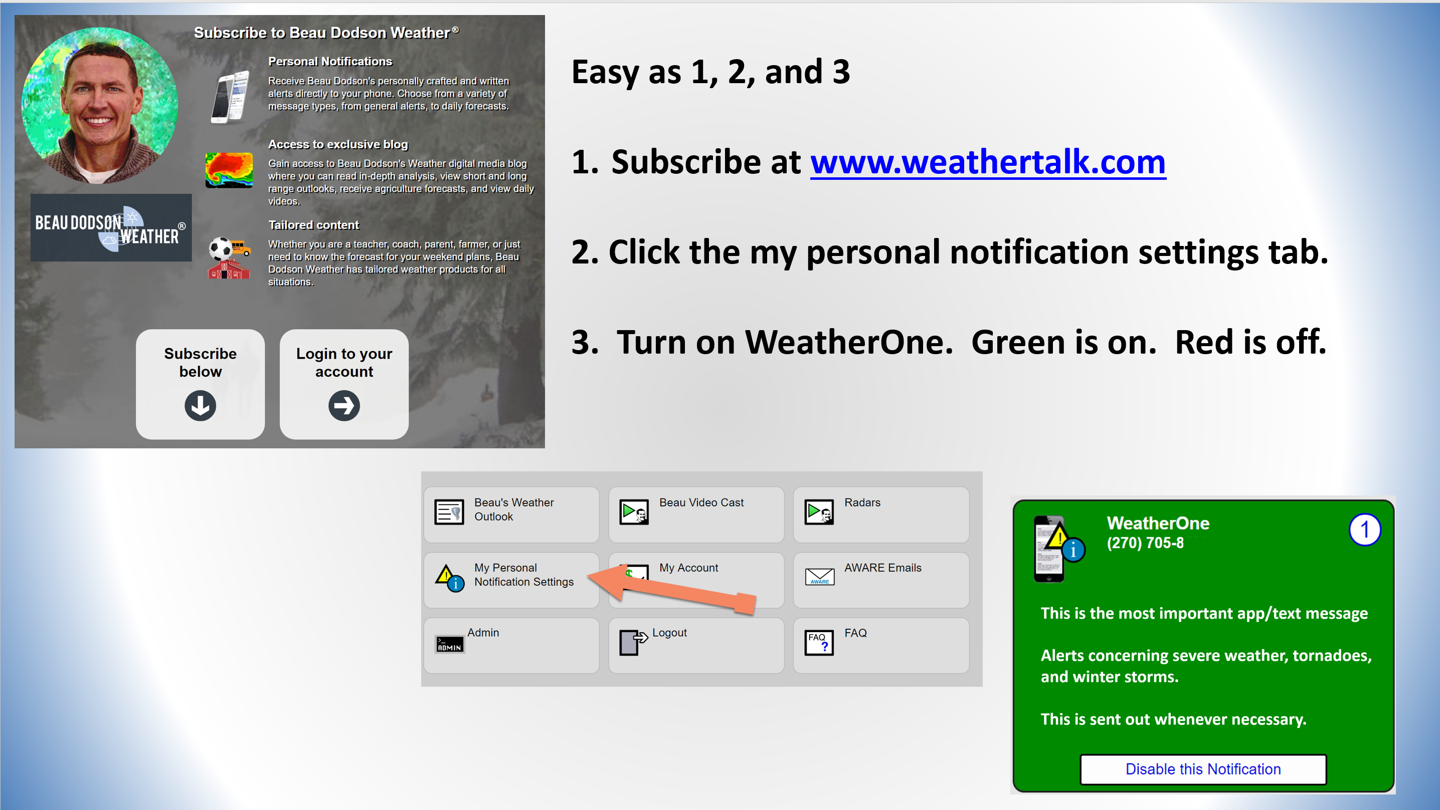
WeatherTalk subscribers, check your severe weather settings. Make sure your tornado alerts are turned on.
First, check your www.weathertalk.com settings.
Make sure you have turned on WeatherOne in your www.weathertalk.com accounts.
Samples from previous events.
We have been averaging 5 to 10 minutes ahead of other sources. Always have three or four sources to receive severe weather information. Do not rely on just one.
Click these images to enlarge them.
.

Click one of the links below to take you directly to each section.
-
- Go to today’s forecast
- Go to the winter storm and severe weather outlook
- Go to the weather forecast discussion
- Go to the model future-cast radars
- Go to videos
- Go to weeks one, two, three, and four temperature and precipitation graphics
- Go to Weatherbrains
- View some of our charity work. Your subscription dollars help support these causes.
Even if your account has expired you WOULD still receive app/text messages. I have to manually stop them even if your payment method has expired.
Log into your account at this link www.weathertalk.com
Have questions? Email me at beaudodson@usawx.com
Thank you.
Not receiving app/text messages?
- Make sure you have the correct app/text options turned on. Do that under the personal notification settings tab at www.weathertalk.com. Red is off. Green is on.
- USE THE APP. Verizon and ATT have been throttling text messages. The app receives the same messages instantly. Texts can take longer. Please, use the app. It is under Beau Dodson Weather in the app stores.
Radar Link: Interactive local city-view radars & regional radars.
You will also find clickable warning and advisory buttons on the local city-view radars.
If the radar is not updating then try another one. If a radar does not appear to be refreshing then hit Ctrl F5. You may also try restarting your browser.
Not working? Email me at beaudodson@usawx.com
A quick look at the seven-day forecast.
My text forecast below these graphics may vary a bit.
I made the blog free today. I wanted everyone to see the changes. If you would like to subscribe then please go to www.weathertalk.com and then follow the setup process.
Click here if you would like to return to the top of the page
Interactive live weather radar page. Choose the city nearest your location. If one of the cities does not work then try a nearby one. Click here.
National map of weather watches and warnings. Click here.
Storm Prediction Center. Click here.
Weather Prediction Center. Click here.

Live lightning data: Click here.

Interactive GOES R satellite. Track clouds. Click here.
GOES 16 slider tool. Click here.

Here are the latest local river stage forecast numbers Click Here.
Here are the latest lake stage forecast numbers for Kentucky Lake and Lake Barkley Click Here.
Satellite
View the satellites in real time!
College of Dupage satellites. Click here
Interactive GOES R satellite. Track clouds. Click here.
.
Missouri


Illinois


Kentucky


Tennessee

Subscribers, do you need a forecast for an outdoor event?

Did you know that you can find me on Twitter? Click here to view my Twitter weather account.

Find Beau on Facebook! Click the banner.

.
Find Beau on Twitter! Share your weather photos! @beaudodson

Click here to go to the top of the page
Did you know that a portion of your monthly subscription helps support local charity projects? Not a subscriber? Becoming one at www.weathertalk.com
You can learn more about those projects by visiting the Shadow Angel Foundation website and the Beau Dodson News website.
