Subscribers: The long range outlooks and videos have been posted on the pay site. You can access that by clicking here
This is a reminder that if you don’t subscribe to WeatherTalk, please do so. Average monthly costs (from my pocket) are between $1000 and $2000.00. You can subscribe at www.beaudodsonweather.com. Your subscription will also get you app/text forecasts, alerts, social media posting alerts, and videos. It is only $3 per month. Also, please download the app (it receives the same text messages but ten times faster).
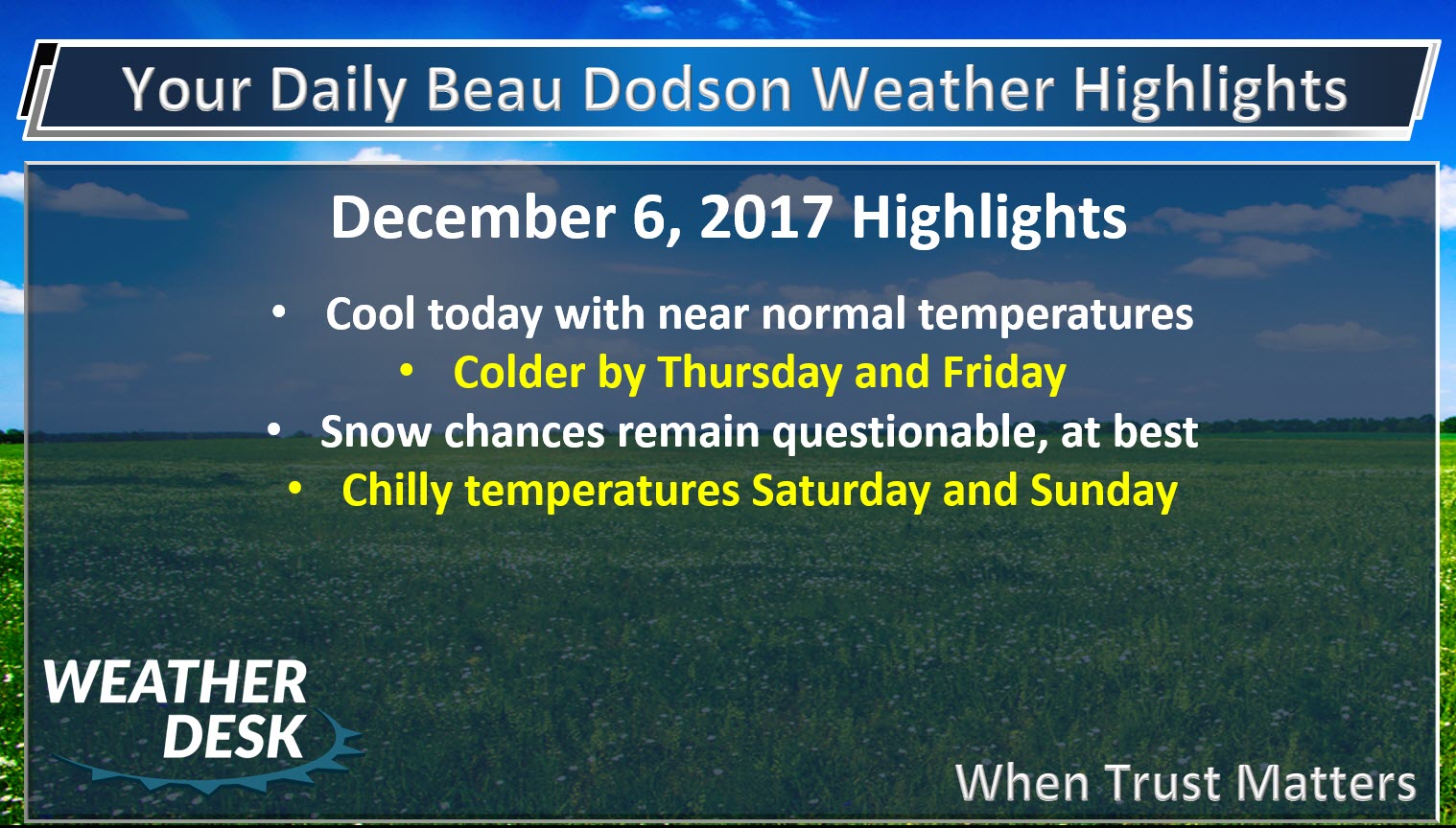
December 6, 2017
.
.
First, let’s take a look at the daily weather forecast.
December 6, 2017
Wednesday Night Forecast Details:
Forecast: Clear to partly cloudy. Colder.
Temperatures: MO ~ 23 to 26 IL ~ 23 to 28 KY ~ 24 to 28
Wind chill values: 18 to 23
Accumulating snow or ice: No
Winds: North and northwest winds at 5 to 10 mph
What impacts are anticipated from the weather? Most likely none
My confidence in the forecast verifying: High
Is severe weather expected? No
The NWS defines severe weather as 58 mph wind or great, 1″ hail or larger, and/or tornadoes
Is freezing rain, sleet, or snow expected? No
What is the chance of precipitation? MO ~ 0% IL ~ 0% KY ~ 0%
Coverage of precipitation: None
Should I cancel my outdoor plans: No
.
December 7, 2017
Thursday Forecast Details
Forecast: Partly cloudy to mostly sunny. Cold. Well below normal temperatures.
Temperatures: MO ~ 34 to 38 IL ~ 34 to 38 KY ~ 36 to 42
Wind chill values: 22 to 34
Accumulating snow or ice: No
Winds: West and northwest winds at 5 to 10 mph with gusts to 14 mph
What impacts are anticipated from the weather? None
My confidence in the forecast verifying: High
Is severe weather expected? No
The NWS defines severe weather as 58 mph wind or great, 1″ hail or larger, and/or tornadoes
Is freezing rain, sleet, or snow expected? Flurries if anything at all
What is the chance of precipitation? MO ~ 0% IL ~ 10% KY ~ 10%
Coverage of precipitation: Most likely none.
Should I cancel my outdoor plans? No
.
Thursday Night Forecast Details:
Forecast: Mostly clear. Some late night clouds. Colder.
Temperatures: MO ~ 18 to 24 IL ~ 18 to 24 KY ~ 20 to 25
Wind chill values: 12 to 18
Accumulating snow or ice: No
Winds: North and northwest winds at 5 to 10 mph
What impacts are anticipated from the weather? Cold wind chills.
My confidence in the forecast verifying: Medium
Is severe weather expected? No
The NWS defines severe weather as 58 mph wind or great, 1″ hail or larger, and/or tornadoes
Is freezing rain, sleet, or snow expected? Snow showers are possible
What is the chance of precipitation? MO ~ 10% IL ~ 10% KY ~ 10%
Coverage of precipitation: None
Should I cancel my outdoor plans: No
.
December 8, 2017
Friday Forecast Details
Forecast: Mostly sunny during the morning. Some afternoon clouds possible.
Temperatures: MO ~ 36 to 42 IL ~ 36 to 42 KY ~ 38 to 42
Wind chill values: 20 to 30
Accumulating snow or ice: No
Winds: West and southwest winds at 6 to 12 mph with gusts to 25 mph
What impacts are anticipated from the weather? Low wind chills possible
My confidence in the forecast verifying: Medium
Is severe weather expected? No
The NWS defines severe weather as 58 mph wind or great, 1″ hail or larger, and/or tornadoes
Is freezing rain, sleet, or snow expected? Snow showers are possible
What is the chance of precipitation? MO ~ 10% IL ~ 10% KY ~ 10%
Coverage of precipitation: Most likely none
Should I cancel my outdoor plans? No
.
Friday Night Forecast Details:
Forecast: Quite a few clouds. Snow showers possible. Cold.
Temperatures: MO ~ 23 to 26 IL ~ 23 to 26 KY ~ 23 to 26
Wind chill values: 12 to 24
Accumulating snow or ice: Unlikely. Small chance over SE IL and NW KY
Winds: West and northwest winds at 7 to 14 mph. Gusty.
What impacts are anticipated from the weather? Monitor updates
My confidence in the forecast verifying: Medium
Is severe weather expected? No
The NWS defines severe weather as 58 mph wind or great, 1″ hail or larger, and/or tornadoes
Is freezing rain, sleet, or snow expected? Snow showers are possible
What is the chance of precipitation? MO ~ 10% IL ~ 30% KY ~ 30%
Coverage of precipitation: Perhaps some scattered snow showers over SE IL and NW KY
Should I cancel my outdoor plans: No
.
December 9, 2017
Saturday Forecast Details
Forecast: Quite a few clouds. Snow showers possible (mainly over southeast Illinois and northwest Kentucky). Cold.
Temperatures: MO ~ 35 to 40 IL ~ 35 to 40 KY ~ 35 to 40
Wind chill values: 15 to 24
Accumulating snow or ice: Small chance over SE IL and NW KY
Winds: West and southwest winds at 6 to 12 mph with gusts to 18 mph
What impacts are anticipated from the weather? Monitor updates
My confidence in the forecast verifying: Medium
Is severe weather expected? No
The NWS defines severe weather as 58 mph wind or great, 1″ hail or larger, and/or tornadoes
Is freezing rain, sleet, or snow expected? Snow showers are possible
What is the chance of precipitation? MO ~ 10% IL ~ 30% KY ~ 30%
Coverage of precipitation: Scattered
Should I cancel my outdoor plans? Monitor updates. It will be cold.
.
Saturday Night Forecast Details:
Forecast: Clearing. Cold.
Temperatures: MO ~ 20 to 25 IL ~ 20 to 25 KY ~ 20 to 25
Wind chill values: 12 to 20 degrees
Accumulating snow or ice: No
Winds: North and northwest winds at 6 to 12 mph
What impacts are anticipated from the weather? None
My confidence in the forecast verifying: Medium
Is severe weather expected? No
The NWS defines severe weather as 58 mph wind or great, 1″ hail or larger, and/or tornadoes
Is freezing rain, sleet, or snow expected? Most likely none
What is the chance of precipitation? MO ~ 0% IL ~ 10% KY ~ 10%
Coverage of precipitation: Most likely none
Should I cancel my outdoor plans: No
.
December 10, 2017
Sunday Forecast Details
Forecast: Mostly sunny and cold.
Temperatures: MO ~ 43 to 46 IL ~ 40 to 45 KY ~ 42 to 46
Wind chill values: 25 to 35
Accumulating snow or ice: No
Winds: West and southwest winds at 6 to 12 mph with gusts to 18 mph
What impacts are anticipated from the weather? None
My confidence in the forecast verifying: Medium
Is severe weather expected? No
The NWS defines severe weather as 58 mph wind or great, 1″ hail or larger, and/or tornadoes
Is freezing rain, sleet, or snow expected? No
What is the chance of precipitation? MO ~ 0% IL ~ 0% KY ~ 0%
Coverage of precipitation: None
Should I cancel my outdoor plans? No
.
Sunday Night Forecast Details:
Forecast: Mostly clear. Cold.
Temperatures: MO ~ 25 to 30 IL ~ 25 to 30 KY ~ 26 to 32
Wind chill values: 22 to 25 degrees
Accumulating snow or ice: No
Winds: Light winds
What impacts are anticipated from the weather? None
My confidence in the forecast verifying: Medium
Is severe weather expected? No
The NWS defines severe weather as 58 mph wind or great, 1″ hail or larger, and/or tornadoes
Is freezing rain, sleet, or snow expected? None
What is the chance of precipitation? MO ~ 0% IL ~ 0% KY ~ 0%
Coverage of precipitation: None
Should I cancel my outdoor plans: No
.
December 11, 2017
Monday Forecast Details
Forecast: Mostly sunny and not as cold.
Temperatures: MO ~ 46 to 52 IL ~ 45 to 52 KY ~ 48 to 54
Wind chill values: 35 to 45
Accumulating snow or ice: No
Winds: West and southwest winds at 6 to 12 mph with gusts to 18 mph
What impacts are anticipated from the weather? None
My confidence in the forecast verifying: Medium
Is severe weather expected? No
The NWS defines severe weather as 58 mph wind or great, 1″ hail or larger, and/or tornadoes
Is freezing rain, sleet, or snow expected? No
What is the chance of precipitation? MO ~ 0% IL ~ 0% KY ~ 0%
Coverage of precipitation: None
Should I cancel my outdoor plans? No
.
Monday Night Forecast Details:
Forecast: Partly to mostly cloudy. Snow or rain showers possible.
Temperatures: MO ~ 28 to 34 IL ~ 28 to 34 KY ~ 28 to 34
Wind chill values: 20 to 25 degrees
Accumulating snow or ice: Unlikely
Winds: Northwest winds 5 to 10 mph with gusts to 15 mph
What impacts are anticipated from the weather? Perhaps wet roadways. Monitor updates.
My confidence in the forecast verifying: LOW
Is severe weather expected? No
The NWS defines severe weather as 58 mph wind or great, 1″ hail or larger, and/or tornadoes
Is freezing rain, sleet, or snow expected? None
What is the chance of precipitation? MO ~ 20% IL ~ 20% KY ~ 20%
Coverage of precipitation: Isolated to scattered
Should I cancel my outdoor plans: No
.
Chilly weather has arrived and it will likely stick around right on through the weekend and perhaps much of next week.
Partly sunny today with highs in the 45 to 50 degree range. Lows tonight will dip into the 24 to 28 degree range.
Thursday and Friday will deliver mostly sunny sky conditions. Perhaps a few clouds. It will be cold both days with highs mostly in the 30’s. There is a small chance of snow flurries both days. Right now, that seems unlikely, but I did mention it in my daily outlook.
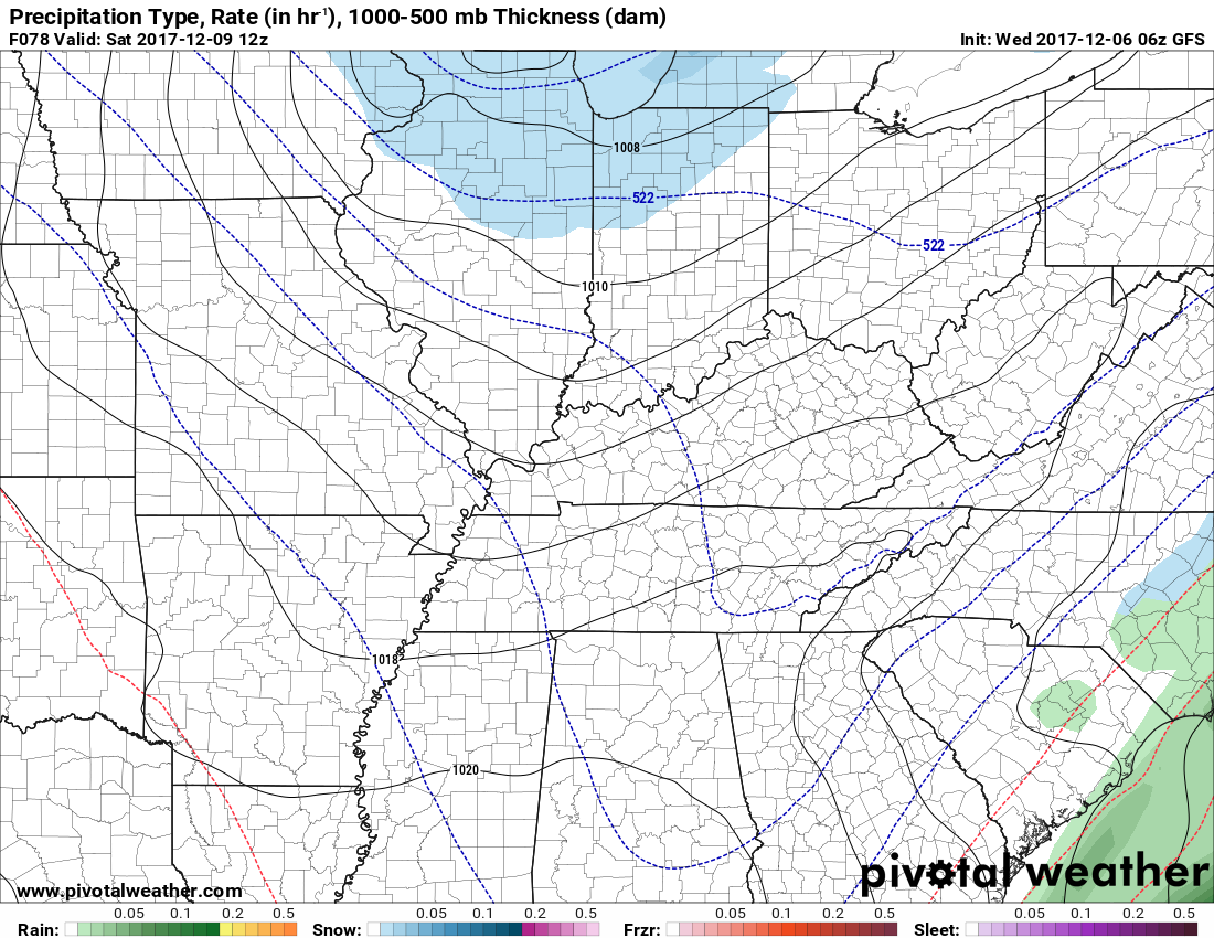
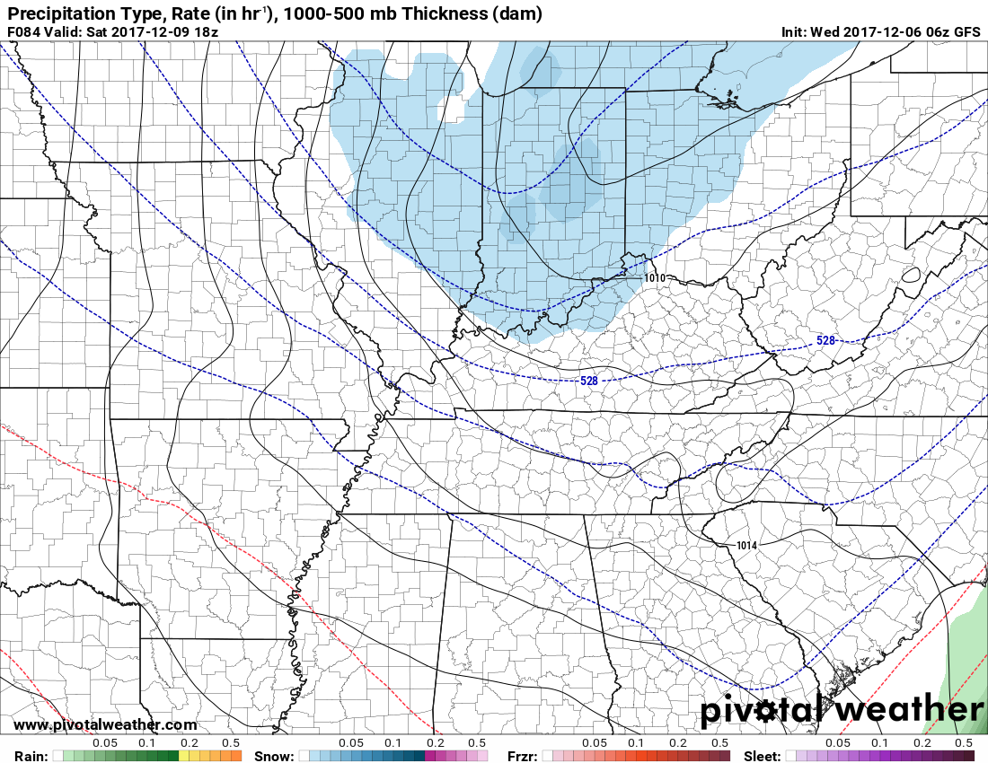
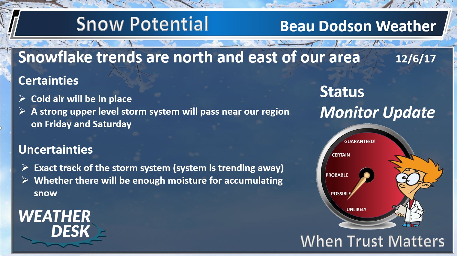
An upper level disturbance will move into the region Friday night and Saturday. Model trends are pushing it further and further away from our area. If this trend continues then the chance of any snow will be removed from the forecast. What is important with the model guidance is not what they actually show, but rather the trends and the overall pattern.
Still some time for adjustments, but the trend is not your friend (if you want snow).
Here is the GFS model for late Friday night into Saturday morning. You can see the snow well to our north and east. Blue would be light snow or snow showers.
.
.
.
Temperatures should be a bit milder on Sunday vs Friday and Saturday. Highs are forecast to range from 45 to 50 degrees. Still cool, but closer to seasonal norms.
Sunday and Monday are currently forecast to be dry.
I am monitoring precipitation chances Monday night, Tuesday and Wednesday of next week. Still a bit early for certainties.
A series of fast moving clippers will need to be monitored. Clippers dive into our region from the northwest. They are often times starved of moisture, but can occasionally produce snow.
I am also monitoring several larger systems between now and Christmas. Snow lovers should not give up. There is a higher than normal chance of snow over the coming weeks.
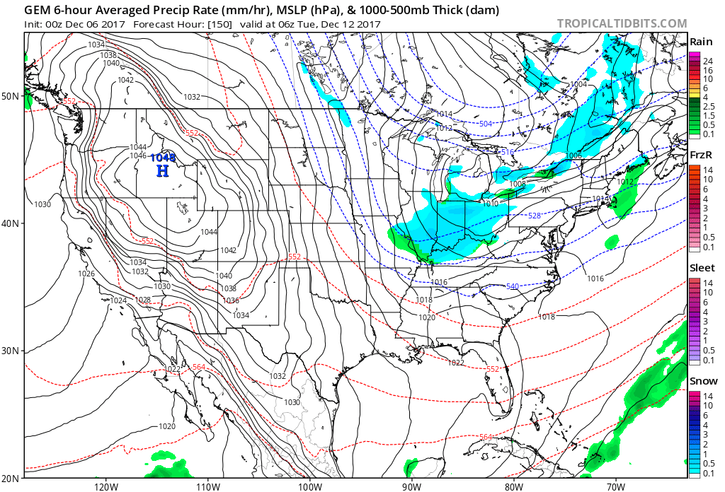
Let me show you the Canadian and GFS model guidance packages. I am showing you the active look to the pattern.
Don’t take the specifics on these maps. Just take the idea that we are in a pattern that could deliver precipitation chances.
This first one is Tuesday, December 12, 2017
This is another clipper system. Track will be key to where snow falls. Models don’t do all that well in the long range. Green would be rain and blue would be snow. Again, too soon to know the track.
.
.
Here is another system on December 14th. Another clipper dives in from the northwest. Too soon to know the track.
.
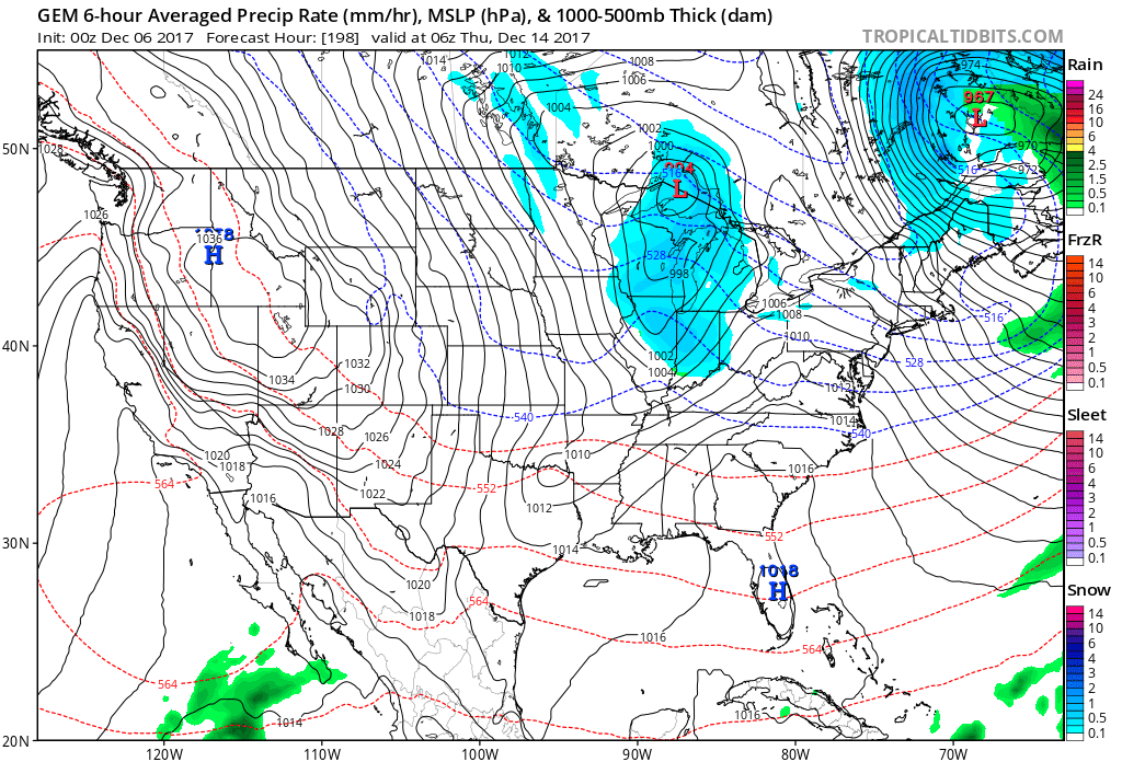
.
The GFS model shows the potential for another system around the 18th.
.
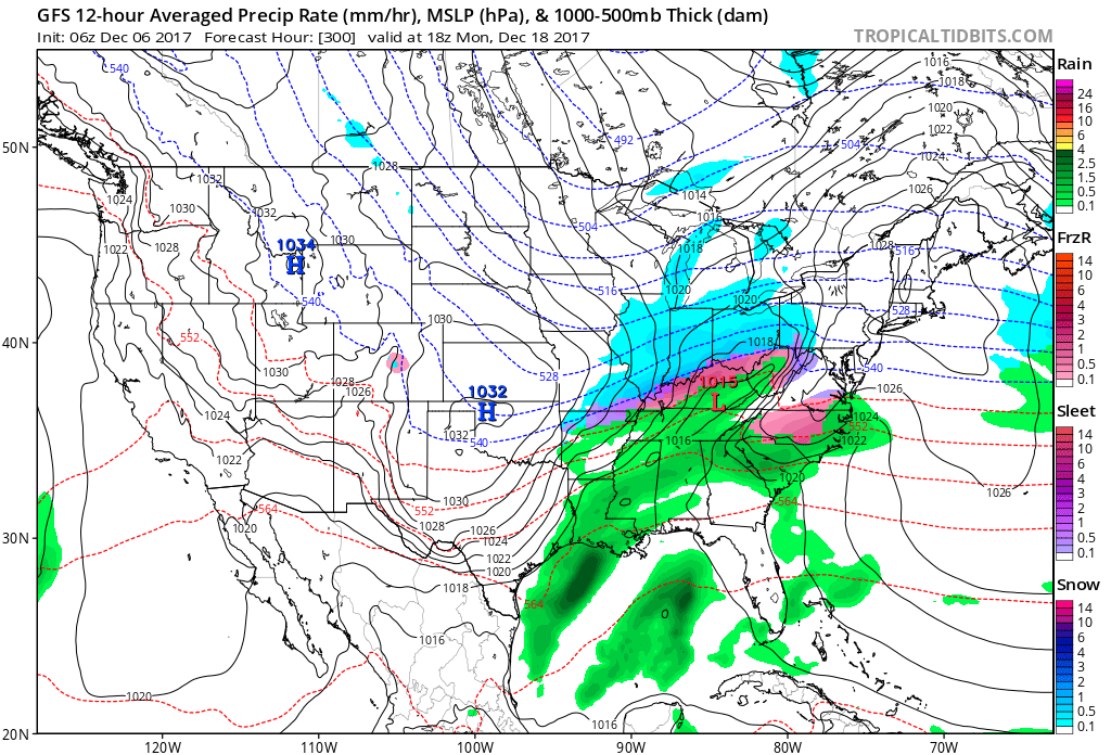
.
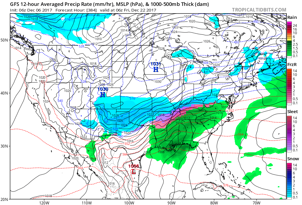
Here is another potential system around the 22nd.
The key to all of this is not the specifics. It is that there are precipitation chances moving forward.
.
.
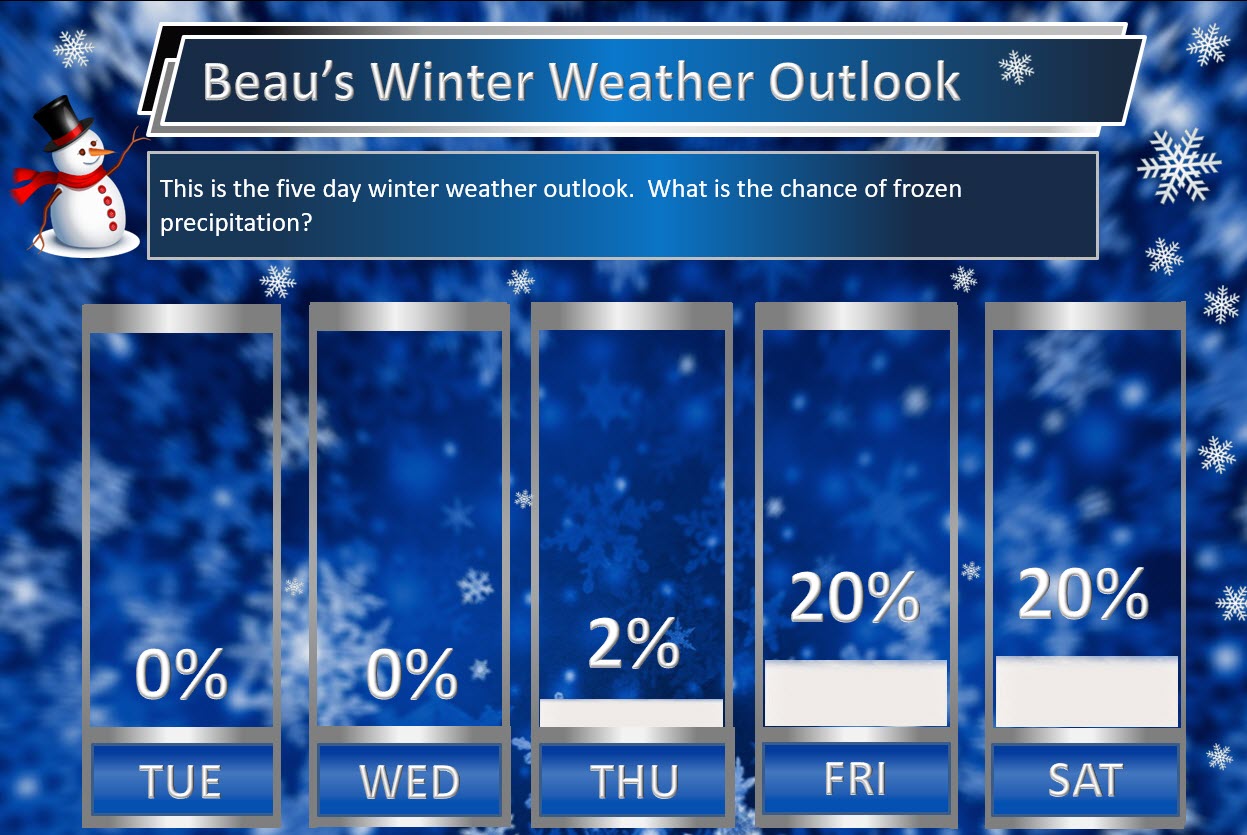
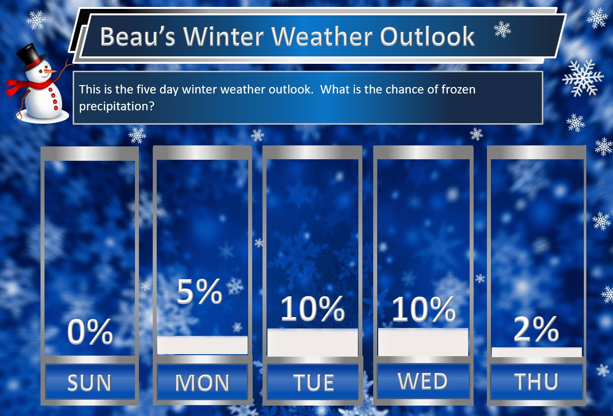
Beau’s Winter Weather Outlook
.
.
Here are my latest snow probability maps. These graphics have nothing to do with accumulation. This is simply the forecast probability of snow falling.
.
Numbers were lowered a bit in today’s outlook.
.
.
.