We have our first sponsor for the blog. Milner and Orr Funeral Home and Cremation Services located in Paducah, Kentucky and three other western Kentucky towns – at Milner and Orr they believe in families helping families.
![]()

This forecast update covers far southern Illinois, far southeast Missouri, and far western Kentucky. See the coverage map on the right side of the blog.
Saturday – Dreary. Periods of rain. Cool, but not cold. Cloudy through the day. Temperatures will be around 50 degrees with perhaps falling temperatures towards evening as a cold front approaches. South winds at 5-10 mph becoming west/northwest late in the day. Chance of rain near 100%.
Saturday night – Scattered light showers. Turning colder. North winds at 5-10 mph. Chance of rain 80%.
Sunday – Cloudy sky conditions. A chance for a shower. Colder with near steady temperatures in the upper 30’s and lower 40’s. North winds at 5-10 mph.
Sunday night – Cloudy and chilly. Low temperatures around 30 degrees. North winds at 5-10 mph.
Monday – A mix of sun and clouds. Colder. High temperatures only in the 40’s. Northeast winds at 5-10 mph.
Radars
WEATHER RADAR PAGE – Click here —
We also have a new national interactive radar – you can view that radar by clicking here.

Current Temperatures Around The Local Area and the national temperature map.
Check out the colder air advancing southward from the northern United States.


An explanation of what is happening in the atmosphere over the coming days.
Welcome to Saturday! I hope you had a nice Friday? It felt more like early March than late December. Go figure. But, like I told you the other day – don’t get used to these nice temperatures. They are not here to stay.
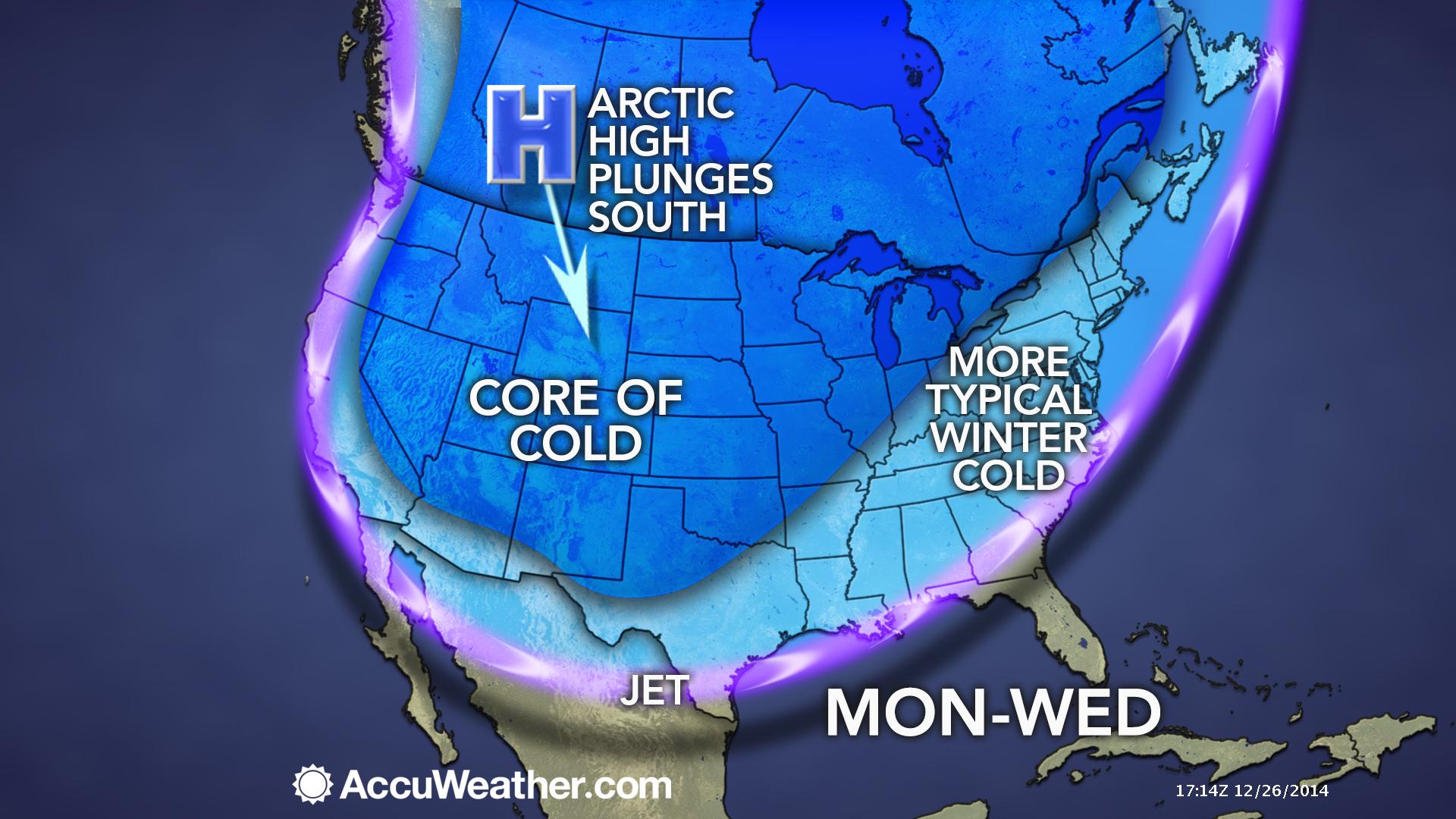
A cold front will advance into the region later today. This front will usher winter back into the Tri-State area. Temperatures will already be falling by late this afternoon over our western counties.
The front will be accompanied by showers.
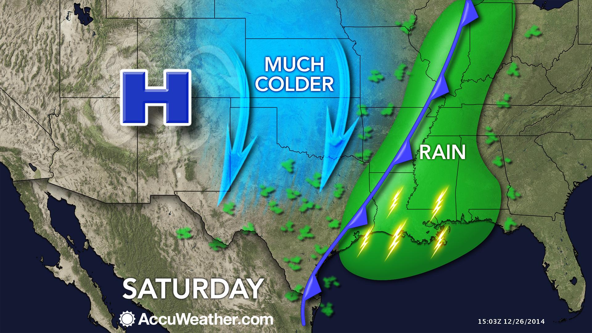
Sunday will bring a few lingering showers and cool temperatures. The cool/cold weather will last all week.
High pressure will dominate the area from Sunday night well into the new work week. A reinforcing shot of cold air arrives by Monday and Tuesday.
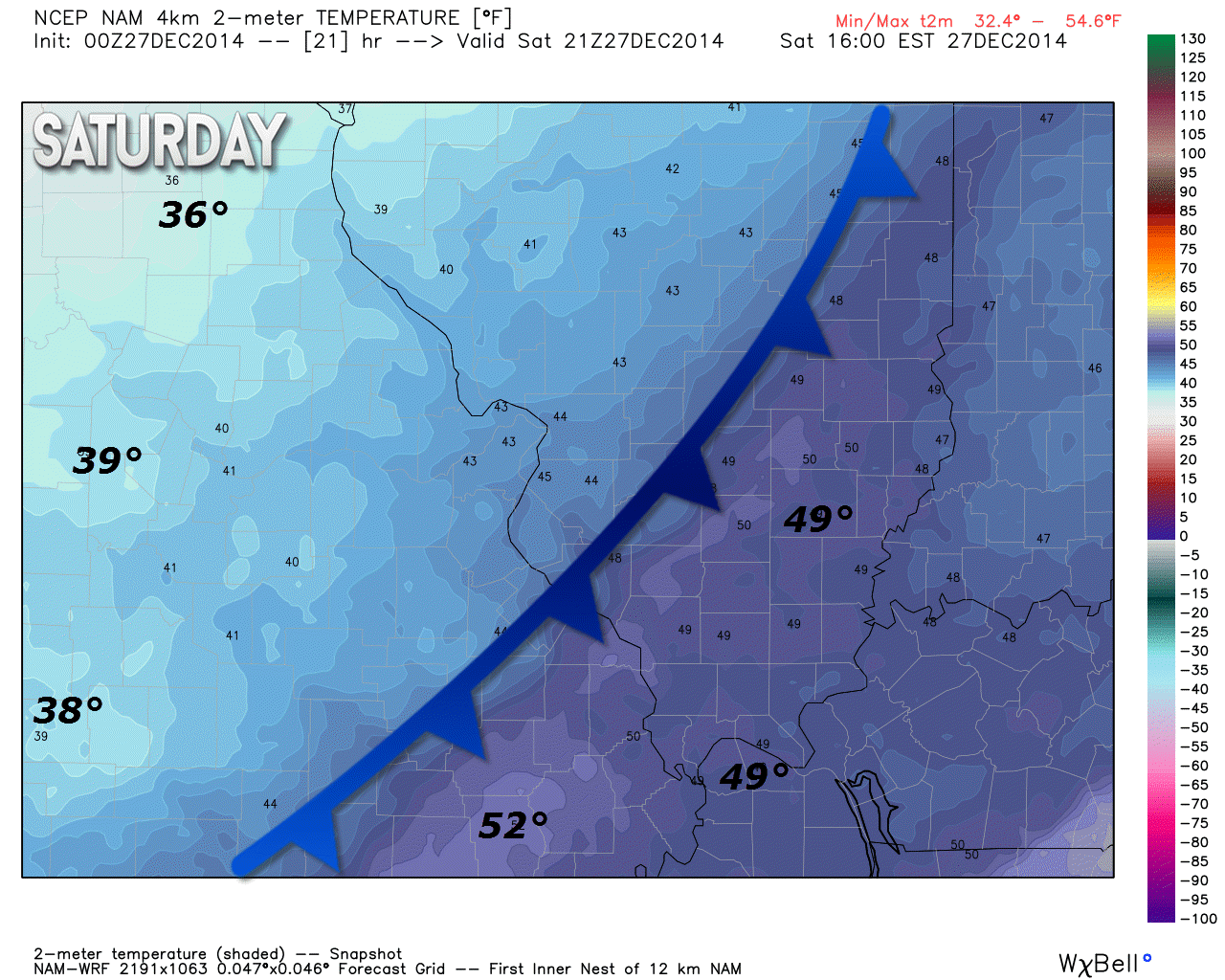
You can see the cold front advancing across the area on Saturday afternoon. Note the 50+ degrees over southeast Missouri with 30’s to the west. It will feel a bit more like winter on Sunday. Nothing extreme, but colder none-the-less.
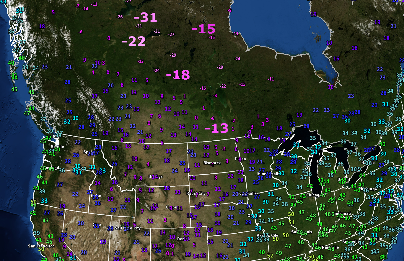
Speaking of extreme. Check out these temperatures from late last night (Friday night). Canada is shivering.

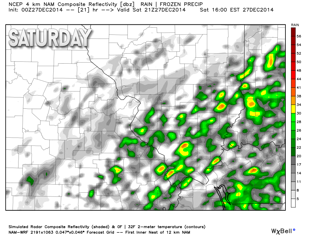
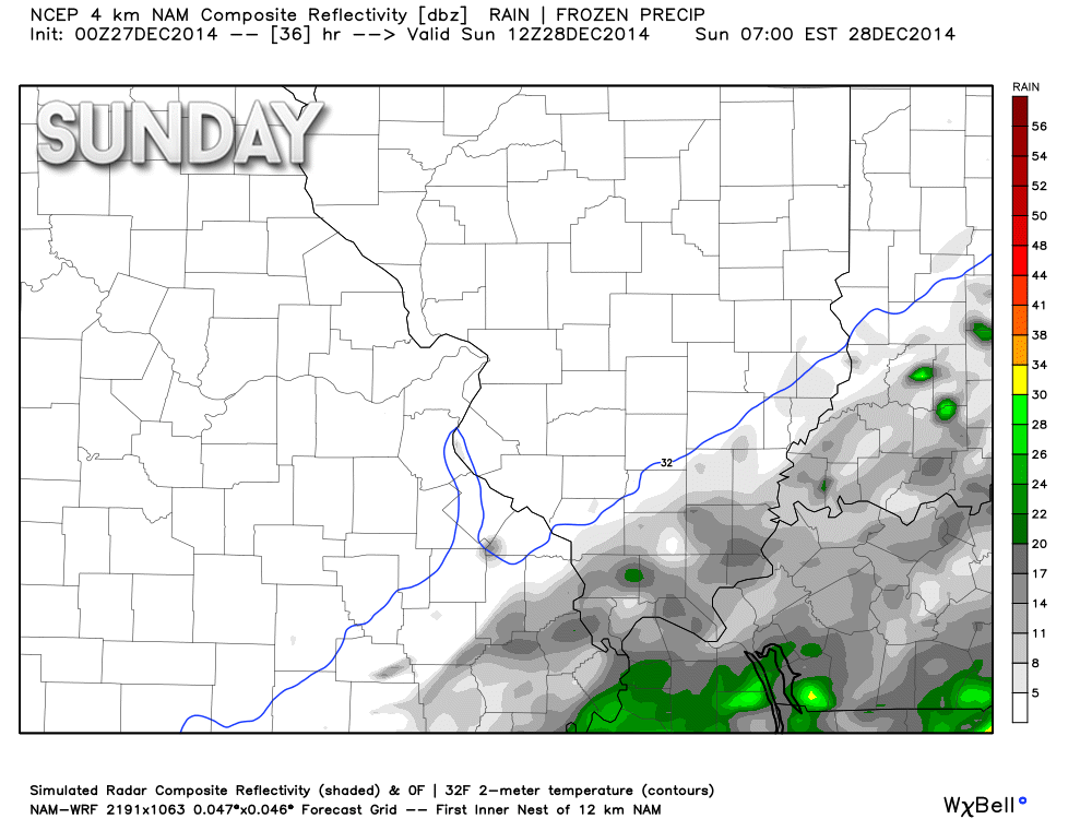
Here is the future-cast radar for today (Saturday). The first image is for 6 am and the second image is for this afternoon.
You can see quite a few showers dotting the landscape.
The last image is for Sunday. Note a few remaining showers.
Images are from weatherbell.com


No major changes in this forecast. Forecast seems on track for our rain event.

No major concerns.

The wild card tells you where the most uncertainty is in the current forecast.
Wild card in this forecast – I really don’t have a strong wild card in this forecast. Perhaps how much rain will linger into Sunday. Perhaps a few light showers.

Can we expect severe thunderstorms over the next 24 to 48 hours? Remember that a severe thunderstorm is defined as a thunderstorm that produces 58 mph winds or higher, quarter size hail or larger, and/or a tornado.
Thunderstorm threat level is ONE
I can’t completely rule out some thunder.


Will I need to take action?
Umbrellas.

How much rain should this system produce over our region?
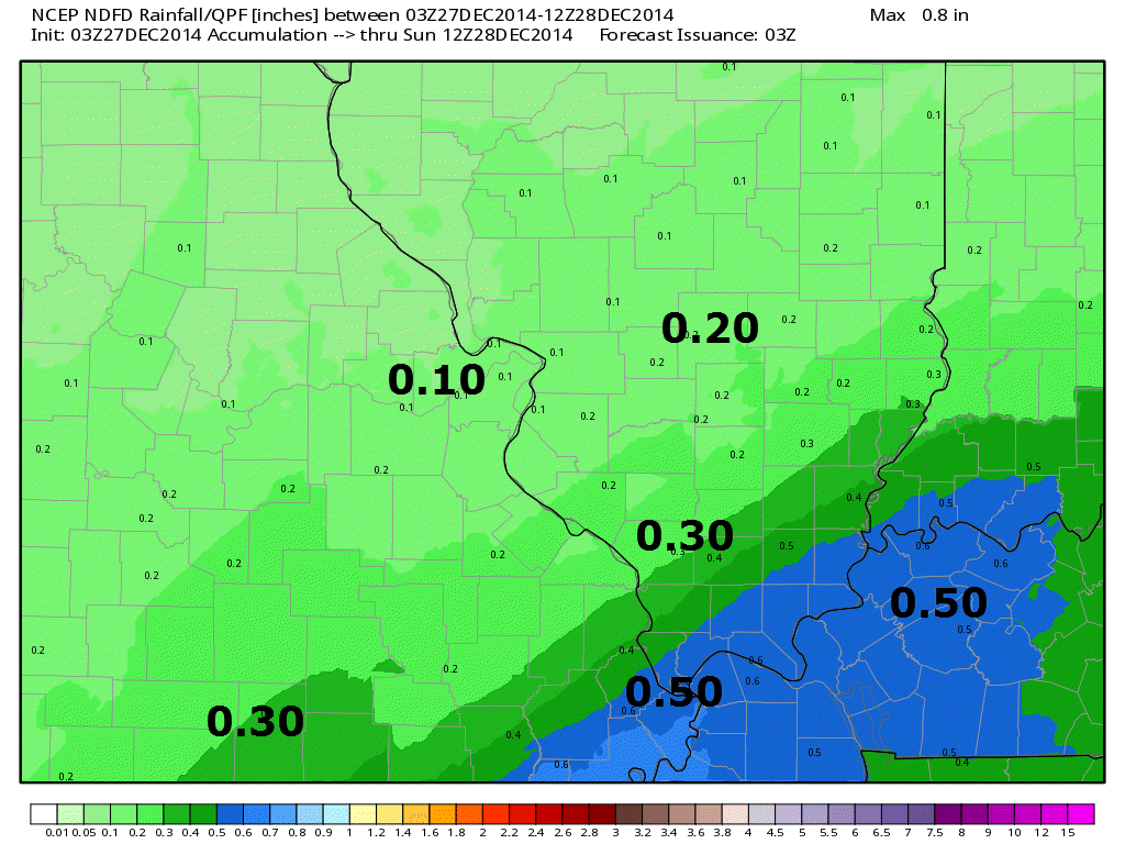
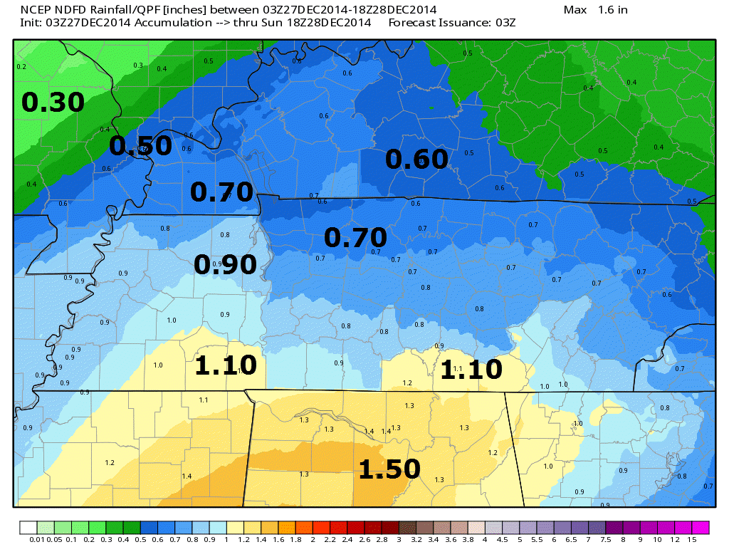
Rain will fall through this evening. Precipitation will be more scattered tonight and perhaps even on Sunday. Right now I am forecasting 0.25″-0.50″ with a few spots picking up more.
Here are the official National Weather Service forecast totals. I agree with these totals. They seem reasonable. This is a broad-brush forecast. Of course amounts always vary from county to county. But, you get the general idea.

No winter storms through Wednesday. Sorry snow fans.
Monitoring a system towards the end of next week. Stay tuned.

Folks, I know you have been wondering when winter will show up. And I have been promising you that the end of December would be cold. It appears it will be cold.
The real question is how long will the cold temperatures last and will we end up with a winter storm mixed in with the cold weather.
I am watching one system towards the end of the new work week. I have absolutely no faith in the computer weather models. They have been nothing less than horrible over the past few weeks. They even busted on the Christmas Eve snowstorm for central and northern Illinois (they busted within 12 hours of the event). Embarrassing.
I certainly won’t make you any promises on a storm system that is still five or six days away.
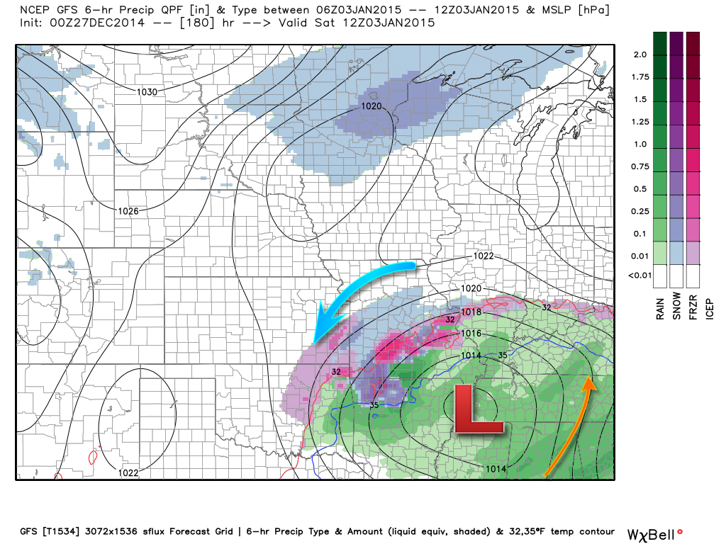
Speaking of models…this is what the high resolution GFS model is showing for the late week storm. That is rain for most of our region. So, again – who knows that far out. Will there even be precipitation? Will it be too warm for snow or ice? Will it miss us all together?
Time will tell.
Purple and blue represents snow and ice.
Green represents rain.
Image is from weatherbell.com
All I will say is that I am monitoring a precipitation event for Thursday through Saturday of next week. Perhaps centered on Thursday night into Friday. Whether this system actually can manage to squeak out some winter weather for our local counties has yet to be determined.
The track of the system and the intensity of the system is questionable.
If you have been watching for a winter weather event then at least you have something to tune back in for over the coming days. I will be watching, monitoring, and forecasting.
Meanwhile, regardless of whether or not we end up with some wintry precipitation late next week, we will be dealing with colder temperatures.
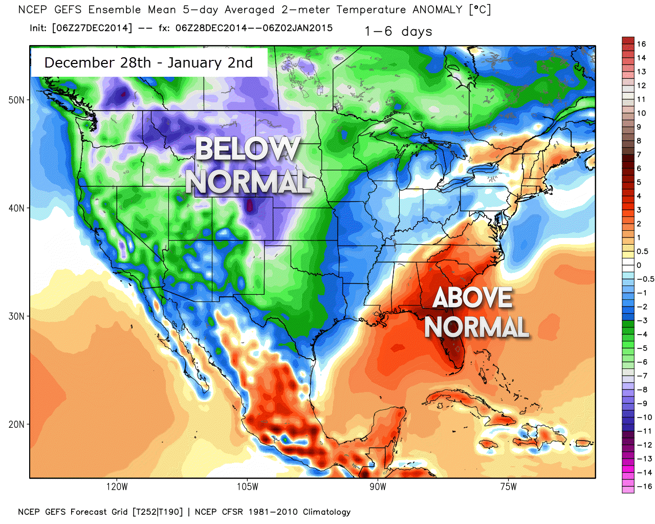
Here are the temperature anomalies for December 28th through January 2nd. You can see the coldest air is centered over the Rocky Mountains. The mildest air is centered over the southeast United States. That leaves us a few degrees below normal – a cold period.
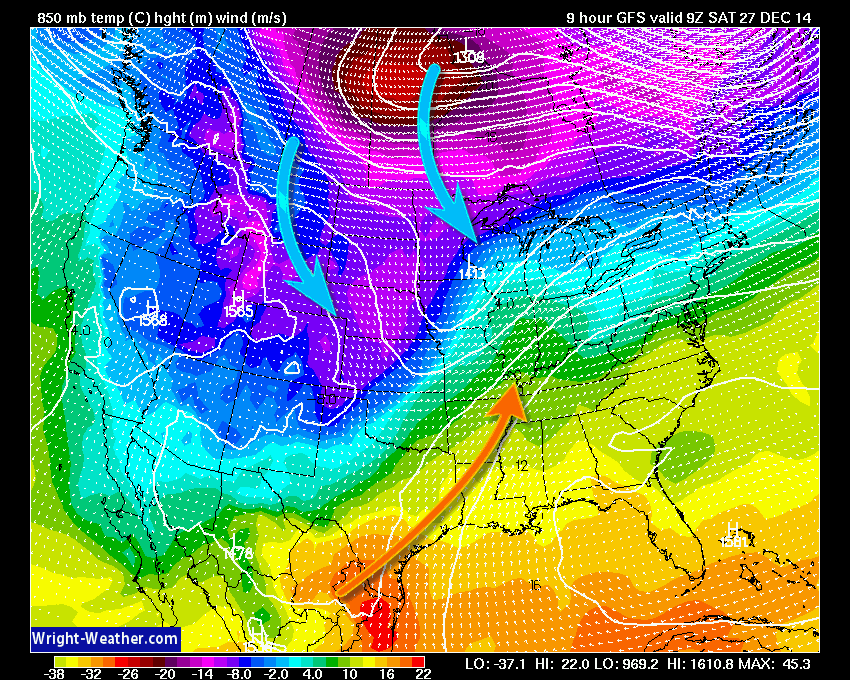
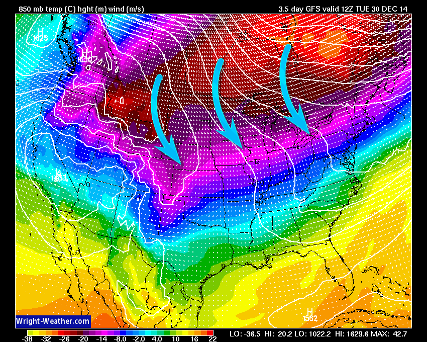
Let’s compare the 850 mb temperature map for today vs Tuesday morning. This is several thousand feet above the surface. You can see the milder air for the area today. But notice the colder (blue and purple) temperatures advancing through the northern United States. That becomes even more pronounced later this week (the second image).
It will be cold, but nothing too extreme. It will feel like winter.
I know some are sold on this cold lasting into January – relentless. But, I am leaning more towards cold shots mingled with mild spells. The storm track will determine temperatures. If the storm tracks are more north of us than south of us then we will see some periods of milder temperatures. With those milder temperatures will come rain.
Right now it does not look like this January will be the never ending cold we saw last winter. Of course, weather is fickle in our region and subject to changes. Long range forecasting is not an exact science.

We have regional radars and local city radars – if a radar does not seem to be updating then try another one. Occasional browsers need their cache cleared. You may also try restarting your browser. That usually fixes the problem. Occasionally we do have a radar go down. That is why I have duplicates. Thus, if one fails then try another one.
If you have any problems then please send me an email beaudodson@usawx.com
WEATHER RADAR PAGE – Click here —
We also have a new national interactive radar – you can view that radar by clicking here.
Local interactive city radars include St Louis, Mt Vernon, Evansville, Poplar Bluff, Cape Girardeau, Marion, Paducah, Hopkinsville, Memphis, Nashville, Dyersburg, and all of eastern Kentucky – these are interactive radars. Local city radars – click here
NOTE: Occasionally you will see ground clutter on the radar (these are false echoes). Normally they show up close to the radar sites – including Paducah.

Regional Radar – Click on radar to take you our full radar page.


Regional Radar

Live Lightning Data – zoom and pan: Click here
Live Lightning Data with sound (click the sound button on the left side of the page): Click here

Current WARNINGS (a warning means take action now). Click on your county to drill down to the latest warning information. Keep in mind that there can be a 2-3 minute delay in the updated warning information.
I strongly encourage you to use a NOAA Weather Radio or warning cell phone app for the most up to date warning information. Nothing is faster than a NOAA weather radio.


Color shaded counties are under some type of watch, warning, advisory, or special weather statement. Click your county to view the latest information.

Missouri Warnings

Illinois Warnings

Kentucky Warnings

Please visit your local National Weather Service Office by clicking here. The National Weather Service Office, for our region, is located in Paducah, Kentucky.

Here is the official 6-10 day and 8-14 day temperature and precipitation outlook. Check the date stamp at the top of each image (so you understand the time frame).
The forecast maps below are issued by the Weather Prediction Center (NOAA).


The latest 8-14 day temperature and precipitation outlook. Note the dates are at the top of the image. These maps DO NOT tell you how high or low temperatures or precipitation will be. They simply give you the probability as to whether temperatures or precipitation will be above or below normal.


Many of my graphics are from www.weatherbell.com – a great resource for weather data, model data, and more


This blog was inspired by ABC 33/40’s Alabama Weather Blog – view their blog
Current tower cam view from the Weather Observatory- Click here for all cameras.

Southern Illinois Weather Observatory

The Weather Observatory

Southern Illinois Weather Observatory
WSIL TV 3 has a number of tower cameras. Click here for their tower camera page & Illinois Road Conditions

Marion, Illinois
WPSD TV 6 has a number of tower cameras. Click here for their tower camera page & Kentucky Road Conditions & Kentucky Highway and Interstate Cameras

Downtown Paducah, Kentucky
Benton, Kentucky Tower Camera – Click here for full view

Benton, Kentucky

I24 Paducah, Kentucky

I24 Mile Point 9 – Paducah, KY

I24 – Mile Point 3 Paducah, Kentucky

You can sign up for my AWARE email by clicking here I typically send out AWARE emails before severe weather, winter storms, or other active weather situations. I do not email watches or warnings. The emails are a basic “heads up” concerning incoming weather conditions.