.
Not a subscriber? Go to www.weathertalk.com/welcome
.

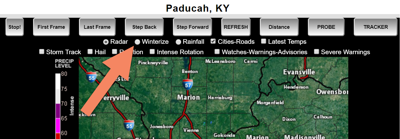
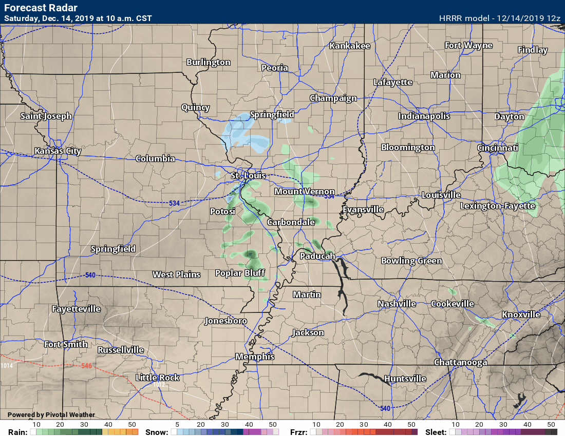
Radar Link: Interactive local city-view radars & regional radars.
You will find clickable warning and advisory buttons on the local city-view radars.
If the radar is not updating then try another one. If a radar does not appear to be refreshing then hit Ctrl F5. You may also try restarting your browser.
Not working? Email me at beaudodson@usawx.com
On the local city-view radars, you can click the winterize button to see precipitation type. Click image to enlarge it.
.
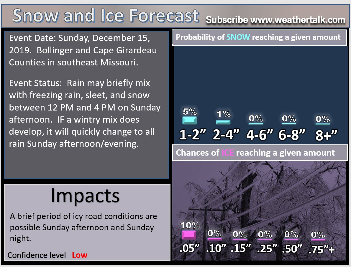
Key Points
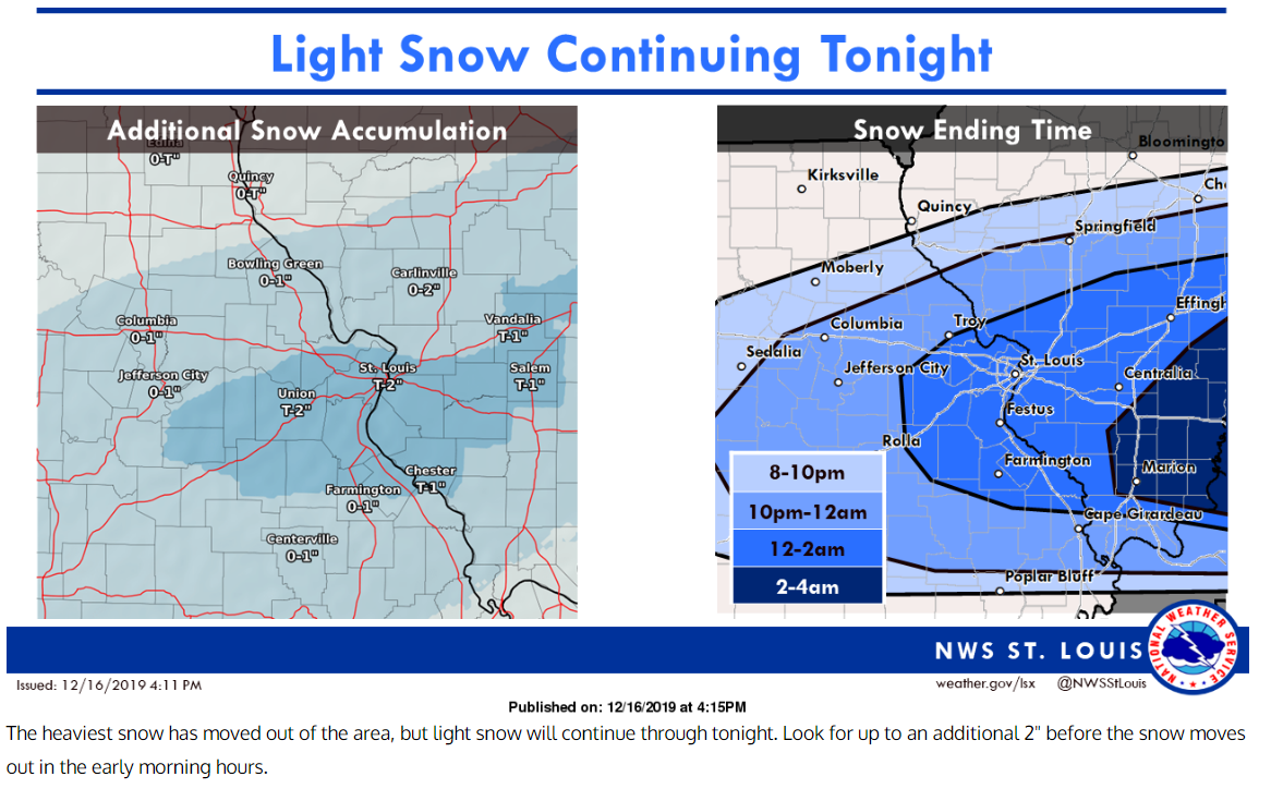
I will keep the Winter Storm Live Blog updated through Monday morning. The latest information will be posted right below the key points. Check back frequently for updates.
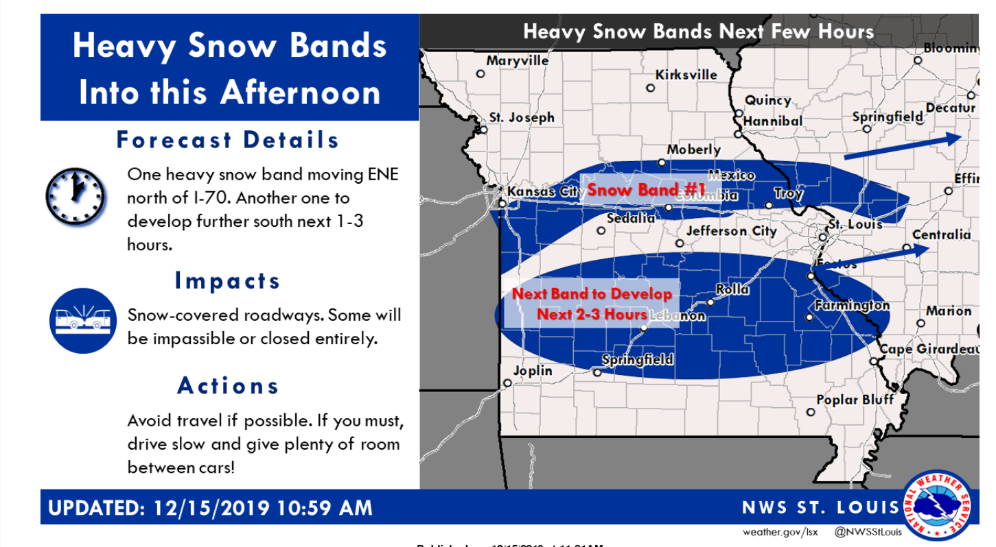
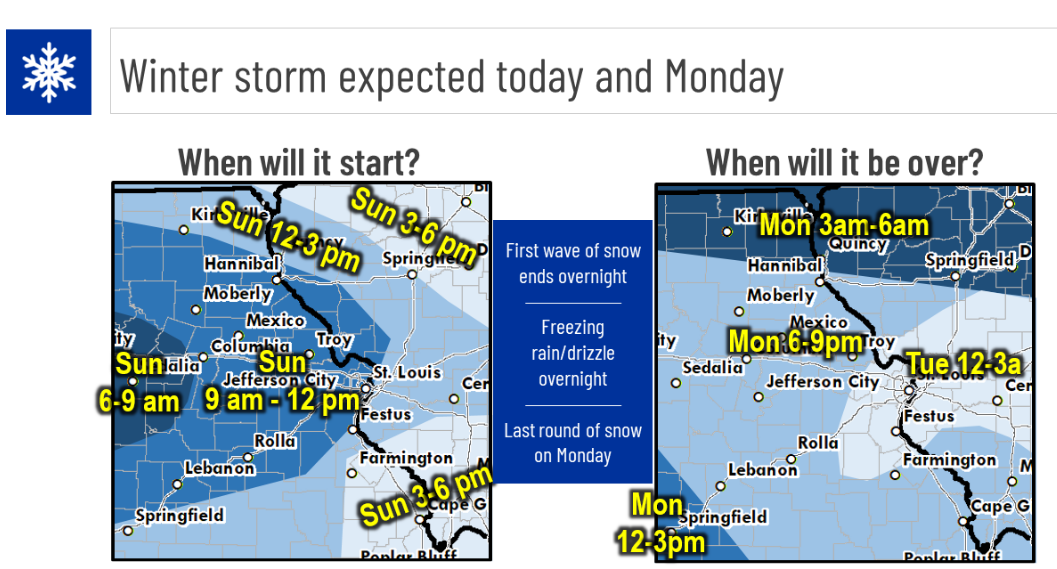
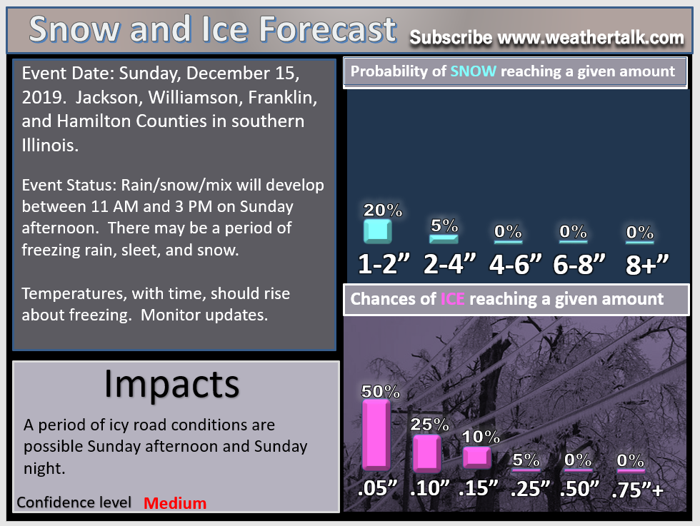
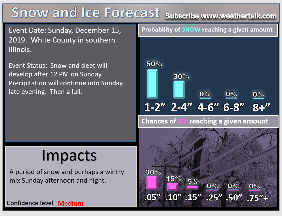
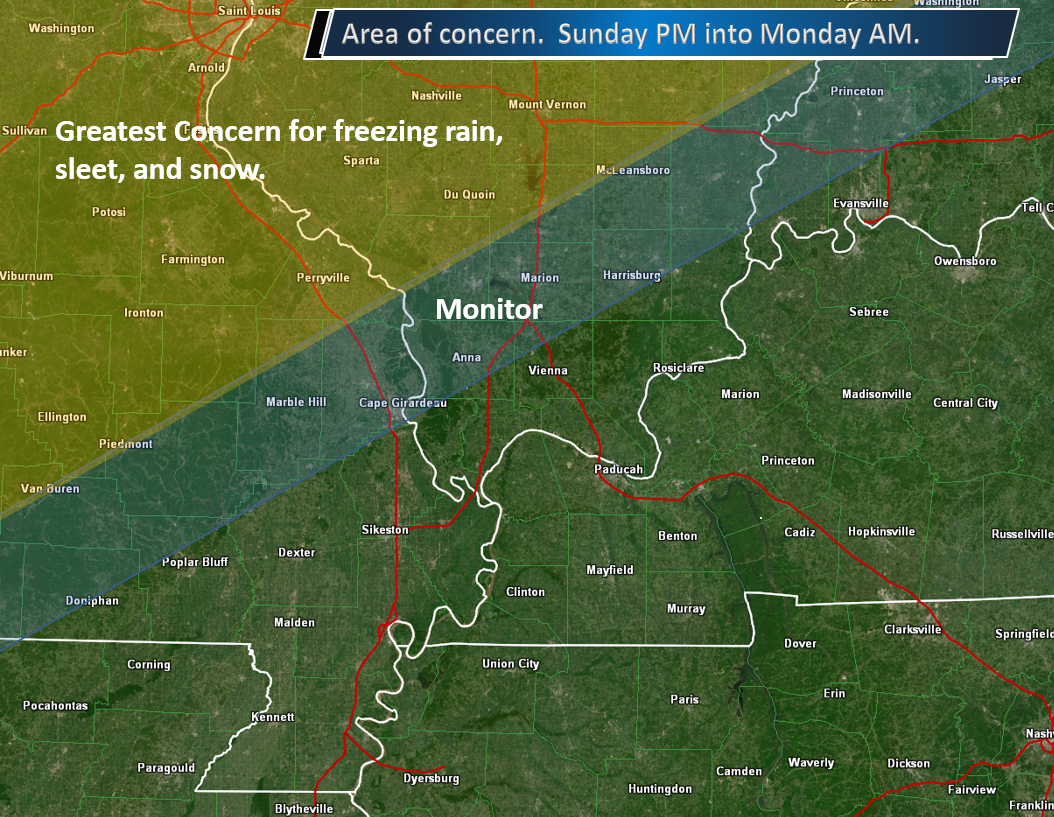
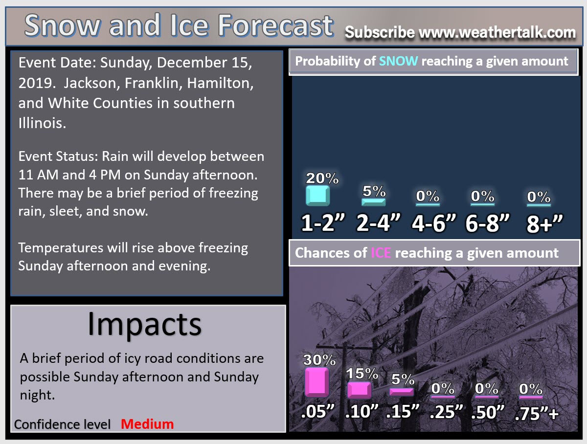
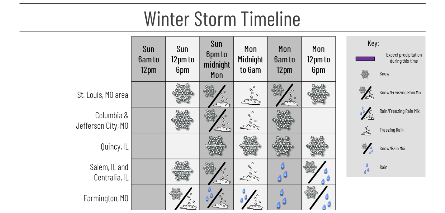
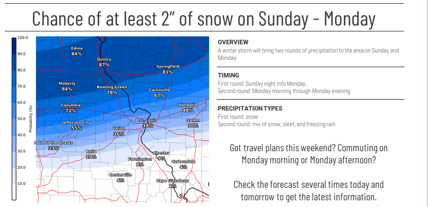
- A winter weather event will develop on Sunday afternoon and continue into Monday. The type of precipitation is the biggest concern and question.
- The second round of precipitation arrives on Monday PM.
- Portions of the region will likely receive all rain. Keep that in mind.
.
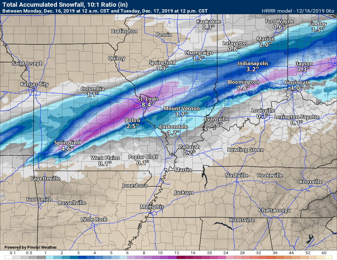
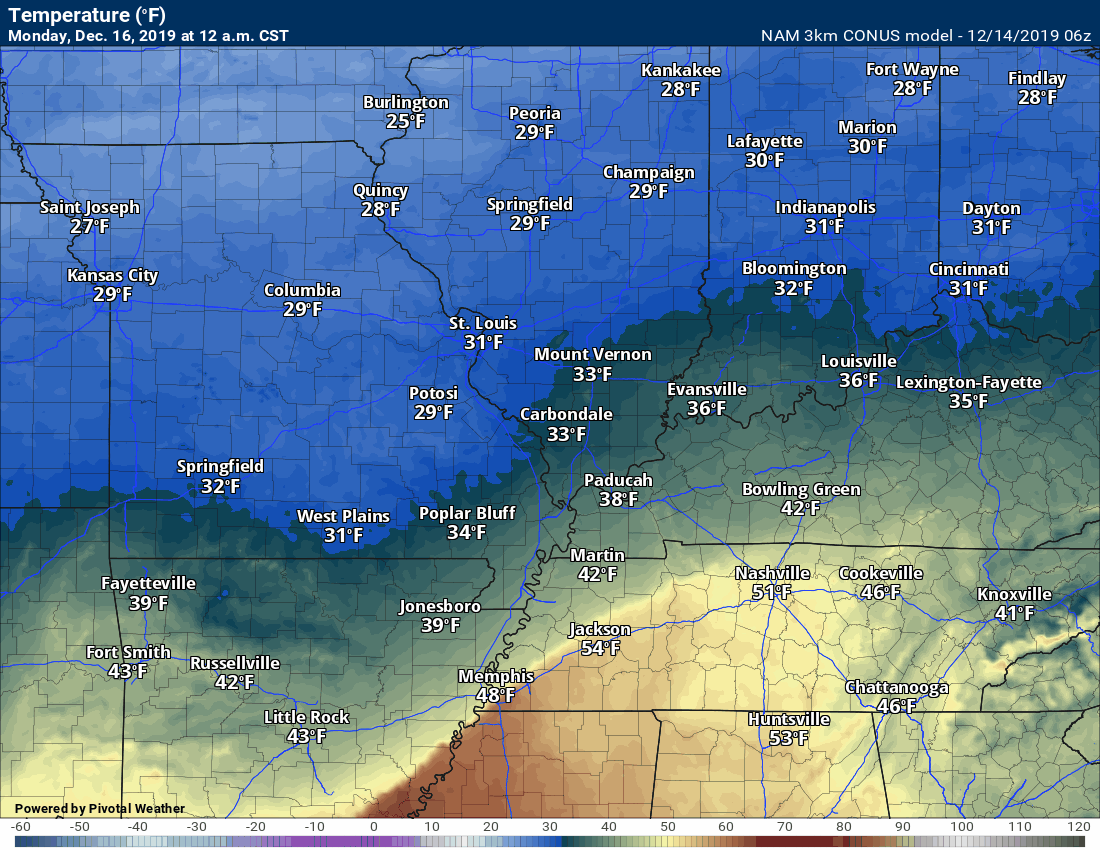
TUESDAY, DECEMBER 16, 2019
Winter Storm Updates
Not a subscriber? Go to www.weathertalk.com/welcome Subscribers will receive links via their Weather Talk app when a winter storm/severe thunderstorm live blog has been activated.
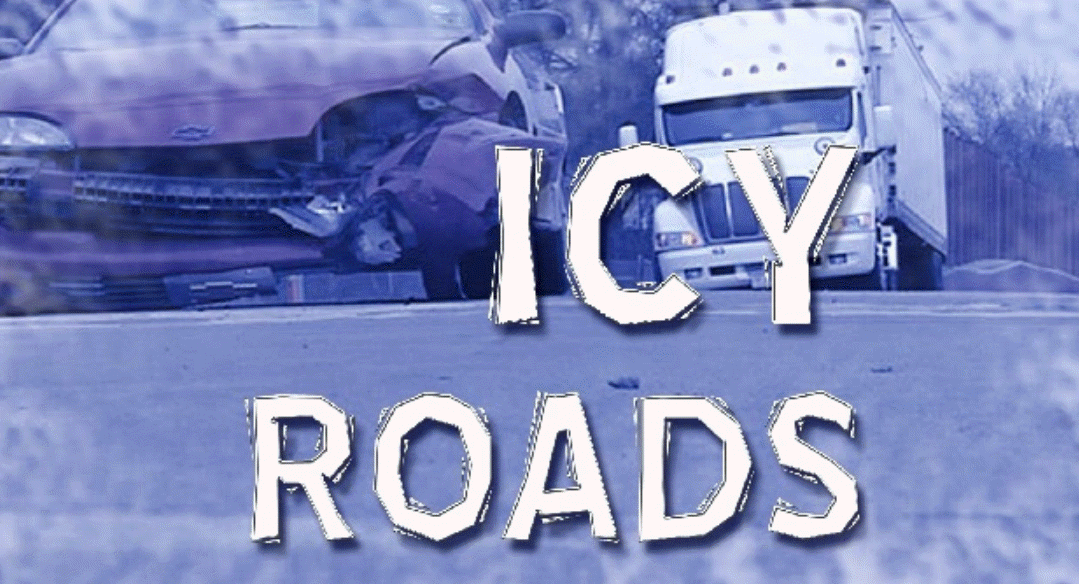
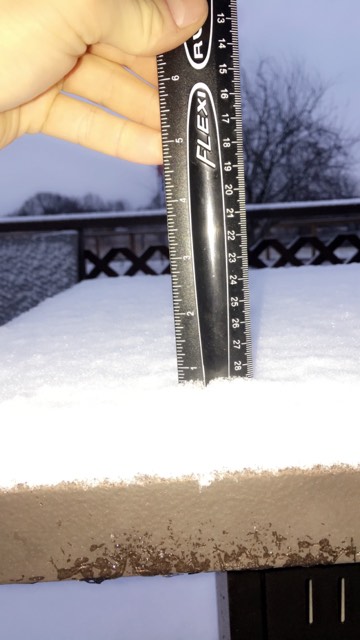
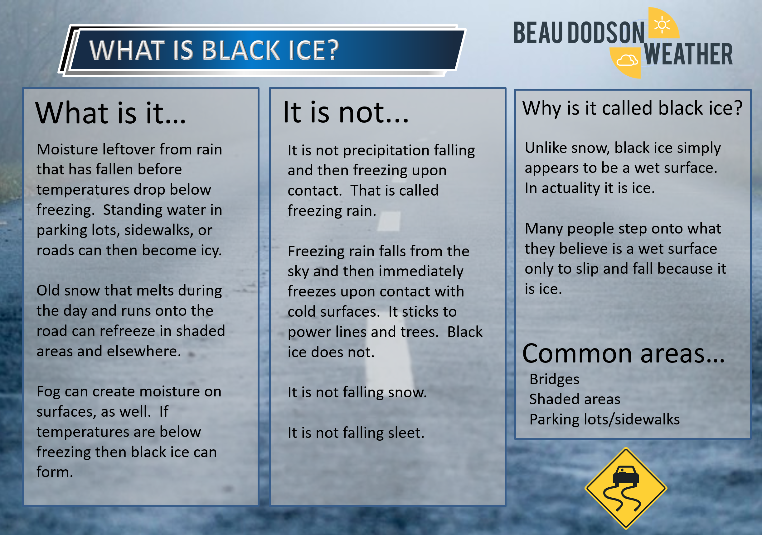
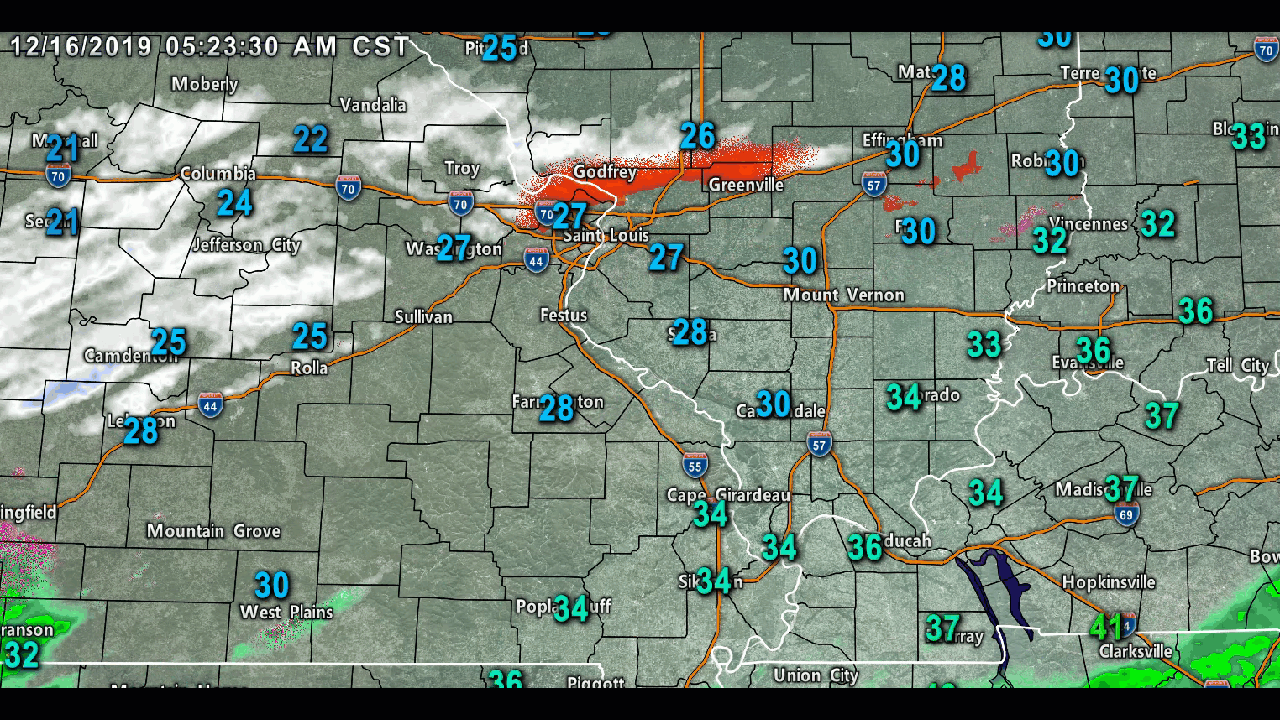
Watch for icy spots this morning. Some of you have 1/2 to 1″ of snow. Others have ice. Some have black ice. Some do not have any impacts.
Remember, elevated surfaces can be icy even when other roads are dry.
Marion, Illinois. Cody Simmerman photos.
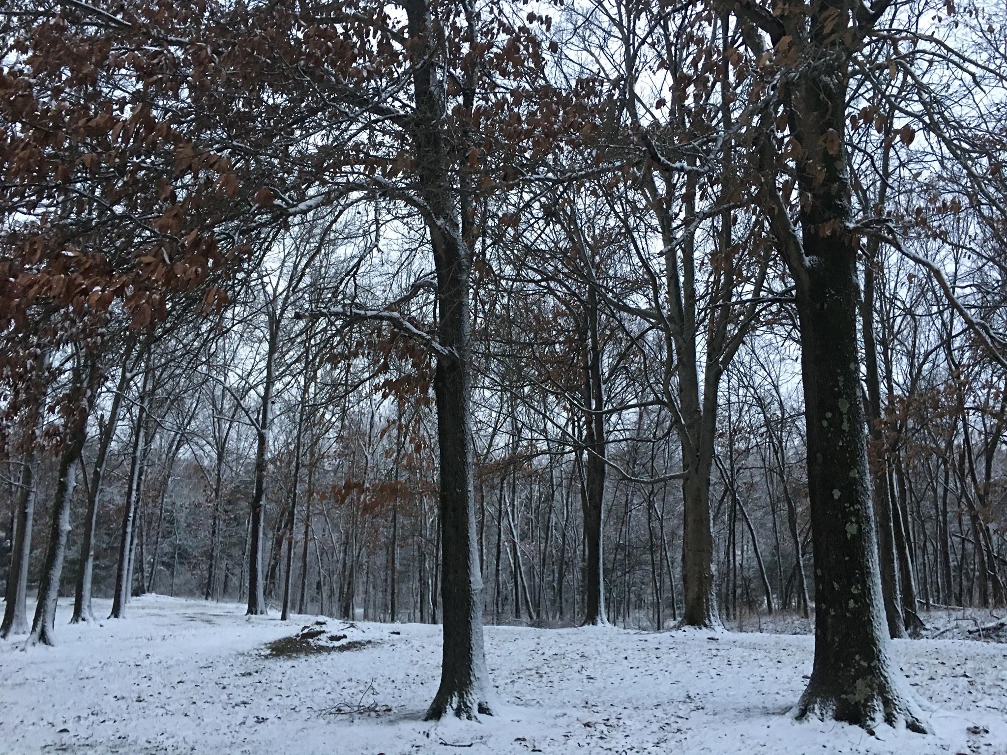
Marion, Illinois. Cody Simmerman photos.
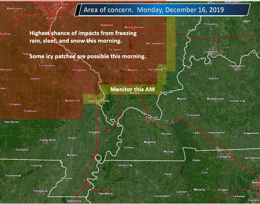
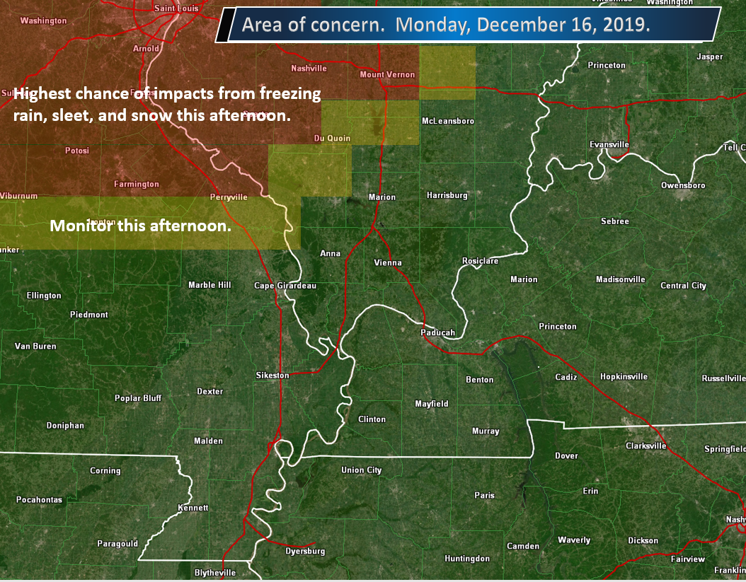
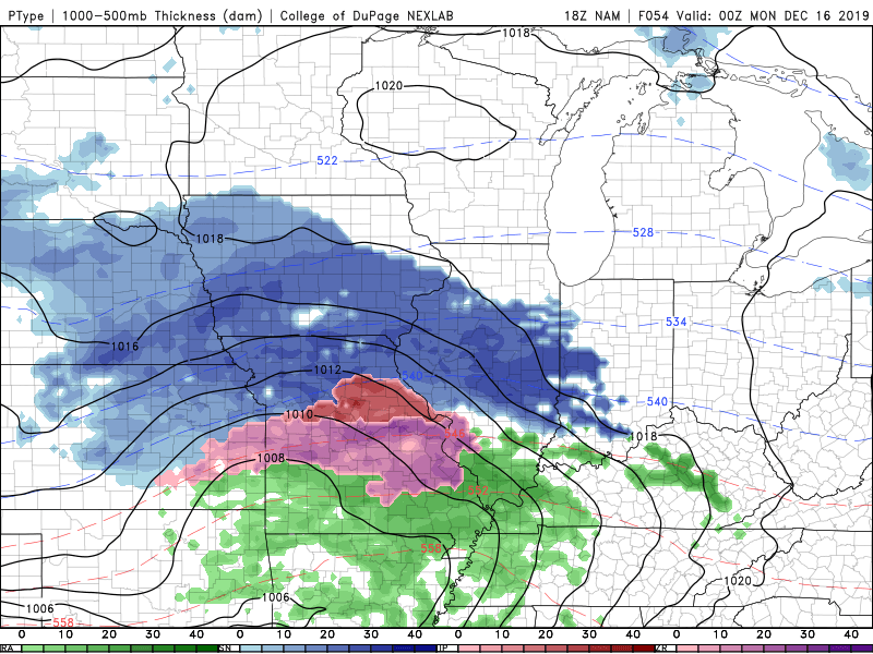
MONDAY, DECEMBER 16, 2019
Winter Storm Updates
11:25 PM
Last update for tonight.
See the live radars to track the precipitation. Other information below.
Radar Link: Interactive local city-view radars & regional radars.
.
10:05 PM
Not a subscriber? Go to www.weathertalk.com/welcome Subscribers will receive links via their Weather Talk app when a winter storm/severe thunderstorm live blog has been activated.
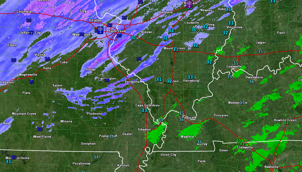
Sleet and snow have developed in Du Quoin in the last 20 minutes. Report from a trained spotter.
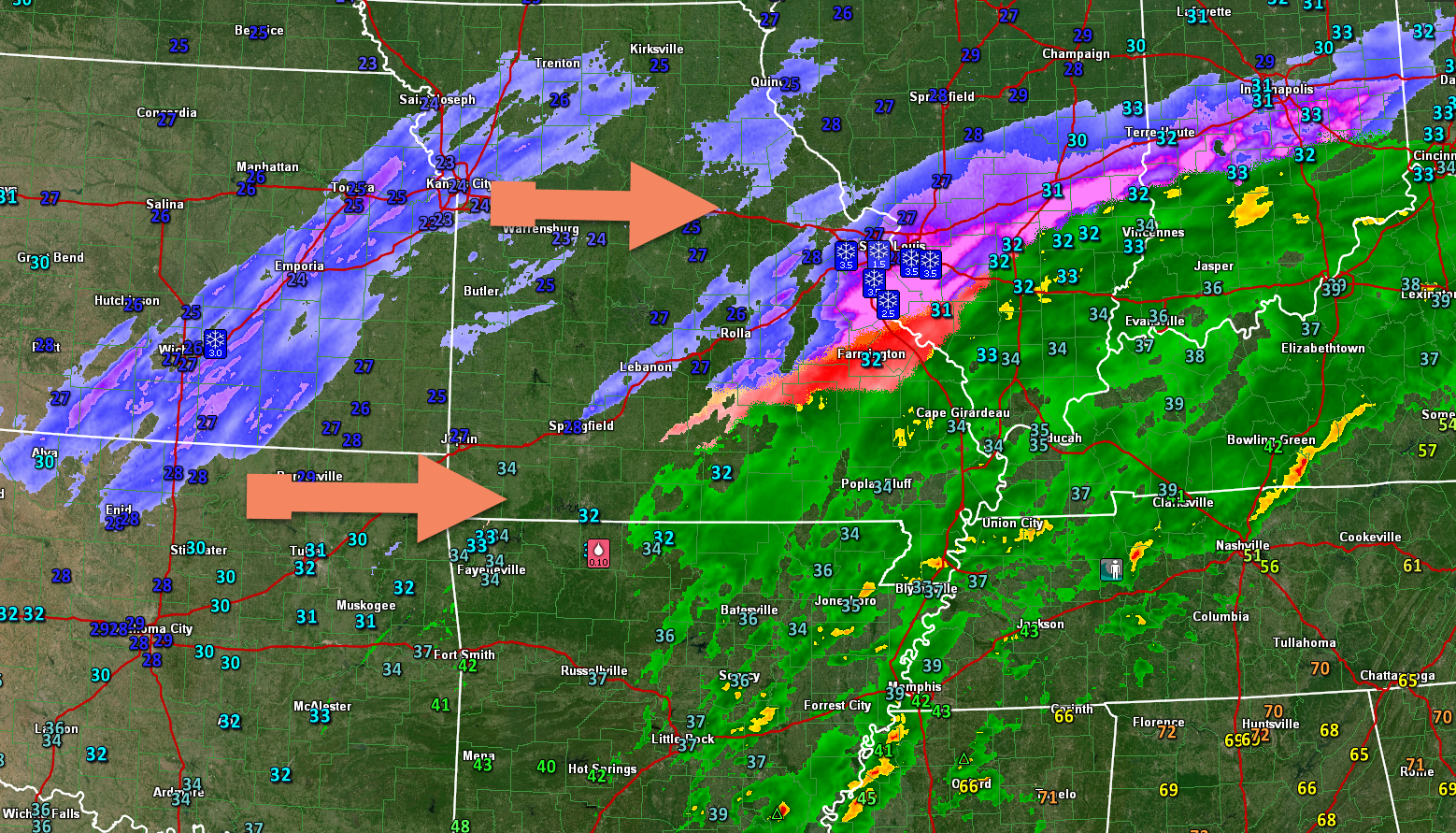
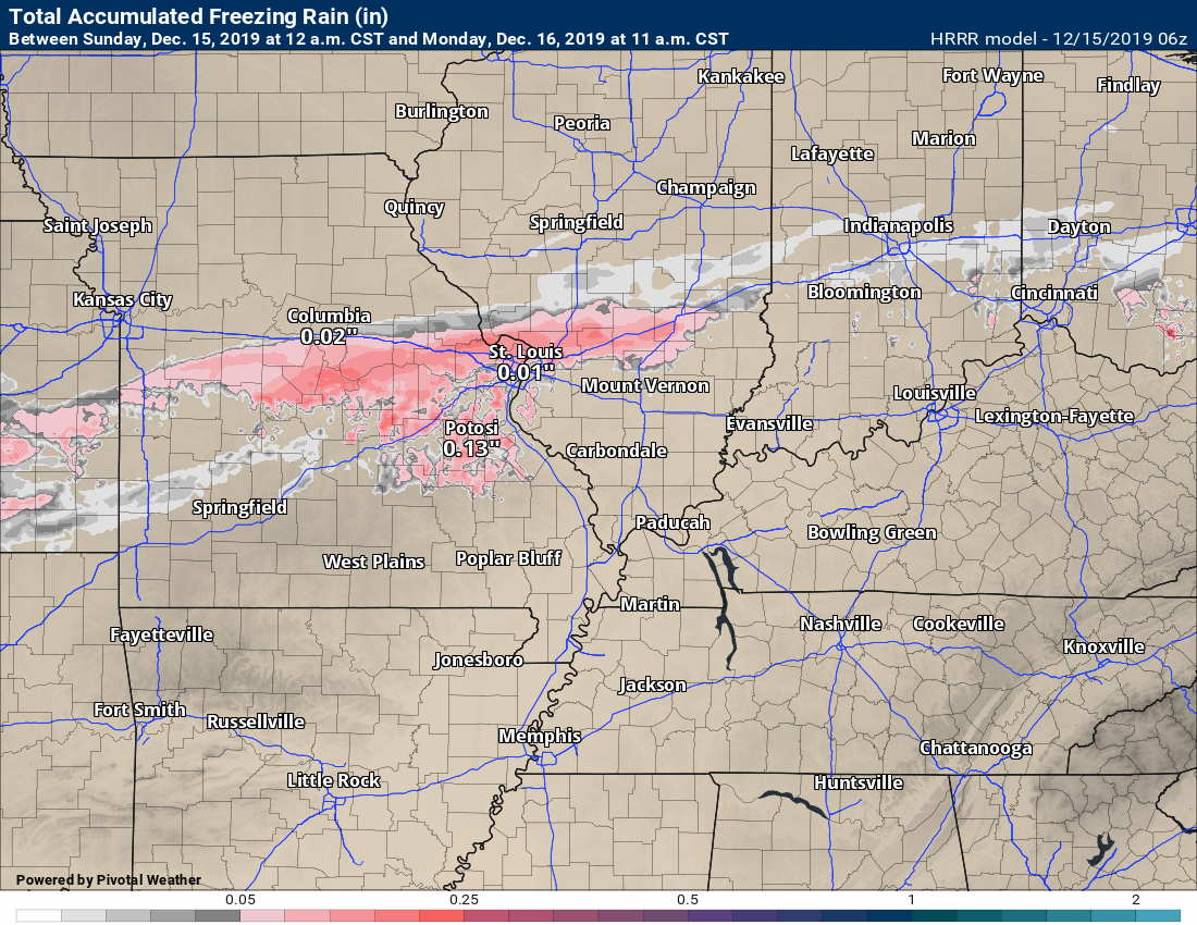
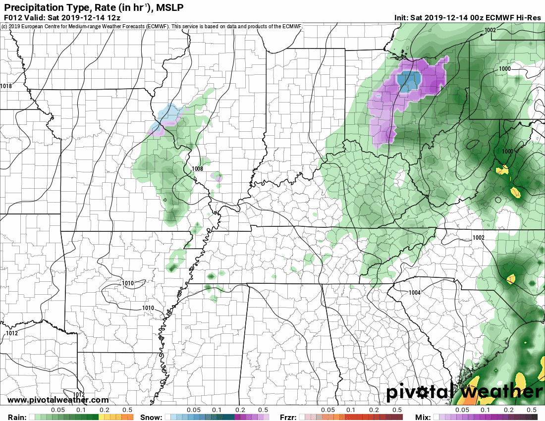
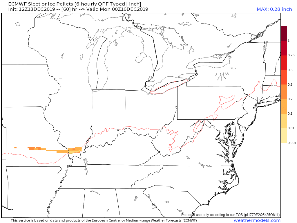
Numerous reports of freezing rain, sleet, and snow over southeast Missouri and southern Illinois. The freezing line runs from near Poplar Bluff, Missouri, towards Alexander County, Illinois, and then northeast into the Harrisburg, Illinois, area.
The freezing line will continue to slowly shift south and east over the coming hours.
At this time, the precipitation in the Missouri Bootheel, western Kentucky, and northwest Tennessee is in the form of rain. Temperatures are above freezing.
See the live radars Radar Link: Interactive local city-view radars & regional radars.
Click winterize on the local-city view radars. That will show you the snow, sleet, freezing rain, and rain.
.
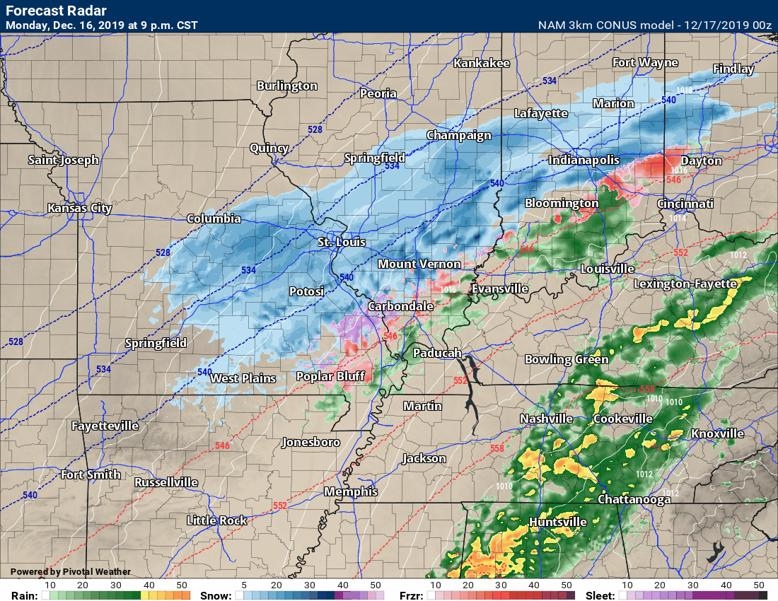
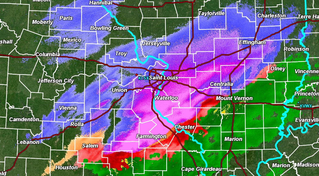
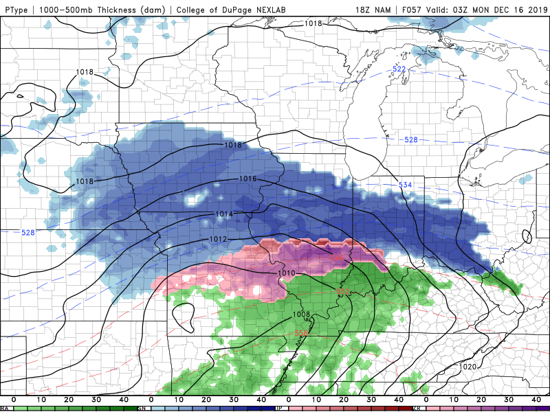
9:15 PM
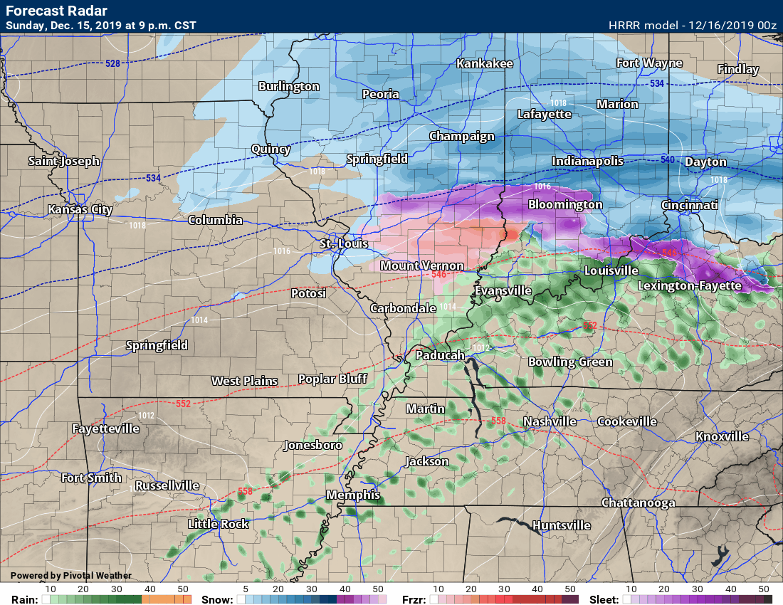
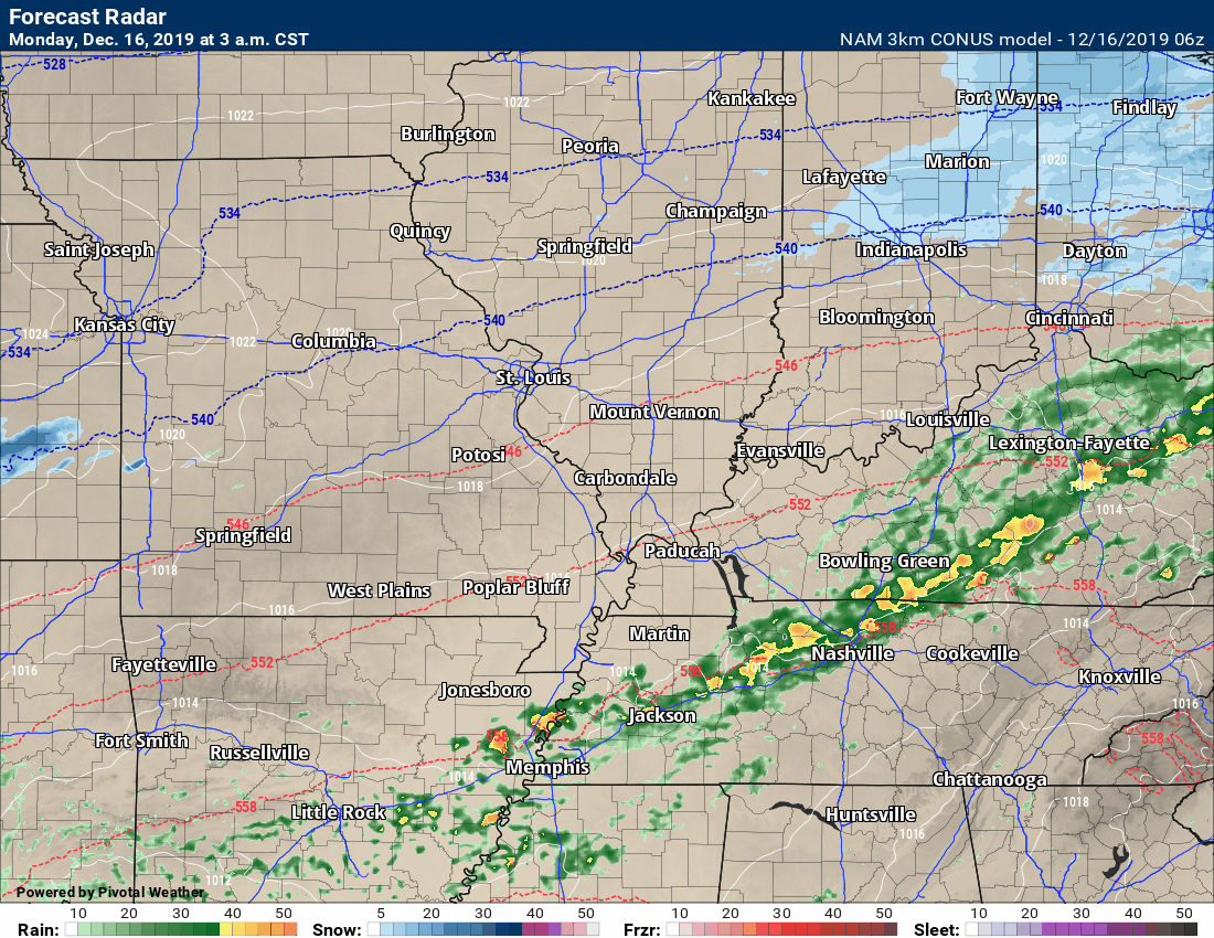
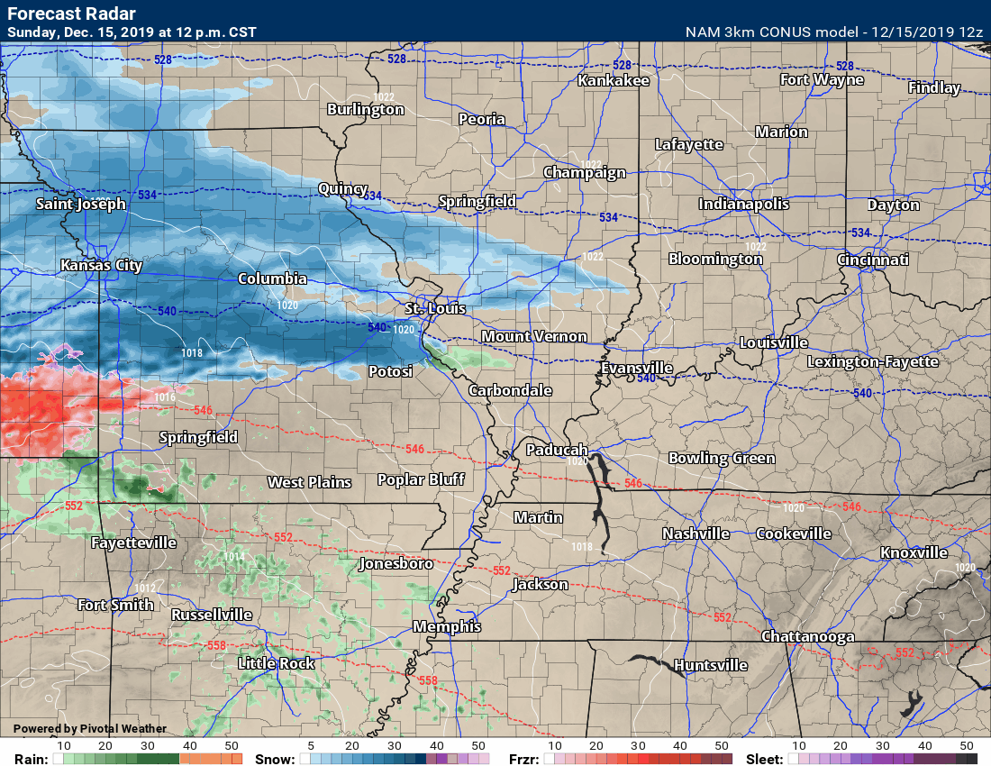
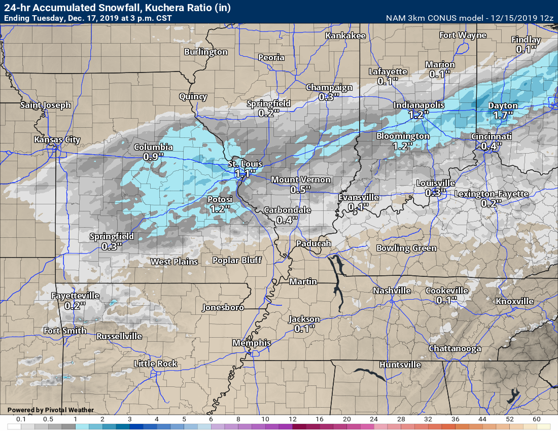
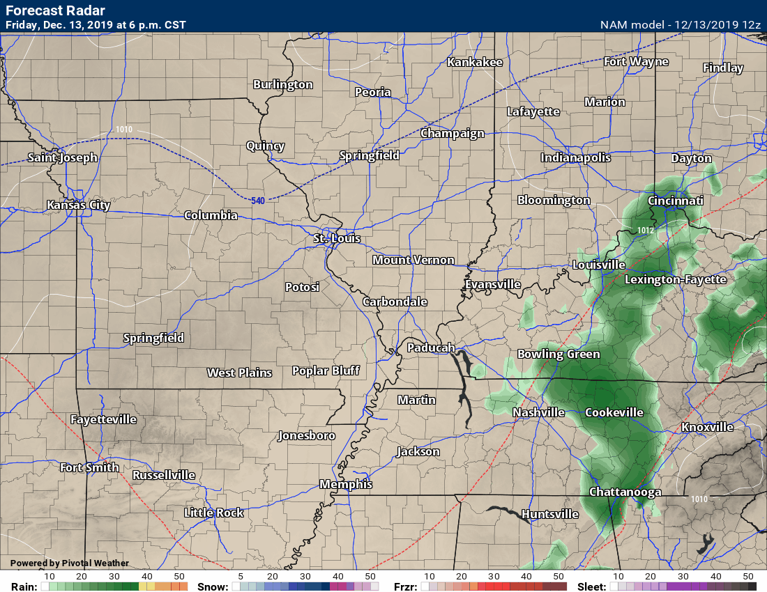
Future-cast radar shows how the snow will rapidly move east/northeast over the coming hours.
Blue is snow. It will be a wintry mix in our area. The model shows snow. It will actually be freezing rain, sleet, and snow.
The greatest impact will be over southeast Missouri and southern Illinois.
.
8:55 PM
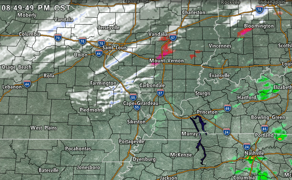
Butler County: Some light precip is redeveloping to your west. A light wintry mix is possible tonight. Black ice is the main concern. Black ice forms when moisture is left on roadways and temps fall into the 20s. Use care tonight and tomorrow AM. Radar (some of the precip is too light to show up) Use the winterize button the local-city radars http://weatherobservatory.com/radar_pbluff.htm
.
8:40 PM
Western Kentucky and extreme southern Illinois:
I am monitoring freezing rain, sleet, and snow developing in southeast Missouri and southern Illinois.
Temperatures in western Kentucky remain above freezing but will fall over the coming hours.
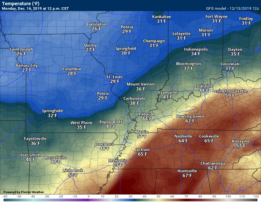
8:30 PM temperatures
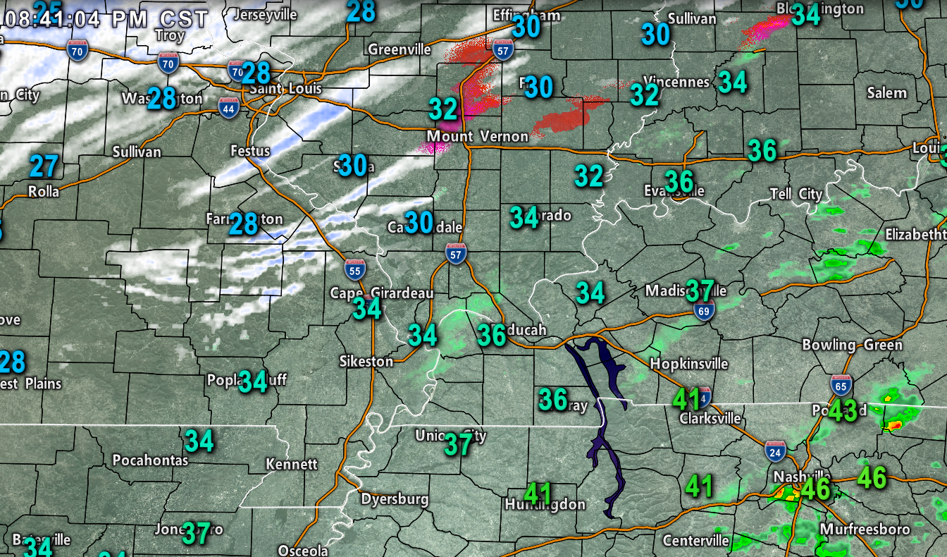
White is snow. I think a lot of that in SE MO is actually freezing rain. The computer algorithm may be off.
Black ice is a concern tonight.
What is black ice? Click to enlarge the graphic.
.
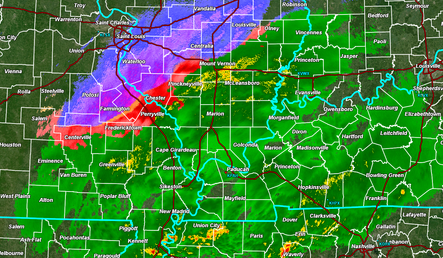
Union, Johnson, Pope, Hardin, Alexander, Pulaski, Massac, and west KY and far SE MO. Precip is rapidly redeveloping as the back edge of the storm moves through. Temperatures, over the coming hours, will fall into the 20s. Freezing rain is a concern. It may mix with snow and sleet. It will be light. It would only take a little bit of precipitation to cause problems once temperatures are in the 20s. Use care tonight and early tomorrow morning. Not everyone will experience problems. Keep that in mind. Radars http://weatherobservatory.com/weather-radar.htm
.
8:35 PM
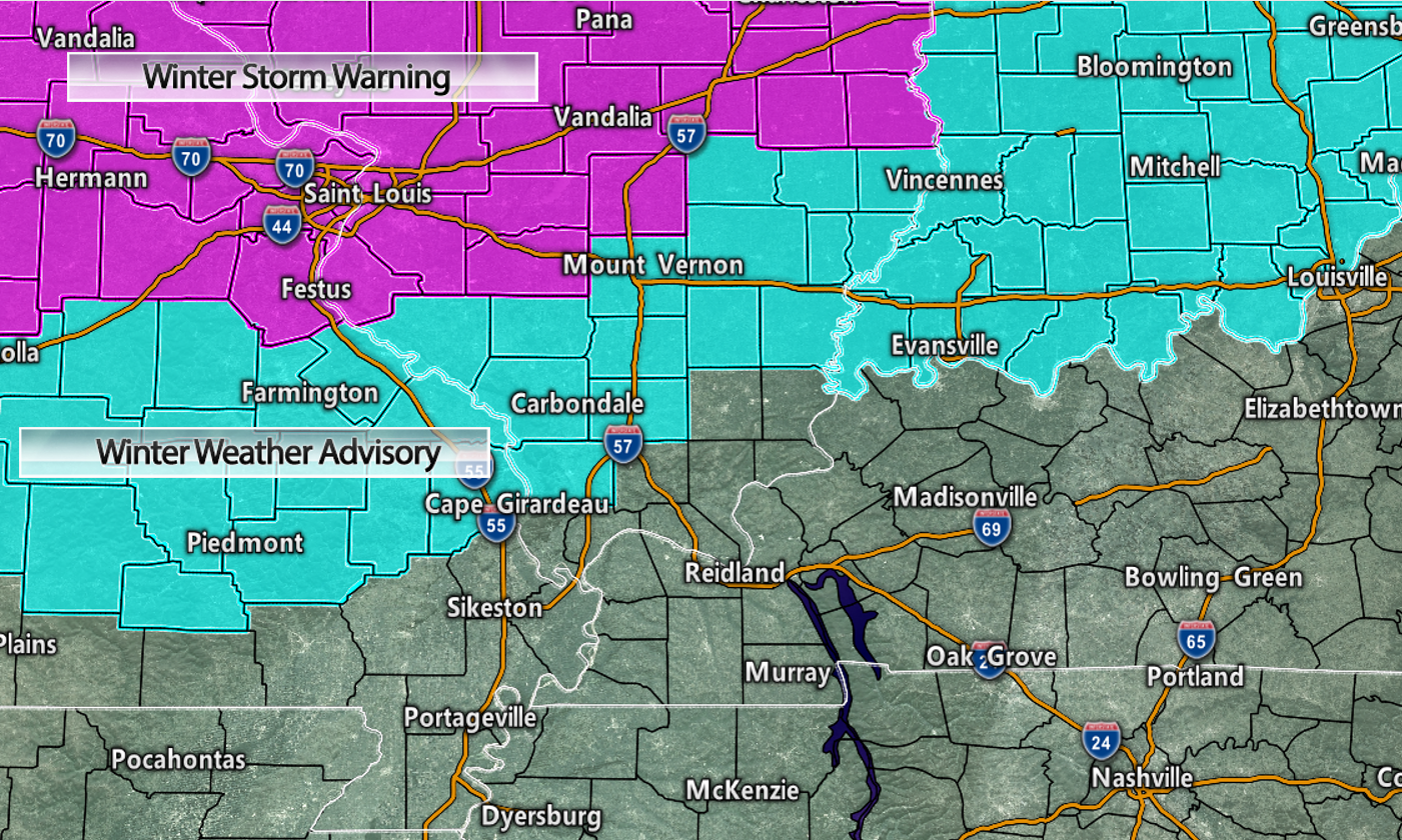
From the NWS
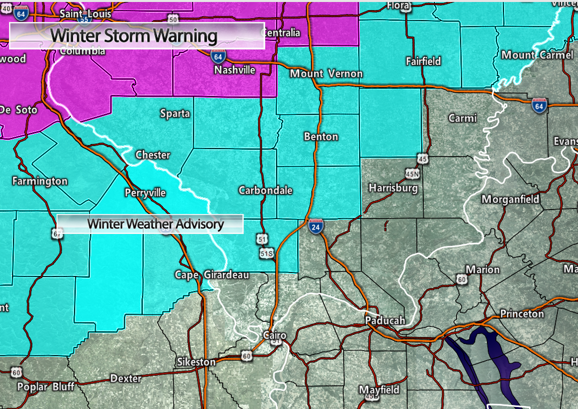
NWS Paducah-Christine Wielgos: Updated winter weather advisory to include mention of possible isolated power outages due to the gusty north winds in combination with any ice accumulations on trees/power lines. Still not problems reported on the roadways.
.
8:30 PM
Missouri travel conditions
http://traveler.modot.org/
Illinois travel conditions
https://www.gettingaroundillinois.com/WinterConditions/index.html
Jefferson, Franklin, Hamilton, White, Saline, Gallatin, and Williamson Counties: Freezing rain, sleet, and snow are redeveloping and moving in from the W SW. Temperatures will continue to fall into the 20s. Untreated roadways may become icy. Decks and porches. Black ice is likely. Radars (use the local-city view radars and click winterize to see precip type). http://weatherobservatory.com/weather-radar.htm
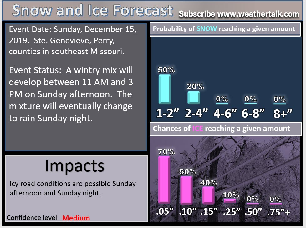
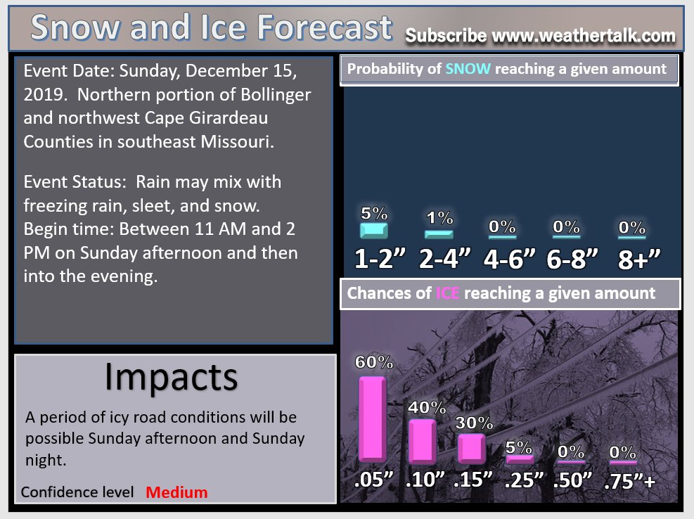
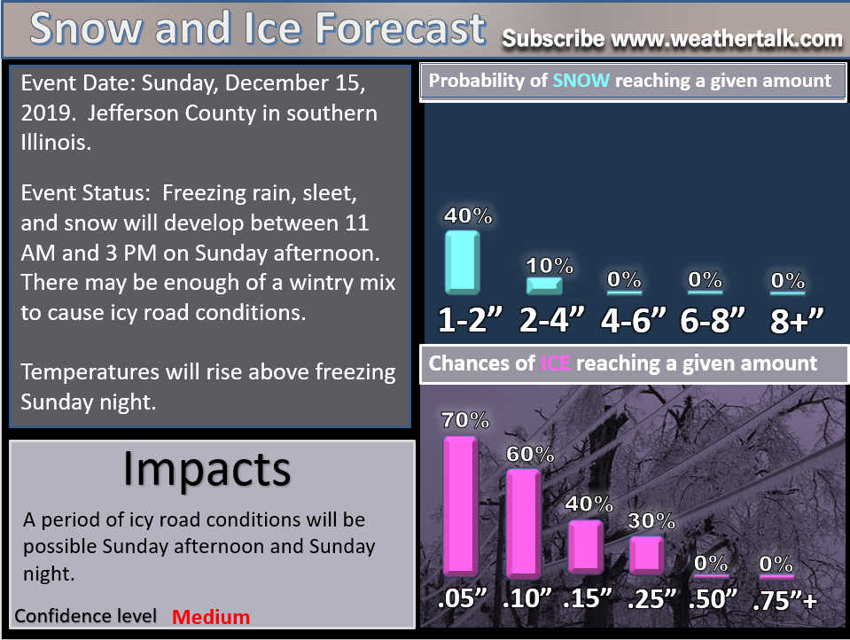
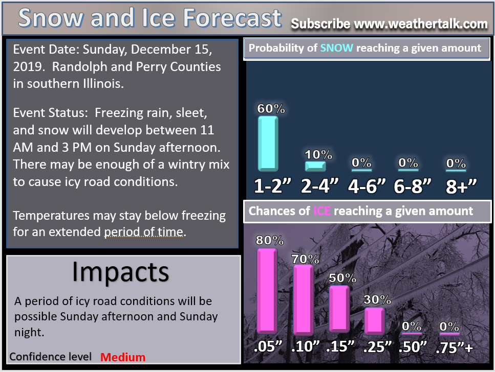
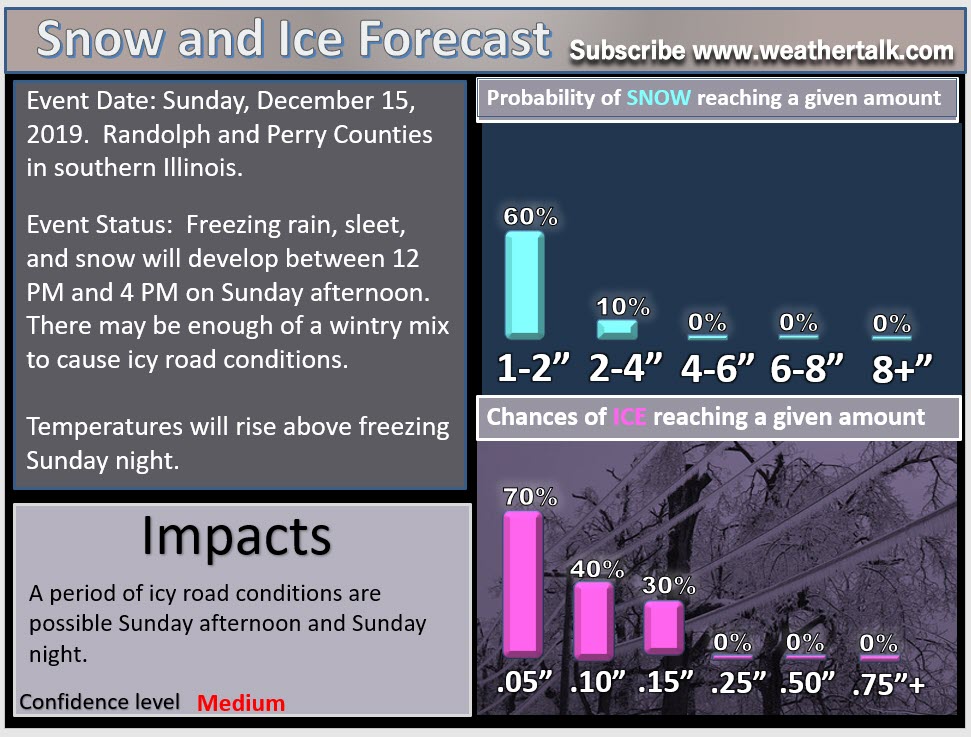
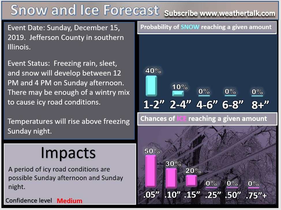
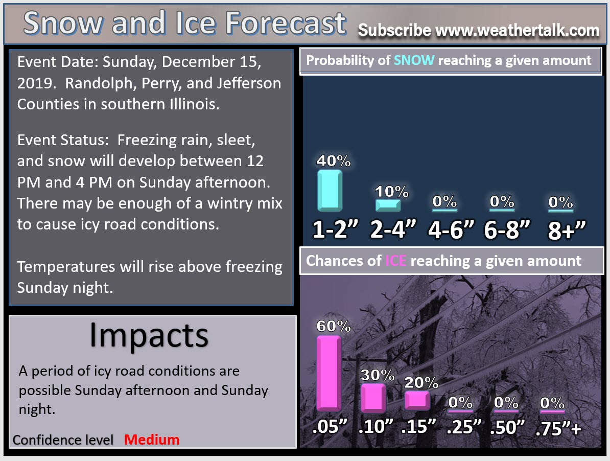
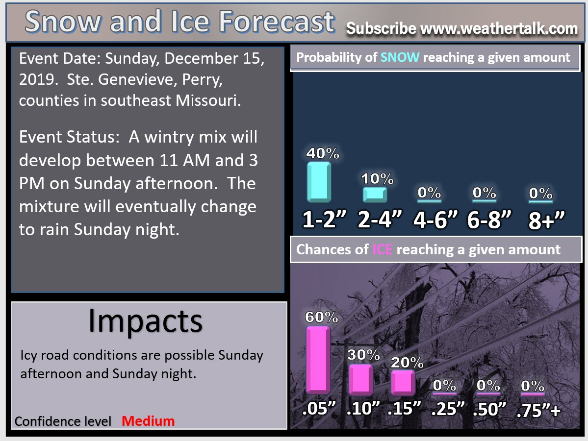
Ste Gene, Perry, Bollinger, Cape G Counties in MO. Randolph, Perry, Jackson, Union Counties in IL: Temps continue to fall into the 20s. Freezing rain, snow, and sleet are now redeveloping. Some areas have 0.20+ of ice on power lines. Gusty winds could bring down some lines. A wintry mix will continue to develop and move through these counties over the coming hours. Roads may become icy as temps continue to fall.
St Louis put this out.
For my counties, it is more likely to be freezing rain, sleet, and snow mix (not just snow)
.
8:25 PM
Snow and freezing rain are spreading back into southeast Missouri and southern Illinois.
Temperatures have fallen into the 20s in some locations.
Roads may become icy.
Gusty winds could bring down powerlines where the ice is thick enough. Several counties have more than 0.20″ of ice on power lines.
See the live radars Radar Link: Interactive local city-view radars & regional radars.
.
4:33 PM
Video update from the BAM weather team. They help me with videos.
There has not been much change in the overall forecast.
The bulk of the precipitation is moving off to the east.
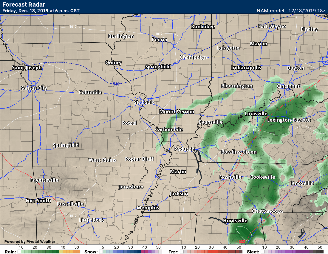
The latest batch of precipitation is advancing through Missouri. Radar Link: Interactive local city-view radars & regional radars.
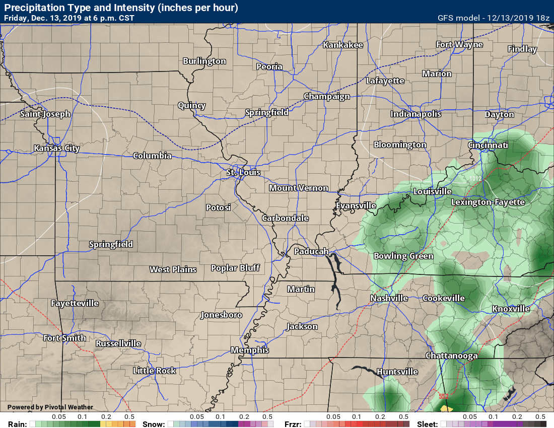
You can see that here. The blue is the snow.
This batch will move across Missouri and Illinois over the coming six to eight hours.
Most of this will be a mixture of light freezing rain and snow.
There could be black ice overnight across the area.
The greatest chance of this will be over southeast Missouri and southern Illinois.
Mainly from this zone northward. South of the zone could have black ice, as well. Just not as much.
It only takes a little bit of ice to cause issues on bridges and overpasses.
.
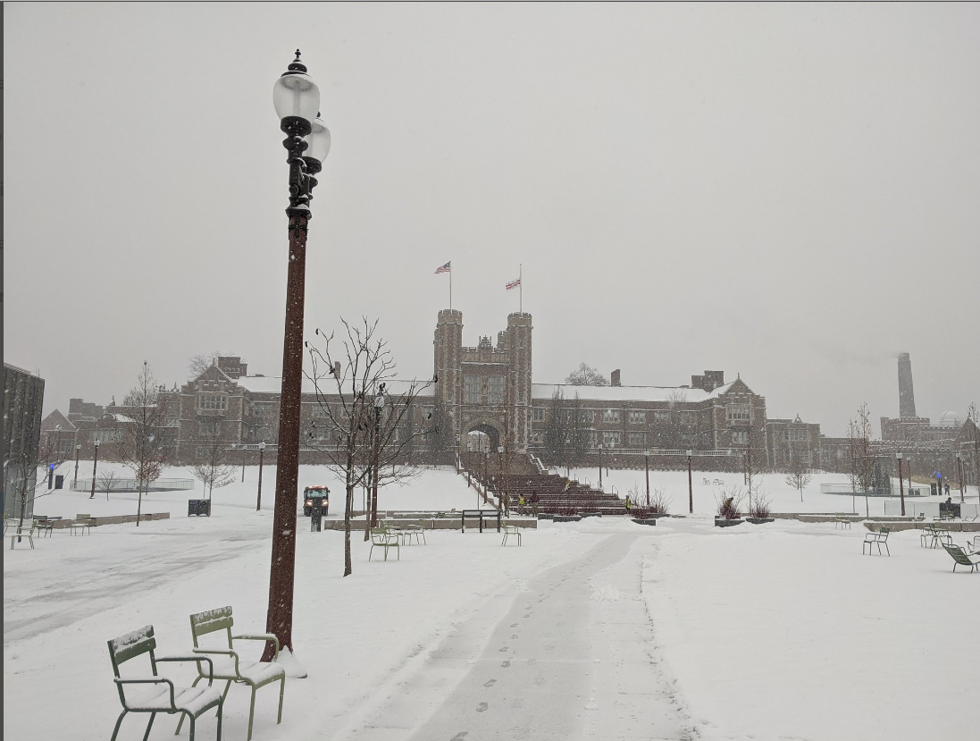
St Louis had quite the snow today. From Sarah Sanders (Twitter)
12:56 PM
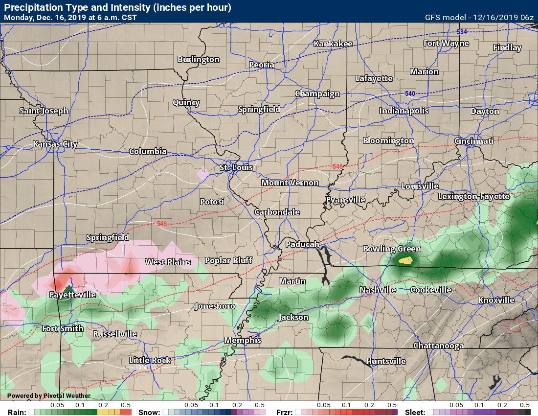
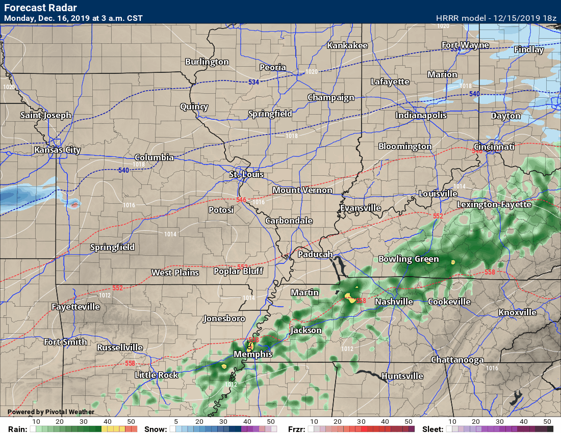
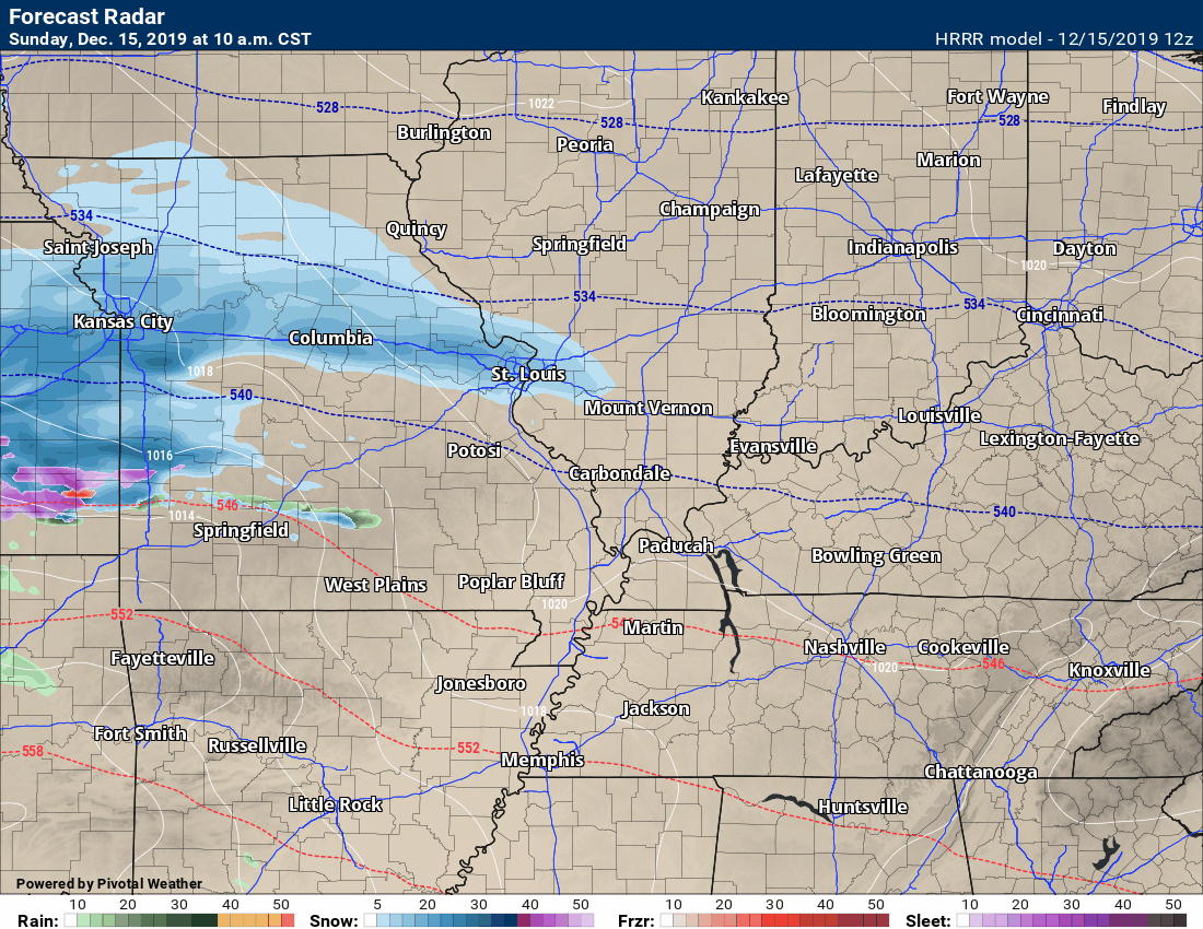
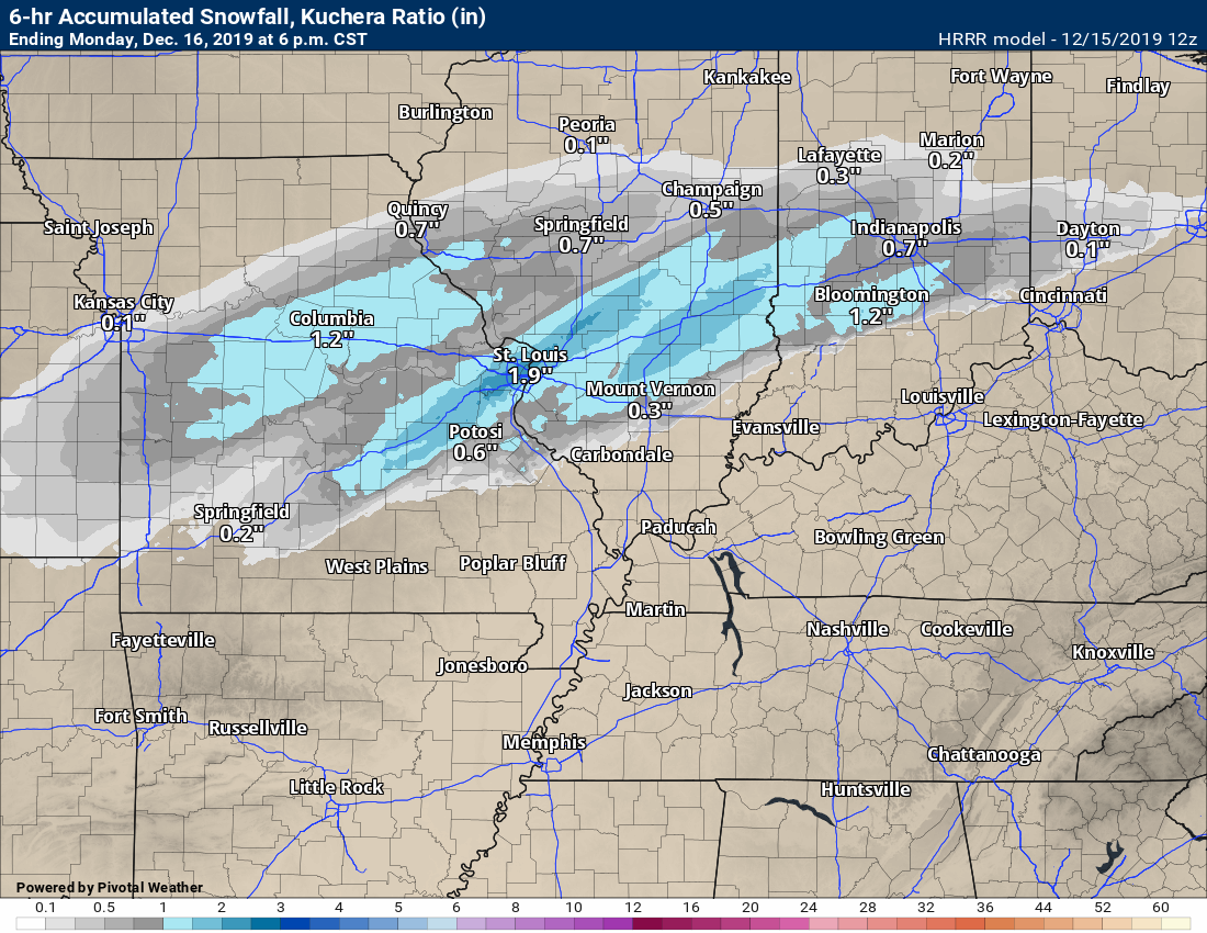
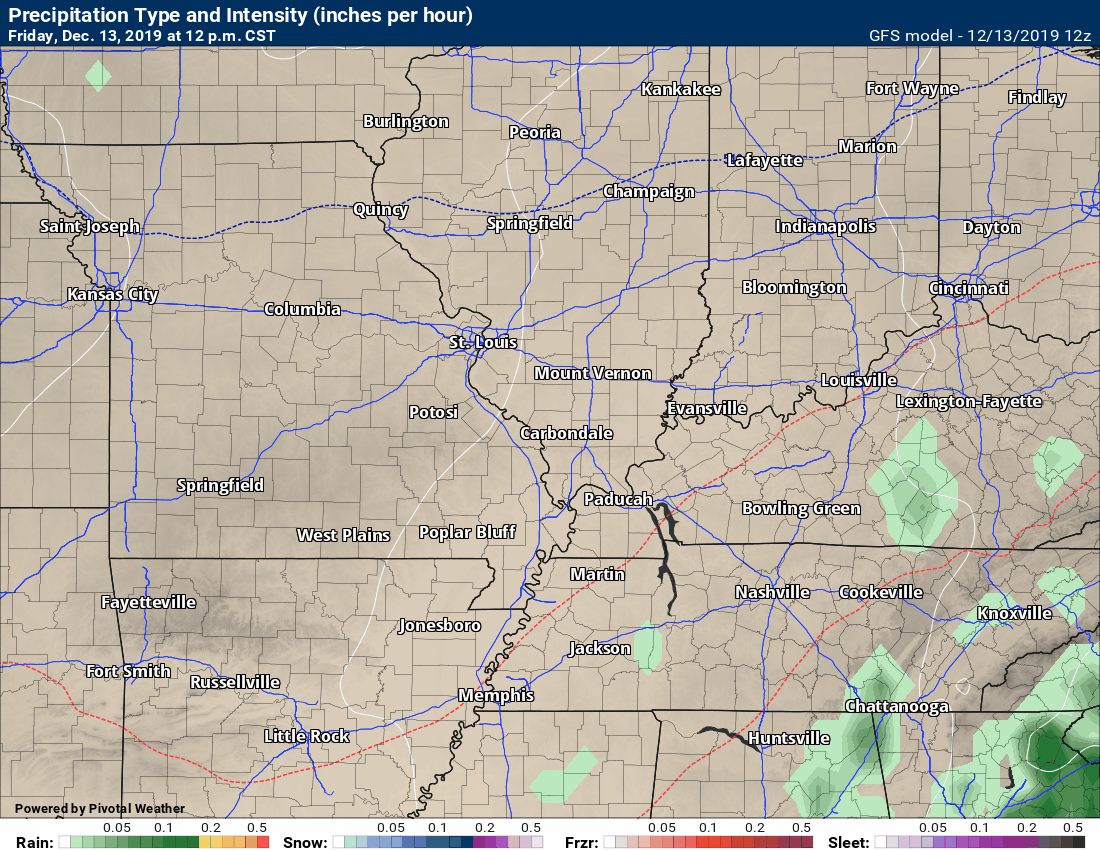
Hrrr future-cast radar.
Blue is snow. Pink is sleet and freezing rain. Green, yellow, and orange would be rain.
Time-stamp upper left.
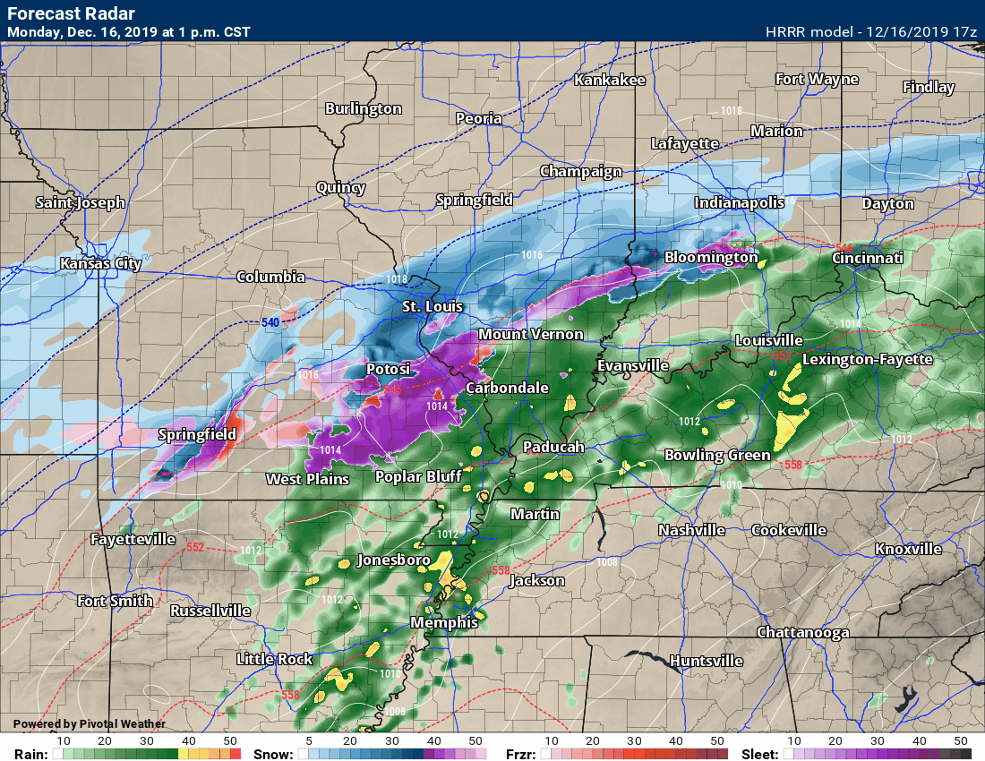
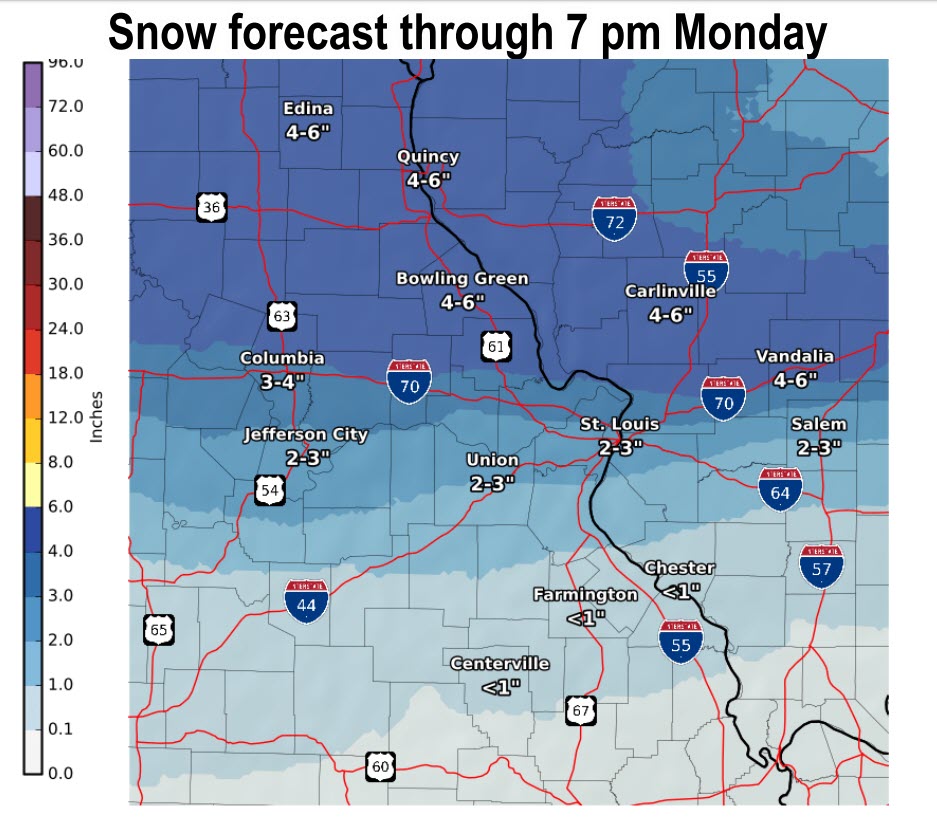
The snow in Kansas will drag its way across MO and IL tonight. That will bring an end to the precipitation.
That could bring light snow to portions of our region. Most likely the northern counties in SE MO and the northern three-quarters of southern IL. Marion, IL northward (best chance for light snow with that back edge).
Radar shows the freezing line has shifted further north and west.
The green is rain. Blue is snow. Ice is red and orange. That purple and pink zone is heavier snow.
10:00 AM
Ste Gene & Perry County, MO, Randolph, Perry, and Jefferson County, IL: Freezing rain, sleet, and snow are ongoing across these counties. Temps are in the 28 to 32-degree range. Wintry precip will continue for several hours to come. Use care on untreated roadways, bridges, overpasses, and elevated surfaces.
9:33 AM
Freezing rain in Farmington, MO. The main impact is on elevated surfaces.
Live Radar Link: Interactive local city-view radars & regional radars.
Missouri travel conditions
http://traveler.modot.org/
Illinois travel conditions
https://www.gettingaroundillinois.com/WinterConditions/index.html
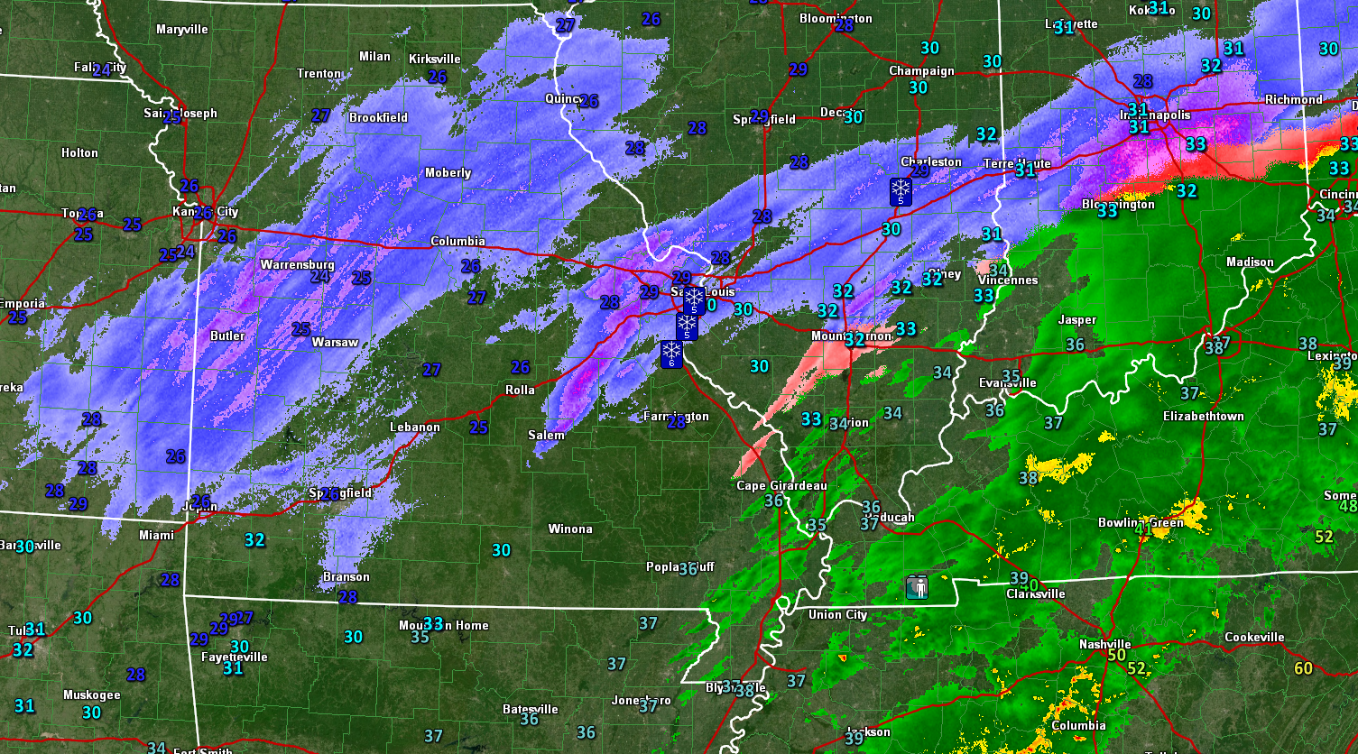
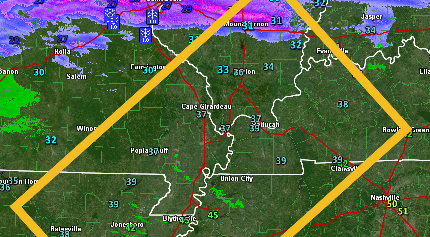
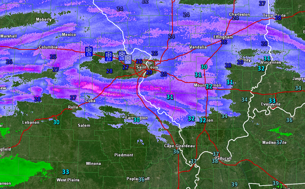
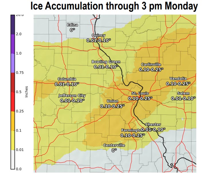
Radar shows the expansive area of freezing rain, sleet, snow, and rain.
Red is freezing rain. White and blue represent snow. There could be a mixture in there, as well. Pink is more freezing rain and sleet mix. This is a computer algorithm so it won’t be exact.
Click the animation to enlarge it.
.
9:15 AM
Bollinger, Cape G, Union, Jackson, Williamson, Franklin, and Hamilton. Temps have fallen a degree or two over the past hour. Temps are ranging from 30 to 33. Precipitation has redeveloped over much of the area and is spreading northeast. Use care on bridges, overpasses, decks, and untreated roadways.
.
9:00 AM
Deputies in Ste Genevieve are reporting in the north end of the county a snow sleet rain mix and the middle part of the county a sleet rain mix
.
8:20 AM
Bam weather has finished its Missouri Valley video.
.
8:00 AM
Ste Genevieve and Randolph Counties: 8 AM. Steady freezing rain and sleet are falling county-wide. Temperatures are in the upper 20s. Icy road conditions are likely. Ice will also accumulate on power lines and tree limbs. Steady accumulation for the next few hours.
.
7:45 AM
Radars are showing widespread rain and ice developing. The pink is the ice zone. See the local city-view winter weather live radars to track the precipitation yourself.
Radar Link: Interactive local city-view radars & regional radars. On the local city-view radars, you can click the winterize button to see where the ice, snow, and rain are occurring.
.
7:35 AM
Radars
Radar Link: Interactive local city-view radars & regional radars.
Let’s take a look at some future-cast radar.
GFS model. Blue is snow. Pink is sleet and freezing rain. Green, yellow, and orange would be rain.
Time-stamp upper left.
Hrrr model future-cast radar
Blue is snow. Pink is sleet and freezing rain. Green, yellow, and orange would be rain.
Time-stamp upper left.
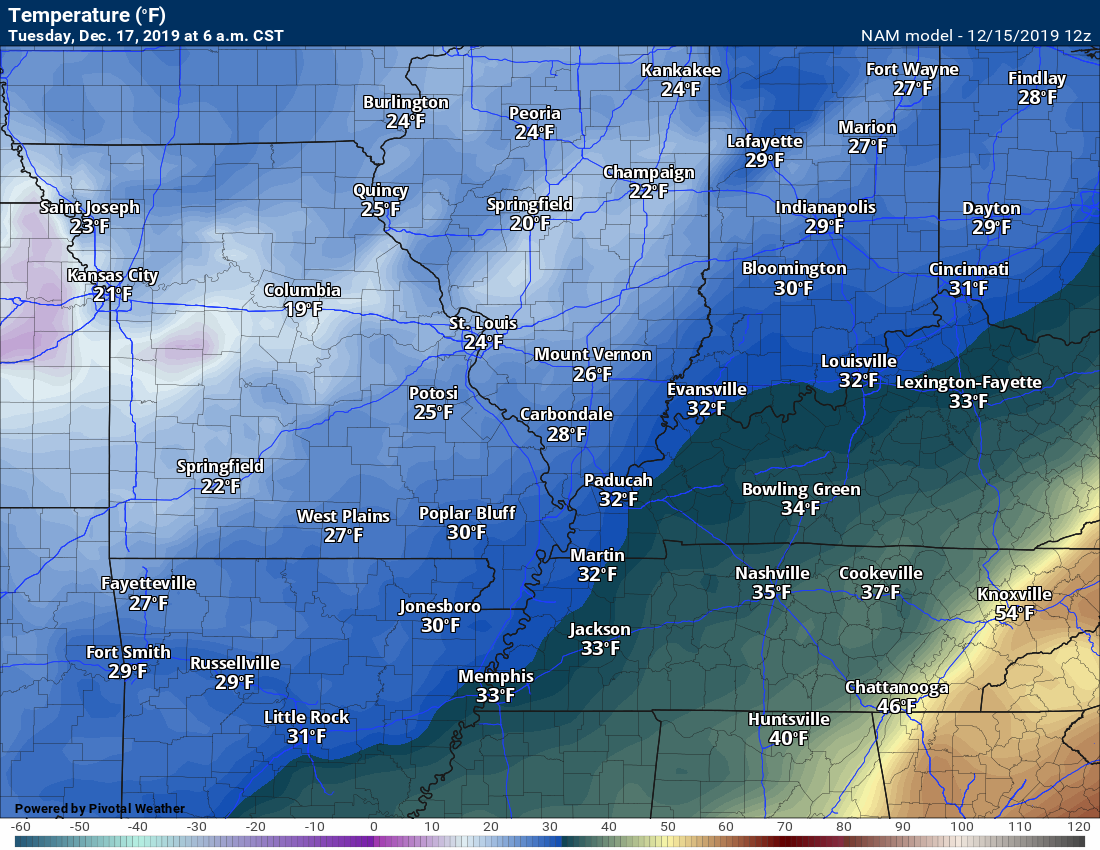
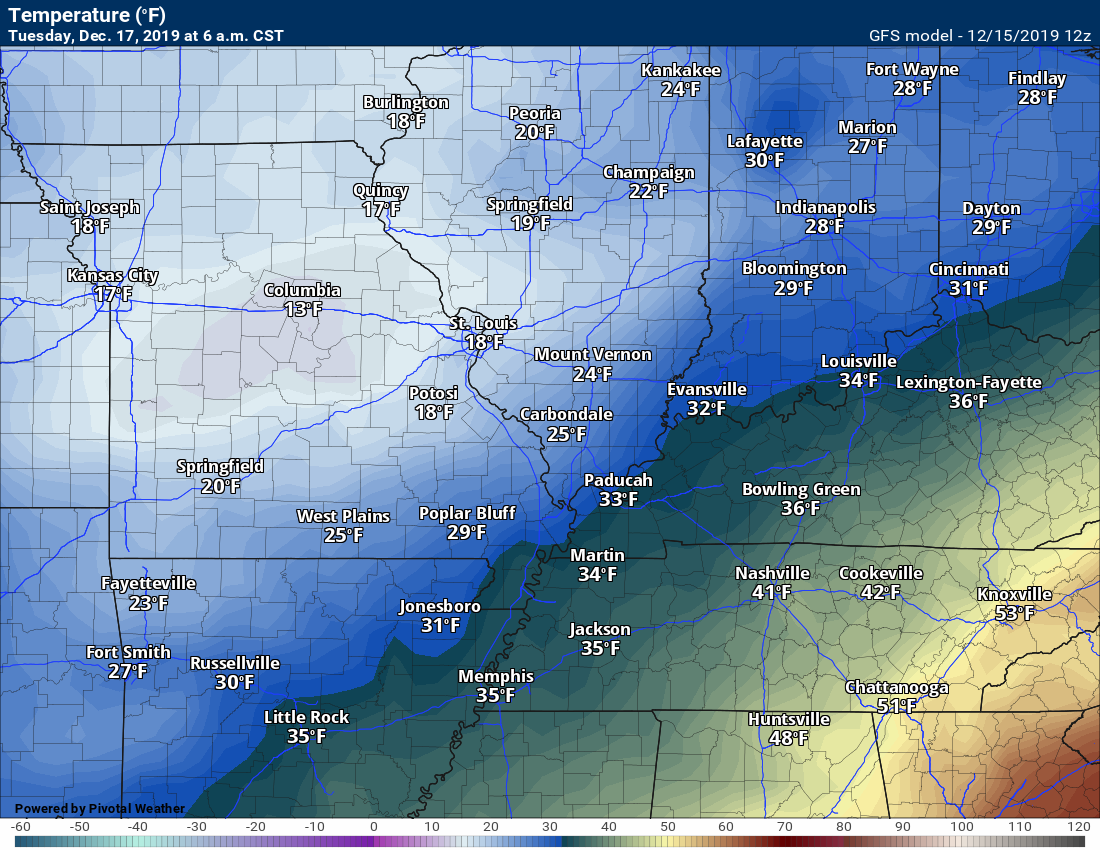
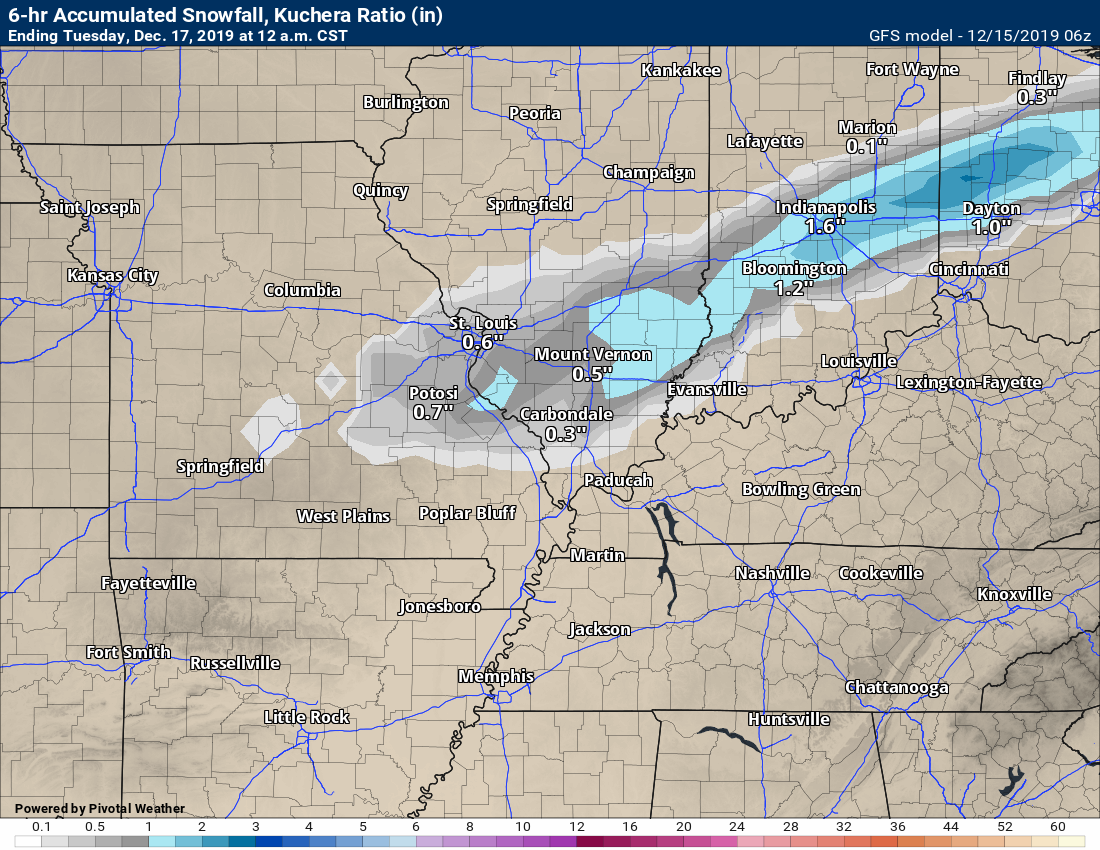
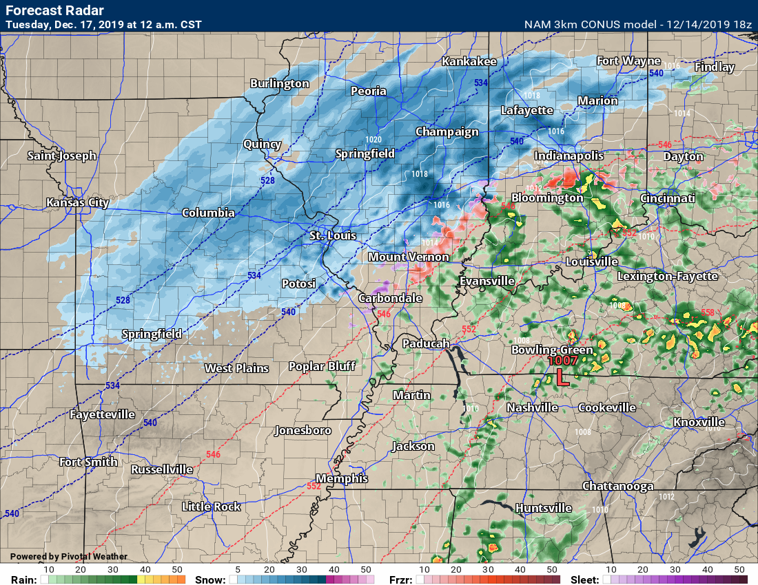
NAM 3K model guidance
Blue is snow. Pink is sleet and freezing rain. Green, yellow, and orange would be rain.
Time-stamp upper left.
Notice all the models drag an area of light snow across portions of the region tonight. That is the end of the system.
7:28 AM
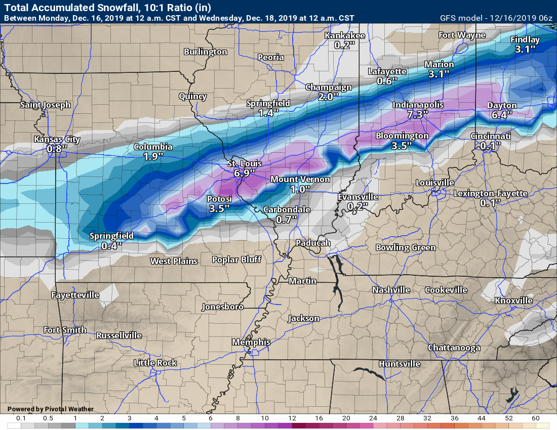
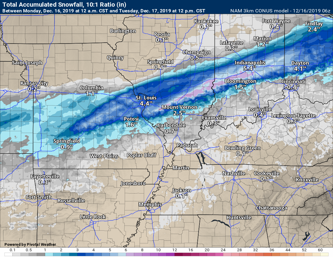
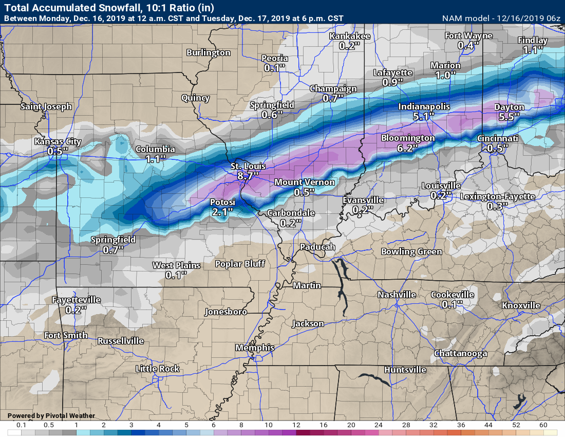
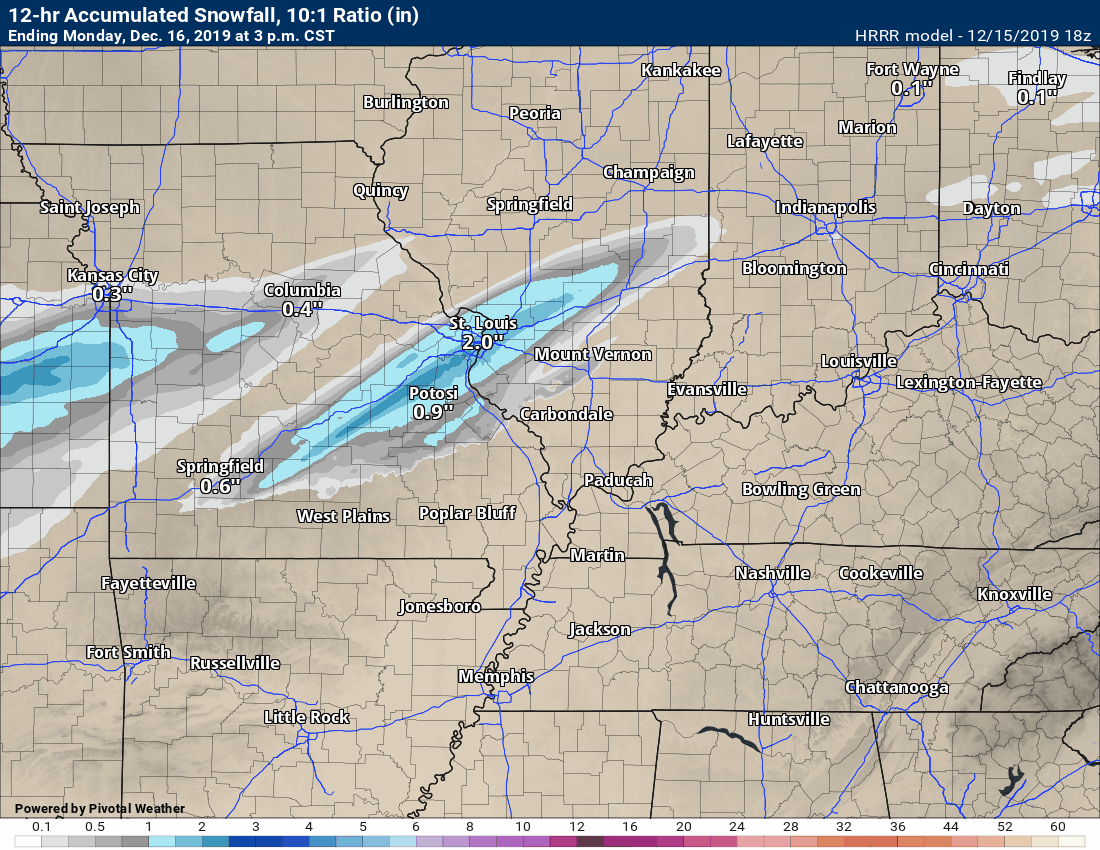
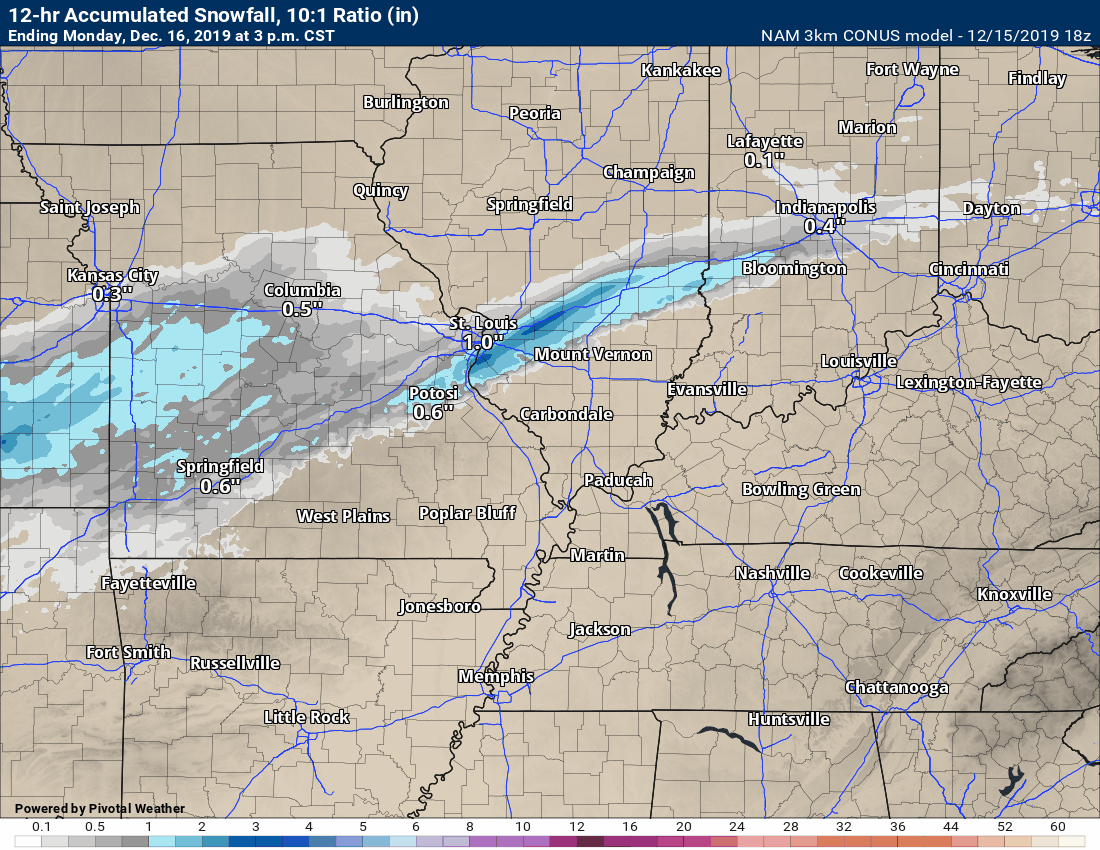
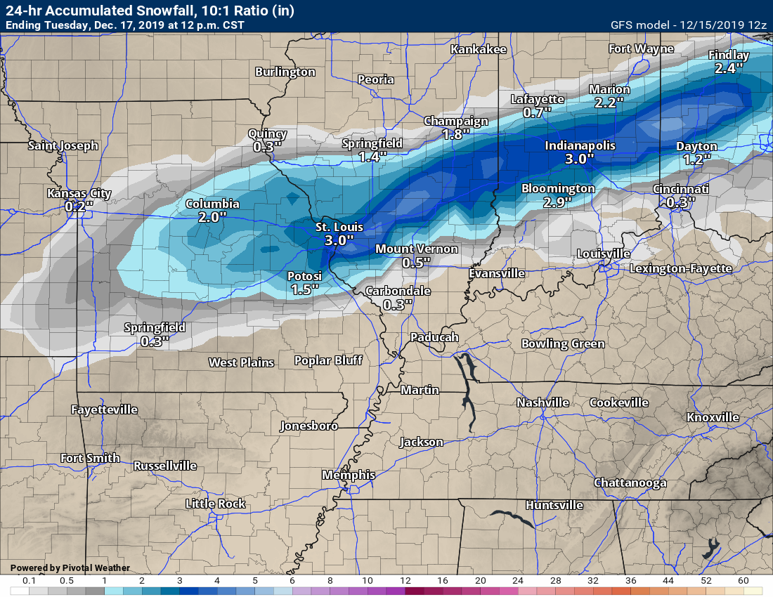
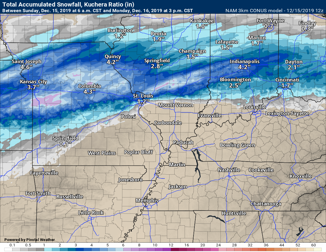
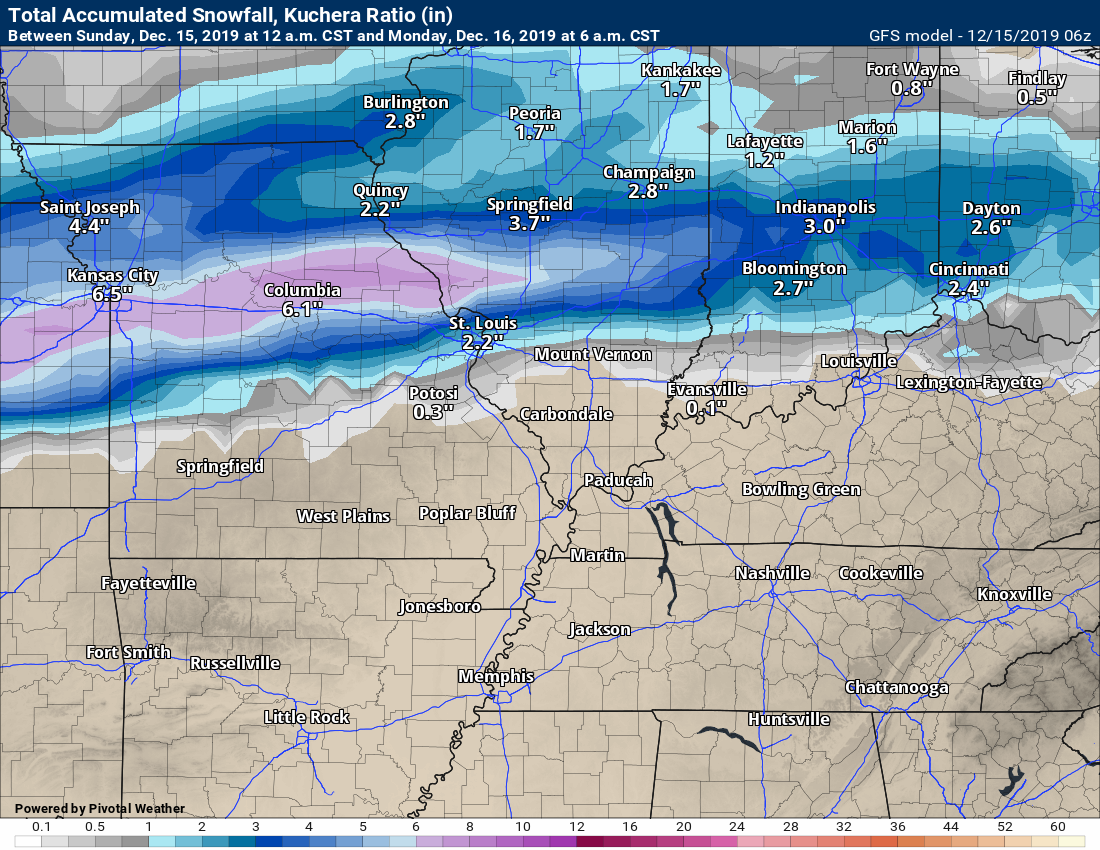
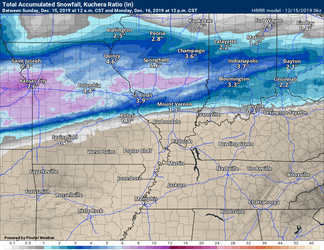
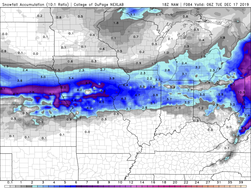
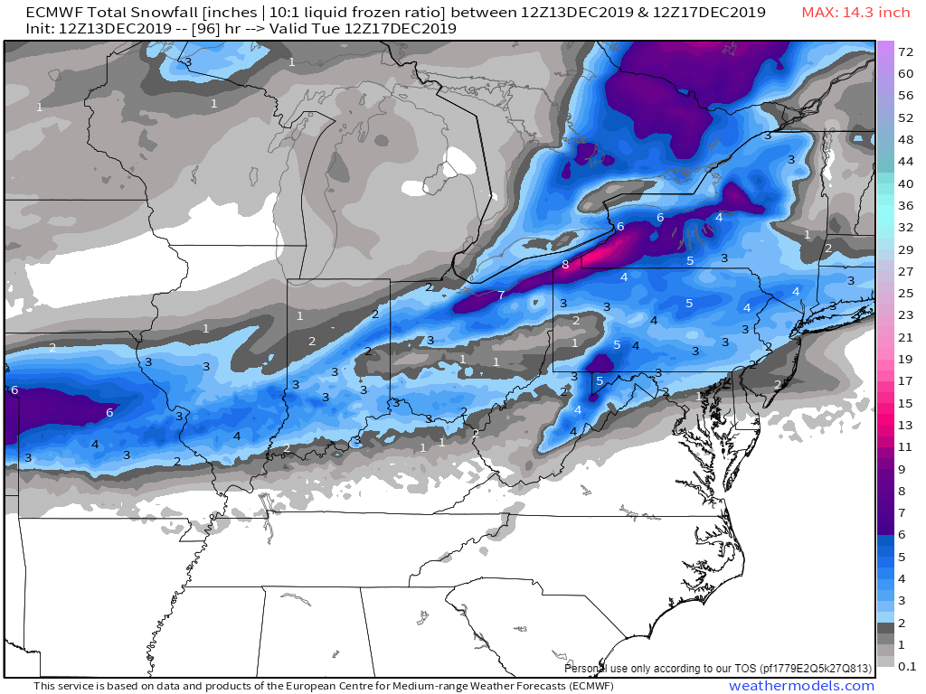
Model forecast snowfall totals.
There is agreement on the placement of the heaviest band to our north and west.
GFS model. If we have snow accumulation locally then it would most likely occur towards evening and tonight.
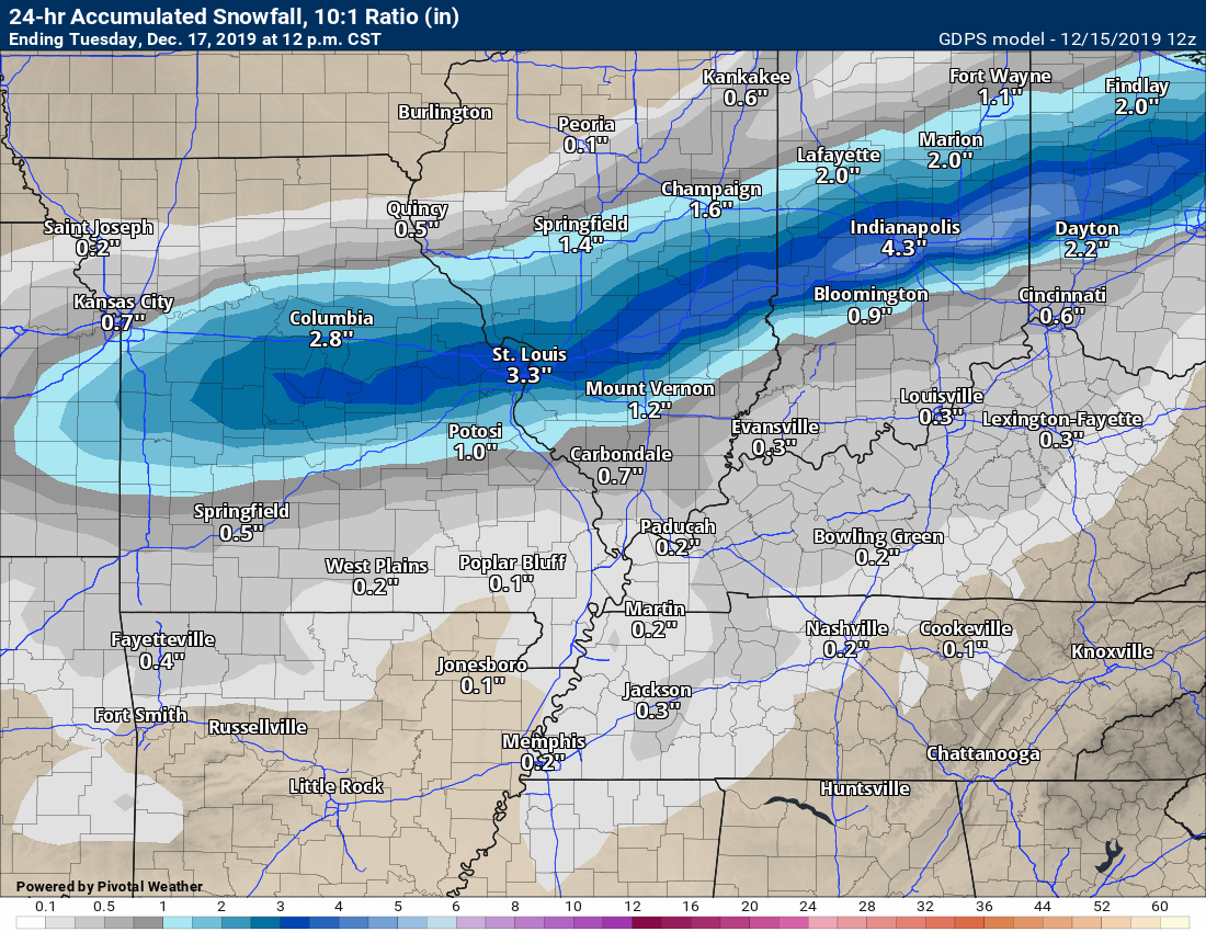
NAM 3K Model
NAM model
Hrrr model guidance
.
7:00 AM update
.
Official watches and warnings from the NWS
.
The Illinois and Ohio Valley BAM video has been posted.
.
SUNDAY, DECEMBER 15, 2019
Winter Storm Updates
7:45 PM
The latest guidance for tomorrow does not give much of a lull in the precipitation.
Here is the latest Hrrr future-cast radar.
Blue is snow. Pink is ice. Green is rain. Yellow is heavier rain
7:25 PM
Patchy fog tonight.
Northern Scott, Bollinger, Cape Girardeau, Jackson, Williamson, Saline, Gallatin, Union, Alexander, Pulaski, Johnson, northern half of Pope, and Hardin. Temperatures are hovering in the 31 to 34 degree range. Temps may fall a bit more tonight. Watch for patchy ice on elevated surfaces, bridges, overpasses, and side roads. Porches. Light precip will continue for the coming hours. Areas north of these counties are colder and well aware of the freezing potential. Counties south of these are above freezing and should remain that way.
.
5 PM
No new updates. Forecast holds.
Next update will be after 8:30 PM.
4:00 PM
.
3:25 PM
Here is what the Hrrr and NAM 3K are showing for round two.
Notice the placement. Light totals locally.
.
1:57 PM
Here is the second round on the Hrrr model.
This is future-cast radar. What the Hrrr model believes will happen.
Time-stamp upper left. Click the animation to enlarge it.
Blue is snow. Pink is ice. Green is rain.
.
1:51 PM
Rain and precip will rapidly develop in this square box over the next one to two hours. It will spread northeast.
.
1:25 PM
Missouri travel conditions
http://traveler.modot.org/
Illinois travel conditions
https://www.gettingaroundillinois.com/WinterConditions/index.html
.
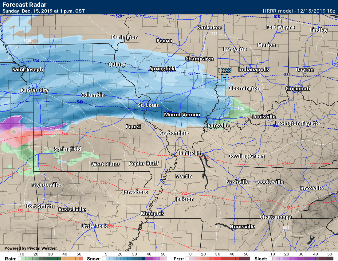
1:18 PM
Here is the latest Hrrr model guidance. This is the future-cast radar. This takes us into Monday morning.
This is only round one.
Time-stamp upper left. Click the animation to enlarge it.
.
1:15 PM
Randolph, Perry, Jefferson, White, Hamilton, and a portion of Franklin County is still below freezing, as well. Franklin County is flirting with 32 33 34
Perry County and Ste. Genevieve County in southeast Missouri are below freezing.
.
1:10 PM
Much of Bollinger, Cape Girardeau, Jackson, Union, Williamson, Saline, and Gallatin Counties are above freezing now. Perhaps some of the hills in northern Bollinger County are still close to freezing.
Temperatures will rise some this afternoon and then fall a few degrees tonight.
.
1:05 PM
Ste. Genevieve, Bollinger, Cape Girardeau, and Perry Counties. Jackson County, IL. There are lulls in the precipitation. More will likely develop later this afternoon and move northwest. Totals should be light. The main concern is some icy patches on bridges and overpasses (in areas that actually remain below freezing). Temperatures will slowly rise this afternoon and then may fall a few degrees tonight.
.
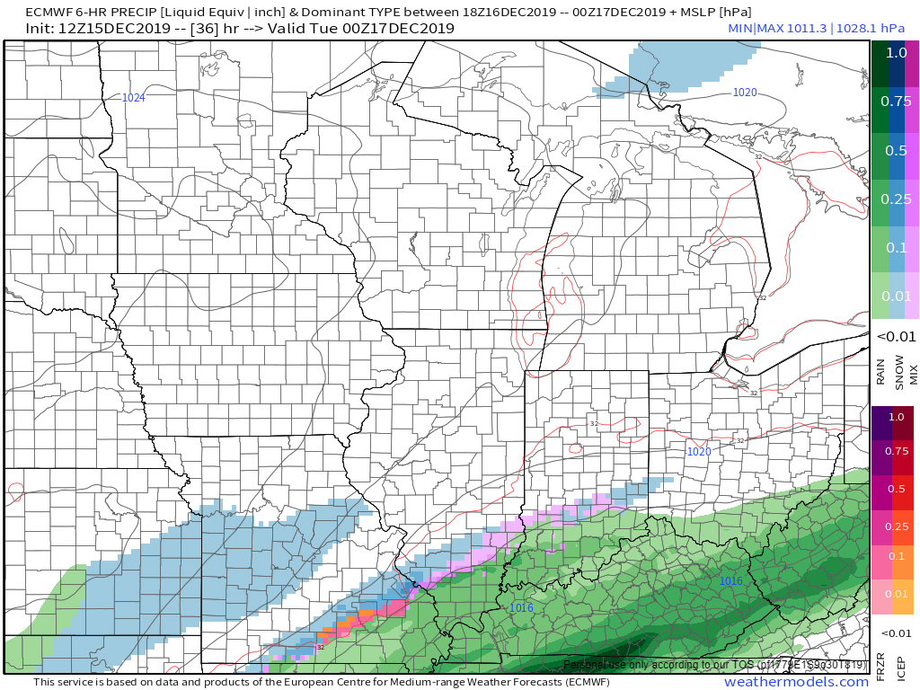
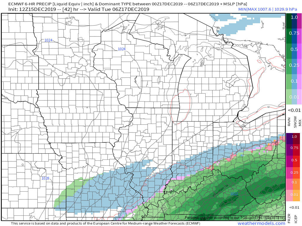
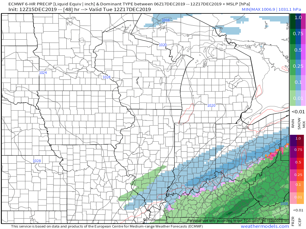
1:00 PM
Round two.
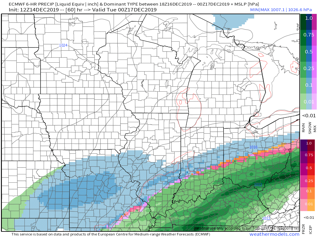
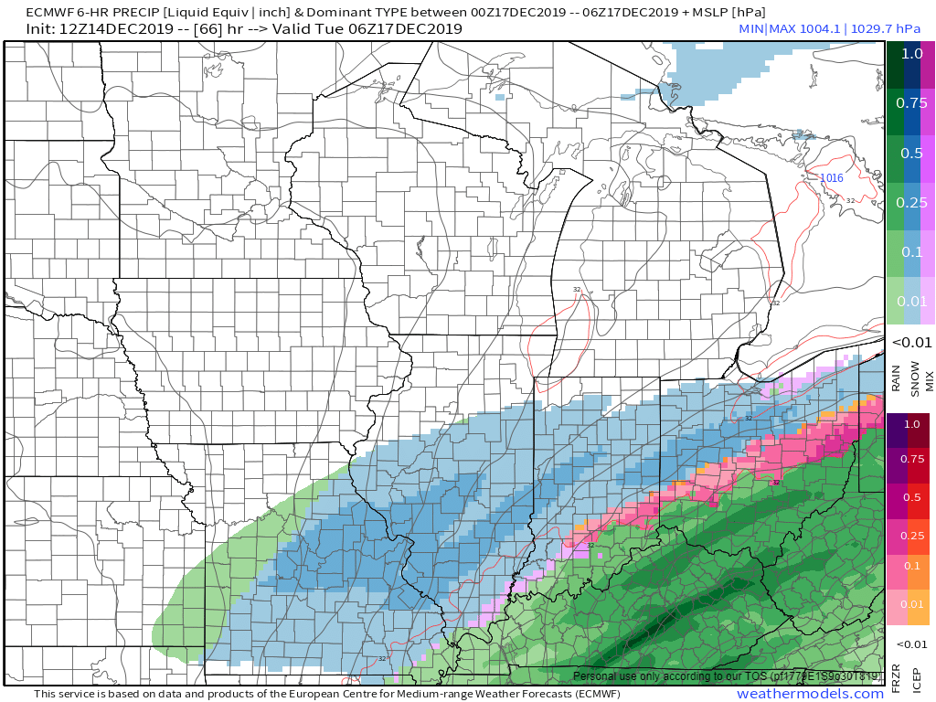
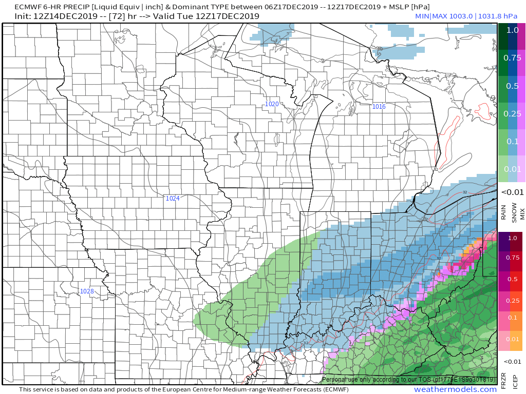
Here is the latest EC model guidance on round two.
Six-hour precipitation totals.
Green is rain. Pink is ice. Blue is snow.
12 PM to 6 PM Monday
6 PM to 12 AM Monday
12 AM to 6 AM Tuesday
.
12:45 PM
Western Perry County in southern Illinois is reporting snow.
.
12:37 PM
The bright pink area is where heavier snow is likely occurring. I have not received any reports, yet from my forecast counties.
Radar. Green is rain. White is snow. Some of this is not reaching the ground.
Click to enlarge
.
12:21 PM
Ste. Genevieve and Perry Counties in SE MO. Randolph, Perry, and Jefferson Counties in southern IL. Snow, sleet, and freezing rain are spreading in from the west. Temperatures are in the 28 to 30-degree range. Bridges and overpasses will become ice-covered first. Radars http://weatherobservatory.com/weather-radar.htm
Bollinger and Cape Girardeau Counties in SE MO. Jackson, Franklin, White, and Hamilton Counties in southern IL. Temperatures are in the lower 30s. A mixture of precipitation is developing overhead. There could be some ice concerns on bridges and overpasses. Again, temps vary from location to location. The range right now is 30 to 34 degrees. Radars http://weatherobservatory.com/weather-radar.htm
It does not take much snow or ice to cause issues.
Currently, near St Louis.
.
11:54 Am
Round two.
Here is what the models are showing for the Monday afternoon and night snow event.
Whether our local area will receive accumulating snow is still a question.
I do have snow in the forecast for at least the northern half of southeast Missouri and a decent part of southern Illinois. Light totals.
.
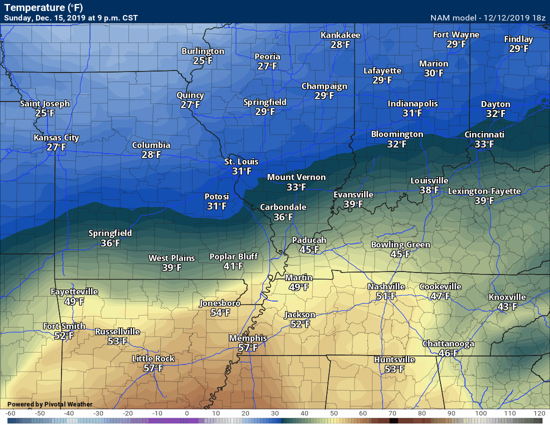
Temperatures Monday night will dip into the 20s over a decent chunk of our region.
GFS and NAM are closer in agreement on temperatures.
Click the images to enlarge them.
.
On another note, this is what is happening in Kansas City. Heavier snow up that way.
.
11:17 AM
Missouri video update
.
10:24 AM
Click to enlarge.
The southern edge of this is where the least confidence resides.
.
10:18 AM
We have winter weather radars.
The local-city view ones are the ones you can winterize.
Link
http://weatherobservatory.com/weather-radar.htm
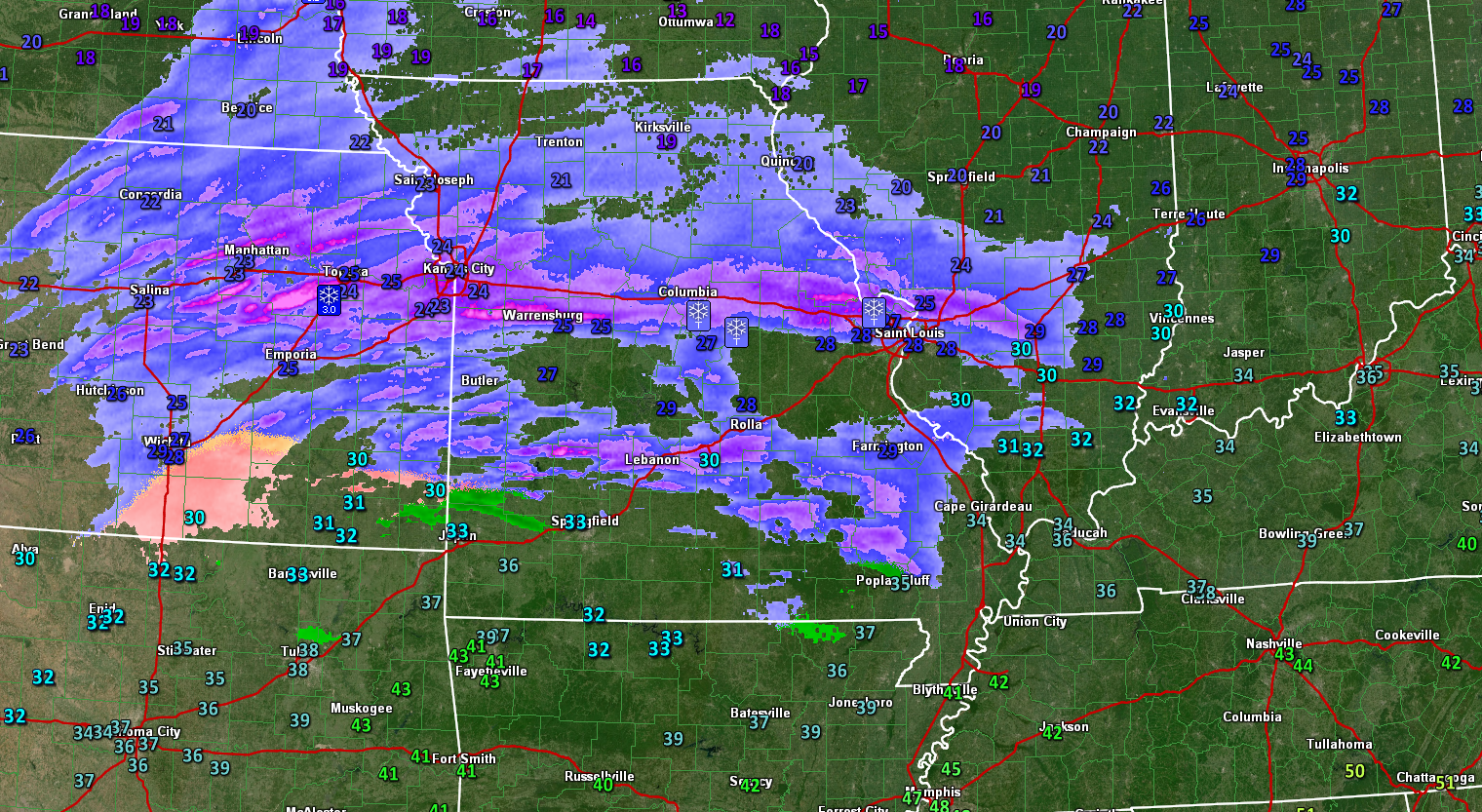
Radars at 10:18 AM
Click to enlarge the graphics. The numbers are temperatures.
Blue/white is snow. Pink is ice. Green is rain.
Blue is snow on this one. Purple and pink are heavy snow.
That orange/pinkish color in south central Kansas is sleet and freezing rain. Green is rain.
.
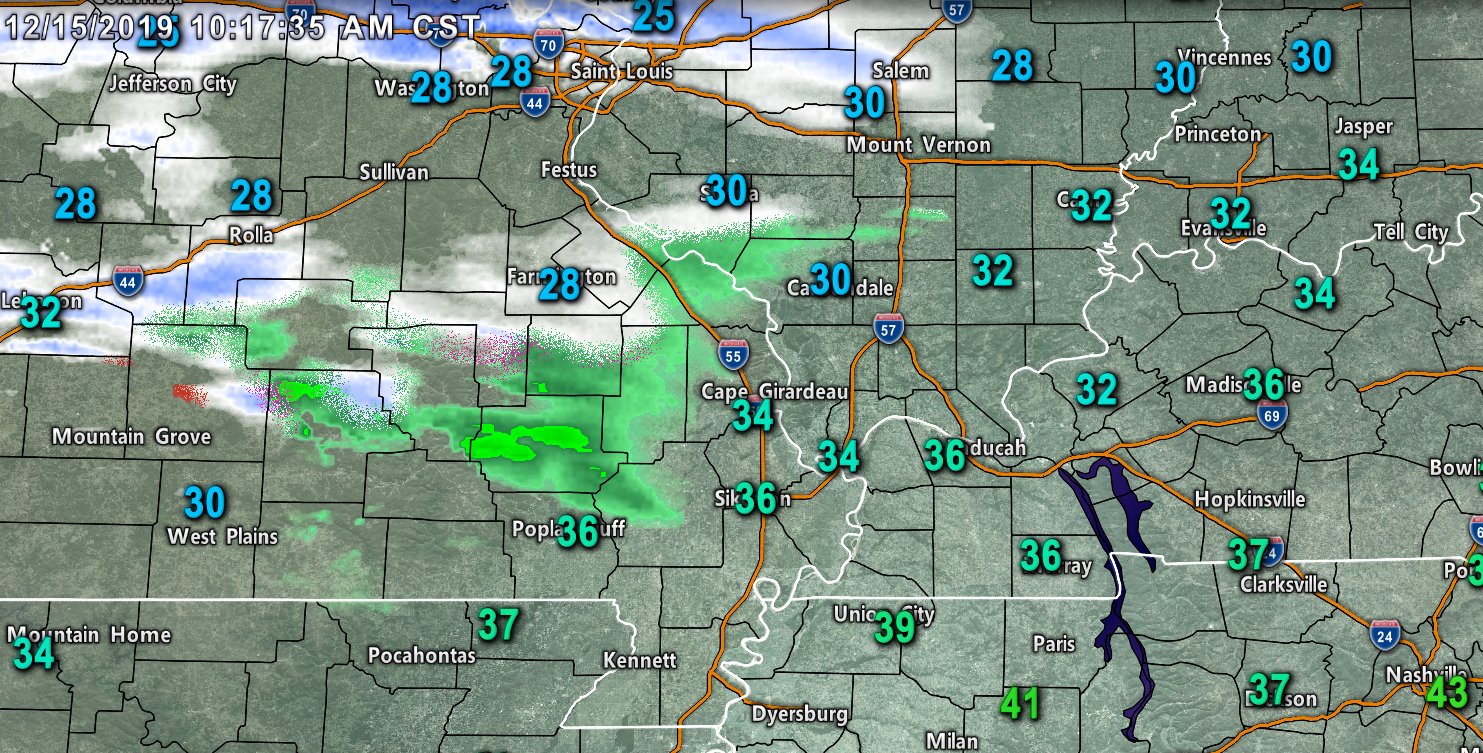
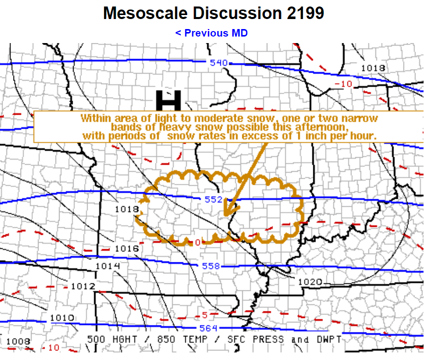
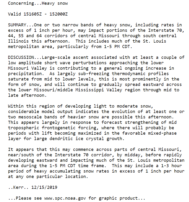
10:17 AM
Mesoscale update
Click to enlarge graphics.
.
10:05 AM
Longer update below this post. Please read that one, as well.
.
9:00 AM
There has been little change over the last 12 hours.
The forecast still has several questions remaining. I doubt that changes.
The main questions are the following:
Where to place the 32-degree line. Several of my forecast counties will swing from 31 to 34 degrees. An error of one or two degrees will completely change the forecast.
I am satisfied with my original forecast from 72-hours ago. Little changes were made.
I did add a higher risk zone. That would include Ste. Genevieve County, Missouri, and Randolph and Jefferson Counties in southern Illinois. This is the area that is most likely to experience the greatest impacts. That would include hazardous road conditions this afternoon into Tuesday morning.
Areas to the southeast of there will likely experience a wintry mix, as well. That would include areas from northern Bollinger, far northwest Cape Girardeau, and all of Perry County in southeast Missouri. That band would then extend into portions of Jackson, extreme northwest Williamson, Perry, Franklin, Jefferson, Hamilton, and White Counties in southern Illinois. These counties will hover near the freezing mark. The main concern will be a wintry mix impacting elevated surfaces. Trees, power lines, bridges, overpasses, porches, and so on. If temperatures are a degree or two warmer then there will be little or no impact.
With time, temperatures should rise above freezing across most of Bollinger and Cape Girardeau Counties in southeast Missouri (perhaps Perry). Temperatures should rise above freezing late this afternoon into tonight across Jackson, Franklin, Union, Williamson, Hamilton, and White Counties in southern Illinois.
I should once again note that some data keeps the above-mentioned areas above freezing through the entire event. For now, my forecast continues to include a period of wintry mix before temperatures rise and changes everything to rain.
Temperatures will then drop a few degrees after sunset. That could change the rain back over to a wintry mix overnight across Perry County, Missouri, and then we will need to monitor the northern portion of Bollinger County and northwest Cape Girardeau County in southeast Missouri and Jackson, northwest Williamson, Franklin, Hamilton, and White Counties in southern Illinois. If precipitation continues and temperatures fall then some icing would occur.
Round one, today into Monday early afternoon, will only produce rain over the rest of southeast Missouri, southern Illinois, and western Kentucky. Perhaps a sleet pellet or snowflake at the beginning. No impact.
There will be a lull in the rain and frozen precipitation late tonight into the first half of Monday.
Precipitation then redevelops across the area Monday afternoon into Monday night.
Here are some future-cast radars to show you the timing.
Blue is snow. Red/pink is a wintry mix of freezing rain and sleet. Green is rain. Yellow is rain.
Time-stamp upper left.
NAM model.
Hrrr model guidance.
.
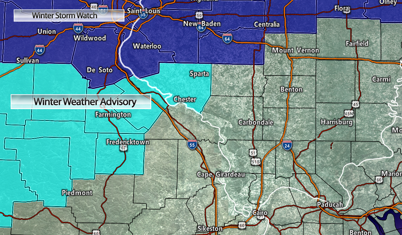
The National Weather Service has now extended its winter weather advisories and winter storm warnings.
The southern half of Bollinger, the southern half of Cape Girardeau County, the southern half of Jackson County, all of Union County, and Williamson County is questionable, at best. Not sure they need an advisory and they are outside of my forecast area of concern. Officially, however, they are under the NWS advisory.
Generally speaking, the southern row of counties is questionable.
Click to enlarge.
Round Two:
The next question becomes round two.
Round two does not arrive until Monday afternoon and Monday night. This event is equally complicated.
The main question is how far south to pull the measurable precipitation.
The most likely area to experience a wintry mix to snow would be portions of southeast Missouri and southern Illinois. Perhaps northwest Kentucky. A lesser concern would be areas south of there.
I made small changes to the Kentucky portion of the graphic that I posted last night. Pushing the orange zone further north.
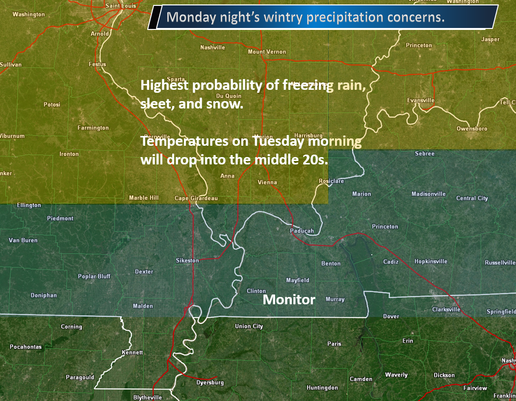
.
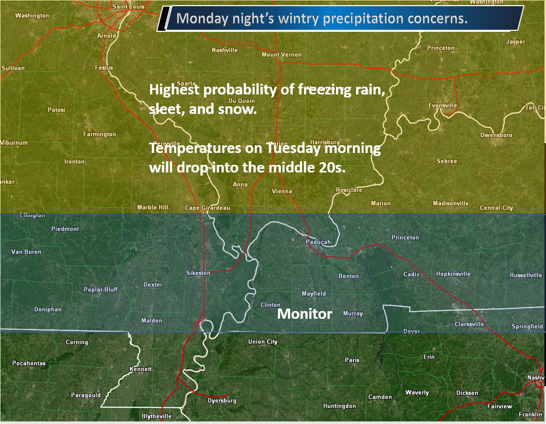
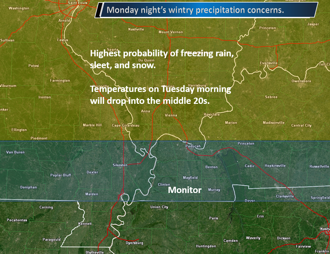
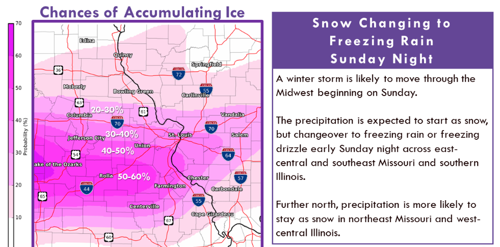
A mixture of freezing rain, sleet, and snow will change to all snow tomorrow afternoon and night across portions of our region.
The further north you travel, the greater the chance of travel problems. Southern areas will likely remain all or mostly rain. We will need to watch for black ice if temperatures fall fast enough Monday night/Tuesday morning.
Temperatures by Tuesday morning will fall into the middle 20s. Whatever does fall will stick. Road surfaces will be cold.
Let me show you some graphics.
Here are the different model ideas on event number one. That would be today into the first half of Monday. Much of the precipitation occurs this afternoon into the first half of tonight.
Snow only.
Decent agreement among the models. Within a county or two.
NAM model guidance.
GFS model guidance.
Hrrr model guidance.
Freezing rain only.
Three different models. The Hrrr model is warmer than the GFS and NAM model guidance. Thus, it has freezing rain further north.
GFS model guidance.
NAM model guidance.
Hrrr model guidance.
.
Round two.
NAM model guidance. Mostly snow.
GFS model guidance
Hrrr model guidance.
Notice on round two that the focus of wintry precipitation is a bit further south than round one. It may not be far enough south, however, to impact the southern portions of southeast Missouri, western Kentucky, or northwest Tennessee. It may end up being another Southeast Missouri and southern Illinois event. Perhaps northwest Kentucky (near the Indiana border).
Monitor updates concerning round two. There remain questions on placement.
Illinois video from the BAM team.
.
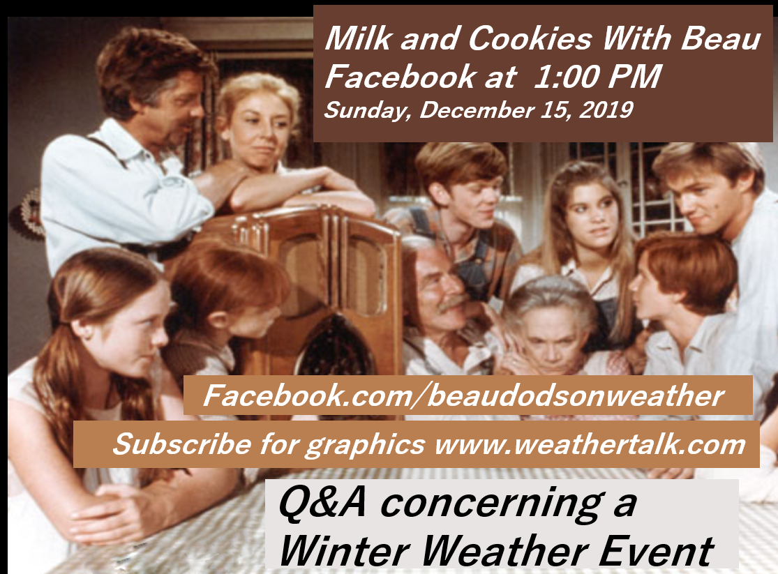
I will have a Q&A thread over on the Beau Dodson Weather Facebook page at 1 PM today.
8:30 AM
Good day, everyone.
I am working on a full update.
I wanted to get this graphic posted.
This is for today through tonight/tomorrow morning. Event one.
I have fine-tuned the areas of greatest concern.
There is a higher than usual concern about the verification of this event. Model guidance does not agree on where to place the 32 degree line. This forecast has not changed all that much from 72 hours ago.
All I did was shift the monitor zone slightly NW. I added the red zone. Otherwise, the overall forecast remains the same.
It is possible that the orange zone mainly experiences impacts on elevated surfaces. Trees, power lines, bridges, porches, and so on.
Snow totals in the orange zone should be less than two inches. Freezing rain accumulation of 0.10″ to 0.20″ are possible (if temperatures verify). Some sleet. If it is a tad warmer (one to three degrees warmer) then there will be little or no impact. Remember that. Temperatures are key.
The red zone will experience heavier snow totals (my counties will remain below two inches). Heavier freezing rain accumulation is also possible. Some sleet.
Click to enlarge.
SATURDAY, DECEMBER 14, 2019
Winter Storm Updates
10:00 PM
A full update will be posted on Sunday morning.
The major adjustments to the going forecast.
Models are fairly cold tomorrow across a large chunk of SE MO and south IL.
My forecast from 72 hours ago will hold.
You can see the probability maps further down in this blog update.
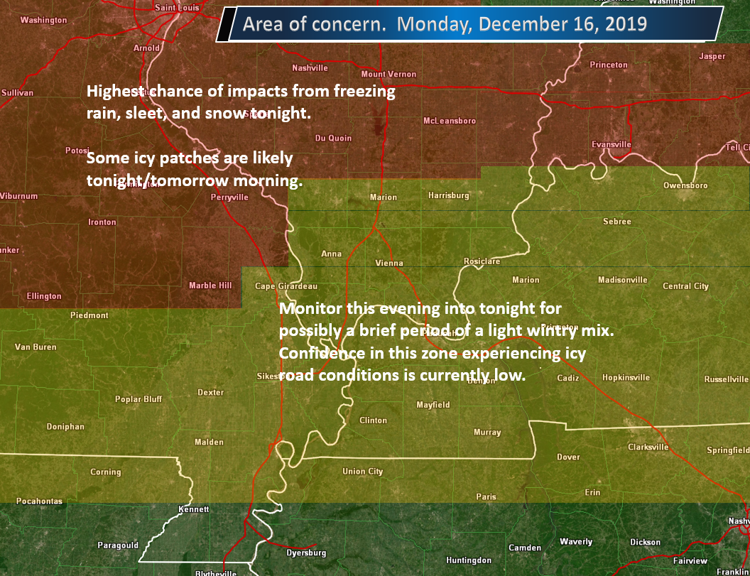
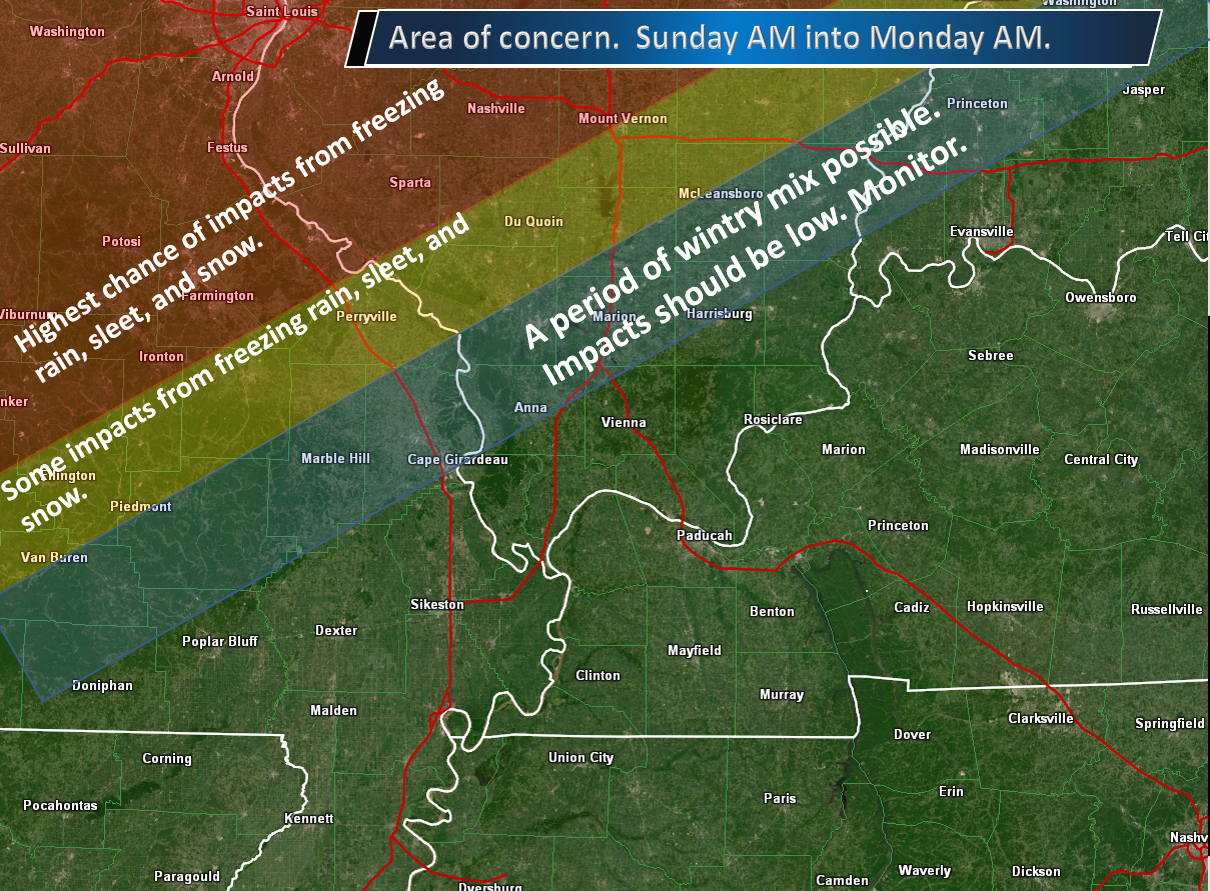
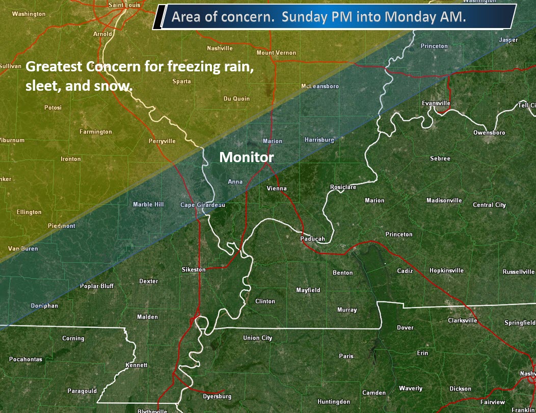
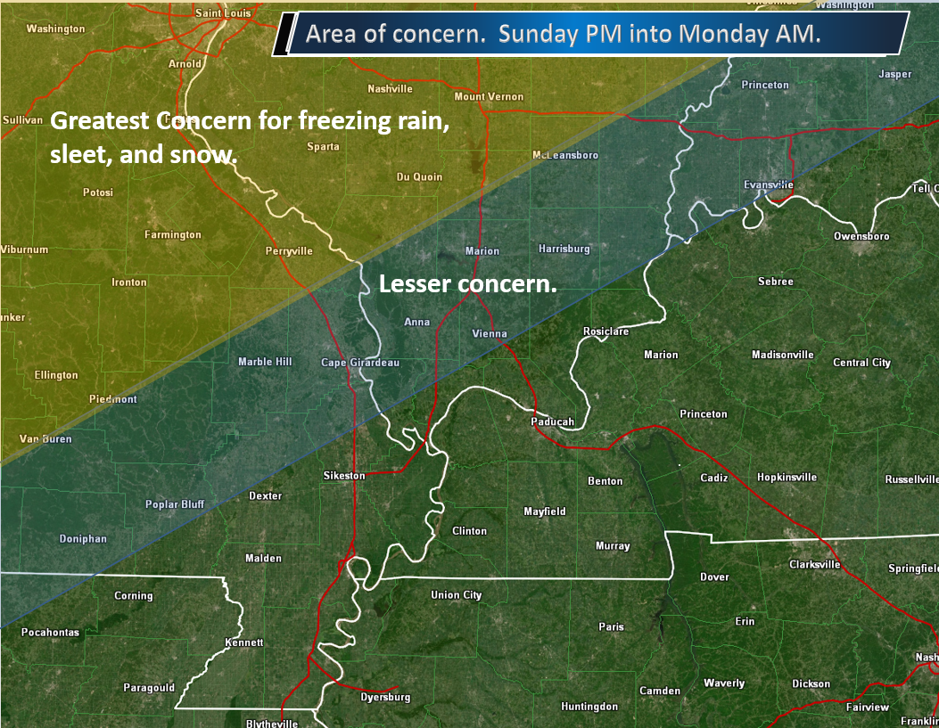
Here is the area of greatest concern.
,
The second round of precipitation will occur Monday evening/night. I am still monitoring trends in guidance.
This appears to be a light freezing rain, sleet, and snow event. Temperatures will fall into the 20s by Tuesday morning.
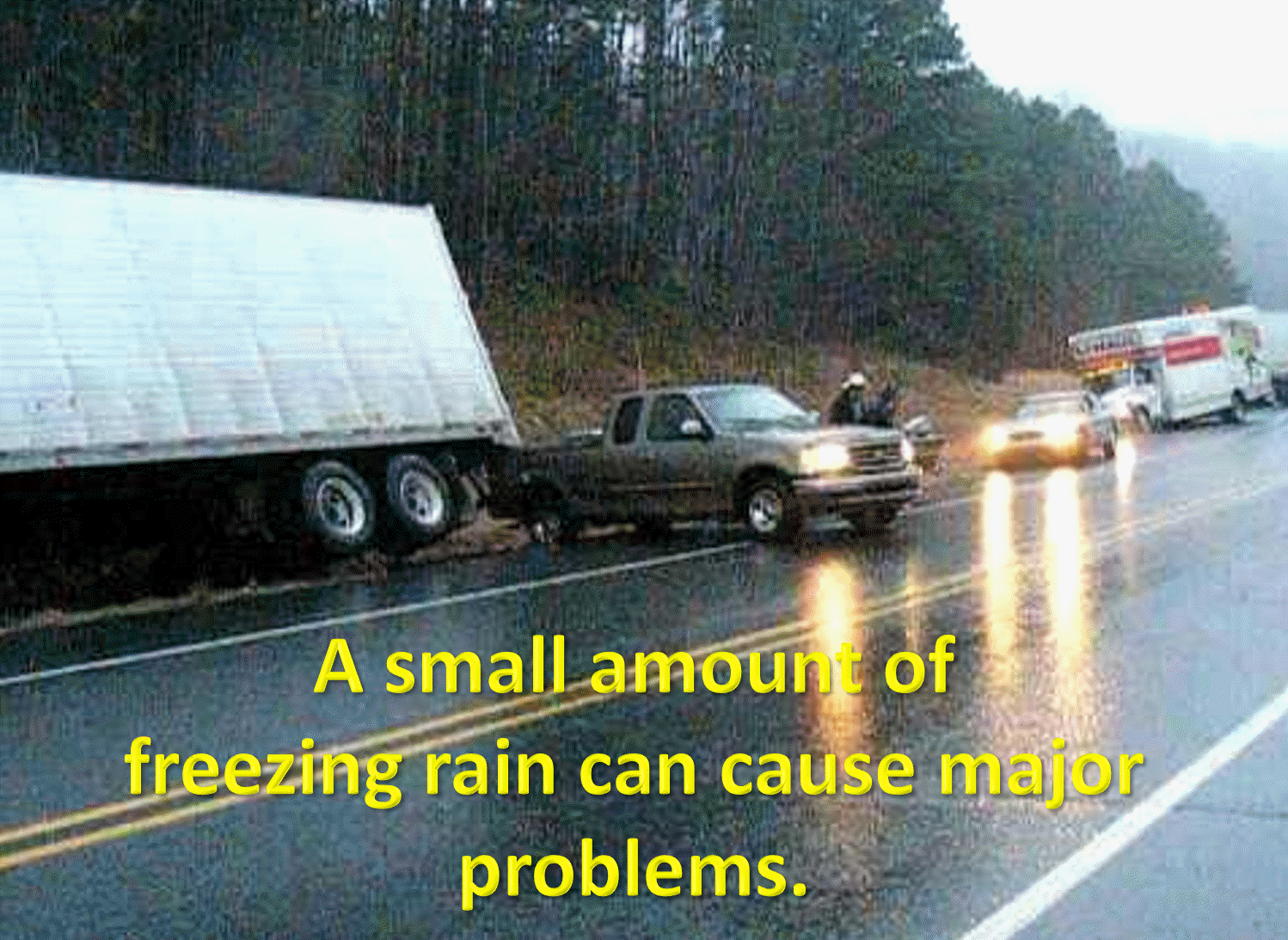
That means cold road surfaces. If precipitation does fall then it would likely cause problems. Even small amounts.
,
6:40 PM
I am receiving reports of mist over southeast Missouri and southern Illinois. Temperatures in some areas are below freezing.
Bridges and overpasses freeze first. Use caution.
.
4:30 PM
I will monitor this evening’s model guidance. The next significant update will likely be after 8:30 or 9:00 PM. That is when I will have all the fresh data.
Facebook update (Saturday evening)
.
4:15 PM
The Illinois video has been updated by the BAM team.
Link
https://weathertalk.com/app/beaucast
.
3:37 PM
Monday night is starting to look as if it will produce a second round of freezing rain, sleet, and snow. This time further south.
I had snow showers in the forecast.
I will need to update that to freezing rain, sleet, and snow with some accumulation possible (perhaps likely).
Temperatures will fall into the middle 20s by Tuesday morning. Icy road conditions are likely if the precipitation does verify.
This is the area of concern (Monday night/Tuesday morning)
.
You can see that second round on the NAM model.
We will need to monitor how far south that precipitation tracks.
Blue is snow. Pink is freezing rain and sleet. Green is rain. Yellow is rain.
This is Tuesday morning at 12 AM (late Monday night).
.
Here is the EC model guidance future-cast radar.
Blue is snow. Pink is freezing rain and sleet. Green is rain. Yellow is rain.
That green on the back edge is likely not going to be rain. It would be a wintry mix to snow.
This is Monday evening into early Tuesday morning.
.
Concerning the Sunday and Sunday night event (into Monday).
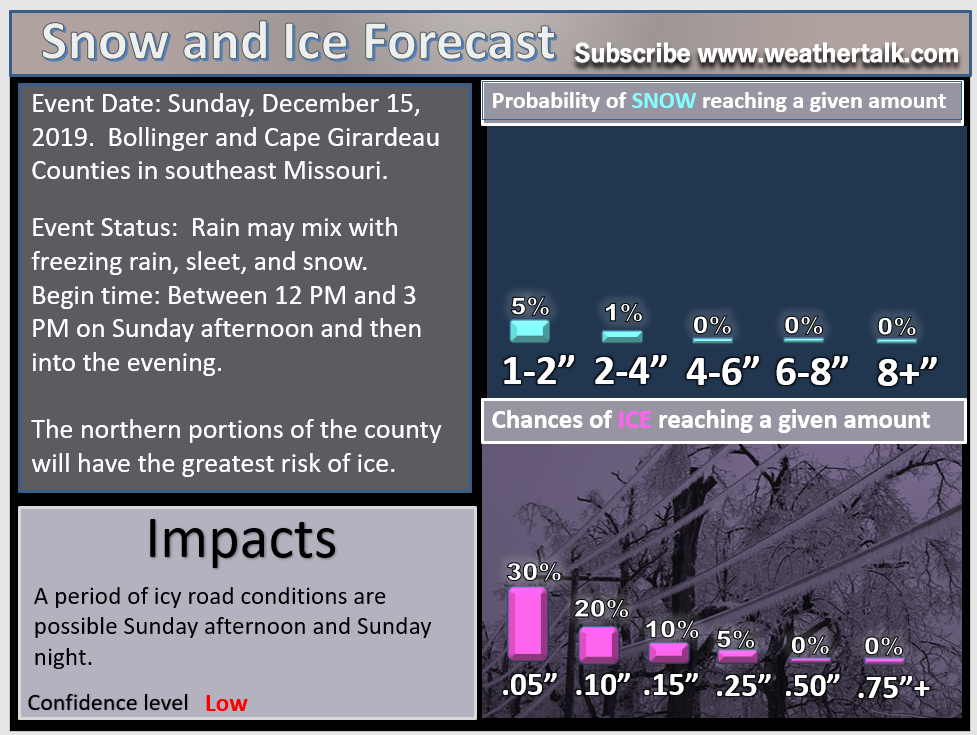
The winter storm watch has been upgraded to a winter weather advisory for my far northwest counties. Snow, up to one inch, and ice, up to 0.10 to 0.20″, is anticipated from Sunday morning through Monday night.
I believe the snow totals may need to be raised for the Monday night portion of this system.
3:20 PM
Ste. Genevieve and Randolph. The winter storm watch has been upgraded to a winter weather advisory from Sunday morning until midnight Monday. Snow up to one inch and ice accumulation of 0.10″ to 0.20″ is the current forecast. Additional counties may need to be added. Areas south and east should monitor updates.
.
1:48 PM
Model data is showing the low pushing a bit further south than forecast models showed 24 hours ago.
This is more in line with my forecast from the last few days. We will see how the new data looks this afternoon.
Either way, here is my forecast.
Here are some updated numbers
.
1:30 PM
Fresh videos have been posted on the video page.
Link https://weathertalk.com/app/beaucast
.
9:05 AM
Timing for southeast Missouri.
It will continue east from there. Arrival in southwest Illinois will be between 12 PM and 3 PM.
Click images to enlarge them.
.
9:00 AM
Here is the latest future-cast radar from the Hrrr model.
.
9:00 AM
I have updated these counties (scroll down for other counties).
.
6:30 AM
I have made no adjustments to my forecast from the previous 48-hours.
The system is on track to bring freezing rain, sleet, and snow to portions of my forecast area.
The greatest concern continues to be my far northwest and northern counties.
I am increasingly concerned about ice over Ste. Genevieve and perhaps Perry Counties in southeast Missouri and then Randolph County in southern Illinois.
Guidance shows temperatures remaining at or below freezing in these areas for most of the event. There is a one to two-degree error in the forecast. Thus, it will be a close call on rain vs ice.
Let me show you some graphics.
This continues to be the area of concern.
.
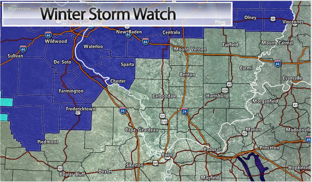
The NWS has now issued a winter storm watch for my northwest counties.
That includes Ste. Genevieve County in southeast Missouri and Randolph County in southern Illinois.
Remember, a winter storm watch means that conditions are favorable for winter weather. The watch could be upgraded to a winter weather advisory or winter storm warning.
We will just have to monitor temperatures in the watch area. It will be a close call for my forecast counties. Temperatures will hover near freezing.
.
Click all of these images to enlarge them.
.
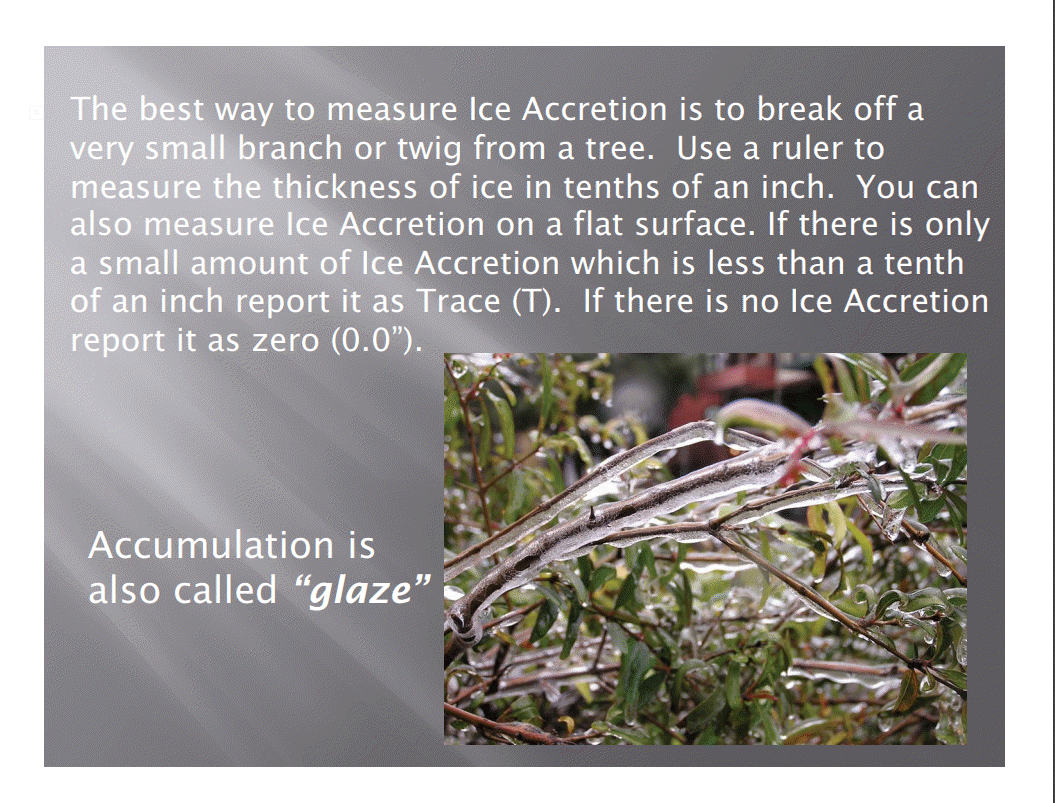
What does 0.10″ of freezing rain look like?
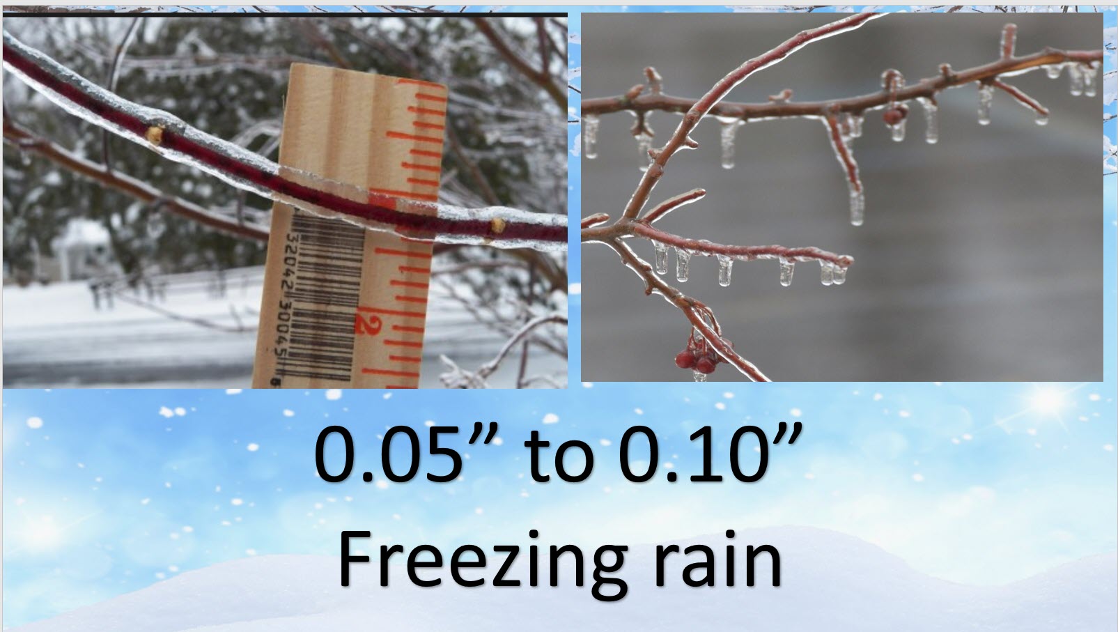
.
How to measure freezing rain and glaze.
.
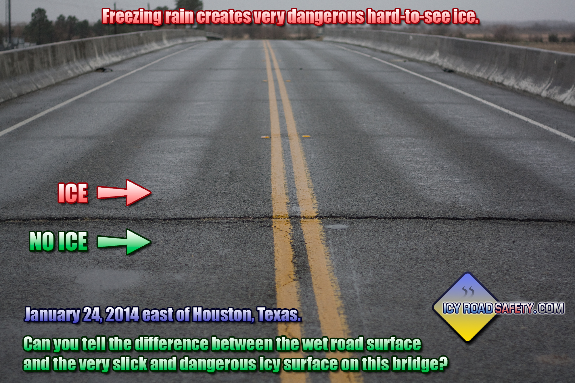
Remember, bridges and overpasses will freeze first. This can create dangerous and deadly driving conditions.
.
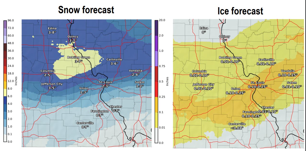
Here are my probability numbers for snow and ice (county by county)
This one was adjusted upward.
This one was adjusted upward.
This one was adjusted upward.
No change in this graphic
No change in this graphic
.
Here are the current forecast numbers from the NWS. What is anticipated in the way of snowfall?
Ice projections.
.
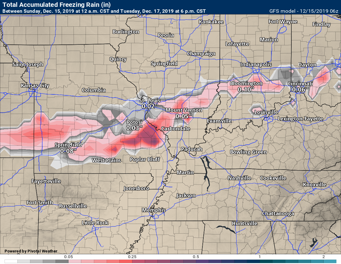
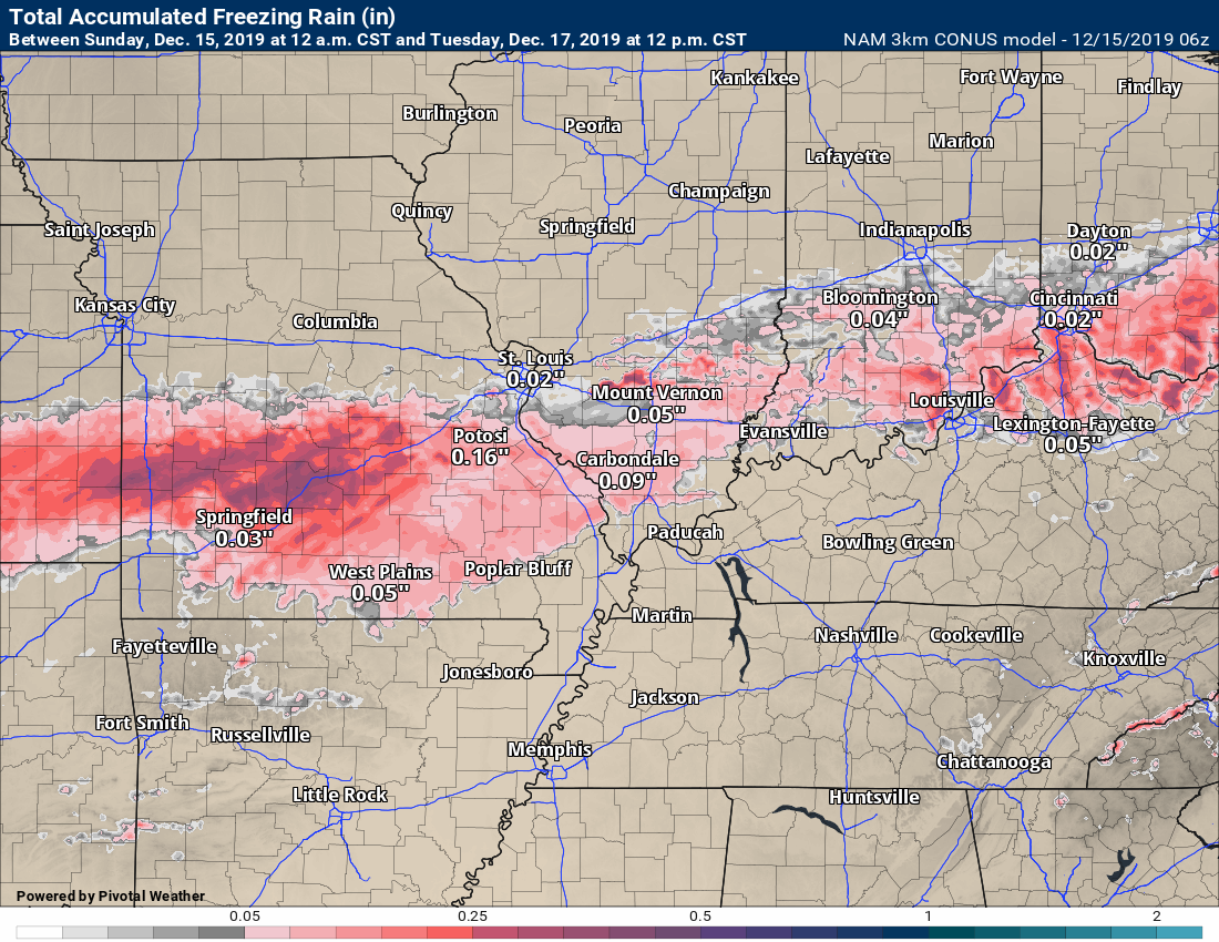
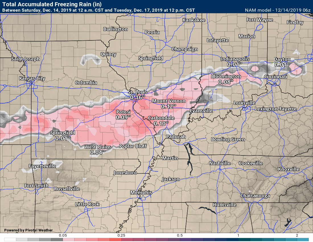
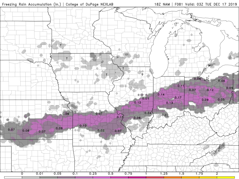
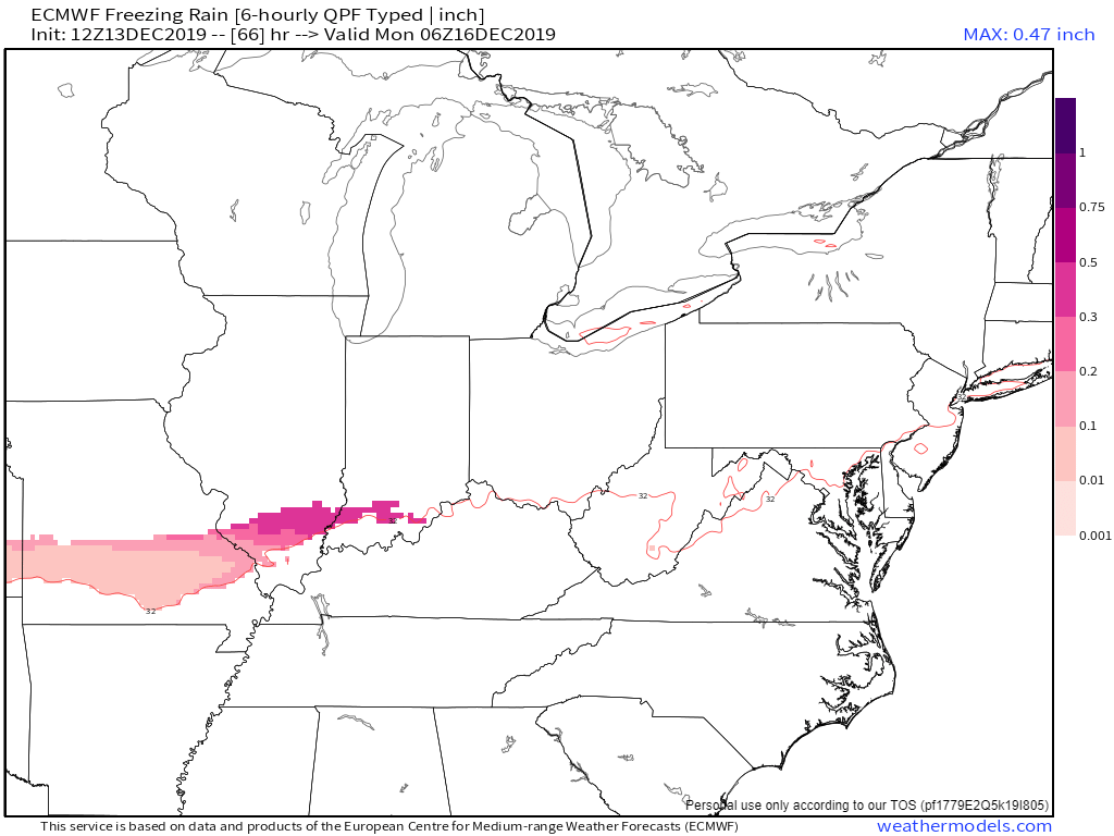
Here is the NAM freezing rain forecast.
There is some debate about the southern row of counties.
Notice the deeper colors around Ste. Genevieve and Perry counties in southeast Missouri and Randolph County in southern Illinois. Higher totals per the NAM.
It will be a close call in these areas.
.
Here is the temperature animation from the NAM model.
Click all of these images to enlarge them.
You can see that the temperature remains at or below freezing in my far northwest counties.
Notice the surge of warm air ahead of the system in Tennessee and south-central/eastern Kentucky. Impressive temperature gradient.
.
The current thinking on the start time.
I am closely monitoring Monday afternoon and night for some wrap-around freezing drizzle and perhaps snow.
The most likely area of concern would be Ste. Genevieve and Perry counties in southeast Missouri and then Jackson, Williamson, Saline, and Gallatin Counties in southern Illinois and then north from there. Then, I would be monitoring Union, Henderson, and Daviess Counties in western Kentucky.
.
Future-cast radar animation.
Blue is snow. Ice is pink and purple. Green and yellow represent rain.
EC model guidance. The time on this one is in Zulu. 12z=6 AM. 18z=12 pm. 00z=6 PM and so on.
.
GFS model guidance. Different model than the one above.
Time-stamp upper left.
.
Friday’s updates are below.
7:00 PM
The next update will be posted late tonight and tomorrow morning.
No changes, at this time.
5;45 PM
I am monitoring the chance of freezing drizzle on Monday night (area-wide).
.
5:40 PM
Here are some of the latest forecast thoughts from St Louis, Missouri, NWS.
I agree with these graphics. You can see mine further down.
.
.
.
.
5:20 PM
Here are my latest forecast thoughts. Broken down by county.
.
.
.
.
5:00 PM
No real change to my forecast. A slight adjustment on the monitor zone. A few miles adjustment to the N NW. Overall, the significant change.
Here are the latest NAM and GFS future-cast radar forecasts. There are some differences.
The NAM trended a bit warmer this afternoon when compared to the morning run.
Click images and animations to enlarge them.
Time-stamp upper left. Blue is snow. Green is rain. The pink colors are a wintry mix.
GFS model.
Time-stamp upper left. Blue is snow. Green is rain. The pink colors are a wintry mix.
Latest zone of concern
.
4:40 PM
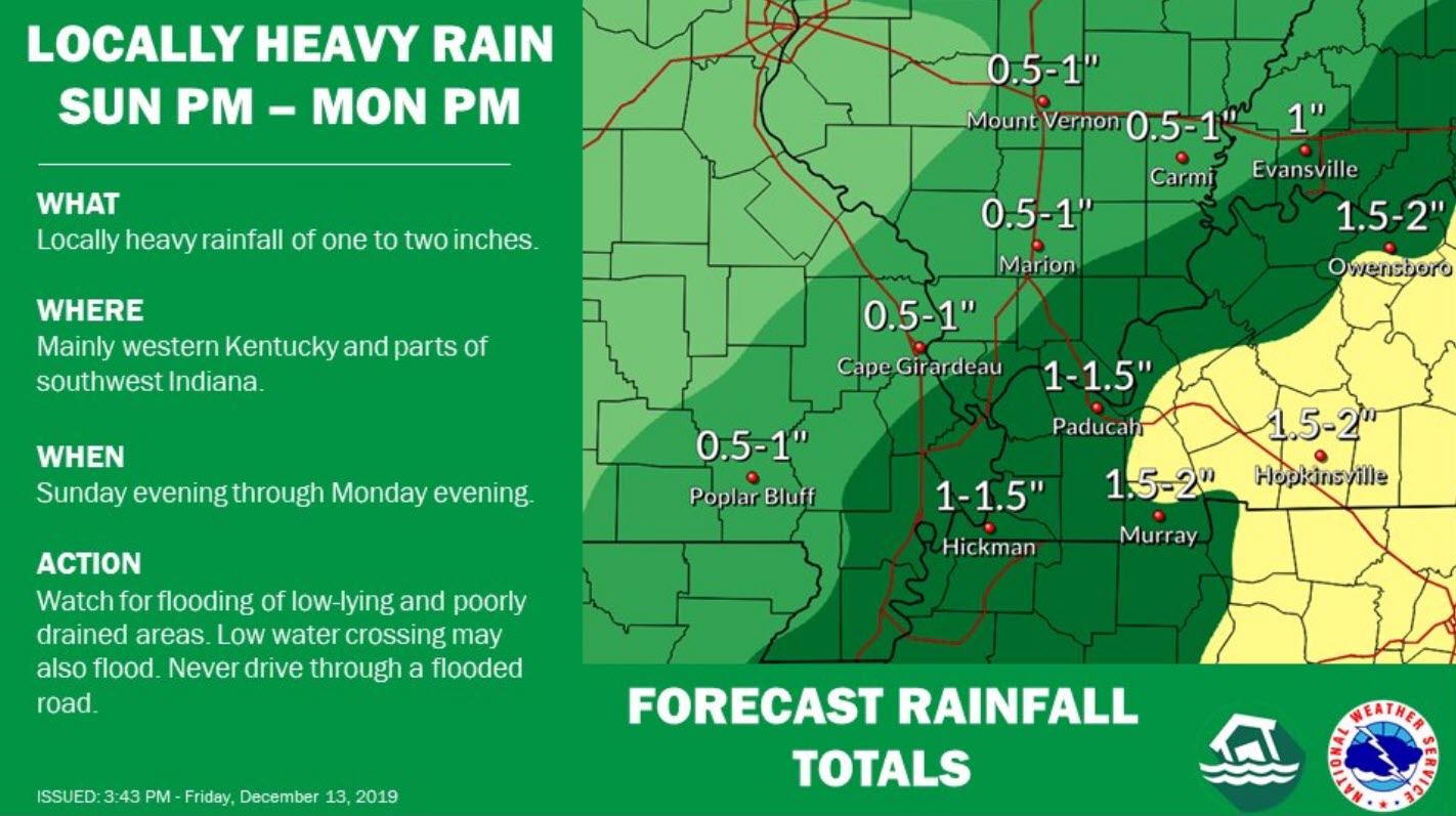
Locally heavy rain is also a concern from this event.
.
3:00 PM
The afternoon NAM model guidance is in. It trended slightly warmer this time.
No real adjustments to my forecast thoughts. I think the big question will be how much time will the temperature be below freezing before it all changes to rain.
Here is where the NAM paints freezing rain and sleet Sunday afternoon and evening.
Here is where the NAM places the snow.
6 PM Sunday. Future-cast radar from the NAM model. You can see the green is rain. Pink and red are sleet and freezing rain. Blue is snow.
9 PM Sunday. Future-cast radar. The freezing line continues to push northward with time.
This is the NAM’s opinion. Models are within a two to three county spread as to where to place the freezing line.
.
Check out the sharp temperature difference on Monday. There will be thunderstorms ahead of the cold front over portions of Kentucky, Tennessee, and then southward.
1:45 PM
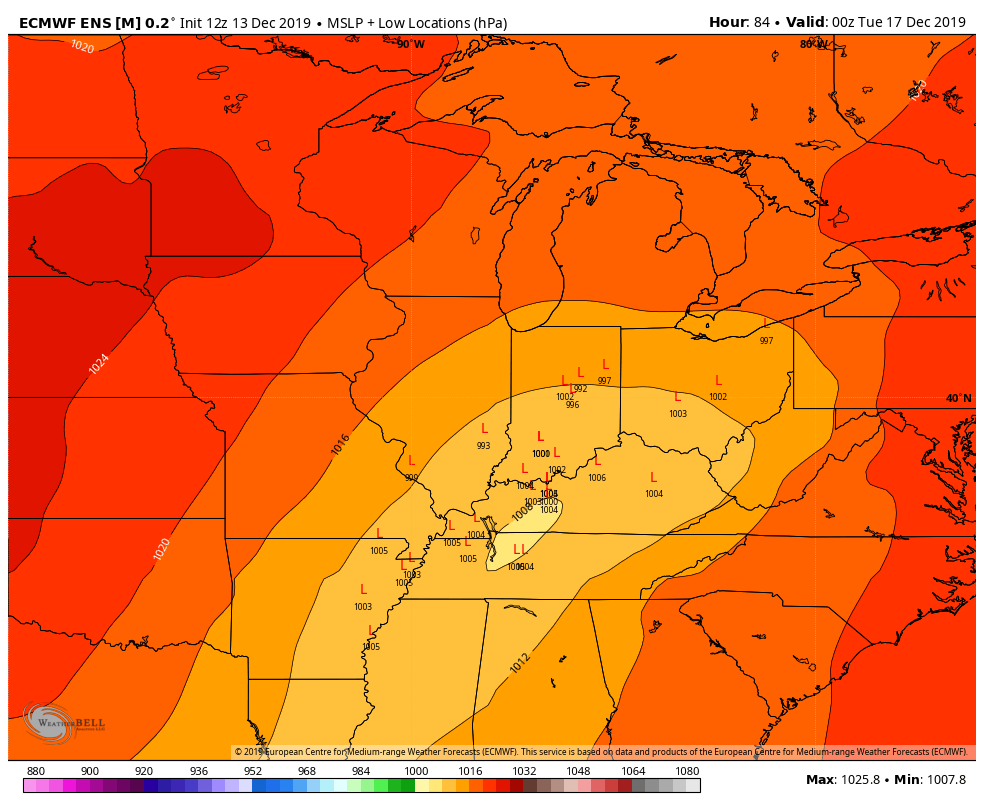
The EC model ensembles are in. The track of the low is key to where thunderstorms occur and where the frozen precipitation occurs.
I have been tracking the low into TN and KY. Some models show that. Some are further north.
The EC centers the track into south-central Kentucky.
All of the red L’s are the different ensemble members. The mean is east of the LBL area. There is still some spread in the members.
.
1:25 PM
This is my current forecast concern. I am sure there will be adjustments. There is a chance that this is mostly a rain event for most of the area. Some models do show that.
The area of concern is for wintry precipitation.
.
The EC model ensembles are in.
In theory, each square, that agrees with the other increases the confidence in the overall forecast.
In other words, if all the squares agree then confidence is very high in the final outcome.
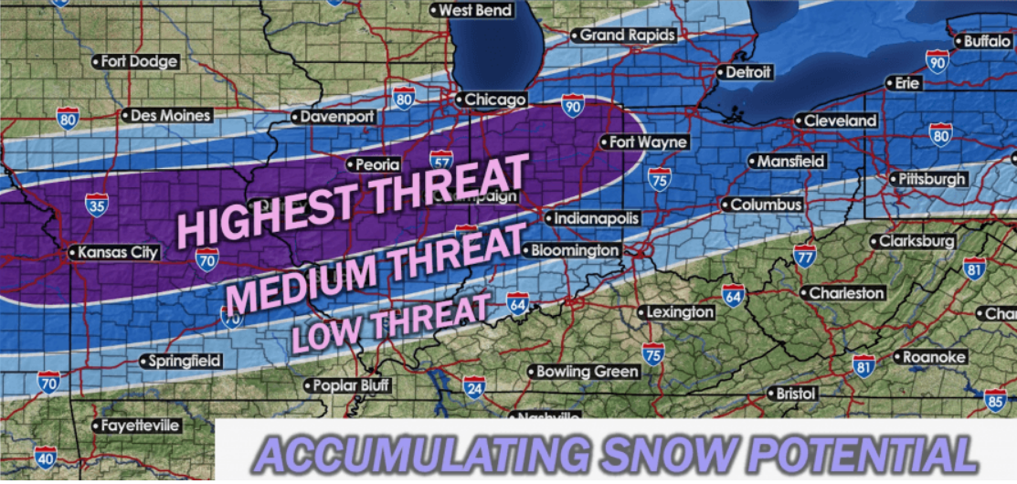
EC as zeroed in on MO and IL for the heaviest snow. North of my forecast counties.
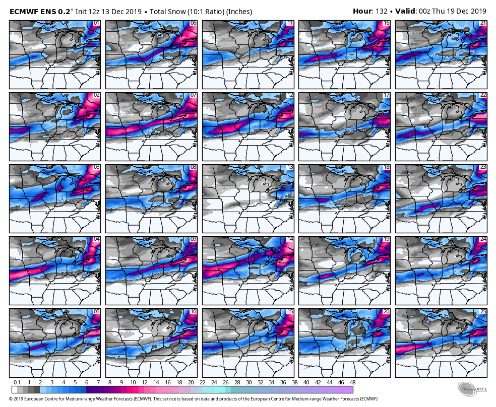
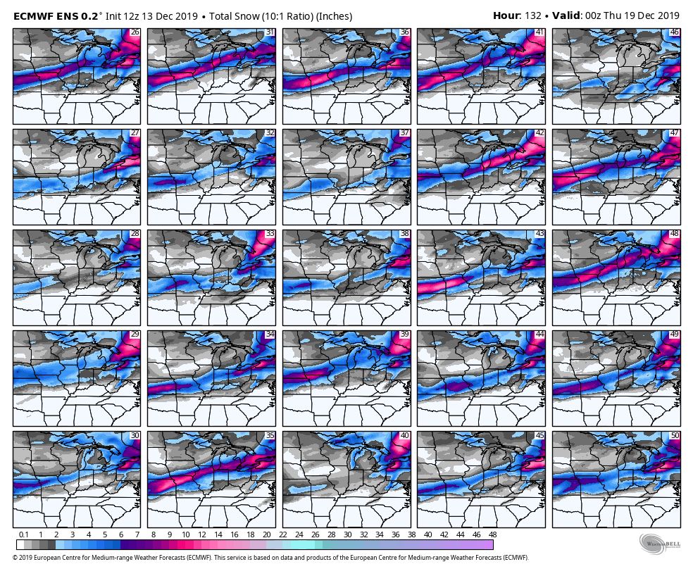
Here is the EC ensemble snowfall forecast.
Click each image to enlarge it.
.
.
Here is the snowfall mean projection. All of the above put together.
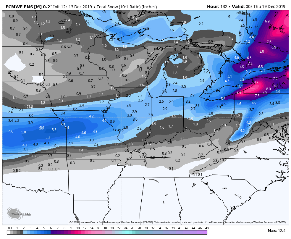
.
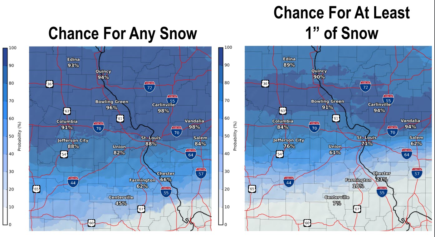
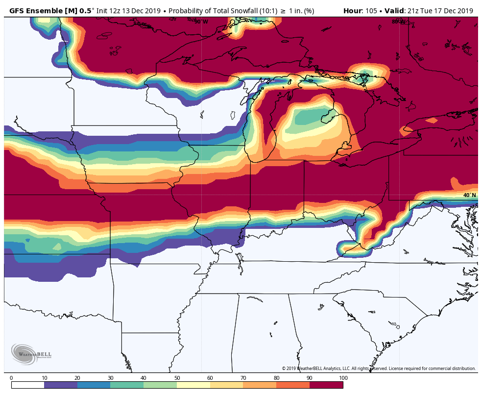
What is the probability of one or more inches of snow?
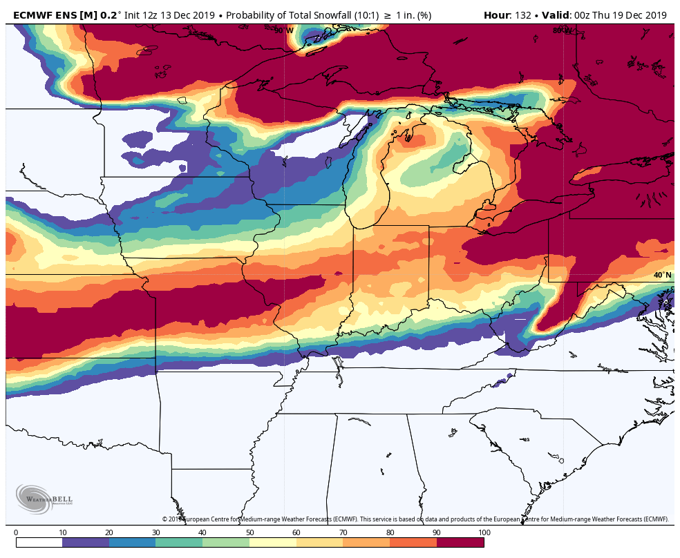
.
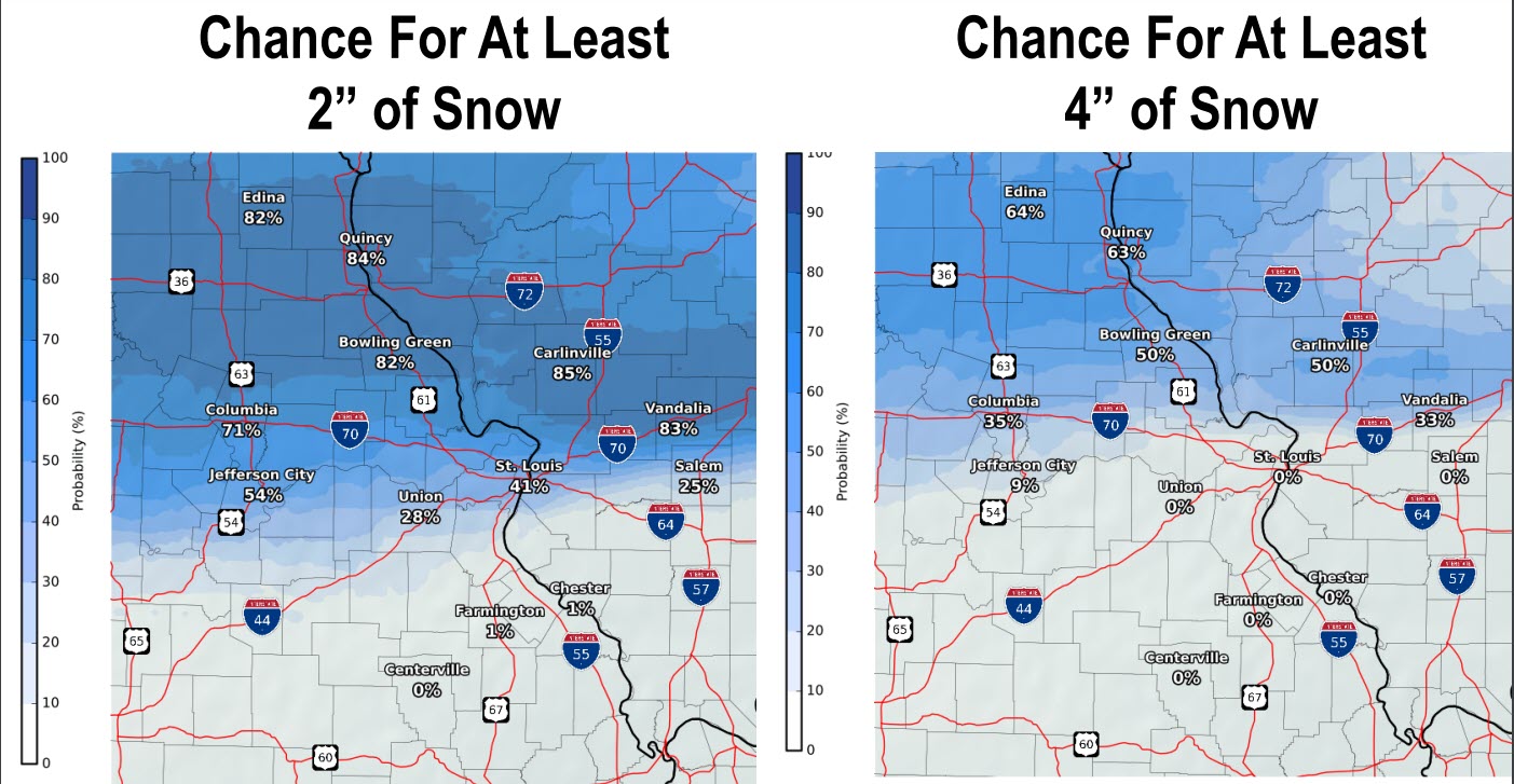
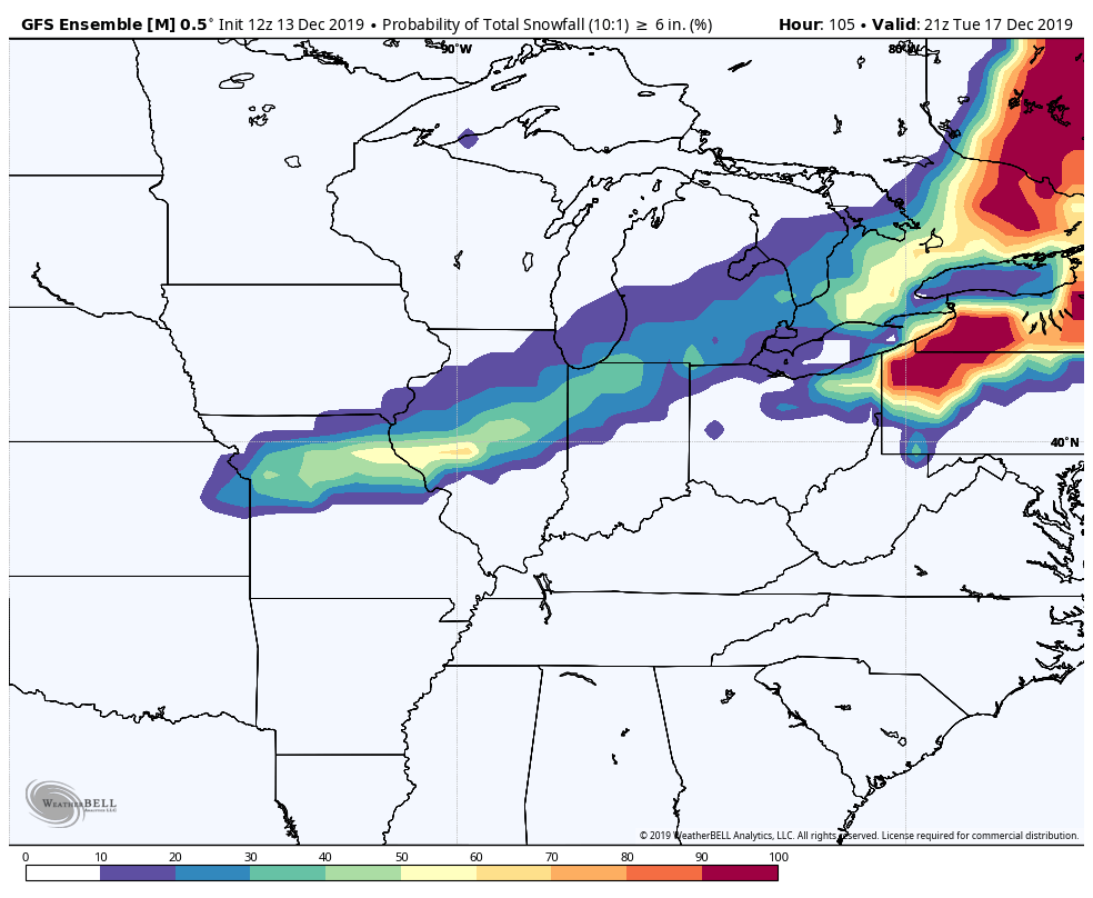
What is the probability of six or more inches of snow?
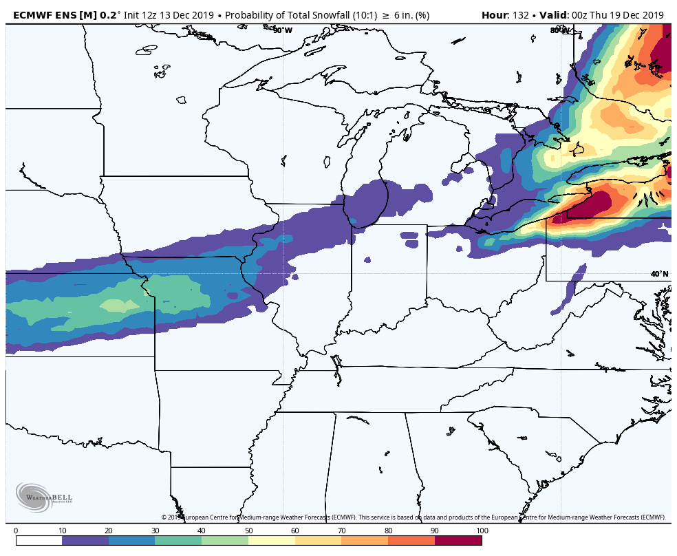
.
1:15 PM
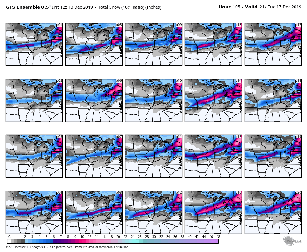
The GFS model ensembles are in.
In theory, each square, that agrees with the other increases the confidence in the overall forecast.
In other words, if all the squares agree then confidence is very high in the final outcome.
GFS has zeroed in on MO and IL for the heaviest snow. North of my forecast counties.
Here is the GFS ensemble snowfall forecast.
Click each image to enlarge it.
What is the probability of at least one inch of snow?
What is the probability of six or more inches of snow?
.
12:55 PM
EC model guidance is in. It agrees with my going forecast.
Here are a few graphics.
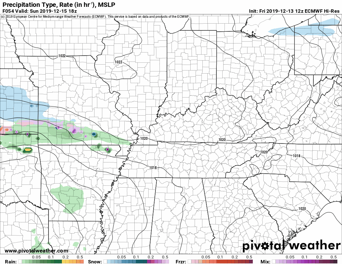
Future-cast radar.
Click the image to enlarge it.
Green and yellow are showers and some thunderstorms.
Blue is snow. Purple and pink/red represent sleet and freezing rain.
The time is un Zulu. 12z=6 am. 18z=12 pm. 0Z=6 pm. 06z=12 am.
.
Here is where the EC thinks the freezing rain will fall before changing to all rain.
.
Here is where the EC believes sleet will fall before changing to rain.
.
Here is where the EC guidance drops snow. Some of that grey area in my forecast counties will occur before it changes to rain (if it snows at all).
There could also be snow showers Monday afternoon and night behind the system.
.
I thought you might find this interesting. This is an animation of the forecasts over the past few days of snow accumulation.
This is why I tell you to ignore models until about 48 hours before an event.
Just look at the wild swings in the placement of the heaviest snow band.
Each of the graphic changes represents one run of the EC model. This goes back to last Sunday.
.
Here is the latest update from the EC model. It is likely a tad too far south with the snow. We will see. We are still 48 hours out.
.
12;30 PM
Here is the latest timeline. St Louis, Missouri, NWS posted this graphic.
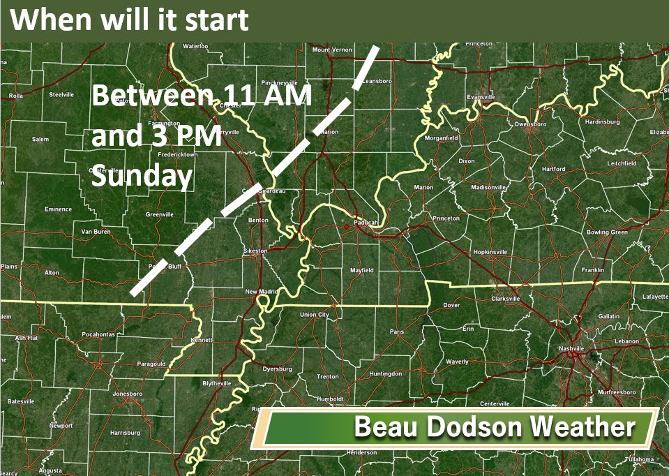
I am in agreement. The system will track eastward with time.
Precipitation will likely track into southwest Illinois between 11 AM and 3 PM. Then eastward through the afternoon and overnight hours.
.
11:30 AM Friday update.
Click images to enlarge them.
.
This is my current forecast concern. I am sure there will be adjustments. There is a chance that this is mostly a rain event for most of the area. Some models do show that.
The area of concern is for wintry precipitation.
.
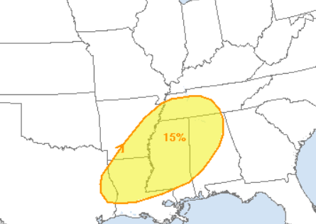
In addition to the above, there is a low-end chance of a few strong thunderstorms over the Missouri Bootheel, western Kentucky, and northwest Tennessee.
The SPC has shifted southward with their threat area. I never did think it should be further north.
I will be monitoring the track of the low. If it does trend northward then storms will move further north, as well.
For now, the concerns are mostly to our south.
.
Here are the latest graphics from the St Louis NWS office. I agree with these.
Click each graphic to enlarge it.
Click to enlarge
.
Here are some future-cast radars.
Keep in mind, models vary and this event is still two days away.
The NAM model is drier than any other model. It shows very little precipitation through the event. Other models show heavy rain over at least the Missouri Bootheel, western Kentucky, and northwest Tennessee.
Here is the NAM future-cast radar. Time-stamp upper left. Blue is snow. Green is rain. The pink colors are a wintry mix.
.
Here is the GFS future-cast radar. Time-stamp upper left. Blue is snow. Green is rain. The pink colors are a wintry mix.
.
The NAM model came in colder this morning.
Here is the NAM model temperature forecast. I combined four different runs of the model. Each run is a bit colder. This will need to be monitored. The risk of ice will increase if the NAM is correct. That would be across portions of southeast Missouri and southern Illinois.
On the other hand, the GFS model is much warmer and shows almost all rain in our region.
Click to enlarge.
.
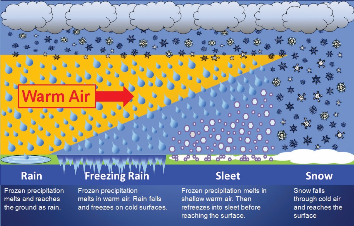
What determines precipitation type? Temperatures aloft.
The depth of the cold air will determine what type of precipitation will fall from the sky.
If the temperature is at or below freezing through the entire atmospheric column you will normally experience a snow event. Warmer air can nudge into the cold air. When that happens it melts the snowflakes. Once a snowflake is melted it can not turn back into a snowflake. Your precipitation can then change to sleet or freezing rain.
.
.
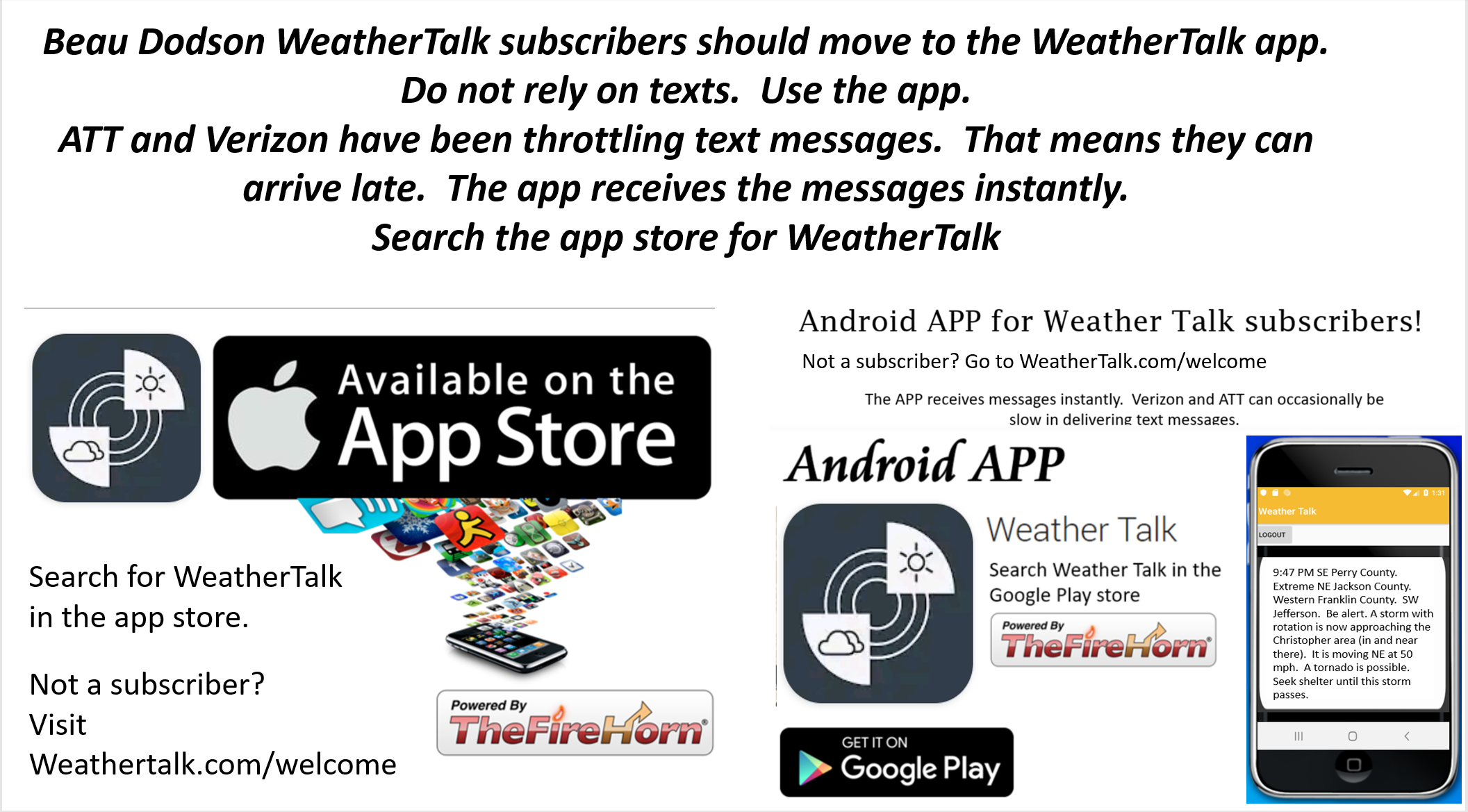
Not receiving app/text messages?
USE THE APP. ATT and Verizon are slowing or stopping the text messages.
Make sure you have the correct app/text options turned on. Find those under the personal notification settings tab at www.weathertalk.com. Red is off. Green is on.
Subscribers, PLEASE USE THE APP. ATT and Verizon are not reliable during severe weather. They are delaying text messages.
The app is under WeatherTalk in the app store.

Apple users click here

Android users click here
.
National map of weather watches and warnings. Click here.
Storm Prediction Center. Click here.
Weather Prediction Center. Click here.
.

Live lightning data: Click here.
.

Interactive GOES R satellite. Track clouds. Click here.
GOES 16 slider tool. Click here.
College of Dupage satellites. Click here
.
Did you know that you can find me on Twitter? Click here to view my Twitter weather account.

.

.
Who do you trust for your weather information and who holds them accountable?
I have studied the weather in our region since the late 1970s. I have 40 years of experience in observing our regions weather patterns.
My degree is in Broadcast Meteorology from Mississippi State University and a Bachelor of Science (BS).
I am an NOAA Weather-Ready Nation Ambassador. I am the Meteorologist for McCracken County rescue squad. When asked, I assist Ballard and Massac Counties, as well.
I own and operate the Southern Illinois Weather Observatory and WeatherTalk LLC.
There is a lot of noise on the internet. Over time you should learn who to trust for your weather information.
My forecast philosophy is simple and straight forward.
- Communicate in simple terms
- To be as accurate as possible within a reasonable time frame before an event
- Interact with you on Twitter, Facebook, and the blog
- Minimize the “hype” that you might see on television or through other weather sources
- Push you towards utilizing wall-to-wall LOCAL TV coverage during severe weather events
I am a recipient of the Mark Trail Award, WPSD Six Who Make A Difference Award, Kentucky Colonel, and the Caesar J. Fiamma” Award from the American Red Cross.
In 2009 I was presented with the Kentucky Office of Highway Safety Award.
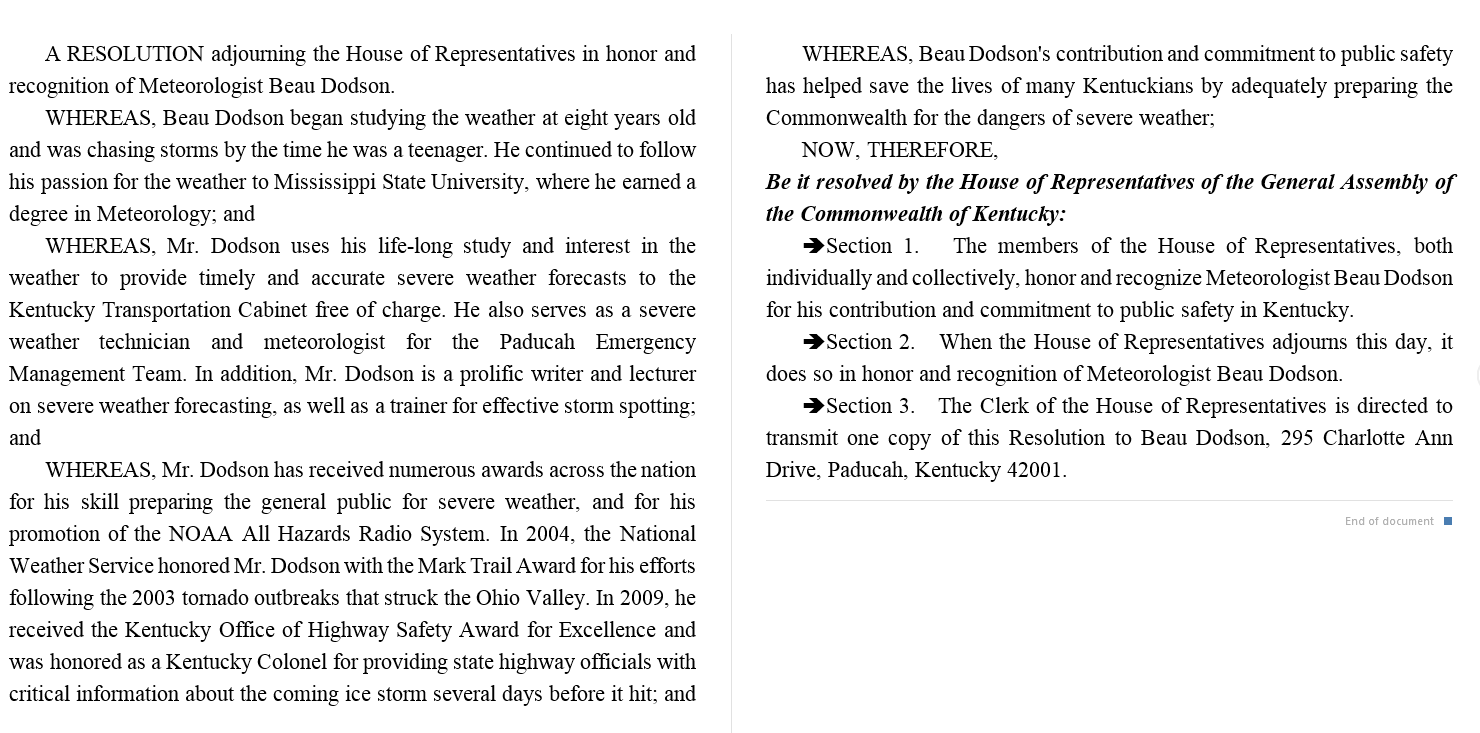
I was recognized by the Kentucky House of Representatives for my service to the State of Kentucky leading up to several winter storms and severe weather outbreaks.
If you click on the image below you can read the Kentucky House of Representatives Resolution.
.
.
Find Beau on Facebook! Click the banner.

.
Find Beau on Twitter! Share your weather photos! @beaudodson

.
![]()
![]()
Did you know that a portion of your monthly subscription helps support local charity projects? Not a subscriber? Becoming one at www.weathertalk.com
You can learn more about those projects by visiting the Shadow Angel Foundation website and the Beau Dodson News website.
