
.

🌪️ Seven-Day Tornado Outlook ⛈️
April 17th to April 23rd
Current risk: MONITOR.
Current confidence level: Medium.
Comments: The risk of tornadoes will be low. I will monitor tonight and early Saturday morning (mainly MO and IL)
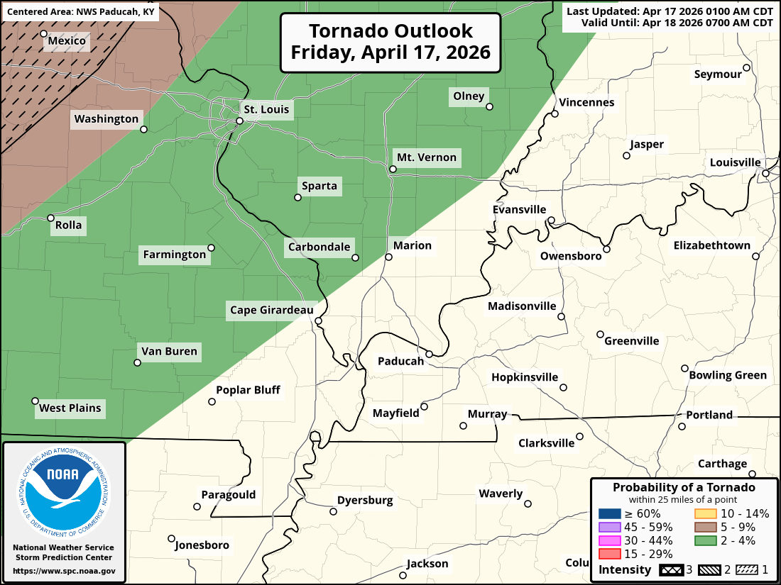
Here is the tornado outlook graphic from the SPC (NOAA/NWS). A low risk extends into portions of southeast MO and southwest IL.
.

Seven-Day Hazardous Weather Outlook
1. Is lightning in the forecast? YES. Lightning is possible today through Saturday afternoon. Peak chances will be tonight and tomorrow morning.
2. Are organized severe thunderstorms. MONITOR. I will monitor tonight. Mainly across southeast Missouri and southwest Illinois. The risk drops off as you move eastward. I will monitor Saturday. It appears the Saturday risk will likely remain to our northeast.
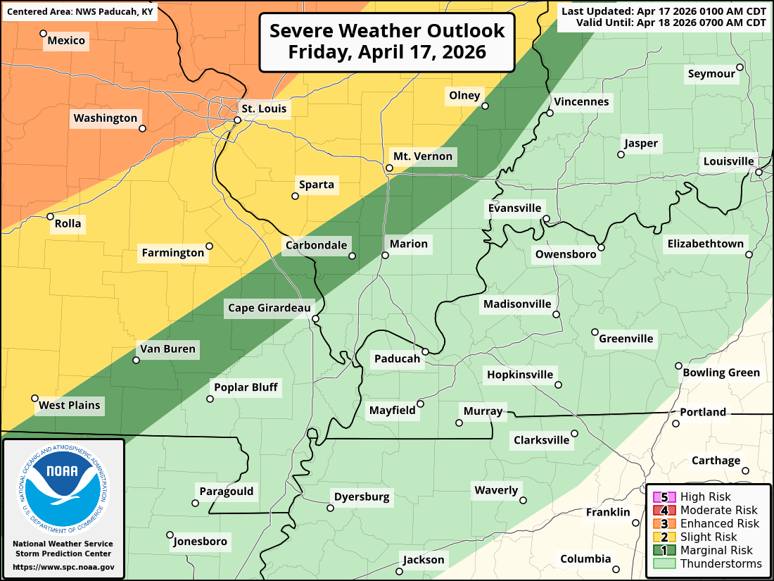
Here is the early-morning day-one severe weather outlook from the Storm Prediction Center (SPC). The threat will run from late this afternoon into tonight.
Light green is where sub-severe storms are possible.
Dark green is the level one out of five severe weather risk (the lowest severe threat)
Yellow is a level two severe weather risk.
Orange is a level three out of five severe weather risk.
.
3. Is significant or widespread flash flooding in the forecast? NO.
4. Will non-thunderstorm winds top 40 mph? NO.
5. Will the temperature rise above 90 degrees? ISOLATED CHANCE. Today.
6. Is the heat index forecast to rise above 100 degrees? NO.
.
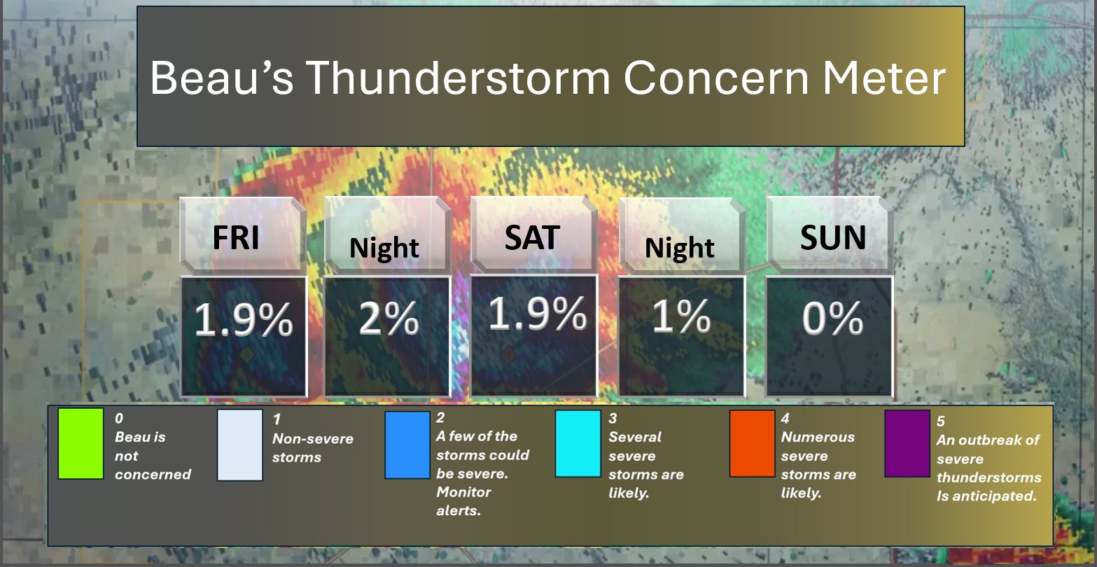
⛈️ Here is the short-range thunderstorm concern meter.
I will monitor late this afternoon and tonight.
.
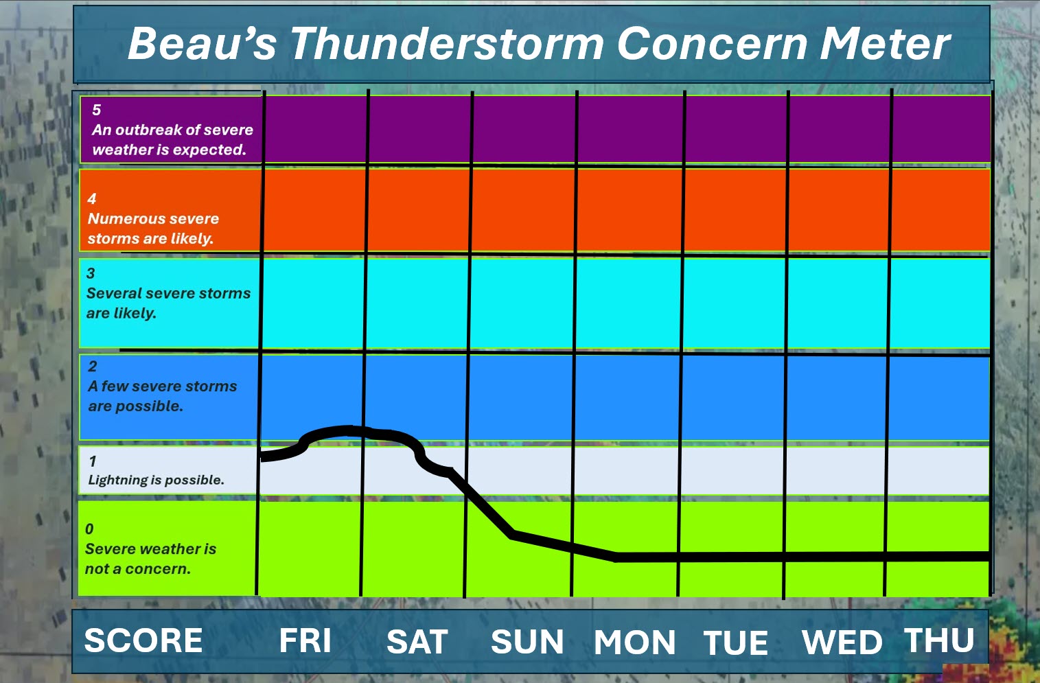
⛈️ Here is the extended thunderstorm concern meter.
I will monitor late this afternoon and tonight. The risk is mainly tonight over southeast Missouri and southwest Illinois.
.


.
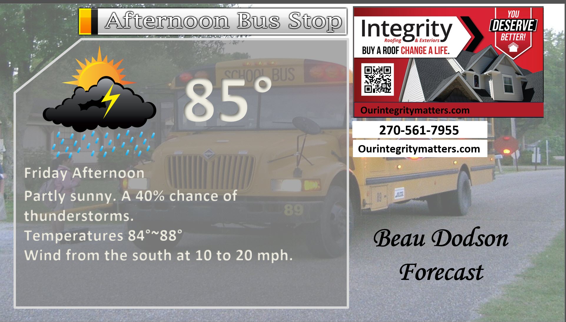
Here is your bus stop forecast
.
This morning

.
This afternoon
.
Tomorrow morning
.
Tomorrow afternoon
.
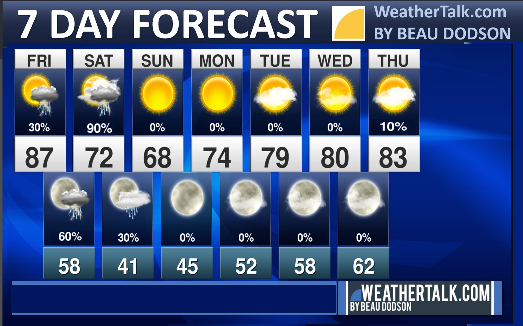
Seven-day outlook graphic.
See the video and graphics below for more details specific to your county. This is a broad-brush overview of the entire region.
.


Forecast discussion
- A warm day ahead of us. A few thunderstorms could bubble up this afternoon and evening. Higher chances tonight and tomorrow.
- Near record high temperatures today. It is likely that some areas will break their record high temperatures.
- A cold front will push across the region on Saturday and Saturday night. Showers and storms will accompany it tonight and tomorrow. There is a low end risk of a few severe thunderstorms tonight over southeast Missouri and southwest Illinois.
- Cooler air will arrive on Sunday and Monday. A warming trend as we move through next week.
.
 .
.
.
What is the primary weather concern today and tonight?
Near-record-high temperatures today in the eighties. A few thunderstorms will be possible this afternoon and evening. Increasing chances west to east tonight and tomorrow. A few of the storms tonight could be intense. Mainly over southeast Missouri and southwest Illinois. Monitor updates, as always.
.
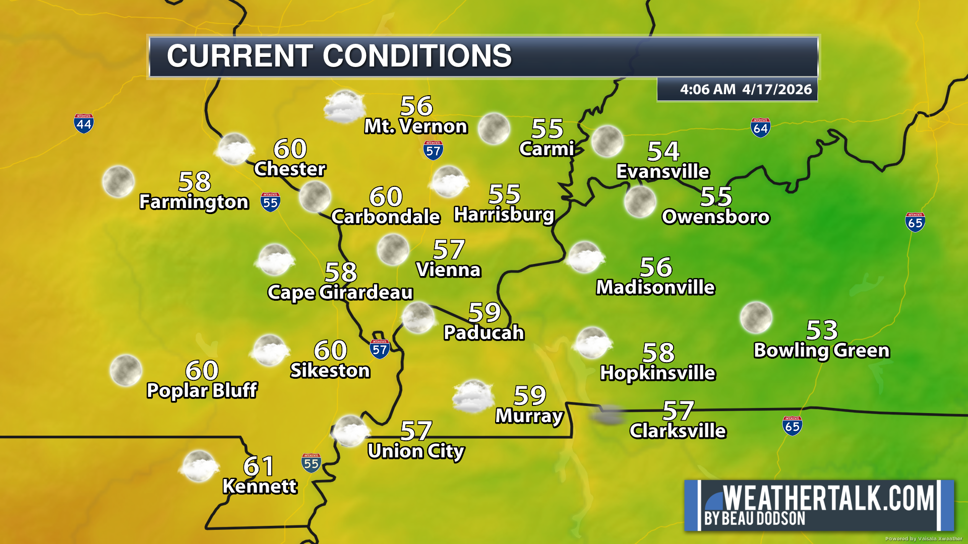
Here are the early morning current conditions. These are the 4 AM readings.
.
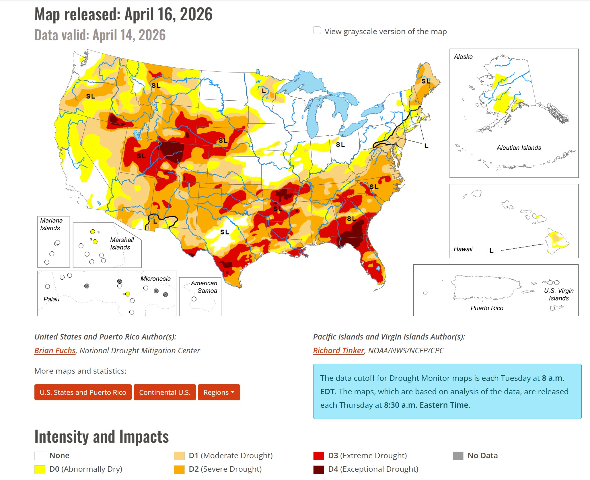
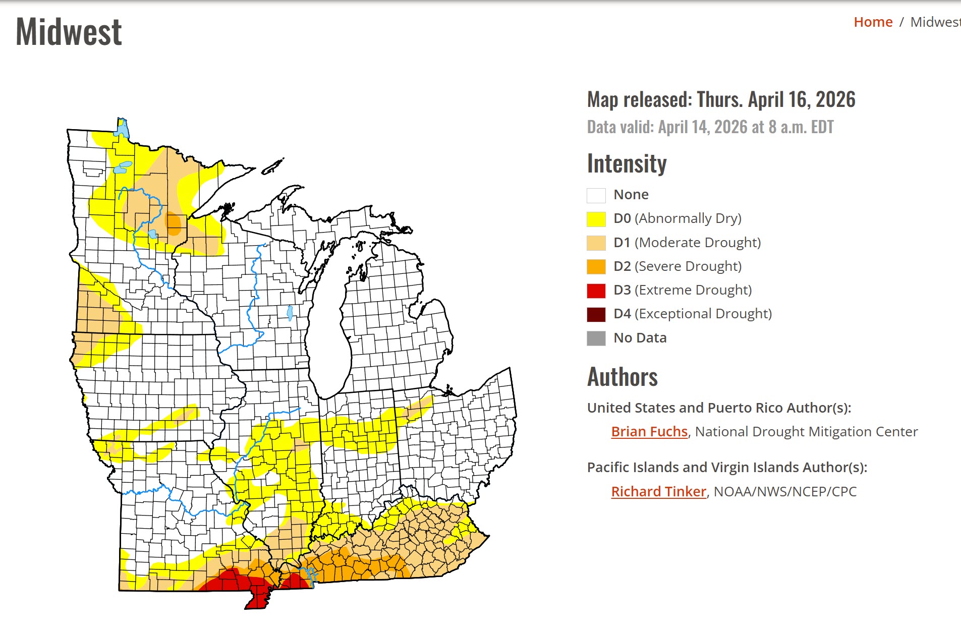
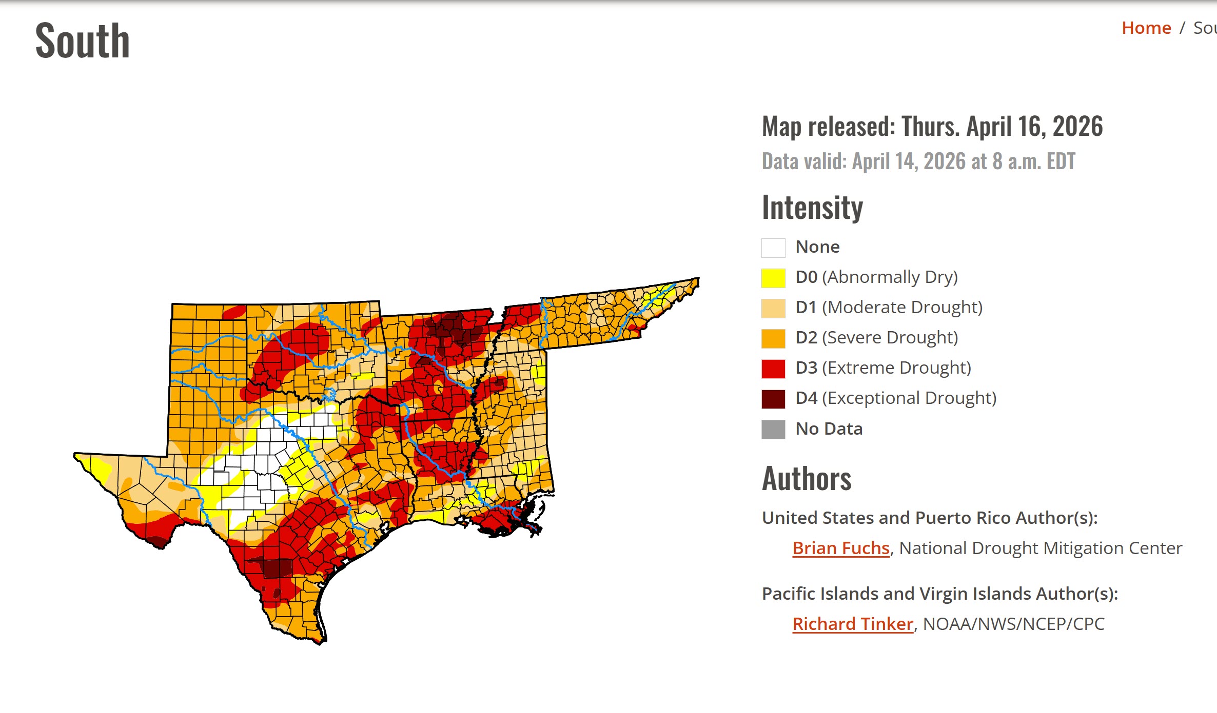
The new drought monitor maps have been posted. Our region continues to see the drought deepen. We need rain. A lot of rain.
Of course, farmers need to get into their fields. At the same time, they need rain.
Double-click images to enlarge them.
.
.
.
We did have numerous reports of hail on Thursday.
The number of hail and wind damage reports was a bit surprising. Although we did have severe storms in the forecast, the activity was more numerous than expected.
I sent quite a few alerts out before and during the event. This is why I always say “monitor updates” on severe weather days.
We did have a few reports of tennis-ball-sized hail across southeast Missouri and western Kentucky. A bit smaller over extreme southern Illinois!
Impressive hailstorms.
We did make it halfway through April with no severe weather reports. Then, one day, after we had severe storms. I guess we had a good run!
We are waking up to a few clouds. Mild temperatures. Patchy fog.
A few storms will be possible this afternoon and evening. Rain chances rapidly increase late tonight into tomorrow. See the graphics below.
No severe weather concerns through 4 PM.
I can’t rule out a few severe thunderstorms tonight. Mainly across southeast Missouri and southern Illinois. Lower chances as you travel south and east.
Again, here is the severe weather outlook for today and tonight from the SPC. You can see that it is skewed to our west-northwest. It nudges into our region during the evening and overnight hours. Perhaps late afternoon, but there is uncertainty on that.
Light green is where sub-severe storms are possible.
Dark green is the level one out of five severe weather risk (the lowest severe threat)
Yellow is a level two severe weather risk.
Orange is a level three out of five severe weather risk.
.
The primary concern will be a few reports of hail and wind damage. The tornado risk is low. Perhaps not zero, but low.
Monitor your Beau Dodosn Weather App later today and tonight. I will send out a few updates.
As always, during the spring, monitor updated forecasts. Forecasts can change or need adjusting.
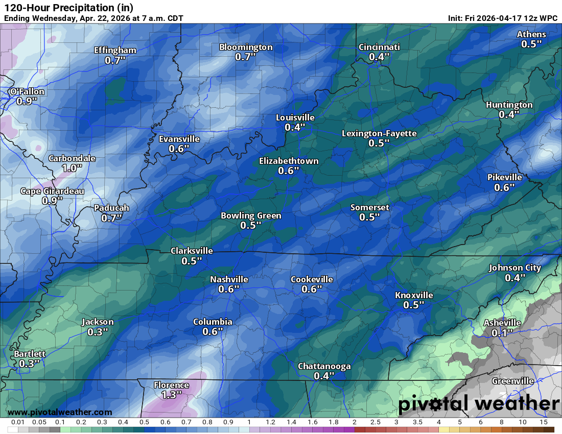
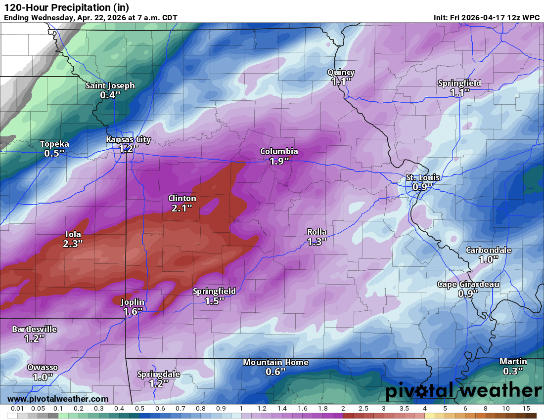
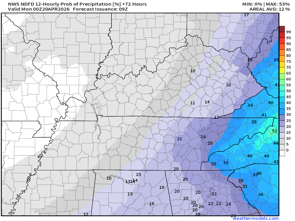
Here are the expected rain totals from today through Sunday.
A lot of the rain, over the past four months, has ended up being less than forecast. We will see how this week goes. We need rain. A lot of rain. Drought conditions continue to worsen.
Double-click on images to enlarge them.
Central view of our region.
.
Missouri view
.
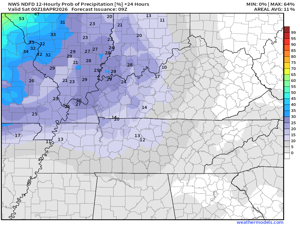
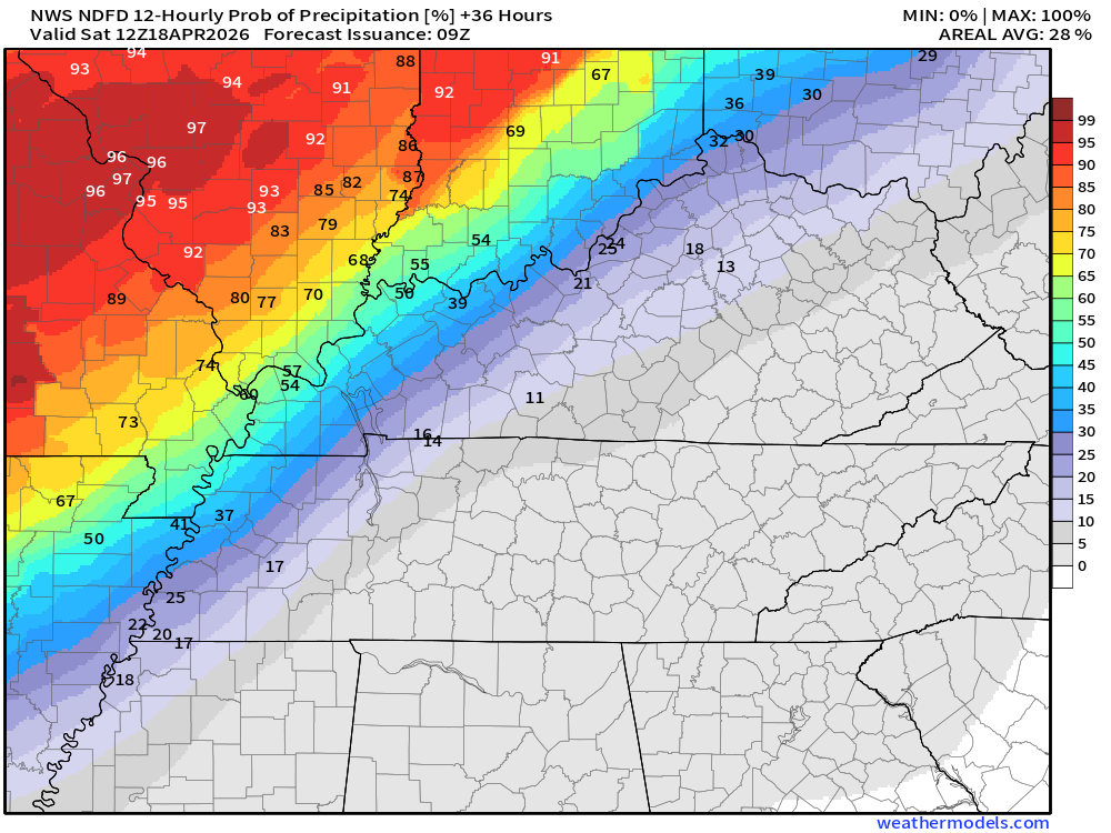
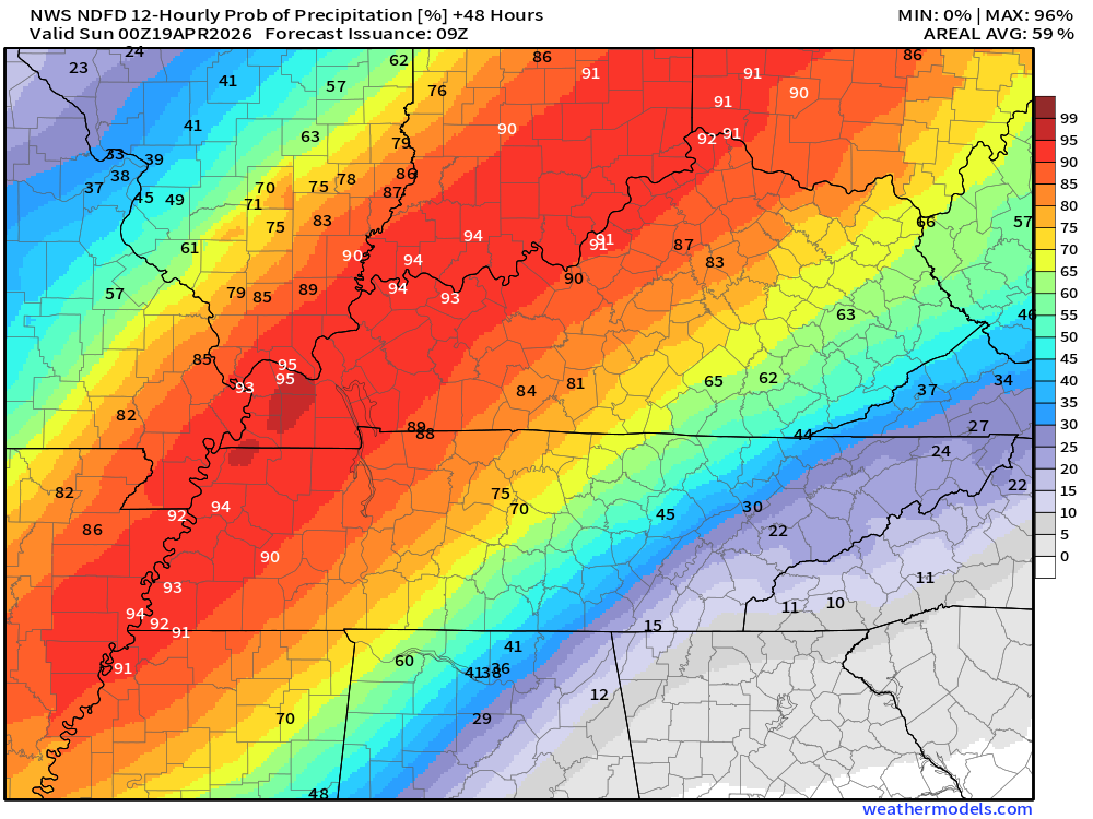
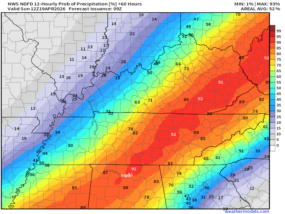
Let’s look at those rain probabilities.
What is the % chance of rain?
Double-click images to enlarge them.
It will turn cooler on Sunday (behind the cold front). Highs may only reach into the 60s on Sunday.
No frost in the forecast at this time.
.

.
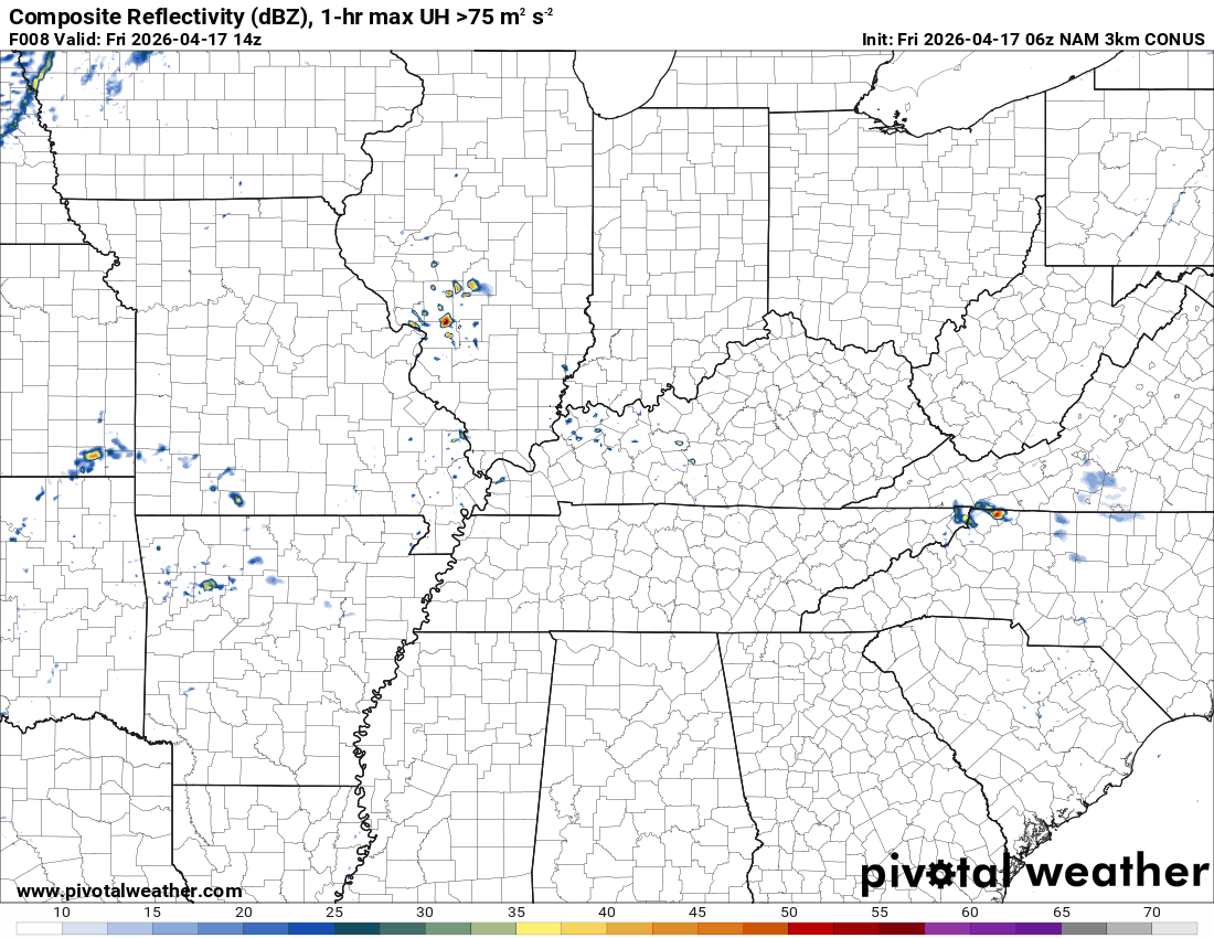
The timestamp (upper left) is in Zulu. 12z=7 am. 18z=1 pm. 00z=7 pm.
Green is rain. Yellow is moderate rain. Orange indicates locally heavy rain.
This model pops most of the storms east northeast of our region (on Thursday PM)
Double-click the animation to enlarge it.
3K NAM Model
.
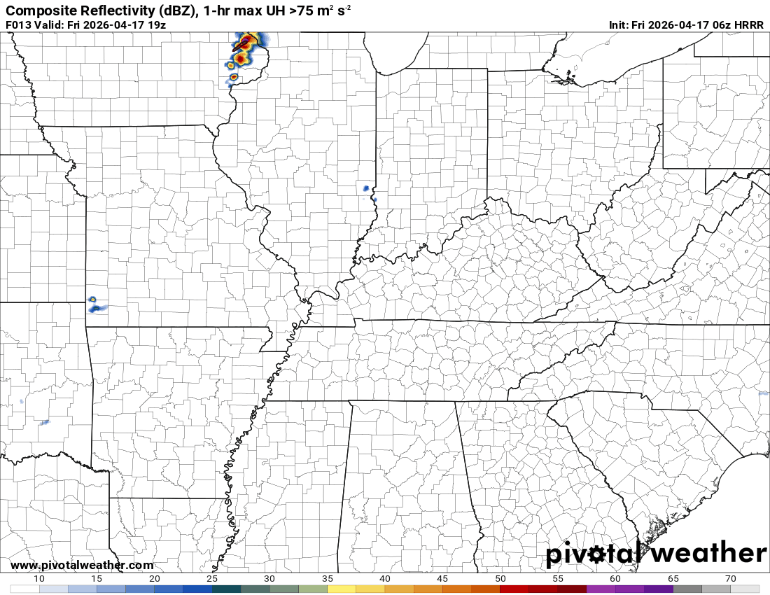
The timestamp (upper left) is in Zulu. 12z=7 am. 18z=1 pm. 00z=7 pm.
Green is rain. Yellow is moderate rain. Orange indicates locally heavy rain.
Double-click the animation to enlarge it.
Hrrr Model
.
.
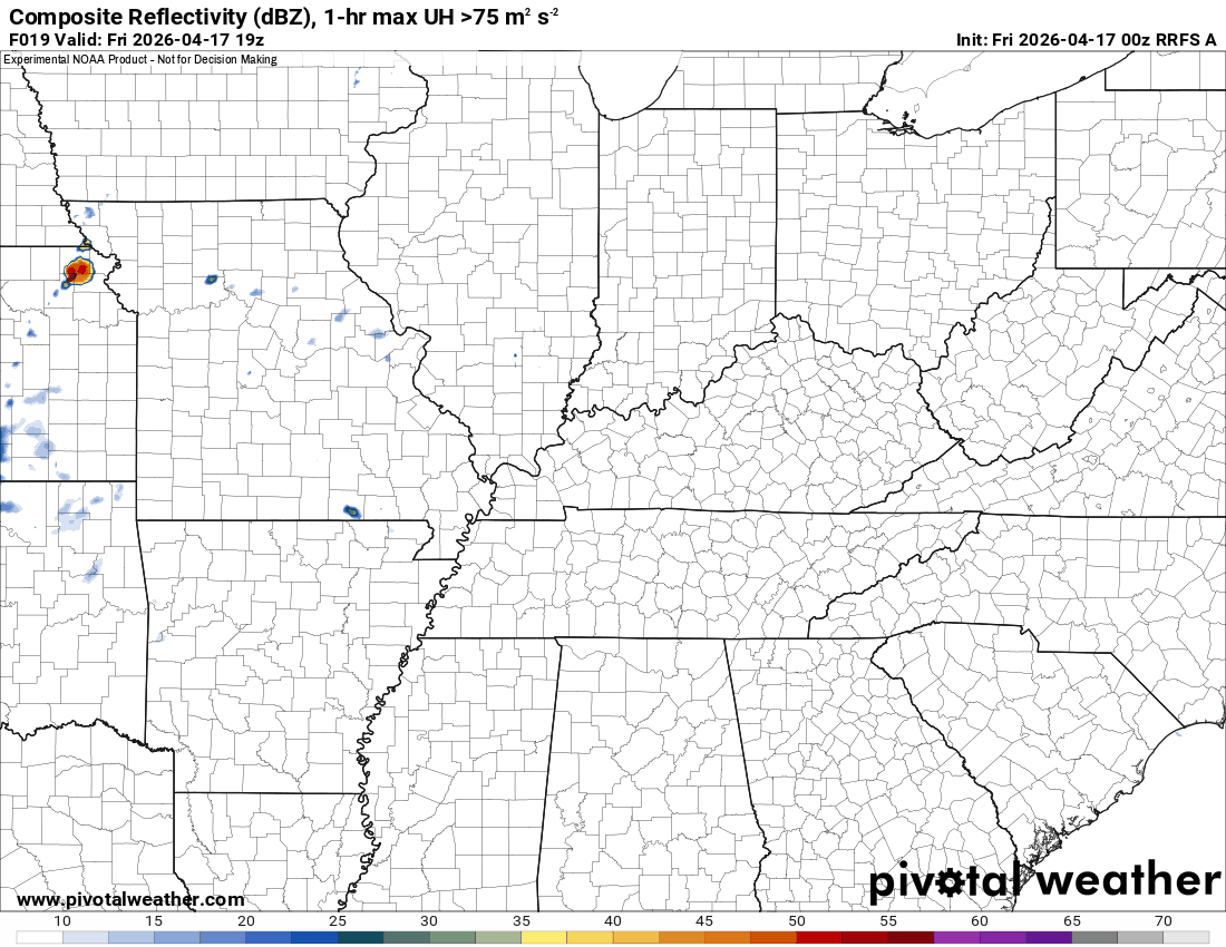
The timestamp (upper left) is in Zulu. 12z=7 am. 18z=1 pm. 00z=7 pm.
Green is rain. Yellow is moderate rain. Orange indicates locally heavy rain.
Double-click the animation to enlarge it.
RRFS Model
.
..
.
Click here if you would like to return to the top of the page.
.Average high temperatures for this time of the year are around 69 degrees.
Average low temperatures for this time of the year are around 46 degrees.
Average precipitation during this time period ranges from 1.00″ to 1.20″
Six to Ten Day Outlook.
Blue is below average. Red is above average. The no color zone represents equal chances.
Average highs for this time of the year are in the lower 60s. Average lows for this time of the year are in the lower 40s.

Green is above average precipitation. Yellow and brown favors below-average precipitation. Average precipitation for this time of the year is around one inch per week.

.

Average low temperatures for this time of the year are around 47 degrees.
Average precipitation during this time period ranges from 1.00″ to 1.30″
.
Eight to Fourteen Day Outlook.
Blue is below average. Red is above average. The no color zone represents equal chances.

Green is above average precipitation. Yellow and brown favors below average precipitation. Average precipitation for this time of the year is around one inch per week.

.
.
.
We have a new service to complement your www.weathertalk.com subscription. This does NOT replace www.weathertalk.com It is simply another tool for you to receive severe weather information.
.
https://weathercallservices.com/beau-dodson-weather


Want to receive the daily forecast/other products on your Beau Dodson Weather app?
Did you know you have four options in your www.weathertalk.com account
You will then receive these via your Beau Dodson Weather app.
Just log into your www.weathertalk.com account
Click the NOTIFICATION SETTINGS TAB
Then, turn them on (green) and off (red)
🌪️ Number 1 is the most important one. Severe alerts, tornado alerts, and so on.
Number 2 is the daily video, blog, livestream alerts, and severe weather Facebook threads on severe days or winter storm days.
Number 3 is the daily forecast. I send that out every day during the afternoon hours. It is the seven-day forecast, hazardous weather outlook, fire outlook, and more.
Number 4 is to receive the daily video, blog, and other content on NON-severe weather days (every day without severe threats in other words)
GREEN IS ON
RED IS OFF


Radars and Lightning Data
Interactive-city-view radars. Clickable watches and warnings.
https://wtalk.co/B3XHASFZ
Old legacy radar site (some of you like it better)
https://weatherobservatory.com/weather-radar.htm
If the radar is not updating then try another one. If a radar does not appear to be refreshing then hit Ctrl F5. You may also try restarting your browser.
Backup radar site in case the above one is not working.
https://weathertalk.com/morani
Regional Radar
https://imagery.weathertalk.com/prx/RadarLoop.mp4
** NEW ** Zoom radar with chaser tracking abilities!
ZoomRadar
If the radar is not working, then email me: Email me at beaudodson@usawx.com
.
We do have some sponsors! Check them out.
Roof damage from recent storms? Link – Click here
INTEGRITY ROOFING AND EXTERIORS!
⛈️ Roof or gutter damage from recent storms? Today’s weather is sponsored by Integrity Roofing. Check out their website at this link https://www.ourintegritymatters.com/

![]()
![]()
![]()
Make sure you have three to five ways of receiving your severe weather information.
Weather Talk is one of those ways! Now, I have another product for you and your family.

.
Want to add more products to your Beau Dodson Weather App?
Receive daily videos, weather blog updates on normal weather days and severe weather and winter storm days, your county by county weather forecast, and more!
Here is how to do add those additional products to your app notification settings!
Here is a video on how to update your Beau Dodson Weather payment.
The app is for subscribers. Subscribe at www.weathertalk.com/welcome then go to your app store and search for WeatherTalk
Subscribers, PLEASE USE THE APP. ATT and Verizon are not reliable during severe weather. They are delaying text messages.
The app is under WeatherTalk in the app store.

Apple users click here

Android users click here
.
Radars and Lightning Data
Interactive-city-view radars. Clickable watches and warnings.
https://wtalk.co/B3XHASFZ
Old legacy radar site (some of you like it better)
https://weatherobservatory.com/weather-radar.htm
If the radar is not updating then try another one. If a radar does not appear to be refreshing then hit Ctrl F5. You may also try restarting your browser.
Backup radar site in case the above one is not working.
https://weathertalk.com/morani
Regional Radar
https://imagery.weathertalk.com/prx/RadarLoop.mp4
** NEW ** Zoom radar with chaser tracking abilities!
ZoomRadar
Lightning Data (zoom in and out of your local area)
https://wtalk.co/WJ3SN5UZ
Not working? Email me at beaudodson@usawx.com
National map of weather watches and warnings. Click here.
Storm Prediction Center. Click here.
Weather Prediction Center. Click here.
.

Live lightning data: Click here.
Real time lightning data (another one) https://map.blitzortung.org/#5.02/37.95/-86.99
Our new Zoom radar with storm chases
.
.

Interactive GOES R satellite. Track clouds. Click here.
GOES 16 slider tool. Click here.
College of DuPage satellites. Click here
.

Here are the latest local river stage forecast numbers Click Here.
Here are the latest lake stage forecast numbers for Kentucky Lake and Lake Barkley Click Here.
.
.
Find Beau on Facebook! Click the banner.


 .
.