October 27, 2023
Good day, everyone.
First off, I like to remind everyone about the downfalls of seasonal forecasting. I could not have said it better than this post on John Dee’s website. Click here for his soapbox on seasonal forecasting pitfalls.
What everyone wants to know is how much snow will fall in their backyard, will we have an ice-storm, will we have river flooding, or will we have tornadoes. Those are specific forecasts. Not seasonal forecasts.
Specific forecasts are impossible past a few days. If you have lived here long enough, then you know that we can barely forecast exact snow totals two days in advance, let alone weeks or months in advance. It is not possible. Anyone who gives you specific snow dates and snowfall numbers is guessing. Some years they might get lucky and other years a swing and a miss.
With that said, here are our current thoughts concerning the upcoming winter season.
The BAM Weather Team has posted their yearly winter weather outlook video.
Keep in mind, there are many variables that go into making a winter weather forecast. Yes, this is an El Nino winter. El Nino, however, isn’t the only factor when considering a winter forecast.
What is El Nino? Click here for more information on El Nino and La Nina.
I am forecasting a higher than average chance of a double digit snowstorm this winter. That does not mean it will happen. It simply means our chances are higher than the last few years.
The last three years have been La Nina winters. Our region experienced numerous tornadoes. Tornadoes are more likely, in our region, during La Nina winters.
Unfortunately, a warmer climate lends itself to winter severe weather events (tornadoes). I will be monitoring that over the coming months.
The Gulf of Mexico water temperatures continue to run above average. That is a signal for severe weather.
Typically, our region experiences a wide range of winter weather conditions. There is no reason to believe that won’t be the case this winter.
There are drought concerns. Typically, El Nino winters are dry in the Ohio Valley. Typically, they are very wet along the the Gulf of Mexico.
That places our area in the middle of the two. Dry to the north northeast and wet to the south.
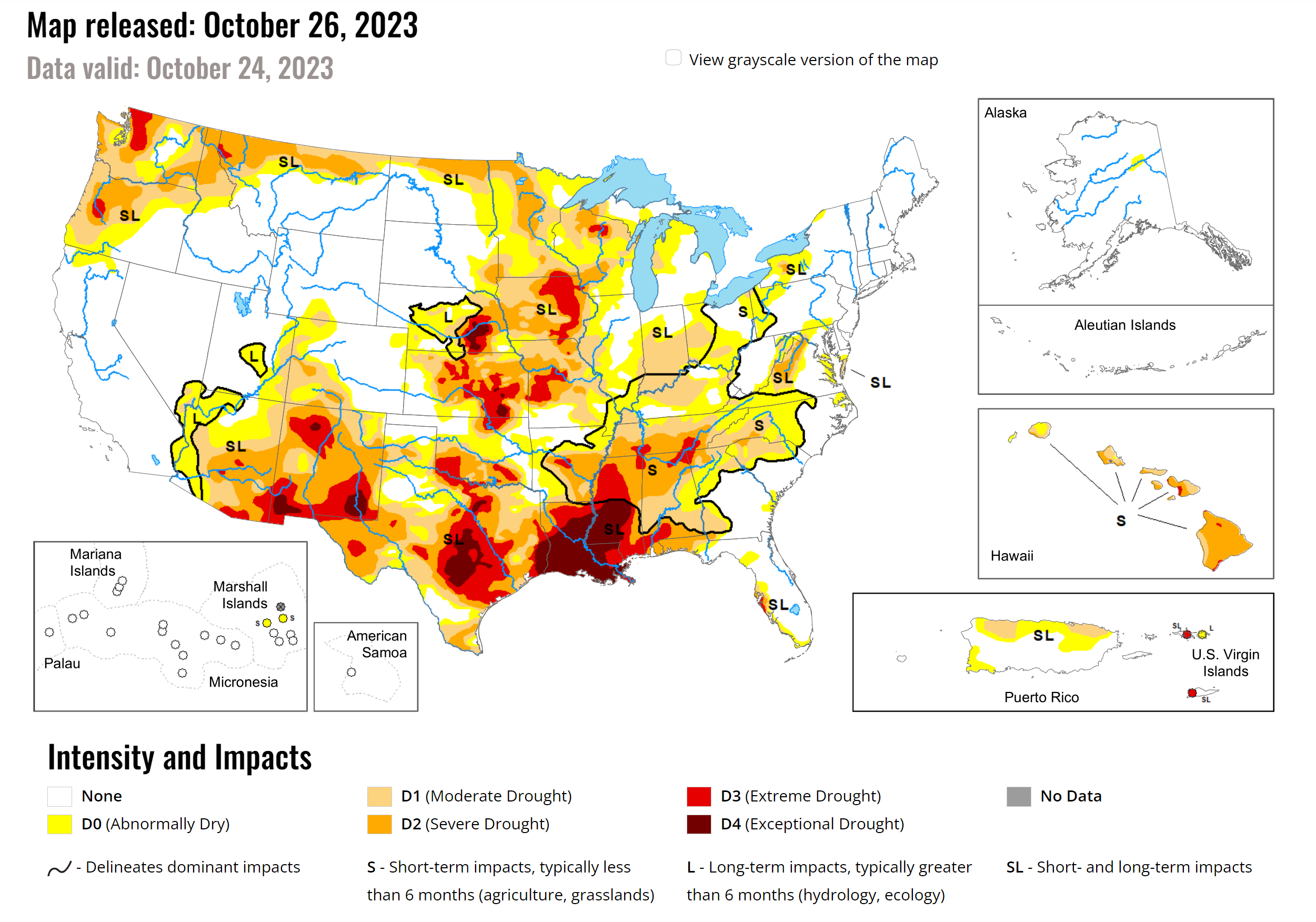
Many areas are already in drought. The drought is severe along the Gulf of Mexico.
Remember, we entered last winter in severe drought. Then, the precipitation returned in December.
Double click images to enlarge them.
Drought Monitor.
There are signals for a warmer than average November and perhaps even a warmer than average December. Warm meaning above average temperatures. That does not mean there won’t be cold shots.
Our winters usually come down to one to three main weather events. We can not forecast those weeks or months in advance.
Again, I do believe this winter will provide at least one opportunity for a significant snowstorm in the region.
Here is the detailed winter weather outlook from the BAM weather team. They help me with long range forecasting.
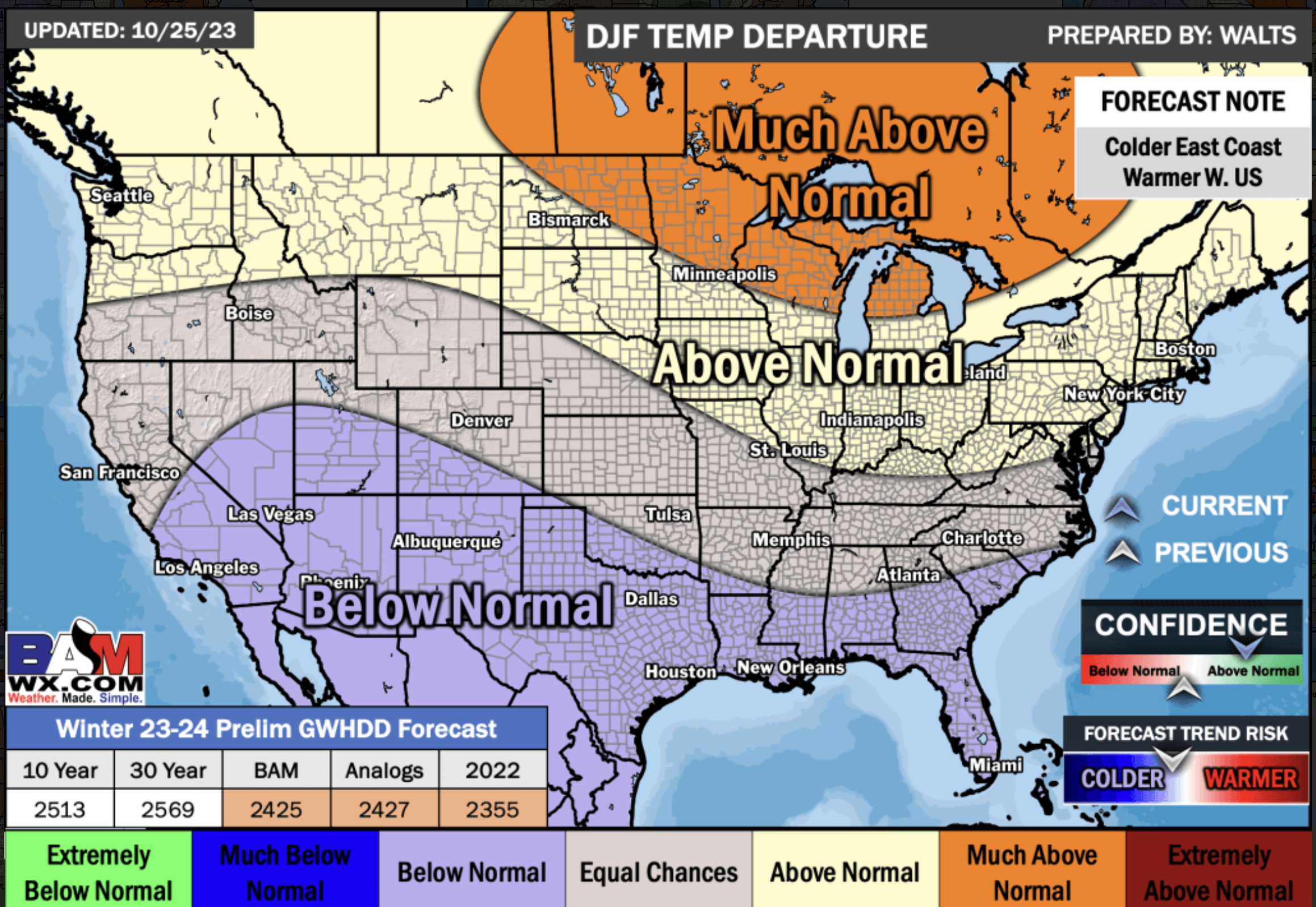
December through February temperature anomalies.
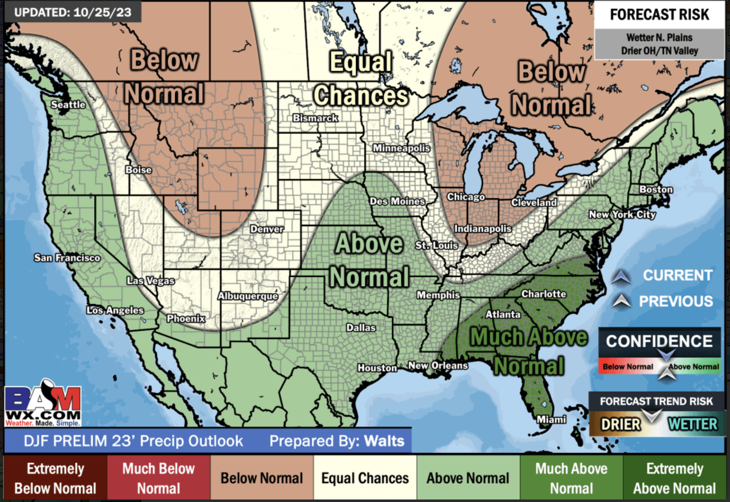
December through February precipitation anomalies.
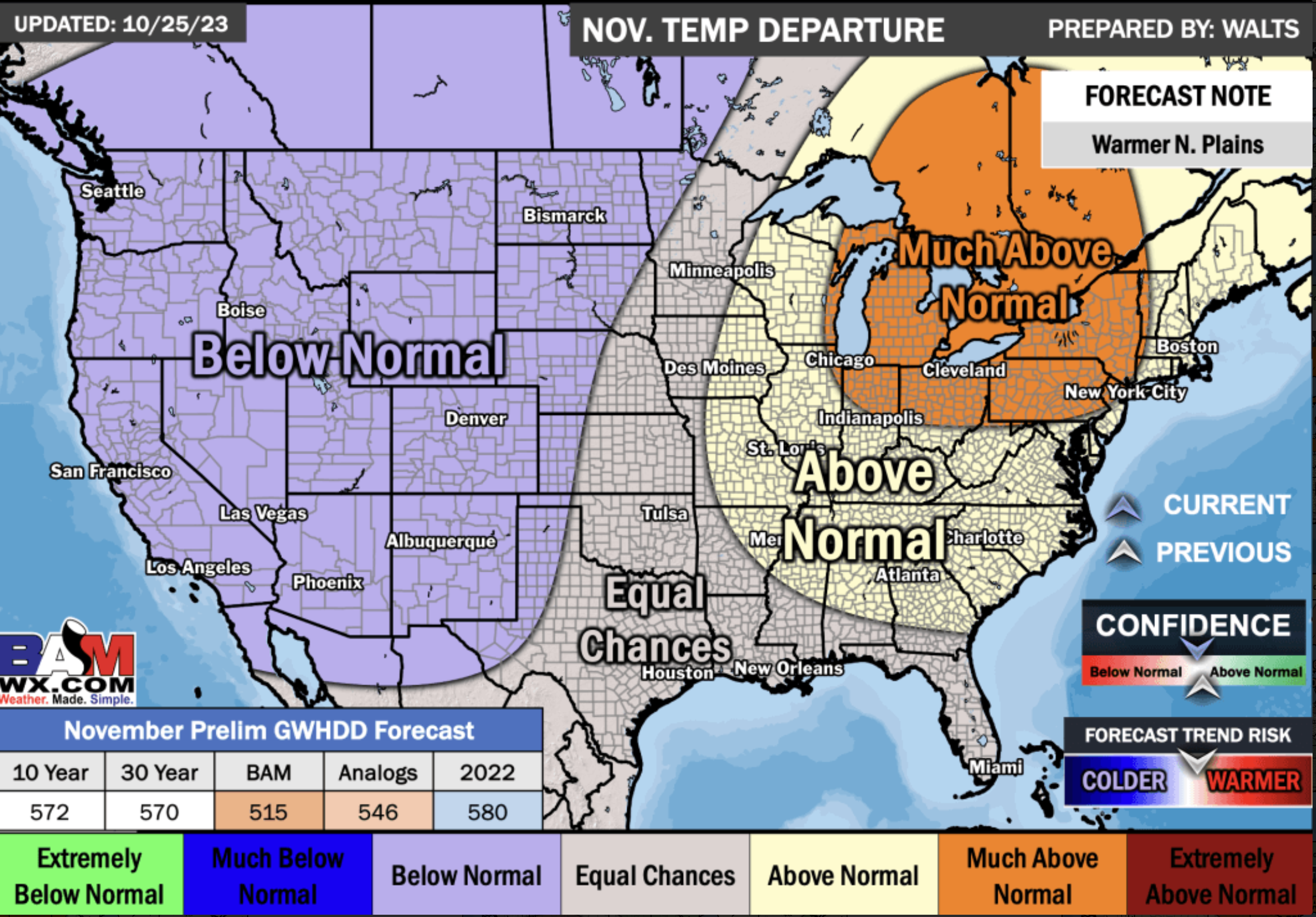
November Temperature Outlook
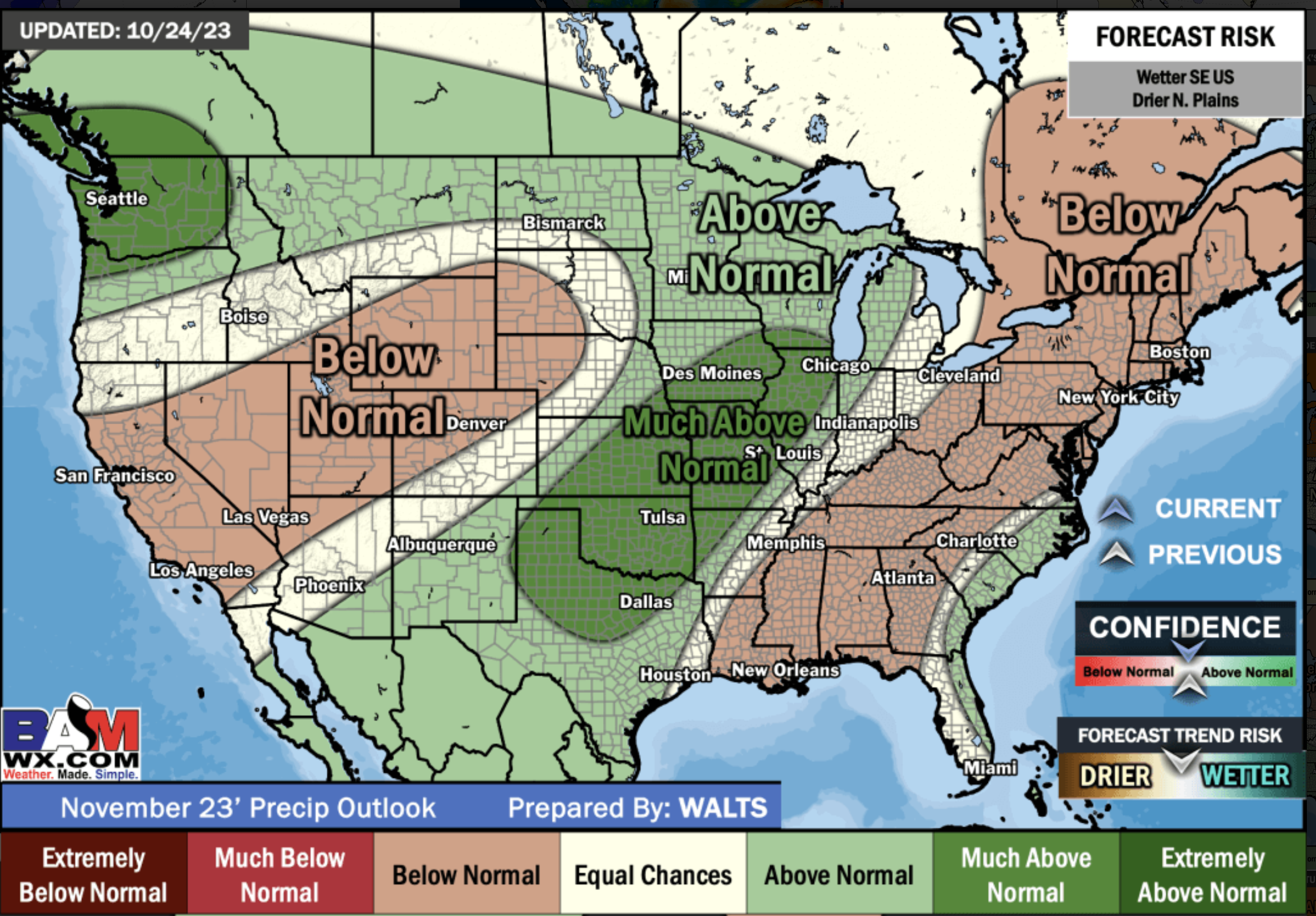
November Precipitation Outlook
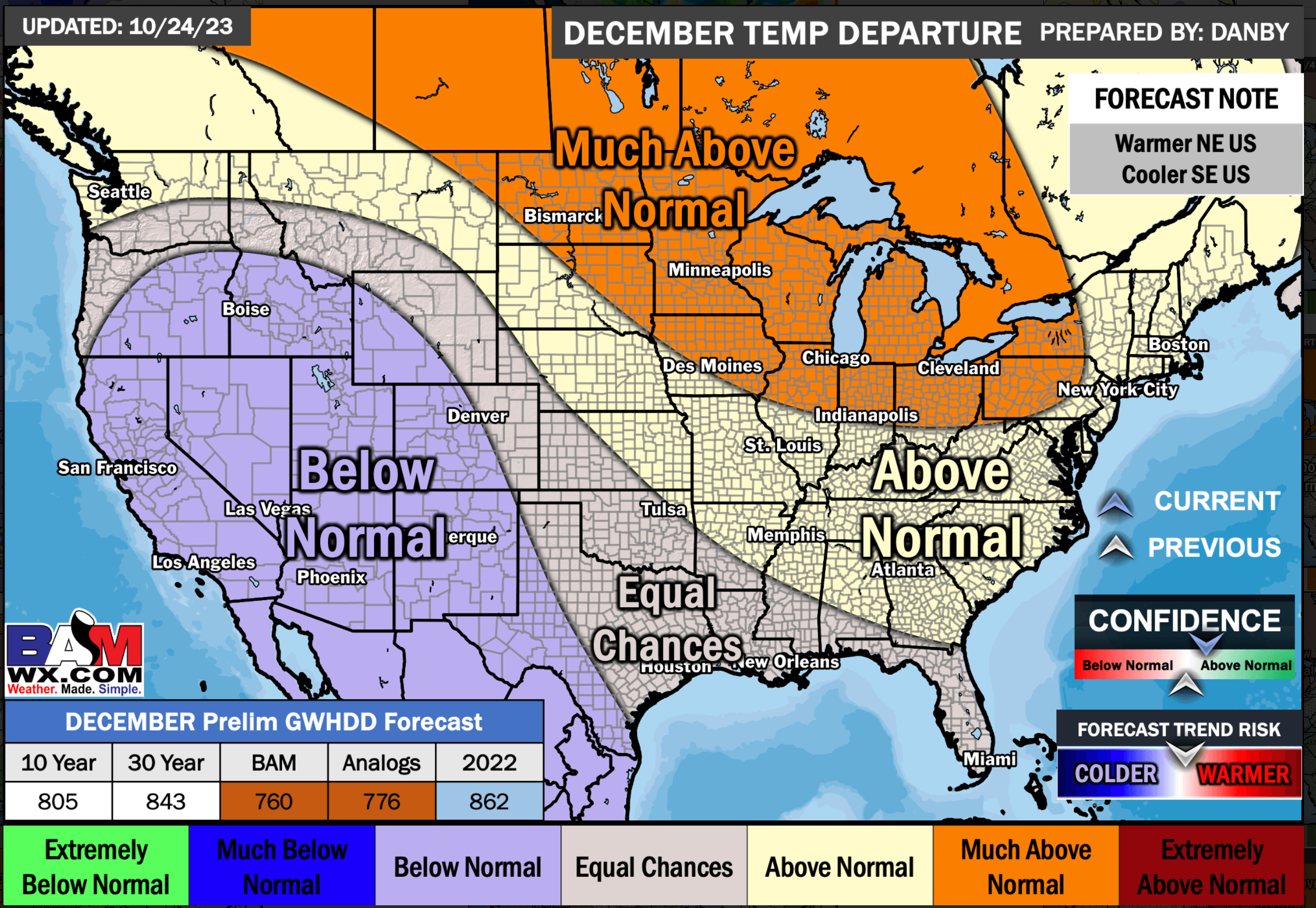
December Temperature Outlook
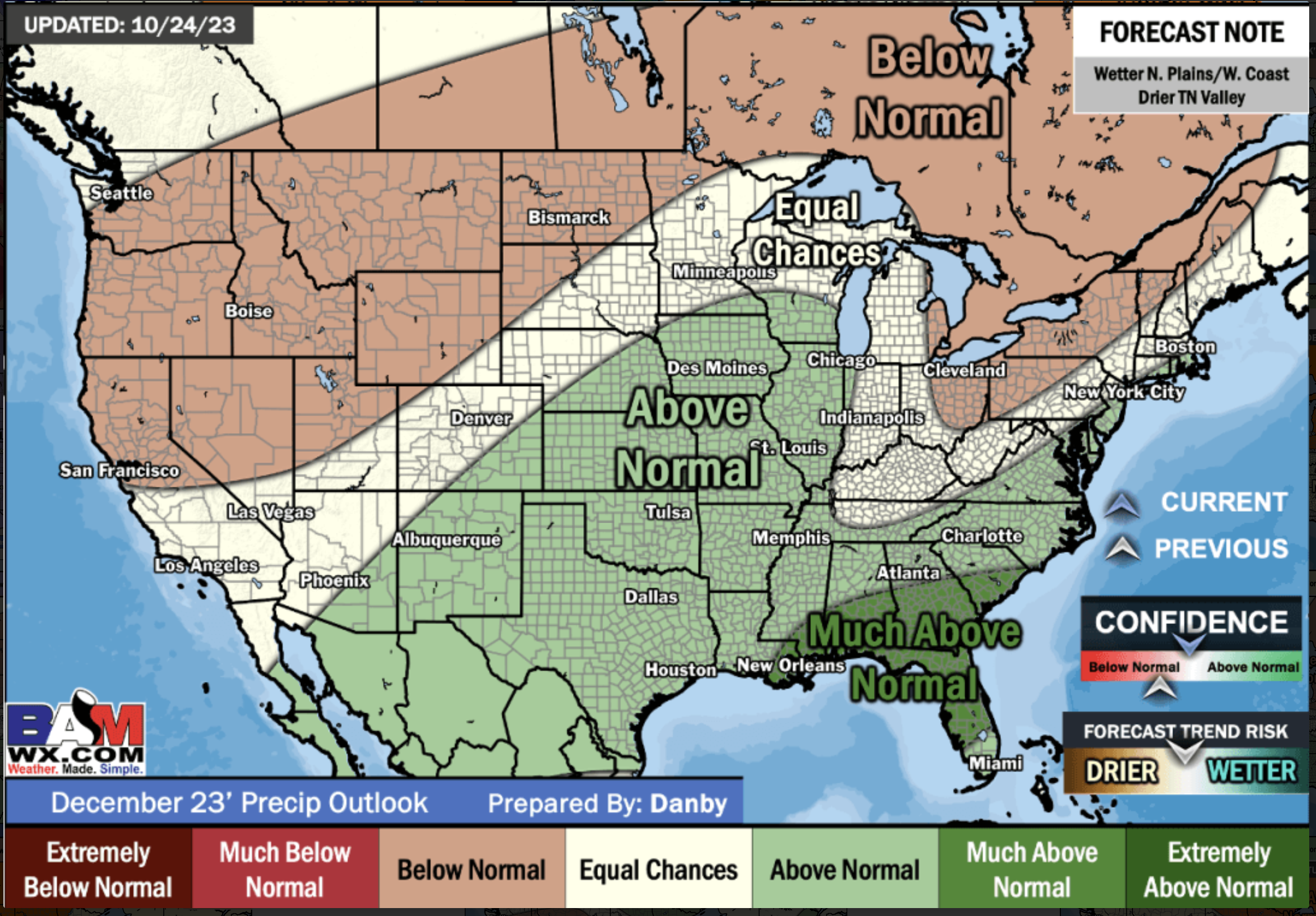
December Precipitation Outlook
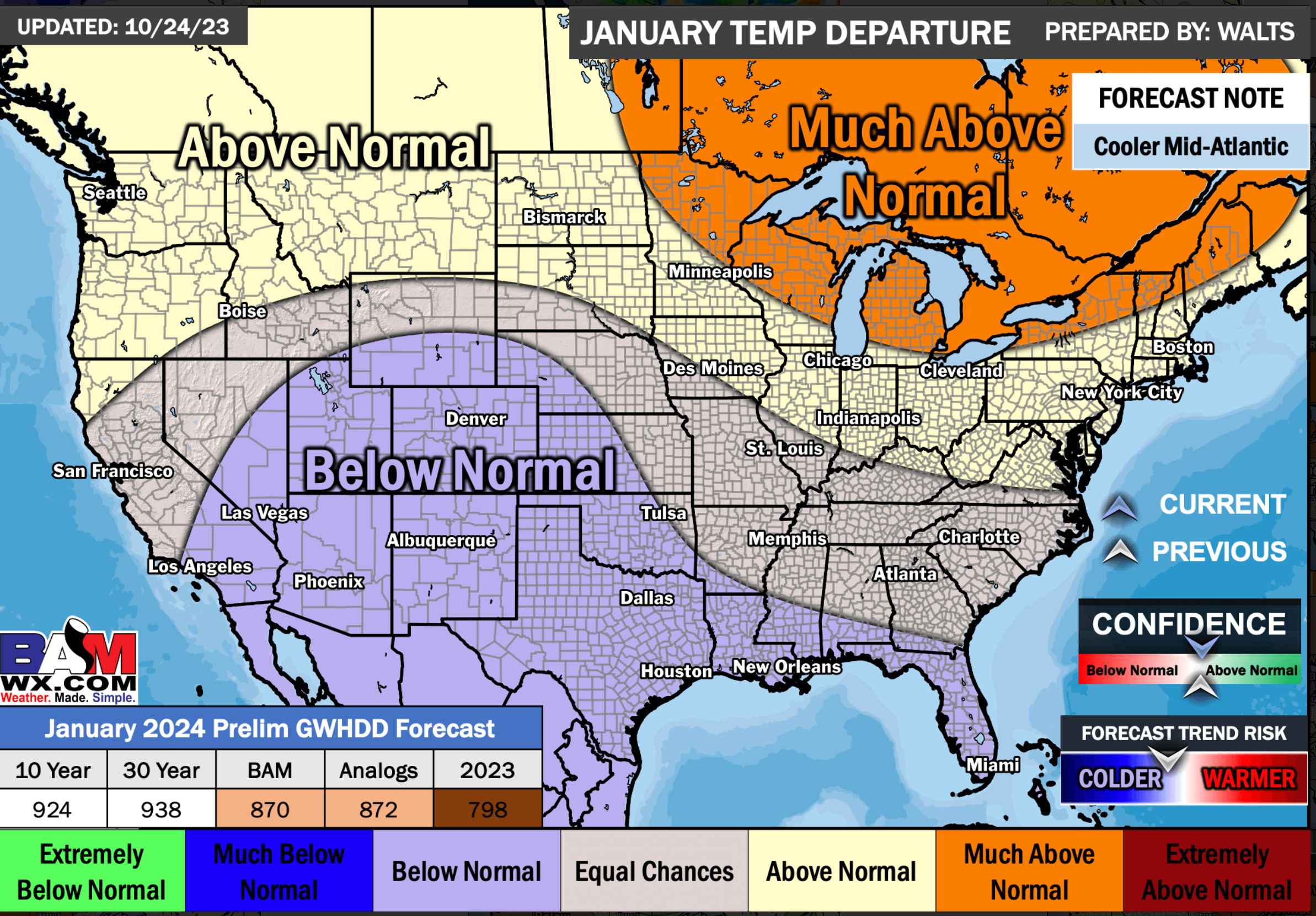
January Temperature Outlook
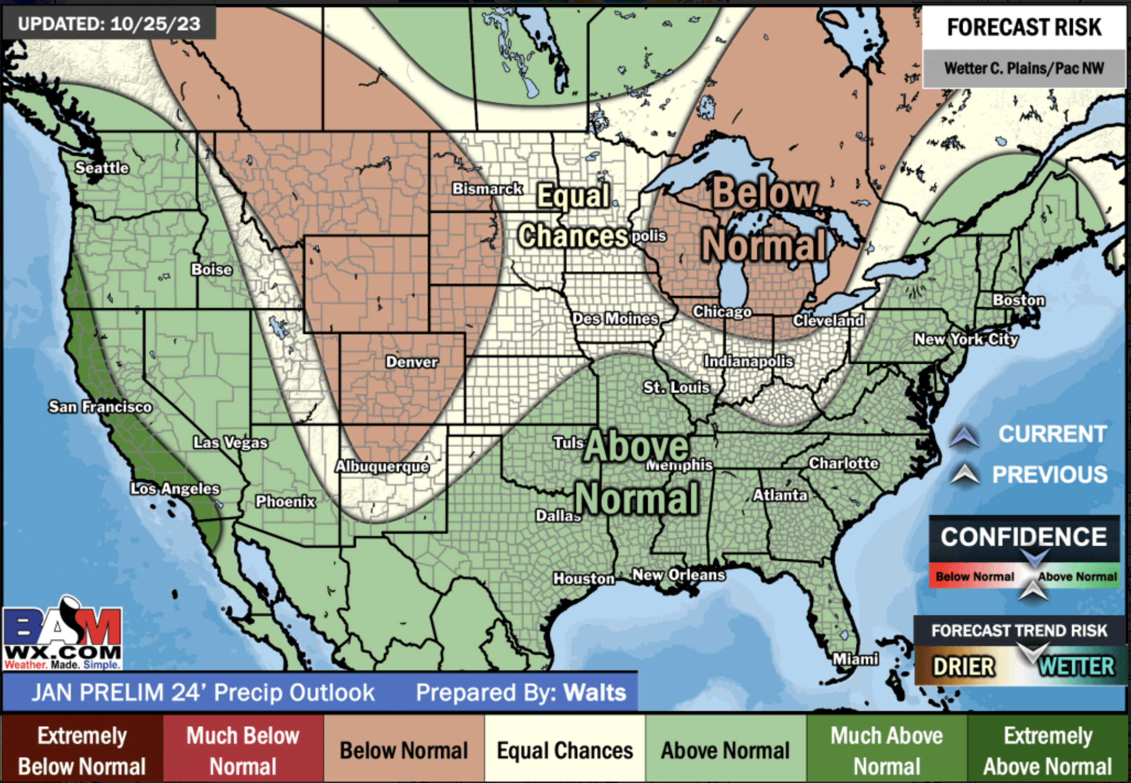
January Precipitation Outlook
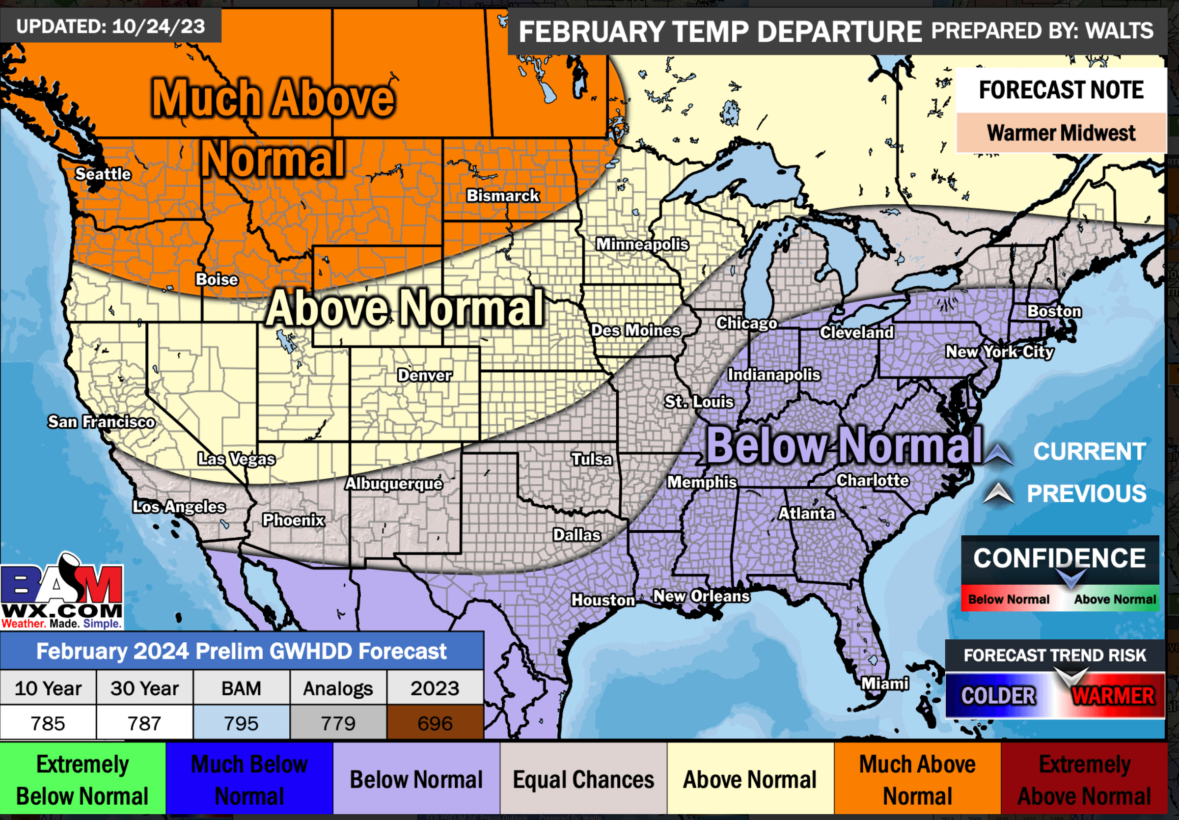
February Temperature Outlook
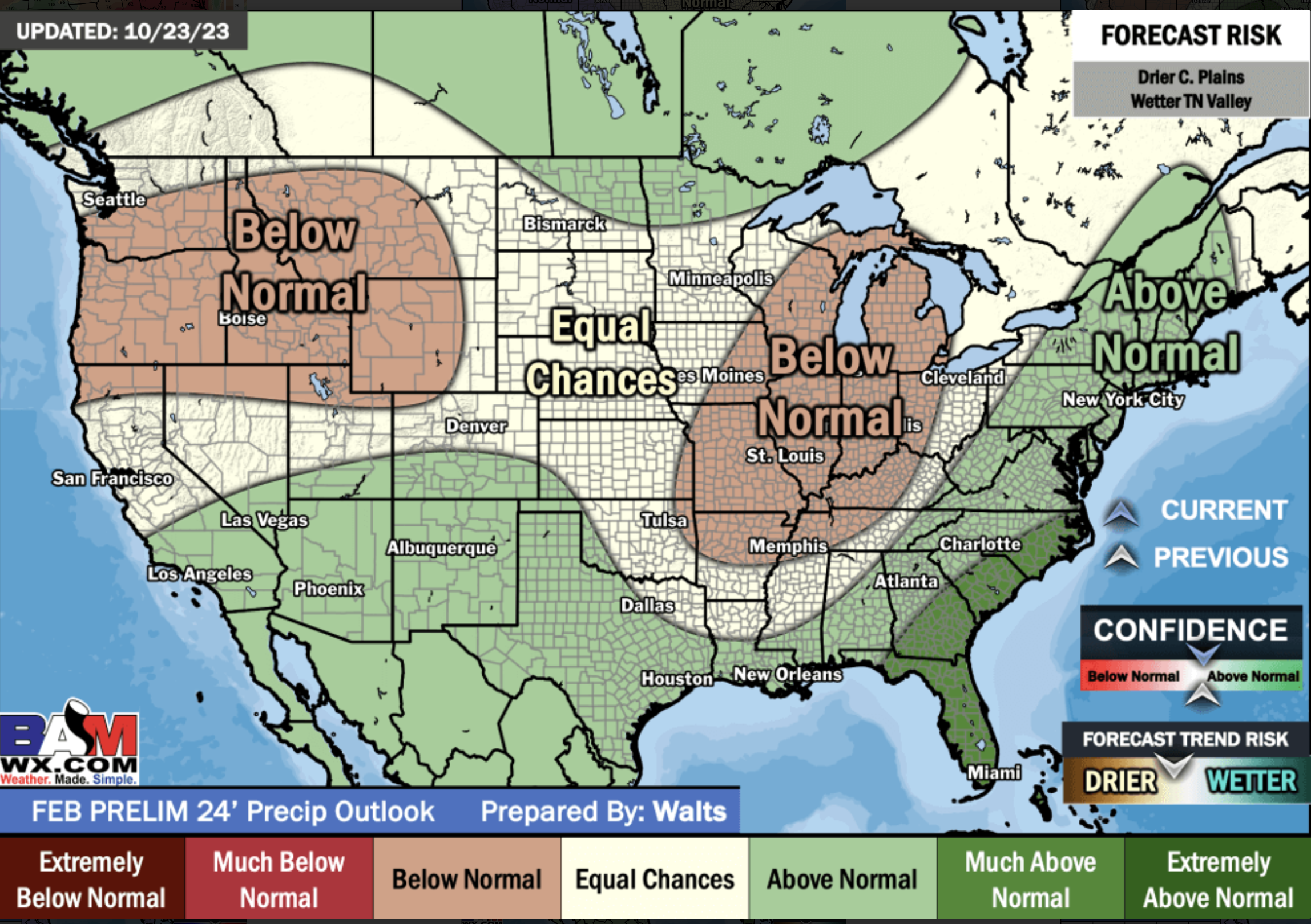
February Precipitation Outlook


