

.
I have some question-and-answer threads over on the Facebook page. Link to those threads CLICK HERE
Or email me at beaudodsonweather@gmail.com
..

🌪️ Seven-Day Tornado Outlook ⛈️
January 14th through January 20th
Current risk: No concerns.
Current confidence level: High confidence.
Comments: Severe weather is not anticipated.
.

Seven-Day Hazardous Weather Outlook
1. Is lightning in the forecast? NO.
2. Are organized/widespread severe thunderstorms in the forecast? NO.
..3. Is significant or widespread flash flooding in the forecast? NO.
4. Will non-thunderstorm winds top 40 mph? LOW RISK. A small chance on Friday.
5. Will the temperature fall below 20 degrees? YES. The highest probability of this will be on Thursday night, Friday night, Saturday night, Sunday night, and Monday night. Scattered locations will dip below 20 degrees.
6. Is the wind chill forecast to drop below ten degrees? YES. On and off from Friday night into Sunday night. I will monitor next week.
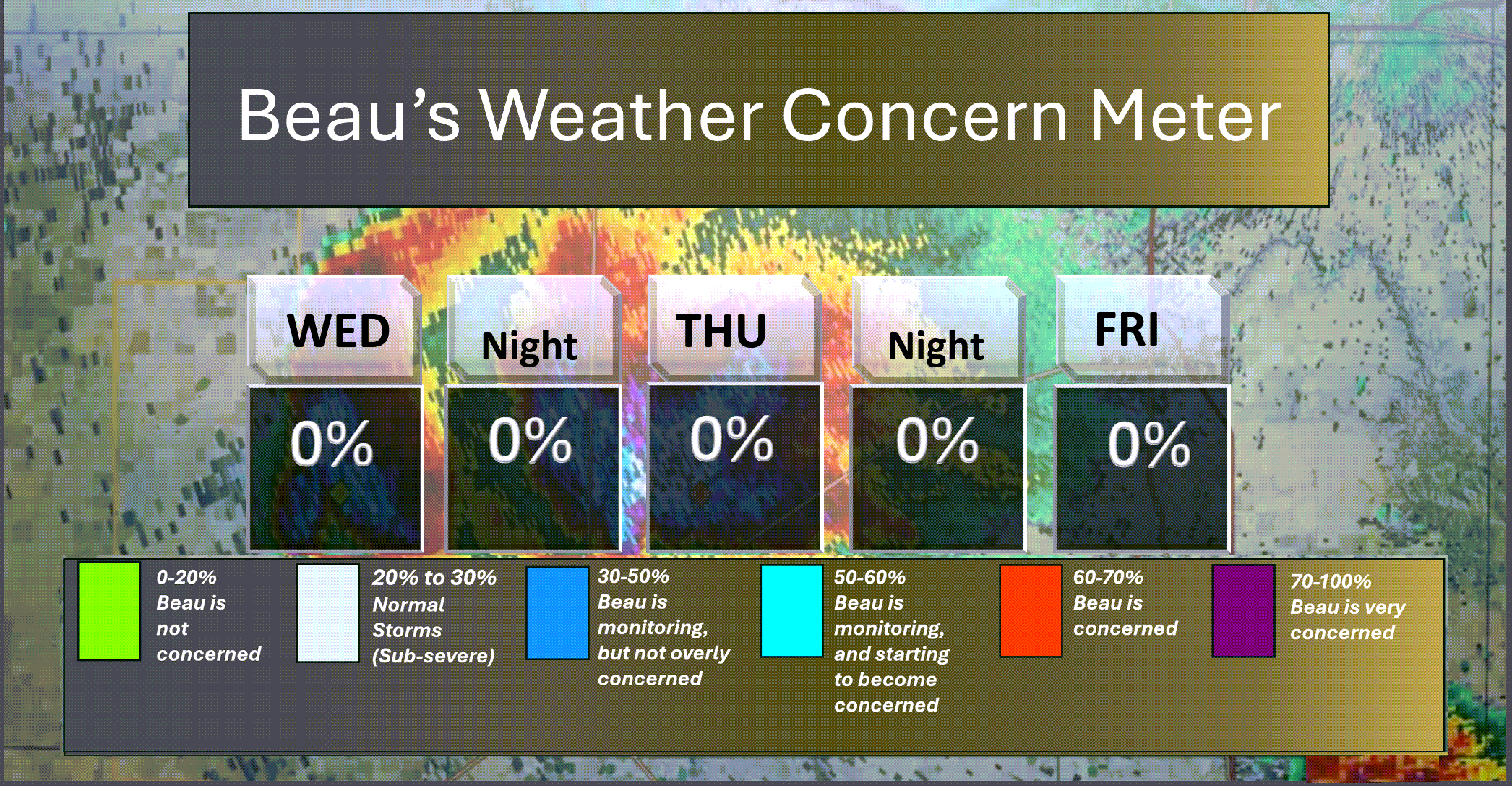
Here is the short-range thunderstorm concern meter.
.
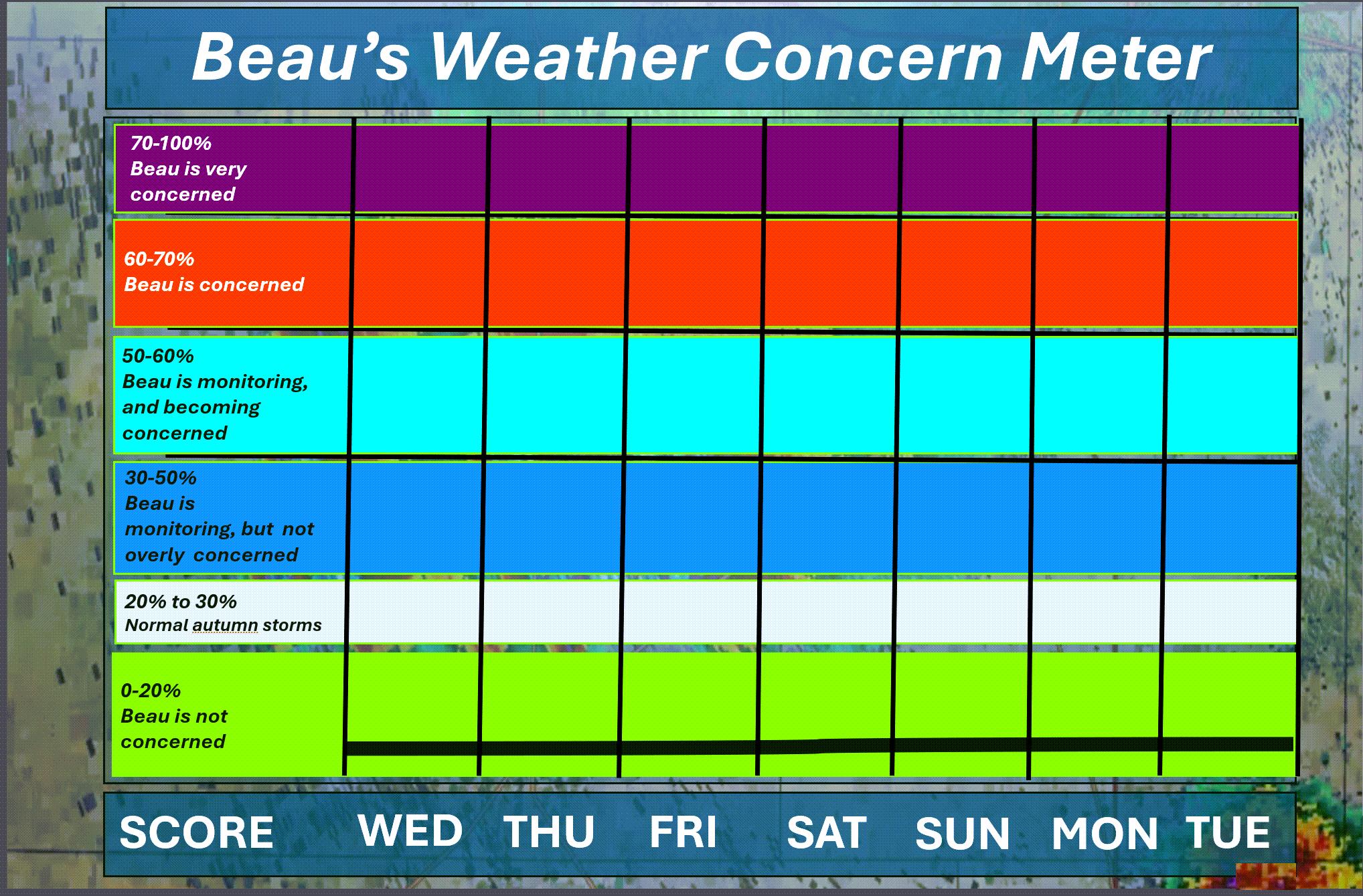
Here is the extended concern meter.
We will remain in the green. No thunderstorm threats.
.
A quick forecast glance. Your 48-hour forecast Graphics


.
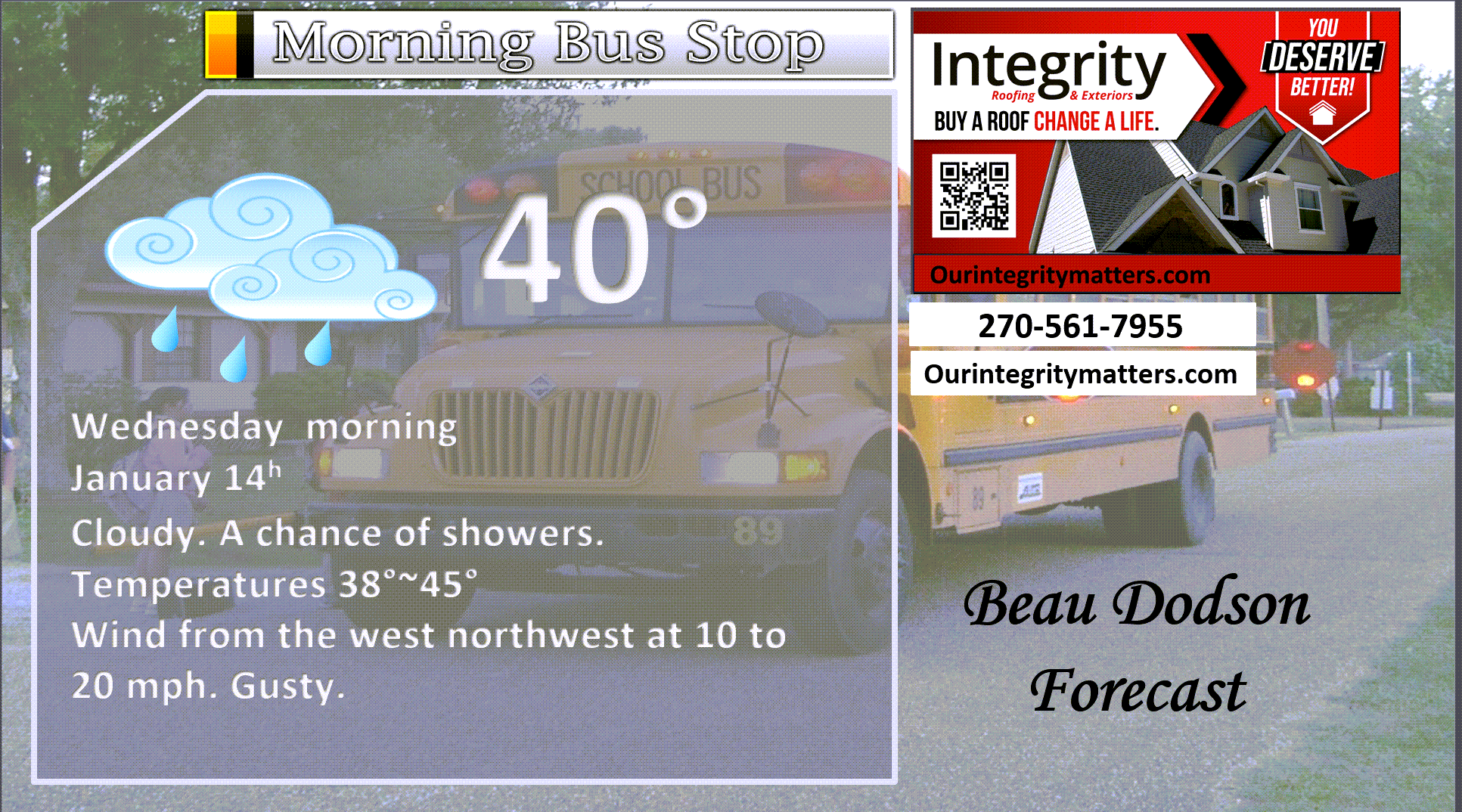
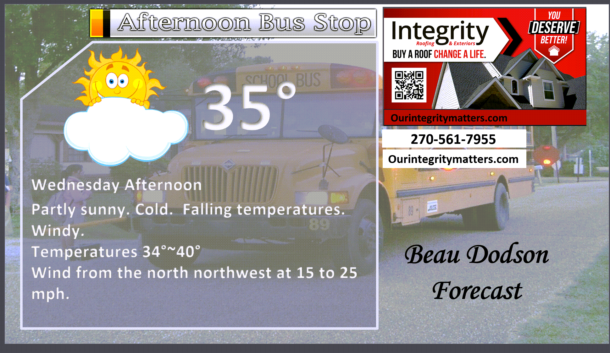
Here is your bus stop forecast
.
This afternoon
.


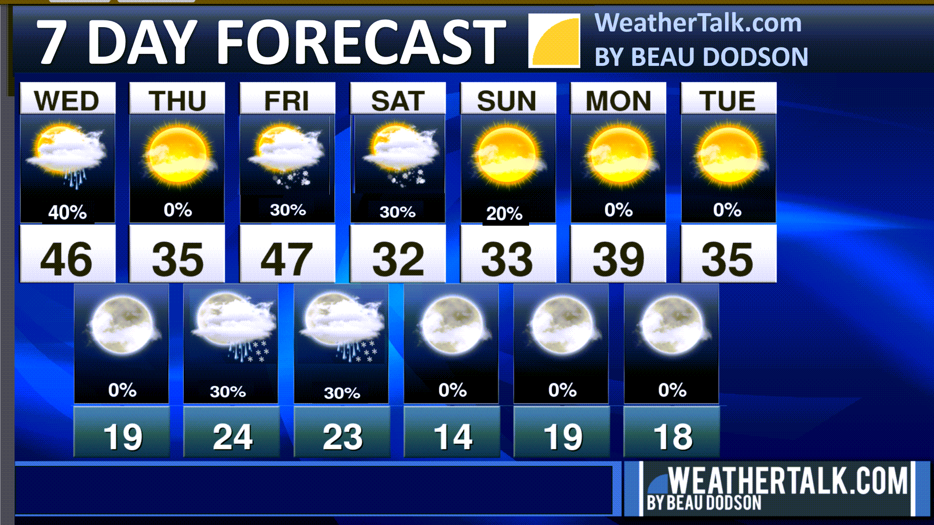
Forecast discussion
- Turning colder today. Rain will push eastward.
- Mostly cold weather over the next seven days.
- A few snow flurries and snow showers Thursday night into the weekend.
- A dusting of snow is possible in some locations. The chances of one inch or more of snow are only 10%/
- Breezy conditions into early next week. Peak winds will be on Friday.
.
 .
.
.
What is the primary weather concern?
Several shots of cold air will be the primary weather story.
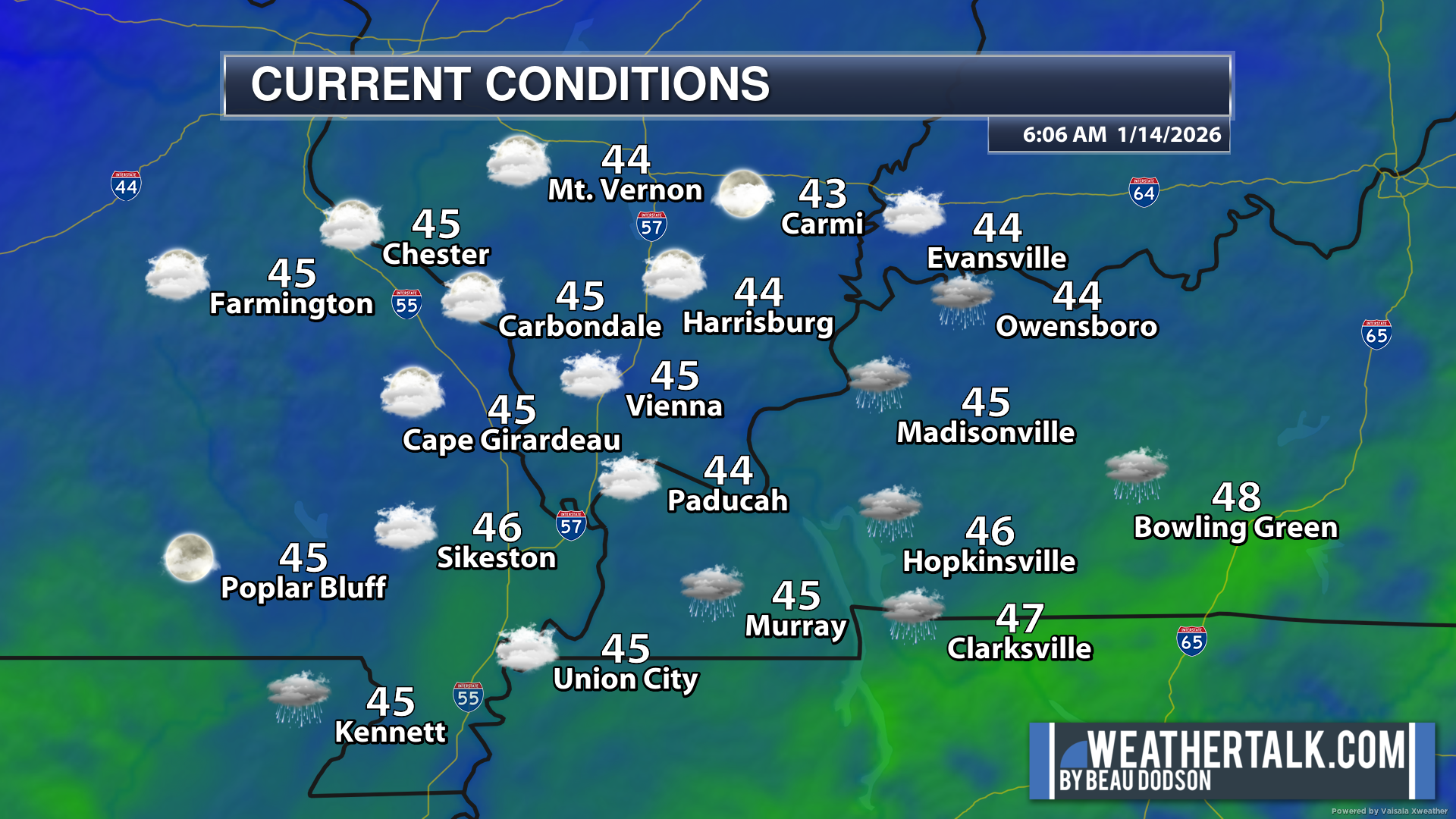
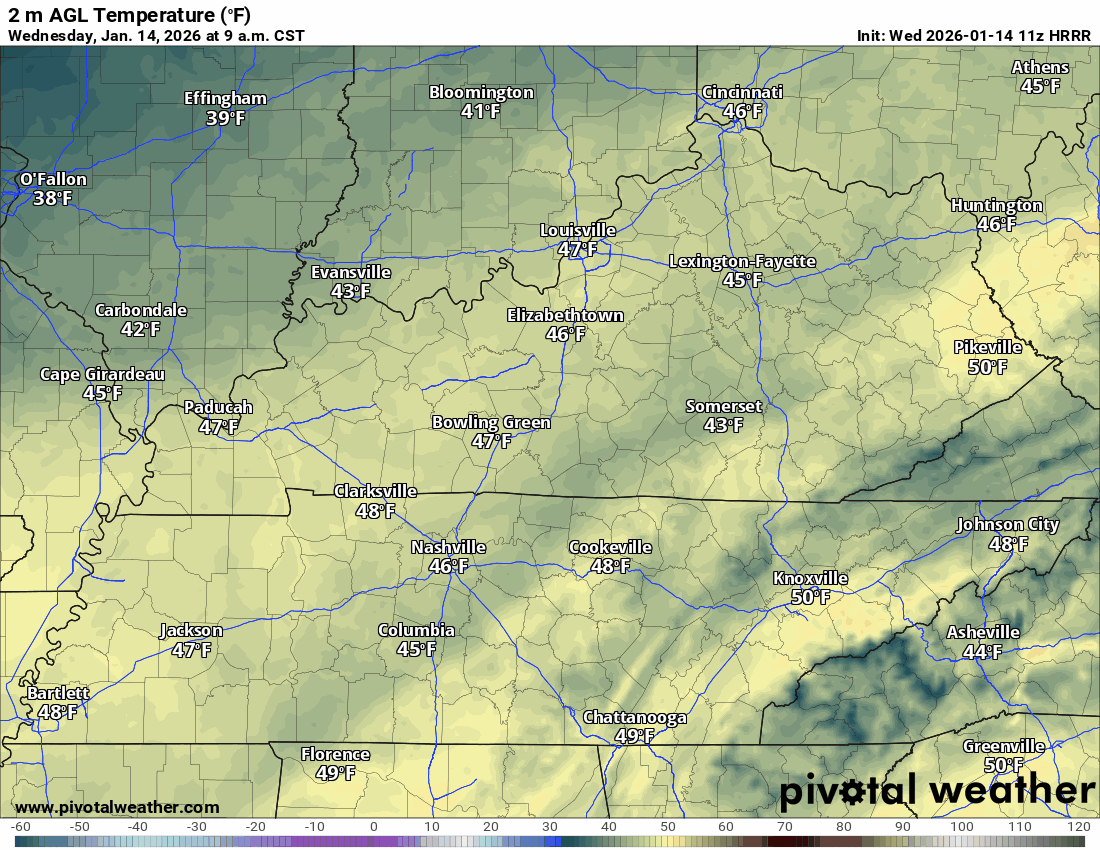
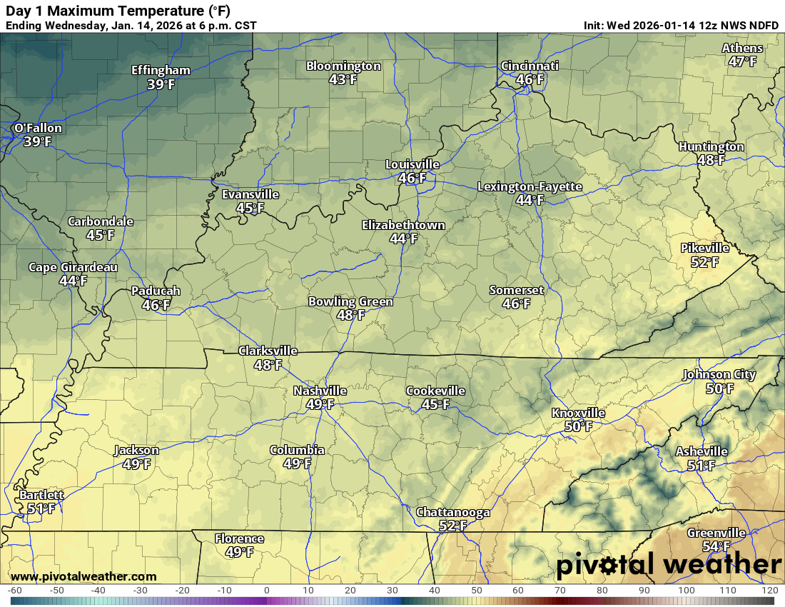
Falling temperatures today. Highs will occur this morning. Temperatures will fall into the thirties.
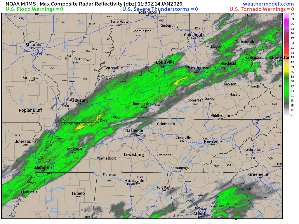
A cold front will move through the region today. Light rain is accompanying the front. Don’t expect much. Trace amount up to 0.15″. The rain will push east this morning.
Here was the 6:30 AM radar animation.
See our local radars at the bottom of the page.
.
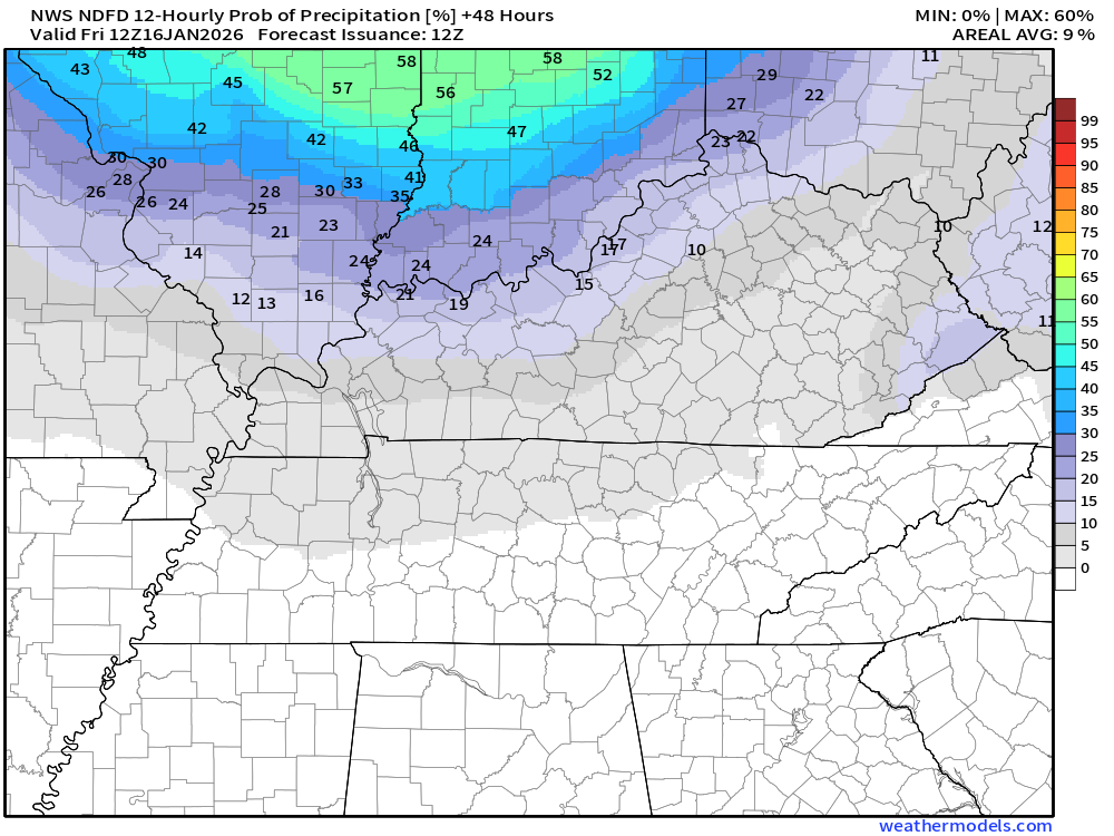
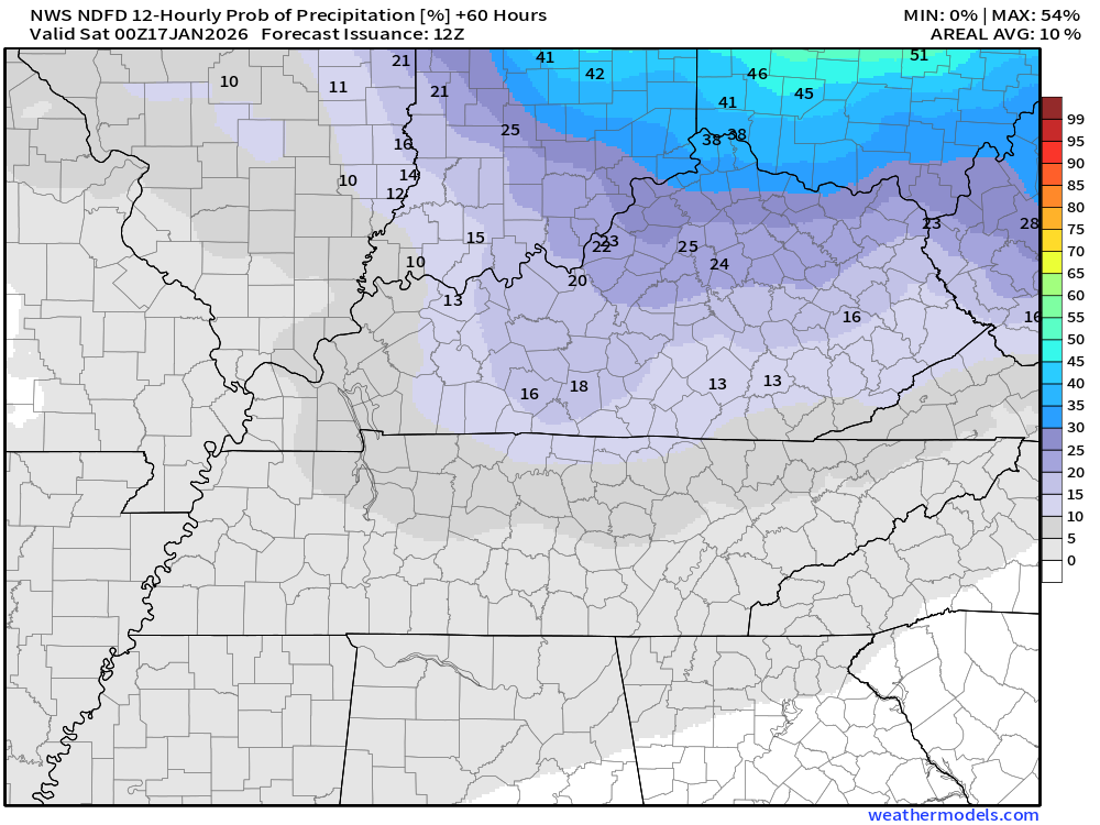
We do have a chance of snow flurries on Thursday night and Friday. Additional chances Friday night into the weekend. Snow totals of 0″ to 0.50″ are possible. In other words, a dusting.
A stronger cold front will arrive this weekend. As a matter of fact, it will definitely feel like winter on Saturday and Sunday. Brrr.
.
.
Seven-day outlook graphic.
See the video or graphics below for more details specific to your county. This is a broad-brush overview of the entire region.
Notice the cold air this weekend. Brrr.
.
Today through Friday night
It will turn colder today. Gusty winds will make it feel colder.
Winds will gust into the 15 to 25 mph range.
You can see those falling temperatures in this temperature animation.
Double-click to enlarge the animation.
.
This morning’s rain will push off to the east over the coming hours.
That will leave us with some clouds.
Some clearing is possible later today with cold blustery northwest winds.
Dry conditions are likely on Thursday.
By Thursday night and Friday, another system will bring low-end rain and snow chances to the region.
Don’t expect much. Trace amounts.
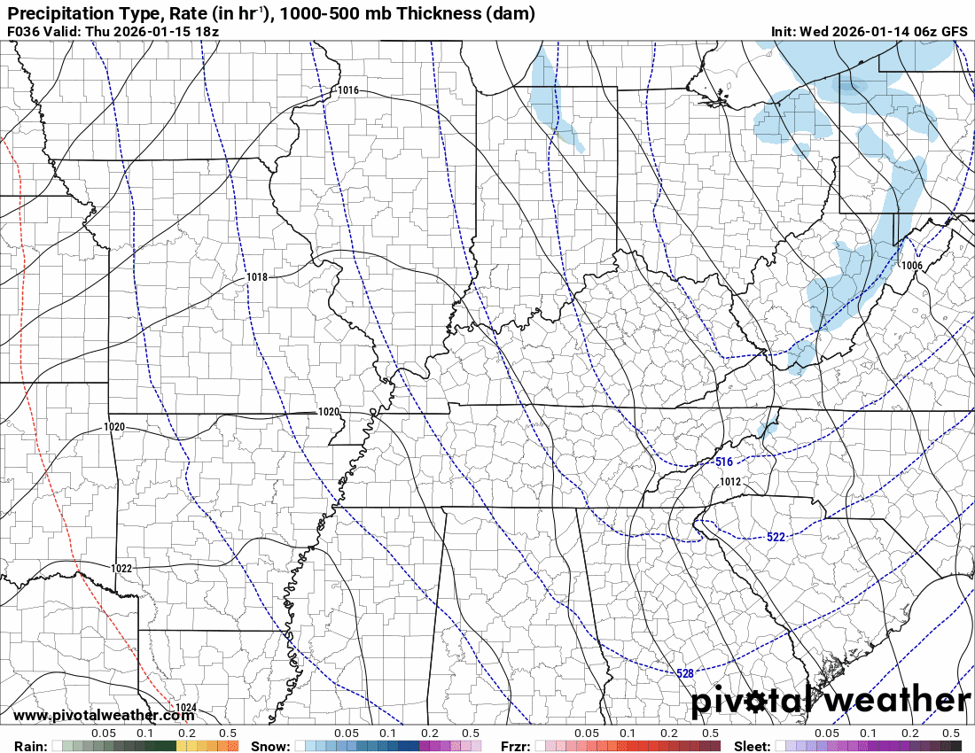
Thursday night’s rain/snow probabilities. What is the % chance of rain or snow?
The bulk of the rain/snow chances will be north and northeast. Lower chances over southeast Missouri.
Friday will be windy. Wind gusts above 25 mph will be possible.
Let’s look at temperatures.
Wednesday’s highs. Falling temperatures through the day.
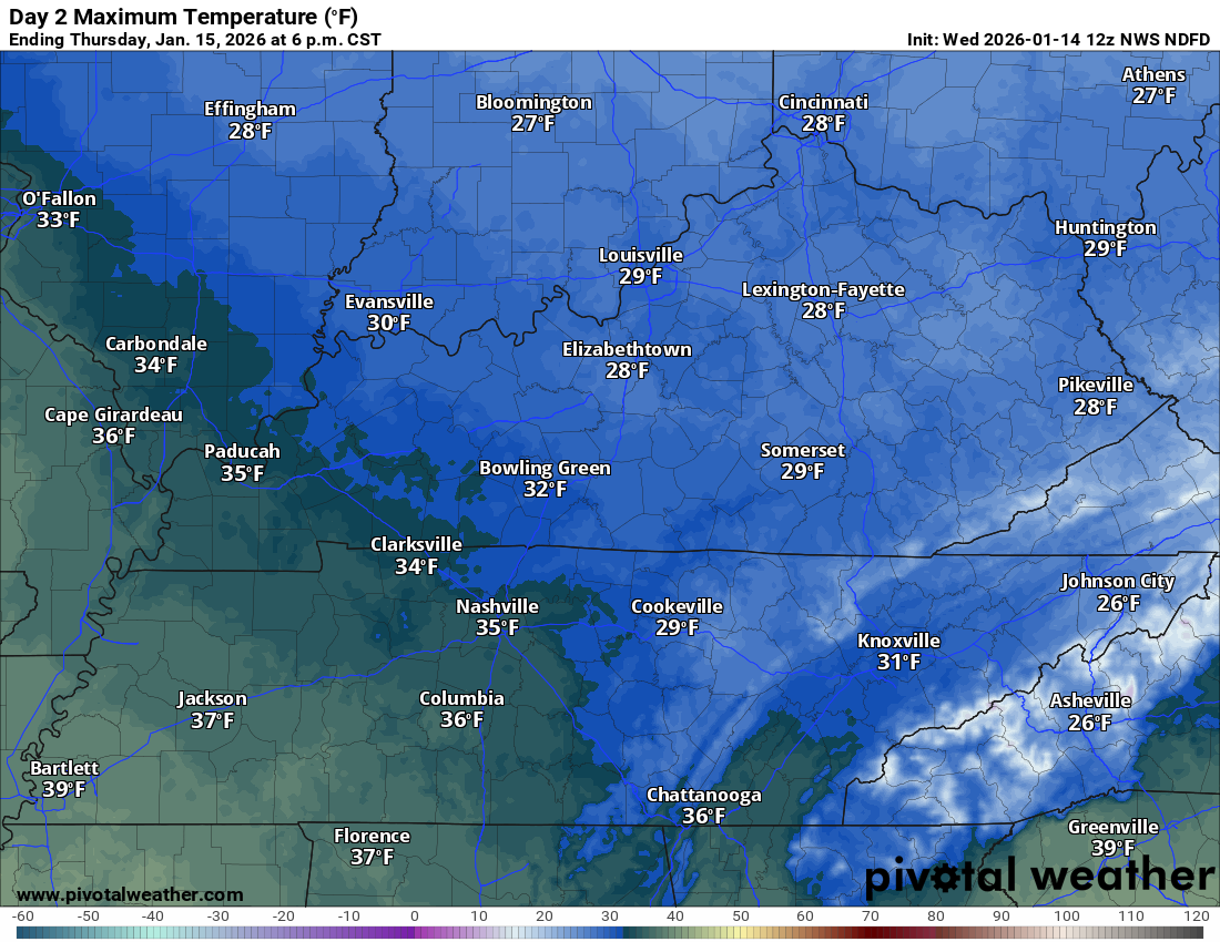
Thursday’s highs
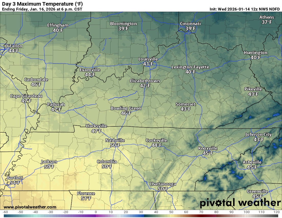
Friday’s highs
.
Saturday through Tuesday
It will be cold this weekend into next week.
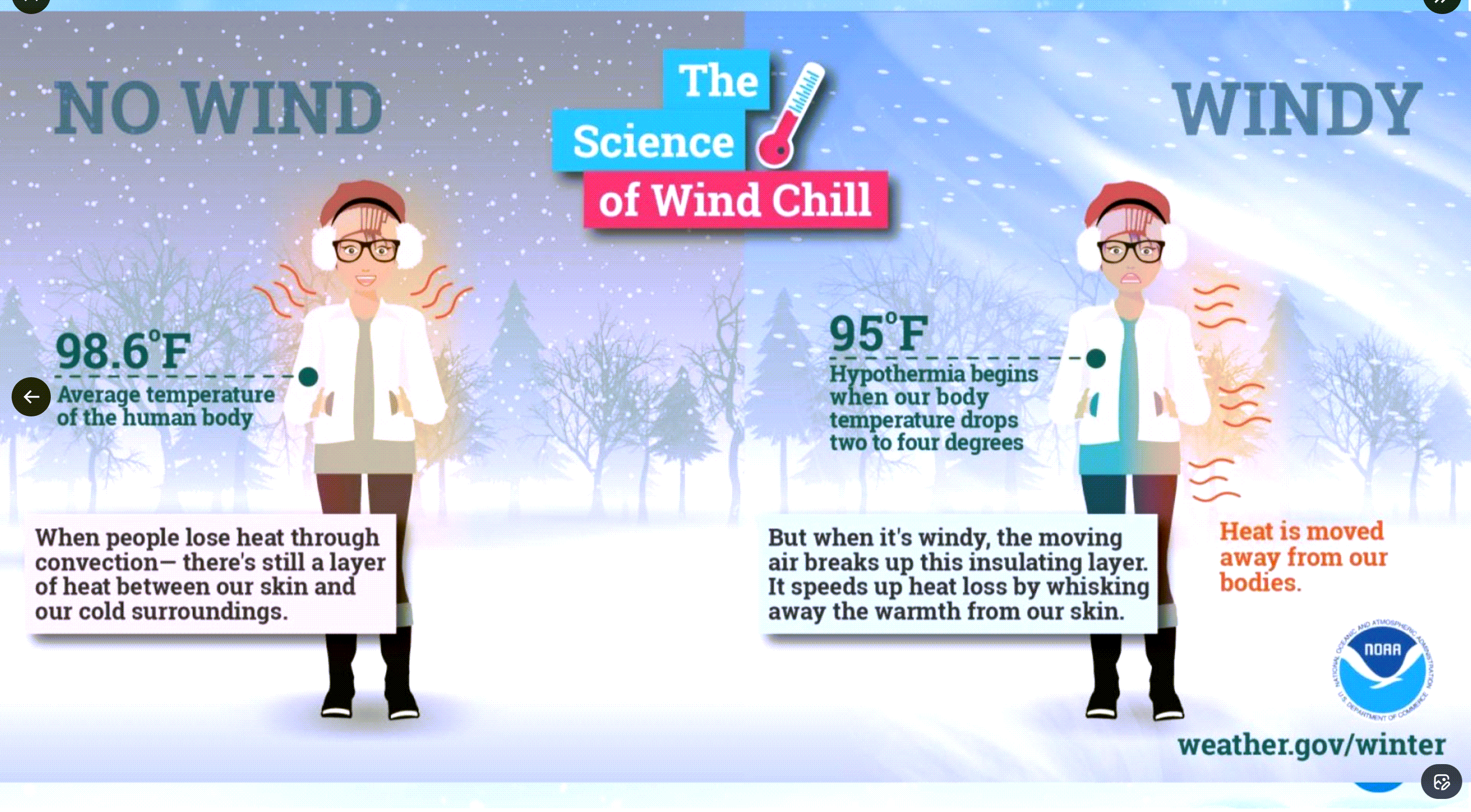
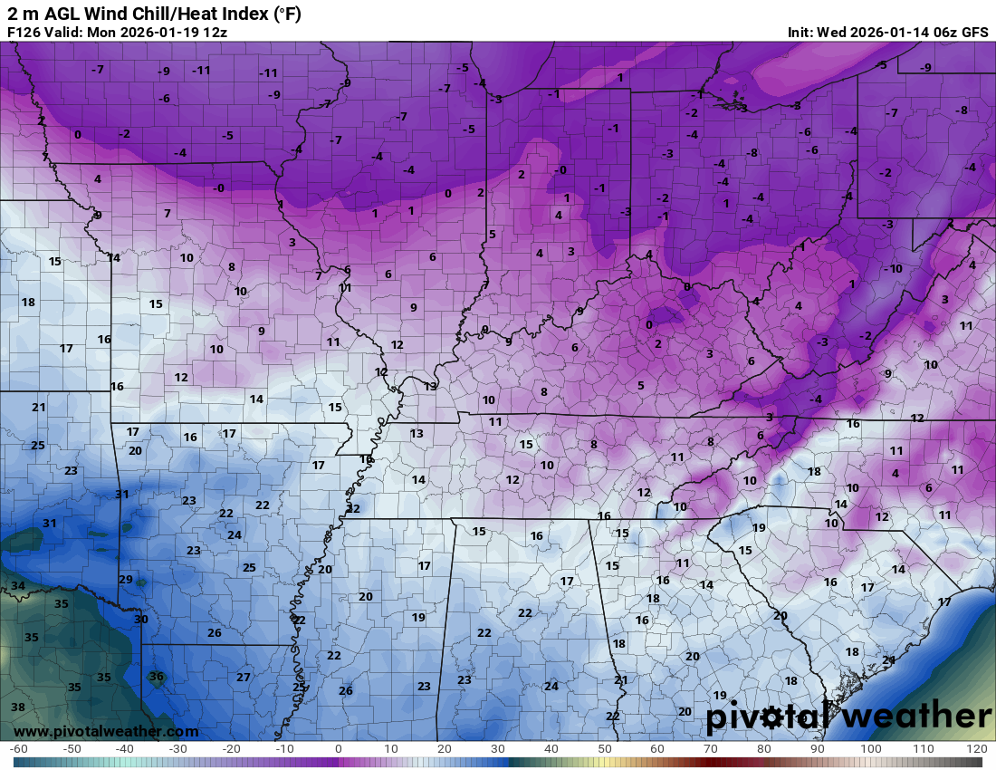
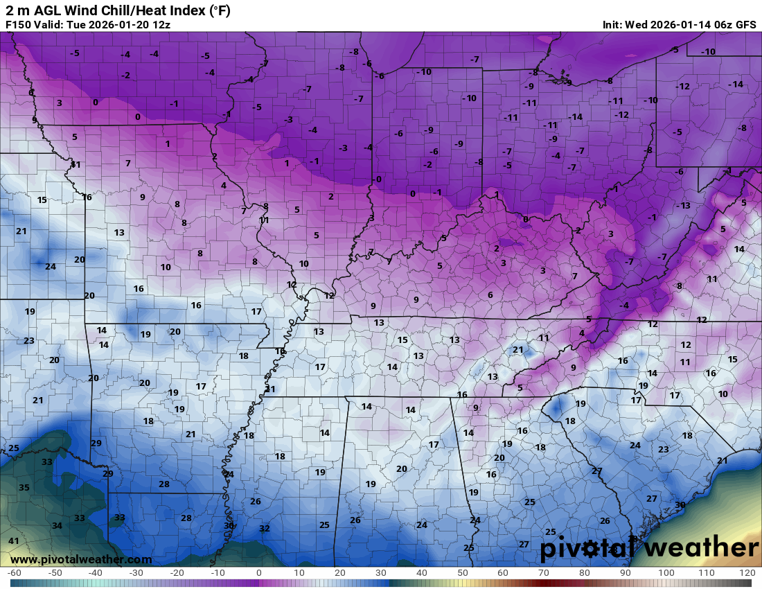
Let’s look at the wind chill values.
Wind chill is how the temperature feels to human skin.
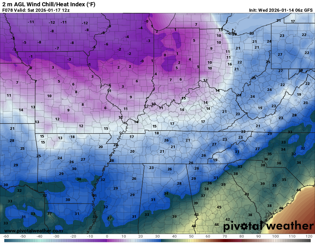
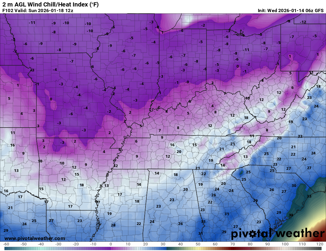
At times, wind chill values will drop into the 0 to 15 above range.
Let me show you those wind chill values
.
Saturday morning
Sunday morning
Monday morning
Tuesday morning
.
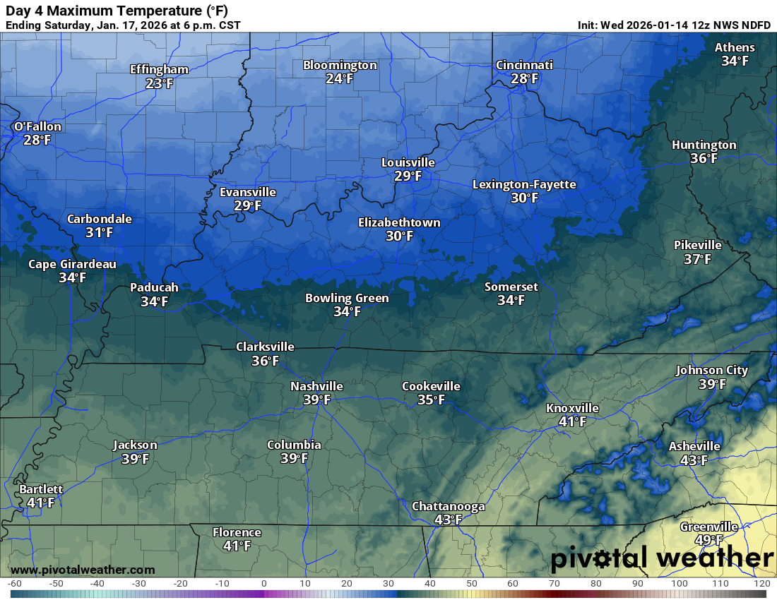
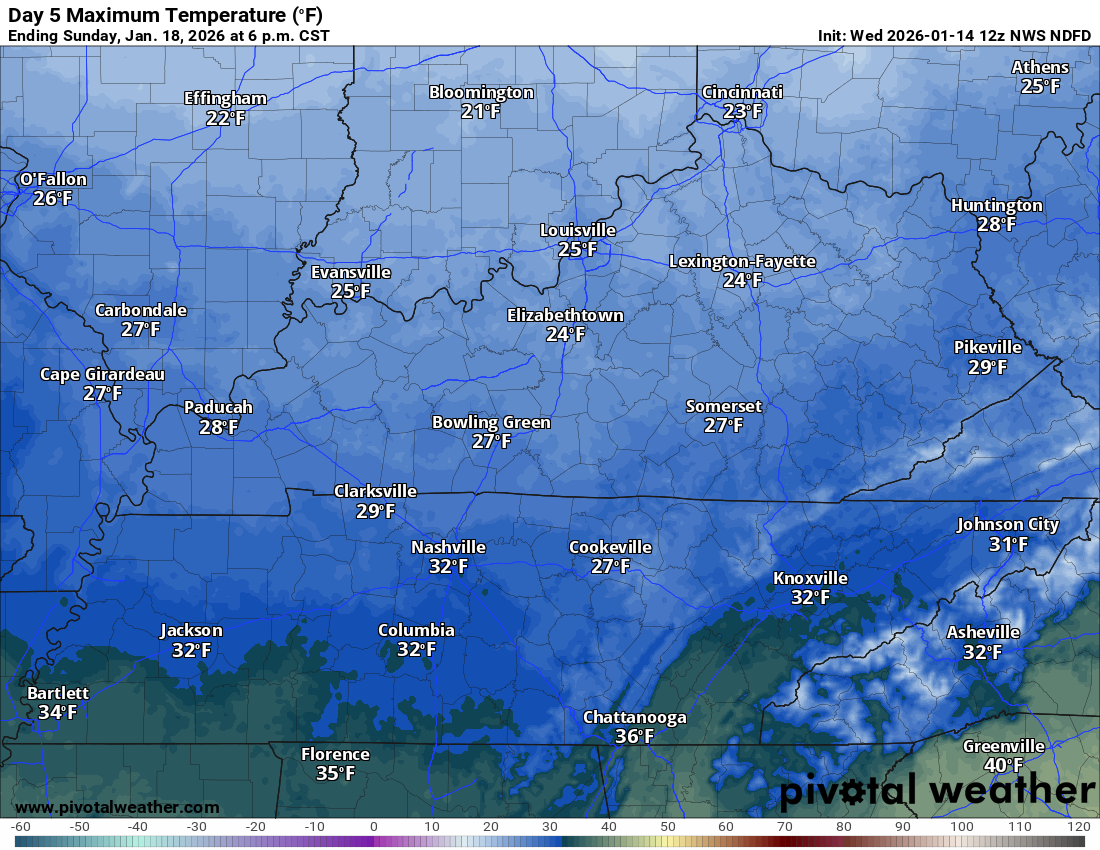
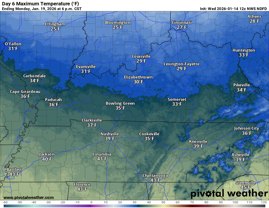
Let’s look at the actual temperatures
Saturday high temperatures
Sunday high temperatures
Monday’s high temperatures
.
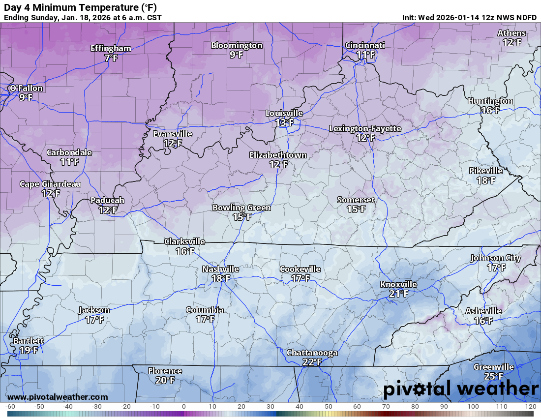
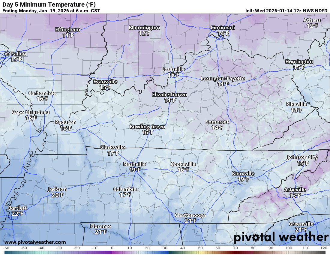
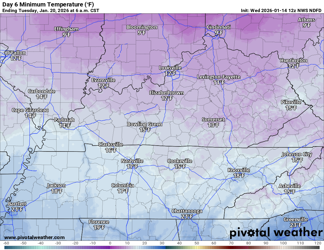
Let’s look at those cold low temperatures.
Sunday morning Brrr
Monday’s low temperatures Brrr
Tuesday’s low temperatures Brrr
.
We are not tracking any significant rain or snow events.
Any snow showers from now into early next week will be light.
Perhaps a dusting of snow for some locations. Just a reminder that it is winter.
Don’t get too excited over the snow!
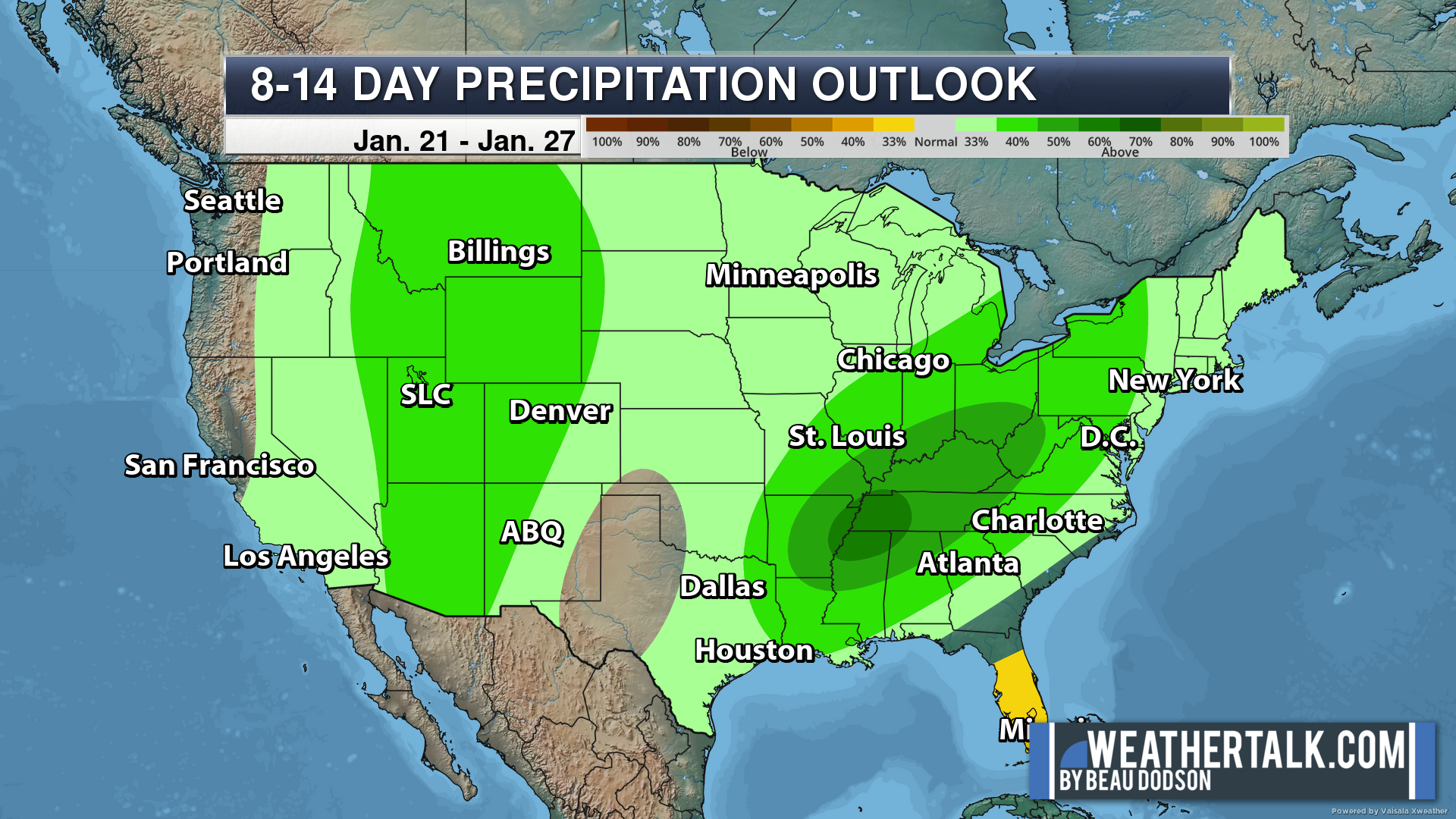
I am watching for above-average precipitation past day seven.
It is too soon for details.
Let’s see how this trends. This is the precipitation outlook for January 21st through January 27th.
This was a big jump from the dry outlook a day ago. Confidence is medium.
The green zone is where the chance of above-average precipitation (rain or snow) is highest.
.

.
The timestamp (upper left) is in Zulu. 12z=6 am. 18z=12 pm. 00z=6 pm.
Double-click the animation to enlarge it.
Green is rain. Yellow is moderate rain. Orange and red indicate locally heavy rain.
Blue is snow.
GFS model
.
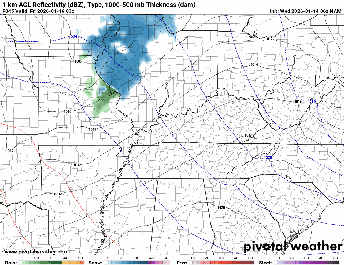
The timestamp (upper left) is in Zulu. 12z=6 am. 18z=12 pm. 00z=6 pm.
Double-click the animation to enlarge it.
Green is rain. Yellow is moderate rain. Red is locally heavy rain. Blue is snow.
NAM model
.
.
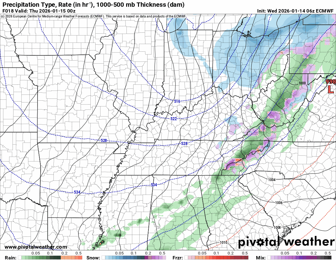
The timestamp (upper left) is in Zulu. 12z=6 am. 18z=12 pm. 00z=6 pm.
Double-click the animation to enlarge it.
Green is rain. Yellow is moderate rain. Blue is snow.
EC model
.
..
.
Click here if you would like to return to the top of the page.
.Average high temperatures for this time of the year are around 44 degrees.
Average low temperatures for this time of the year are around 28 degrees.
Average precipitation during this time period ranges from 1.00″ to 1.25″
Six to Ten Day Outlook.
Blue is below average. Red is above average. The no color zone represents equal chances.
Average highs for this time of the year are in the lower 60s. Average lows for this time of the year are in the lower 40s.

Green is above average precipitation. Yellow and brown favors below average precipitation. Average precipitation for this time of the year is around one inch per week.

.

Average low temperatures for this time of the year are around 26 degrees.
Average precipitation during this time period ranges from 1.00″ to 1.25″
.
Eight to Fourteen Day Outlook.
Blue is below average. Red is above average. The no color zone represents equal chances.

Green is above average precipitation. Yellow and brown favors below average precipitation. Average precipitation for this time of the year is around one inch per week.

.
.
.
We have a new service to complement your www.weathertalk.com subscription. This does NOTreplace www.weathertalk.com It is simply another tool for you to receive severe weather information.
.
https://weathercallservices.com/beau-dodson-weather


Want to receive the daily forecast/other products on your Beau Dodson Weather app?
Did you know you have four options in your www.weathertalk.com account
You will then receive these via your Beau Dodson Weather app.
Just log into your www.weathertalk.com account
Click the NOTIFICATION SETTINGS TAB
Then, turn them on (green) and off (red)
🌪️ Number 1 is the most important one. Severe alerts, tornado alerts, and so on.
Number 2 is the daily video, blog, livestream alerts, and severe weather Facebook threads on severe days or winter storm days.
Number 3 is the daily forecast. I send that out every day during the afternoon hours. It is the seven-day forecast, hazardous weather outlook, fire outlook, and more.
Number 4 is to receive the daily video, blog, and other content on NON-severe weather days (every day without severe threats in other words)
GREEN IS ON
RED IS OFF

I am going to start going live during bigger severe weather events.
Check it out here https://www.youtube.com/user/beaudodson
Click the subscribe button (it’s a free subscription button), and it will alert you when I go live. I will also send out alerts to the app when I go live for an event.

.

Radars and Lightning Data
Interactive-city-view radars. Clickable watches and warnings.
https://wtalk.co/B3XHASFZ
Old legacy radar site (some of you like it better)
https://weatherobservatory.com/weather-radar.htm
If the radar is not updating then try another one. If a radar does not appear to be refreshing then hit Ctrl F5. You may also try restarting your browser.
Backup radar site in case the above one is not working.
https://weathertalk.com/morani
Regional Radar
https://imagery.weathertalk.com/prx/RadarLoop.mp4
** NEW ** Zoom radar with chaser tracking abilities!
ZoomRadar
If the radar is not working, then email me: Email me at beaudodson@usawx.com
.
We do have some sponsors! Check them out.
Roof damage from recent storms? Link – Click here
INTEGRITY ROOFING AND EXTERIORS!
⛈️ Roof or gutter damage from recent storms? Today’s weather is sponsored by Integrity Roofing. Check out their website at this link https://www.ourintegritymatters.com/

![]()
![]()
![]()
Make sure you have three to five ways of receiving your severe weather information.
Weather Talk is one of those ways! Now, I have another product for you and your family.

.
Want to add more products to your Beau Dodson Weather App?
Receive daily videos, weather blog updates on normal weather days and severe weather and winter storm days, your county by county weather forecast, and more!
Here is how to do add those additional products to your app notification settings!
Here is a video on how to update your Beau Dodson Weather payment.
The app is for subscribers. Subscribe at www.weathertalk.com/welcome then go to your app store and search for WeatherTalk
Subscribers, PLEASE USE THE APP. ATT and Verizon are not reliable during severe weather. They are delaying text messages.
The app is under WeatherTalk in the app store.

Apple users click here

Android users click here
.
Radars and Lightning Data
Interactive-city-view radars. Clickable watches and warnings.
https://wtalk.co/B3XHASFZ
Old legacy radar site (some of you like it better)
https://weatherobservatory.com/weather-radar.htm
If the radar is not updating then try another one. If a radar does not appear to be refreshing then hit Ctrl F5. You may also try restarting your browser.
Backup radar site in case the above one is not working.
https://weathertalk.com/morani
Regional Radar
https://imagery.weathertalk.com/prx/RadarLoop.mp4
** NEW ** Zoom radar with chaser tracking abilities!
ZoomRadar
Lightning Data (zoom in and out of your local area)
https://wtalk.co/WJ3SN5UZ
Not working? Email me at beaudodson@usawx.com
National map of weather watches and warnings. Click here.
Storm Prediction Center. Click here.
Weather Prediction Center. Click here.
.

Live lightning data: Click here.
Real time lightning data (another one) https://map.blitzortung.org/#5.02/37.95/-86.99
Our new Zoom radar with storm chases
.
.

Interactive GOES R satellite. Track clouds. Click here.
GOES 16 slider tool. Click here.
College of DuPage satellites. Click here
.

Here are the latest local river stage forecast numbers Click Here.
Here are the latest lake stage forecast numbers for Kentucky Lake and Lake Barkley Click Here.
.
.
Find Beau on Facebook! Click the banner.


 .
.