
.

.
I have some question-and-answer threads over on the Facebook page. Link to those threads CLICK HERE
Or email me at beaudodsonweather@gmail.com
.

Seven-Day Tornado Outlook
February 26th through March 4th
Tornado activity is not anticipated.
.

Seven-Day Hazardous Weather Outlook
1. Is lightning in the forecast? POSSIBLE. This afternoon and evening. I will monitor next Monday into Wednesday.
2. Are severe thunderstorms in the forecast? NOT AT THIS TIME. I will monitor the middle of next week. For now, it appears the severe risk will remain to our south.
3. Is flash flooding in the forecast? NOT AT THIS TIME. There is ongoing river flooding in some counties. I will monitor next Tuesday and Wednesday.
4. Will non-thunderstorm winds top 40 mph? NO.
5. Will temperatures drop below 10 degrees? NO.
6. Will the wind chill dip below 0 degrees? NO.
7. Is measurable snow and/or sleet in the forecast? NO.
8. Is freezing rain/ice in the forecast? NO.
.
A quick forecast glance. Your 48-hour forecast Graphics


.

.


Forecast discussion.
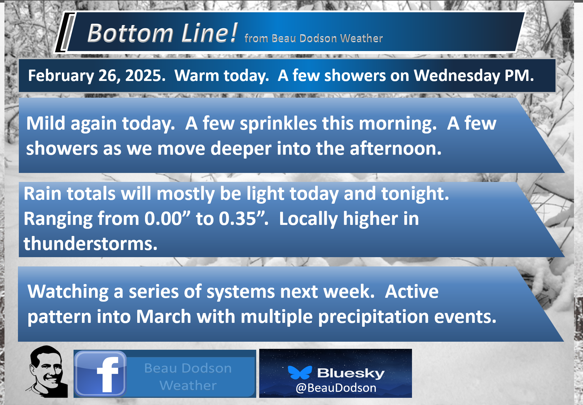
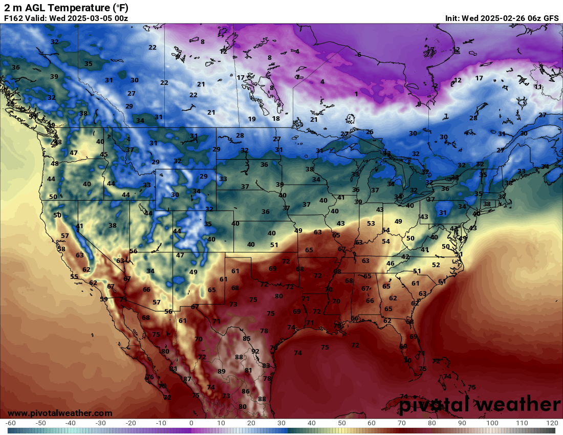
- Mild again today. Some locations will hit the 70-degree mark. What a flip from a week ago. A mix of sun and clouds.
- A few sprinkles are possible this morning. The bulk of showers will occur later this afternoon and evening. Rainfall totals from 0.01″ to 0.30″. The lowest rain totals will be over southeast Missouri. The highest rain totals will be over Kentucky and Tennessee. Slightly higher rain totals are possible in thunderstorms.
- River flooding continues in some counties. It will take some time for the rivers to recede.
- A bit chilly on Saturday and Sunday. Above-average temperatures return in the first half of next week.
- March looks to bring an active precipitation pattern. I am tracking several rain events.
.

.
We are waking up to cool temperatures. Once again, it is a bit warmer than yesterday morning.

.
Yesterday was amazing. Some reporting stations hit 70 degrees! Quite amazing compared to where we were a few short days ago. Last Friday, it was zero degrees. I hope you were able to enjoy yesterday’s weather.
It will be mild today. Widespread sixties will blanket the region. Some locations will hit 70 degrees.
More clouds today, as well.
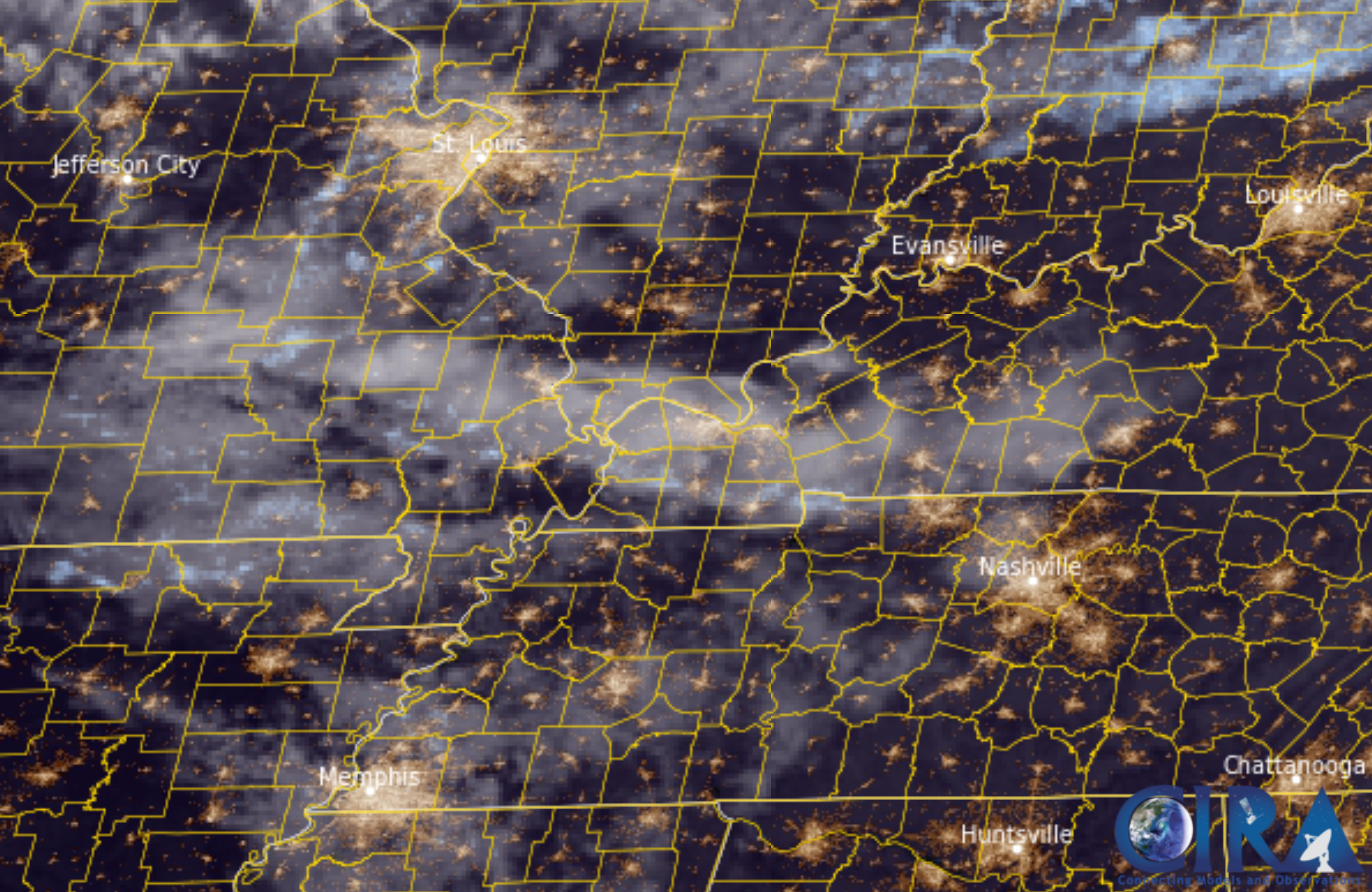
Here was this morning’s satellite view. You can see clouds streaming across the area.
.
There are a few sprinkles on the radar this morning, but the bulk of the rain shower activity will hold off until this afternoon and tonight.
This rain event will move in from the northwest. Diving southeast. It will be a band of showers. Perhaps a rumble of thunder. No severe weather, thankfully.
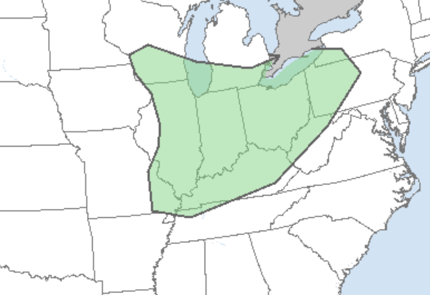
Here is the thunderstorm outlook from the Storm Prediction Center/NOAA. They are responsible for issuing severe weather outlooks.
The green zone is where lightning is possible. Again, we do not have severe weather concerns.
.

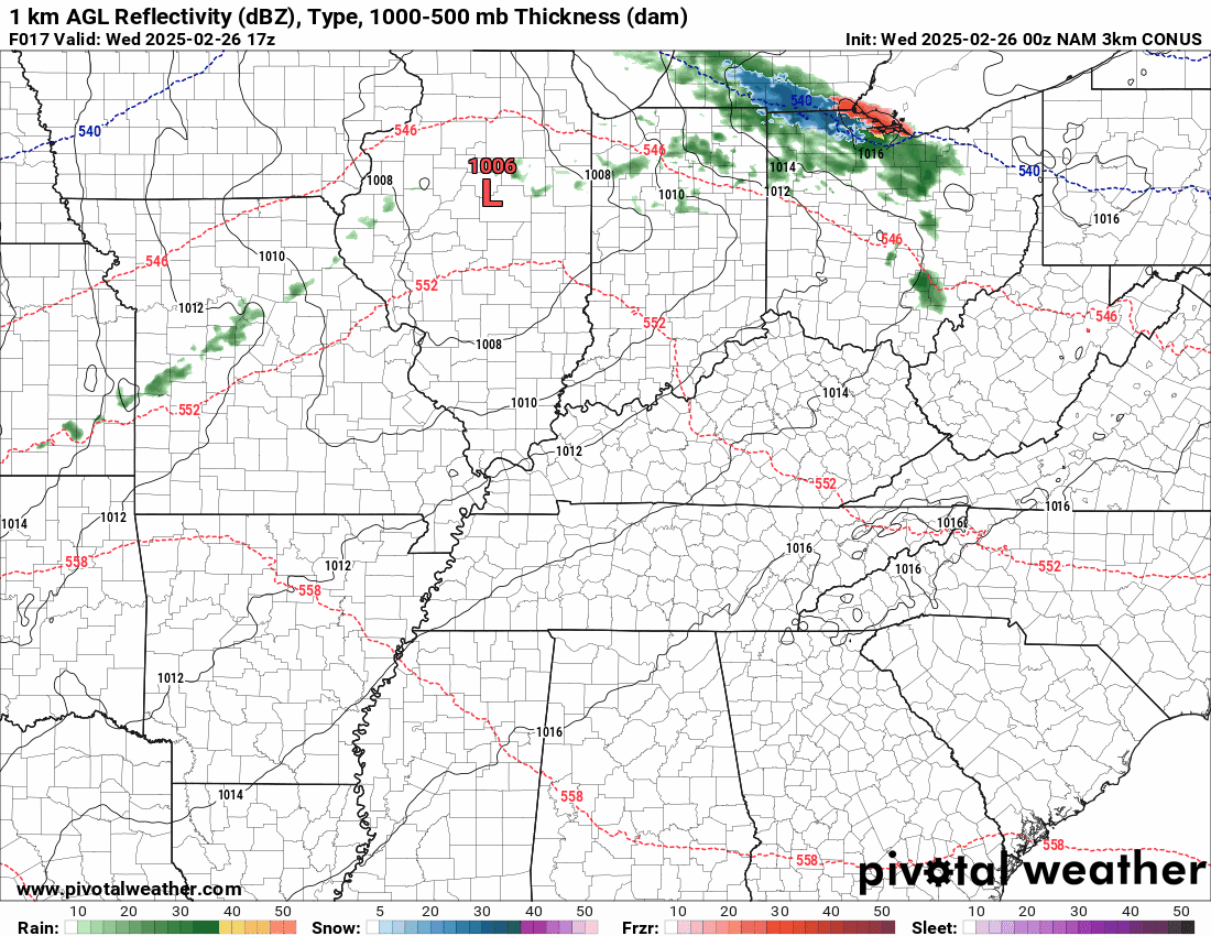
What radar might look like today and tonight.
Here is the NAM future-cast radar.
Double-click the animation to enlarge it.
The timestamp (upper left) is in Zulu. 12z=6 am. 18z=12 pm. 00z=6 pm.
The NAM model shows the mid-week system.
.
This is not going to be a big precipitation event. It will not aggravate the river flooding situation.
Rainfall totals will primarily be on the light side. Don’t be surprised if some locations receive very little rainfall, especially over southeast Missouri.
Thunderstorms could tack on a bit more in spots.
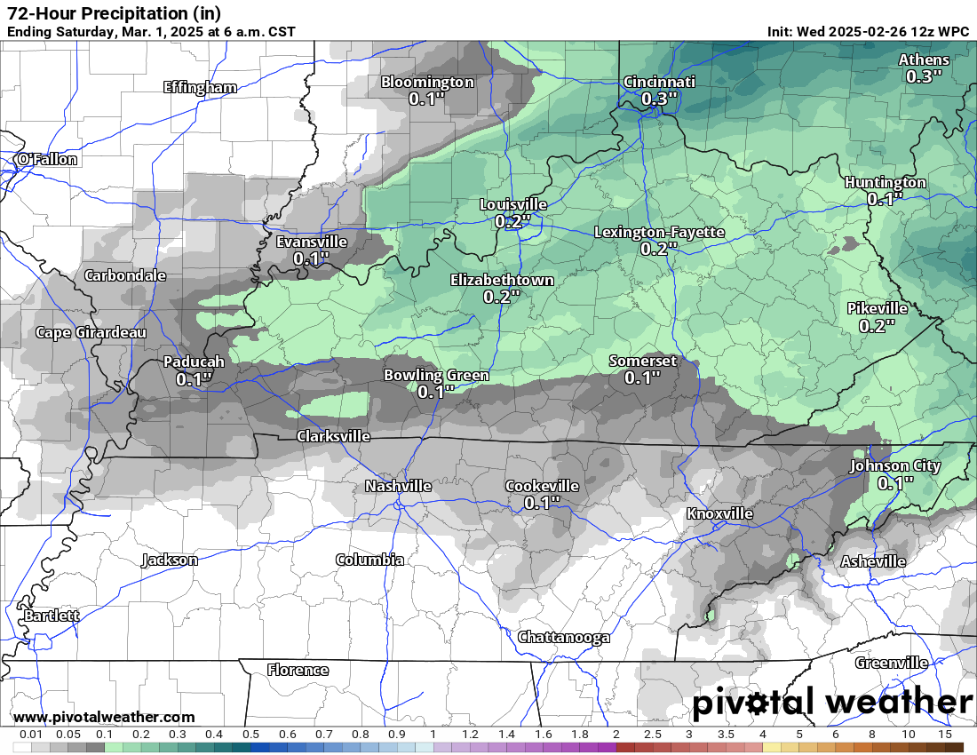
Here is the latest rainfall forecast for the rain event.
You may double-click on the image to enlarge it.
Notice the Poplar Bluff area has trace amounts. A bit more as you travel farther east.
.
Here is the NAM model rainfall outlook.
It shows small areas with somewhat higher totals. It is picking up on the embedded thunderstorms. Overall, this is a light rain event.

.
I am watching several precipitation events during the first ten days of March. Right now, the data looks wet, not white.
I know there are a lot of rumors floating around about the polar vortex returning and snowstorms. That is currently not in the charts. I will monitor trends, as always.
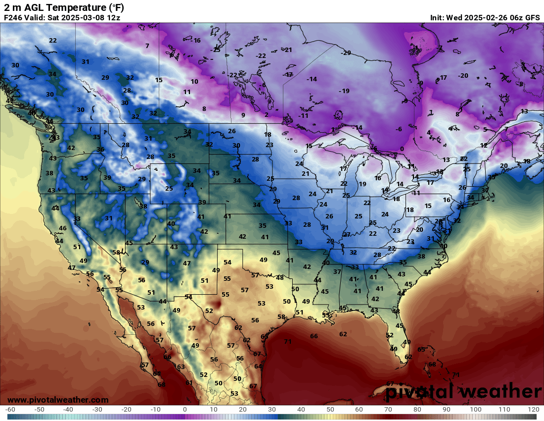
A cooler shot of air is possible behind the March 5th system. Temperatures will likely be several degrees below average.
Guidance shows rain showers with a chance of embedded thunderstorms on Monday..

.
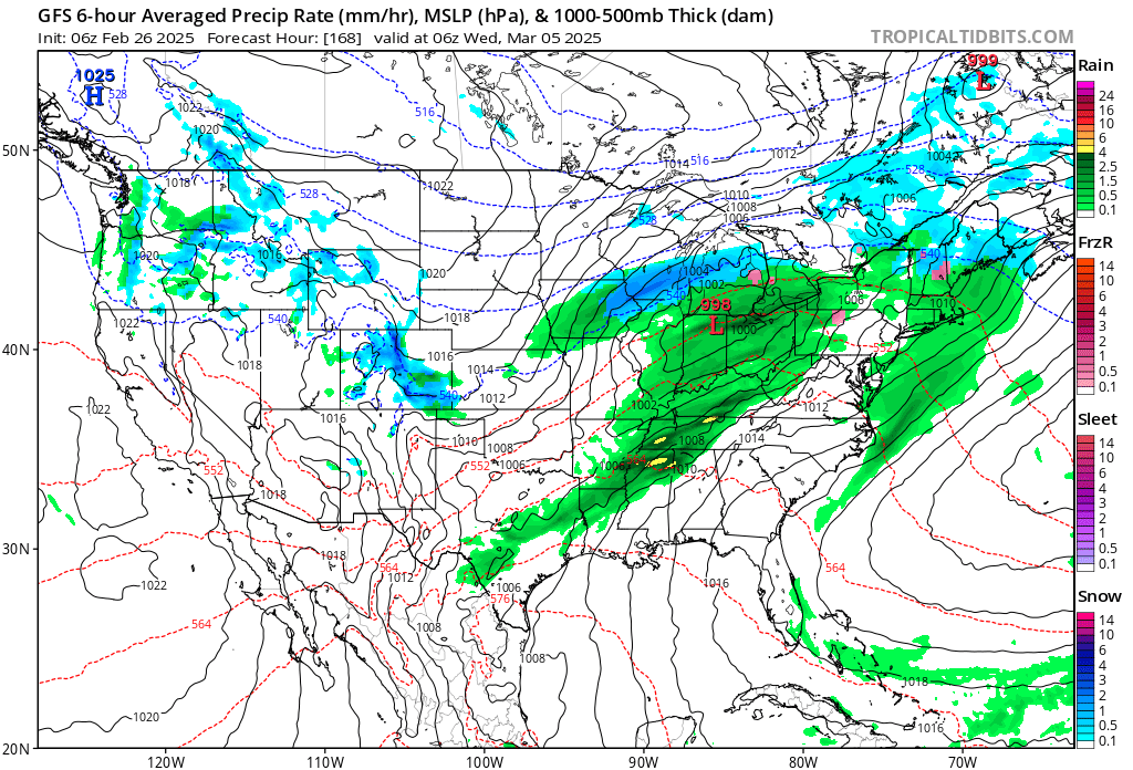
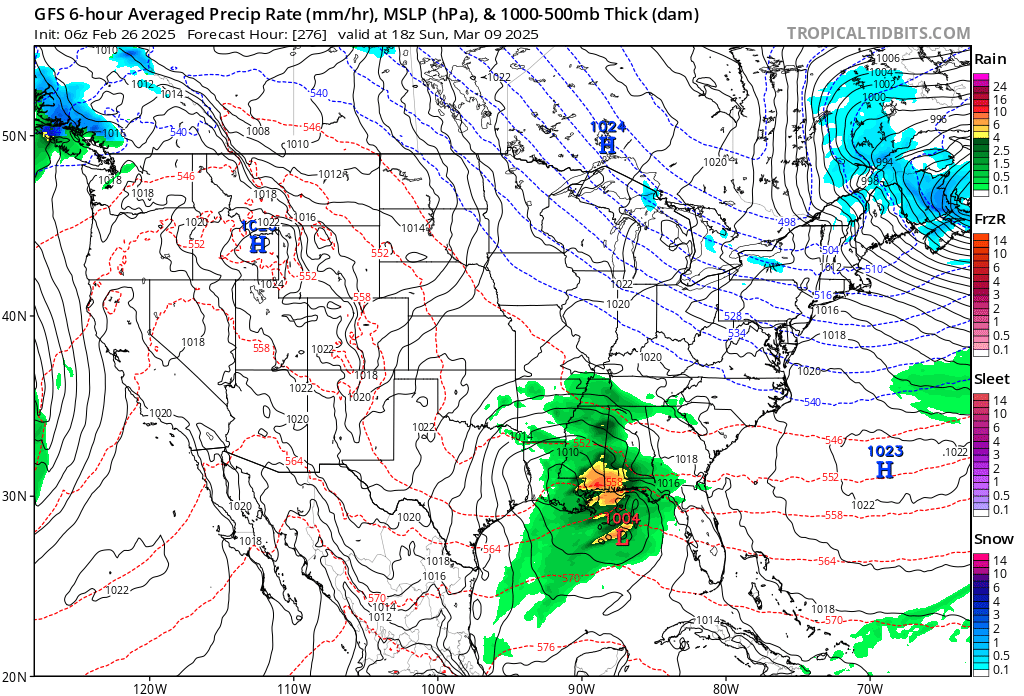
Another system arrives around March 4th and 5th. Plenty of time to monitor these systems.
This one occasionally shows up as a stronger system.
The GFS Model is weaker. The EC model is more potent. I believe the EC model has a better chance of being correct.
The GFS has not done well over the past few months. Both models bring rain into the region.
.
.
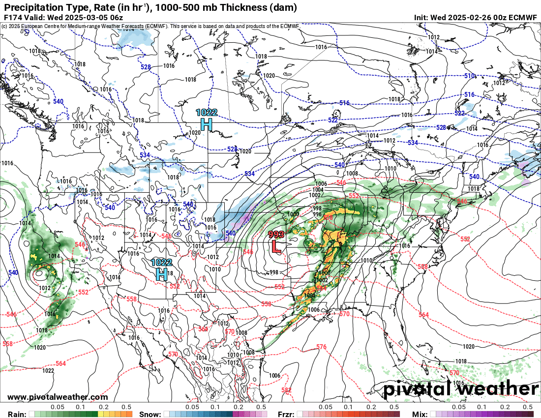
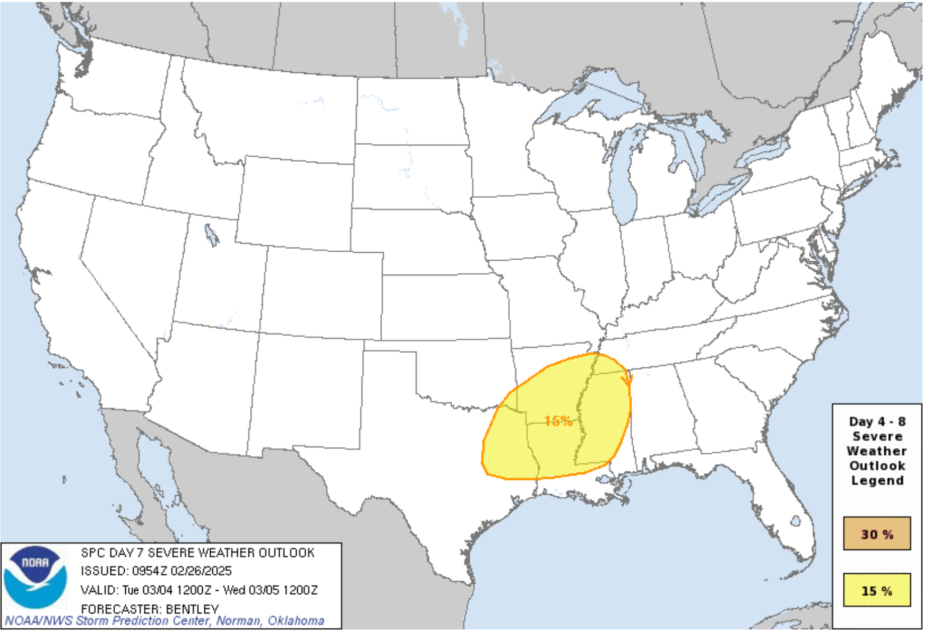
The EC model is a bit stronger with the March 4th/5th system. It would bring a risk of severe storms to our south. I will need to monitor it locally.
Dew points might not be quite high enough for severe storms in our local area, but it would be close. The dew point is a measure of moisture.
I can’t rule out the SPC placing us in a low-end severe weather risk.
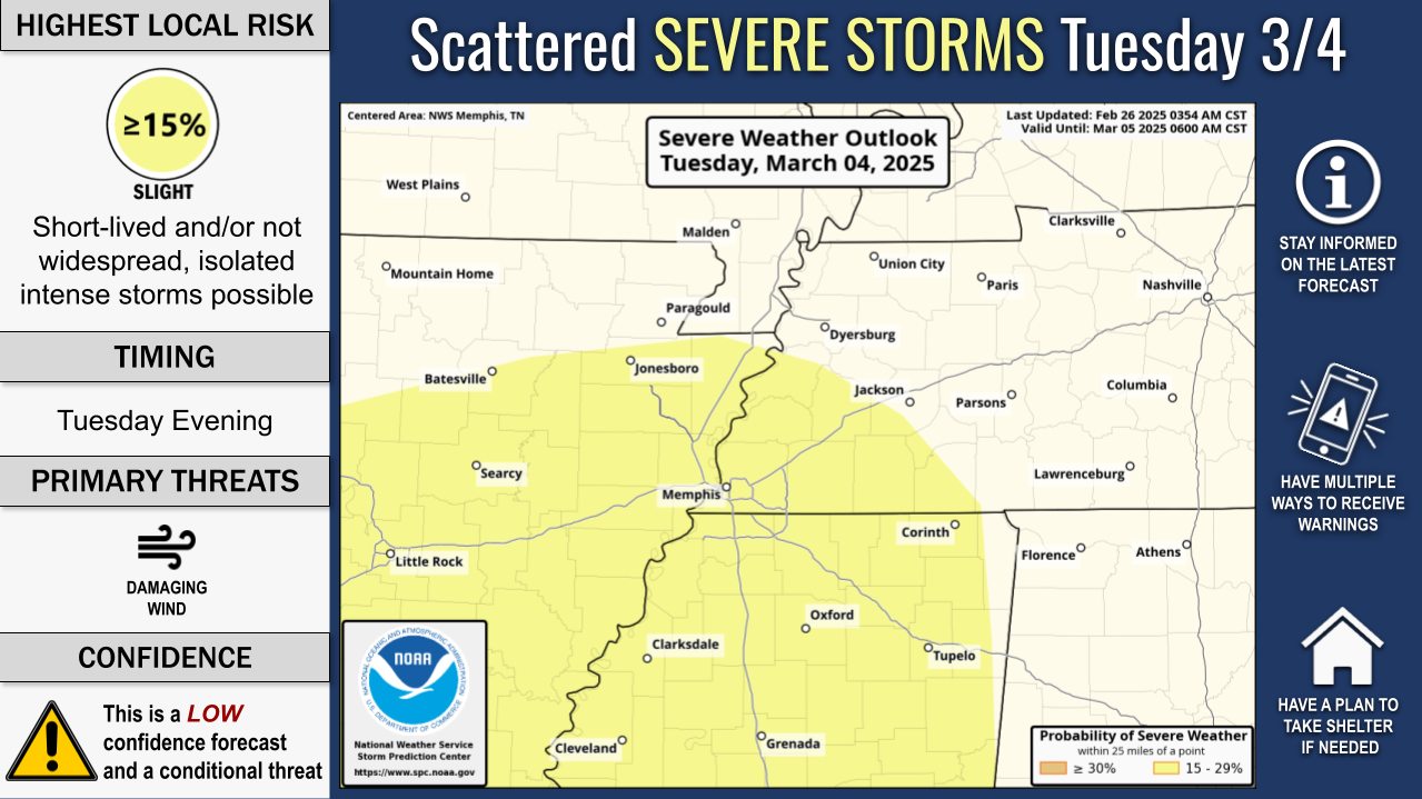
The Memphis, Tennessee, NWS put this graphic out earlier this morning (for next week).
.
You can see how temperatures soar ahead of that front. Then, cooler behind it (late next week). Nothing extreme and certainly not the polar vortex.
Cooler behind that cold front (late next week). Then, we warm up again.
.
Here is the Storm Prediction Center’s severe weather outlook for the March 4th/5th event (TUE and WED of next week).
It is possible a low-end risk nudges into our region, as well.
.
.
.
Overall, an active storm track with multiple chances of precipitation during the month of March
Make sure you have multiple ways of receiving your severe weather alerts.
.
.
.
.

Radars and Lightning Data
Interactive-city-view radars. Clickable watches and warnings.
https://wtalk.co/B3XHASFZ
Old legacy radar site (some of you like it better)
https://weatherobservatory.com/weather-radar.htm
If the radar is not updating then try another one. If a radar does not appear to be refreshing then hit Ctrl F5. You may also try restarting your browser.
Backup radar site in case the above one is not working.
https://weathertalk.com/morani
Regional Radar
https://imagery.weathertalk.com/prx/RadarLoop.mp4
** NEW ** Zoom radar with chaser tracking abilities!
ZoomRadar
If the radar is not working, then email me: Email me at beaudodson@usawx.com
.
We do have some sponsors! Check them out.
Connected and Protected.
They Specialize in Audio, Video, Networking, Security, Cameras, Electrical, New Construction, Remodels, and retrofitting Jobs. Experience the future of smart living and unmatched security with Connected & Protected Solutions today.
Link – Click here

.
Roof damage from recent storms? Link – Click here
INTEGRITY ROOFING AND EXTERIORS!
⛈️ Roof or gutter damage from recent storms? Today’s weather is sponsored by Integrity Roofing. Check out their website at this link https://www.ourintegritymatters.com/

![]()
![]()

.
Click here if you would like to return to the top of the page.
.Average high temperatures for this time of the year are around 50 degrees.
Average low temperatures for this time of the year are around 30 degrees.
Average precipitation during this time period ranges from 0.90″ to 1.20″
Six to Ten Day Outlook.
Blue is below average. Red is above average. The no color zone represents equal chances.
Average highs for this time of the year are in the lower 60s. Average lows for this time of the year are in the lower 40s.

Green is above average precipitation. Yellow and brown favors below average precipitation. Average precipitation for this time of the year is around one inch per week.

.

Average low temperatures for this time of the year are around 31degrees.
Average precipitation during this time period ranges from 0.90″ to 1.20″
.
Eight to Fourteen Day Outlook.
Blue is below average. Red is above average. The no color zone represents equal chances.

Green is above average precipitation. Yellow and brown favors below average precipitation. Average precipitation for this time of the year is around one inch per week.

.
![]()
Make sure you have three to five ways of receiving your severe weather information.
Weather Talk is one of those ways! Now, I have another product for you and your family.

.
.
https://weathercallservices.com/beau-dodson-weather


Want to add more products to your Beau Dodson Weather App?
Receive daily videos, weather blog updates on normal weather days and severe weather and winter storm days, your county by county weather forecast, and more!
Here is how to do add those additional products to your app notification settings!
Here is a video on how to update your Beau Dodson Weather payment.
The app is for subscribers. Subscribe at www.weathertalk.com/welcome then go to your app store and search for WeatherTalk
Subscribers, PLEASE USE THE APP. ATT and Verizon are not reliable during severe weather. They are delaying text messages.
The app is under WeatherTalk in the app store.

Apple users click here

Android users click here
.
Radars and Lightning Data
Interactive-city-view radars. Clickable watches and warnings.
https://wtalk.co/B3XHASFZ
Old legacy radar site (some of you like it better)
https://weatherobservatory.com/weather-radar.htm
If the radar is not updating then try another one. If a radar does not appear to be refreshing then hit Ctrl F5. You may also try restarting your browser.
Backup radar site in case the above one is not working.
https://weathertalk.com/morani
Regional Radar
https://imagery.weathertalk.com/prx/RadarLoop.mp4
** NEW ** Zoom radar with chaser tracking abilities!
ZoomRadar
Lightning Data (zoom in and out of your local area)
https://wtalk.co/WJ3SN5UZ
Not working? Email me at beaudodson@usawx.com
National map of weather watches and warnings. Click here.
Storm Prediction Center. Click here.
Weather Prediction Center. Click here.
.

Live lightning data: Click here.
Real time lightning data (another one) https://map.blitzortung.org/#5.02/37.95/-86.99
Our new Zoom radar with storm chases
.
.

Interactive GOES R satellite. Track clouds. Click here.
GOES 16 slider tool. Click here.
College of DuPage satellites. Click here
.

Here are the latest local river stage forecast numbers Click Here.
Here are the latest lake stage forecast numbers for Kentucky Lake and Lake Barkley Click Here.
.
.
Find Beau on Facebook! Click the banner.


 .
.