Good Sunday morning,
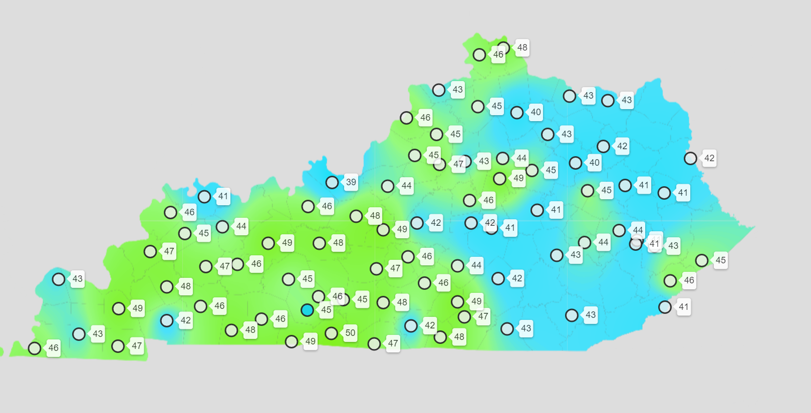
It is a bit chilly outside. Especially when compared with the past week. We are waking up to chilly temperatures. A few reporting stations in southeast Missouri dipped into the 30s. I also noted one northern Kentucky station at 39 degrees. Several in the lower 40s.
What a change from a couple of days ago. About a 50-degree swing!
Here is the Kentucky 6 am temperature map.
This is called a meso-net. Missouri, Illinois, and Tennessee do not have meso-nets.
Double click images to enlarge them.
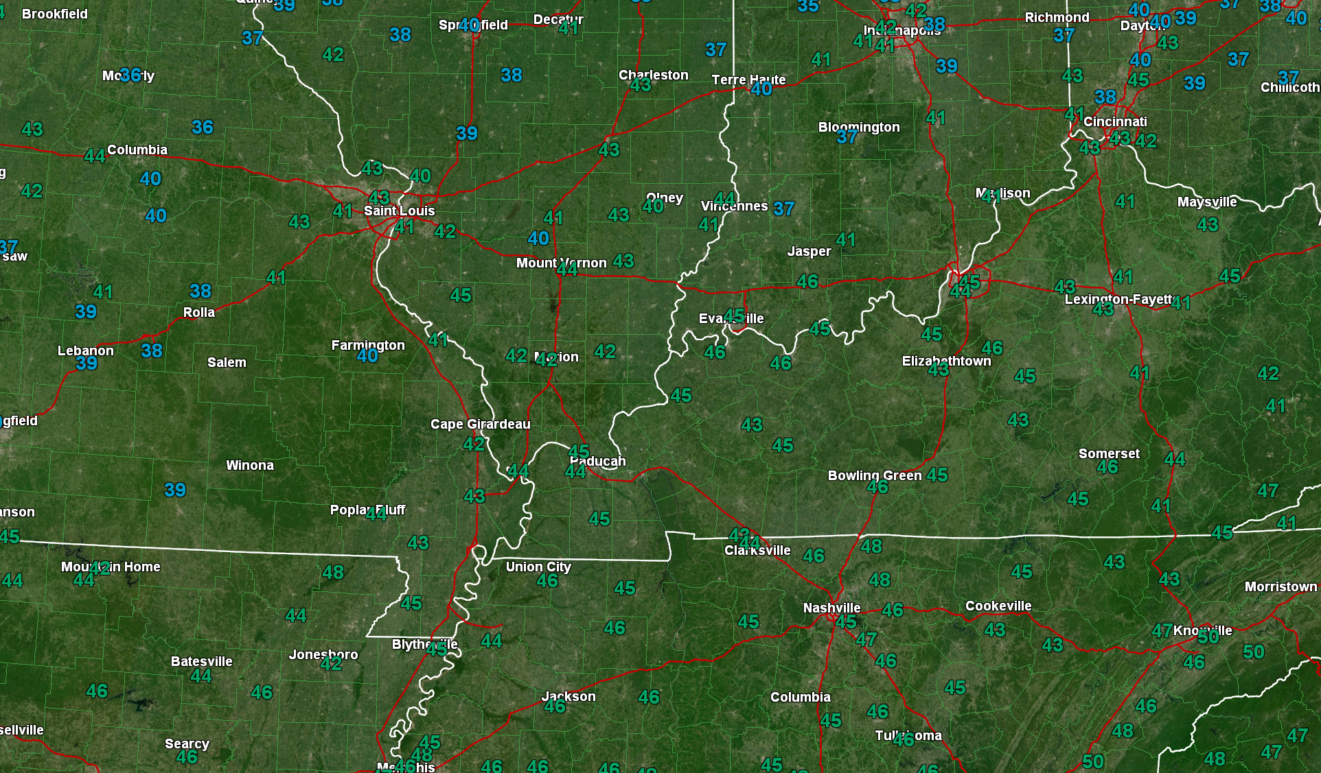
Some local temperatures. 6 am readings. There was a 39 degree reading in Jefferson County, Illinois an hour ago, as well.
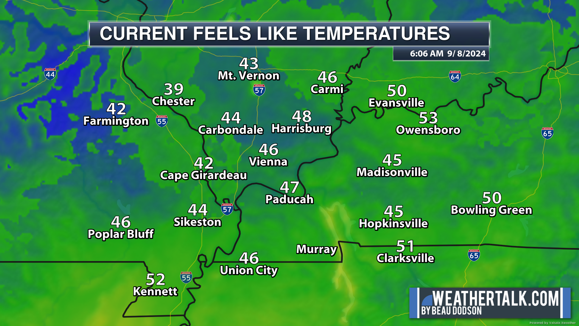
Some local feels like temperatures (6 am).
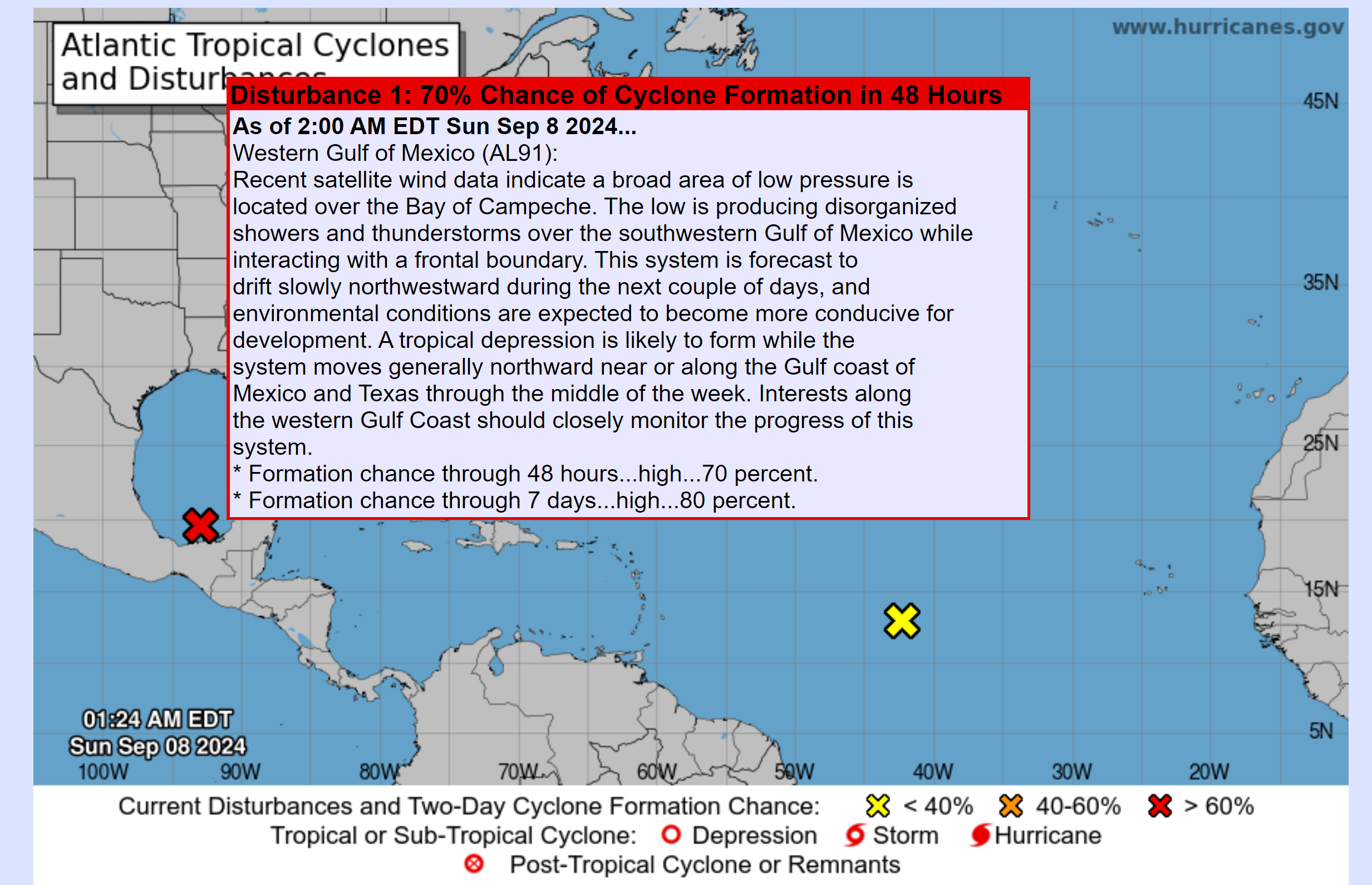
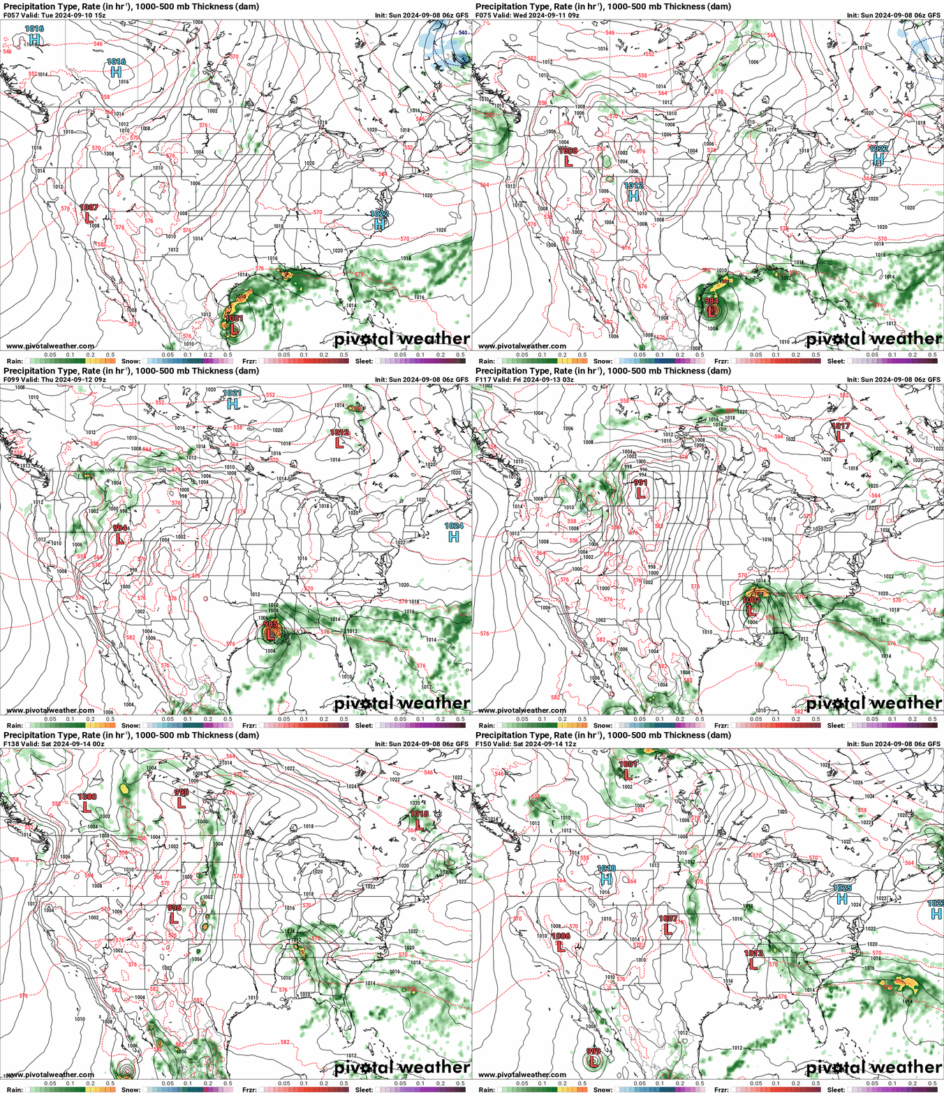
I continue to monitor the tropics. A disturbance in the Gulf of Mexico will move northward over the coming days. We expect it to develop into a tropical depression and/or a named tropical storm/hurricane.
The National Hurricane Center gives this system an 80% chance of developing into at least a tropical depression. The Gulf of Mexico waters are extremely warm. This is a concern. If conditions come together just right, then it could rapidly develop.
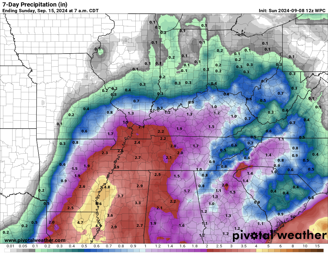
As the system moves northward, it may eventually bring our region much needed widespread rainfall. As a matter of fact, the latest WPC/NOAA rainfall outlook brings it into our region this coming week.
The time-frame will be Thursday, Friday, and Saturday. Perhaps centered on Thursday night into Friday night.
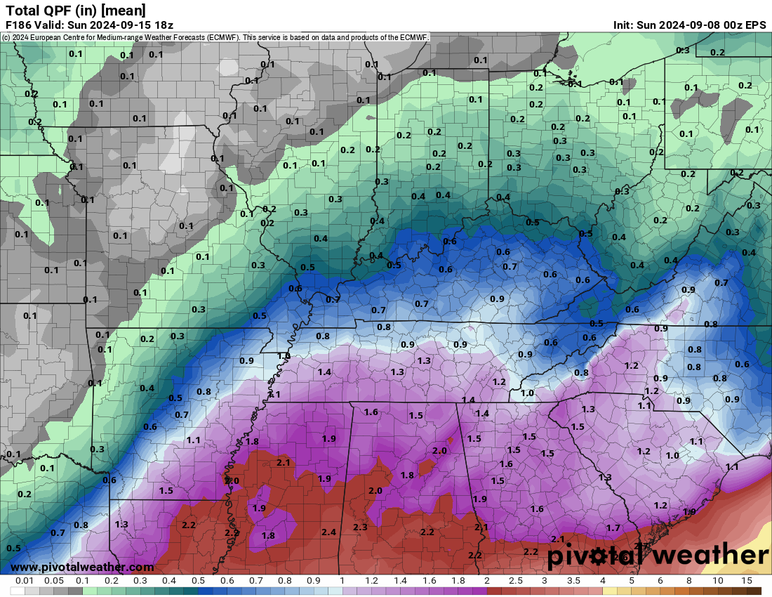
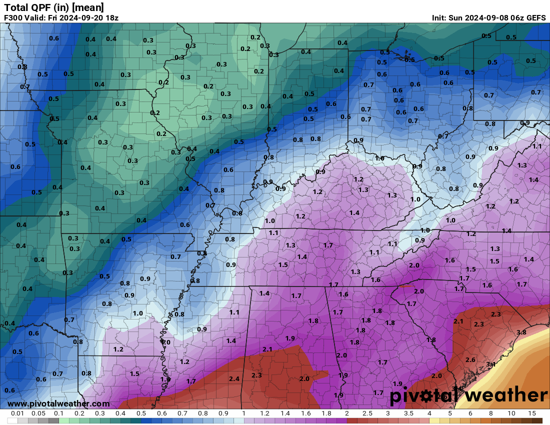
Model ensembles are slanted a bit eastward. Undauntedly, this will continue to evolve over the coming days. I will be monitoring trends in the guidance. Trends usually tell us more about a system than individual model runs.
EC ensemble rainfall mean.
GFS model ensemble rainfall mean.
The Paducah, Kentucky National Weather Service is now talking about the system, as well. This is from their area forecast discussion.
A STRONG UPPER LEVEL TROUGH WILL MOVE ONSHORE THE PACIFIC NORTHWEST AMPLIFYING THE UPPER LEVELS.
MODELS ARE CONVERGING ONTO THE POTENTIAL FOR A TROPICAL SYSTEM TO MOVE OUT OF THE WESTERN GOM
LATE THIS WEEK. THIS SYSTEM HAS THE POTENTIAL TO BRING SOME TROPICAL MOISTURE AND RAINFALL TO
THE REGION LATE THIS WEEK. THE NBM INCREASES POPS THURSDAY INTO FRIDAY MORNING BUT THERE STILL
REMAIN SOME UNCERTAINTY WITH THIS SYSTEM. CERTAINLY SOMETHING TO KEEP AN EYE ON.
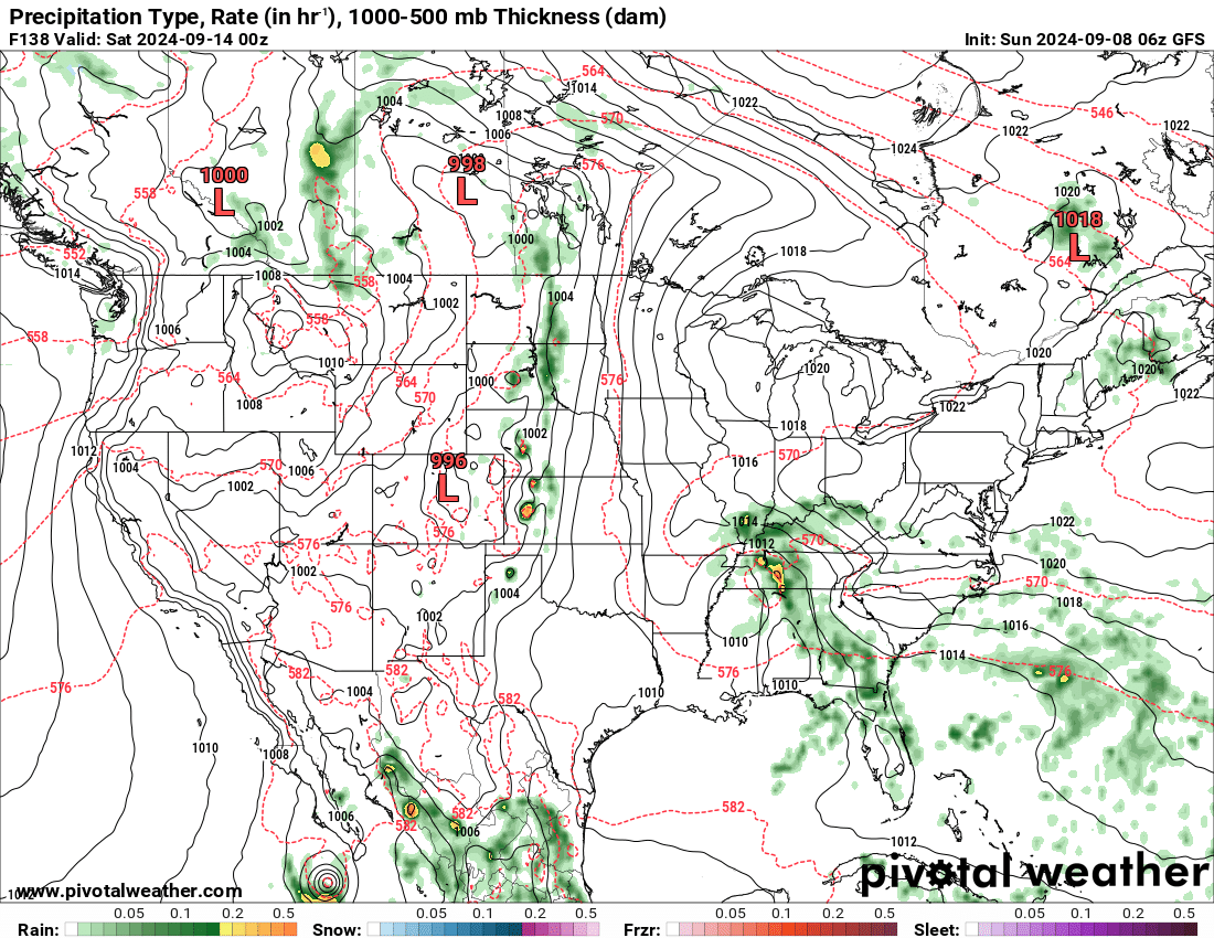
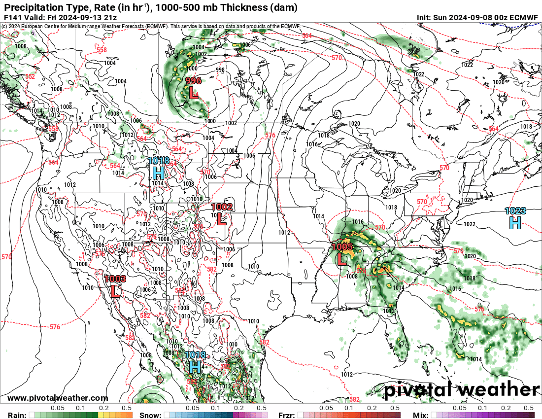
Both the GFS and EC model now bring it into our region. Yesterday, only the GFS model tracked into our region. Let’s keep an eye on it. We need this rain!
GFS model (Friday night). You can see the system moving northward.
Animation
EC model (Friday afternoon). You can see the system tracking into our region.
We desperately need this rain. Stay tuned. I will be tracking it.


