

.
I have some question-and-answer threads over on the Facebook page. Link to those threads CLICK HERE
Or email me at beaudodsonweather@gmail.com
11:30 AM
No changes to the morning forecast.
Right now, we are just waiting for storms to develop.
We do have a few storms over northern portions of southeast Missouri. They are moving northeast.
They will soon move into northern portions of southern Illinois. I can’t rule out some severe thunderstorm warnings with these cells.
For now, they are below severe levels.
Next, we will wait for storms to form over southern Missouri and Arkansas.
.
8:15 AM
The Memphis, TN NWS posted this. This lines up with my thinking, as well.
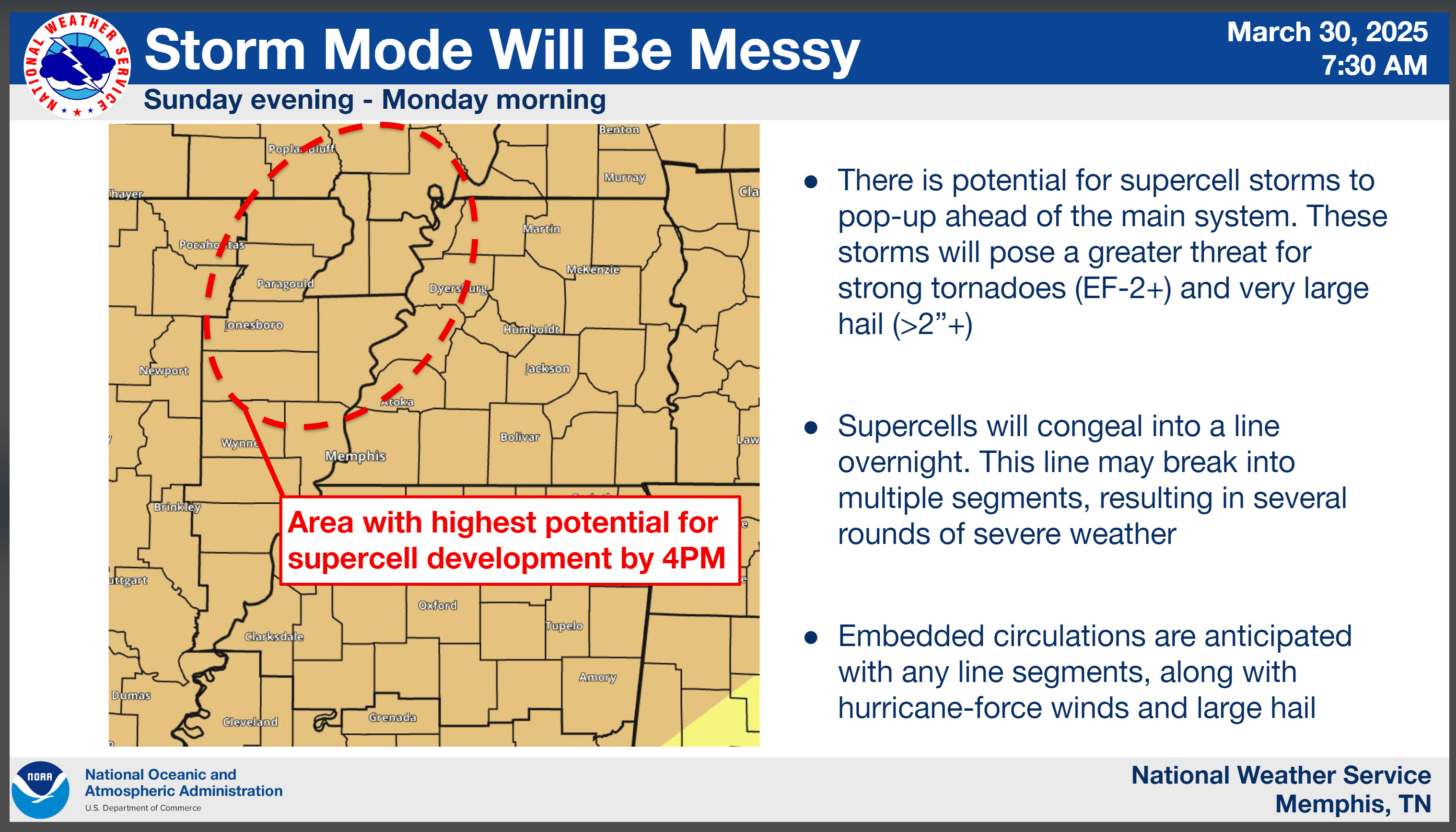
I am watching clouds thin and clear in Arkansas.
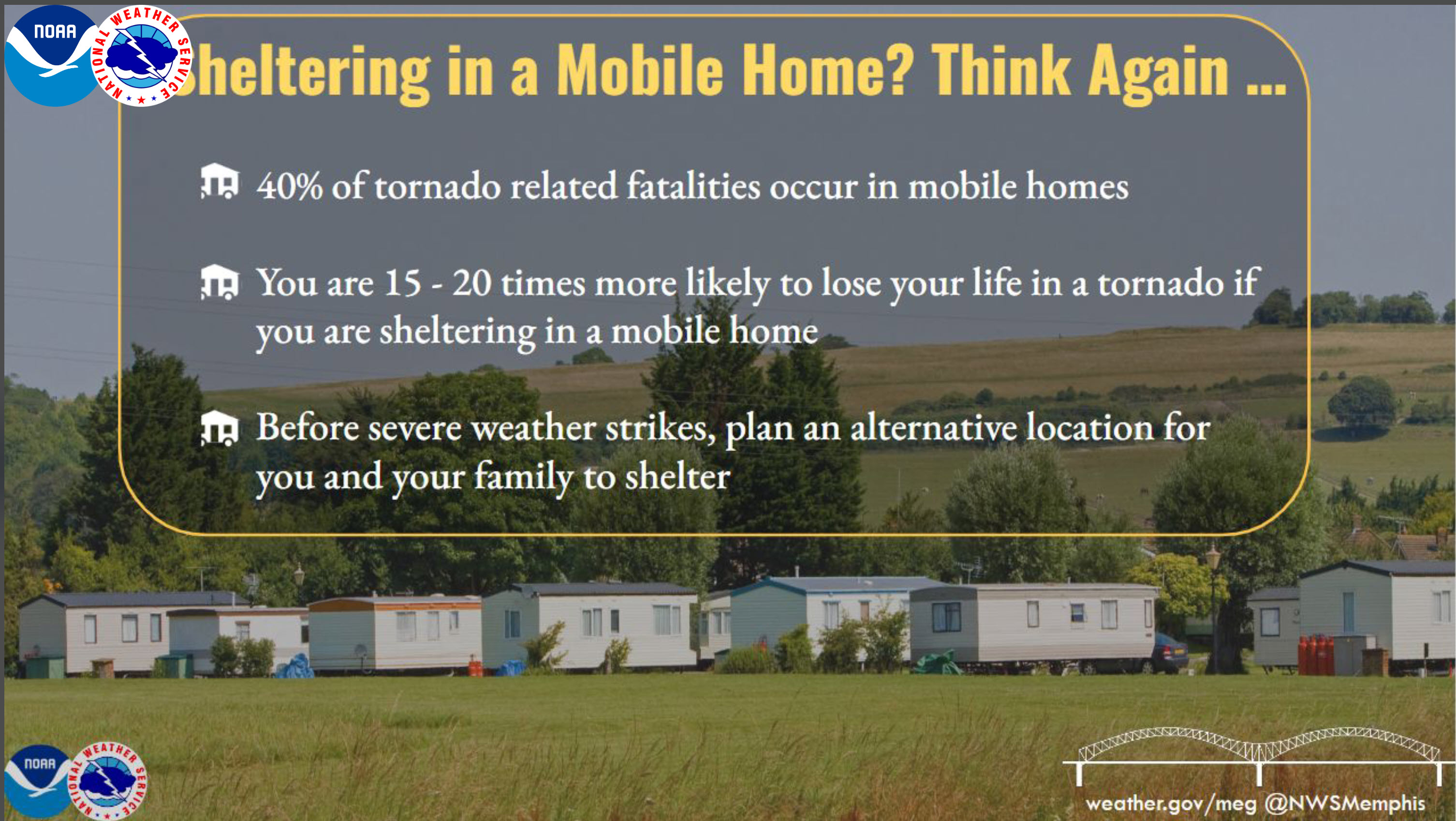
Mobile homes are not safe during severe weather..
.
8 AM Update
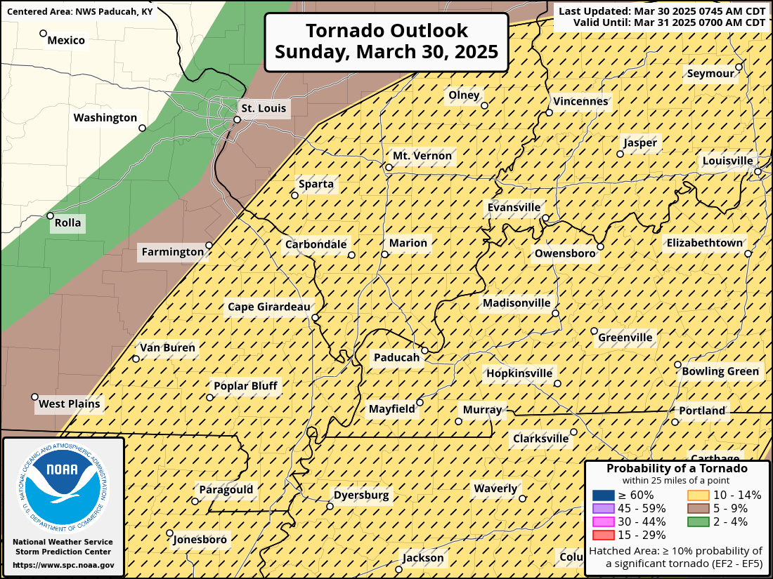
The Storm Prediction Center, in their 8 am update, did push the strong tornado risk back to the west-northwest.
Hatched means some tornadoes could be strong.
.
7:45 AM Update
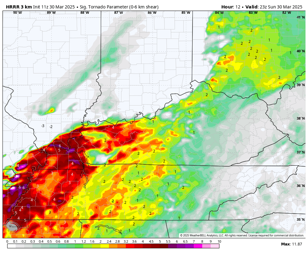
I’m watching some big numbers this afternoon regarding spin in the atmosphere.
6 PM graphic
These colors represent where the atmosphere will be turning. That is called wind shear. Wind shear is the turning of wind direction with height. Winds also become stronger with height.
7 PM graphic
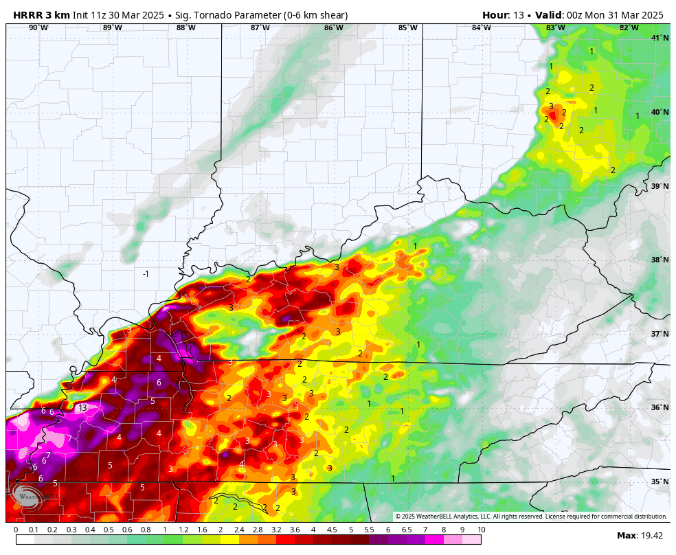
This lines up with the SPC tornado threat zone.
.
7 AM update
The only thing throwing me off this morning is cloud cover.
I am leaning towards two lines of storms.
One line forms during the late morning/early afternoon from near Mt Vernon northward into central Indiana.
Then, a second area of supercells or lines will be form across southern MO and northern/central AR. That will be the one that impacts most of us.
Cloud cover remains a question and a key part of this severe weather forecast.
.
6 AM Update
We have a risk of severe weather this afternoon and tonight. Another risk on Wednesday and Thursday. I am monitoring Friday and Saturday.
Heavy rain is likely this week, as well.
Review your severe weather safety plans.
.
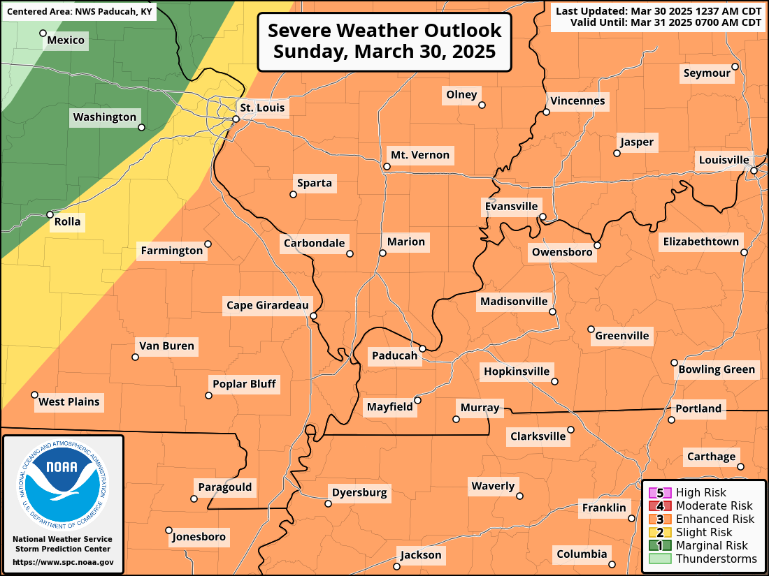
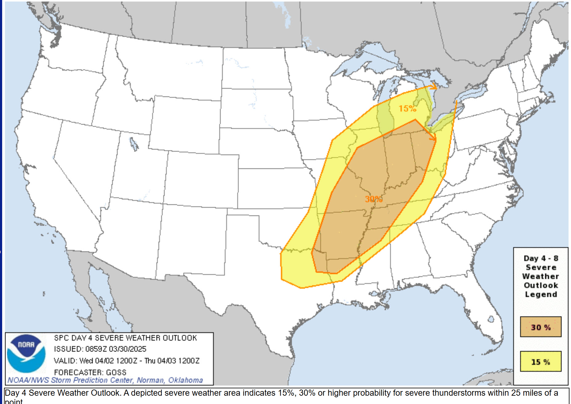
Here is the forecast from the SPC. They could upgrade this to a level four if confidence increases.
Cloud cover could help dampen instability and that would save us from a bigger event. We will just need to monitor it.
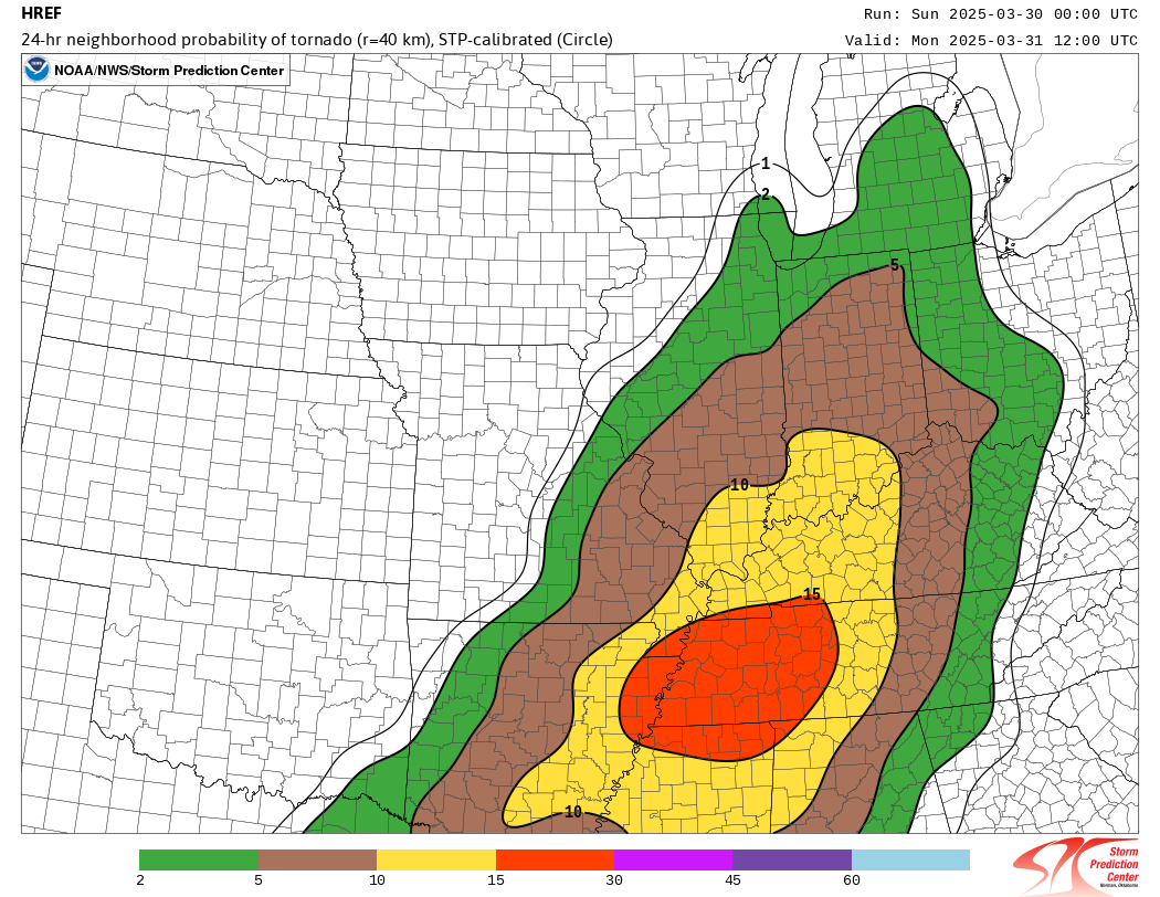
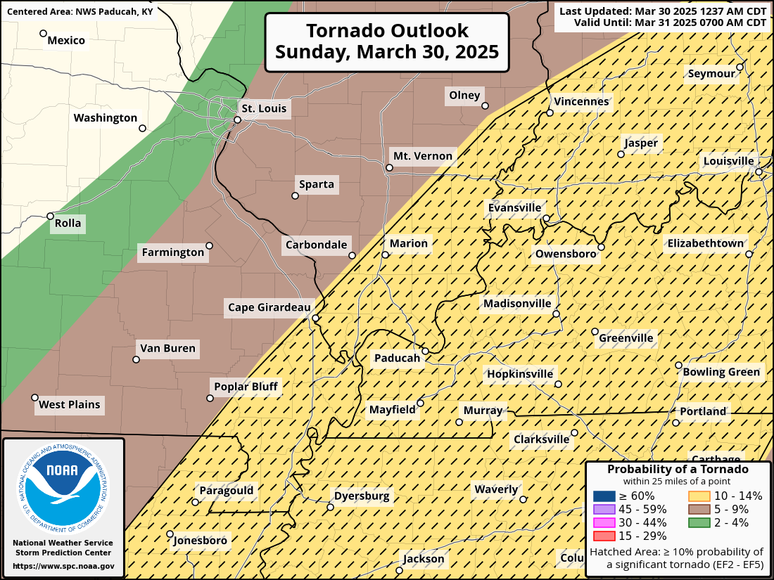
Tornado outlook. Hatched means strong tornadoes are possible.
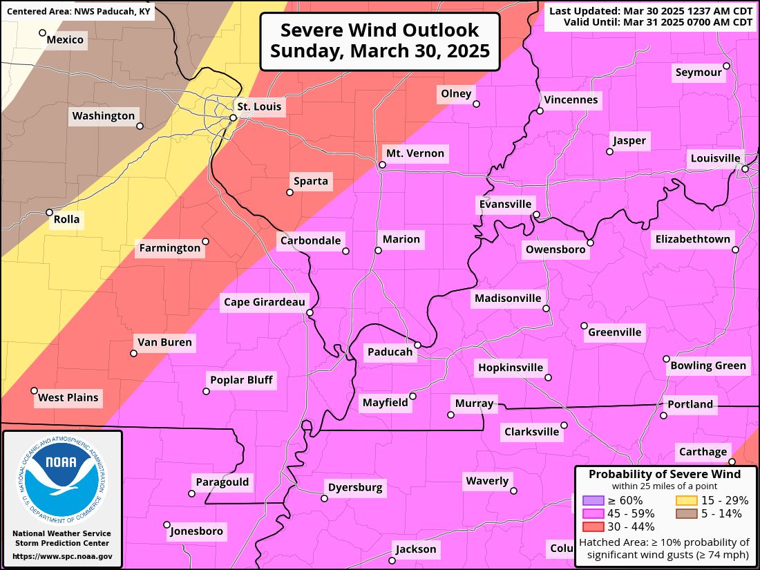
Wind outlook.
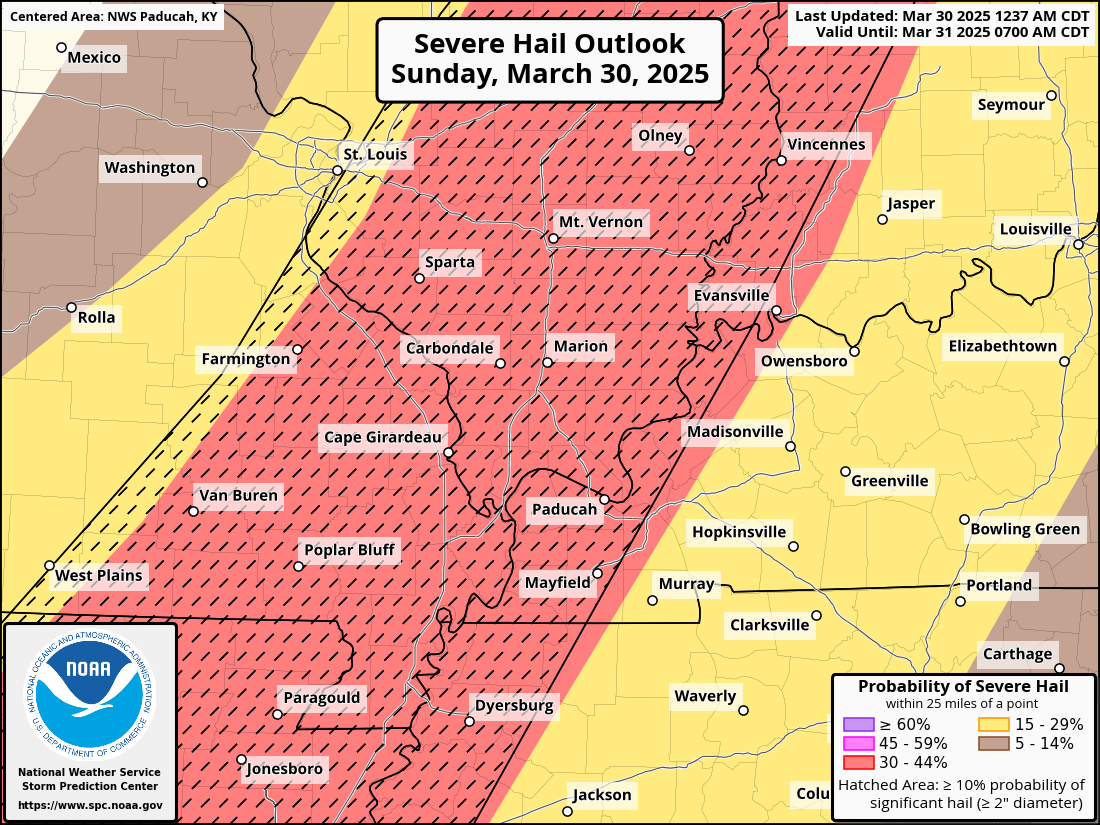
Hail outlook. Hatched means very large hail is possible.
.
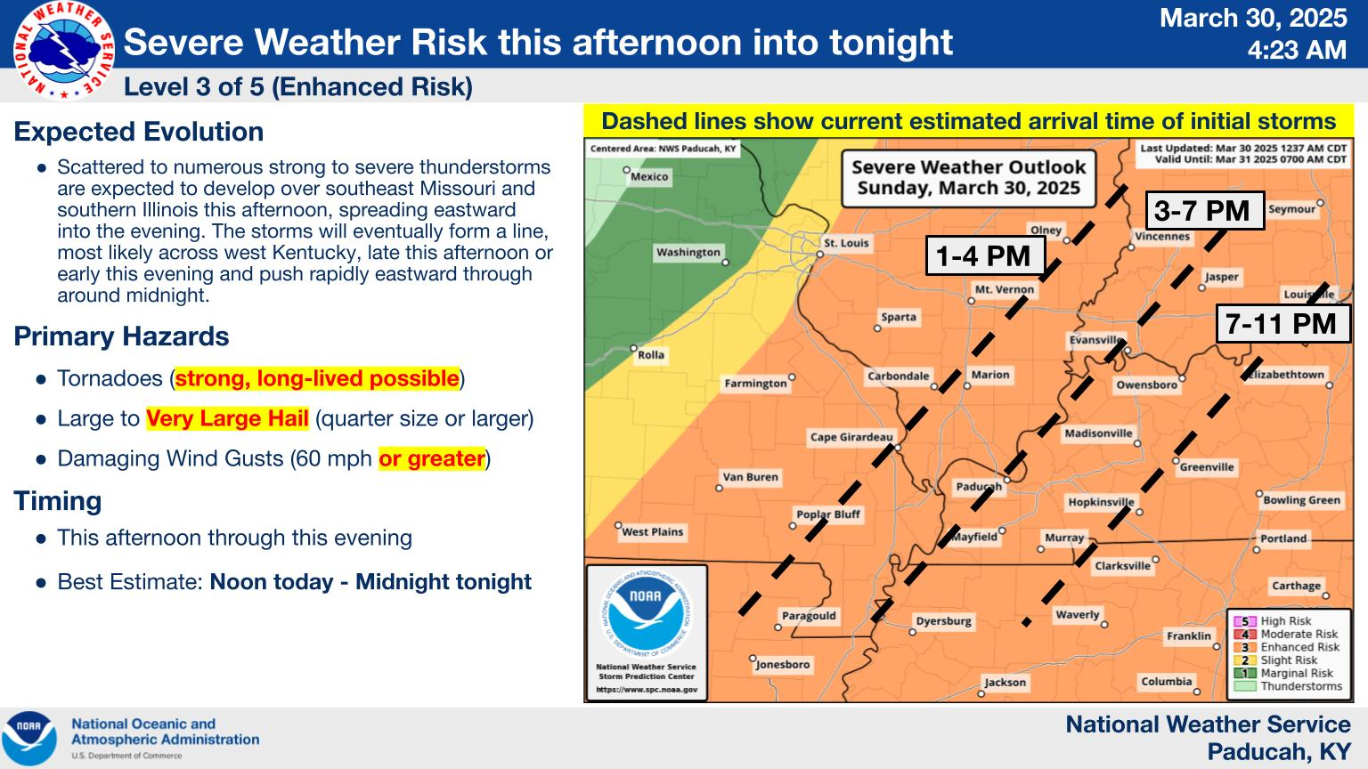
Here is the latest graphic from the NWS in Paducah, KY.
Keep in mind that these times may need adjusting. This is a general idea of what we are expecting.
.
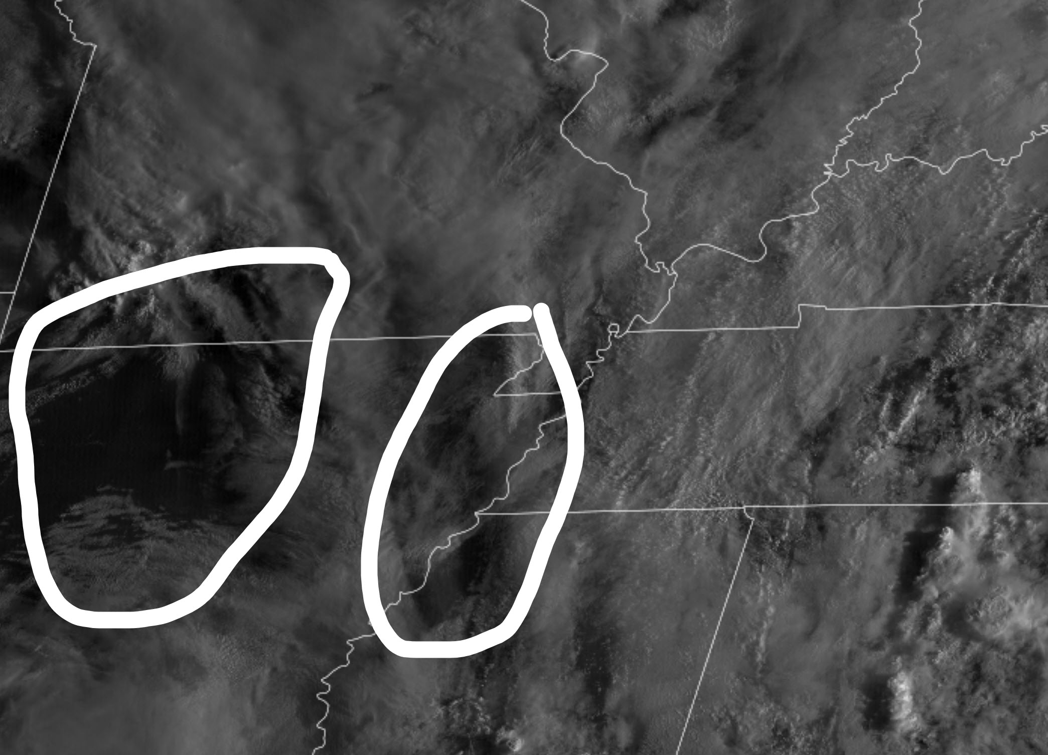
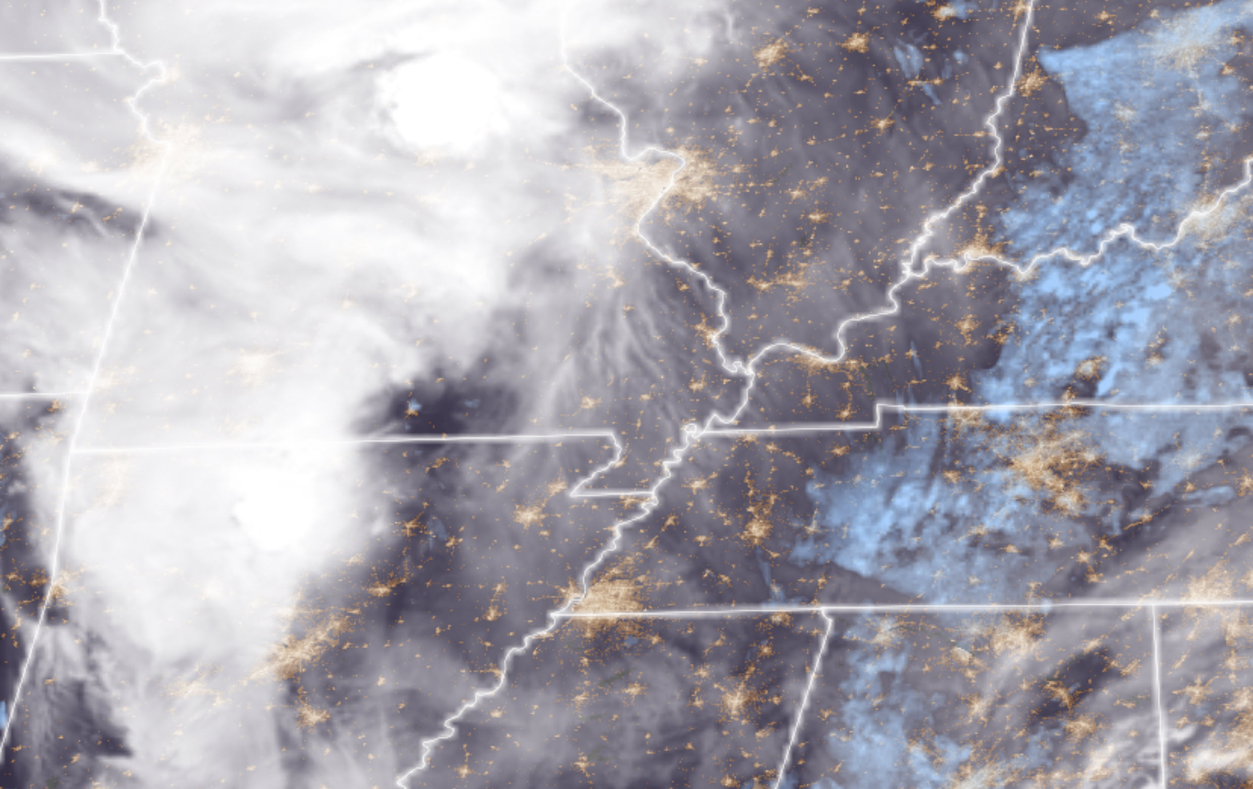
You can see quite a few clouds to our west with a complex of thunderstorms over central Missouri into northern Arkansas.
How this will influence storms later today will need to be monitored.
.
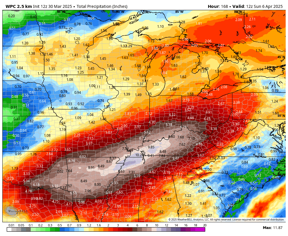
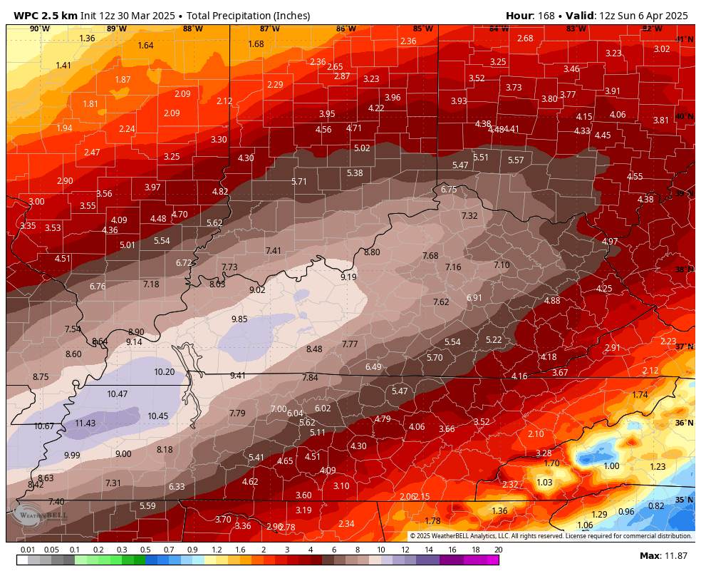
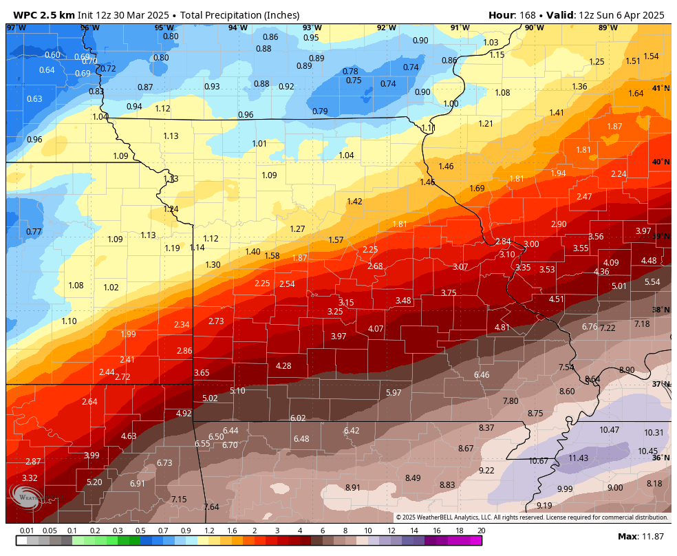
Here is the latest six-day rainfall outlook. Most of this will fall from Wednesday into Saturday. These are some big numbers. Let’s hope this does not verify.
This is a concern for flooding. It will be drawn out over several days.
.
 And Thursday
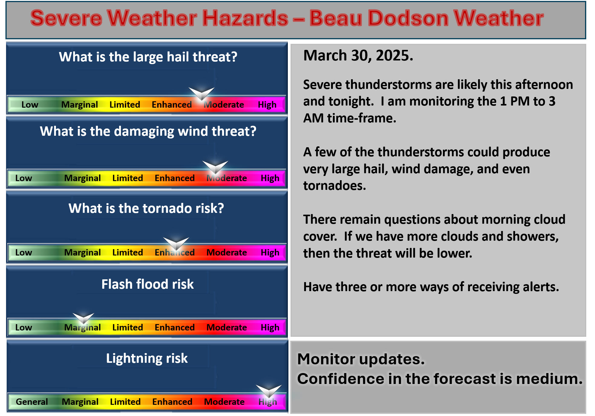
 8:30 AM UpdateWe have a risk of severe thunderstorms on Sunday afternoon and night. The primary concern will be 3 PM to 3 AM. Adjustments in the timing are possible if storms form ahead of the primary line.The concern will be very large hail, damaging wind, and even a few tornadoes.Threat matrix.
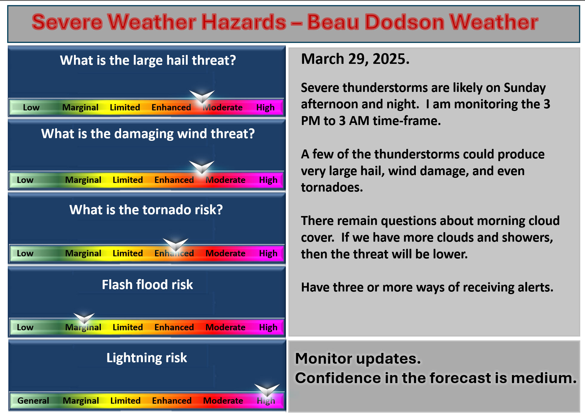 .Now is the time to review your severe weather safety plans. Make sure your safe place is prepared.
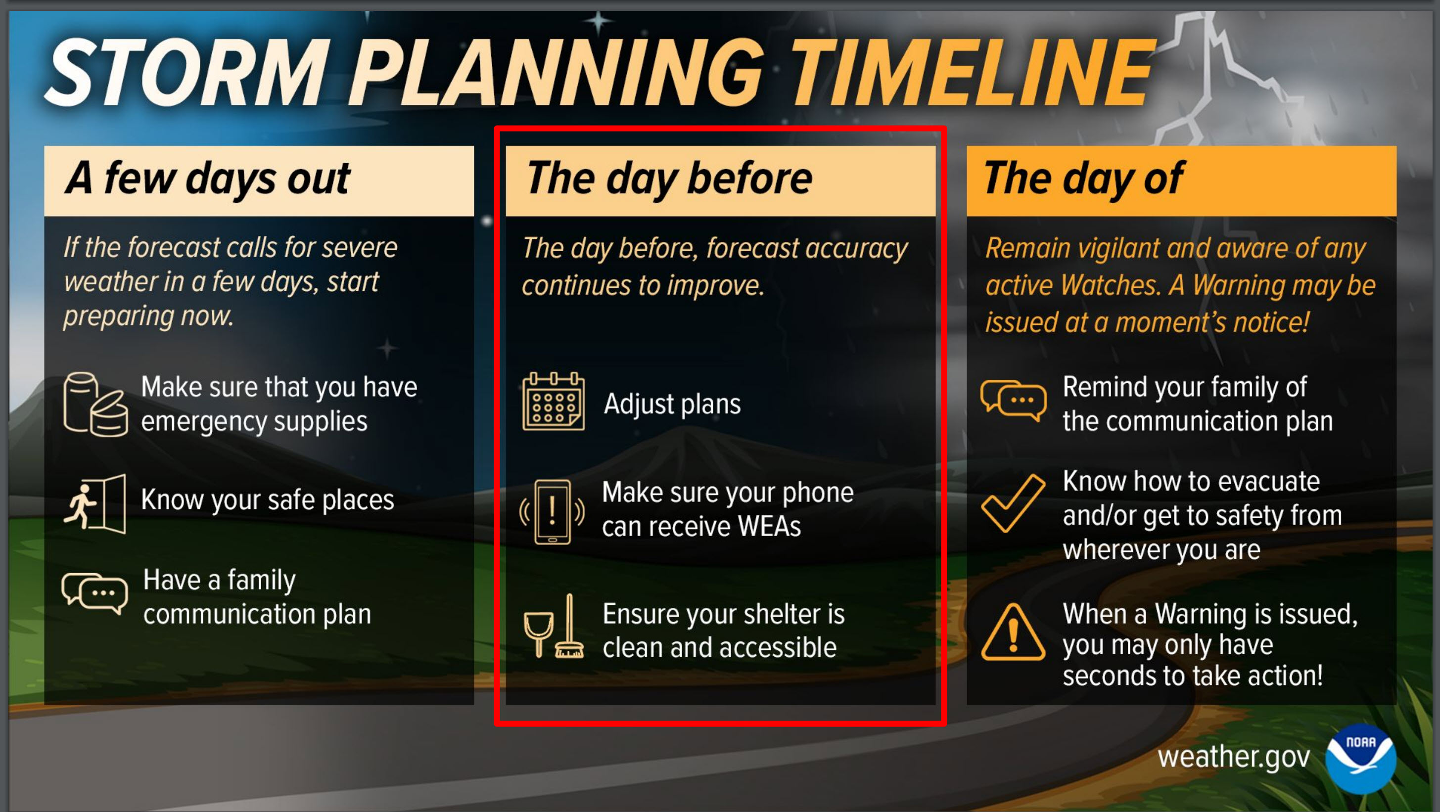 This could be an overnight event for some counties. Keep your keys and wallet near your bed. Keep your shoes and boots near your bed. Have a flashlight, as well.I recommend having helmets in your safe place, as well. For babies, have an infant car seat.


.
Make sure your weather radio is on. Make sure your devices are charged and not muted.
.

The timestamp (upper left) is in Zulu. 12z=6 am. 18z=12 pm. 00z=6 pm.
Double-click the animation to enlarge it.
This is the Hrrr model.
Double-click the animation to enlarge it.
.
![]()
Radars and Lightning Data
Interactive-city-view radars. Clickable watches and warnings.
https://wtalk.co/B3XHASFZ
Old legacy radar site (some of you like it better)
https://weatherobservatory.com/weather-radar.htm
If the radar is not updating, then try another one. If a radar does not appear to be refreshing, then hit Ctrl F5. You may also try restarting your browser.
Backup radar site in case the above one is not working.
https://weathertalk.com/morani
Regional Radar
https://imagery.weathertalk.com/prx/RadarLoop.mp4
Zoom National Radar
ZoomRadar

.
Live lightning data: Click here.
Real time lightning data (second source) https://map.blitzortung.org/#5.02/37.95/-86.99
.
.
.
We have a new service to complement your www.weathertalk.com subscription. This does NOTreplace www.weathertalk.com It is simply another tool for you to receive severe weather information.
.


We do have some sponsors! Check them out.
Roof damage from recent storms? Link – Click here
INTEGRITY ROOFING AND EXTERIORS!
⛈️ Roof or gutter damage from recent storms? Today’s weather is sponsored by Integrity Roofing. Check out their website at this link https://www.ourintegritymatters.com/

.
![]()
Make sure you have three to five ways of receiving your severe weather information.
Weather Talk is one of those ways! Now, I have another product for you and your family.
Want to add more products to your Beau Dodson Weather App?
Receive daily videos, weather blog updates on normal weather days and severe weather and winter storm days, your county by county weather forecast, and more!
Here is how to do add those additional products to your app notification settings!
Here is a video on how to update your Beau Dodson Weather payment.
.
The app is for subscribers. Subscribe at www.weathertalk.com/welcome then go to your app store and search for WeatherTalk
Subscribers, PLEASE USE THE APP. ATT and Verizon are not reliable during severe weather. They are delaying text messages.
The app is under WeatherTalk in the app store.

Apple users click here

Android users click here
.
Find Beau on Facebook! Click the banner.

.
Find Beau on Twitter! Share your weather photos! @beaudodson

 .
.