Sunday, June 11, 2023
4:15 PM
.
3:15 PM
Extreme southern Alexander. Extreme south Pulaski. Far northeast Mississippi. Ballard County.
A band of storms is moving east/southeast through the area. It is moving at 25 to 35 mph.
There are pockets of isolated high wind gusts embedded within this line.
If you have an outdoor event then be weather aware until the storms pass.
.
3 PM
The overall severe weather risk remains fairly low for this afternoon (at any given spot). We are not expecting widespread severe weather.
.
2:20 PM
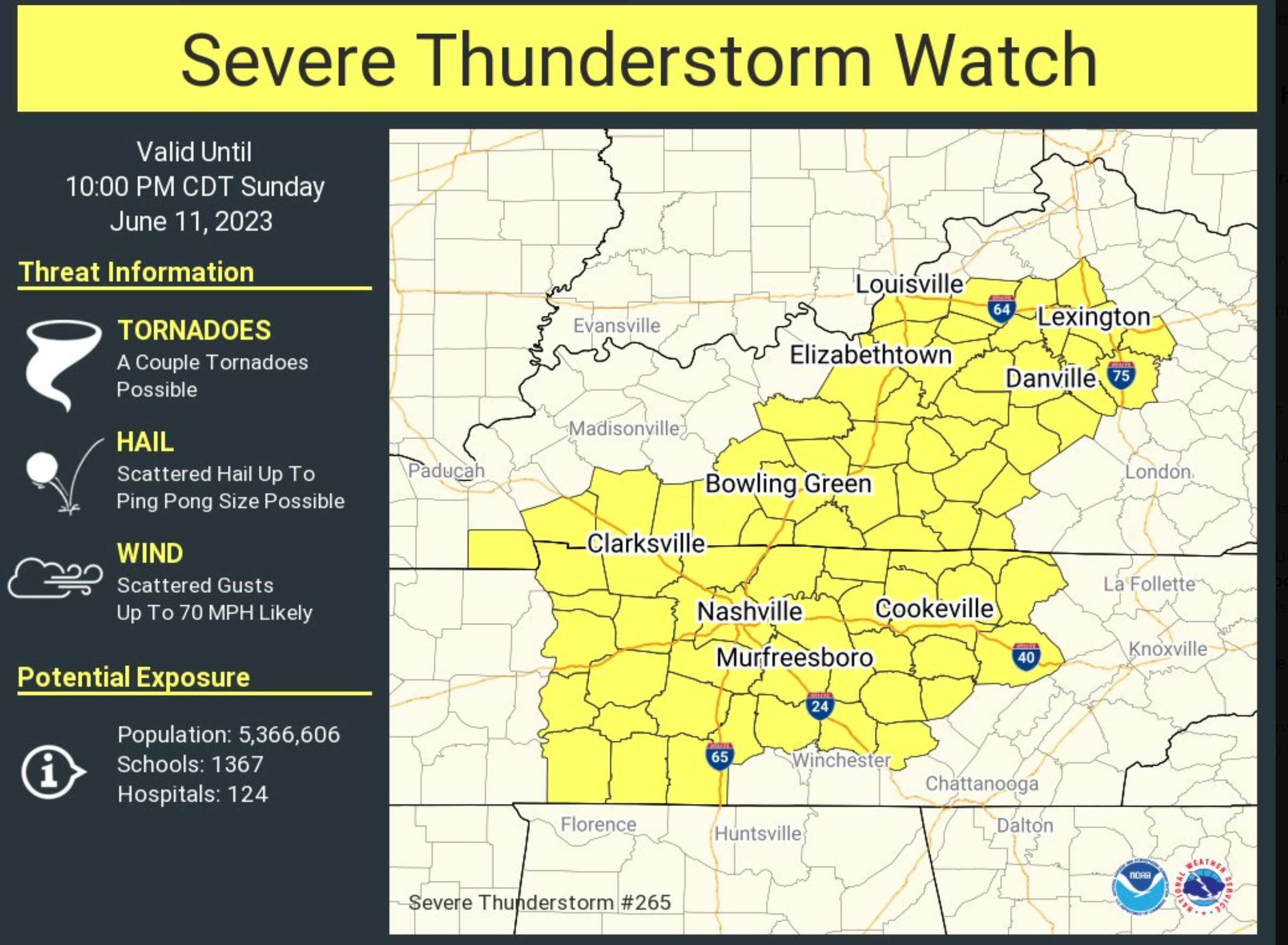
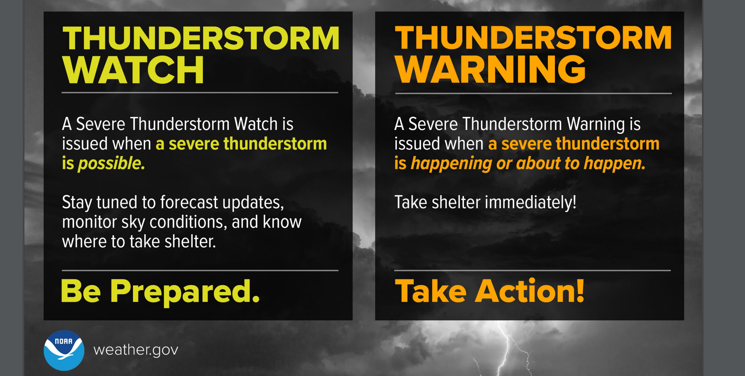
A severe thunderstorm watch has been issued for a few of my forecast counties.
There could be some severe thunderstorms just outside this watch box, as well.
Watch the counties just to the left of it.
SPC watch information. More details – CLICK HERE
.
2 PM Update
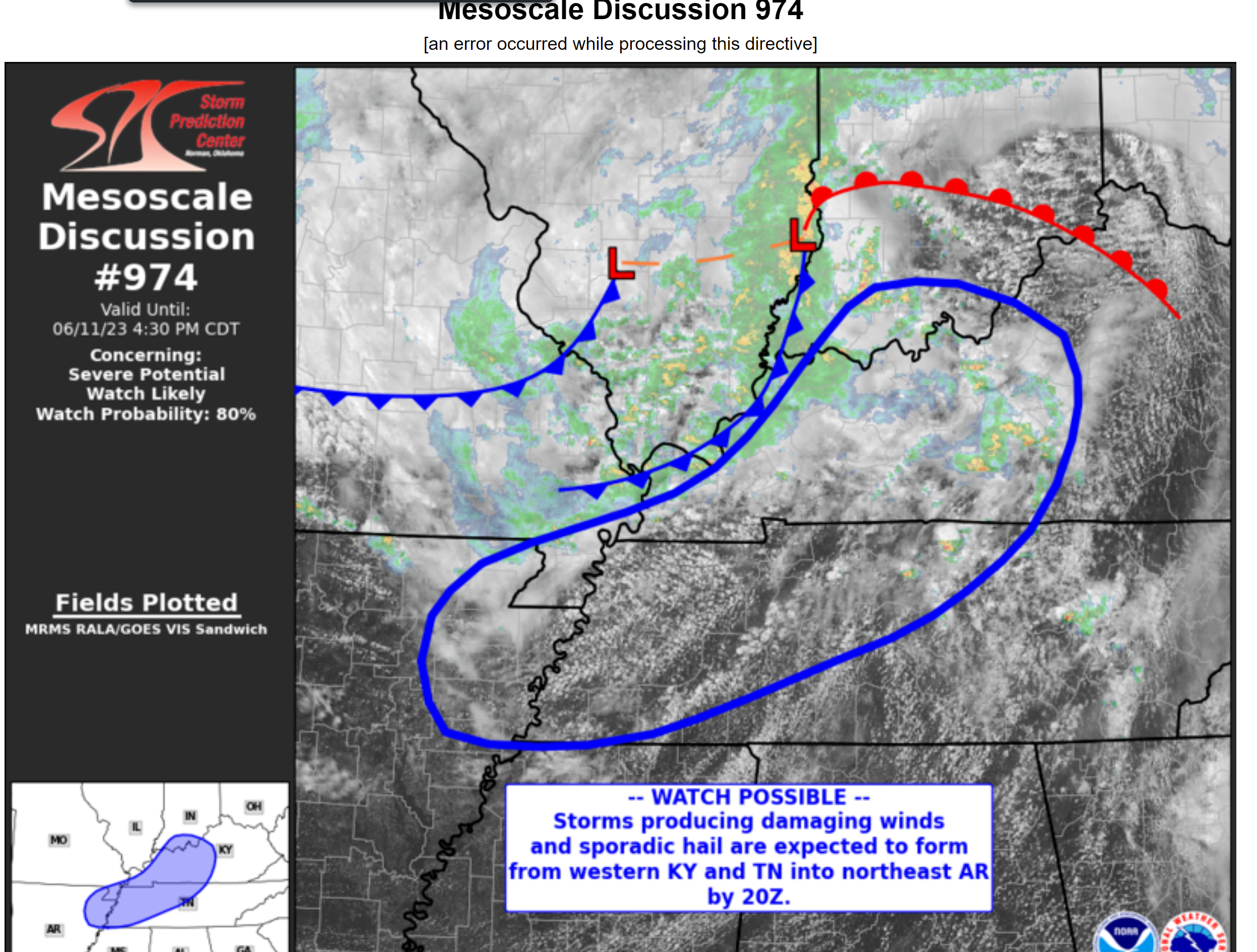
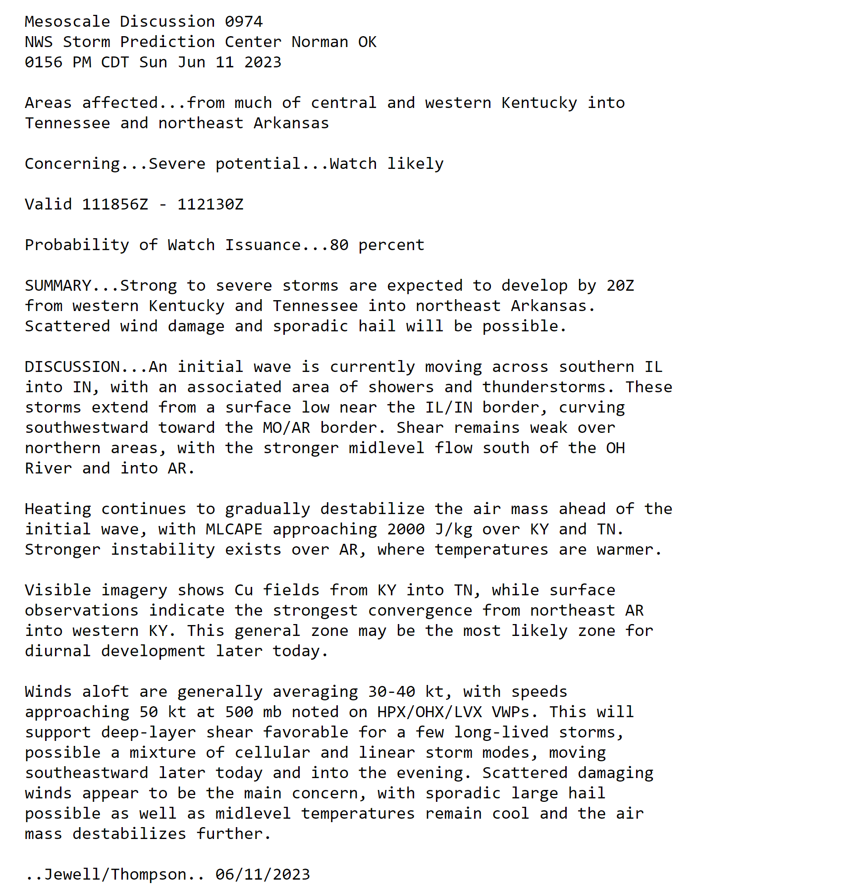
A severe thunderstorm watch may be issued shortly for portions of the region.
Double click the images/text to enlarge them.
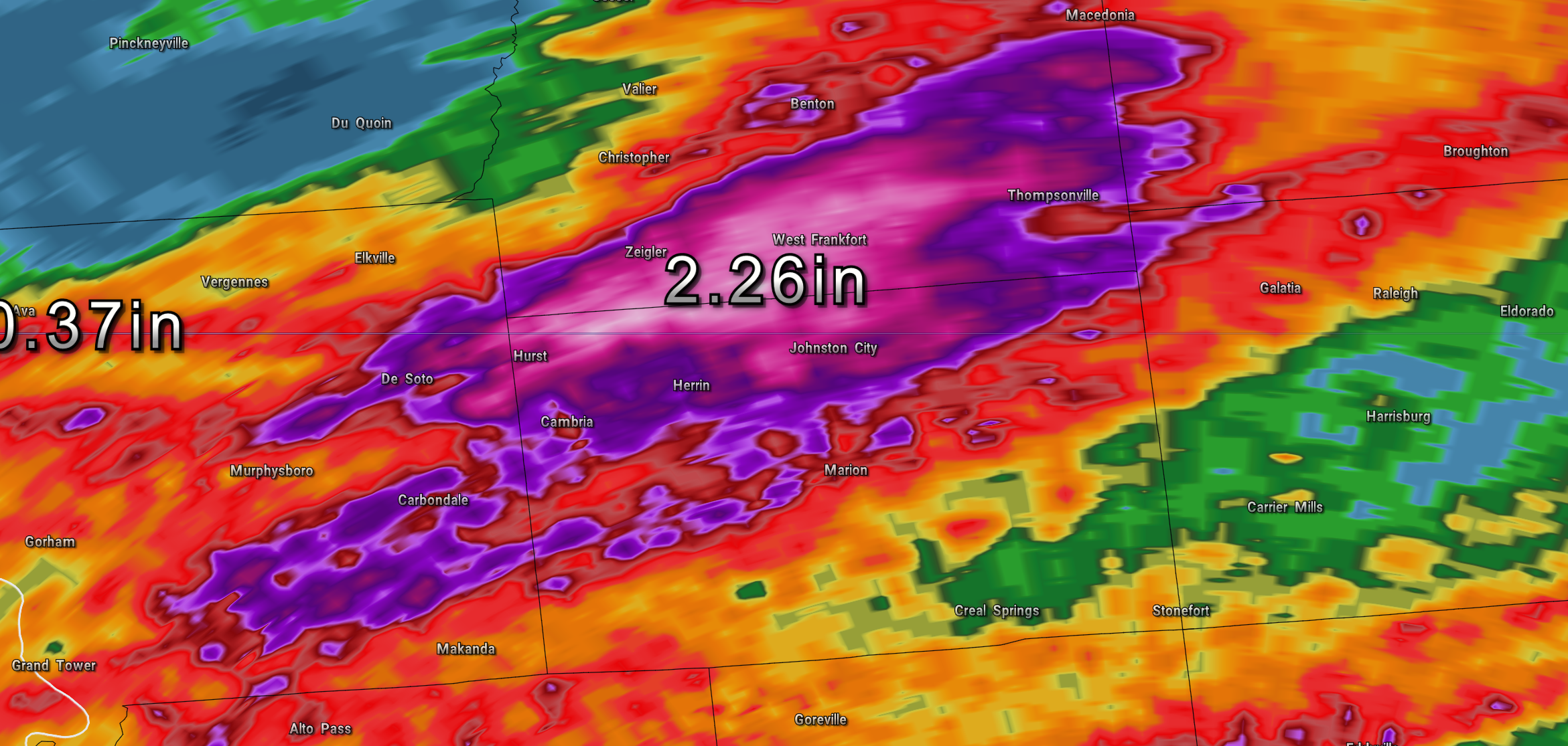
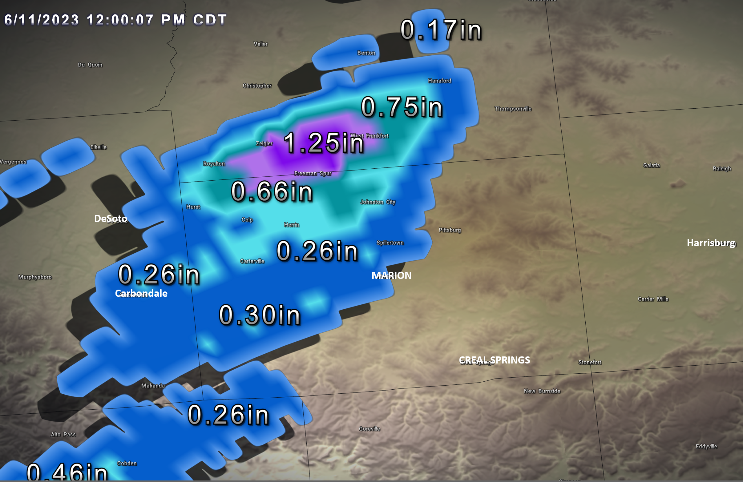
Check out the rain totals in Williamson and Franklin Counties (southern IL)
.
12:30 PM
12:05 PM
Double click on the graphic to enlarge it.
Rain totals, thus far, in Williamson County, IL. Just showing you what the storms are producing.
Keep in mind, some places will receive no rain today or very little. Others may pick up one to two inches.
11:30 AM
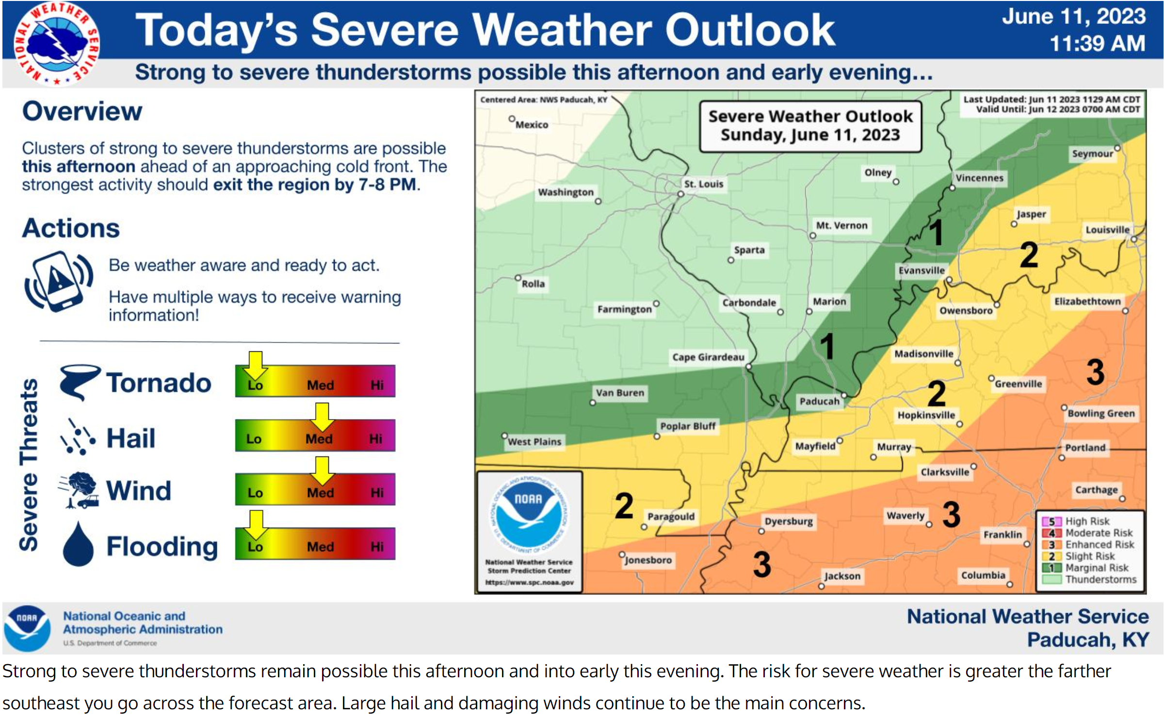
Statement from the National Weather Service
The latest HRRR (14Z) shows a transient bow echo over the southern Pennyrile around 21Z.
Previous runs indicated more and longer-lived bow echoes across the southern tier of counties in west Kentucky.
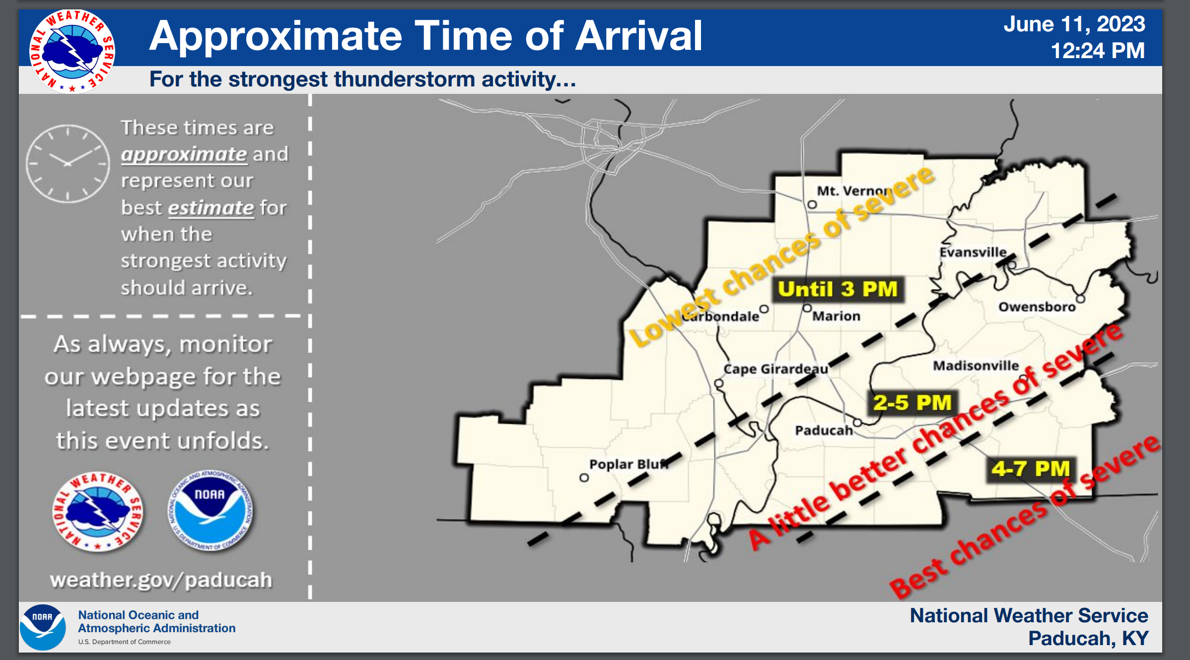
The shear is not that great and we are still waiting for some more persistent sunshine to destabilize the region. The convection should begin to pick up in coverage and intensity over southeast Missouri between Noon to 1 PM and then spread eastward through southern portions of west Kentucky and out of the region by around 5 PM.
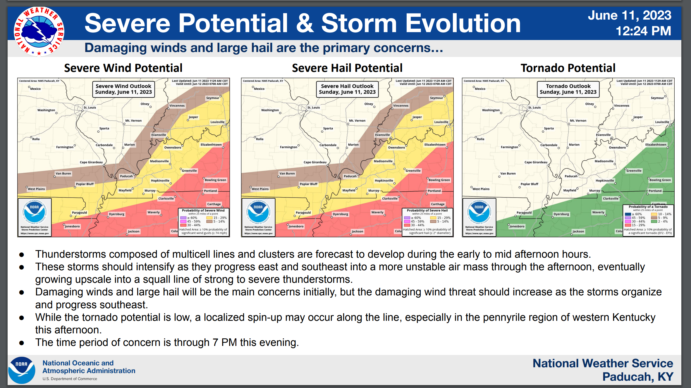
Damaging wind looks like the greatest concern at this time, but large hail cannot be ruled out.
…..
7:00 AM
Storm Tracking Links at the bottom of this post. See the Beau Dodson Weather Radars and lightning links.
Today’s Q&A Severe Weather Thread
Highlights
1. Some of today’s thunderstorms could produce damaging wind and hail. The threat is highest over Kentucky and Tennessee. A lower threat over Missouri and Illinois.
Lightning is a concern for outdoor venues today and/or outdoor activities. When thunder roars, head indoors.
There is also a lake wind advisory in effect for area rivers and lakes. Use care. Winds may gust above 20 mph.
2. The primary time-frame of concern will be 12 PM through the evening hours.
3. Rain totals today and tonight will range from very little/none to over two inches. Generally, the most common totals will be 0.5″ to 1.0″. There will be LARGE differences in rain totals from county to county (and even within counties). This is a typical summer warm rain event. A wide range of totals.
4. Our much anticipated pattern shift. across North America, is underway. The omega block is finally breaking down. Rain chances will become more frequent over the coming days and weeks (into July).
Discussion
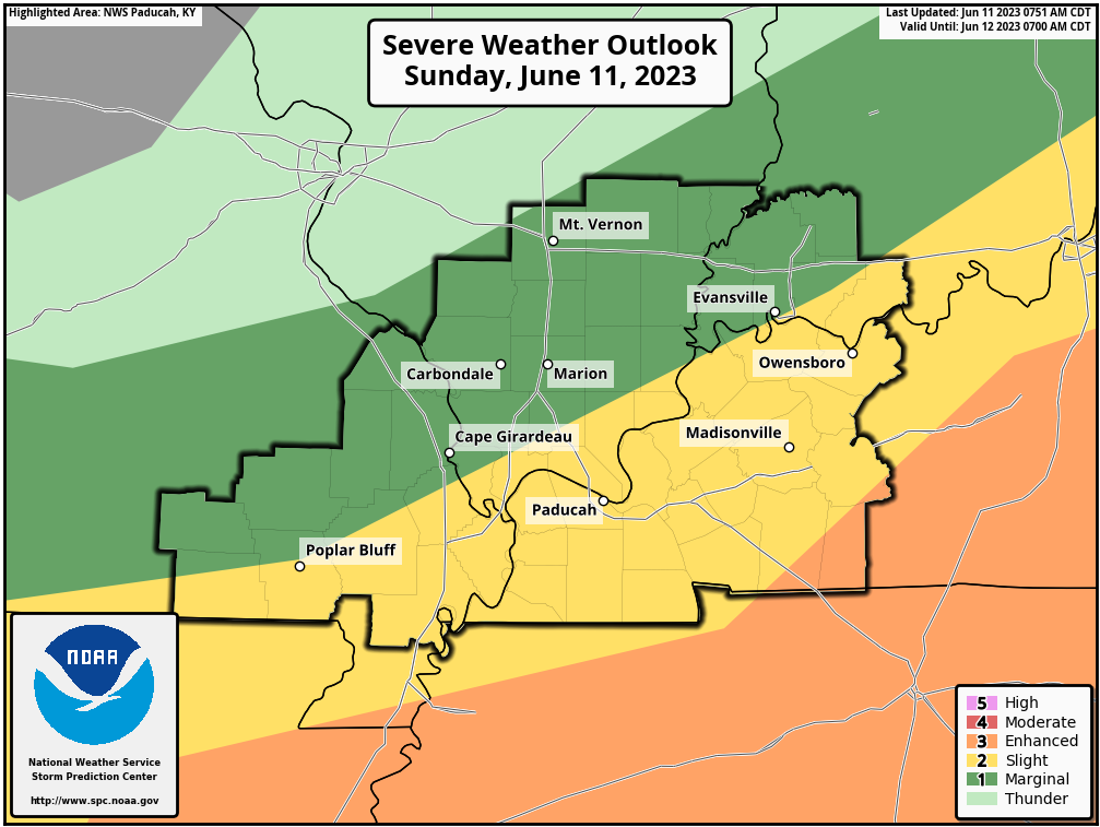
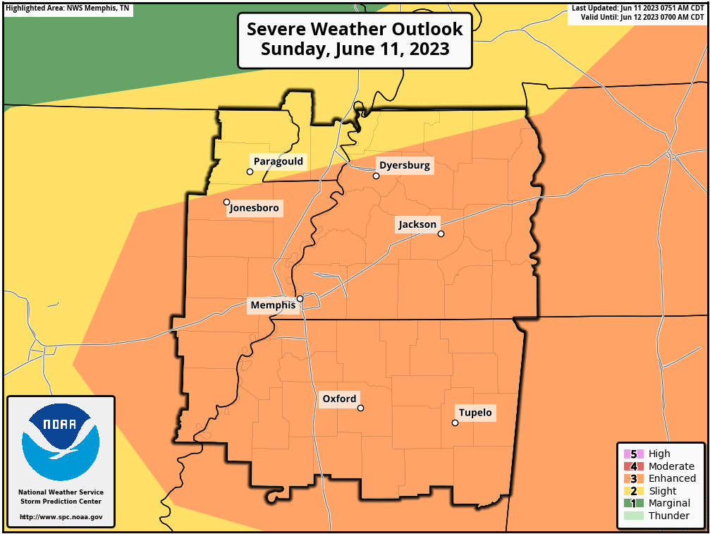
Here is the latest Storm Prediction Center’s severe weather outlook.
Light green is sub-severe. Not severe.
Dark green is a level one threat. The lowest threat level.
Yellow is a level two threat.
Orange is an enhanced threat. A level three threat. The orange is the highest level on this map.
Don’t focus too much on the colors from county to county. Just know that a few storms could become severe later today.
Northern view
Southern view (northeast Arkansas, the Missouri Bootheel, and western Tennessee
Thunderstorms formed last night across portions of Missouri and Illinois. Those storms moved south and southeast and weakened with time.
New thunderstorms are now forming over Missouri and Illinois. These showers and thunderstorms are moving eastward.
The atmosphere will become increasingly unstable today.
Some of the thunderstorms could perk up to severe limits and produce damaging wind and hail. A short-lived QLCS tornado can’t be ruled out.
QLCS tornadoes typically form within a line thunderstorms. They last a few seconds to a few minutes. They are usually EF0 to EF1 in strength. Occasionally, a bit higher.
The overall tornado risk is low.
Today’s atmosphere will be most unstable over Kentucky and Tennessee.
A few warnings may be issued this afternoon and evening. Monitor your Beau Dodson Weather app.
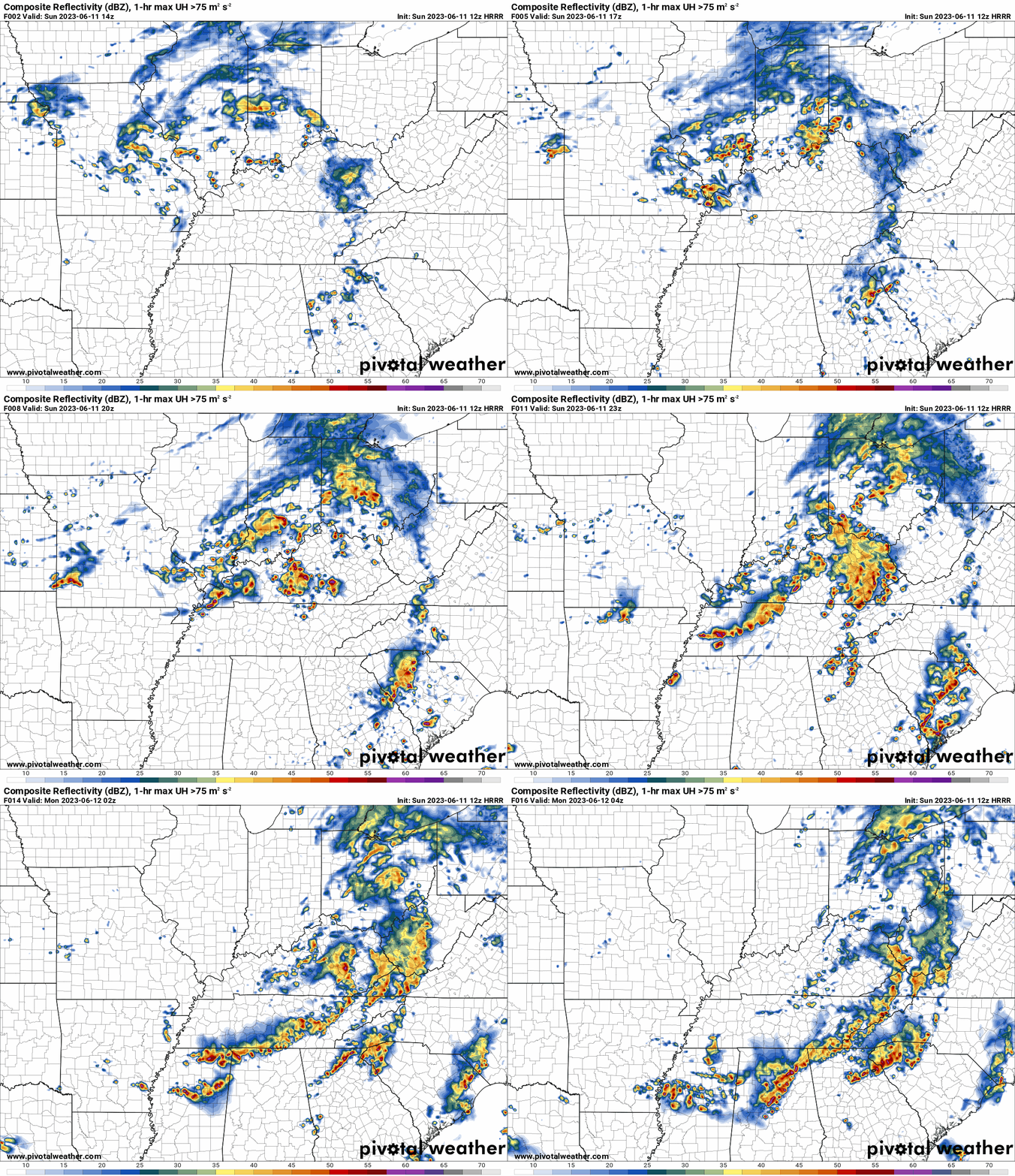
Here is the Hrrr future-cast radar. Zulu time. 18z=1 PM. 22z=5 PM
Double click on the image to enlarge it. This gives you a general idea of how the storms may form today. This is a model forecast, so it won’t be perfect.
![]()
.

Radars and Lightning Data
Interactive-city-view radars. Clickable watches and warnings.
https://wtalk.co/B3XHASFZ
If the radar is not updating then try another one. If a radar does not appear to be refreshing then hit Ctrl F5. You may also try restarting your browser.
Backup radar site in case the above one is not working.
https://weathertalk.com/morani
Regional Radar
https://imagery.weathertalk.com/prx/RadarLoop.mp4
** NEW ** Zoom radar with chaser tracking abilities!
ZoomRadar
Lightning Data (zoom in and out of your local area)
https://wtalk.co/WJ3SN5UZ
Not working? Email me at beaudodson@usawx.com
National map of weather watches and warnings. Click here.
Storm Prediction Center. Click here.
Weather Prediction Center. Click here.
.

Live lightning data: Click here.
Real time lightning data (another one) https://map.blitzortung.org/#5.02/37.95/-86.99
Our new Zoom radar with storm chases
.
.

Interactive GOES R satellite. Track clouds. Click here.
GOES 16 slider tool. Click here.
College of DuPage satellites. Click here
.

Here are the latest local river stage forecast numbers Click Here.
Here are the latest lake stage forecast numbers for Kentucky Lake and Lake Barkley Click Here.
.
.
Find Beau on Facebook! Click the banner.




 .
.