.
SCROLL DOWN THE PAGE FOR UPDATES
.
Click on the words below to subscribe
Storm Tracking Links
Interactive local city-view radars. Clickable watches and warnings.
https://wtalk.co/B3XHASFZ
Backup radar site in case the above one is not working.
https://weathertalk.com/morani
Regional Radar
https://imagery.weathertalk.com/prx/RadarLoop.mp4
*NEW* Zoom interactive radar (with storm chaser streams)
https://wtalk.co/AVWG7GM7
Real time lightning tracker system two.
https://map.blitzortung.org/#5.02/37.95/-86.99
Lightning Data (zoom in and out of your local area)
https://wtalk.co/WJ3SN5UZ
The app is for www.weathertalk.com subscribers. Subscriber first and then download the app.
Apple users click here. Android users click here.
What you need to know
Key Points
- Showers and thunderstorms ongoing today. Locally heavy rain.
- A conditional risk that a few thunderstorms could become severe late this afternoon into this evening.
- Have your Beau Dodson Weather app on. Check it. Make sure you have not logged out of the app.
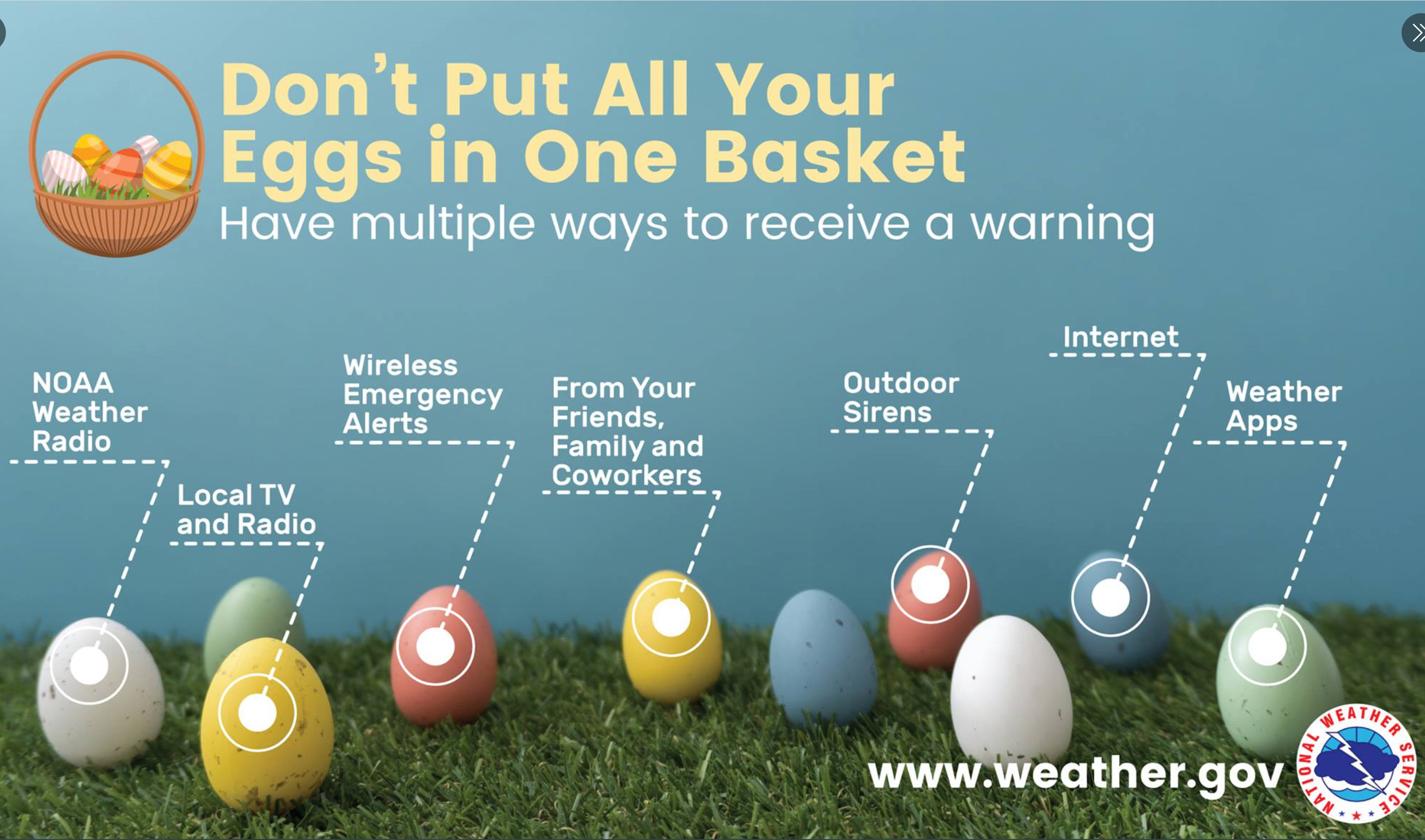
- Have THREE to FIVE ways of receiving your severe weather warnings.
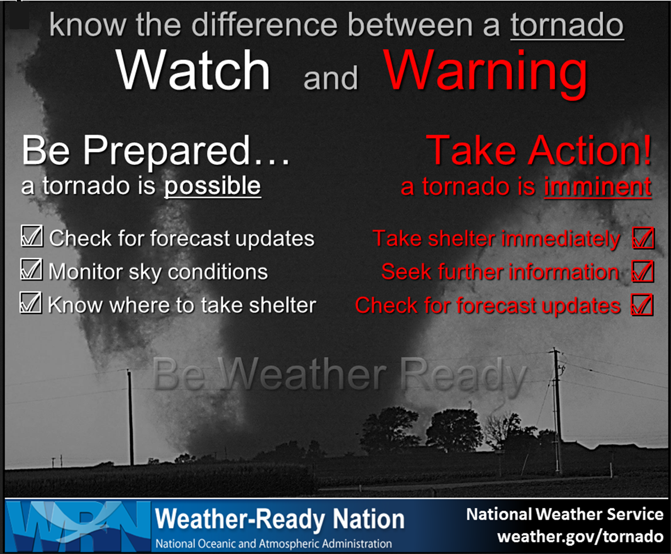
- Remember, a watch means to monitor updates. A warning means to seek shelter. A warning is a higher threat and means to seek shelter immediately. Severe weather may occur in or near your location.
.

Here is Facebooks’ Severe Weather Q&A threads.
Link https://www.facebook.com/beaudodsonweather
Good day, everyone.
BOTTOM LINE
The risk of severe weather, later today/this evening, is uncertain. There remain questions about instability. The lack of instability could mean the risk of severe weather is fairly low.
With that said, if the frontal boundary drifts back northward, then a few of the thunderstorms could produce damaging wind and a brief tornado.
The concerns are a bit higher from the Missouri Bootheel into Kentucky and Tennessee vs areas farther to the north northwest.
The risk of severe thunderstorms and tornadoes is greater farther south of our local area.
Monitor your Beau Dodson Weather app later this afternoon and evening.
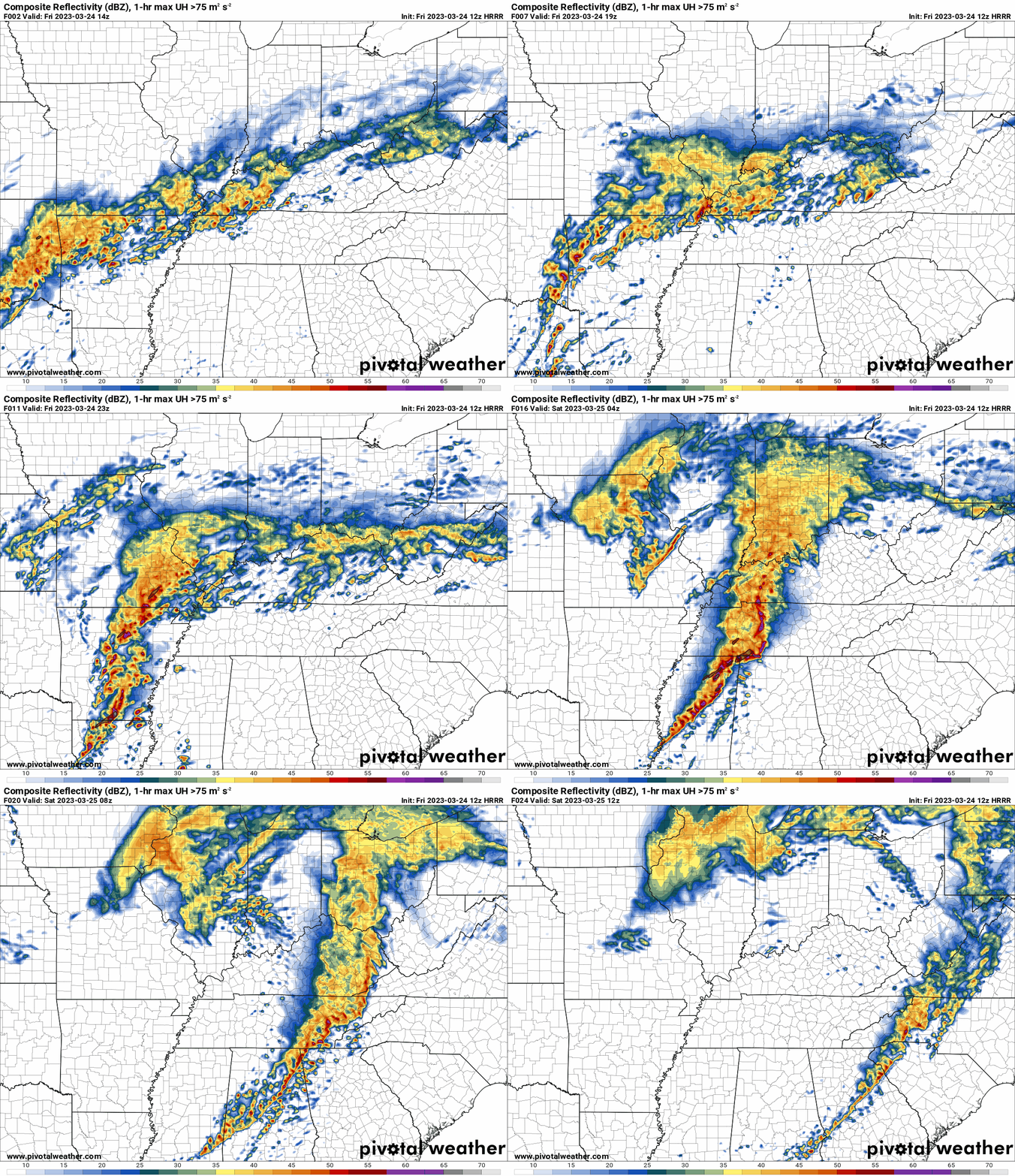
Expect a line of thunderstorms to form along the cold front and move east/northeast through the region. See the future-cast radar below.
The timing for any severe weather threats would likely be the 4 PM to 10 PM time-frame. Then, decreasing concerns after that time.
.
Weather Analysis
10:30 PM
The threat of severe thunderstorms winds and tornadoes has ended over most of the region. Christian and Todd Counties still have intense storms, but they are quickly moving out of that area, as well.
Avoid flooded roadways.
7:45 PM Severe Weather Update
Some good news.
The severe threat has ended for Missouri and Illinois. It has ended for a good chunk of Kentucky, as well.
Heavy rain will remain a concern in the above mentioned areas.
The only area that I am watching for some intense/severe storms will be from northwest Tennessee into the LBL area of western Kentucky and then northeast towards Trigg, Christian, and Todd Counties.
The severe weather threat will end from southwest to northeast as a line of storms rapidly moves across the region. Overall, the severe weather risk at any given point location is low.
7 PM
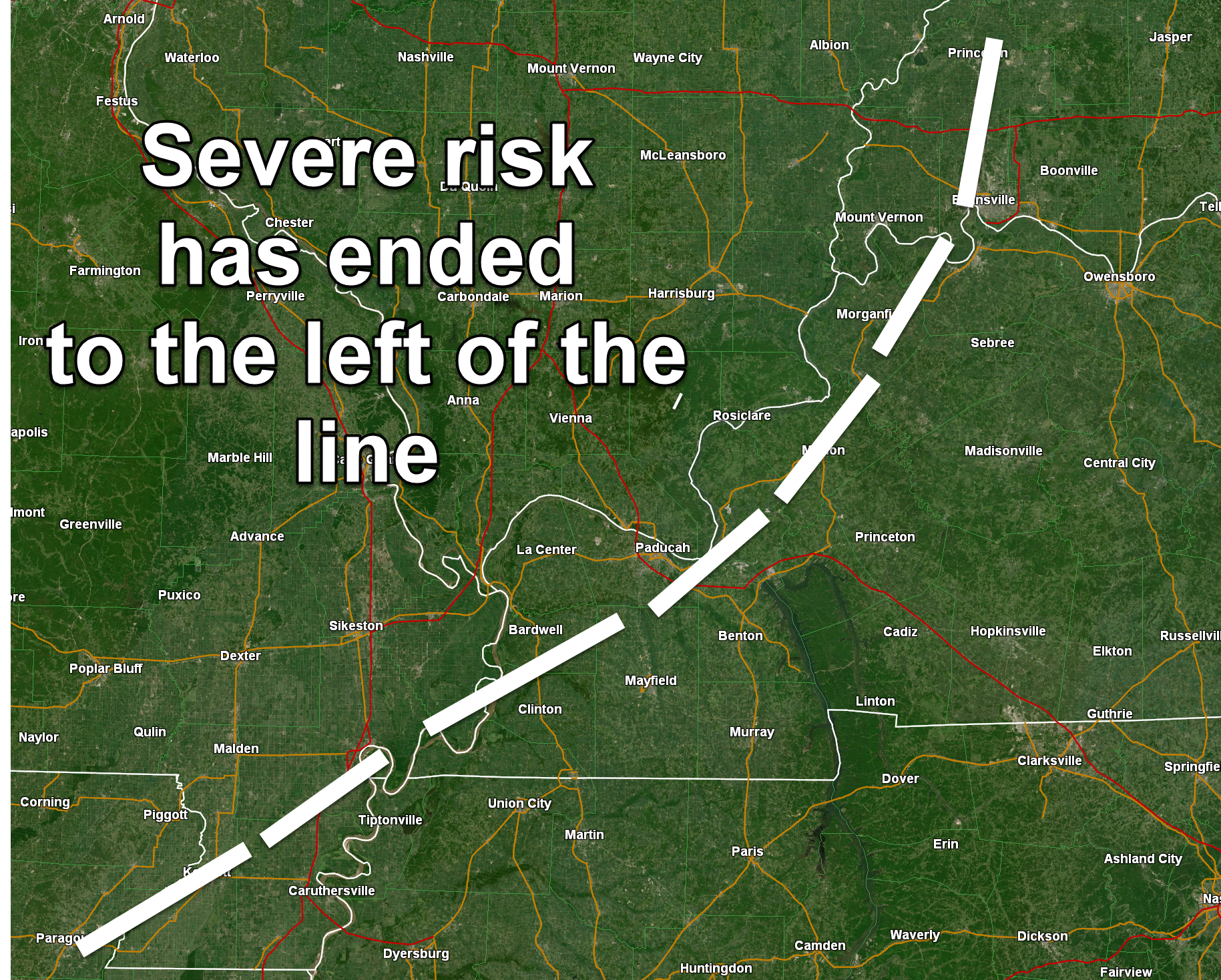
The severe risk is slowly ending northwest to southeast. I am watching storms coming out of northwest Tennessee. That could bring a severe threat to portions of NW TN and western KY. To the southeast of the white line.
6:15 PM
March 24, 2023
6:15 PM
Severe Weather Statement
Dunklin, Pemiscot, New Madrid, Mississippi, Lake, Obion, Weakley, Carlisle, Hickman, Fulton, and Graves. I will monitor other counties and send out additional statements if necessary.
Scattered thunderstorms continue to move through the region.
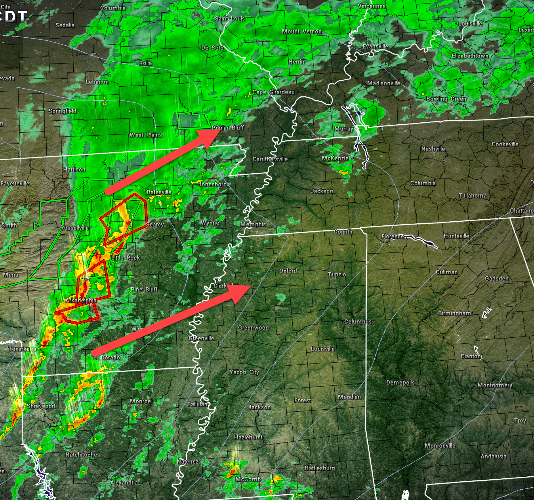
Of greater concern is a band of intense thunderstorms moving rapidly northeast out of Arkansas. This band of storms is forecast to maintain intensity into the Missouri Bootheel, far southeast Missouri, western Kentucky, and northwest Tennessee.
The NWS may need to issue a few severe thunderstorm warnings if the storms show any strengthening. The primary concern will be wind gusts of 60 to 70 mph.
There is some spin in the atmosphere and short-lived tornadoes can’t be ruled out.
Have multiple ways of receiving severe weather information this evening. The line will also produce extremely heavy downpours that may briefly reduce visibility to feet.
4 PM
Storms are tracking northeast. I am watching then closely. These will be the ones that cause us problems after 6 PM and before midnight. Fast moving line of storms.
1 PM
We have a threat of heavy rain today and severe storms this afternoon into this evening.
There are concerns about an enhanced area of severe risk from the MO Bootheel into Kentucky/Tennessee. Perhaps somewhat lower risk farther north.
The primary time-frame of concern for severe thunderstorms will be 4 PM through 11 PM.
Some of the storms could contain wind gusts of 70+ mph and I can’t rule out isolated tornadoes.
There is quite a bit of ongoing precipitation in the region. This is raising questions about how unstable the atmosphere will or won’t become. Often times, clouds and rain will keep the atmosphere a bit more stable.
With that said, there are indications that a meso-low will form in the Bootheel this evening and rapidly move northeast into extreme southern Illinois, western Kentucky, and northwest Tennessee.
If this happens, then the threat of severe weather will be increasing in those areas. Closely monitor your Beau Dodson Weather app and have additional sources for receiving your severe weather information.
9 AM Update
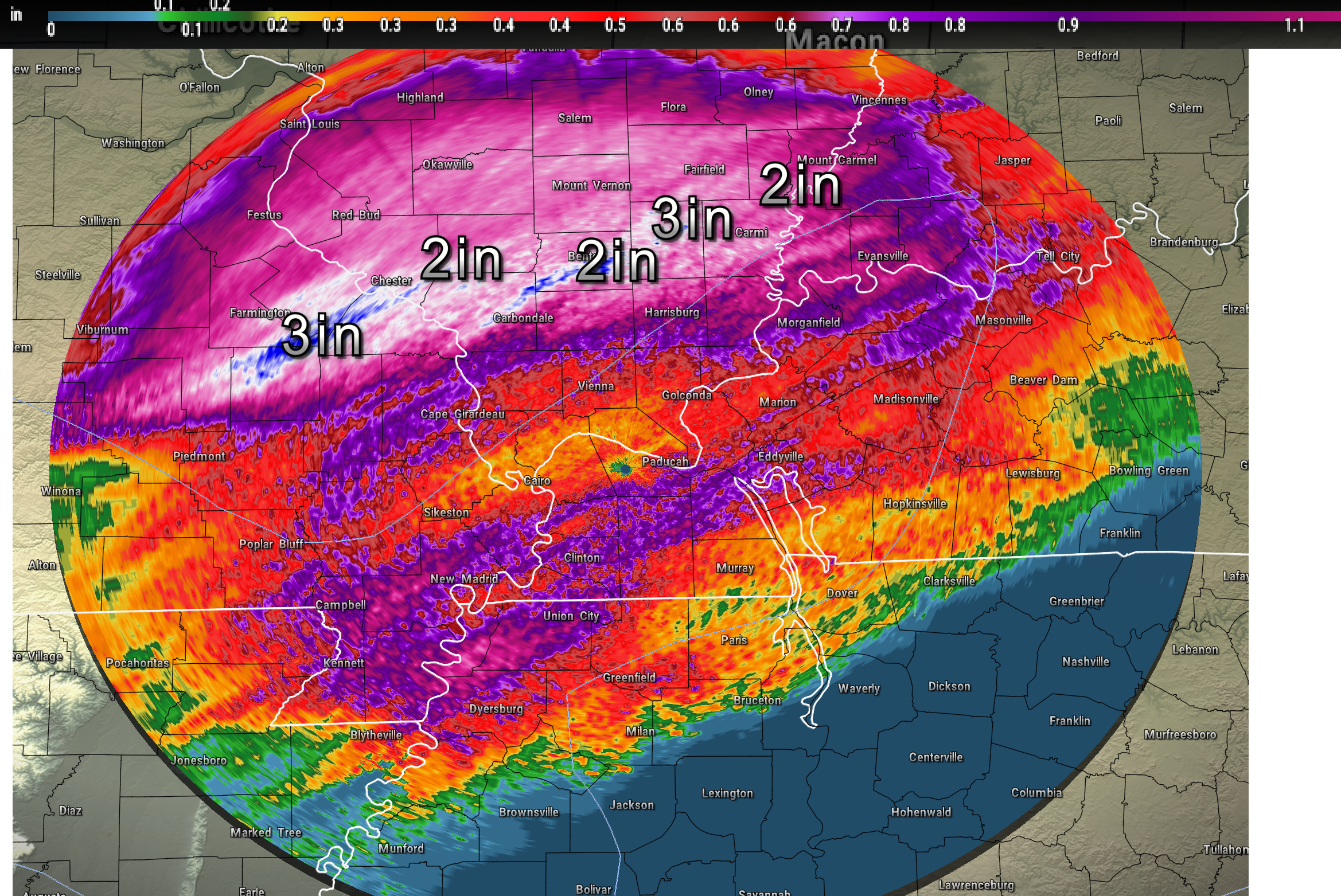
A frontal boundary is draped across our region. This frontal boundary produced heavy rain overnight across portions of southeast Missouri and southern Illinois. Rain totals of one to three inches were reported in many areas.
Here were the radar estimated rain totals as of 8 AM. You can see that heavy band over our northern counties. That is what fell overnight. Lesser totals as you travel southward. That was the forecast.
Additional heavy rain is possible today and tonight. Some of these other areas will fill in with one and two inch+ amounts.
The frontal boundary responsible for the heavy rain sagged southward this morning.
It is now across Arkansas into southern Missouri, Kentucky, and Tennessee.
The position of this boundary is key to where the threat of severe weather will develop this afternoon into tonight.
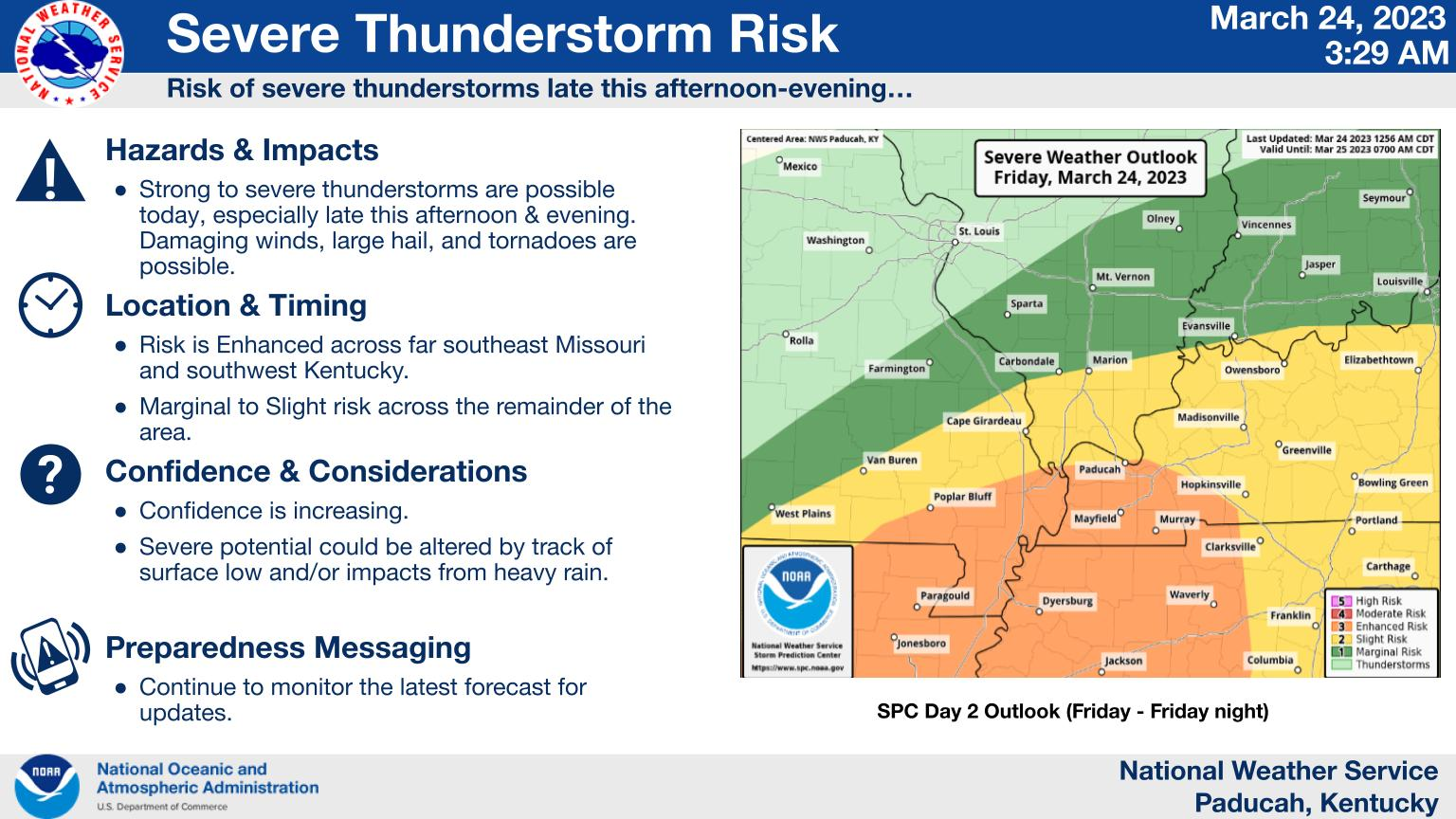
The Storm Prediction Center has outlined our region for the threat of severe weather. Again, some changes in this are still possible. If the front remains farther south, then the orange colors are too far north.
Here were a few graphics produced by our local NWS offices. You get the general idea.
It is possible that the enhanced (orange) risk is too far north northeast. Again, this remains a question in the forecast.
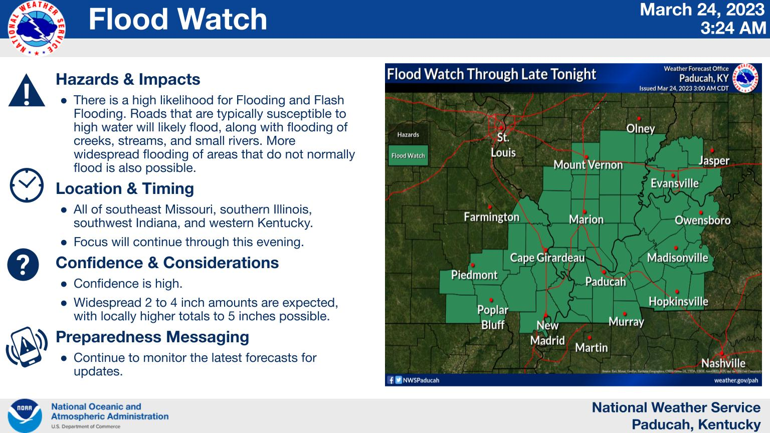
A flood watch covers portions of the region, as well.
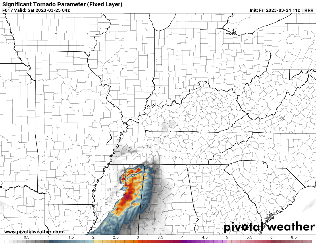
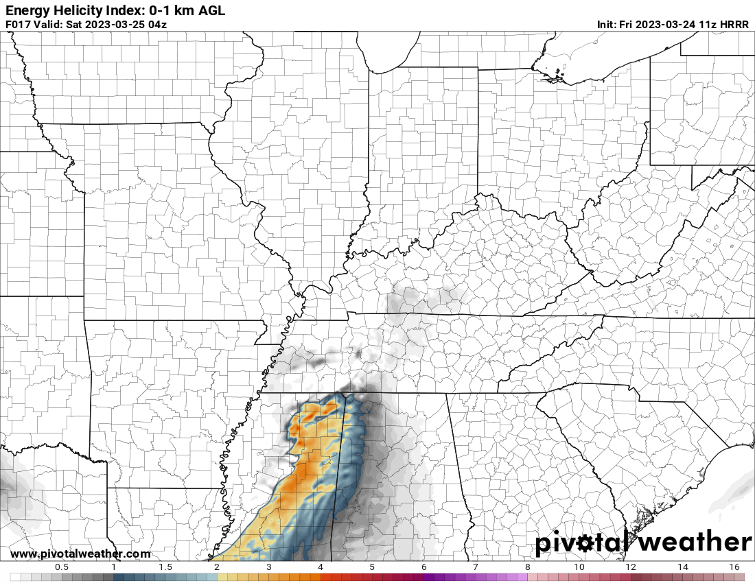
The Hrrr model shows higher instability and spin in the atmosphere south of us later today and tonight.
The NAM model is farther north.
Here is the Hrrr. You can see the significant tornado parameter spikes over Mississippi.
If the Hrrr model is correct then our severe threat would mainly be damaging wind and maybe an isoalted tornado risk, but the more intense storms would be down in Mississippi.
.
Monitor updates through the day. I will post updates here on the blog.
SPC
The Storm Prediction Center has outlined our region in a level one and two severe weather risk (for Thursday/Thursday night).
Keep in mind, the Storm Prediction Center could still shift these colors around.
The bottom line is not to focus on the SPC colors, but focus on the forecast. A few severe storms are possible Thursday/Thursday night.
Light green is where thunderstorms may occur but should be below severe levels.
Dark green is a level one risk. Yellow is a level two risk. Orange is a level three (enhanced) risk. Red is a level four (moderate) risk. Pink is a level five (high) risk.
Ignore the thick black lines.
One is the lowest risk. Five is the highest risk.
A severe storm is one that produces 58 mph wind or higher, quarter size hail, and/or a tornado.
Today’s severe weather outlook.


Click here if you would like to return to the top of the page.
Again, as a reminder, these are models. They are never 100% accurate. Take the general idea from them.
What should I take from these?
- The general idea and not specifics. Models usually do well with the generalities.
- The time-stamp is located in the upper left corner.
.
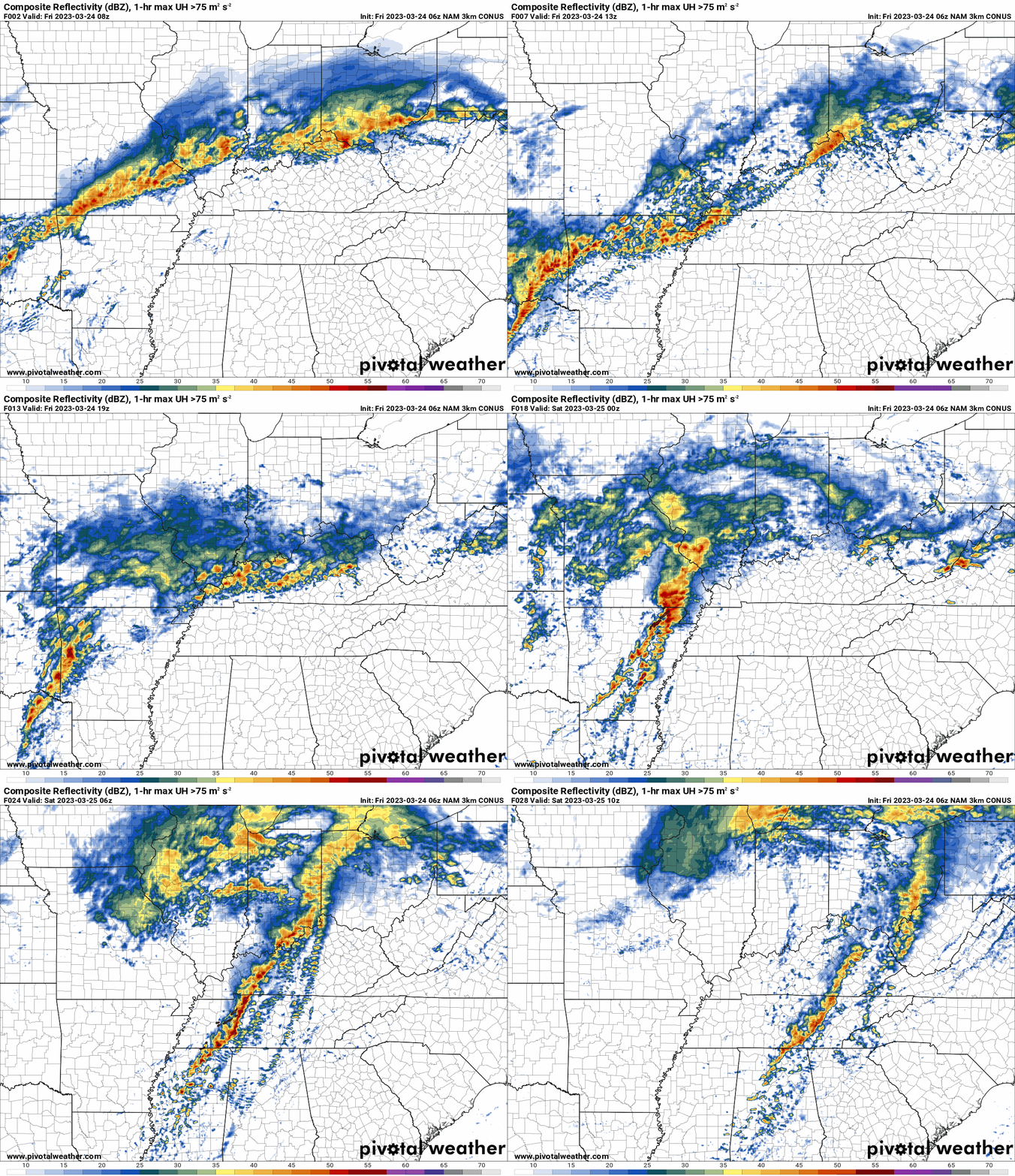
What am I looking at?
You are looking at different models. Meteorologists use many different models to forecast the weather. All models are wrong. Some are more wrong than others. Meteorologists have to make a forecast based on the guidance/models.
I show you these so you can see what the different models are showing as far as precipitation. If most of the models agree, then the confidence in the final weather forecast increases.
You can see my final forecast at the top of the page.
Occasionally, these maps are in Zulu time. 12z=7 AM. 18z=1 PM. 00z=7 PM. 06z=1 AM
This animation is the Hrrr short-range model.
This animation shows you what radar might look like as the next system pulls through the region. It is a future-cast radar.
Time-stamp upper left. Click the animation to enlarge it.
Double click the animation to enlarge it.
Occasionally, these maps are in Zulu time. 12z=7 AM. 18z=1 PM. 00z=7 PM. 06z=1 AM
.
.This animation is the higher-resolution 3K NAM American Model.
Double click the animation to enlarge it.
Occasionally, these maps are in Zulu time. 12z=7 AM. 18z=1 PM. 00z=7 PM. 06z=1 AM
.
Charge your devices in case of power outages.
What you can do to prepare for severe weather
Here is some safety advice from the NWS concerning sheltering from storms. https://www.weather.gov/ama/severesafetytips
1. Have a family safety plan. Discuss it with your family. Make sure your kids know what to do in the event of severe weather.
2. Have your devices fully charged.
3. Change the batteries in your NOAA weather radio.
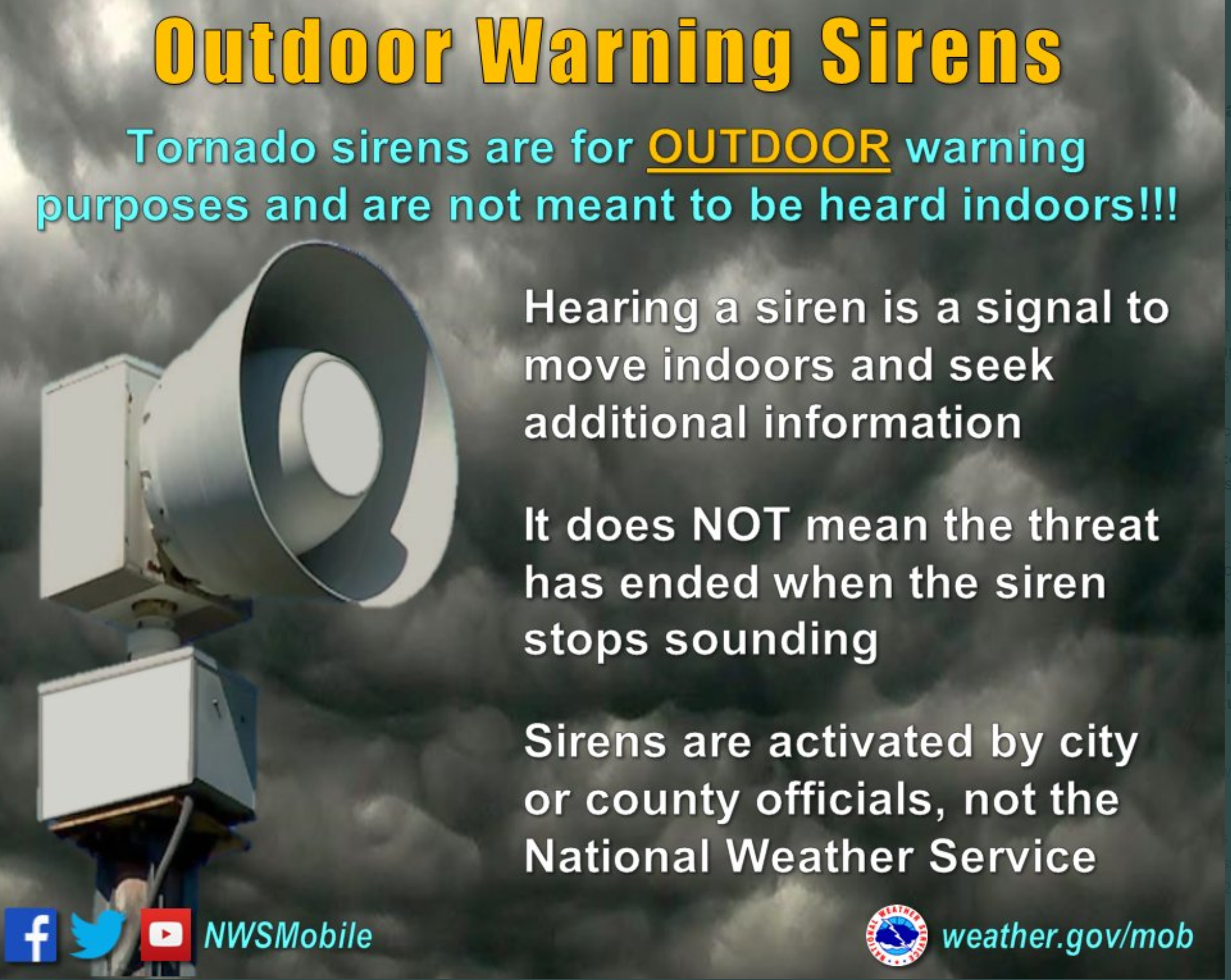
4. Have THREE TO FIVE ways of receiving your severe weather information. All sources can and have failed in the past. The Beau Dodson Weather app is one of those ways, NOAA weather radio, WEA on your phones (google it), local television and radar media, additional weather apps, and outdoor sirens. Do not rely on just the outdoor warning sirens.
5. Leave your shoes and wallet/keys by the bed. If a warning is issued overnight then you will be prepared.
6. We recommend people wear helmets during tornado warnings. In the event of an actual tornado then you will be thankful to have a helmet.
7. Have a thick blanket in your tornado safe-space.
8. Prescription medicine.
Create an emergency supply kit. If the storm is likely to cause a lot of damage, it’s important to be prepared for a variety of problems. Things that you should put in a basic supply kit include:
- Flashlights and extra batteries.
- Emergency radio.
- First aid kit
- Whistle, to alert people to your location.
- Personal sanitation products, such as garbage bags, toilet paper, paper towels, wet wipes, and tampons/pads.
- Plastic tarps
- Extra warm clothes.
- Dusk masks.
- Utility shut off tools.
Know your safety plan. Make sure your kids know the severe weather safety plan.
Have helmets in your safe space. Any kind of helmet is better than no helmet.
Noah Stewart shelters in the closet just 15 minutes before an April 2011 tornado demolished his house. Wearing the helmet may have saved his life, one doctor says.
Now is the time to prepare for severe weather.
Have three to five ways of receiving your severe weather information.
Know your families safety plan in the event severe weather develops.
Have multiple ways of receiving severe weather information. Not just my weather app. Have other ways, as well. All technology can fail. Thus, having more than one source will help keep you safe.
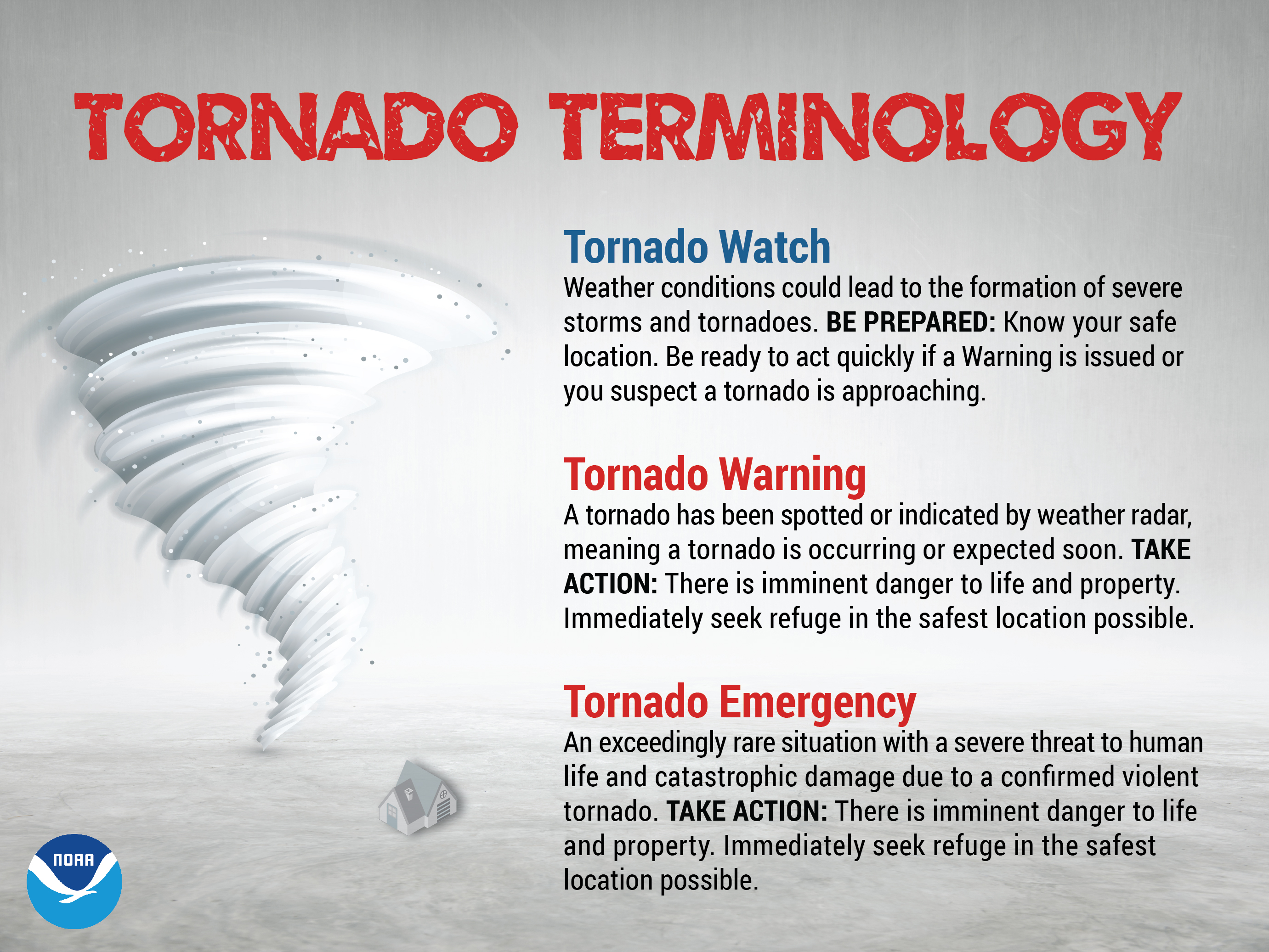
Remember, a WATCH means to monitor updates. You don’t have to change your behavior for a watch. Be prepared.
A WARNING is more serious. A WARNING means severe weather is imminent in or near your location. A WARNING means to seek shelter.
.
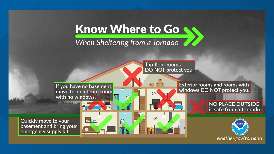
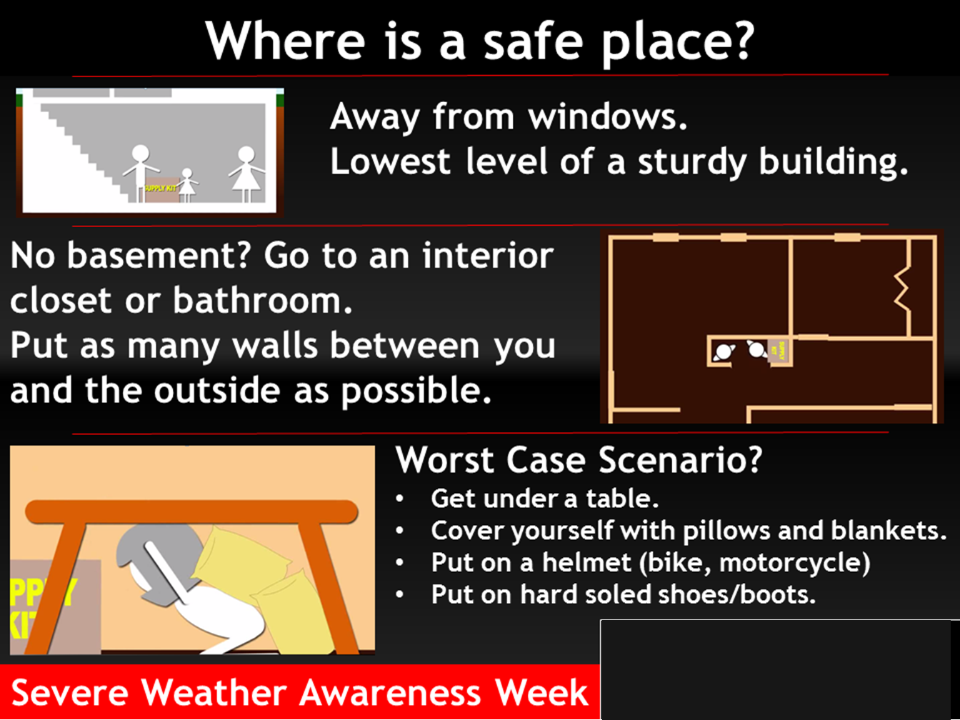
Where is a safe place to hide when tornadoes threaten your location.
![]()
Today’s severe weather outlook from the Storm Prediction Center (below).
Light green is where thunderstorms may occur but should be below severe levels.
Dark green is a level one risk. Yellow is a level two risk. Orange is a level three (enhanced) risk. Red is a level four (moderate) risk. Pink is a level five (high) risk.
One is the lowest risk. Five is the highest risk.
A severe storm is one that produces 58 mph wind or higher, quarter size hail, and/or a tornado.
The tan states are simply a region that SPC outlined on this particular map. Just ignore that.

The black outline is our local area.

.
Tomorrow’s severe weather outlook.

.
SUBSCRIBERS: Download the WeatherTalk app to keep abreast of my latest information.
The app is for subscribers. Subscribe at www.weathertalk.com/welcome then go to your app store and search for WeatherTalk
Subscribers, PLEASE USE THE APP. ATT and Verizon are not reliable during severe weather. They are delaying text messages.
The app is under WeatherTalk in the app store.
Apple users click here
Android users click here
![]()
![]()
.

Radar Link: Interactive local city-view radars & regional radars.
You will find clickable warning and advisory buttons on the local city-view radars.
If the radar is not updating then try another one. If a radar does not appear to be refreshing then hit Ctrl F5. You may also try restarting your browser.
Not working? Email me at beaudodson@usawx.com
Backup radar site in case the above one is not working.
https://weathertalk.com/morani
New ZOOM radar (with storm chasers)
https://wtalk.co/AVWG7GM7
Regional Radar
https://imagery.weathertalk.com/prx/RadarLoop.mp4
Lightning Data (zoom in and out of your local area)
https://wtalk.co/WJ3SN5UZ
Satellite Data
Computers and tablets. These two satellite links may not work well on cell phones.
Visible Satellite. This one is to be used during daylight only. Be sure and hit refresh once you are on the satellite page. Otherwise, the data will be old.
https://col.st/a5A0e
IR Satellite. This one shows cloud temperatures. Bright colors represent cold cloud tops. That could mean thunderstorms. Be sure and hit refresh once you are on the satellite page. Otherwise, the data will be old.
https://col.st/R2fw1
Water Vapor Satellite. This one shows mid-level moisture in the atmosphere. Be sure and hit refresh once you are on the satellite page. Otherwise, the data will be old.
https://col.st/xFVwx
.

Live lightning data: Click here.
Not receiving app/text messages?
Log in and out of your app.
USE THE APP. ATT and Verizon are slowing or stopping the text messages. Move to the app (not texts).
Make sure you have the correct app/text options turned on. Find those under the personal notification settings tab at www.weathertalk.com. Red is off. Green is on.
Subscribers, PLEASE USE THE APP. ATT and Verizon are not reliable during severe weather. They are delaying text messages.
The app is under WeatherTalk in the app store.
Apple users click here
Android users click here
.


