Click on the words below to subscribe
Storm Tracking Links
Interactive local city-view radars. Clickable watches and warnings.
https://wtalk.co/B3XHASFZ
Backup radar site in case the above one is not working.
https://weathertalk.com/morani
Regional Radar
https://imagery.weathertalk.com/prx/RadarLoop.mp4
*NEW* Zoom interactive radar (with storm chaser streams)
https://wtalk.co/AVWG7GM7
Real time lightning tracker system two.
https://map.blitzortung.org/#5.02/37.95/-86.99
Lightning Data (zoom in and out of your local area)
https://wtalk.co/WJ3SN5UZ
Apple users click here. Android users click here.
What you need to know
Key Points
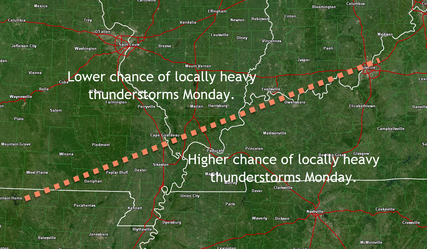
- Thunderstorm are likely Monday/Monday evening. Some could be severe with high winds and hail. Locally heavy rain and lightning, as well. The chance of severe thunderstorms is higher along and south of the Ohio River.
- Overall, the severe weather risk is fairly low.
- Have your Beau Dodson Weather app on. Check it. Make sure you have not logged out of the app.
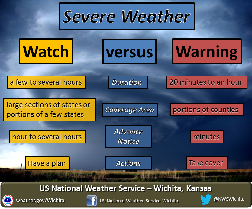
- Remember, a watch means to monitor updates. A warning means to seek shelter. A warning is a higher threat.
.

The latest update will be posted here at the top of Beau’s severe weather blog.
THREAT HAS ENDED.
June 21, 2021
Severe weather risk is over. Flash flooding continues in some counties.
WATCH COUNTY NOTIFICATION FOR WATCH 301
NATIONAL WEATHER SERVICE PADUCAH KY
244 PM CDT MON JUN 21 2021

KYC047-177-219-221-212045-
/O.CAN.KPAH.SV.A.0301.000000T0000Z-210622T0100Z/

THE NATIONAL WEATHER SERVICE HAS CANCELLED SEVERE THUNDERSTORM
WATCH 301 FOR THE FOLLOWING AREAS

IN KENTUCKY THIS CANCELS 4 COUNTIES

IN WESTERN KENTUCKY

CHRISTIAN             MUHLENBERG            TODD
TRIGG

THIS INCLUDES THE CITIES OF CADIZ, ELKTON, GREENVILLE,
AND HOPKINSVILLE.

.
1:25 PM
BULLETIN - EAS ACTIVATION REQUESTED
FLASH FLOOD WARNING
NATIONAL WEATHER SERVICE PADUCAH KY
120 PM CDT MON JUN 21 2021

THE NATIONAL WEATHER SERVICE IN PADUCAH HAS ISSUED A

* FLASH FLOOD WARNING FOR...
  HOPKINS COUNTY IN NORTHWESTERN KENTUCKY...
  CHRISTIAN COUNTY IN SOUTH CENTRAL KENTUCKY...
  MUHLENBERG COUNTY IN SOUTH CENTRAL KENTUCKY...

* UNTIL 415 PM CDT.

* AT 120 PM CDT, DOPPLER RADAR INDICATED THUNDERSTORMS ALONG AND
  AHEAD OF A COLD FRONT PRODUCING HEAVY RAIN ACROSS THE WARNED AREA.
  BETWEEN 1 AND 2 INCHES OF RAIN HAVE FALLEN. SOME OF THESE STORMS
  ARE CAPABLE OF EXTREMELY HIGH RAINFALL RATES OF 1 INCH IN 15
  MINUTES. FLASH FLOODING IS ONGOING OR EXPECTED TO BEGIN SHORTLY.
  ANOTHER 1 TO 2 INCHES IS POSSIBLE WITH LOCALLY HIGHER AMOUNTS.

  HAZARD...FLASH FLOODING CAUSED BY THUNDERSTORMS.

  SOURCE...DOPPLER RADAR.

  IMPACT...FLOODING OF SMALL CREEKS AND STREAMS, URBAN AREAS,
           HIGHWAYS, STREETS AND UNDERPASSES AS WELL AS OTHER
           DRAINAGE AND LOW LYING AREAS.

* SOME LOCATIONS THAT WILL EXPERIENCE FLASH FLOODING INCLUDE...
  HOPKINSVILLE, MADISONVILLE, OAK GROVE, CENTRAL CITY, DAWSON
  SPRINGS, FORT CAMPBELL, CLARKSVILLE, EARLINGTON, NORTONVILLE,
  PEMBROKE, MORTONS GAP, CROFTON, POWDERLY, WEIR, GRAHAM,
  GREENVILLE, DUNMOR, WHITE PLAINS, DRAKESBORO AND ST. CHARLES.

PRECAUTIONARY/PREPAREDNESS ACTIONS...

TURN AROUND, DON'T DROWN WHEN ENCOUNTERING FLOODED ROADS. MOST FLOOD
DEATHS OCCUR IN VEHICLES.
12:58 PM
THE NATIONAL WEATHER SERVICE HAS ISSUED SEVERE THUNDERSTORM WATCH 301 IN EFFECT UNTIL 8 PM CDT THIS EVENING FOR THE FOLLOWING AREAS IN KENTUCKY THIS WATCH INCLUDES 4 COUNTIES IN WESTERN KENTUCKY CHRISTIAN MUHLENBERG TODD TRIGG THIS INCLUDES THE CITIES OF CADIZ, ELKTON, GREENVILLE, AND HOPKINSVILLE..
June 21, 2021
12:47 PM
Trigg and Christian Counties.
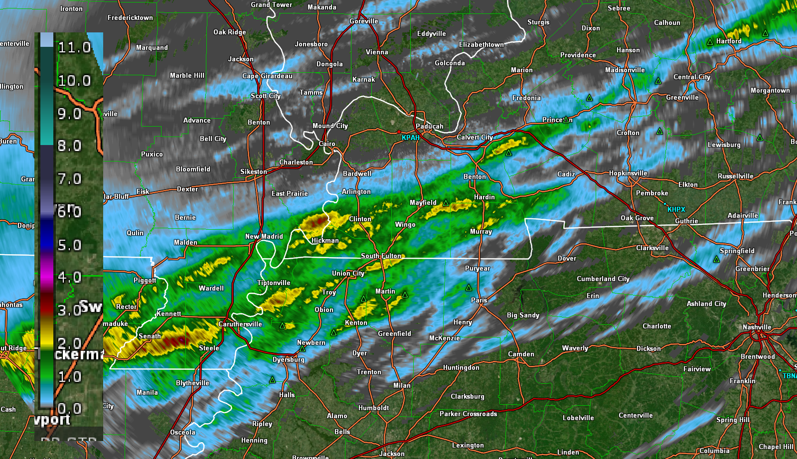
Radar shows thunderstorms beginning to produce higher wind gusts over the past few minutes.
These storms are moving E NE at 30 mph. They will produce occasional (pockets of) wind gusts above 50 mph. Torrential rain, as well. An inch of rain or more could fall in less than 15 minutes. Lightning, of course.
,
Very heavy rain in some locations.
Totals, thus far.
Click on the image to enlarge it
BULLETIN - EAS ACTIVATION REQUESTED
FLASH FLOOD WARNING
NATIONAL WEATHER SERVICE PADUCAH KY
1233 PM CDT MON JUN 21 2021

THE NATIONAL WEATHER SERVICE IN PADUCAH HAS ISSUED A

* FLASH FLOOD WARNING FOR...
  CALDWELL COUNTY IN WESTERN KENTUCKY...
  CALLOWAY COUNTY IN WESTERN KENTUCKY...
  GRAVES COUNTY IN WESTERN KENTUCKY...
  LYON COUNTY IN WESTERN KENTUCKY...
  MARSHALL COUNTY IN WESTERN KENTUCKY...
  TRIGG COUNTY IN WESTERN KENTUCKY...

* UNTIL 330 PM CDT.

* AT 1233 PM CDT, DOPPLER RADAR INDICATED THUNDERSTORMS ALONG AND
  AHEAD OF A COLD FRONT PRODUCING HEAVY RAIN ACROSS THE WARNED AREA.
  BETWEEN 1 AND 2 INCHES OF RAIN HAVE FALLEN. SOME OF THESE STORMS
  ARE CAPABLE OF EXTREMELY HIGH RAINFALL RATES OF 1 INCH IN 15
  MINUTES. FLASH FLOODING IS ONGOING OR EXPECTED TO BEGIN SHORTLY.
  ANOTHER 1 TO 2 INCHES IS POSSIBLE WITH LOCALLY HIGHER AMOUNTS.

  HAZARD...FLASH FLOODING CAUSED BY THUNDERSTORMS.

  SOURCE...DOPPLER RADAR.

  IMPACT...FLOODING OF SMALL CREEKS AND STREAMS, URBAN AREAS,
           HIGHWAYS, STREETS AND UNDERPASSES AS WELL AS OTHER
           DRAINAGE AND LOW LYING AREAS.

* SOME LOCATIONS THAT WILL EXPERIENCE FLASH FLOODING INCLUDE...
  MURRAY, MAYFIELD, PRINCETON, BENTON, CALVERT CITY, CADIZ,
  EDDYVILLE, LAND BETWEEN THE LAKES AREA, CANTON, SEDALIA,
  LYNNVILLE, COBB, FARMERSVILLE, ROCKCASTLE, KUTTAWA, WINGO, HARDIN,
  HAZEL, WATER VALLEY AND AURORA.

PRECAUTIONARY/PREPAREDNESS ACTIONS...

TURN AROUND, DON'T DROWN WHEN ENCOUNTERING FLOODED ROADS. MOST FLOOD
DEATHS OCCUR IN VEHICLES.
12 PM SPC Update
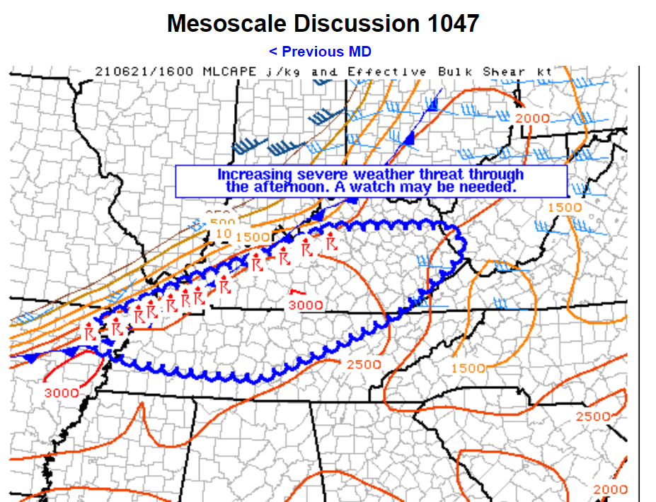
Mesoscale Discussion 1047
NWS Storm Prediction Center Norman OK
1135 AM CDT Mon Jun 21 2021
Areas affected…Portions of eastern Kentucky and northern Tennessee
Concerning…Severe potential…Watch possible
Valid 211635Z – 211800Z
Probability of Watch Issuance…60 percent
SUMMARY…Storms along a cold front are expected to become more
organized through the afternoon with a threat for some large hail
and damaging winds.
DISCUSSION…Storms have developed along the cold front from
northern Kentucky into northeast Arkansas with some additional
development occurring in the unstable airmass ahead of this
activity. Mid-level flow is weaker in this region (~30-35 kts per
area VWP) which yields around 20 to 25 knots of effective shear
given the southwesterly surface winds. Therefore, storms have
struggled to become organized thus far. However, the airmass ahead
of this front is very unstable with MLCAPE around 2500 J/kg and
increasing with surface dewpoints in the low to mid 70s. This
instability and moderately steep mid-level lapse rates (~7 C/km per
BNA 12Z RAOB) will support rapid updraft growth which may pose a
threat for isolated damaging wind and large hail. As storms congeal,
they may become better organized which could support a greater wind
damage threat. If this occurs, a watch may need to be considered
across at least parts of northern Tennessee and eastern Kentucky.
..Bentley/Hart.. 06/21/2021
11:45 AM
BULLETIN - EAS ACTIVATION REQUESTED
FLASH FLOOD WARNING
NATIONAL WEATHER SERVICE PADUCAH KY
1133 AM CDT MON JUN 21 2021

THE NATIONAL WEATHER SERVICE IN PADUCAH HAS ISSUED A

* FLASH FLOOD WARNING FOR...
  FULTON COUNTY IN WESTERN KENTUCKY...
  HICKMAN COUNTY IN WESTERN KENTUCKY...
  SOUTHEASTERN MISSISSIPPI COUNTY IN SOUTHEASTERN MISSOURI...
  SOUTHERN NEW MADRID COUNTY IN SOUTHEASTERN MISSOURI...

* UNTIL 230 PM CDT.

* AT 1133 AM CDT, DOPPLER RADAR INDICATED THUNDERSTORMS PRODUCING
  HEAVY RAIN ACROSS THE WARNED AREA. RADAR IS ESTIMATING RAINFALL
  RATES OF 1 INCH IN 15 MINUTES AND UP TO 3 INCHES IN AN HOUR.
  BETWEEN 1 TO 2 INCHES HAS FALLEN AND AN ADDITIONAL 1 TO 2 INCHES
  IS POSSIBLE BEFORE THE COLD FRONT PUSHES THE HEAVIEST RAINS SOUTH.
  FLASH FLOODING IS ONGOING OR EXPECTED TO BEGIN SHORTLY.

  HAZARD...FLASH FLOODING CAUSED BY THUNDERSTORMS.

  SOURCE...DOPPLER RADAR.

  IMPACT...FLOODING OF SMALL CREEKS AND STREAMS, URBAN AREAS,
           HIGHWAYS, STREETS AND UNDERPASSES AS WELL AS OTHER
           DRAINAGE AND LOW LYING AREAS.

* SOME LOCATIONS THAT WILL EXPERIENCE FLASH FLOODING INCLUDE...
  PORTAGEVILLE, NEW MADRID, FULTON, HICKMAN, CLINTON, LILBOURN, BIG
  OAK TREE STATE PARK, TOWOSAHGY STATE HISTORIC SITE, HUNTER-DAWSON
  STATE HISTORIC SITE, GIDEON, MARSTON, HOWARDVILLE, RISCO, DORENA,
  CAYCE, FULGHAM, COLUMBUS, TALLAPOOSA, NORTH LILBOURN AND
  BOUNDURANT.

PRECAUTIONARY/PREPAREDNESS ACTIONS...

TURN AROUND, DON'T DROWN WHEN ENCOUNTERING FLOODED ROADS. MOST FLOOD
DEATHS OCCUR IN VEHICLES.
.
11:45 AM
Thunderstorm update for the following counties.
Lyon, Caldwell, Hopkins, and Muhlenberg
Widespread thunderstorm activity is developing from SW to NE across the area. Thunderstorms are training over the same areas.
Some locations could receive an inch of rain in less than 15 minutes. This could cause some flash flooding. Local law enforcement and emergency management officials ask you to avoid flooded roadways.
.
11:35 AM
Thunderstorm update for the following counties.
New Madrid, Mississippi, Lake, Obion, Weakley, Henry, Carlisle, Hickman, Fulton, Graves, Marshall, Calloway, Trigg, Christian, and Todd Counties.
Areas further north will need to be monitored.
Widespread thunderstorm activity is developing from SW to NE across the area. Thunderstorms are training over the same areas.
There will be some locations that receive more than three inches of rain today (not everyone). This will cause some flash flooding. Local law enforcement and emergency management officials ask you to avoid flooded roadways.
Conditions remain favorable for a few of the thunderstorms to produce strong and gusty wind and small hail. I can’t rule out isolated downburst wind damage. That would be the exception and not the rule. Small hail is also possible.
As always, lightning is a concern for those who have to work outdoors.
See the live radars to track the ongoing thunderstorm activity.
.
11:30 AM
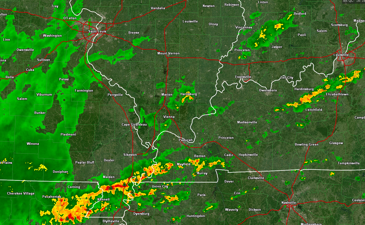
Widespread showers and thunderstorms have formed south of the cold front. Less to the north.
No change in the going forecast. Isolated damaging wind risk.
High chance of some flash flooding where thunderstorms move repeatedly over the same areas.
See the live radar links
Static image
Storm Tracking Links
Interactive local city-view radars. Clickable watches and warnings.
https://wtalk.co/B3XHASFZ
Backup radar site in case the above one is not working.
https://weathertalk.com/morani
Regional Radar
https://imagery.weathertalk.com/prx/RadarLoop.mp4
*NEW* Zoom interactive radar (with storm chaser streams)
https://wtalk.co/AVWG7GM7
Real time lightning tracker system two.
https://map.blitzortung.org/#5.02/37.95/-86.99
Lightning Data (zoom in and out of your local area)
https://wtalk.co/WJ3SN5UZ
.
10:15 AM
Dunklin and Pemiscot Counties
A large area of thunderstorms is moving into the Missouri Bootheel. Locally heavy rain will occur with these storms. Avoid flooded roadways, if they develop.
In addition to the above, an isolated report of wind damage can’t be ruled out with these thunderstorms. Downburst winds will be the primary concern. Lightning, of course.
.
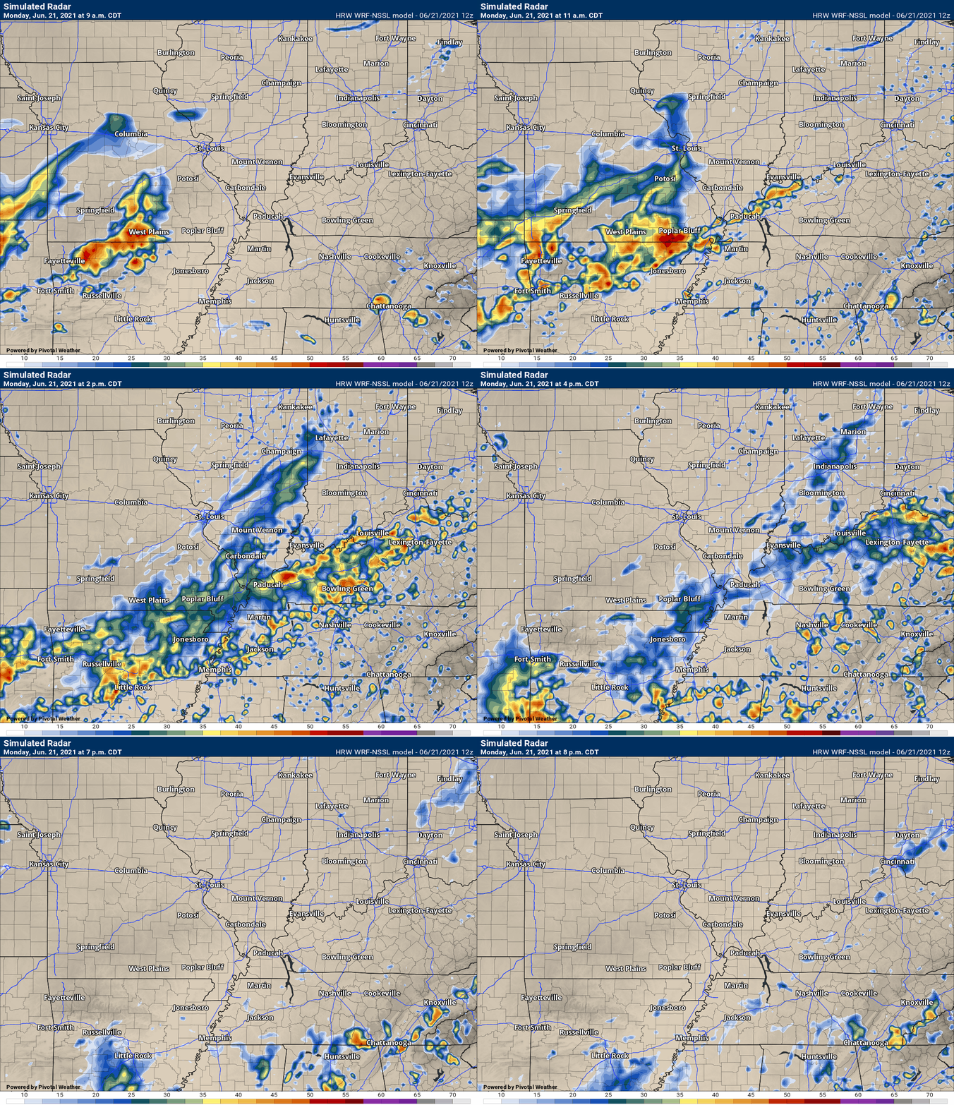
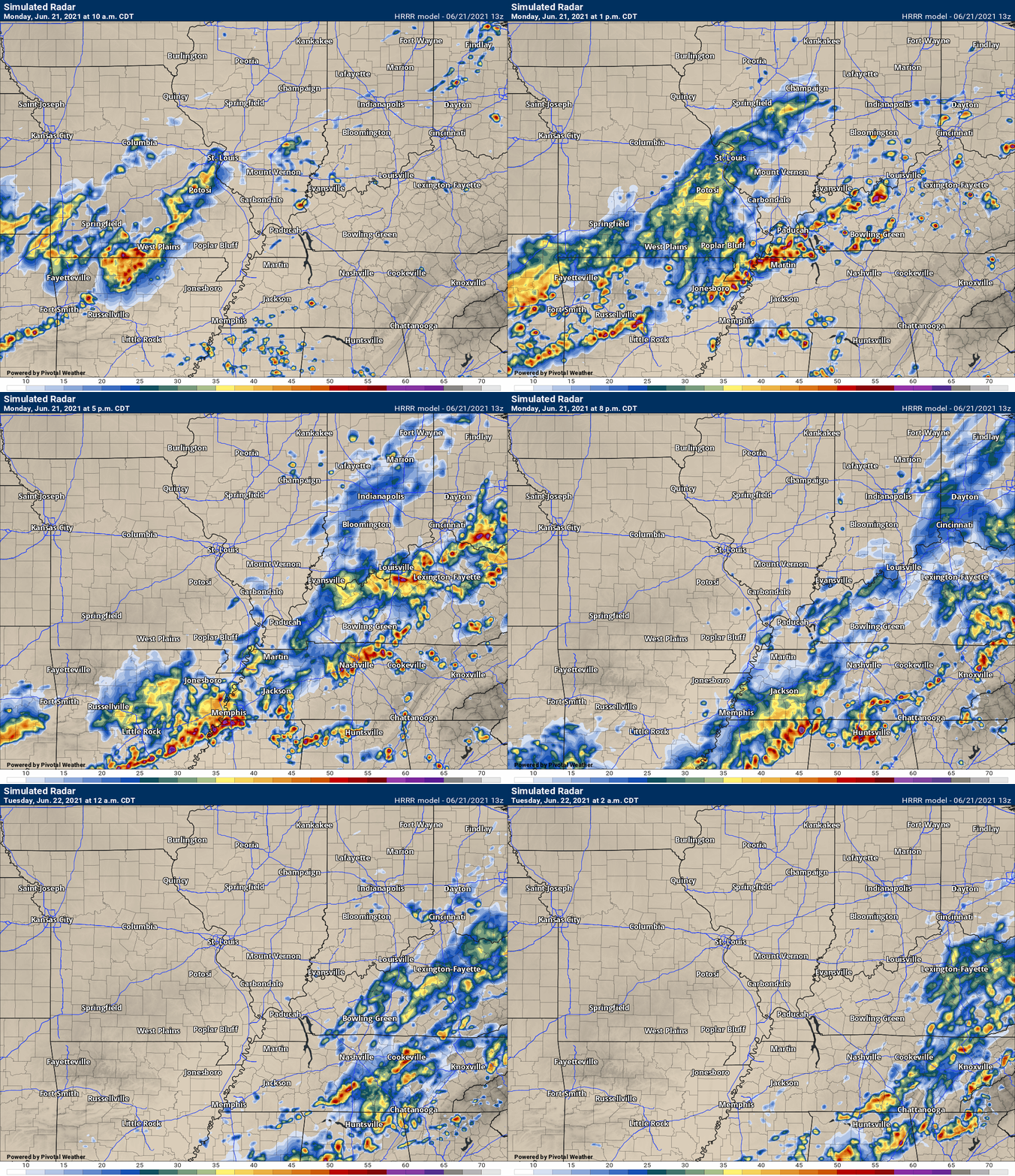
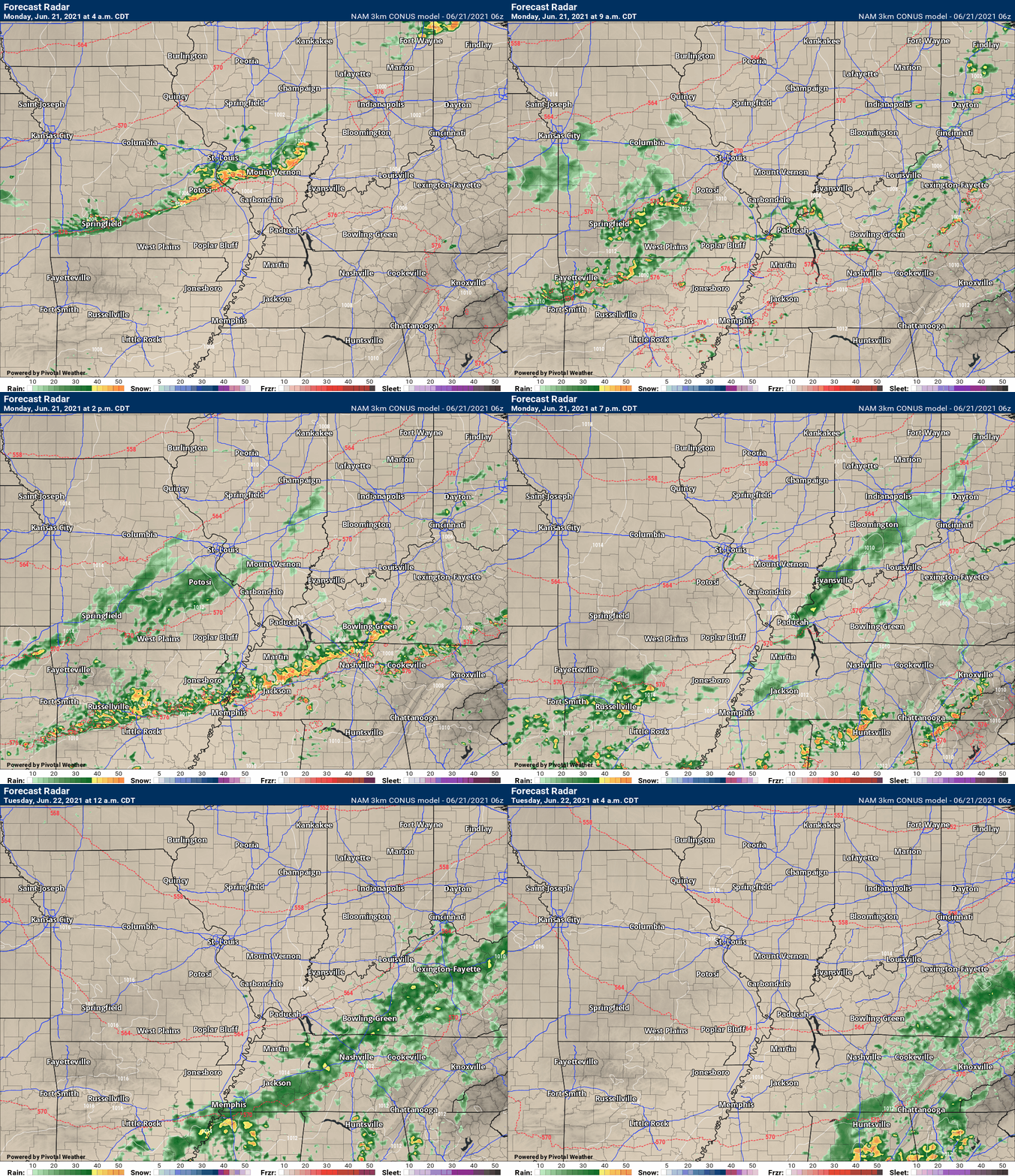
Future-cast radars have been updated.
No adjustments to the previous update.
Overall, the severe weather threat is low-end.
.
June 20, 2021
12 PM
A line of showers and thunderstorms will push into southeast Missouri and southern Illinois Sunday night. It will be weakening.
Severe weather is unlikely tonight.
The band will redevelop across the southern half of our forecast area from mid-morning into the afternoon hours (Monday).
See the future-radars further down in this blog update.
This redevelopment will include locally heavy thunderstorms. Some storms will produce one to two inches of rain in less than thirty minutes. A few storms could produce 50+ mph wind gusts, nickel size hail, and frequent lightning.
The tornado risk Monday morning and afternoon will be low.
Monitor your Beau Dodson Weather app for the latest watches and warnings.
.

Click here if you would like to return to the top of the page.
Again, as a reminder, these are models. They are never 100% accurate. Take the general idea from them.
What should I take from these?
- The general idea and not specifics. Models usually do well with the generalities.
- The time-stamp is located in the upper left corner.
- The EC European weather model is in Zulu time.
.
What am I looking at?
You are looking at different models. Meteorologists use many different models to forecast the weather. All models are wrong. Some are more wrong than others. Meteorologists have to make a forecast based on the guidance/models.
I show you these so you can see what the different models are showing as far as precipitation. If most of the models agree, then the confidence in the final weather forecast increases.
You can see my final forecast at the top of the page.
.
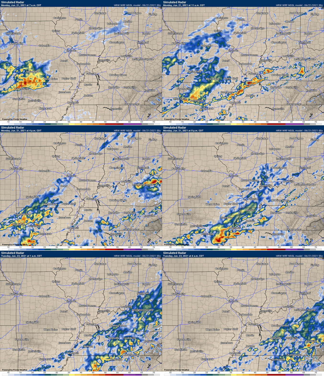
This animation is the Storm Prediction Center WRF model.
This animation shows you what radar might look like as the next system pulls through the region. It is a future-cast radar.
Time-stamp upper left. Click the animation to enlarge it.
.
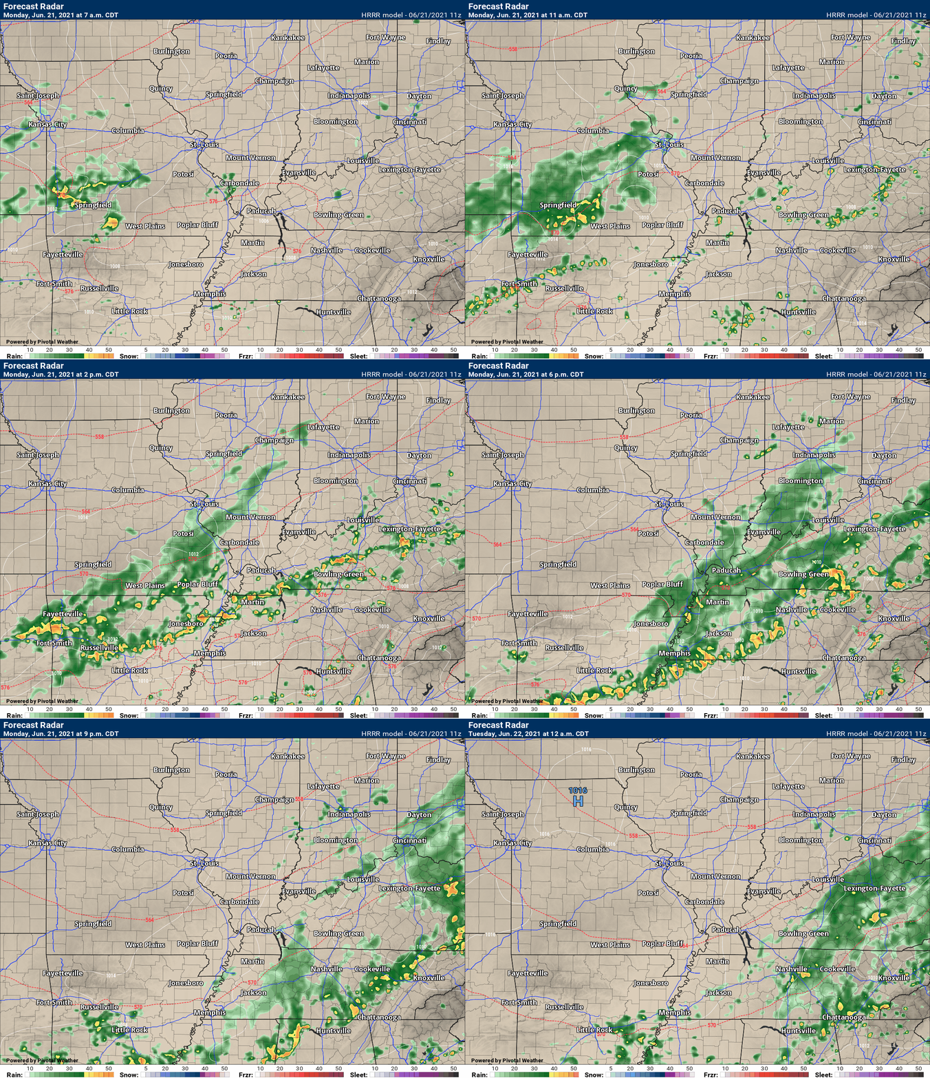
This animation is the Hrrr short-range model.
This animation shows you what radar might look like as the next system pulls through the region. It is a future-cast radar.
Time-stamp upper left. Click the animation to enlarge it.
.
.This animation is the higher-resolution 3K NAM American Model.
![]()
Today’s severe weather outlook from the Storm Prediction Center (below).
Light green is where thunderstorms may occur but should be below severe levels.
Dark green is a level one risk. Yellow is a level two risk. Orange is a level three (enhanced) risk. Red is a level four (moderate) risk. Pink is a level five (high) risk.
One is the lowest risk. Five is the highest risk.
A severe storm is one that produces 58 mph wind or higher, quarter size hail, and/or a tornado.
The tan states are simply a region that SPC outlined on this particular map. Just ignore that.

The black outline is our local area.

.
Tomorrow’s severe weather outlook.

![]()
![]()
Some safety graphics.
.![]()
.
.

Radar Link: Interactive local city-view radars & regional radars.
You will find clickable warning and advisory buttons on the local city-view radars.
If the radar is not updating then try another one. If a radar does not appear to be refreshing then hit Ctrl F5. You may also try restarting your browser.
Not working? Email me at beaudodson@usawx.com
Backup radar site in case the above one is not working.
https://weathertalk.com/morani
New ZOOM radar (with storm chasers)
https://wtalk.co/AVWG7GM7
Regional Radar
https://imagery.weathertalk.com/prx/RadarLoop.mp4
Lightning Data (zoom in and out of your local area)
https://wtalk.co/WJ3SN5UZ
Satellite Data
Computers and tablets. These two satellite links may not work well on cell phones.
Visible Satellite. This one is to be used during daylight only. Be sure and hit refresh once you are on the satellite page. Otherwise, the data will be old.
https://col.st/a5A0e
IR Satellite. This one shows cloud temperatures. Bright colors represent cold cloud tops. That could mean thunderstorms. Be sure and hit refresh once you are on the satellite page. Otherwise, the data will be old.
https://col.st/R2fw1
Water Vapor Satellite. This one shows mid-level moisture in the atmosphere. Be sure and hit refresh once you are on the satellite page. Otherwise, the data will be old.
https://col.st/xFVwx
.

Live lightning data: Click here.
Not receiving app/text messages?
Log in and out of your app.
USE THE APP. ATT and Verizon are slowing or stopping the text messages. Move to the app (not texts).
Make sure you have the correct app/text options turned on. Find those under the personal notification settings tab at www.weathertalk.com. Red is off. Green is on.
Subscribers, PLEASE USE THE APP. ATT and Verizon are not reliable during severe weather. They are delaying text messages.
The app is under WeatherTalk in the app store.
Apple users click here
Android users click here
.


