Click on the words below to subscribe
Storm Tracking Links
Interactive local city-view radars. Clickable watches and warnings.
https://wtalk.co/B3XHASFZ
Backup radar site in case the above one is not working.
https://weathertalk.com/morani
Regional Radar
https://imagery.weathertalk.com/prx/RadarLoop.mp4
*NEW* Zoom interactive radar (with storm chaser streams)
https://wtalk.co/AVWG7GM7
Real time lightning tracker system two.
https://map.blitzortung.org/#5.02/37.95/-86.99
Lightning Data (zoom in and out of your local area)
https://wtalk.co/WJ3SN5UZ
Apple users click here. Android users click here.
What you need to know
Key Points
- Thunderstorms are likely Friday.
- There is a low-end risk of a tornado. The primary concern will be damaging wind gusts and perhaps a few reports of hail.
- Locally heavy rain will be possible with thunderstorms.
- Have your Beau Dodson Weather app on. Check it. Make sure you have not logged out of the app.
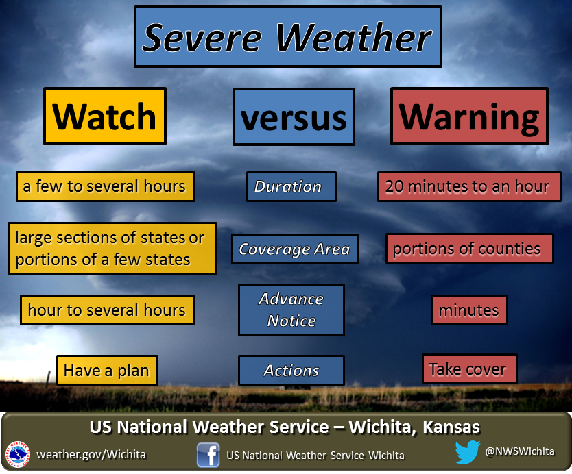
- Remember, a watch means to monitor updates. A warning means to seek shelter. A warning is a higher threat.
.

The latest update will be posted here at the top of Beau’s severe weather blog.
7 PM
SEVERE WEATHER CONCERNS HAVE ENDED
.
6:30 PM
6:28 PM
Storms in McCracken and Massac County are weakening. They could still produce some 40+ mph wind gusts.
.
6:10 PM
October 15. 2021
6:10 PM
Southern Pope County
A line of thunderstorms is pushing across Ballard County into extreme southern Illinois. The line is moving east at 25 mph.
There have been several reports of 50+ mph wind gusts with this line of thunderstorms. It would not take much of an increase in intensity to produce spotty wind damage. Locally heavy rain will accompany the core of the storms, as well. Lightning, of course.
If you are in the path of these storms remain weather aware until the storms pass.
.
6 PM
October 15. 2021
6 PM
Northeastern Mississippi County, Ballard, southern Massac, and McCracken
A line of thunderstorms is pushing across Mississippi County Missouri into extreme southern Illinois. The line is moving east at 25 mph.
There have been several reports of 40+ mph wind gusts with this line of thunderstorms. It would not take much of an increase in intensity to produce spotty wind damage. Locally heavy rain will accompany the core of the storms, as well. Lightning, of course.
If you are in the path of these storms remain weather aware until the storms pass.
.
5:51 PM
NE Franklin County, extreme southeast Jefferson County, and Hamilton County.
An intense thunderstorm may be producing a small area of quarter size hail near Ewing in Franklin County. The hail core will be moving east at 25 mph. There may also be 50 mph wind gusts with this thunderstorm.
Be weather aware as this storm pushes into the above mentioned areas.
.
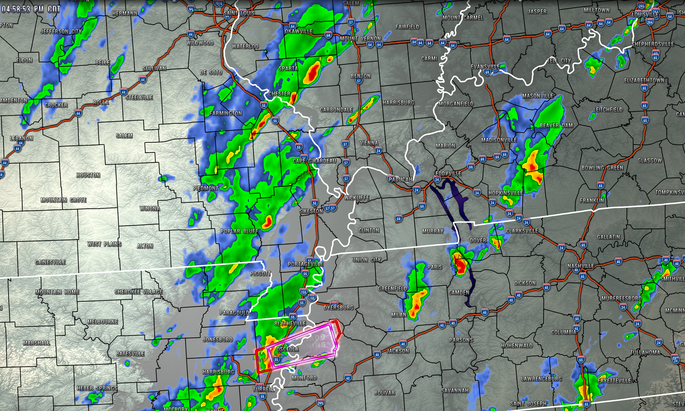
5:01 PM
Severe storms south of my county area. For now, just some showers and storms locally, but nothing severe at this time.
.
5 PM
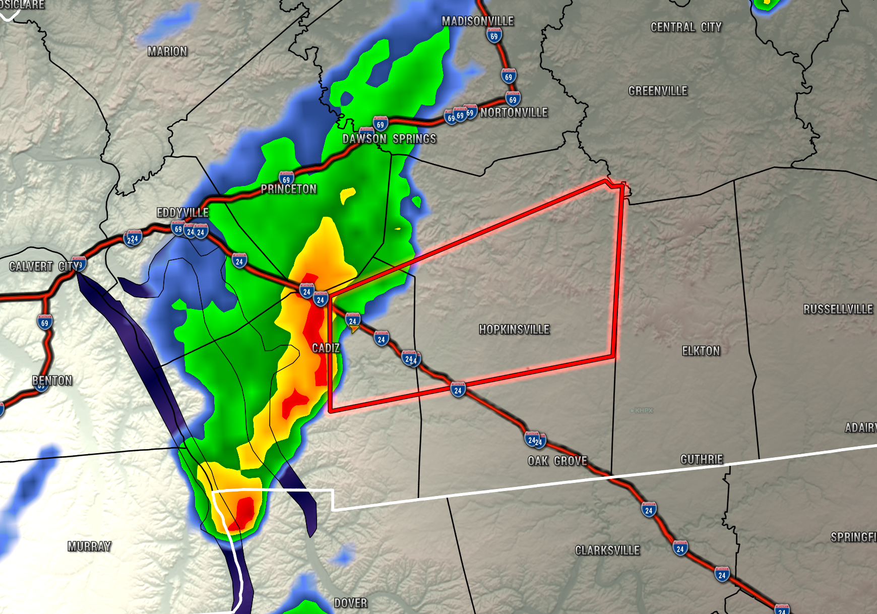
4:01 PM
Todd County
An intense thunderstorm was moving across northern Christian County. This storm is moving east at 25 mph. It will soon move into Todd County. The most intense portion of the storm will likely impact the northern half of the county.
The storm may produce 60 mph wind gusts and nickel size hail. There is also some rotation, from time to time, with this thunderstorm.
Be weather aware as this storm pushes into the above mentioned areas.
.
3:51 PM
October 15, 2021
3:50 PM
Christian County
An intense thunderstorm was moving across Trigg County. This storm is moving east at 25 mph. It will soon move into the northern half of Christian County, Kentucky.
The storm may produce 60 mph wind gusts and nickel size hail. There is also some rotation, from time to time, with this thunderstorm.
Be weather aware as this storm pushes into the above mentioned areas.
Interactive local city-view radars. Clickable watches and warnings.
https://wtalk.co/B3XHASFZ
.
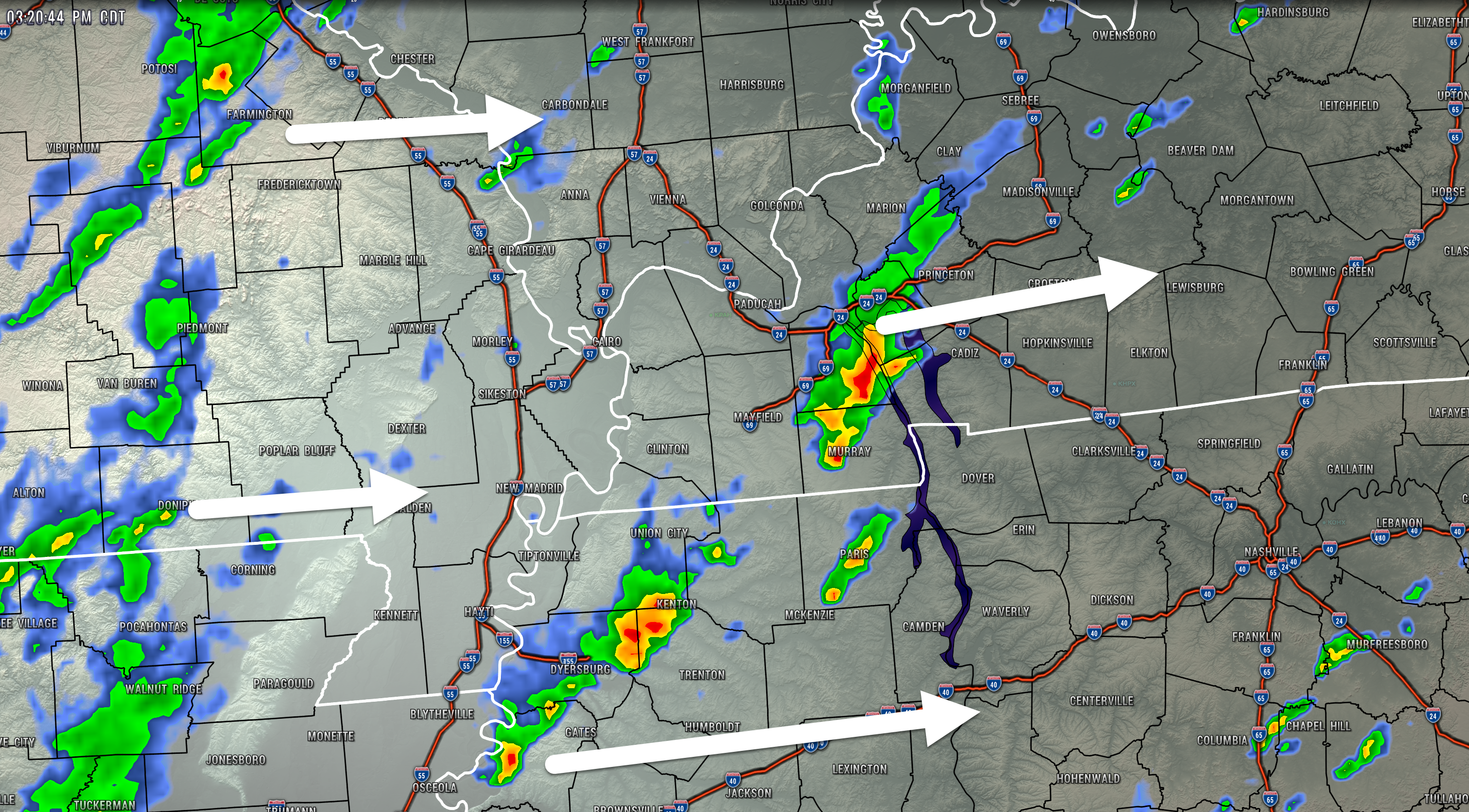
3:44 PM
Storms moving into Christian County could produce gusty winds, but below severe levels for now.
.
3:30 PM
.
3:15 PM
Southern half of Weakley County.
An intense thunderstorm was moving across northern Gibson County. This storm is moving east/northeast at 25 mph. The storm may produce 60 mph wind gusts and nickel size hail. There is also some rotation, from time to time, with this thunderstorm.
Be weather aware as this storm pushes into the above mentioned areas.
.
3:00 PM
Far southern Lyon County. Trigg County.
A severe thunderstorm was moving across southern Marshall County. This storm is moving east at 25 mph. The storm may produce 60 mph wind gusts and nickel size hail. There is also some rotation, from time to time, with this thunderstorm.
Be weather aware as this storm pushes into the above mentioned areas.
.
2:56 PM
.
2:44 PM
Local Storm Report by NWS PAH: 1 N Mayfield [Graves Co, KY] trained spotter reports TSTM WND GST of E0 MPH at 02:27 PM CDT — 50 to 55 mph wind gusts.
.
2:41 PM
Radar showed rotation about 7 miles east of Mayfield, Kentucky. Movement is east at 25 mph. Seek shelter if you are in the path of the storm.
.
2:39 PM
A tornado warning has been issued for east central Graves County. A tornado is possible. This is a radar indicated tornado with no ground confirmation.
The storm is moving east at 25 mph. The main concern will be east/northeast of Mayfield and then moving eastward into east central Graves County. Marshall County should monitor updates, as well.
.
2:30 PM
A severe thunderstorm was located near Mayfield, Kentucky, moving east at 25 mph. This storm may produce 60 mph wind gusts and nickel size hail. The storm has been intensifying over the past few minutes.
The storm will push across northeast and east central Graves County and soon enter Marshall and far northern Calloway County.
This storm also has some rotation with it.
2:11 PM
SPECIAL WEATHER STATEMENT
NATIONAL WEATHER SERVICE PADUCAH KY
206 PM CDT FRI OCT 15 2021

KYZ006-151930-
GRAVES KY-
206 PM CDT FRI OCT 15 2021

...STRONG THUNDERSTORMS WILL IMPACT PORTIONS OF NORTHERN GRAVES
COUNTY THROUGH 230 PM CDT...

AT 205 PM CDT, DOPPLER RADAR WAS TRACKING STRONG THUNDERSTORMS ALONG
A LINE EXTENDING FROM NEAR LOVELACEVILLE TO 10 MILES NORTHWEST OF
MAYFIELD TO NEAR FULGHAM. MOVEMENT WAS EAST AT 40 MPH.

HAZARD...WINDS IN EXCESS OF 30 MPH.

SOURCE...RADAR INDICATED.

IMPACT...GUSTY WINDS COULD KNOCK DOWN TREE LIMBS AND BLOW AROUND
         UNSECURED OBJECTS.

STRONG THUNDERSTORMS WILL BE NEAR...
  MAYFIELD AROUND 225 PM CDT.

THIS INCLUDES INTERSTATE 69 IN KENTUCKY BETWEEN MILE MARKERS 19 AND
33.

PRECAUTIONARY/PREPAREDNESS ACTIONS...

IF OUTDOORS, CONSIDER SEEKING SHELTER INSIDE A BUILDING.

TORRENTIAL RAINFALL IS ALSO OCCURRING WITH THESE STORMS AND MAY LEAD
TO LOCALIZED FLOODING. DO NOT DRIVE YOUR VEHICLE THROUGH FLOODED
ROADWAYS.

TO REPORT SEVERE WEATHER, CONTACT YOUR NEAREST LAW ENFORCEMENT
AGENCY. THEY WILL RELAY YOUR REPORT TO THE NATIONAL WEATHER SERVICE
OFFICE IN PADUCAH.
.
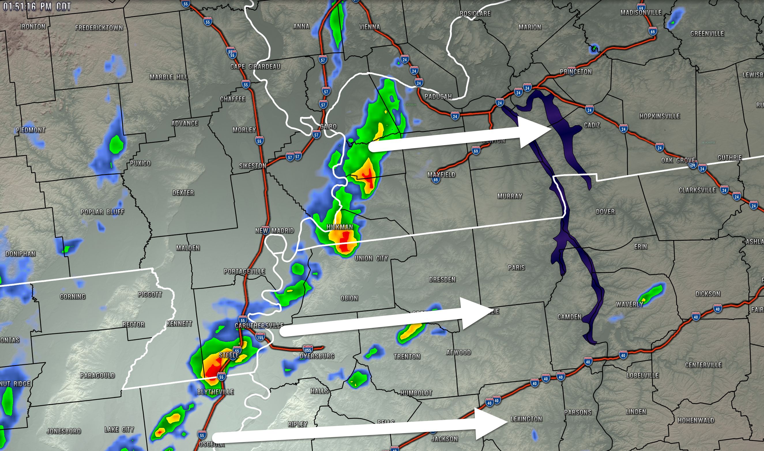
1:51 PM
SPECIAL WEATHER STATEMENT
NATIONAL WEATHER SERVICE PADUCAH KY
144 PM CDT FRI OCT 15 2021

KYZ001-002-151930-
FULTON KY-HICKMAN KY-
144 PM CDT FRI OCT 15 2021

...A STRONG THUNDERSTORM WILL IMPACT PORTIONS OF SOUTHEASTERN FULTON
AND SOUTHEASTERN HICKMAN COUNTIES THROUGH 230 PM CDT...

AT 144 PM CDT, DOPPLER RADAR WAS TRACKING A STRONG THUNDERSTORM NEAR
CLAYTON, OR NEAR HICKMAN, MOVING EAST AT 30 MPH.

HAZARD...WINDS IN EXCESS OF 30 MPH.

SOURCE...RADAR INDICATED.

IMPACT...GUSTY WINDS COULD KNOCK DOWN TREE LIMBS AND BLOW AROUND
         UNSECURED OBJECTS.

THIS STRONG THUNDERSTORM WILL BE NEAR...
  CAYCE AROUND 200 PM CDT.

OTHER LOCATIONS IN THE PATH OF THIS STORM INCLUDE FULTON.

THIS INCLUDES INTERSTATE 69 IN KENTUCKY BETWEEN MILE MARKERS 1 AND 8.

PRECAUTIONARY/PREPAREDNESS ACTIONS...

IF OUTDOORS, CONSIDER SEEKING SHELTER INSIDE A BUILDING.
.
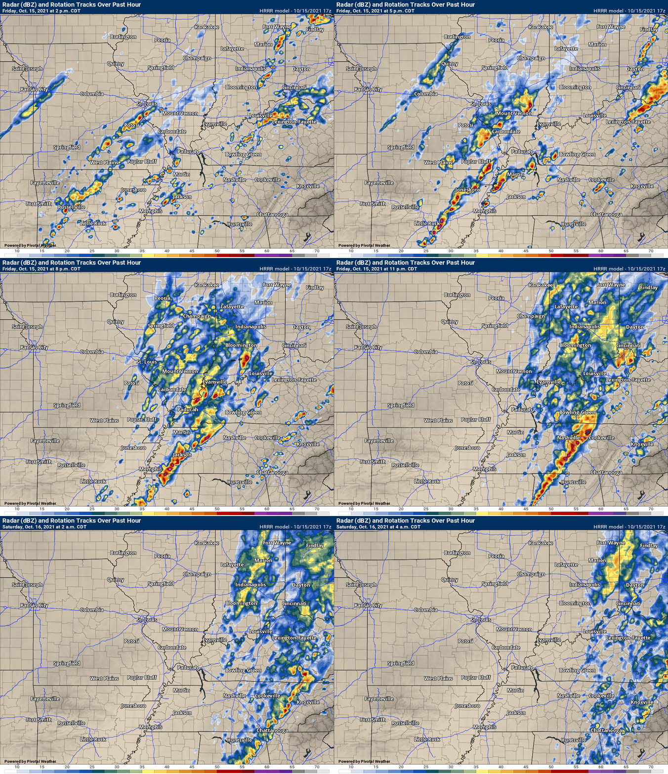
1:30 PM
Future-cast radar from the Hrrr model guidance.
.
1:10 PM
SPECIAL WEATHER STATEMENT
NATIONAL WEATHER SERVICE PADUCAH KY
106 PM CDT FRI OCT 15 2021

KYZ001-MOZ114-151845-
FULTON KY-NEW MADRID MO-
106 PM CDT FRI OCT 15 2021

...STRONG THUNDERSTORMS WILL IMPACT PORTIONS OF SOUTHWESTERN FULTON
AND SOUTHEASTERN NEW MADRID COUNTIES THROUGH 145 PM CDT...

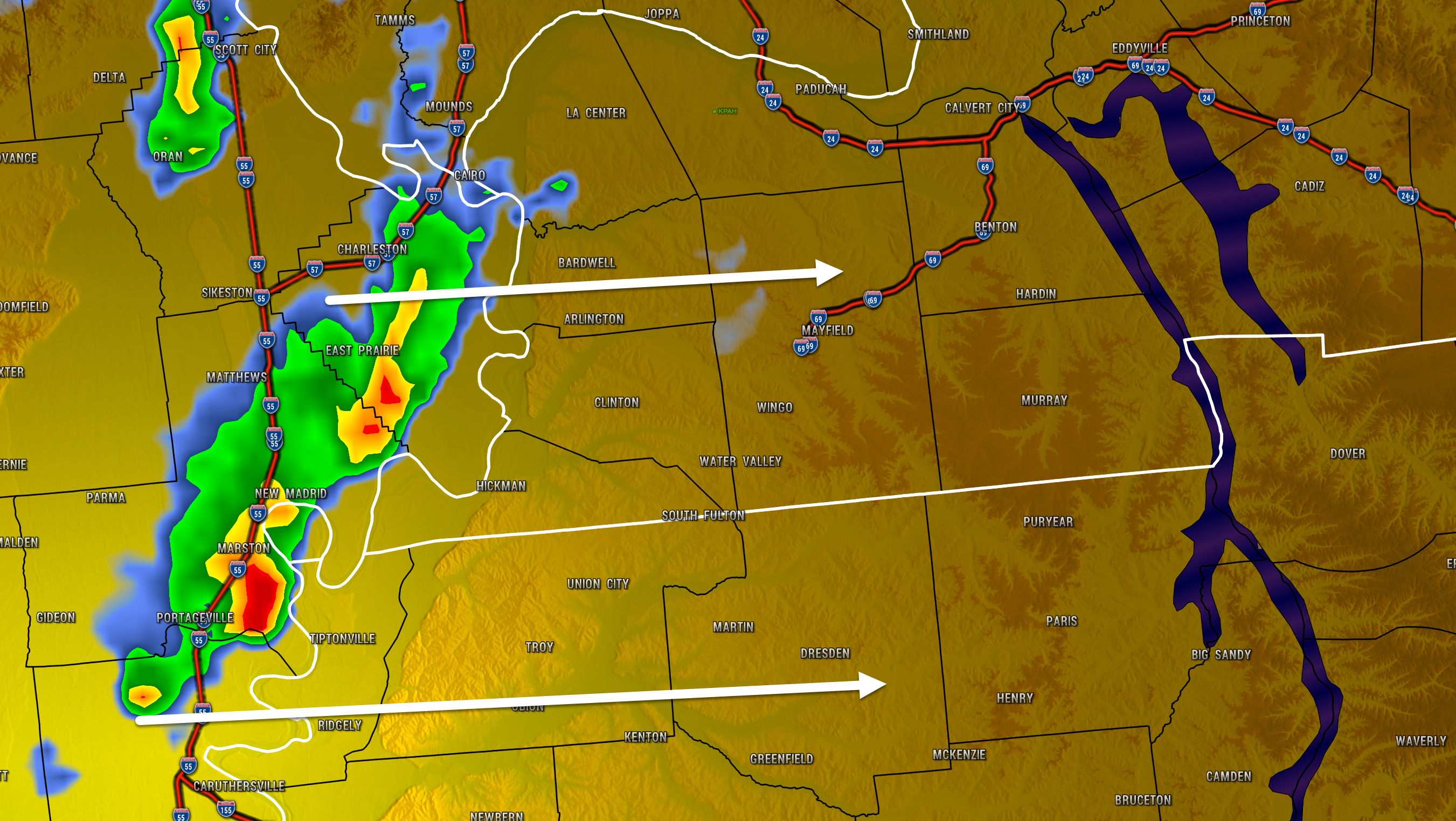
AT 105 PM CDT, DOPPLER RADAR WAS TRACKING STRONG THUNDERSTORMS ALONG
A LINE EXTENDING FROM MARSTON TO 7 MILES NORTHWEST OF TIPTONVILLE TO
NEAR PORTAGEVILLE. MOVEMENT WAS EAST AT 25 MPH.

HAZARD...WINDS IN EXCESS OF 30 MPH.

SOURCE...RADAR INDICATED.

IMPACT...GUSTY WINDS COULD KNOCK DOWN TREE LIMBS AND BLOW AROUND
         UNSECURED OBJECTS.

THESE STORMS WILL REMAIN OVER MAINLY RURAL AREAS OF SOUTHWESTERN
FULTON AND SOUTHEASTERN NEW MADRID COUNTIES, INCLUDING THE FOLLOWING
LOCATIONS... BOUNDURANT.
12:50 PM
.
12:45 PM
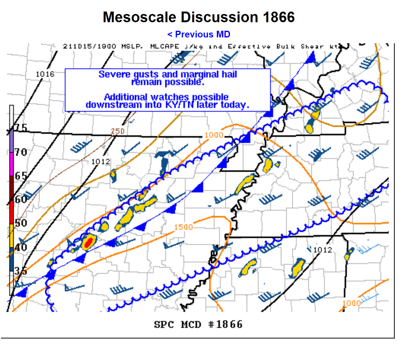
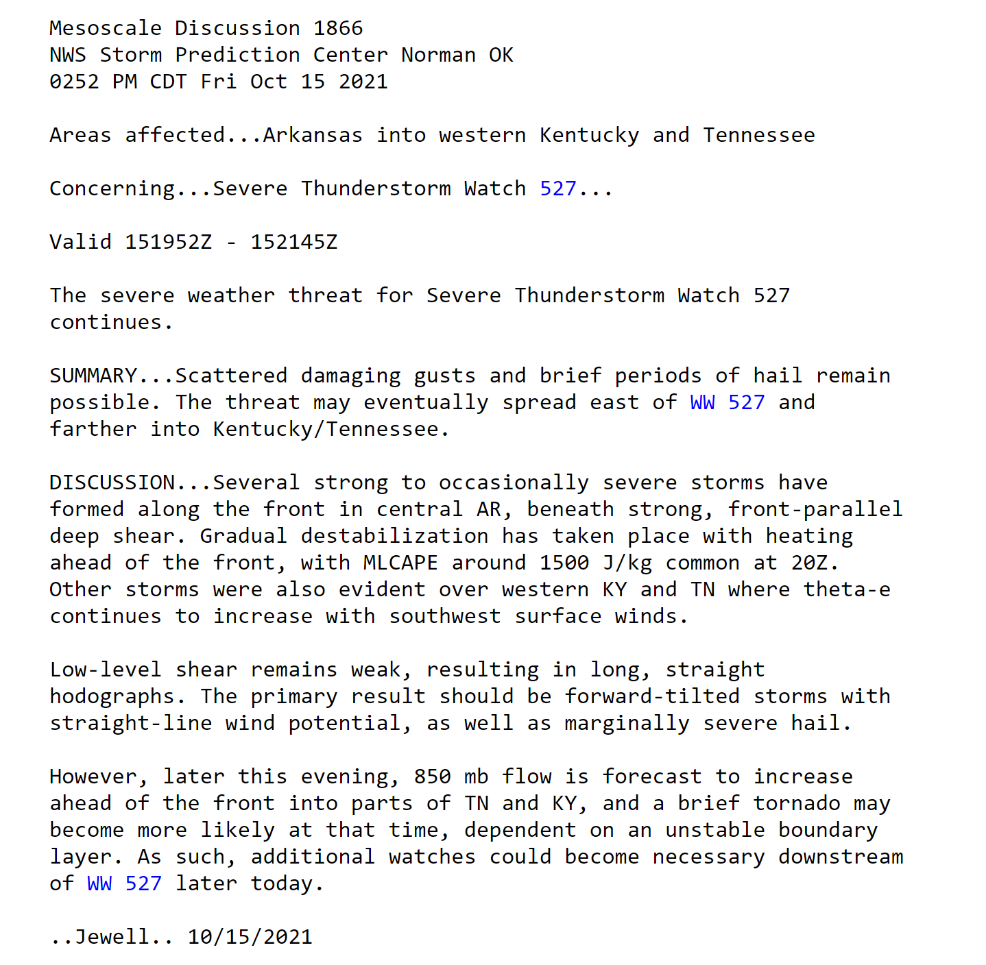
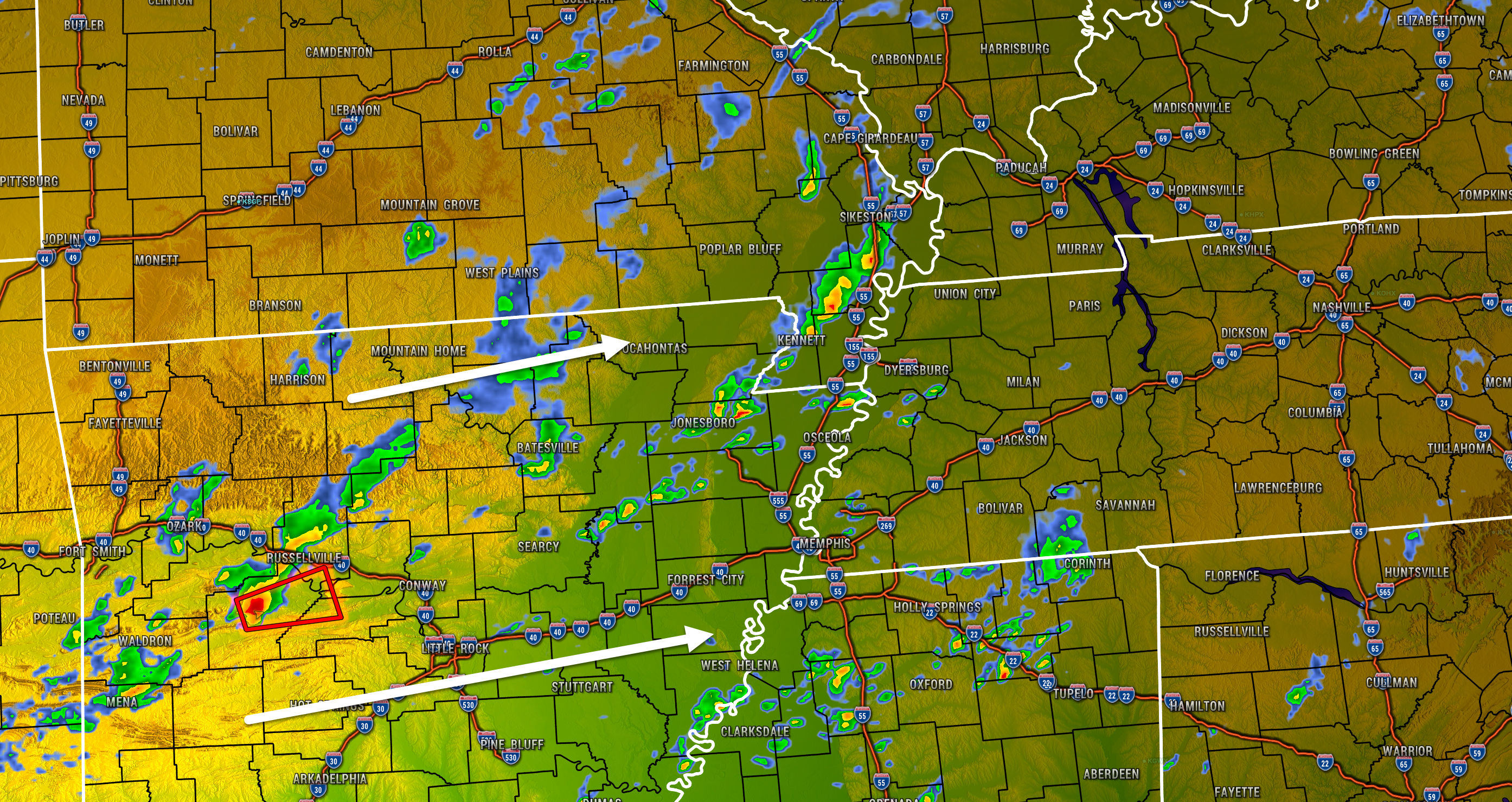
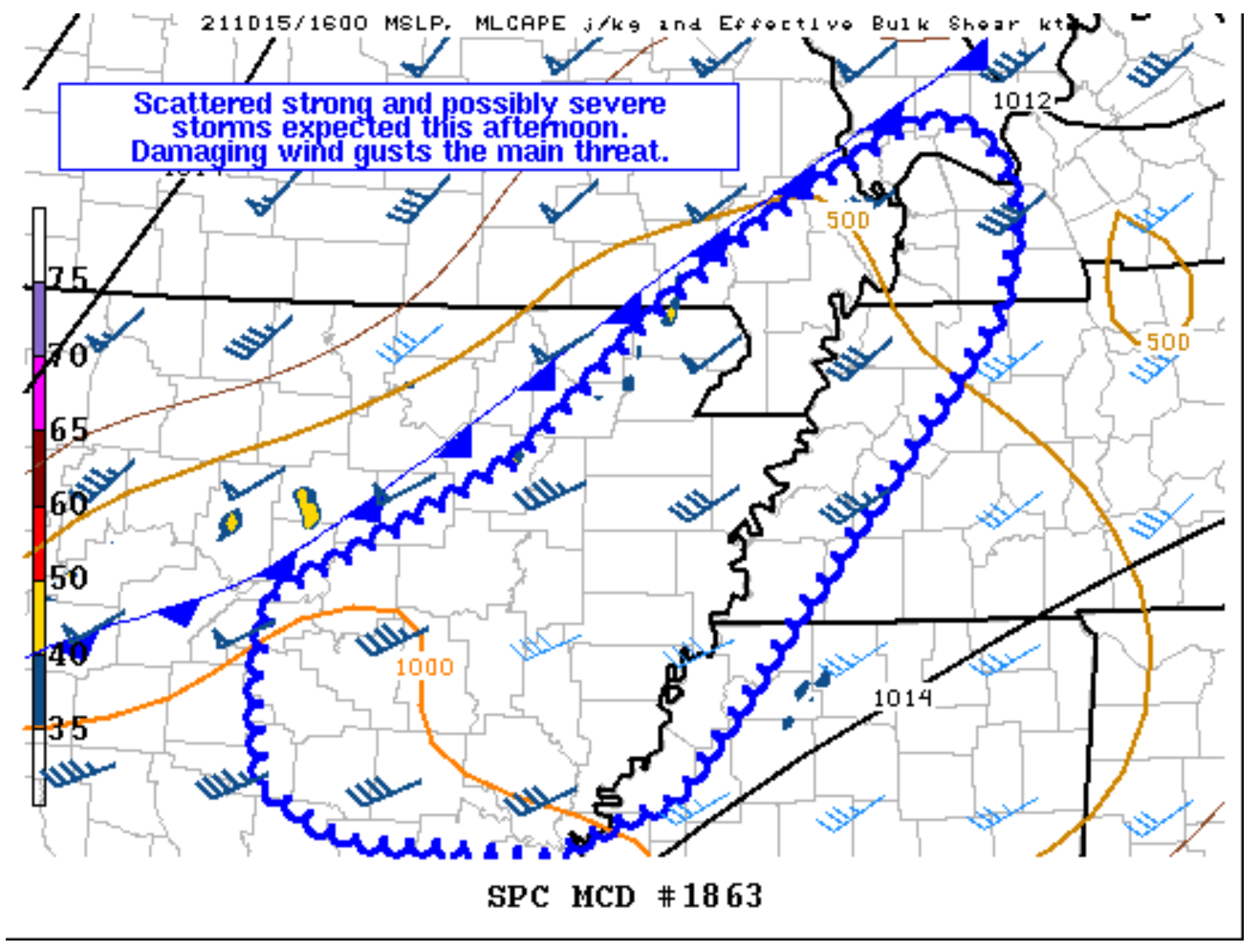
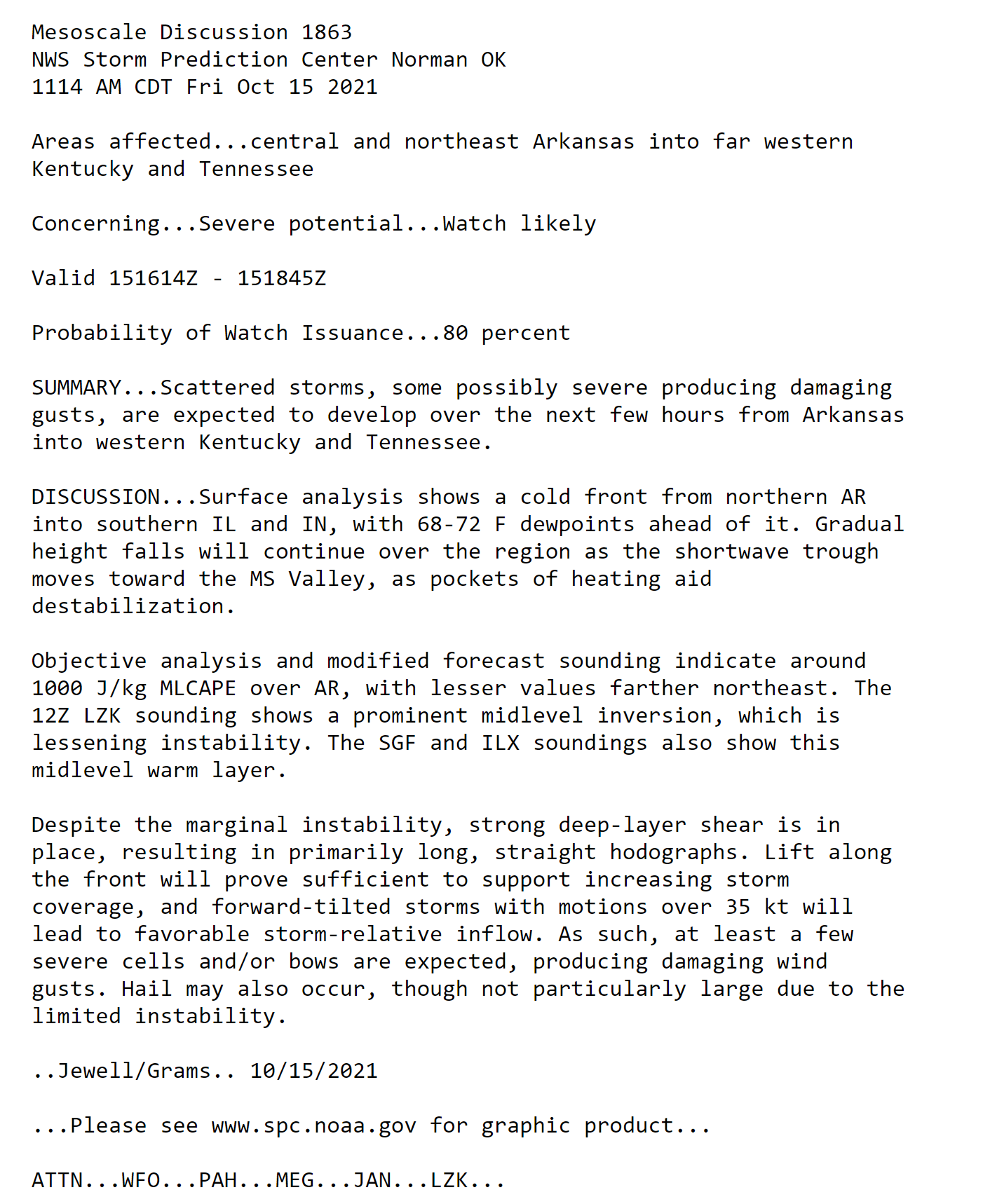
SPC is most concerned about the convection currently over western Arkansas, which would reach our area likely after 5 PM. We will monitor the line currently approaching the MS River, but that is not expected to be the main show.
.
12:35 PM
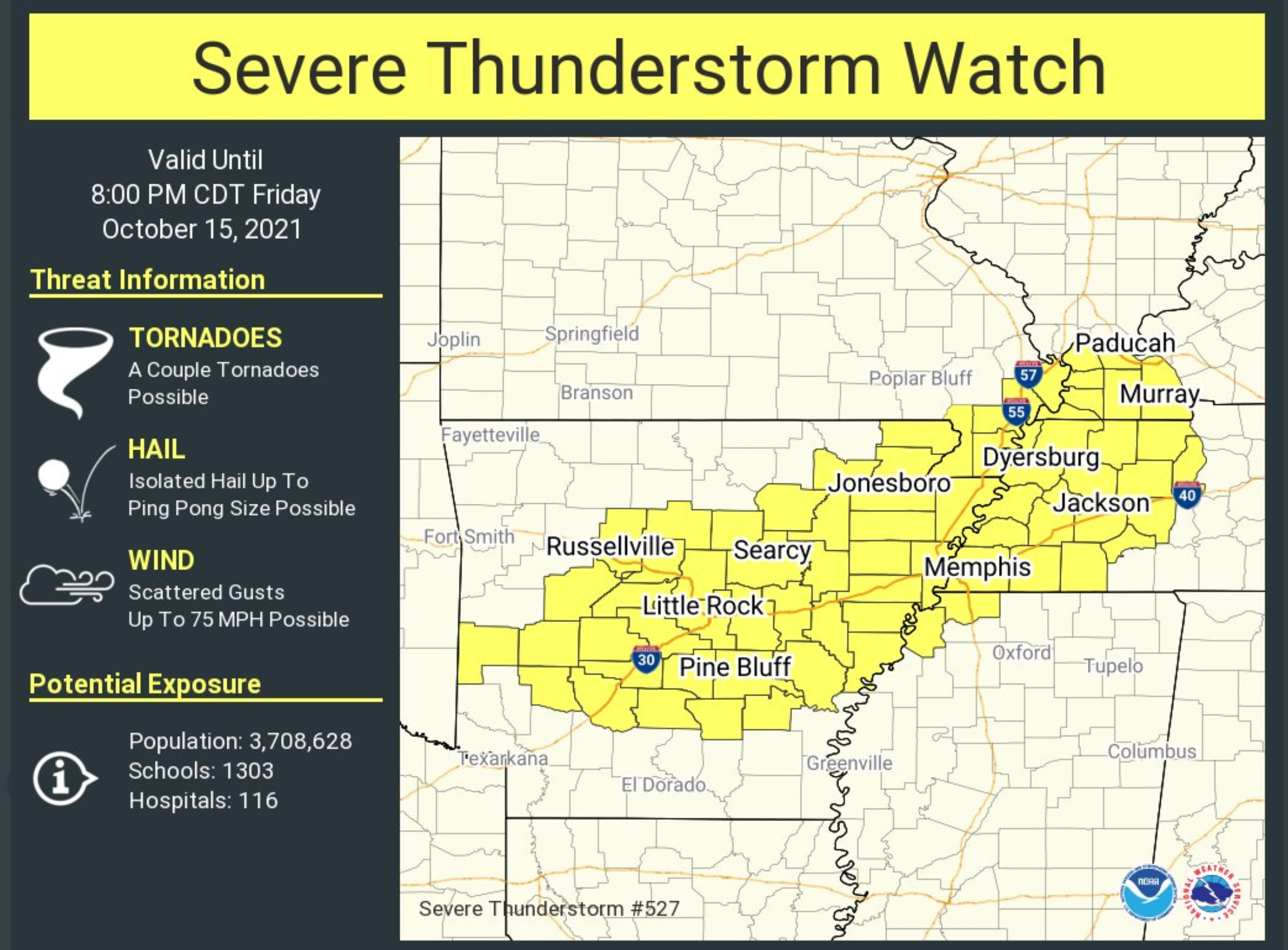
A severe thunderstorm WATCH has been issued for the Missouri Bootheel, all of northwest Tennessee, and Ballard, Carlisle, Hickman, Fulton, McCracken, Graves, Marshall, and Calloway Counties in western Kentucky.
Counties near the watch should also monitor updated watches and warnings. Remember, a WATCH means to monitor updates. Some severe storms are possible. A WARNING means to seek shelter – a severe thunderstorm is imminent.
The watch will last through 8 PM. If storms exit sooner then counties will be removed from the watch.
11:40 AM
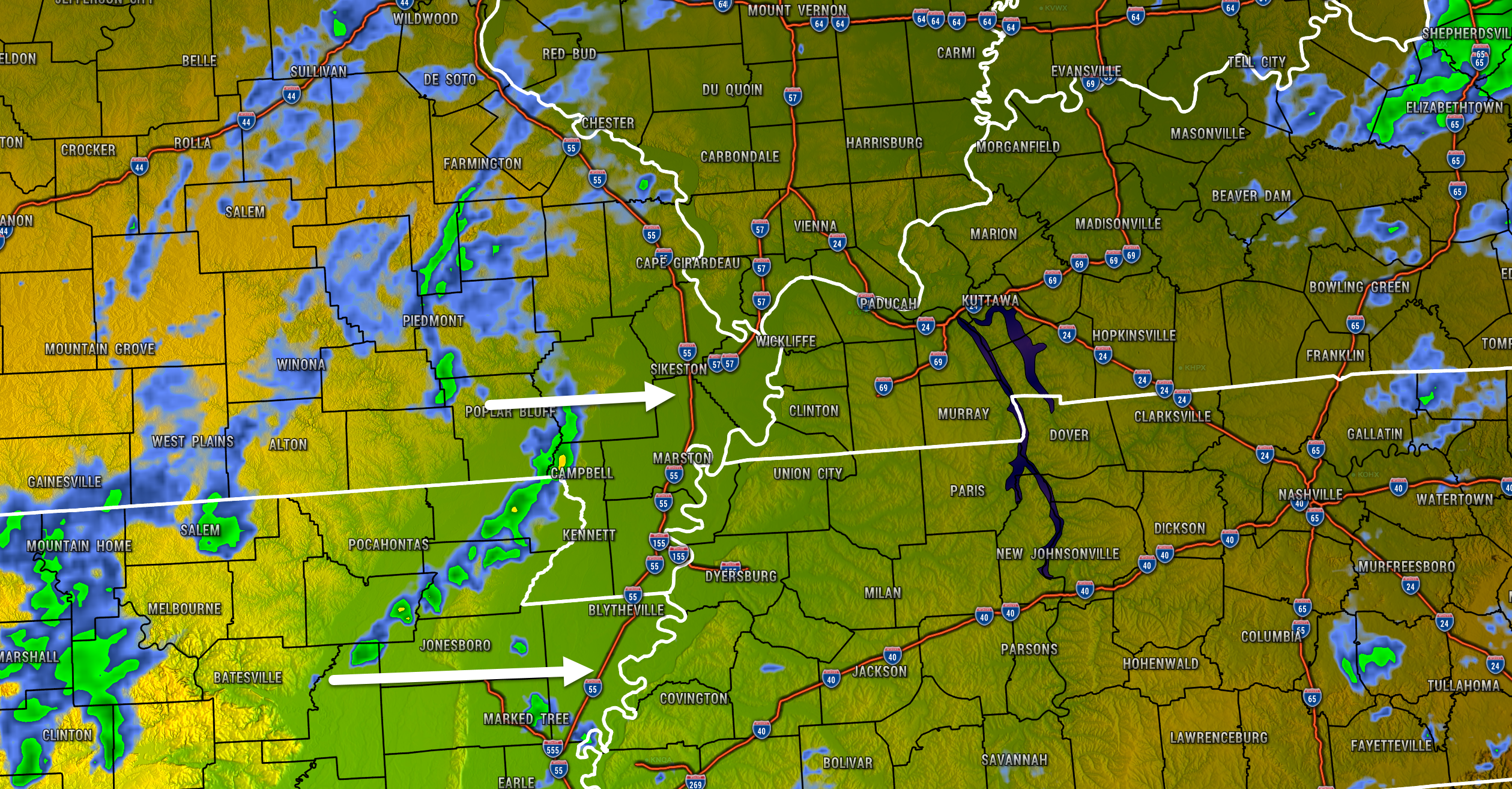
Radar shows a band of showers and thunderstorms moving eastward into the Missouri Bootheel. I will keep an eye on these storms in case they intensify.
.
11:20 AM
A severe weather watch may be issued shortly.
8:30 AM Friday, October 15, 2021
I continue to monitor mainly this afternoon for heavier showers and thunderstorms. A few storms could produce damaging wind gusts. I can’t rule out a tornado or two, as well.
Monitor your Beau Dodson Weather Talk app.
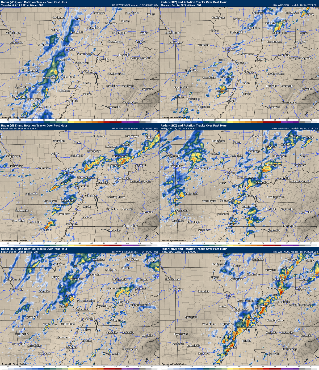
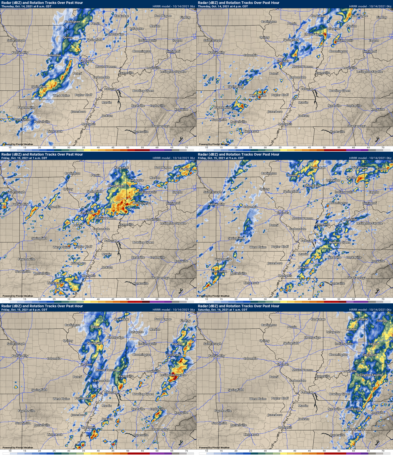
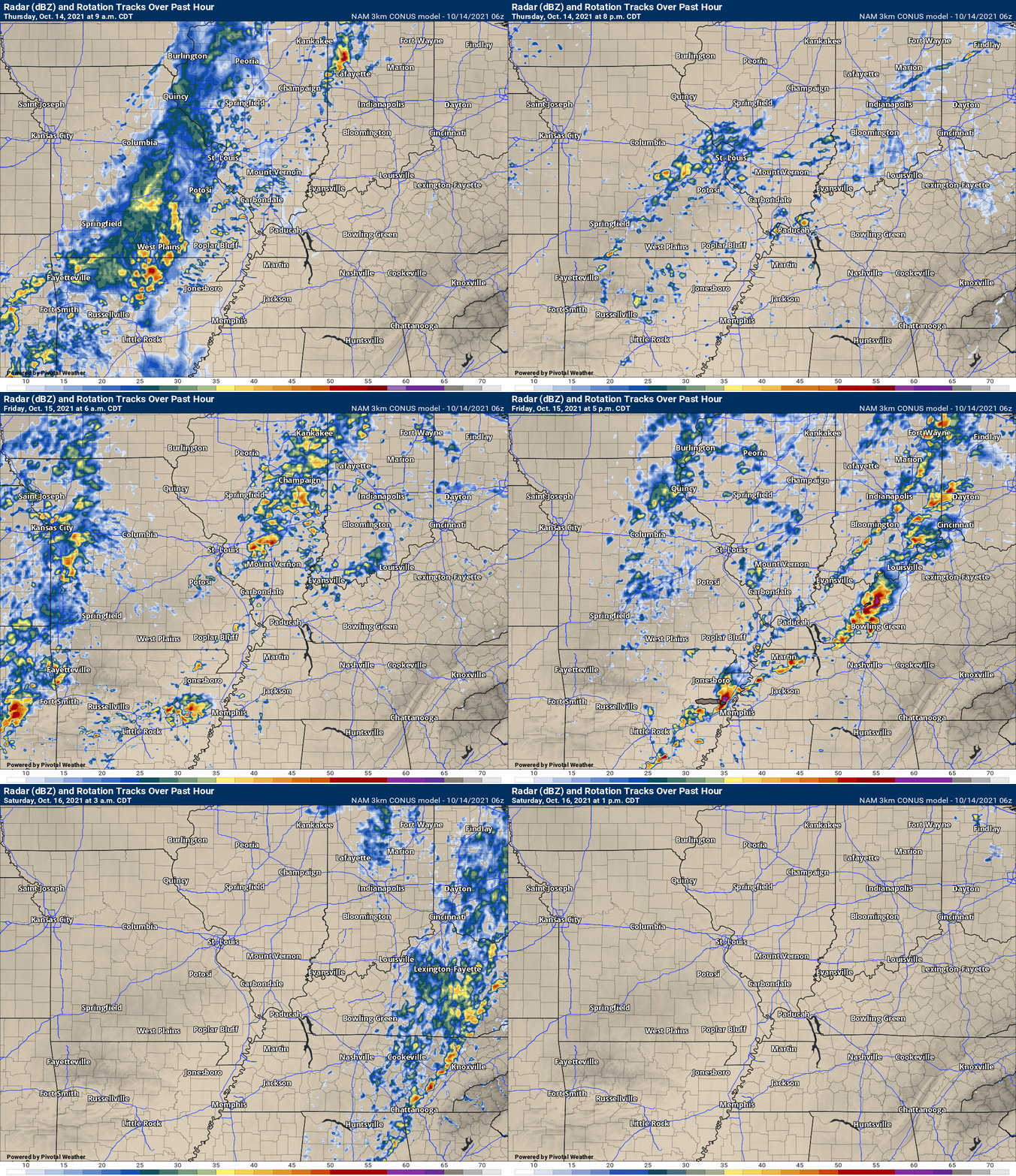
Here are the latest future-cast radars

Click here if you would like to return to the top of the page.
Again, as a reminder, these are models. They are never 100% accurate. Take the general idea from them.
What should I take from these?
- The general idea and not specifics. Models usually do well with the generalities.
- The time-stamp is located in the upper left corner.
- The EC European weather model is in Zulu time.
.
What am I looking at?
You are looking at different models. Meteorologists use many different models to forecast the weather. All models are wrong. Some are more wrong than others. Meteorologists have to make a forecast based on the guidance/models.
I show you these so you can see what the different models are showing as far as precipitation. If most of the models agree, then the confidence in the final weather forecast increases.
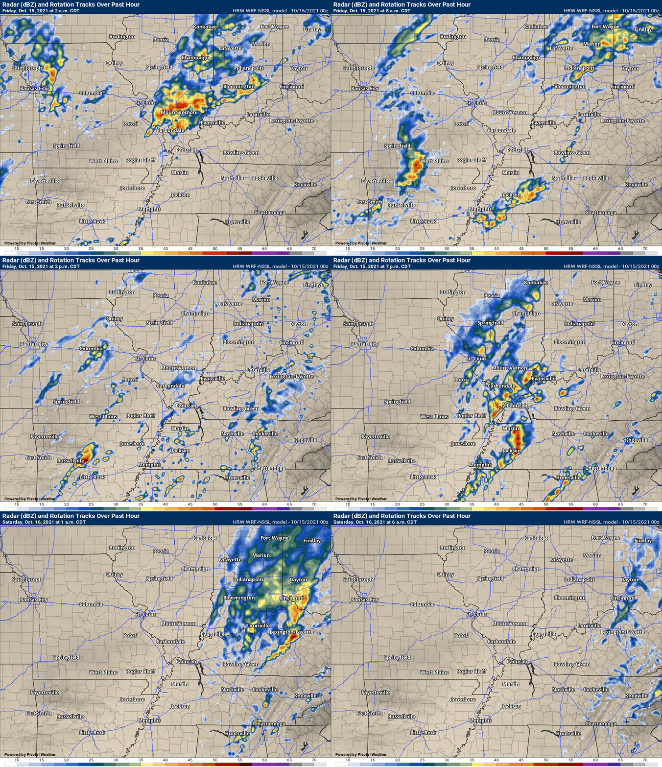
This animation is the Storm Prediction Center WRF model.
This animation shows you what radar might look like as the next system pulls through the region. It is a future-cast radar.
Time-stamp upper left. Click the animation to enlarge it.
.
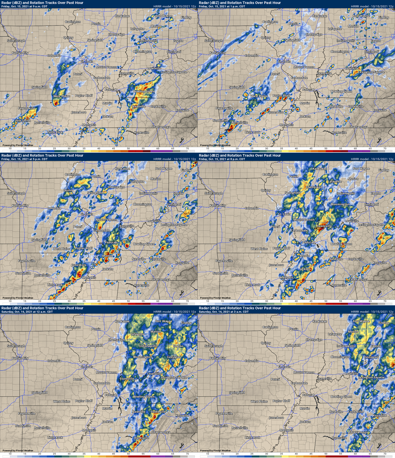
This animation is the Hrrr short-range model.
This animation shows you what radar might look like as the next system pulls through the region. It is a future-cast radar.
Time-stamp upper left. Click the animation to enlarge it.
.
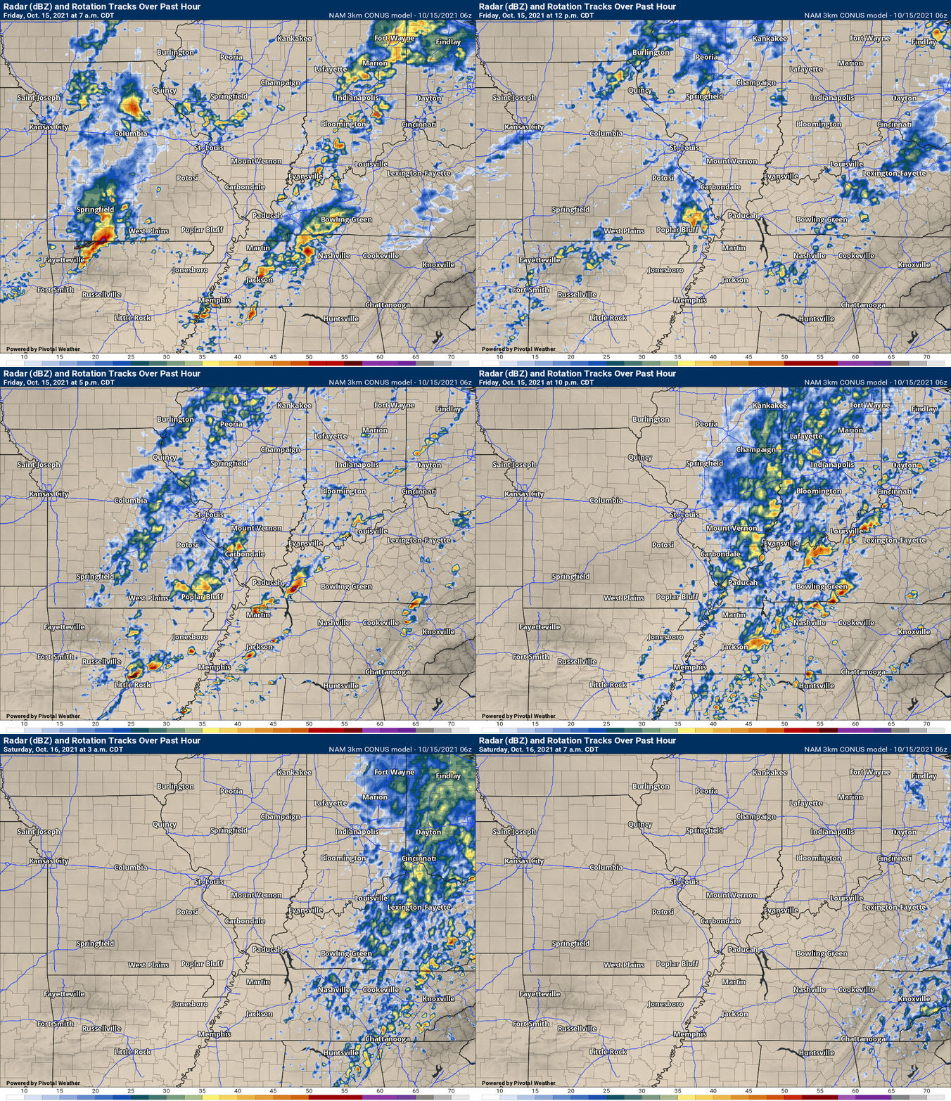
.This animation is the higher-resolution 3K NAM American Model.
.
.
3 PM Thursday, October 14, 2021
A couple of storms this afternoon and evening may produce gusty wind and dime size hail. A low risk of a severe thunderstorm.
I continue to monitor Friday. A powerful autumn cold front will sweep across the region from west to east. Warm and humid air ahead of the cold front will help produce showers and thunderstorms. A few of the storms could become severe.
There remain questions about the extent of severe weather. Cloud cover may help keep instability in check. If there are breaks in the clouds and we do have some sunshine then that will help enhance the severe weather threat.
Continue to monitor updates over the coming 24 to 36 hours.
The front will sweep eastward Friday night and the threat of severe weather will end.
Here is the latest future-cast radar from the SPC WRF model
.
A few storms could become severe Friday morning and afternoon. Monitor your Beau Dodson Weather Talk app.
The dark green and yellow zones are where severe storms will be possible. This covers my entire area. The yellow zone is a higher risk than the dark green, but don’t get too caught up in the colors. A severe thunderstorm in one zone is just as bad as the other.

Weather Discussion
The primary weather concern will be the chance of showers and thunderstorms today into Friday night. Some of the storms could be severe Friday.
A few shower’s and thunderstorms will be possible today. Mainly over southeast Missouri and southern Illinois. Elsewhere, there will be a mix of sun and clouds.
Shower and thunderstorm chances ramp up tonight as a cold front approaches from the west. Some of the showers and storms could produce locally heavy rain.
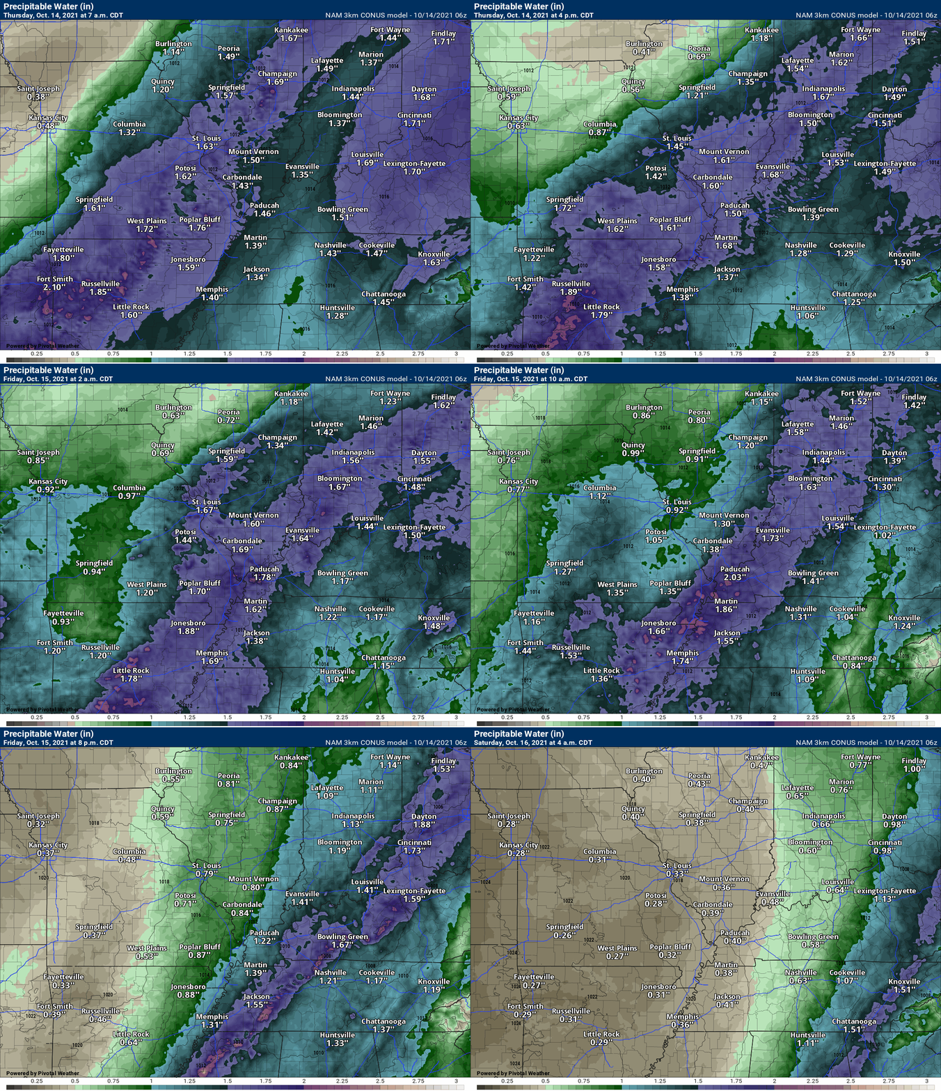
PWAT values will be high for this time of the year. PWAT is a measure of moisture in the entire atmosphere.
Rain totals of 0.50″ to 1.50″ will be possible with this event. Don’t be surprised if some locations top two inches.
You can see the stream of PWAT’s here on this animation.
The front moves across the region Friday. There should be enough instability for at least a few strong thunderstorms. Whether we have severe thunderstorms will depend on just how much CAPE we have. Remember, CAPE is energy for thunderstorms to tap into.
Earlier in the week it appeared we would not have enough instability. The models have been creeping upward with CAPE over the last 48 hours. There still remain questions.
We will have a lot of clouds in the region Friday. We will also have numerous showers and thunderstorms to deal with. If CAPE does develop then all modes of severe weather will be possible. That includes damaging wind, hail, and even a tornado.
We went through this Monday with only a couple of severe weather reports.
The Storm Prediction Center upgraded us to a level two risk Friday. They had us at a level one risk. The scale goes to five. One being the lowest. Five being the highest.
Severe weather is not a certainty Friday, but there are enough parameters showing up in the models to warrant us paying attention.
The shower and thunderstorm activity will taper off Friday night and Saturday morning. There could still be some showers early Saturday morning before clearing arrives and the showers come to an end.
![]()
.

Click here if you would like to return to the top of the page.
Again, as a reminder, these are models. They are never 100% accurate. Take the general idea from them.
What should I take from these?
- The general idea and not specifics. Models usually do well with the generalities.
- The time-stamp is located in the upper left corner.
- The EC European weather model is in Zulu time.
.
What am I looking at?
You are looking at different models. Meteorologists use many different models to forecast the weather. All models are wrong. Some are more wrong than others. Meteorologists have to make a forecast based on the guidance/models.
I show you these so you can see what the different models are showing as far as precipitation. If most of the models agree, then the confidence in the final weather forecast increases.
You can see my final forecast at the top of the page.
.
This animation is the Storm Prediction Center WRF model.
This animation shows you what radar might look like as the next system pulls through the region. It is a future-cast radar.
Time-stamp upper left. Click the animation to enlarge it.
.
This animation is the Hrrr short-range model.
This animation shows you what radar might look like as the next system pulls through the region. It is a future-cast radar.
Time-stamp upper left. Click the animation to enlarge it.
.
.This animation is the higher-resolution 3K NAM American Model.
.
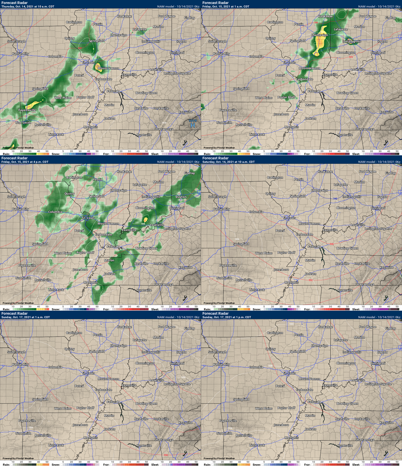
This next animation is the lower-resolution NAM American Model.
This animation shows you what radar might look like as the system pulls through the region. It is a future-cast radar.
Time-stamp upper left. Click the animation to enlarge it.
.
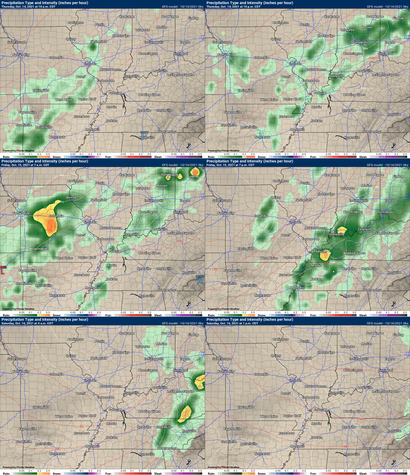
This next animation is the GFS American Model.
![]()
Today’s severe weather outlook from the Storm Prediction Center (below).
Light green is where thunderstorms may occur but should be below severe levels.
Dark green is a level one risk. Yellow is a level two risk. Orange is a level three (enhanced) risk. Red is a level four (moderate) risk. Pink is a level five (high) risk.
One is the lowest risk. Five is the highest risk.
A severe storm is one that produces 58 mph wind or higher, quarter size hail, and/or a tornado.
The tan states are simply a region that SPC outlined on this particular map. Just ignore that.

The black outline is our local area.

.
Tomorrow’s severe weather outlook.

![]()
![]()
Some safety graphics.
.![]()
.
.

Radar Link: Interactive local city-view radars & regional radars.
You will find clickable warning and advisory buttons on the local city-view radars.
If the radar is not updating then try another one. If a radar does not appear to be refreshing then hit Ctrl F5. You may also try restarting your browser.
Not working? Email me at beaudodson@usawx.com
Backup radar site in case the above one is not working.
https://weathertalk.com/morani
New ZOOM radar (with storm chasers)
https://wtalk.co/AVWG7GM7
Regional Radar
https://imagery.weathertalk.com/prx/RadarLoop.mp4
Lightning Data (zoom in and out of your local area)
https://wtalk.co/WJ3SN5UZ
Satellite Data
Computers and tablets. These two satellite links may not work well on cell phones.
Visible Satellite. This one is to be used during daylight only. Be sure and hit refresh once you are on the satellite page. Otherwise, the data will be old.
https://col.st/a5A0e
IR Satellite. This one shows cloud temperatures. Bright colors represent cold cloud tops. That could mean thunderstorms. Be sure and hit refresh once you are on the satellite page. Otherwise, the data will be old.
https://col.st/R2fw1
Water Vapor Satellite. This one shows mid-level moisture in the atmosphere. Be sure and hit refresh once you are on the satellite page. Otherwise, the data will be old.
https://col.st/xFVwx
.

Live lightning data: Click here.
Not receiving app/text messages?
Log in and out of your app.
USE THE APP. ATT and Verizon are slowing or stopping the text messages. Move to the app (not texts).
Make sure you have the correct app/text options turned on. Find those under the personal notification settings tab at www.weathertalk.com. Red is off. Green is on.
Subscribers, PLEASE USE THE APP. ATT and Verizon are not reliable during severe weather. They are delaying text messages.
The app is under WeatherTalk in the app store.
Apple users click here
Android users click here
.


