

.
I have some question-and-answer threads over on the Facebook page. Link to those threads CLICK HERE
Or email me at beaudodsonweather@gmail.com
..

🌪️ Seven-Day Tornado Outlook ⛈️
September 24th through October 1st
Current risk: UNLIKELY
Current confidence level: Medium confidence in the forecast.
Comments: At this time, we do not expect tornado activity with today’s storms.
.

Seven-Day Hazardous Weather Outlook
1. Is lightning in the forecast? YES. There is a chance of lightning today and tonight. A small chance on Thursday.
2. Are organized/widespread severe thunderstorms in the forecast? ISOLATED. A few storms could produce strong winds and nickel-sized hail this afternoon and evening.
3. Is flash flooding in the forecast? ISOLATED. Locally heavy thunderstorms are expected today and could briefly cause issues. The concern would be rapid runoff. The risk of organized widespread flash flooding is low. Scattered issues can’t be ruled out.
4. Will non-thunderstorm winds top 40 mph? NO.
5. Will temperatures rise above 90 degrees? NO.
6. Will temperatures rise above 100 degrees? NO.
7. Will the heat index (feels like) rise above 100 degrees? NO.
8. Will the heat index rise above 115 degrees? NO.
9. Will the temperature fall below 32 degrees? NO.
.
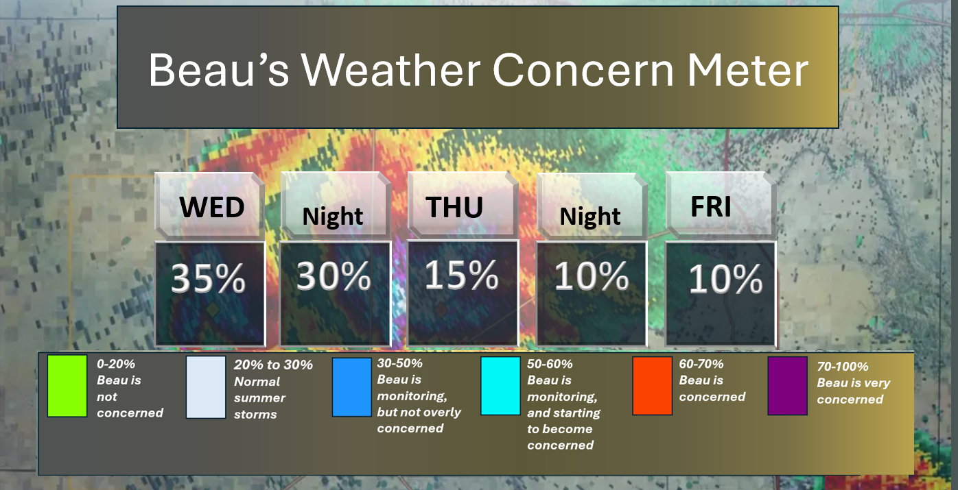
Here is the short-range concern meter.
A few storms could be intense today. The primary concern will be gusty winds and nickel-sized hail.
.
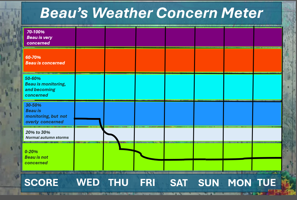
Here is the extended concern meter. This takes us through next Tuesday.
We will pop into the blue zone today.
A few storms could trigger a severe thunderstorm warning, mainly for wind and nickel-sized hail.
.
.
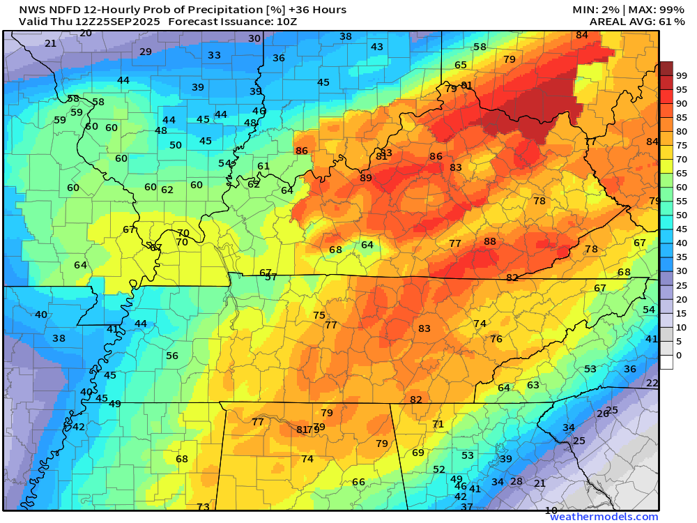
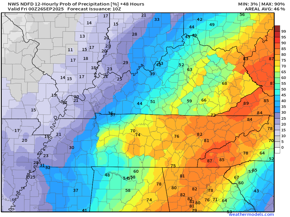
Let’s look at rain probabilities over the coming days.
What is the percent (%) chance of showers and thunderstorms?
Double-click on the images to enlarge them.
Today
.
Tonight
.
Tomorrow
.
.

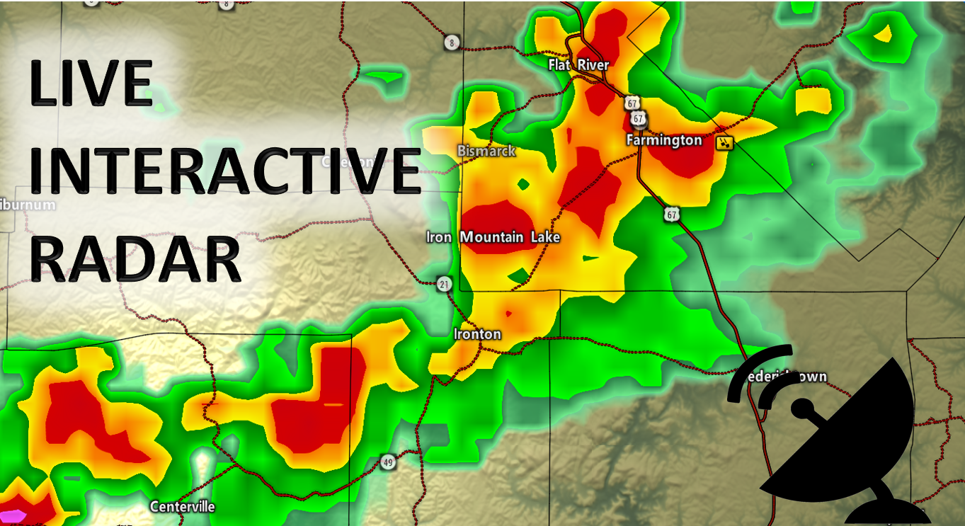
Radars and Lightning Data
Interactive-city-view radars. Clickable watches and warnings.
https://wtalk.co/B3XHASFZ
Old legacy radar site (some of you like it better)
https://weatherobservatory.com/weather-radar.htm
If the radar is not updating, then try another one. If a radar does not appear to be refreshing then hit Ctrl F5. You may also try restarting your browser.
Backup radar site in case the above one is not working.
https://weathertalk.com/morani
Regional Radar
https://imagery.weathertalk.com/prx/RadarLoop.mp4
** NEW ** Zoom radar with chaser tracking abilities!
ZoomRadar
Lightning Data (zoom in and out of your local area)
https://wtalk.co/WJ3SN5UZ
A quick forecast glance. Your 48-hour forecast Graphics


.
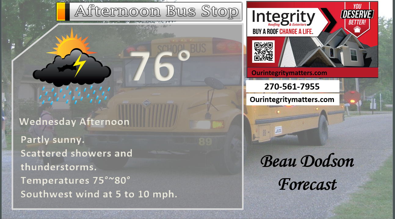
Here is your bus stop forecast.
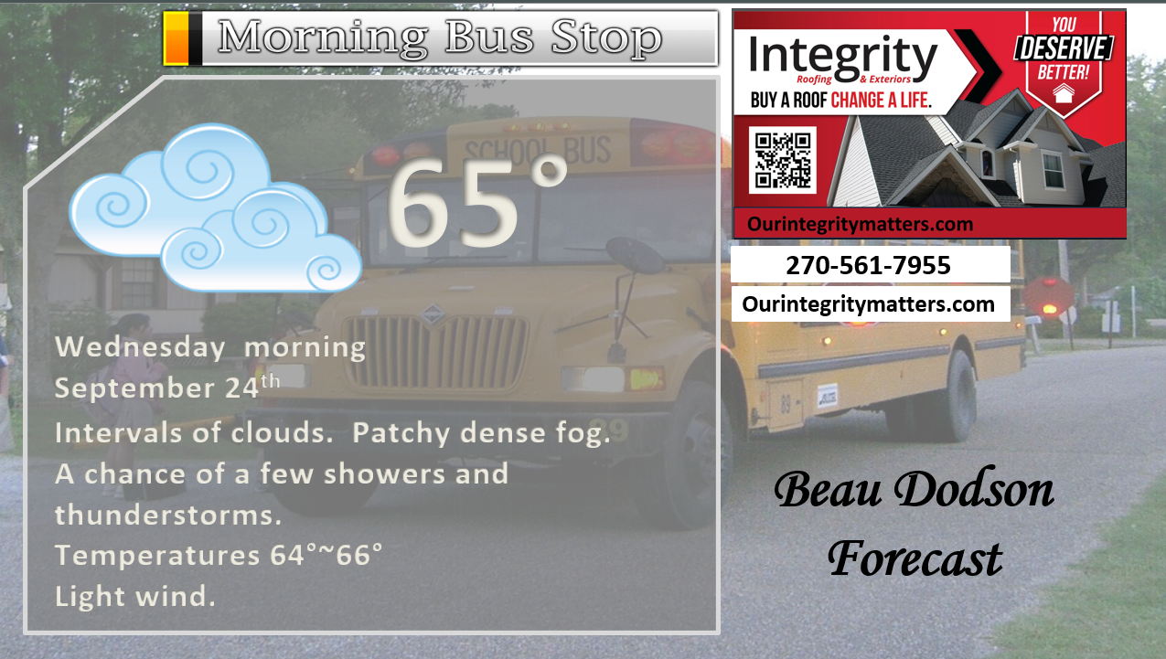
.
This afternoon
.

.

Forecast discussion
- Shower and thunderstorm chances today and tonight.
- A few storms could be intense today.
- Cooler temperatures this week.
- A pleasant weekend is on tap for the region.
.
 .
.
.
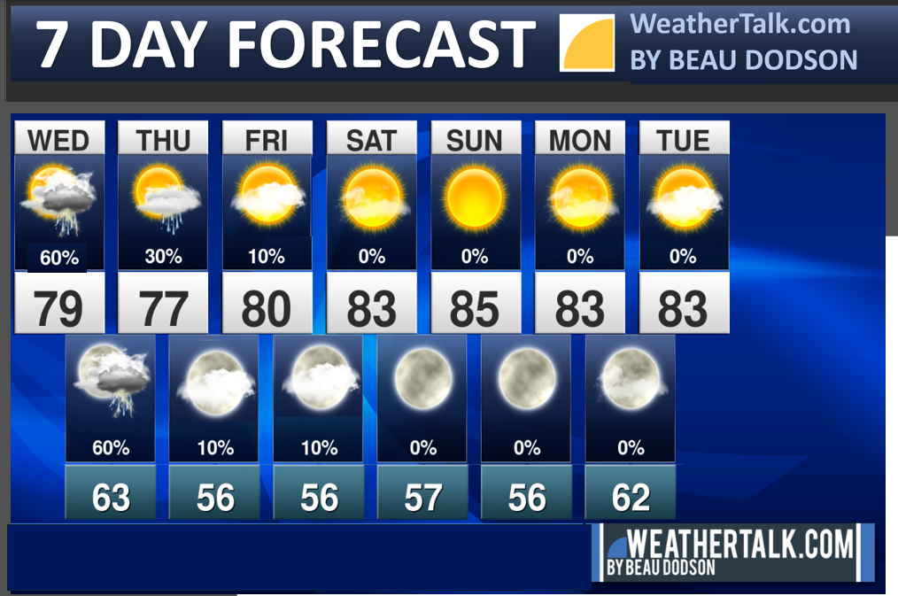
Seven-day outlook graphic.
.
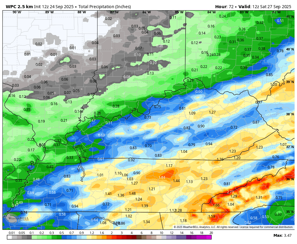
By now, almost every county has received one to three inches of rain. There have been pockets of three to six inches.
There are likely a few spots that received less than that, but the majority of the region has received decent rain over the past few days.
Additional showers and thunderstorms are possible today and tonight. Isolated showers tomorrow.
Friday through Sunday will be dry. A tiny chance of a shower on Friday in our far southeastern counties (Todd and Christian).
Some of the rain will be locally heavy today/tonight. Same as recent days.
Thunderstorms can enhance rain totals.
Additional rain totals for today and tonight are expected to range from trace amounts to over an inch in thunderstorms.
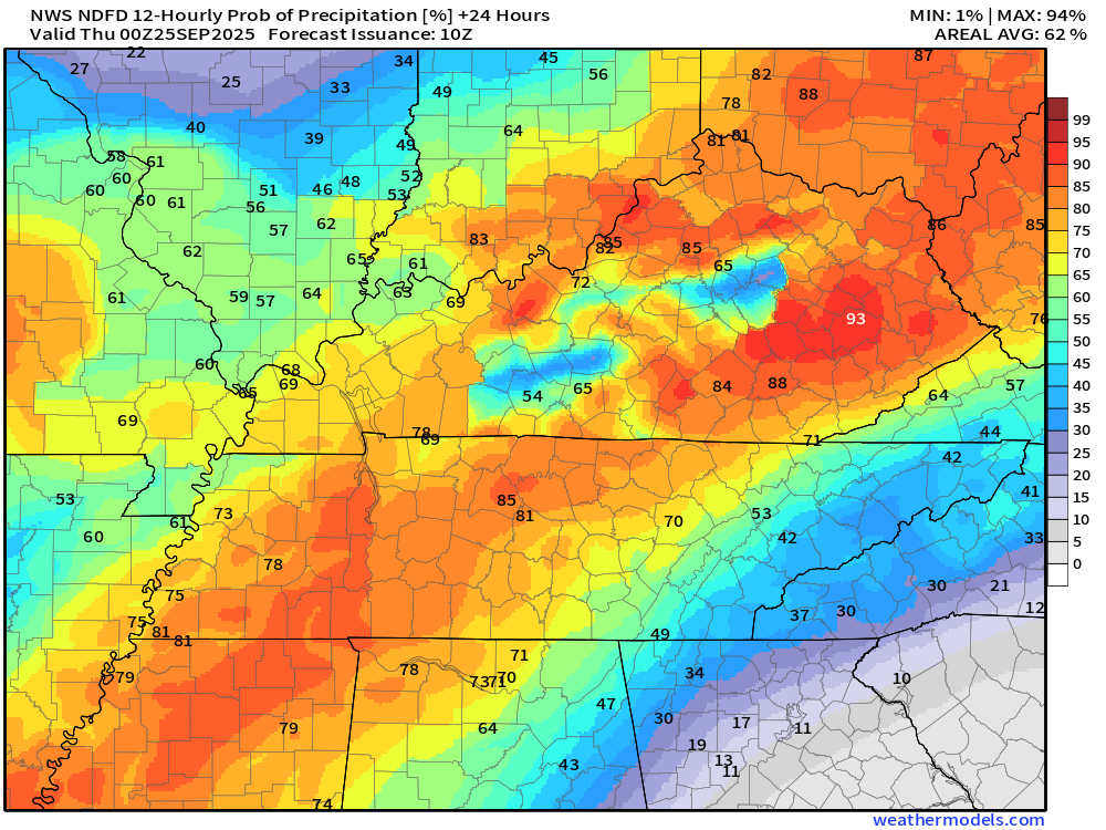
Here is the NOAA rainfall outlook. Totals will vary based on where thunderstorms occur.
Double-click on the image to enlarge it.
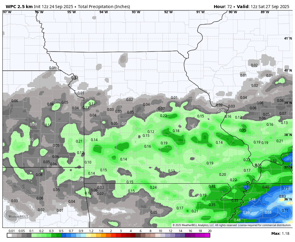
Here is the far southeast MO, southern IL, western KY, and western TN view
.
.
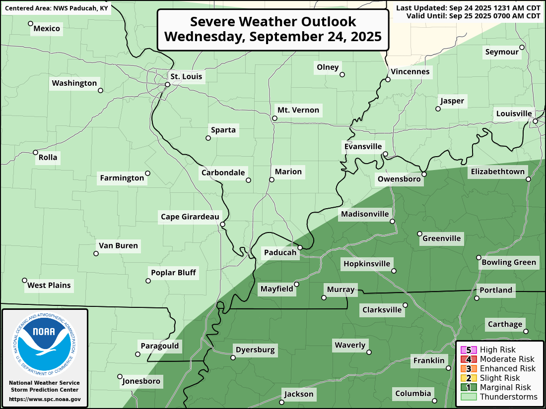
There is a low-level risk of severe thunderstorms this afternoon and evening.
The primary concern will be damaging wind and nickel-sized hail.
The risk of severe weather at any given location will remain small.
Here is today’s severe weather outlook. The light green is sub-severe. The dark green represents the low-level, severe risk zone.
.
.
Temperatures will be pleasant over the coming days, mainly in the seventies and lower eighties.
Friday through Sunday will be nice. Mild temperatures (near average). Cool nights.
Watch for patchy fog over the coming nights. Autumn is here.

.
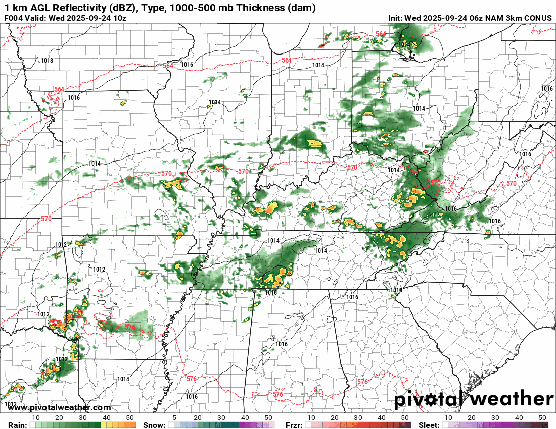
The timestamp (upper left) is in Zulu. 12z=7 am. 18z=1 pm. 00z=7 pm.
Double-click the animation to enlarge it.
NAM 3K model
.
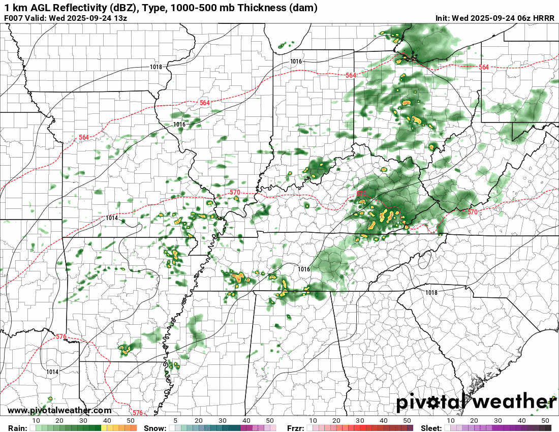
The timestamp (upper left) is in Zulu. 12z=7 am. 18z=1 pm. 00z=7 pm.
Double-click the animation to enlarge it.
Hrrr model
.
..
.
Click here if you would like to return to the top of the page.
.Average high temperatures for this time of the year are around 78 degrees.
Average low temperatures for this time of the year are around 58 degrees.
Average precipitation during this time period ranges from 1.00″ to 1.25″
Six to Ten Day Outlook.
Blue is below average. Red is above average. The no color zone represents equal chances.
Average highs for this time of the year are in the lower 60s. Average lows for this time of the year are in the lower 40s.

Green is above average precipitation. Yellow and brown favors below average precipitation. Average precipitation for this time of the year is around one inch per week.

.

Average low temperatures for this time of the year are around 56 degrees.
Average precipitation during this time period ranges from 1.00″ to 1.25″
.
Eight to Fourteen Day Outlook.
Blue is below average. Red is above average. The no color zone represents equal chances.

Green is above average precipitation. Yellow and brown favors below average precipitation. Average precipitation for this time of the year is around one inch per week.

.
.
.
We have a new service to complement your www.weathertalk.com subscription. This does NOTreplace www.weathertalk.com It is simply another tool for you to receive severe weather information.
.
https://weathercallservices.com/beau-dodson-weather


Want to receive the daily forecast/other products on your Beau Dodson Weather app?
Did you know you have four options in your www.weathertalk.com account
You will then receive these via your Beau Dodson Weather app.
Just log into your www.weathertalk.com account
Click the NOTIFICATION SETTINGS TAB
Then, turn them on (green) and off (red)
🌪️ Number 1 is the most important one. Severe alerts, tornado alerts, and so on.
Number 2 is the daily video, blog, livestream alerts, and severe weather Facebook threads on severe days or winter storm days.
Number 3 is the daily forecast. I send that out every day during the afternoon hours. It is the seven-day forecast, hazardous weather outlook, fire outlook, and more.
Number 4 is to receive the daily video, blog, and other content on NON-severe weather days (every day without severe threats in other words)
GREEN IS ON
RED IS OFF

I am going to start going live during bigger severe weather events.
Check it out here https://www.youtube.com/user/beaudodson
Click the subscribe button (it’s a free subscription button), and it will alert you when I go live. I will also send out alerts to the app when I go live for an event.

.
Radars and Lightning Data
Interactive-city-view radars. Clickable watches and warnings.
https://wtalk.co/B3XHASFZ
Old legacy radar site (some of you like it better)
https://weatherobservatory.com/weather-radar.htm
If the radar is not updating then try another one. If a radar does not appear to be refreshing then hit Ctrl F5. You may also try restarting your browser.
Backup radar site in case the above one is not working.
https://weathertalk.com/morani
Regional Radar
https://imagery.weathertalk.com/prx/RadarLoop.mp4
** NEW ** Zoom radar with chaser tracking abilities!
ZoomRadar
If the radar is not working, then email me: Email me at beaudodson@usawx.com
.
We do have some sponsors! Check them out.
Roof damage from recent storms? Link – Click here
INTEGRITY ROOFING AND EXTERIORS!
⛈️ Roof or gutter damage from recent storms? Today’s weather is sponsored by Integrity Roofing. Check out their website at this link https://www.ourintegritymatters.com/

![]()
![]()
![]()
Make sure you have three to five ways of receiving your severe weather information.
Weather Talk is one of those ways! Now, I have another product for you and your family.

.
Want to add more products to your Beau Dodson Weather App?
Receive daily videos, weather blog updates on normal weather days and severe weather and winter storm days, your county by county weather forecast, and more!
Here is how to do add those additional products to your app notification settings!
Here is a video on how to update your Beau Dodson Weather payment.
The app is for subscribers. Subscribe at www.weathertalk.com/welcome then go to your app store and search for WeatherTalk
Subscribers, PLEASE USE THE APP. ATT and Verizon are not reliable during severe weather. They are delaying text messages.
The app is under WeatherTalk in the app store.

Apple users click here

Android users click here
.
Radars and Lightning Data
Interactive-city-view radars. Clickable watches and warnings.
https://wtalk.co/B3XHASFZ
Old legacy radar site (some of you like it better)
https://weatherobservatory.com/weather-radar.htm
If the radar is not updating then try another one. If a radar does not appear to be refreshing then hit Ctrl F5. You may also try restarting your browser.
Backup radar site in case the above one is not working.
https://weathertalk.com/morani
Regional Radar
https://imagery.weathertalk.com/prx/RadarLoop.mp4
** NEW ** Zoom radar with chaser tracking abilities!
ZoomRadar
Lightning Data (zoom in and out of your local area)
https://wtalk.co/WJ3SN5UZ
Not working? Email me at beaudodson@usawx.com
National map of weather watches and warnings. Click here.
Storm Prediction Center. Click here.
Weather Prediction Center. Click here.
.

Live lightning data: Click here.
Real time lightning data (another one) https://map.blitzortung.org/#5.02/37.95/-86.99
Our new Zoom radar with storm chases
.
.

Interactive GOES R satellite. Track clouds. Click here.
GOES 16 slider tool. Click here.
College of DuPage satellites. Click here
.

Here are the latest local river stage forecast numbers Click Here.
Here are the latest lake stage forecast numbers for Kentucky Lake and Lake Barkley Click Here.
.
.
Find Beau on Facebook! Click the banner.


 .
.