

.
I have some question-and-answer threads over on the Facebook page. Link to those threads CLICK HERE
Or email me at beaudodsonweather@gmail.com
..

🌪️ Seven-Day Tornado Outlook ⛈️
September 19th through September 25th
Current risk: NO
Current confidence level: High confidence in the forecast.
Comments: At this time, there are no concerns.
.

Seven-Day Hazardous Weather Outlook
1. Is lightning in the forecast? YES. There is a chance of scattered lightning today through next Thursday.
2. Are organized/widespread severe thunderstorms in the forecast? Not at this time.
3. Is flash flooding in the forecast? ISOLATED. Locally heavy thunderstorms this weekend and next week could briefly cause issues. The ground is very hard. The concern would be rapid runoff. The risk of organized flash flooding is low. Isolated issues can’t be ruled out.
4. Will non-thunderstorm winds top 40 mph? NO.
5. Will temperatures rise above 90 degrees? YES. Today. Some reporting stations will hit 90 degrees on Saturday and Sunday, as well.
6. Will temperatures rise above 100 degrees? NO.
7. Will the heat index (feels like) rise above 100 degrees? NO.
8. Will the heat index rise above 115 degrees? NO.
9. Will the temperature fall below 32 degrees? NO.
.
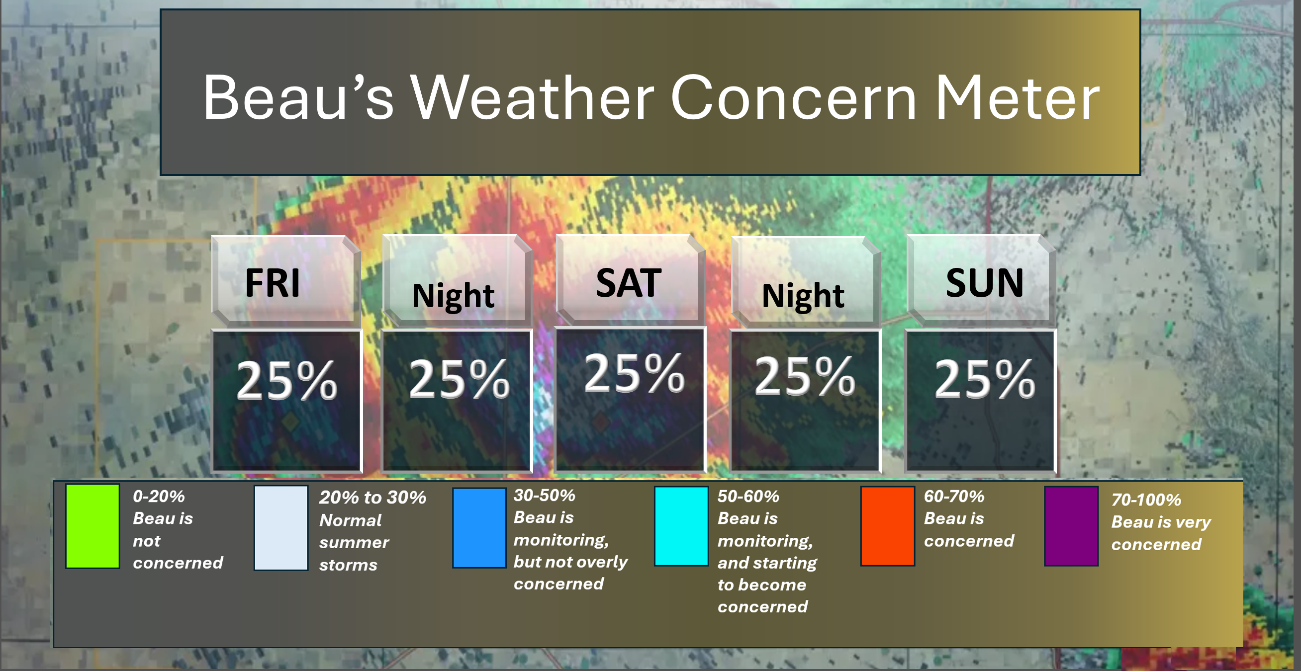
Here is the short-range concern meter.
Severe weather is not anticipated. We pop into the grey zone by this weekend. That is for general thunderstorms (lightning being the concern).
.
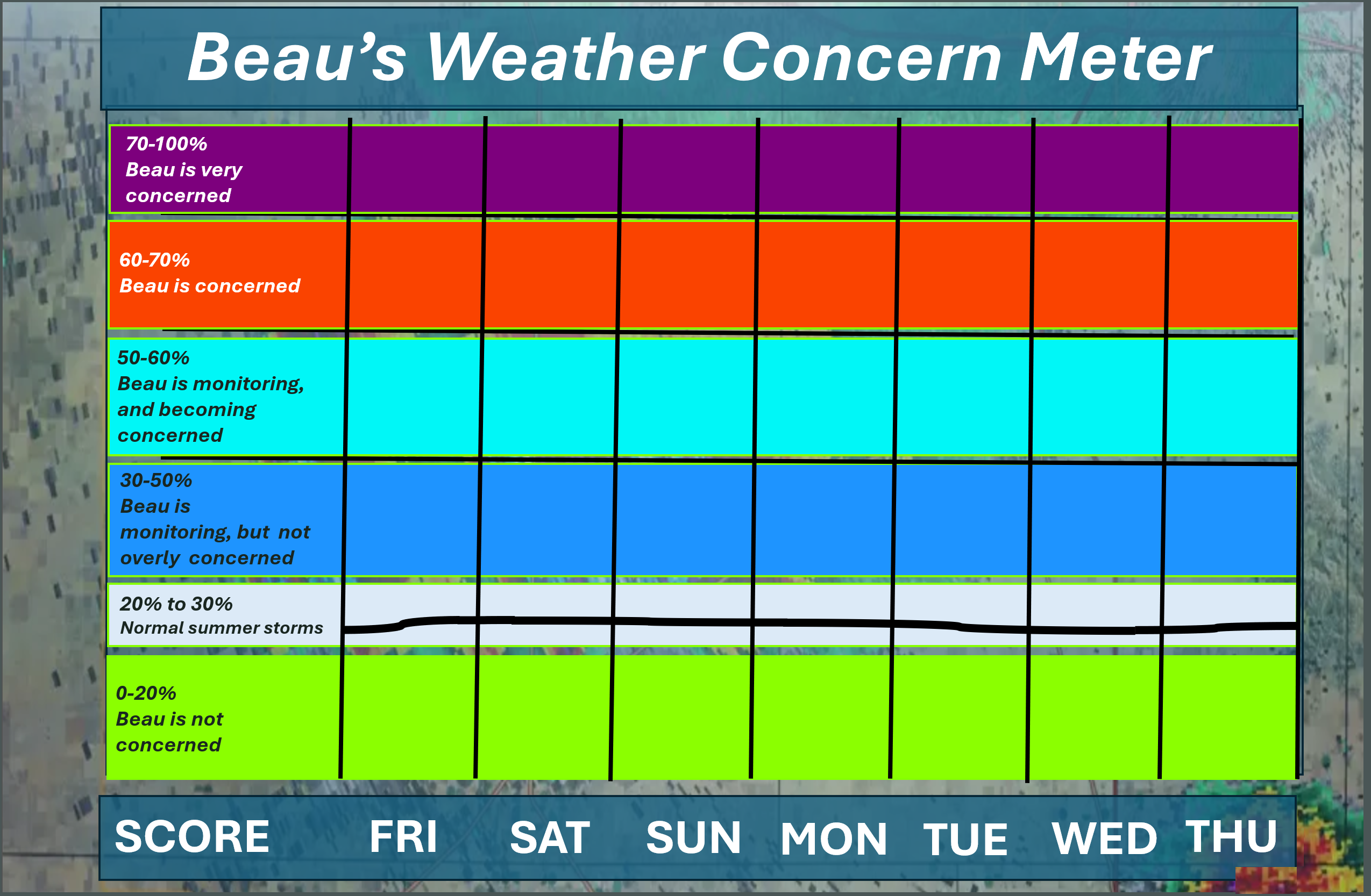
Here is the extended concern meter. This takes us through next Thursday.
We pop into the grey zone later this week. That will be for lightning. At this time, severe storms are not anticipated.
A quick forecast glance. Your 48-hour forecast Graphics


.
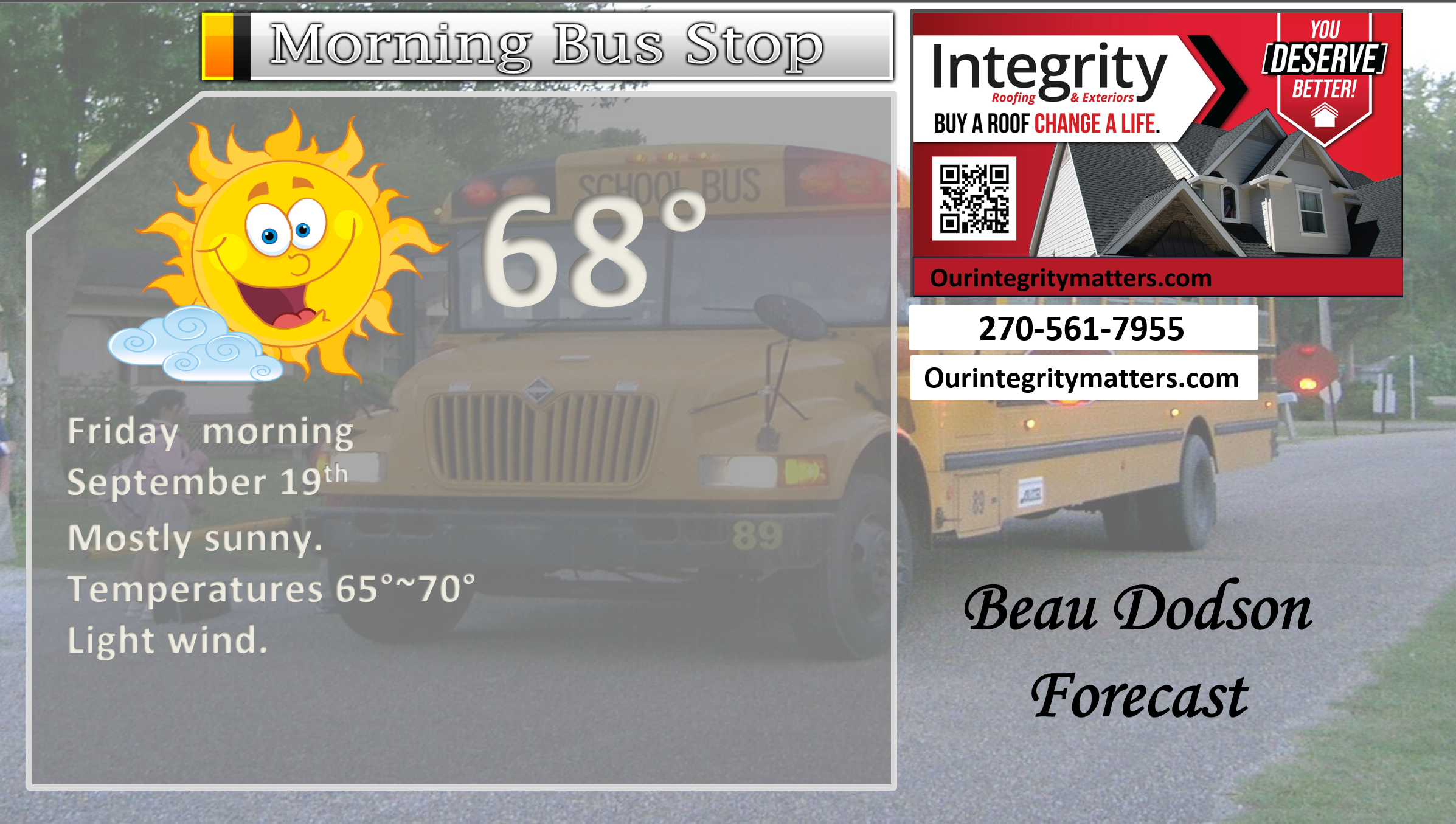
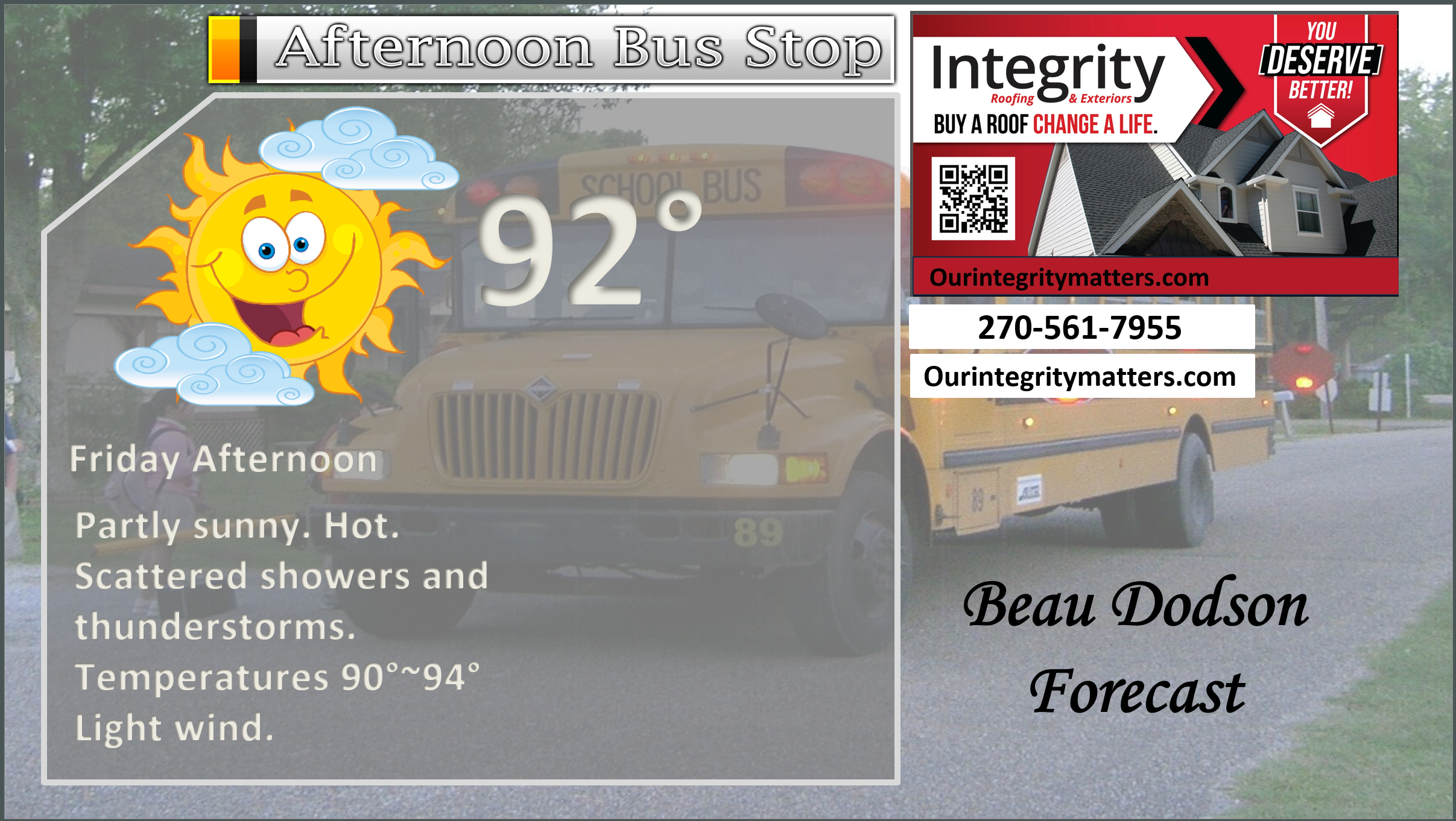
Here is your bus stop forecast.
This afternoon
.

.

Forecast discussion
- Hot today.
- Saturday will be quite warm, as well.
- Monitoring rain chances.
- Cooler temperatures next week.
.
 .
.
.
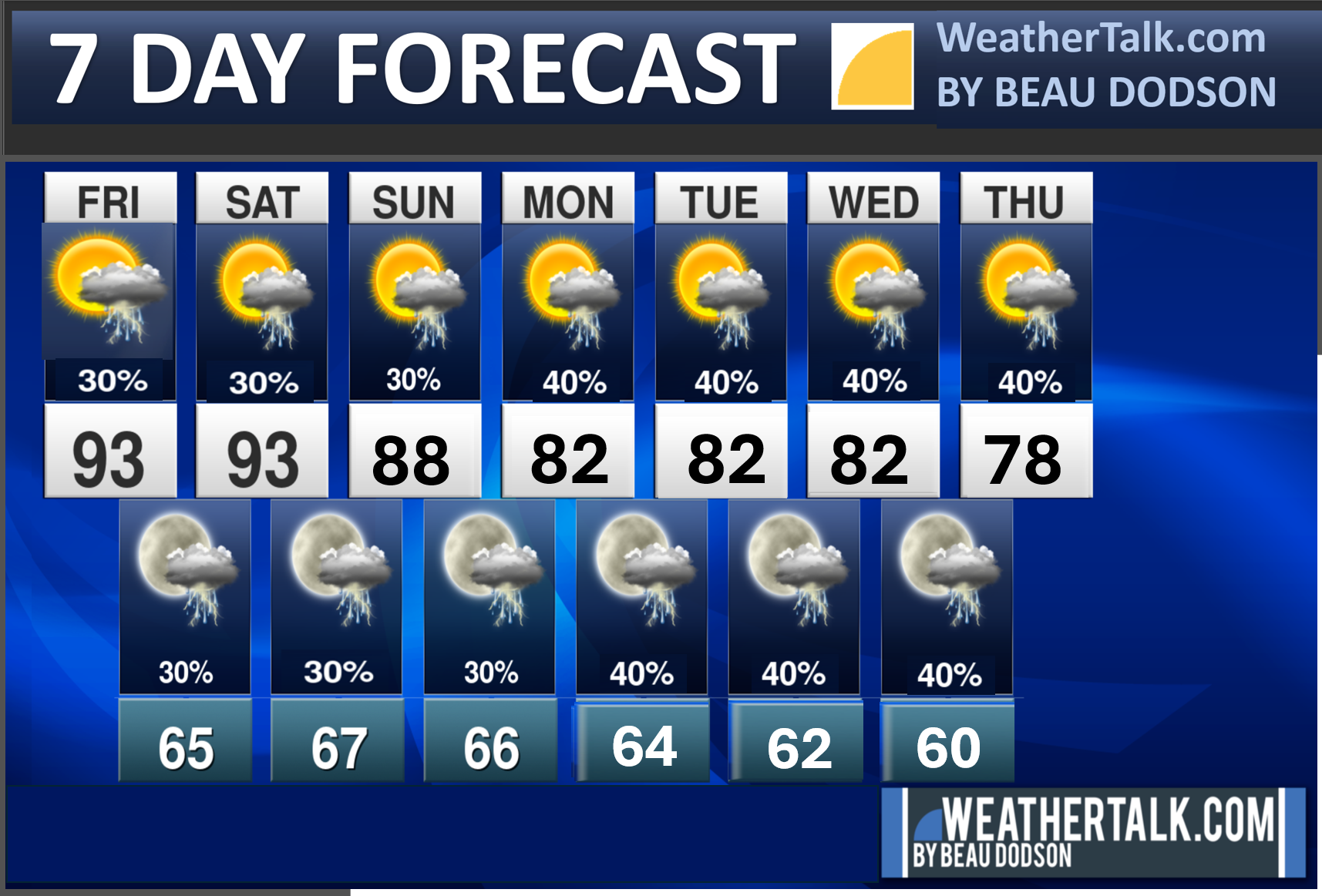
Seven-day outlook graphic.
.
Good Friday morning, everyone. I hope you had a nice week.
Drought continues to intensify across the region. It is very dry, as you know.
The new drought monitor maps are out.
Here it is. The red zone is extreme drought.
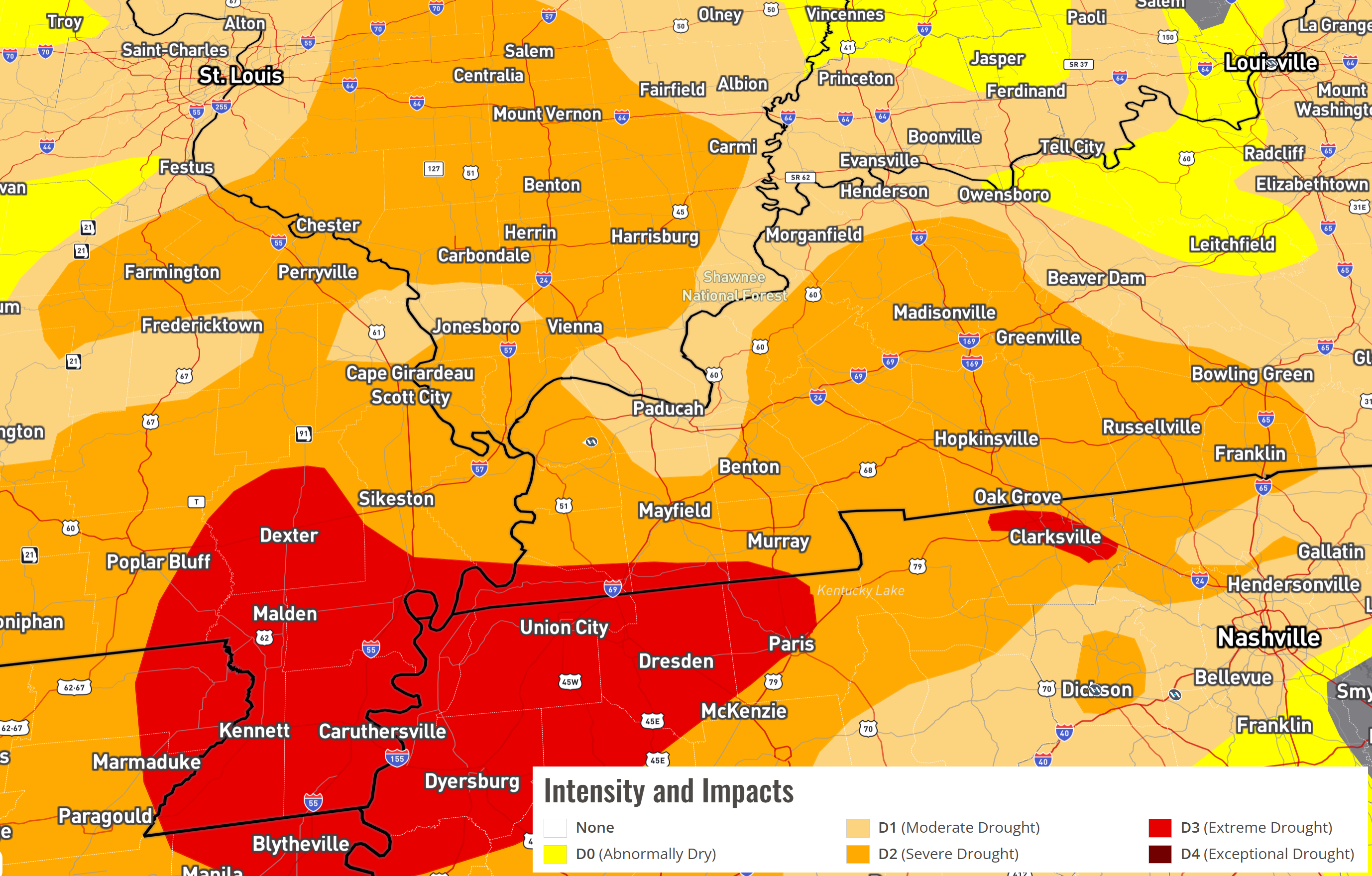
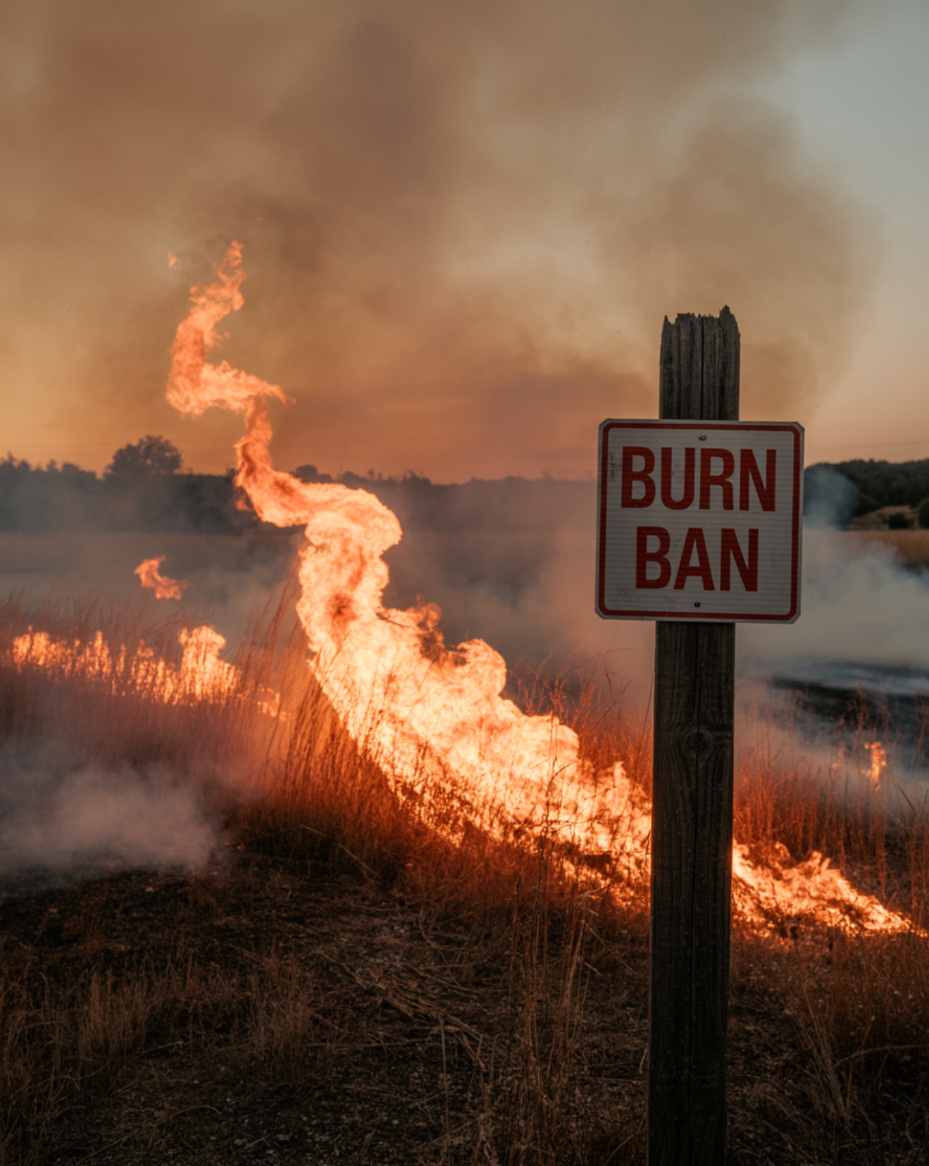
As a reminder, many counties have burn bans in effect. Avoid burning brush, leaves, and fields. Check with your county officials to see if you are in a burn ban.
.
We do have more hot weather in the forecast. Widespread nineties today. I can’t rule out some reporting stations hitting 90 degrees on Saturday and Sunday, as well.
Scattered showers and thunderstorms will be with us today through Sunday. Then, chances will increase Monday through Thursday. That is the good news.
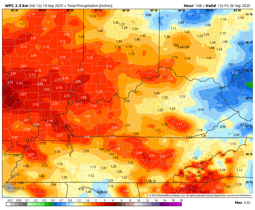
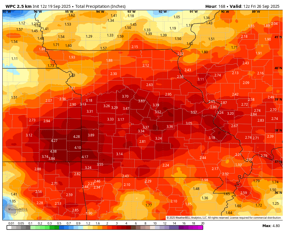
Seven-day rain totals have increased. Let’s hope this verifies.
Rain totals, over the next seven days, will vary, but will generally range from 1.00″ to 2.00″. Locally higher totals are likely in thunderstorms.
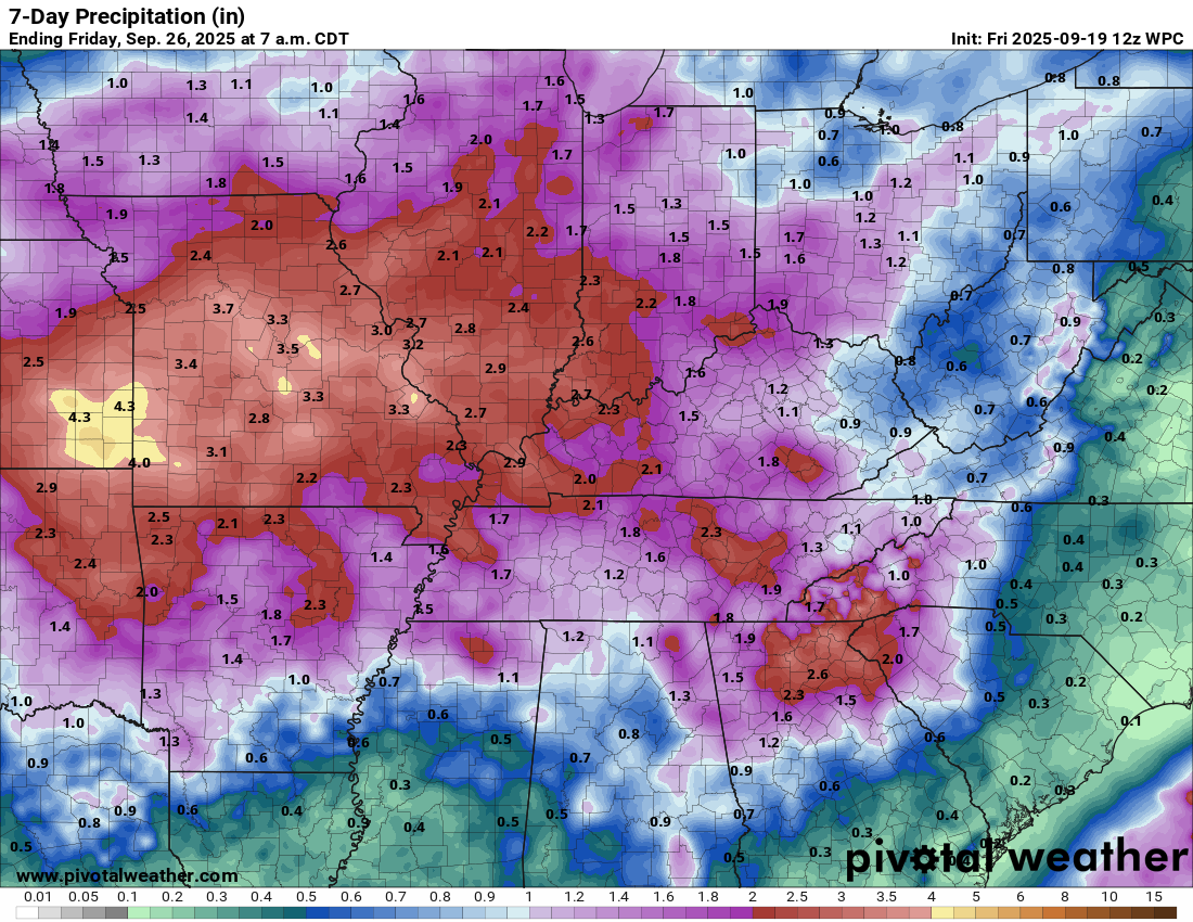
Here is the latest NOAA/WPC rainfall outlook. This covers today through next Friday morning.
Southeast Missouri, Illinois, Kentucky, and Tennessee.
Double-click the images to enlarge them.
.
Missouri
.
Regional view
Double-click images to enlarge them.
.
Again, peak rain chances are likely to occur on Monday through Wednesday. Perhaps Thursday (depending on how fast the system exits).
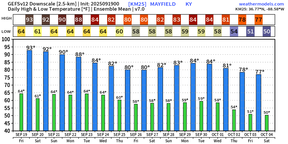
Temperatures from Sunday through next week are expected to be a bit cooler. I am anticipating widespread eighties. We could even dip into the 70s by next Thursday and Friday. Either way, widespread nineteies will disappear next week. That is also the good news.
Here are the GFS ensemble temperatures. This shows you the anticipated high and low temperatures.
You can take the general idea from this.

.
The timestamp (upper left) is in Zulu. 12z=7 am. 18z=1 pm. 00z=7 pm.
Double-click the animation to enlarge it.
NAM 3K model
.
The timestamp (upper left) is in Zulu. 12z=7 am. 18z=1 pm. 00z=7 pm.
Double-click the animation to enlarge it.
GFS model
.
..
.
Click here if you would like to return to the top of the page.
.Average high temperatures for this time of the year are around 82 degrees.
Average low temperatures for this time of the year are around 58 degrees.
Average precipitation during this time period ranges from 1.00″ to 1.25″
Six to Ten Day Outlook.
Blue is below average. Red is above average. The no color zone represents equal chances.
Average highs for this time of the year are in the lower 60s. Average lows for this time of the year are in the lower 40s.

Green is above average precipitation. Yellow and brown favors below average precipitation. Average precipitation for this time of the year is around one inch per week.

.

Average low temperatures for this time of the year are around 56 degrees.
Average precipitation during this time period ranges from 1.00″ to 1.25″
.
Eight to Fourteen Day Outlook.
Blue is below average. Red is above average. The no color zone represents equal chances.

Green is above average precipitation. Yellow and brown favors below average precipitation. Average precipitation for this time of the year is around one inch per week.

.
.
.
We have a new service to complement your www.weathertalk.com subscription. This does NOTreplace www.weathertalk.com It is simply another tool for you to receive severe weather information.
.
https://weathercallservices.com/beau-dodson-weather


Want to receive the daily forecast/other products on your Beau Dodson Weather app?
Did you know you have four options in your www.weathertalk.com account
You will then receive these via your Beau Dodson Weather app.
Just log into your www.weathertalk.com account
Click the NOTIFICATION SETTINGS TAB
Then, turn them on (green) and off (red)
🌪️ Number 1 is the most important one. Severe alerts, tornado alerts, and so on.
Number 2 is the daily video, blog, livestream alerts, and severe weather Facebook threads on severe days or winter storm days.
Number 3 is the daily forecast. I send that out every day during the afternoon hours. It is the seven-day forecast, hazardous weather outlook, fire outlook, and more.
Number 4 is to receive the daily video, blog, and other content on NON-severe weather days (every day without severe threats in other words)
GREEN IS ON
RED IS OFF

I am going to start going live during bigger severe weather events.
Check it out here https://www.youtube.com/user/beaudodson
Click the subscribe button (it’s a free subscription button), and it will alert you when I go live. I will also send out alerts to the app when I go live for an event.

.

Radars and Lightning Data
Interactive-city-view radars. Clickable watches and warnings.
https://wtalk.co/B3XHASFZ
Old legacy radar site (some of you like it better)
https://weatherobservatory.com/weather-radar.htm
If the radar is not updating then try another one. If a radar does not appear to be refreshing then hit Ctrl F5. You may also try restarting your browser.
Backup radar site in case the above one is not working.
https://weathertalk.com/morani
Regional Radar
https://imagery.weathertalk.com/prx/RadarLoop.mp4
** NEW ** Zoom radar with chaser tracking abilities!
ZoomRadar
If the radar is not working, then email me: Email me at beaudodson@usawx.com
.
We do have some sponsors! Check them out.
Roof damage from recent storms? Link – Click here
INTEGRITY ROOFING AND EXTERIORS!
⛈️ Roof or gutter damage from recent storms? Today’s weather is sponsored by Integrity Roofing. Check out their website at this link https://www.ourintegritymatters.com/

![]()
![]()
![]()
Make sure you have three to five ways of receiving your severe weather information.
Weather Talk is one of those ways! Now, I have another product for you and your family.

.
Want to add more products to your Beau Dodson Weather App?
Receive daily videos, weather blog updates on normal weather days and severe weather and winter storm days, your county by county weather forecast, and more!
Here is how to do add those additional products to your app notification settings!
Here is a video on how to update your Beau Dodson Weather payment.
The app is for subscribers. Subscribe at www.weathertalk.com/welcome then go to your app store and search for WeatherTalk
Subscribers, PLEASE USE THE APP. ATT and Verizon are not reliable during severe weather. They are delaying text messages.
The app is under WeatherTalk in the app store.

Apple users click here

Android users click here
.
Radars and Lightning Data
Interactive-city-view radars. Clickable watches and warnings.
https://wtalk.co/B3XHASFZ
Old legacy radar site (some of you like it better)
https://weatherobservatory.com/weather-radar.htm
If the radar is not updating then try another one. If a radar does not appear to be refreshing then hit Ctrl F5. You may also try restarting your browser.
Backup radar site in case the above one is not working.
https://weathertalk.com/morani
Regional Radar
https://imagery.weathertalk.com/prx/RadarLoop.mp4
** NEW ** Zoom radar with chaser tracking abilities!
ZoomRadar
Lightning Data (zoom in and out of your local area)
https://wtalk.co/WJ3SN5UZ
Not working? Email me at beaudodson@usawx.com
National map of weather watches and warnings. Click here.
Storm Prediction Center. Click here.
Weather Prediction Center. Click here.
.

Live lightning data: Click here.
Real time lightning data (another one) https://map.blitzortung.org/#5.02/37.95/-86.99
Our new Zoom radar with storm chases
.
.

Interactive GOES R satellite. Track clouds. Click here.
GOES 16 slider tool. Click here.
College of DuPage satellites. Click here
.

Here are the latest local river stage forecast numbers Click Here.
Here are the latest lake stage forecast numbers for Kentucky Lake and Lake Barkley Click Here.
.
.
Find Beau on Facebook! Click the banner.


 .
.