Winter Weather Update
Do you have any suggestions or comments? Email me at beaudodson@usawx.com
.
.
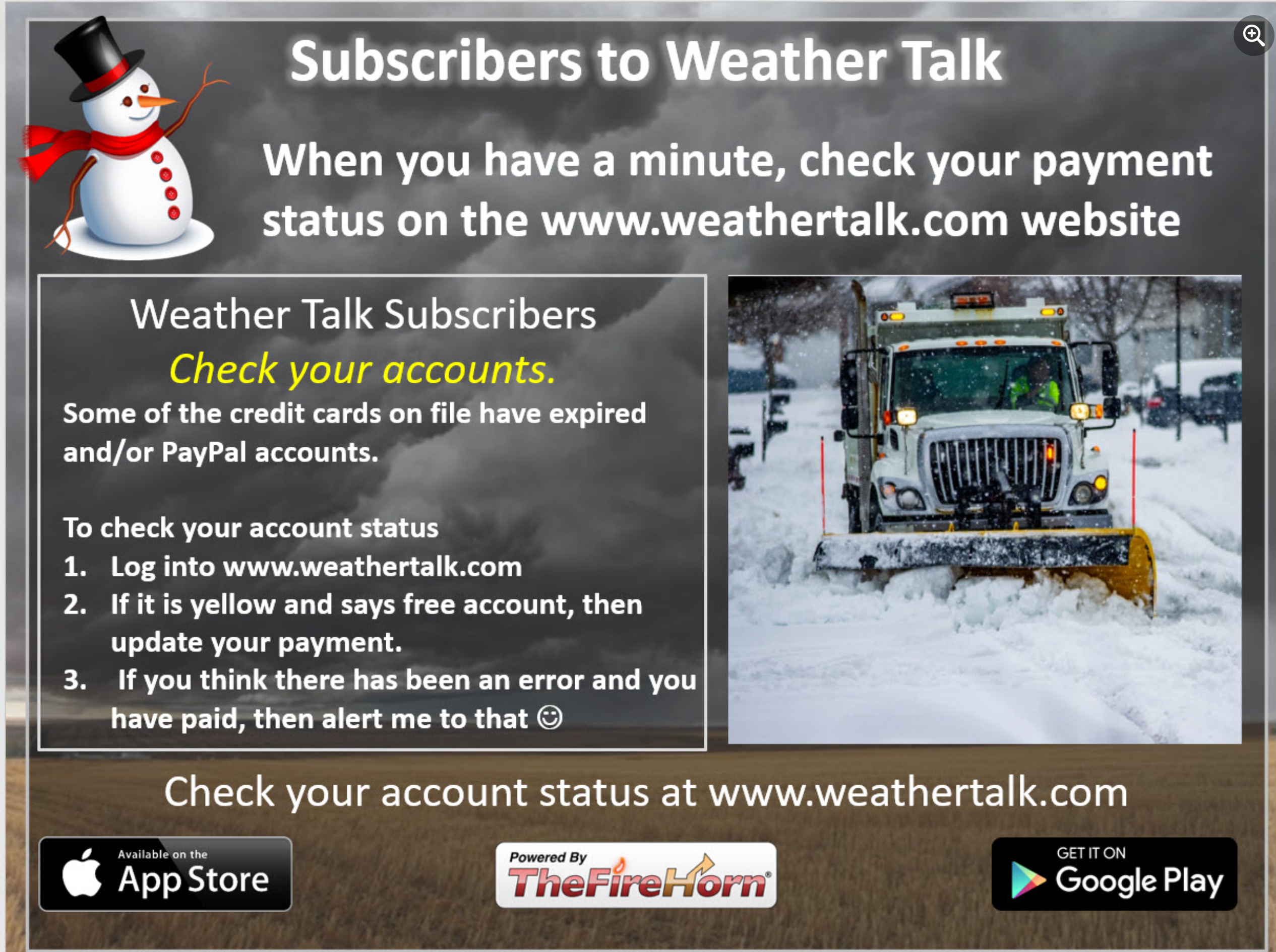
into www.weathertalk.com and then click the payment tab. Thank you
-
- Bitterly cold air. Arctic outbreak.
- Monitoring precipitation chances.
- Important to point out that some of the data shows a major winter storms Thursday and Friday. This can’t be completely discounted. Monitor updates.
Weather advice:
Monitor updates concerning the upcoming arctic outbreak of cold air and wintry precipitation.
Sunday Update
Sunday, December 18, 2022
Cold and snow update.
9 AM post.
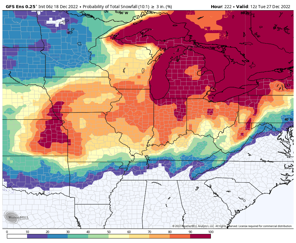
The graphic shown is the probability of three or more inches of snow. GEFS model suite.
Hit the share button.
If you like all of this weather information, then please become a supporter. Monthly costs run into the thousands of dollars.
Become a support at www.weathertalk.com and then download the Weather Talk app from the app stores.
Receive app messages with links to the blog, the Facebook discussions, the severe weather alerts, tornado alerts, ice storm alerts, winter storm alerts, short- and long-range videos, and more.
** I consider this a dangerous weather event because of the December near historic/historic cold temperatures being forecast. **
It is not unusual for our region to occasionally experience extremely cold temperatures.
It is also not unusual for our region to experience deadly consequences from those extremely cold temperatures.
Confidence in the forecast:
Temperatures: Near certain. 90% confidence.
Snow/hazardous driving conditions: Medium confidence. 40% confidence.
Impacts:
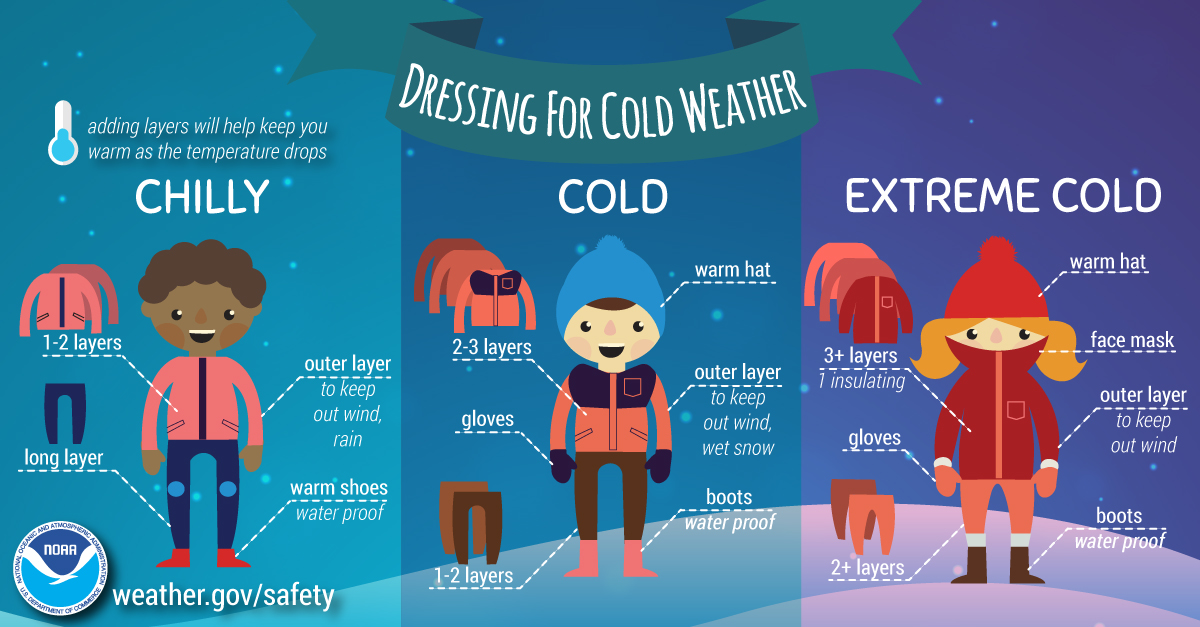
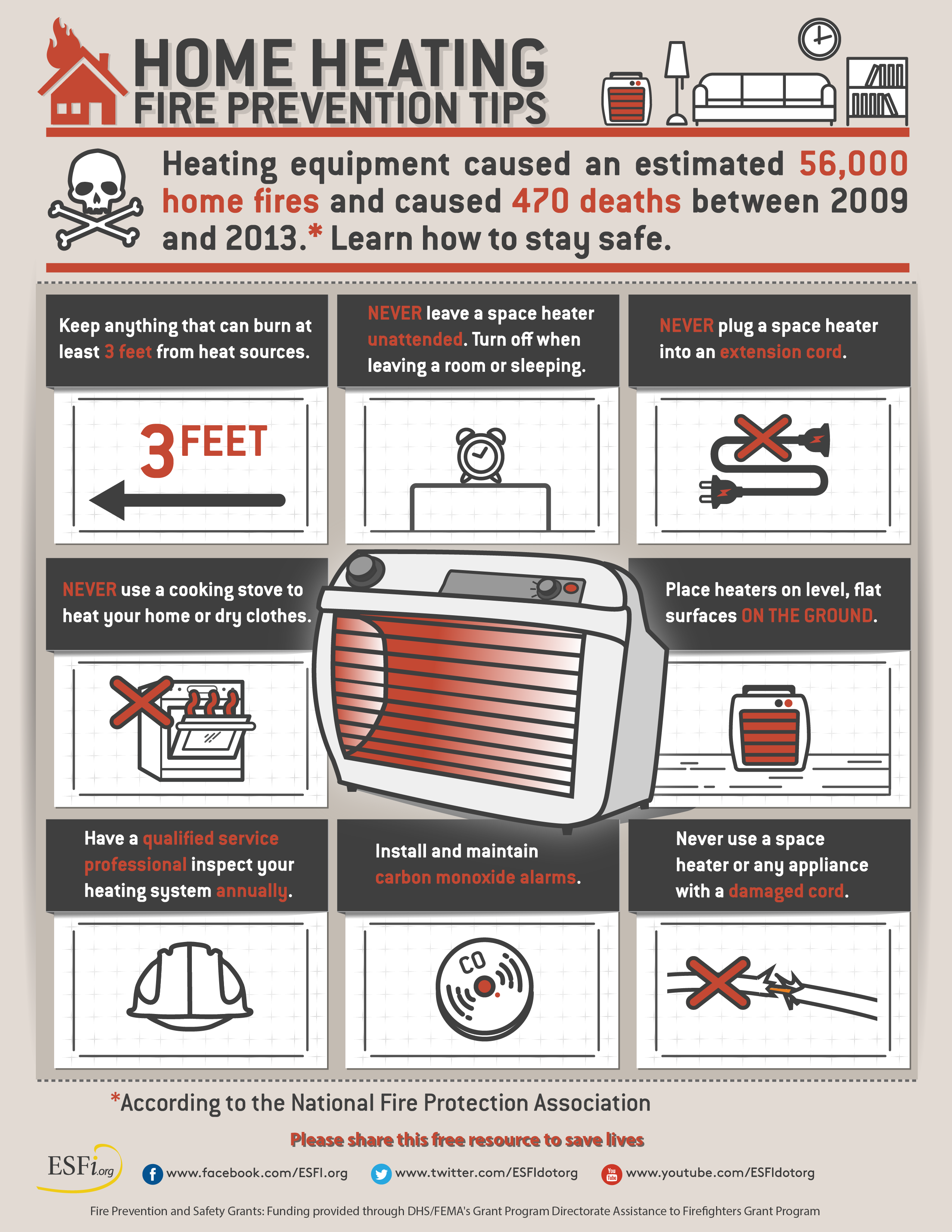
1. Increased house fire danger from improper use of heating devices.
2. Frost bite. Hypothermia if caught outdoors for a prolonged period of time with improper clothing (elderly).
3. Hazardous driving conditions over portions of the Missouri, Ohio, and Tennessee Valleys. Accumulating and blowing snow possible.
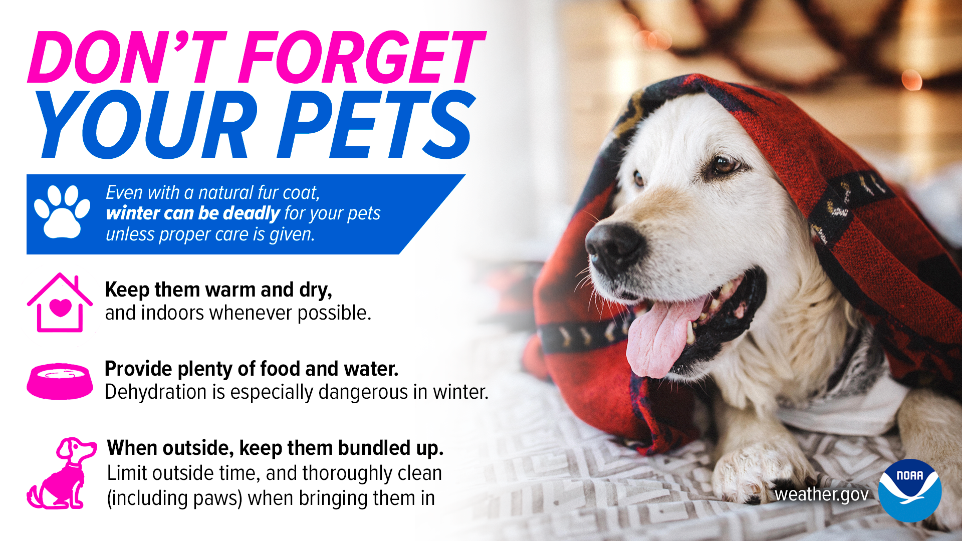
4. Last, but not least, harsh conditions for livestock and outdoor animals/pets.
Beau’s Forecast
This event is still five days away. But a forecast must be made. It is the holiday season and many people will be making travel plans.
Keep in mind, adjustments to the forecast are likely. Typically, an accurate snow totals forecast is made 24 to 48 hours in advance of a winter storm.
Focus on impacts and not totals. Whether it snows an inch or five inches, the end result will be icy road conditions.
If you must travel Thursday and Friday, then monitor updates. This is the peak time frame of concern for precipitation falling from the sky.
You may need to adjust your travel plans if the data is correct.
Of course, anything that falls will stick around into the weekend.
The bitterly cold air is coming. There is no question about it.
Peak cold days will be Thursday through Sunday night. That would include Christmas Eve and Christmas Day.
I am forecasting the arctic front to arrive Wednesday night into Thursday morning. Bitterly cold wind driven air behind the front.
Periods of snow Thursday and Thursday night with a dusting to three inches. Blowing and drifting snow will also be a concern.
Some data shows much higher snow totals. This can’t be ruled out, but I would rather ramp up vs ramping down. In other words, a forecast should not start with the highest possible totals.
Snow may begin as rain and sleet, but confidence in that is low.
Slight changes in storm track can quickly change the going forecast. Even a 25-to-50-mile shift in the key forecast players will change the outcome.
Confidence in the forecast numbers will continue to increase as the event draws closer.
Analysis
Today through Wednesday afternoon: No significant weather concerns.
Where clouds develop, a few sprinkles or flurries possible into Monday night.
It will remain cold today through Wednesday. Nothing extreme, but below average temperatures. Average highs are around 42 and average lows are around 30 degrees.
Now is the time to prepare for this week’s bitterly cold (perhaps December record cold) temperatures.
Prepare the elderly who live alone and any of your adult children who may not be as wise as you are when it comes to bitterly cold temperatures.
Dangerously cold temperatures will arrive towards the middle/end of the week.
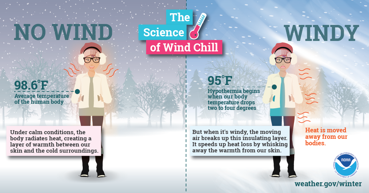
Wind chill temperatures will make it feel even colder. Remember, your skin reacts to wind chill.
This means an increased risk of fires. Historically, this type of cold weather brings numerous house/mobile home fires with it. People using heating devices incorrectly. Space heaters/other.
Also, with the cost of living being so high, elderly and others may try and save money by using a space heater vs central heating/air unit. This is a concern. Check on the elderly.
Protect vulnerable pipes (you know who you are if you have them). Prepare for harsh conditions for livestock and outdoor animals.
Get out the mittens and gloves for kids and adults. Frost bite concerns will be high.
Obviously, prolonged exposure to these temperatures can also cause hypothermia.
In the past, there have been several deaths among the elderly with these types of temperatures.
Wednesday into Wednesday night.
There continue to be two model/guidance camps for the Wednesday afternoon into Thursday morning time-frame.
Some guidance is warmer and some colder. The precipitation would begin as rain and then change to a wintry mix ending as all snow.
This would be the worst case scenario for driving conditions. It would be better to have all snow vs a wintry mix.
The only question about temperatures is how fast the cold air arrives.
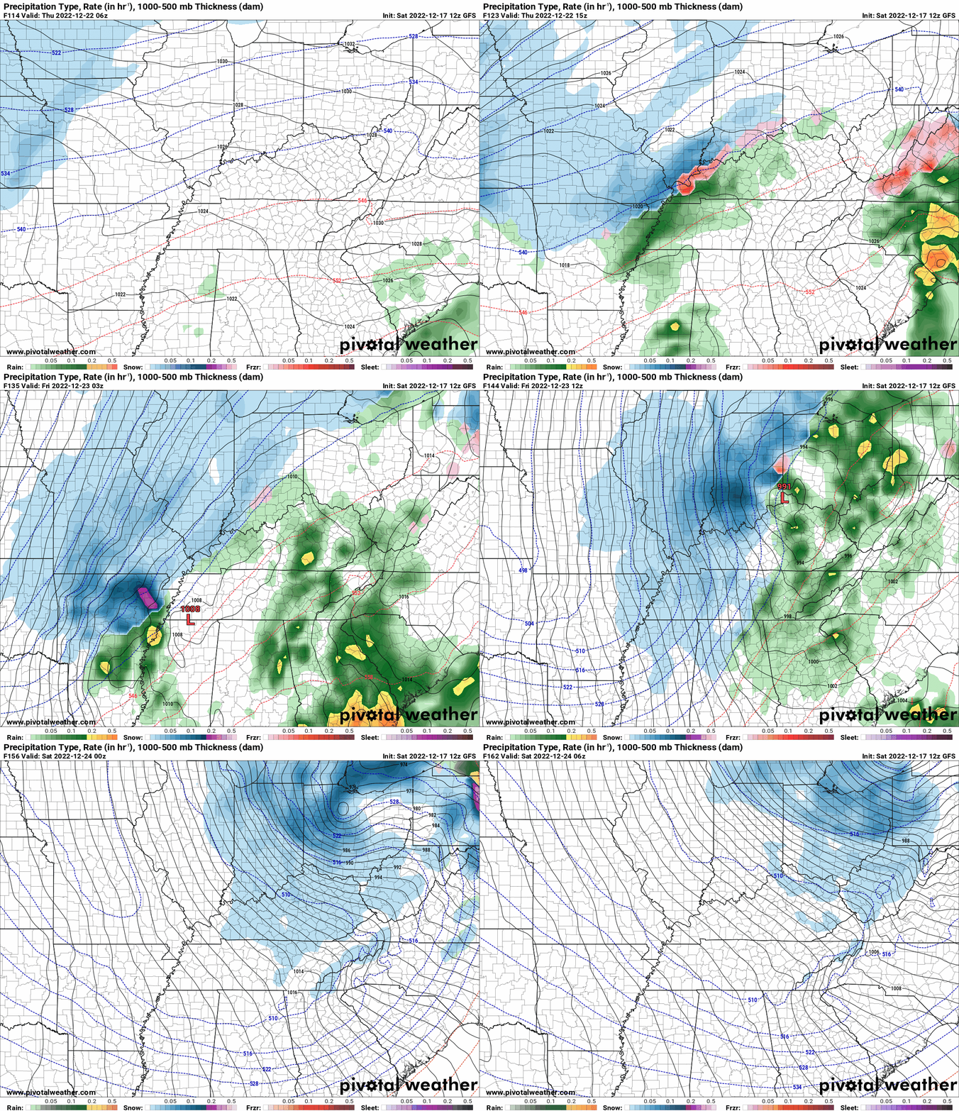
The GFS model guidance packages have colder weather conditions. Highs in the 20s.
The arctic front sweeps through late Wednesday night into Thursday with even colder temperatures. Windy conditions, as well.
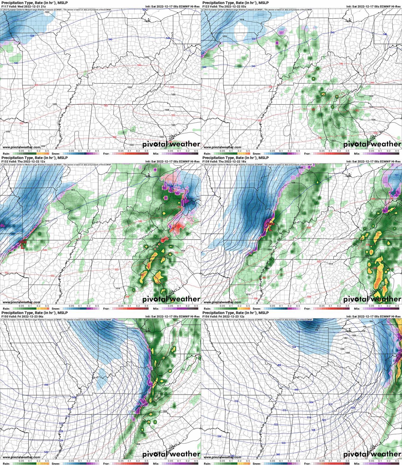
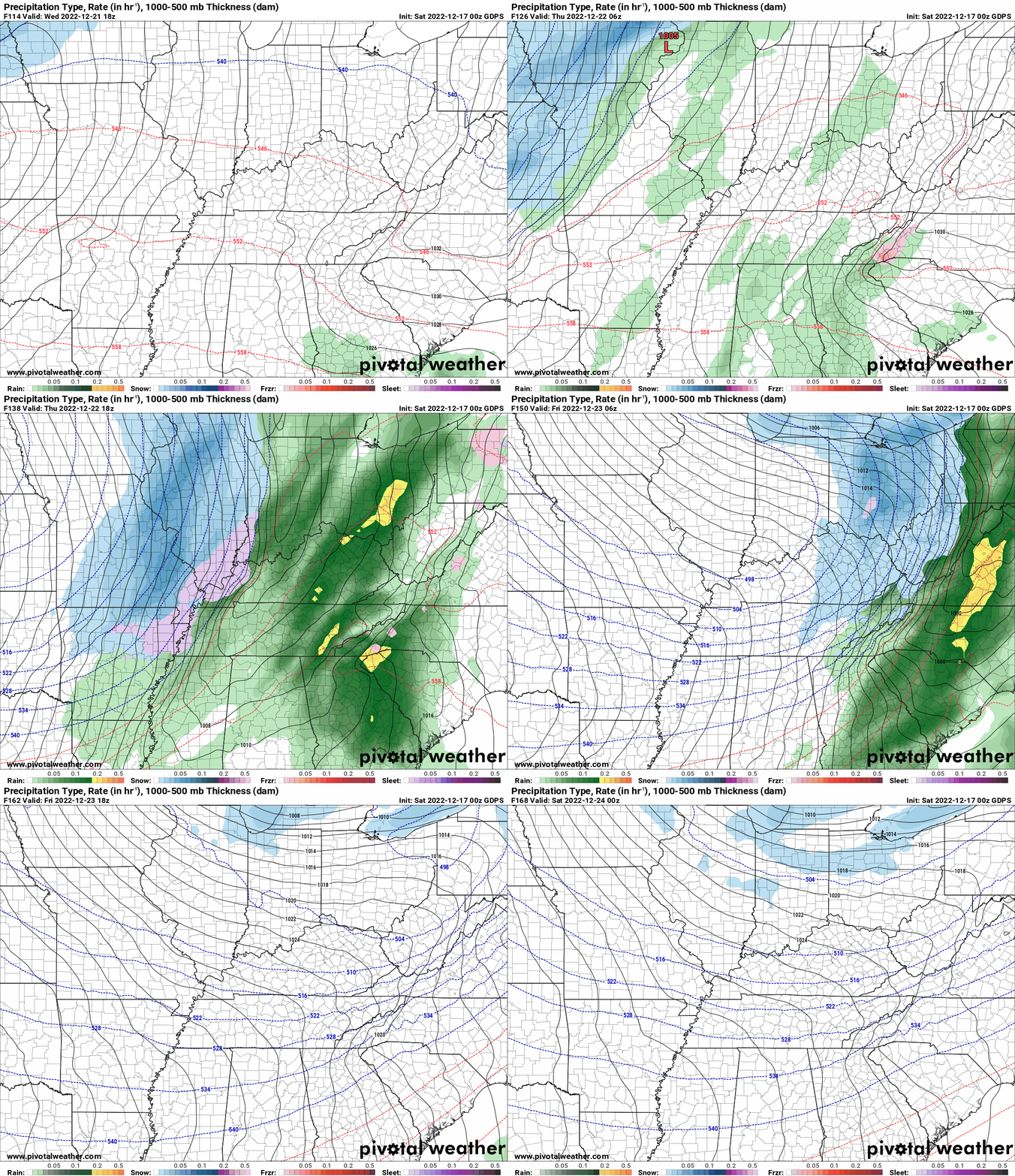
The EC and Canadian model guidance show warmer air pushing northward with highs in the 40s to around 50 degrees. Ahead of the strong cold front and developing area of low pressure.
The difference is that the GFS model forms the low-pressure center to our east/southeast vs west.
That would place us on the cold side of the low vs the EC and Canadian models which form the low to our west (placing us in the warmer sector).
I will likely take the middle ground approach for Wednesday’s weather. Highs in the 30s.
Thursday into Christmas Day:
Two camps in the model guidance.
The GFS camp.
The GFS camp has trended towards a much stronger winter storm for our entire region.
It is showing snow totals in excess of three inches across many of our local counties. Significant blowing and drifting snow, as well.
Overnight lows Thursday and Friday night would drop into the single digits to perhaps even below zero. Wind chill values of 0 to 15 below.
Highs Thursday, Friday, and Saturday would remain in the teens. This is rare for our region during the Month of December.
The EC and Canadian model camps.
Totally different solution.
The EC shows a cold front sweeping across the region Thursday. Precipitation begins as rain and then quickly changes to snow.
The EC would drop a dusting to perhaps up to four inches of snow across the region. Blowing snow, as well.
It would imply a wintry mix.
A flash freeze would occur.
A flash freeze is what meteorologists call when precipitation (usually rain) falls ahead of a cold front. Temperatures then fall so fast that the pavements don’t have time to dry off. They become icy simply from the previous non-frozen precipitation.
Flash freezes when combined with rain can cause locks on cars to freeze up. Icy road and parking lot conditions.
One thing the models do agree on and that is the bitterly cold air. All of our guidance show bitterly cold air pushing into the region Thursday into the holiday weekend.
The only question left is snow.
Current Weather Discussion
Saturday, December 17, 2022
Lengthy Snow Update
10 AM post.
If you like all of this weather information, then please become a supporter. Monthly costs run into the thousands of dollars.
Become a support at www.weathertalk.com and then download the Weather Talk app from the app stores.
Receive app messages with links to the blog, the Facebook discussions, the severe weather alerts, tornado alerts, ice storm alerts, winter storm alerts, short- and long-range videos, and more.
** I consider this a dangerous weather event because of the December near historic/historic cold temperatures being forecast. **
Confidence in the forecast:
Temperatures: Near certain. 90% confidence.
Snow/hazardous driving conditions: Low confidence. 30% confidence.
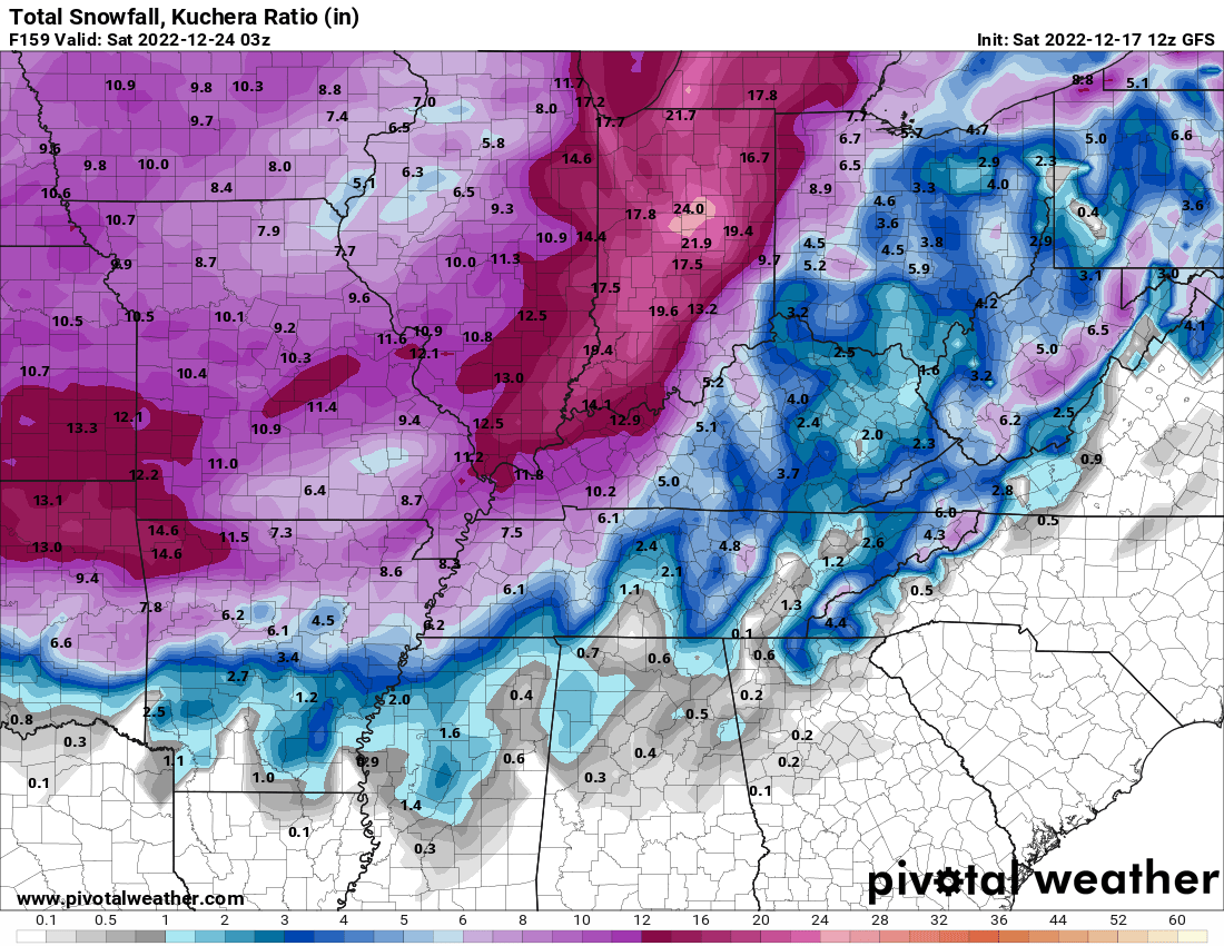
This morning’s GFS model. This model runs four times each day.
This run shows an historic winter storm. Previous runs showed barely any snow. These are the wild type of model swings that we are watching.
.
Impacts:
I will caution you that some of the data is showing a significant winter storm impacting our region Thursday and Friday. They are the outliers but could be correct. Thus, monitor updates moving forward.
.
Today through Tuesday: No significant weather concerns.
Where there are thicker clouds there could be a flurry (northern and northeastern counties).
It will remain cold today through Monday. Nothing extreme, but below average temperatures. Average highs are around 42 and average lows are around 30 degrees.
Now is the time to prepare for next week’s bitterly cold (perhaps December record cold) temperatures.
Prepare the elderly who live alone and any of your adult children who may not be as wise as you are when it comes to bitterly cold temperatures.
Dangerously cold temperatures will arrive towards the middle/end of next week.
Wind chill temperatures will make it feel even colder. Remember, your skin reacts to wind chill.
This means an increased risk of fires. Historically, this type of cold weather brings numerous house/mobile home fires with it. People using heating devices incorrectly. Space heaters/other.
Also, with the cost of living being so high, elderly and others may try and save money by using a space heater vs central heating/air unit. This is a concern. Check on the elderly.
Protect vulnerable pipes (you know who you are if you have them). Prepare for harsh conditions for livestock and outdoor animals.
Get out the mittens and gloves for kids and adults. Frost bite concerns will be high.
Obviously, prolonged exposure to these temperatures can also cause hypothermia.
In the past, there have been several deaths among the elderly with these types of temperatures.
.
Wednesday:
There are two model/guidance camps for Wednesday’s weather.
The only question about temperatures is how fast the cold air arrives.
The GFS model guidance packages have cold weather conditions. Highs in the 20s.
The arctic front sweeps through late Wednesday night into Thursday with even colder temperatures. Windy conditions, as well.
The EC and Canadian model guidance show warmer air pushing northward with highs in the 40s to around 50 degrees. Ahead of the strong cold front and developing area of low pressure.
The difference is that the GFS model forms the low-pressure center to our east/southeast vs west.
That would place us on the cold side of the low vs the EC and Canadian models which form the low to our west (placing us in the warmer sector).
I will likely take the middle ground approach for Wednesday’s weather. Highs in the 30s.
.
Wednesday night into Christmas Day:
Two camps in the model guidance.
The GFS camp.
The GFS model has a tendency to be too progressive with its low pressure/ejections of energy. It is a model bias.
If the GFS is showing that bias, then it means it is pushing the storm system out too fast. Ejecting the energy too quickly. Thus, it shows the primary low-pressure center developing in the Middle Atlantic and pushing up the East Coast.
That would mean a significant winter storm for the East Coast.
A powerful arctic cold front will sweep across our local area with rapidly falling temperatures and winds gusting above 30 mph. This will deliver below zero wind chill values.
Overnight lows Thursday and Friday night would drop into the single digits to lower teens. Wind chill values of 5 above to 10 below. Perhaps colder.
Highs Thursday, Friday, and Saturday would remain in the teens and twenties. This is rare for our region during the Month of December.
Light snow would develop during the day Thursday. Snow accumulation of a dusting to two inches is the most likely GFS model guidance scenario. Some of its ensemble members show more.
Ensembles are the same model ran over and over again with slightly different beginning variables. The general idea is that the more ensemble members that agree, the higher the confidence in the forecast.
I would be comfortable saying a dusting to a couple of inches. Blowing snow, as well. Gusty winds. Bitterly cold.
The EC and Canadian model camps.
Totally different solution.
The EC bias is to be too slow with ejecting energy.
The EC and Canadian models are showing a much slower system.
They develop the low to our west. That places us briefly in the warm sector ahead of the cold front.
Temperatures would rise into the 40s to around 50 degrees ahead of the front.
Temperatures would then crash behind the front into the teens.
Occasionally, the EC and Canadian models show near blizzard or blizzard conditions in or near our region. Perhaps north of us a tad.
Rain would develop Thursday and Thursday evening. It would then change to freezing rain, sleet, and eventually snow.
This would give our region anywhere from an inch to five inches of wind driven snow.
The EC and Canadian would cause hazardous driving conditions with a flash freeze.
A flash freeze is what meteorologists call when precipitation (usually rain) falls ahead of a cold front. Temperatures then fall so fast that the pavements don’t have time to dry off. They become icy simply from the previous non-frozen precipitation.
Flash freezes when combined with rain can cause locks on cars to freeze up. Icy road and parking lot conditions.
Both the EC and Canadian show precipitation continuing behind the cold front. So, not only would we have the rain ahead of it, but we would also have some precipitation behind it.
.
Beau’s Forecast
This event is still six days away. But a forecast must be made. It is the holiday season, and many people will be making travel plans.
Keep in mind, adjustments to the forecast are almost CERTAIN.
The bitterly cold air is coming. There is no question about it.
Peak cold days will be Thursday through Sunday night. That would include Christmas Eve and Christmas Day.
I will forecast the arctic front to arrive Wednesday night into Thursday morning. Bitterly cold wind driven air behind the front.
Periods of snow Thursday and Thursday night with a dusting to two inches.
I would like to see better model agreement to increase confidence in the overall forecast.
I cannot discount the EC and Canadian models. Especially since they have high agreement among their ensemble members.
I want to see if the GFS moves towards the EC and Canadian model camps. If that begins to happen, then confidence in the overall forecast will increase.
This event is still six days away. That is considered the long-range portion of the forecast.
Slight chances in storm track can quickly change the going forecast. Even a 25-to-50-mile shift in the key forecast players will change the outcome.
The energy for these systems is still thousands of miles away from our region. To make an accurate forecast is threading a needle, at this point.
Monitor updates. I will update again tonight.

Click here if you would like to return to the top of the page.
Again, as a reminder, these are models. They are never 100% accurate. Take the general idea from them.
What should I take from these?
- The general idea and not specifics. Models usually do well with the generalities.
- The time-stamp is located in the upper left corner.
.
What am I looking at?
You are looking at different models. Meteorologists use many different models to forecast the weather. All models are wrong. Some are more wrong than others. Meteorologists have to make a forecast based on the guidance/models.
I show you these so you can see what the different models are showing as far as precipitation. If most of the models agree, then the confidence in the final weather forecast increases.
You can see my final forecast at the top of the page.
Occasionally, these maps are in Zulu time. 12z=7 AM. 18z=1 PM. 00z=7 PM. 06z=1 AM
Green represents light rain. Dark green represents moderate rain. Yellow and orange represent heavy rain.
Red represents freezing rain. Purple represents sleet. Blue represents snow. Dark blue represents heavy snow.
.
This next animation is the GFS American Model.
This animation shows you what radar might look like as the system pulls through the region. It is a future-cast radar.
Occasionally, these maps are in Zulu time. 12z=7 AM. 18z=1 PM. 00z=7 PM. 06z=1 AM
Green represents light rain. Dark green represents moderate rain. Yellow and orange represent heavy rain.
Red represents freezing rain. Purple represents sleet. Blue represents snow. Dark blue represents heavy snow.
Time-stamp upper left. Click the animation to enlarge it.
.
This next animation is the EC European Weather model.
This animation shows you what radar might look like as the system pulls through the region. It is a future-cast radar.
Occasionally, these maps are in Zulu time. 12z=7 AM. 18z=1 PM. 00z=7 PM. 06z=1 AM
Green represents light rain. Dark green represents moderate rain. Yellow and orange represent heavy rain.
Red represents freezing rain. Purple represents sleet. Blue represents snow. Dark blue represents heavy snow.
Time-stamp upper left. Click the animation to enlarge it.
.
This next animation is the Canadian Weather model.
This animation shows you what radar might look like as the system pulls through the region. It is a future-cast radar.
Occasionally, these maps are in Zulu time. 12z=7 AM. 18z=1 PM. 00z=7 PM. 06z=1 AM
Green represents light rain. Dark green represents moderate rain. Yellow and orange represent heavy rain.
Red represents freezing rain. Purple represents sleet. Blue represents snow. Dark blue represents heavy snow.
Time-stamp upper left. Click the animation to enlarge it.
.

Great news! The videos are now found in your WeatherTalk app and on the WeatherTalk website.
These are bonus videos for subscribers.
The app is for subscribers. Subscribe at www.weathertalk.com/welcome then go to your app store and search for WeatherTalk
Subscribers, PLEASE USE THE APP. ATT and Verizon are not reliable during severe weather. They are delaying text messages.
The app is under WeatherTalk in the app store.
Apple users click here
Android users click here
.

Radars and Lightning Data
Interactive-city-view radars. Clickable watches and warnings.
https://wtalk.co/B3XHASFZ
If the radar is not updating then try another one. If a radar does not appear to be refreshing then hit Ctrl F5. You may also try restarting your browser.
Backup radar site in case the above one is not working.
https://weathertalk.com/morani
Regional Radar
https://imagery.weathertalk.com/prx/RadarLoop.mp4
** NEW ** Zoom radar with chaser tracking abilities!
ZoomRadar
Lightning Data (zoom in and out of your local area)
https://wtalk.co/WJ3SN5UZ
Not working? Email me at beaudodson@usawx.com
National map of weather watches and warnings. Click here.
Storm Prediction Center. Click here.
Weather Prediction Center. Click here.
.

Live lightning data: Click here.
Real time lightning data (another one) https://map.blitzortung.org/#5.02/37.95/-86.99
Our new Zoom radar with storm chases
.
.

Interactive GOES R satellite. Track clouds. Click here.
GOES 16 slider tool. Click here.
College of Dupage satellites. Click here
.

Here are the latest local river stage forecast numbers Click Here.
Here are the latest lake stage forecast numbers for Kentucky Lake and Lake Barkley Click Here.
.
.
Find Beau on Facebook! Click the banner.





 .
.