

.
I have some question-and-answer threads over on the Facebook page. Link to those threads CLICK HERE
Or email me at beaudodsonweather@gmail.com
.

🌪️ Seven-Day Tornado Outlook ⛈️
May 9th through May 15th
Current risk: Monitor updates.
I am monitoring Monday. For now, the risk on Monday does not appear to be a concern.
The middle/end of next week and the following week are of more concern. We will have an unstable atmosphere. If thunderstorms develop, then some could be severe. There remain questions about which day will deliver the higher severe weather probabilities. I will monitor Wednesday onward.
Current confidence level: Medium confidence in the forecast.
Comment:
.

Seven-Day Hazardous Weather Outlook
1. Is lightning in the forecast? YES. Lightning is possible late Sunday night into Tuesday evening. Then, I will be monitoring next Wednesday onward. On and off thunderstorm chances will become an issue.
2. Are severe thunderstorms in the forecast? POSSIBLE. I am monitoring Monday. For now, we have not been outlined for a risk. I can’t rule out a low-end severe weather risk. Then, I will closely monitor next Wednesday onward. I suspect we will have some days with a threat of severe thunderstorms.
3. Is flash flooding in the forecast? NOT AT THIS TIME. Locally heavy storms are becoming increasingly possible towards the middle/end of next week. Monitor updates.
4. Will non-thunderstorm winds top 40 mph? NO.
5. Will temperatures rise above 90 degrees? LOW RISK. Temperatures will be quite warm next Thursday. They could approach 90 degrees, but will likely remain in the 80s. Beyond that, several days with temperatures in the 80s are likely towards the middle/end of next week and perhaps the following week. Temperatures will be highly dependent on thunderstorms and the placement of front boundaries.
6. Will the heat index rise above 100 degrees? UNLIKELY. I will monitor next Thursday.
.
A quick forecast glance. Your 48-hour forecast Graphics


.

.


Forecast discussion.
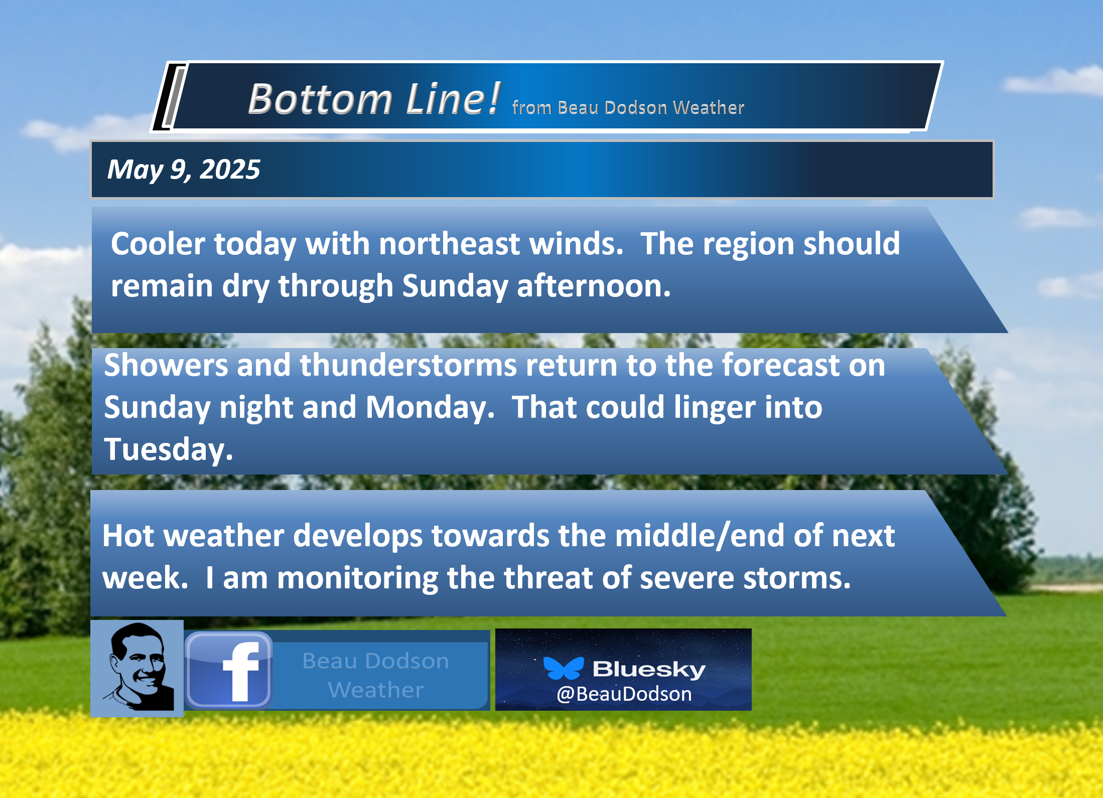
- A nice day ahead of us. A little on the cool side, but not too bad for this time of the year.
- Some counties will have clouds this morning. We will have to see if those clouds break up as we move through the day.
- Dry tonight through Sunday morning.
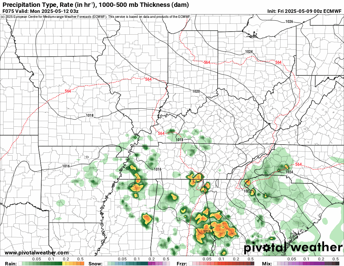
- Increasing clouds on Sunday with increasing precipitation chances as we move into Sunday night, especially on Monday/Monday night. Showers and thunderstorms could linger into Tuesday.
- Temperatures will become quite warm towards the middle/end of next week. The eighties return with heat index values in the 90s.
- I am monitoring the risk of severe thunderstorms towards the middle/end of next week. Perhaps into the following week. Significant questions remain about the placement and timing of severe weather.
.

.
Good morning, everyone.
We are waking up to cool temperatures area-wide. Some patchy fog, as well.
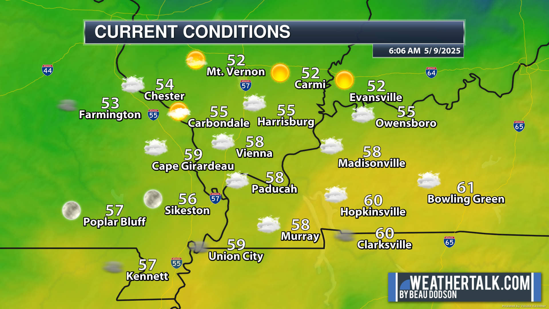
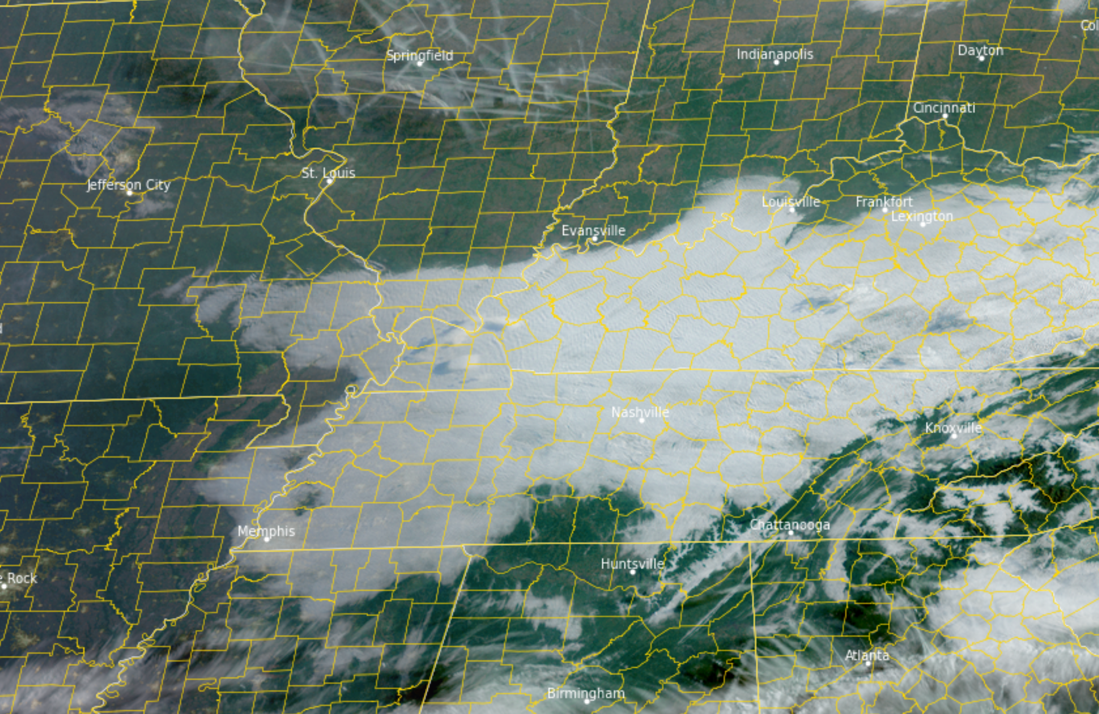
There are some clouds in the region this morning. Clear over our northern counties. Clouds central and south/southeast.
You can see those clouds on Satellite. Clouds may linger in some counties today.
.
The region experienced showers and thunderstorms yesterday. Not everyone received rain. Some locations picked up one to two inches of rain.
There were numerous reports of pea-to-nickel-sized hail, as well. A couple of reports of larger hail.
A hailstorm formed south of Cairo, Illinois, that produced golfball-sized hail. There was even a landspout in southeast Missouri next to Sikeston and Wyatt.
Another hailstorm impacted Henry County, Tennessee. That one produced golfball-sized hail, as well.
The good news is that today will be a nice day. We do not expect any showers or thunderstorms. Temperatures will be a bit below average, but nothing extreme. A few clouds in some counties (as mentioned above).
Saturday will be nice. A bit cool early in the morning. No precipitation. Finally, we will have a nice weekend.
We will have some increase in clouds on Sunday. That will be ahead of our next system, which is developing to the south.
Clouds will thicken from south to north as we move into Sunday afternoon and night. I can’t completely rule out a shower by Sunday evening, but rain chances ramp up quite a bit as we move deeper into Sunday night and Monday.
Showers and thunderstorms are likely on Monday and Monday night. Perhaps lingering into Tuesday, as well.
Uncertainty enters the forecast as we move towards the middle and end of next week.
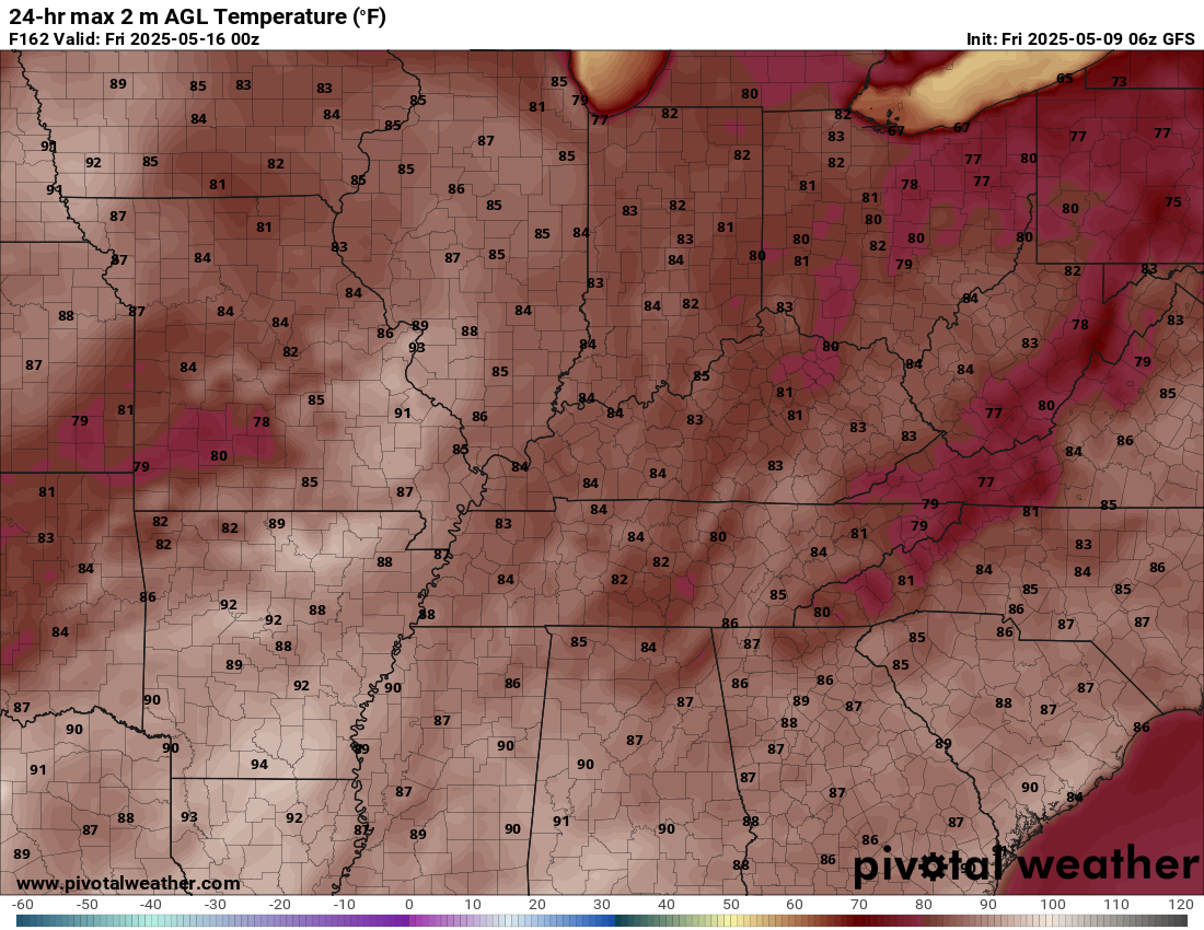
It will become increasingly hot and muggy next week. Highs by Thursday will be in the eighties with heat index values popping above ninety degrees.
For example, here are two maps.
Here are the GFS model’s actual air temperatures for next Thursday. It even shows some nineties in the region.
Heat index values will be even higher.
.
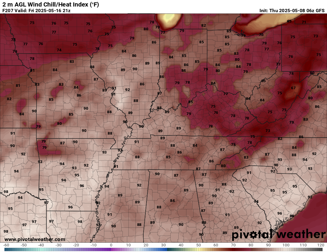
Heat index values next Thursday will likely be in the nineties.
Here are the heat index values for next Friday. Quite warm.
.
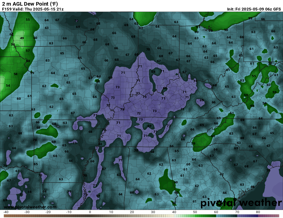
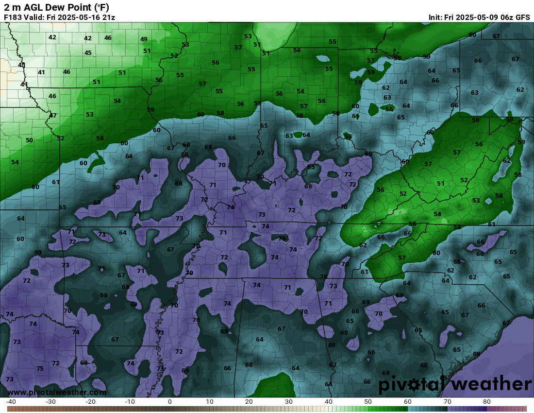
It will be muggy next week. Dew points will climb into the upper 60s and perhaps even 70s. That is air you wear. Humid.
Check out these numbers.
Next Thursday (dew points). Dew point is a measure of moisture.
Next Friday’s dew points. Air you wear.
.
The next question will be thunderstorm chances. I am monitoring next Wednesday into the following week for on-and-off thunderstorm complexes.
There will be plenty of energy for thunderstorms to tap into. Some severe thunderstorms are likely to be the result.
At this time, questions remain about which days will bring the highest thunderstorm probabilities. Confidence in the details is low, but confidence in the potential is high.
In other words, I expect several days with a risk of severe weather next week and the following week. But, for now, I don’t have a clear signal about which days will bring those storms.
I will know more over the coming days.
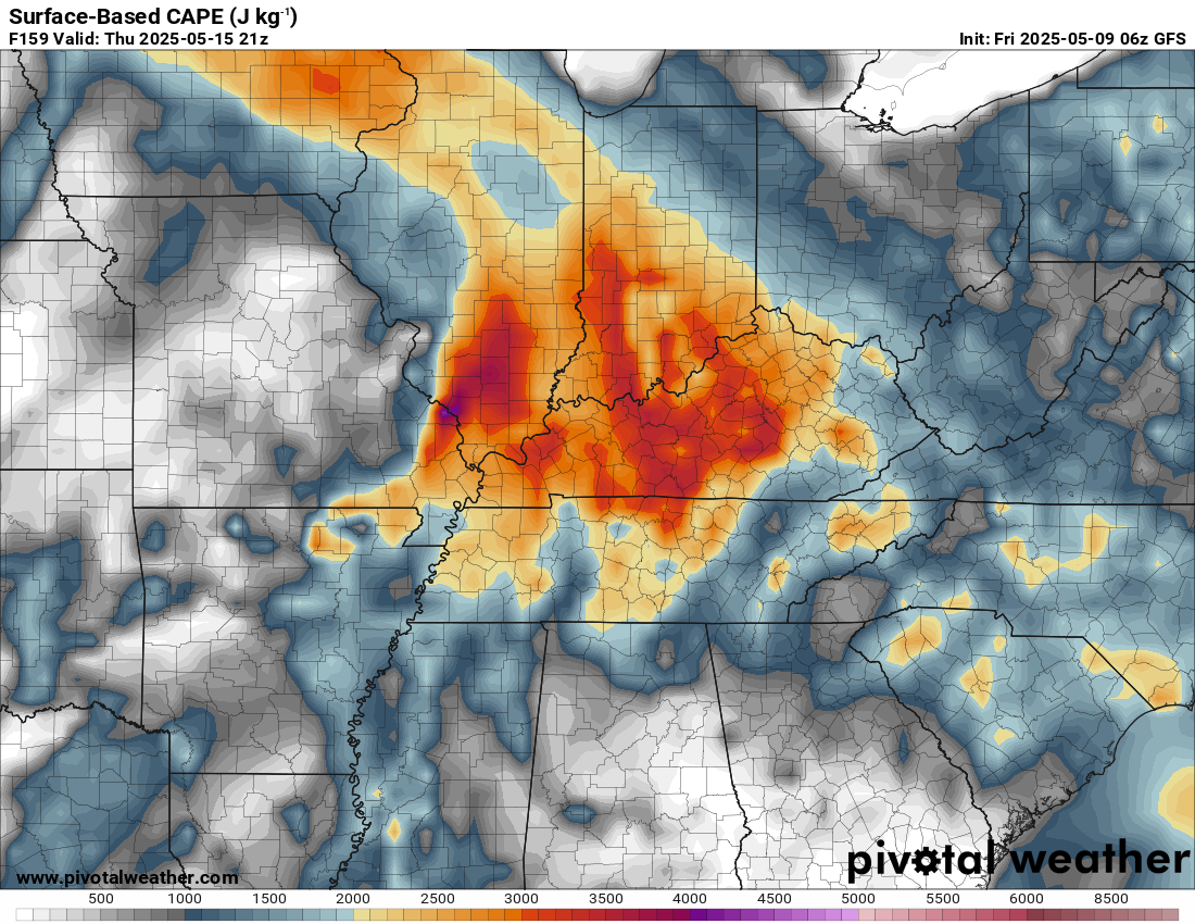
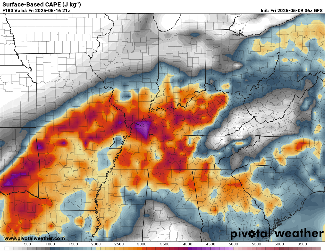
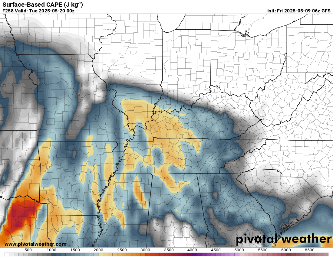
CAPE values show plenty of energy next week. Remember, CAPE is energy that thunderstorms tap into. Higher CAPE numbers usually mean a higher risk of strong/intense thunderstorms.
Here are some CAPE maps.
Next Thursday afternoon.
Next Friday afternoon
Monday the 19th.
Tuesday the 20th of May
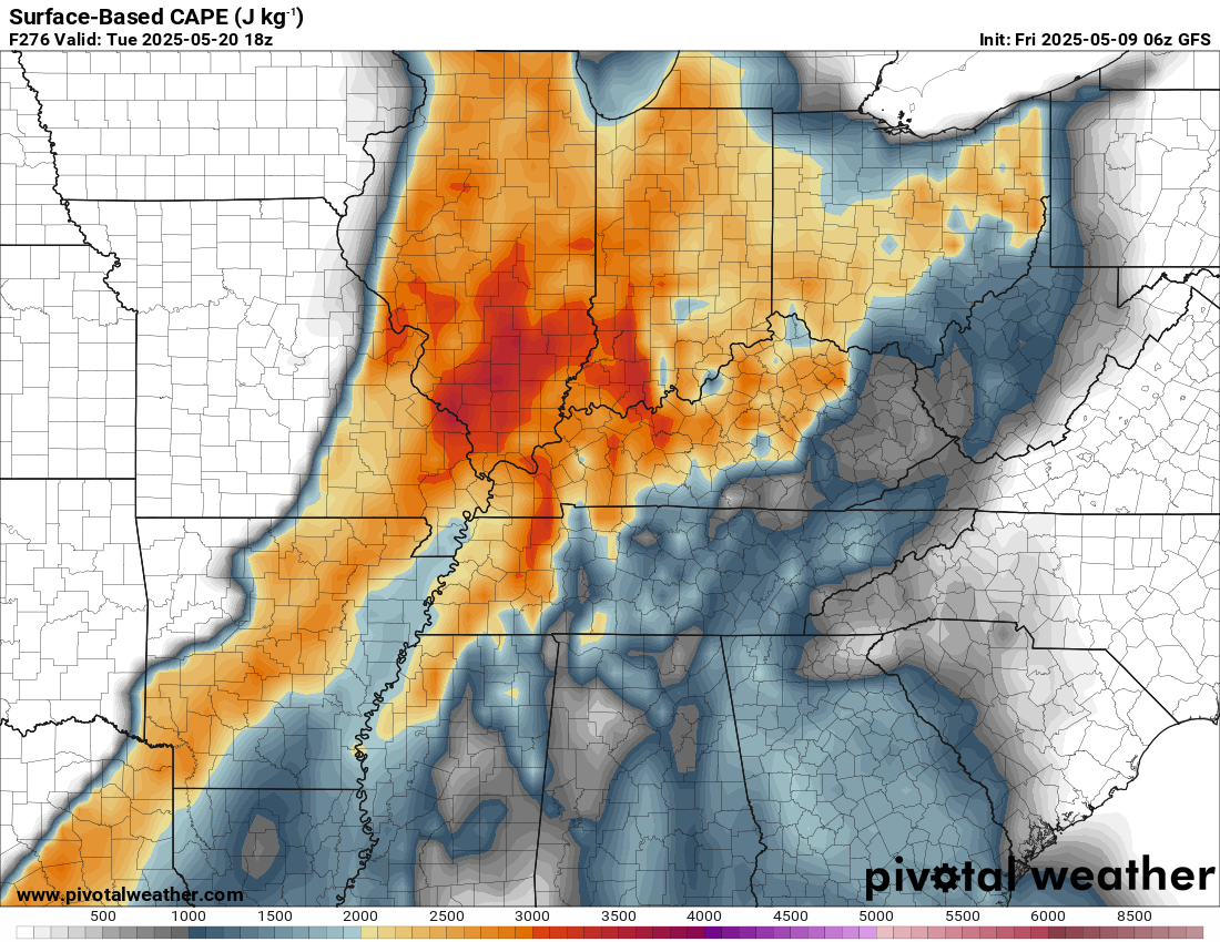
Those maps show you the energy that storms may tap into.
I will be monitoring it closely. We have plenty of time to watch these events.
.

The timestamp (upper left) is in Zulu. 12z=7 am. 18z=1 pm. 00z=7 pm.
Double-click the animation to enlarge it.
GFS model.
.
Here is the EC model.
.
.
.
Click here if you would like to return to the top of the page.
.Average high temperatures for this time of the year are around 73 degrees.
Average low temperatures for this time of the year are around 52 degrees.
Average precipitation during this time period ranges from 1.00″ to 1.40″
Six to Ten Day Outlook.
Blue is below average. Red is above average. The no color zone represents equal chances.
Average highs for this time of the year are in the lower 60s. Average lows for this time of the year are in the lower 40s.

Green is above average precipitation. Yellow and brown favors below average precipitation. Average precipitation for this time of the year is around one inch per week.

.

Average low temperatures for this time of the year are around 55 degrees.
Average precipitation during this time period ranges from 1.20″ to 1.50″
.
Eight to Fourteen Day Outlook.
Blue is below average. Red is above average. The no color zone represents equal chances.

Green is above average precipitation. Yellow and brown favors below average precipitation. Average precipitation for this time of the year is around one inch per week.

.
.
.
We have a new service to complement your www.weathertalk.com subscription. This does NOT replace www.weathertalk.com It is simply another tool for you to receive severe weather information.
.


.

Radars and Lightning Data
Interactive-city-view radars. Clickable watches and warnings.
https://wtalk.co/B3XHASFZ
Old legacy radar site (some of you like it better)
https://weatherobservatory.com/weather-radar.htm
If the radar is not updating then try another one. If a radar does not appear to be refreshing then hit Ctrl F5. You may also try restarting your browser.
Backup radar site in case the above one is not working.
https://weathertalk.com/morani
Regional Radar
https://imagery.weathertalk.com/prx/RadarLoop.mp4
** NEW ** Zoom radar with chaser tracking abilities!
ZoomRadar
If the radar is not working, then email me: Email me at beaudodson@usawx.com
.
We do have some sponsors! Check them out.
Roof damage from recent storms? Link – Click here
INTEGRITY ROOFING AND EXTERIORS!
⛈️ Roof or gutter damage from recent storms? Today’s weather is sponsored by Integrity Roofing. Check out their website at this link https://www.ourintegritymatters.com/

![]()
![]()
![]()
Make sure you have three to five ways of receiving your severe weather information.
Weather Talk is one of those ways! Now, I have another product for you and your family.

.
Want to add more products to your Beau Dodson Weather App?
Receive daily videos, weather blog updates on normal weather days and severe weather and winter storm days, your county by county weather forecast, and more!
Here is how to do add those additional products to your app notification settings!
Here is a video on how to update your Beau Dodson Weather payment.
The app is for subscribers. Subscribe at www.weathertalk.com/welcome then go to your app store and search for WeatherTalk
Subscribers, PLEASE USE THE APP. ATT and Verizon are not reliable during severe weather. They are delaying text messages.
The app is under WeatherTalk in the app store.

Apple users click here

Android users click here
.
Radars and Lightning Data
Interactive-city-view radars. Clickable watches and warnings.
https://wtalk.co/B3XHASFZ
Old legacy radar site (some of you like it better)
https://weatherobservatory.com/weather-radar.htm
If the radar is not updating then try another one. If a radar does not appear to be refreshing then hit Ctrl F5. You may also try restarting your browser.
Backup radar site in case the above one is not working.
https://weathertalk.com/morani
Regional Radar
https://imagery.weathertalk.com/prx/RadarLoop.mp4
** NEW ** Zoom radar with chaser tracking abilities!
ZoomRadar
Lightning Data (zoom in and out of your local area)
https://wtalk.co/WJ3SN5UZ
Not working? Email me at beaudodson@usawx.com
National map of weather watches and warnings. Click here.
Storm Prediction Center. Click here.
Weather Prediction Center. Click here.
.

Live lightning data: Click here.
Real time lightning data (another one) https://map.blitzortung.org/#5.02/37.95/-86.99
Our new Zoom radar with storm chases
.
.

Interactive GOES R satellite. Track clouds. Click here.
GOES 16 slider tool. Click here.
College of DuPage satellites. Click here
.

Here are the latest local river stage forecast numbers Click Here.
Here are the latest lake stage forecast numbers for Kentucky Lake and Lake Barkley Click Here.
.
.
Find Beau on Facebook! Click the banner.


 .
.