The latest update will be posted here at the top of Beau’s severe weather blog. I may delete old posts if it helps speed up the page.
Click on the words below to subscribe
.
May 6, 2021 Event
Concerns:
Thunderstorms will form Thursday afternoon and evening. They will push in from the northwest. Some could be severe.
.
Apple users click here. Android users click here .
..
7:30
The threat of severe weather has ended.
A few storms will continue. Small hail possible. Brief heavy rain.
I don’t expect any additional warnings.
End
6:28 PM
Pope, northern Livingston, and Crittenden Counties.
Strong thunderstorms are moving through central and northeast Pope County and will soon enter southwest and northern Crittenden County and northern Livingston County. If the storm remains on this course then it will push further into Livingston County, as well.
This intense thunderstorm could produce quarter size hail and wind gusts above 50 mph. Isolated wind damage is possible.
Other storms are scattered elsewhere, as well. See the radars.
Be weather aware as these storms move south/southeast at 20 to 30 mph.
These storms have been pulsing up and down throughout the afternoon/evening hours.
See the radars
Interactive local city-view radars. Clickable watches and warnings.
https://wtalk.co/B3XHASFZ
Backup radar site in case the above one is not working.
https://weathertalk.com/morani
..
6:00 PM
Johnson, Massac, and Pope Counties.
Radar now shows one large thunderstorm draped across the northern/central portion of Johnson County. This storm has produced quarter size or larger hail as it moves through Marion, Illinois, and southwest Williamson County. Hail remains likely.
There has been some rotation with these thunderstorms. Be weather aware as these storms move south/southeast at 20 to 30 mph.
If the storm remains on this course (and the intensity continues) then it will impact northern Massac County and portions of Pope County over the next 20 to 40 minutes.
These storms have been pulsing up and down throughout the afternoon/evening hours.
See the radars
Interactive local city-view radars. Clickable watches and warnings.
https://wtalk.co/B3XHASFZ
Backup radar site in case the above one is not working.
https://weathertalk.com/morani
..
5:30 PM
Williamson, northern Johnson, Northern half of Pope County, Southeast Gallatin, and Saline County.
Radar shows several mini-supercell thunderstorms pushing southeast through Williamson and Saline Counties.
These storms may occasionally be strong enough to produce quarter size hail and 50 mph wind gusts. The storms are in a broken line.
There has been some rotation with some of these thunderstorms. Be weather aware as these storms move southeast at 20 to 30 mph.
See the radars
Interactive local city-view radars. Clickable watches and warnings.
https://wtalk.co/B3XHASFZ
Backup radar site in case the above one is not working.
https://weathertalk.com/morani
..
4:16 PM
Jefferson and Hamilton
Radar shows the storm is growing in strength. Hail larger than quarters is likely with this storm. Wind gusts above 65 mph are possible. There is some rotation with the storm.
Seek shelter until this thunderstorm passes your area. It could produce a tornado with little or no additional warning.
Interactive local city-view radars. Clickable watches and warnings.
https://wtalk.co/B3XHASFZ
Backup radar site in case the above one is not working.
https://weathertalk.com/morani
4:11 PM
Hamilton County
A severe thunderstorm with hail and high wind was moving through the northern half of Jefferson County. If it maintains the current path, then it will move into Hamilton County, as well.
The storm has some rotation, as well. Let’s be weather aware over the coming hour as this storm moves into Hamilton County.
Interactive local city-view radars. Clickable watches and warnings.
https://wtalk.co/B3XHASFZ
4:05 PM
Christian and Todd Counties.
A line of intense storms is pushing across Christian County. Over the last 15 minutes radar has started showing signs of high wind. Some hail is likely, as well.
Please see the radars. Seek shelter if you feel threatened by these thunderstorms.
Interactive local city-view radars. Clickable watches and warnings.
https://wtalk.co/B3XHASFZ
Backup radar site in case the above one is not working.
https://weathertalk.com/morani
..
4:00 PM
Jefferson County
A severe thunderstorm was moving into the northern half of the county. It is moving south southeast at 30 mph.
This storm could produce quarter size hail and isolated wind damage.
Interactive local city-view radars. Clickable watches and warnings.
https://wtalk.co/B3XHASFZ
..
3:15 PM
2:32 PM
Eastern half of New Madrid County. Southern Hickman County, Fulton County, and Northern Lake County.
Radar showed a thunderstorm with rotation 5 miles north of New Madrid, MO. This rotation is moving E SE at 20 mph.
Earlier today, a similar storm produced a tornado in southern Cape Girardeau County.
Let’s be weather aware as this storm moves through your area.
Interactive local city-view radars. Clickable watches and warnings.
https://wtalk.co/B3XHASFZ
Backup radar site in case the above one is not working.
https://weathertalk.com/morani
Regional Radar
https://imagery.weathertalk.com/prx/RadarLoop.mp4
..
2:21 PM
Strong storms are approaching southern Dunklin County and Pemiscot County. The storms are moving E SE at 25 mph.
Some of these storms may produce 50 mph wind gusts and quarter size hail.
Interactive local city-view radars. Clickable watches and warnings.
https://wtalk.co/B3XHASFZ
Backup radar site in case the above one is not working.
https://weathertalk.com/morani
Regional Radar
https://imagery.weathertalk.com/prx/RadarLoop.mp4
.
2:04 PM
Scott County
Alexander County
At this time, we have received no further reports of a tornado. The storm still is showing some rotation. We believe the tornado has lifted.
Let’s remain weather aware with this storm, since it did produce a confirmed tornado in southern Cape Girardeau County.
Alexander County should be aware of this storm, as well. It is tracking east at 30 mph.
Quarter size hail is also possible.
Interactive local city-view radars. Clickable watches and warnings.
https://wtalk.co/B3XHASFZ
Backup radar site in case the above one is not working.
https://weathertalk.com/morani
Regional Radar
https://imagery.weathertalk.com/prx/RadarLoop.mp4
.
1:45 PM
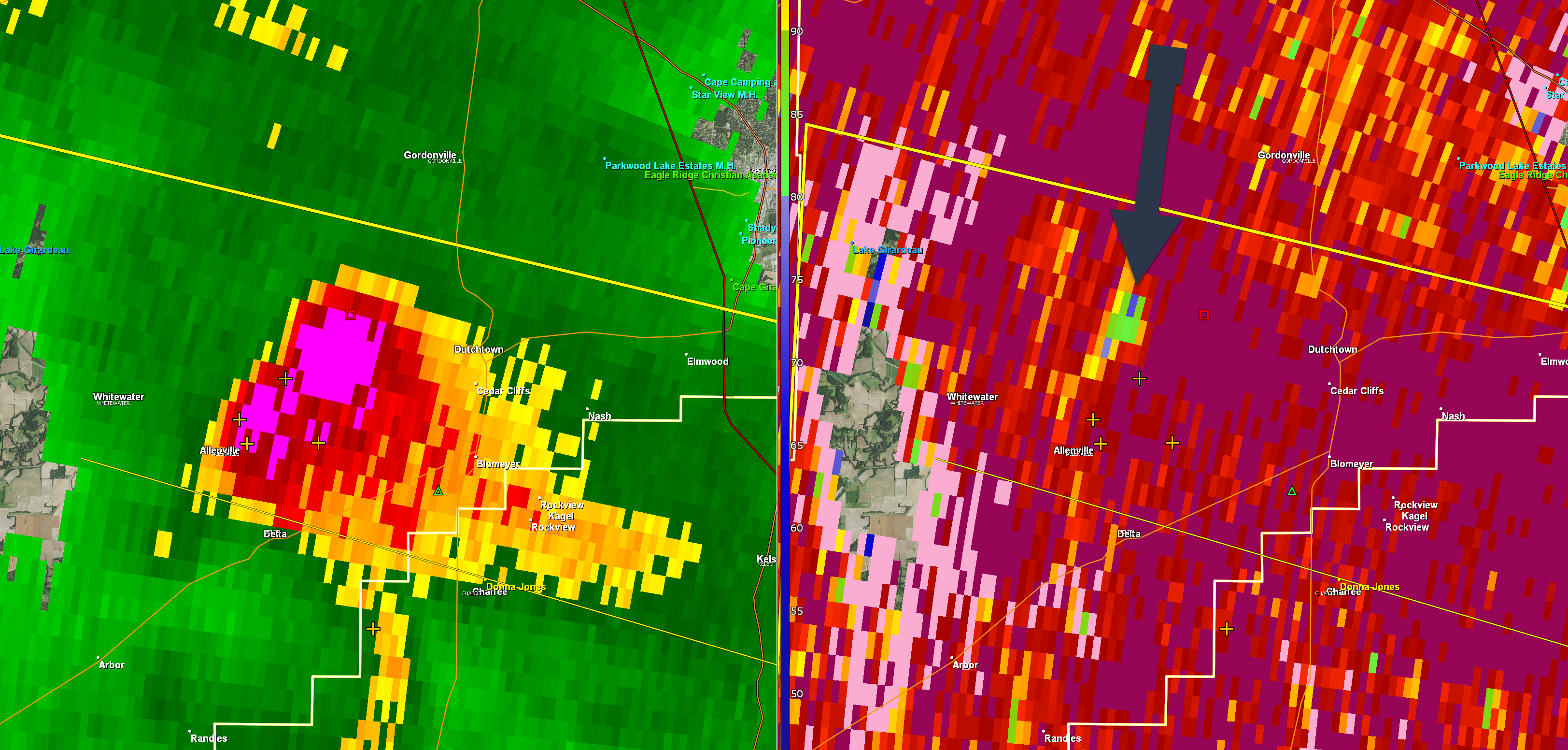
The storm has left Cape G County.
The tornado is currently just south and east of Chaffee, MO. Radar shows that it may still be on the ground. If you are near Chaffee or to the east of Chaffee, Missouri, then seek shelter until this storm leaves your area.
Casey Creek, New Hamburg, and Kelso area should seek shelter.
.
1:40 PM
This was the tornado in Cape Girardeau County
.
1:33 PM
Scott County
Alexander County
A tornado is on the ground cross into Scott County, MO. It was near the town of Chaffee. Anyone in OR NEAR this area should see shelter. A confirmed tornado is moving towards your area.
Alexander County should be aware of this storm, as well. It is tracking east at 30 mph.
Seek shelter until this storm passes your area.
Interactive local city-view radars. Clickable watches and warnings.
https://wtalk.co/B3XHASFZ
.
1:26 PM
.
TORNADO WARNING
NATIONAL WEATHER SERVICE PADUCAH KY
124 PM CDT THU MAY 6 2021

THE NATIONAL WEATHER SERVICE IN PADUCAH HAS ISSUED A

* TORNADO WARNING FOR...
  NORTHERN SCOTT COUNTY IN SOUTHEASTERN MISSOURI...
  SOUTHERN CAPE GIRARDEAU COUNTY IN SOUTHEASTERN MISSOURI...

* UNTIL 215 PM CDT.

* AT 123 PM CDT, A TRAINED SPOTTER REPORTED A TORNADO LOCATED
  NEAR ALLENVILLE, MOVING EAST AT 20 MPH.

  HAZARD...DAMAGING TORNADO AND PING PONG BALL SIZE HAIL.

  SOURCE...WEATHER SPOTTERS CONFIRMED TORNADO.

  IMPACT...FLYING DEBRIS WILL BE DANGEROUS TO THOSE CAUGHT WITHOUT
           SHELTER. MOBILE HOMES WILL BE DAMAGED OR DESTROYED.
           DAMAGE TO ROOFS, WINDOWS, AND VEHICLES WILL OCCUR.  TREE
           DAMAGE IS LIKELY.
:16 PM
Southern Cape Girardeau County, Scott, and Alexander.
Radar shows an intense thunderstorm that has an area of rotation in southern Cape Girardeau County. This storm is moving E SE at 35 mph.
Be weather aware as this storm approaches or moves through your area. It has a better chance of producing strong wind gusts. Hail, as well.
Since it does have rotation, we need to monitor it.
Interactive local city-view radars. Clickable watches and warnings.
https://wtalk.co/B3XHASFZ
May 6
1 PM
Butler, Stoddard, Bollinger, Cape Girardeau, Scott Counties in southeast Missouri.
Union and Alexander Counties in southern Illinois.
At 1 PM radar shows several areas of intense thunderstorms moving through or approaching your county.
These storms have increased in intensity and a few of them may produce wind damage and quarter size hail.
See the radars.
If you are in the path of one of these storms then seek shelter until the storms pass your area.
Radars and Lightning Data
Interactive local city-view radars. Clickable watches and warnings.
https://wtalk.co/B3XHASFZ
Backup radar site in case the above one is not working.
https://weathertalk.com/morani
Regional Radar
https://imagery.weathertalk.com/prx/RadarLoop.mp4
*NEW* Zoom interactive radar (with storm chaser streams)
https://wtalk.co/AVWG7GM7
Real time lightning tracker system two.
https://map.blitzortung.org/#5.02/37.95/-86.99
Lightning Data (zoom in and out of your local area)
https://wtalk.co/WJ3SN5UZ
.
12:50 PM
BULLETIN – IMMEDIATE BROADCAST REQUESTED
Severe Thunderstorm Warning
National Weather Service Paducah KY
1253 PM CDT Thu May 6 2021
The National Weather Service in Paducah has issued a
* Severe Thunderstorm Warning for…
Southwestern Bollinger County in southeastern Missouri…
Eastern Carter County in southeastern Missouri…
Northeastern Ripley County in southeastern Missouri…
Wayne County in southeastern Missouri…
Northwestern Stoddard County in southeastern Missouri…
Northern Butler County in southeastern Missouri…
* Until 130 PM CDT.
* At 1252 PM CDT, a severe thunderstorm was located over Piedmont,
moving east at 35 mph. Another severe storm was near Ellsinore.
HAZARD…60 mph wind gusts and quarter size hail.
SOURCE…Radar indicated.
IMPACT…Hail damage to vehicles is expected. Expect wind damage
to roofs, siding, and trees.
* Locations impacted include…
Poplar Bluff, Piedmont, Greenville, Lake Wappapello State Park,
Ellsinore.
PRECAUTIONARY/PREPAREDNESS ACTIONS…
.
12:45 PM
May 6, 2021
12:45 PM
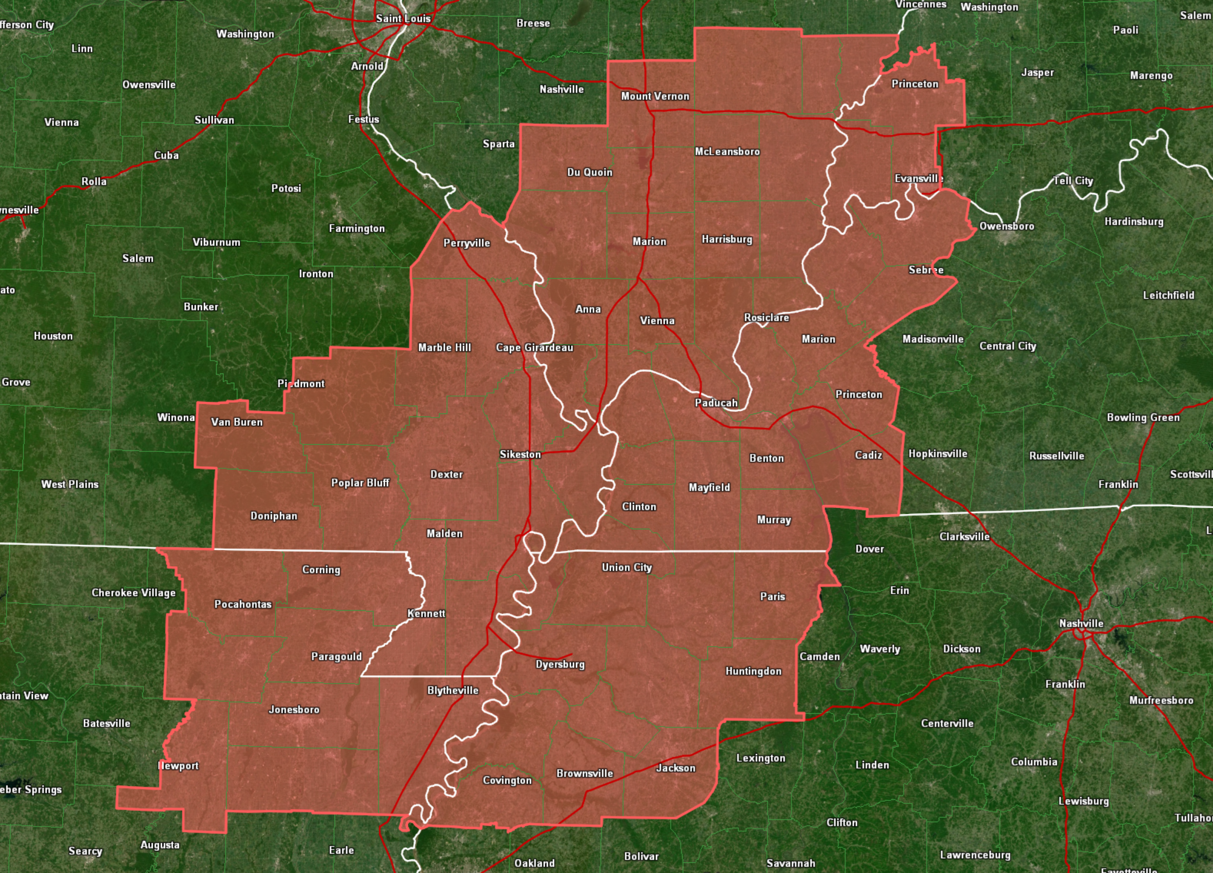
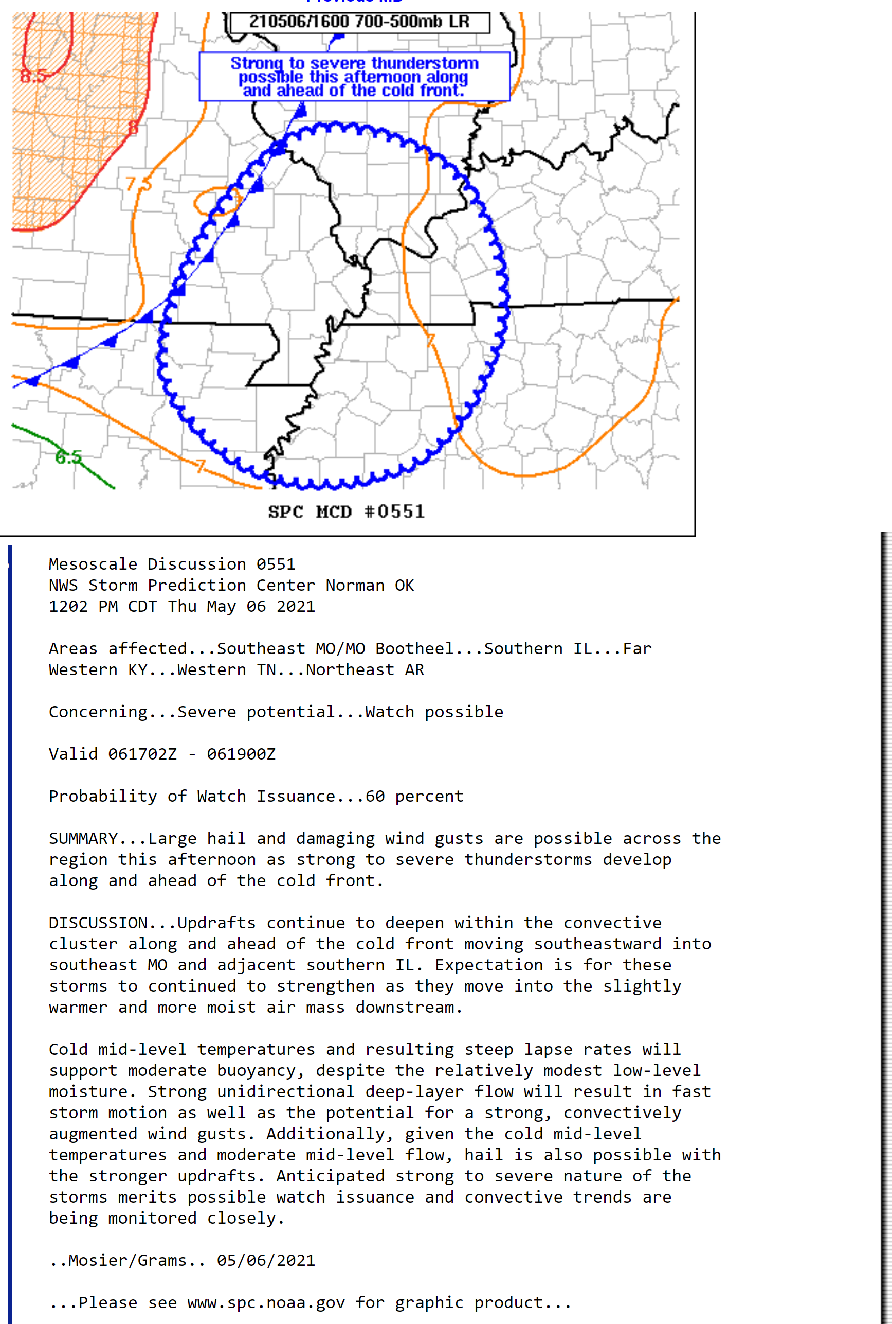
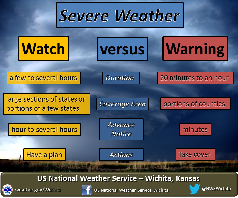
A severe thunderstorm watch has been issued for the rest of the afternoon. The watch will likely be trimmed as the line of storms moves through any given area.
A watch means to monitor. A WARNING means to seek shelter.
The main concern will be a few reports of wind damage and quite a few reports of dime to quarter size hail. There is a chance that some hail is larger, keep that in mind. Lightning, of course.
Here is the Storm Prediction Center watch information.
https://www.spc.noaa.gov/products/watch/ww0152.html
I am monitoring the chance of a few storms forming behind the line.
12:40 PM update
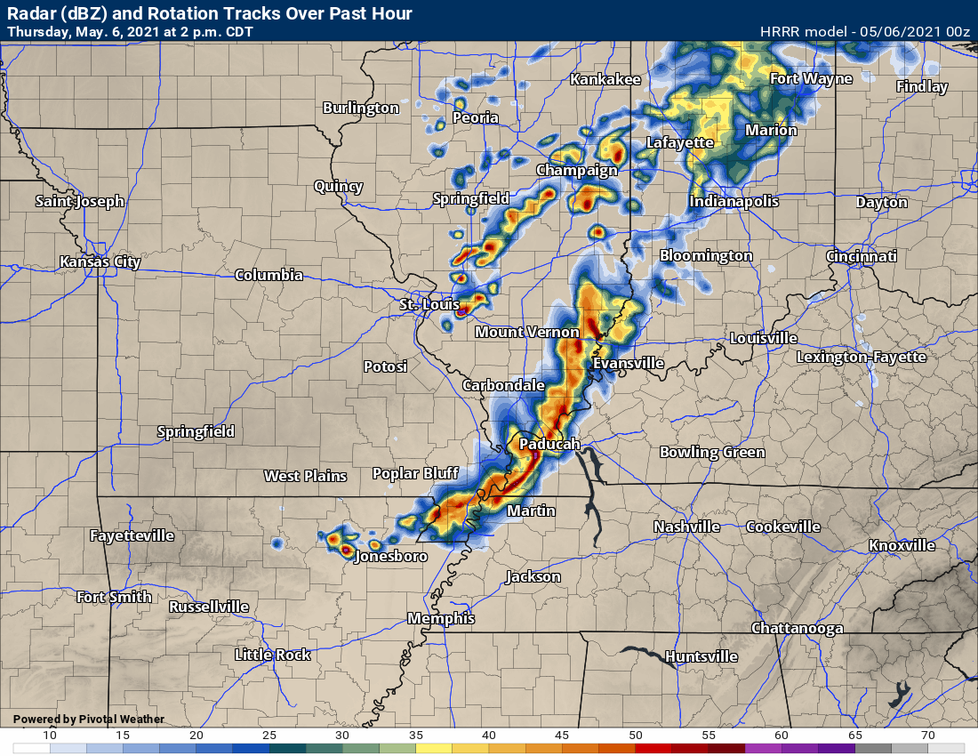
A line of thunderstorms is pushing through southeast Missouri and southern Illinois. Numerous reports of dime to penny size hail have been reported with these thunderstorms.
The storms may strengthen just a tad over the next few hours. That means a few storms could produce quarter size hail and 50 mph wind gusts.
A few severe thunderstorm warnings may be necessary.
.
12 PM update.
A severe thunderstorm watch may need to be issued shortly.
.
May 6, 2021
7 AM Update
No significant changes from what I have written below in the previous discussion.
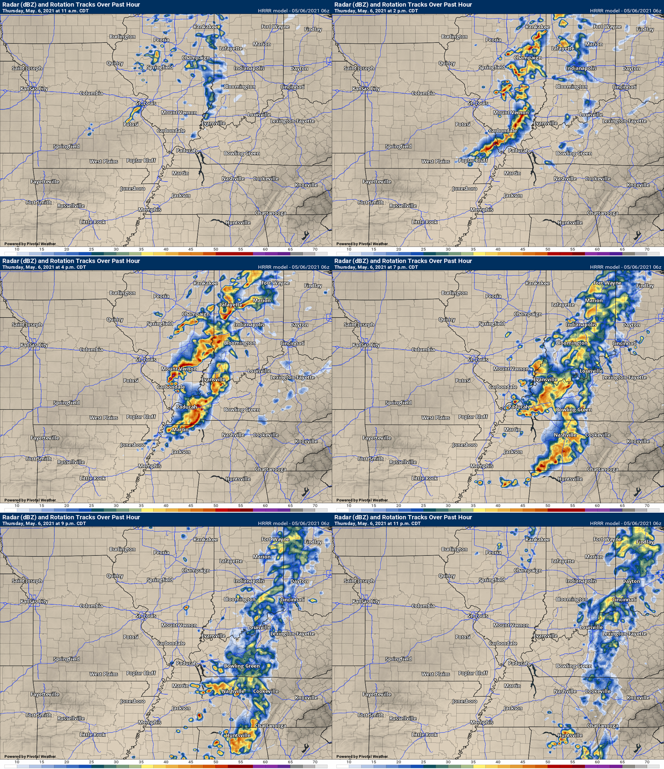
See the updated future-cast radars for timing of the line of thunderstorms that will develop by late morning and afternoon.
This is a low-end risk. A marginal risk from the Storm Prediction Center. They have five risk levels. One is the lowest (marginal).
The main concern continues to be a few reports of heavy rain, lightning, strong and gusty wind, and perhaps hail. The tornado risk remains low.
See graphics below.
.
Storm Tracking Links
Interactive local city-view radars. Clickable watches and warnings.
https://wtalk.co/B3XHASFZ
Backup radar site in case the above one is not working.
https://weathertalk.com/morani
Regional Radar
https://imagery.weathertalk.com/prx/RadarLoop.mp4
*NEW* Zoom interactive radar (with storm chaser streams)
https://wtalk.co/AVWG7GM7
Real time lightning tracker system two.
https://map.blitzortung.org/#5.02/37.95/-86.99
Lightning Data (zoom in and out of your local area)
https://wtalk.co/WJ3SN5UZ

![]()
.Weather advice:
Monitor the live-blog, my Beau Dodson Weather Facebook page, and your app.
.
Weather Discussion
-
- A cold front is approaching from the west.
- Thunderstorms will form Thursday afternoon and evening.
- A few storms could be severe with damaging wind and hail.
Don’t forget our website has a “see all” tab. You can see every warning that I send out (and other information).
Click here for the see all tab. You can monitor other counties. You can make sure you didn’t miss anything. LINK https://weathertalk.com/app/messages
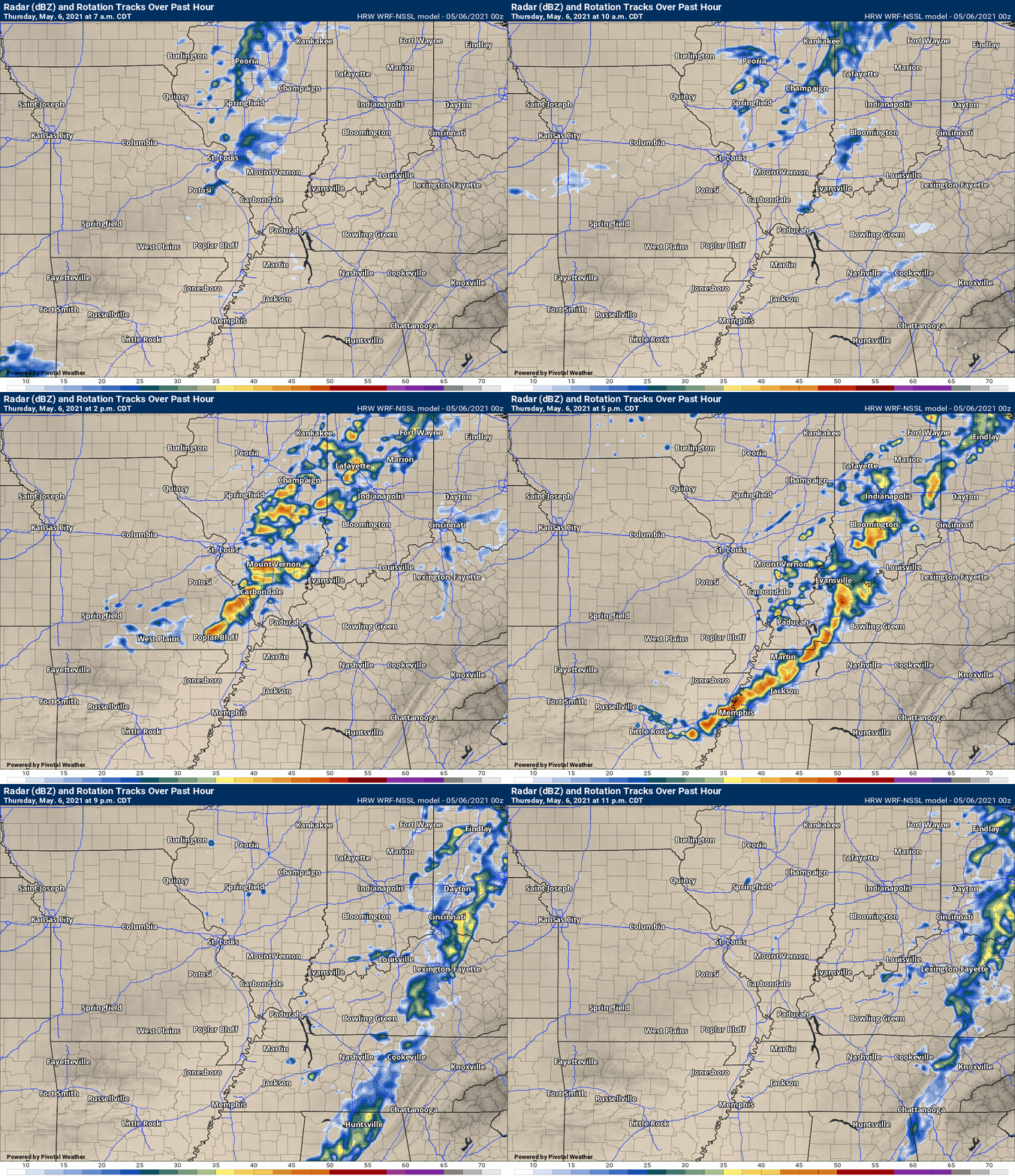
The concern Thursday will mainly be from 12 PM through 7 PM. A line of thunderstorms will push from NW to SE across the region.
The atmosphere will be somewhat unstable. Unstable enough to produce a few severe storms with high wind and perhaps hail. A low-end tornado risk.
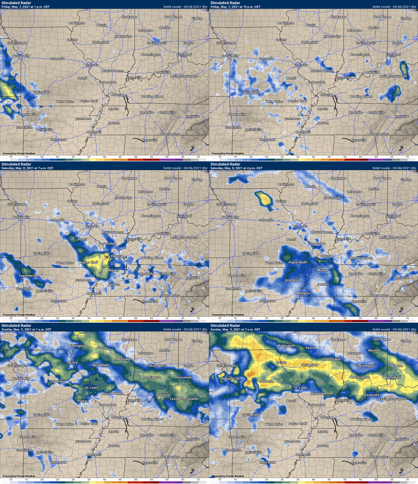
Future-cast radar
Future-cast radar.
.
Today’s outlook (below).
Light green is where thunderstorms may occur but should be below severe levels.
Dark green is a level one risk. Yellow is a level two risk. Orange is a level three (enhanced) risk. Red is a level four (moderate) risk. Pink is a level five (high) risk.
One is the lowest risk. Five is the highest risk.
A severe storm is one that produces 58 mph wind or higher, quarter size hail, and/or a tornado.
The tan states are simply a region that SPC outlined on this particular map. Just ignore that.

The black outline is our local area.

.
Tomorrow’s severe weather outlook.

![]()
![]()
Some safety graphics.
.![]()
.

Again, as a reminder, these are models. They are never 100% accurate. Take the general idea from them.
What should I take from these?
- The general idea and not specifics. Models usually do well with the generalities.
- The time-stamp is located in the upper left corner.
- The EC European weather model is in Zulu time.
.
What am I looking at?
You are looking at different models. Meteorologists use many different models to forecast the weather. All models are wrong. Some are more wrong than others. Meteorologists have to make a forecast based on the guidance/models.
I show you these so you can see what the different models are showing as far as precipitation. If most of the models agree, then the confidence in the final weather forecast increases.
SPC WRF model
.
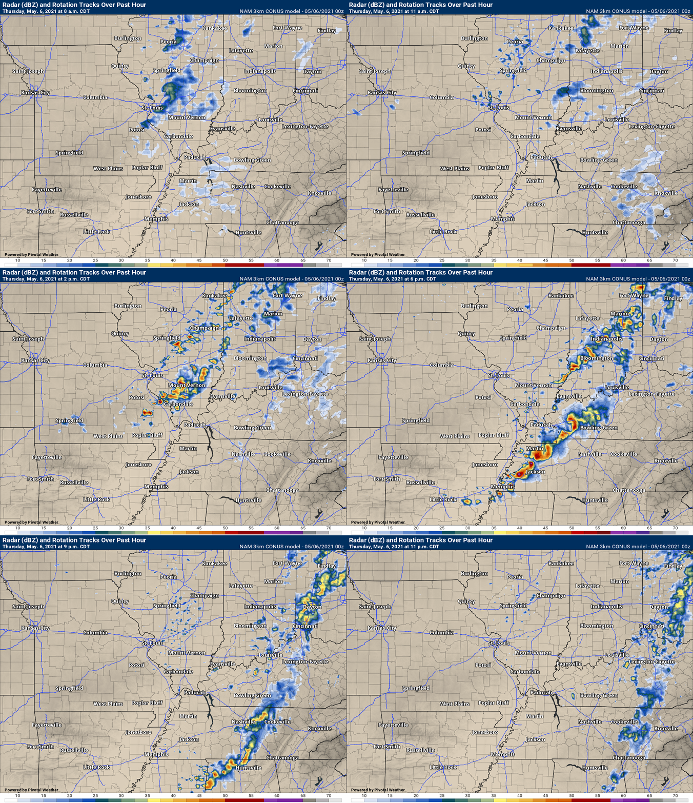
.This animation is the 3K NAM American Model.
This animation shows you what radar might look like as the next system pulls through the region. It is a future-cast radar.
Time-stamp upper left. Click the animation to enlarge it.
This next animation is the lower-resolution NAM American Model.
This animation shows you what radar might look like as the system pulls through the region. It is a future-cast radar.
Time-stamp upper left. Click the animation to enlarge it.
.
What you need to know.
Key Points
- A line of storms will move across the region this afternoon and evening.
- A few of the storms could produce hail and wind damage. A low tornado risk.
- Locally heavy rain and lightning.
- Have your Beau Dodson Weather app on. Check it. Make sure you have not logged out of the app.
- Remember, a watch means to monitor updates. A warning means to seek shelter. A warning is a higher threat.
.
Call to action.
Monitor updated weather forecasts.
Have a safety plan.
Make sure you are using the Beau Dodson Weather Talk app. Download it from the app store. It is under Weather Talk.
The app is for subscribers (please log into your account and make sure your payment has been updated. We have a large number of declined cards and PayPal payments.
Subscribe at www.weathertalk.com/welcome then go to your app store and search for WeatherTalk. Apple users click here. Android users click here .
.
Day one outlook.

.
Day two outlook.

.

Radar Link: Interactive local city-view radars & regional radars.
You will find clickable warning and advisory buttons on the local city-view radars.
If the radar is not updating then try another one. If a radar does not appear to be refreshing then hit Ctrl F5. You may also try restarting your browser.
Not working? Email me at beaudodson@usawx.com
Backup radar site in case the above one is not working.
https://weathertalk.com/morani
New ZOOM radar (with storm chasers)
https://wtalk.co/AVWG7GM7
Regional Radar
https://imagery.weathertalk.com/prx/RadarLoop.mp4
Lightning Data (zoom in and out of your local area)
https://wtalk.co/WJ3SN5UZ
Satellite Data
Computers and tablets. These two satellite links may not work well on cell phones.
Visible Satellite. This one is to be used during daylight only. Be sure and hit refresh once you are on the satellite page. Otherwise, the data will be old.
https://col.st/a5A0e
IR Satellite. This one shows cloud temperatures. Bright colors represent cold cloud tops. That could mean thunderstorms. Be sure and hit refresh once you are on the satellite page. Otherwise, the data will be old.
https://col.st/R2fw1
Water Vapor Satellite. This one shows mid-level moisture in the atmosphere. Be sure and hit refresh once you are on the satellite page. Otherwise, the data will be old.
https://col.st/xFVwx
.

Live lightning data: Click here.
Not receiving app/text messages?
USE THE APP. ATT and Verizon are slowing or stopping the text messages.
Make sure you have the correct app/text options turned on. Find those under the personal notification settings tab at www.weathertalk.com. Red is off. Green is on.
Subscribers, PLEASE USE THE APP. ATT and Verizon are not reliable during severe weather. They are delaying text messages.
The app is under WeatherTalk in the app store.
Apple users click here
Android users click here
.


