

.
I have some question-and-answer threads over on the Facebook page. Link to those threads CLICK HERE
Or email me at beaudodsonweather@gmail.com
I am going to start going live during events.
I have a live stream running now (I am learning how to use the software).
Check it out here https://www.youtube.com/user/beaudodson
Click the subscribe button (it is a free subscribe button), and it will alert you when I go live. I will also send out alerts to the app when I go live for an event.

.

🌪️ Seven-Day Tornado Outlook ⛈️
May 26th through June 1st
Current risk: Currently, we do not have a tornado risk.
Current confidence level: High confidence in the forecast.
Comment: At this time, I do not have tornadoes in the forecast.
.

Seven-Day Hazardous Weather Outlook
1. Is lightning in the forecast? YES. Lightning is possible today into Tuesday night. A low chance on Thursday and Friday.
2. Are severe thunderstorms in the forecast? NO. Not at this time.
3. Is flash flooding in the forecast? LOW RISK. There is a low risk over portions of southeast Missouri. Mainly the Ozarks into the Missouri Bootheel.
4. Will non-thunderstorm winds top 40 mph? NO.
5. Will temperatures rise above 90 degrees? NO.
6. Will the heat index rise above 100 degrees? NO.
.
A quick forecast glance. Your 48-hour forecast Graphics


.

.


Forecast discussion.
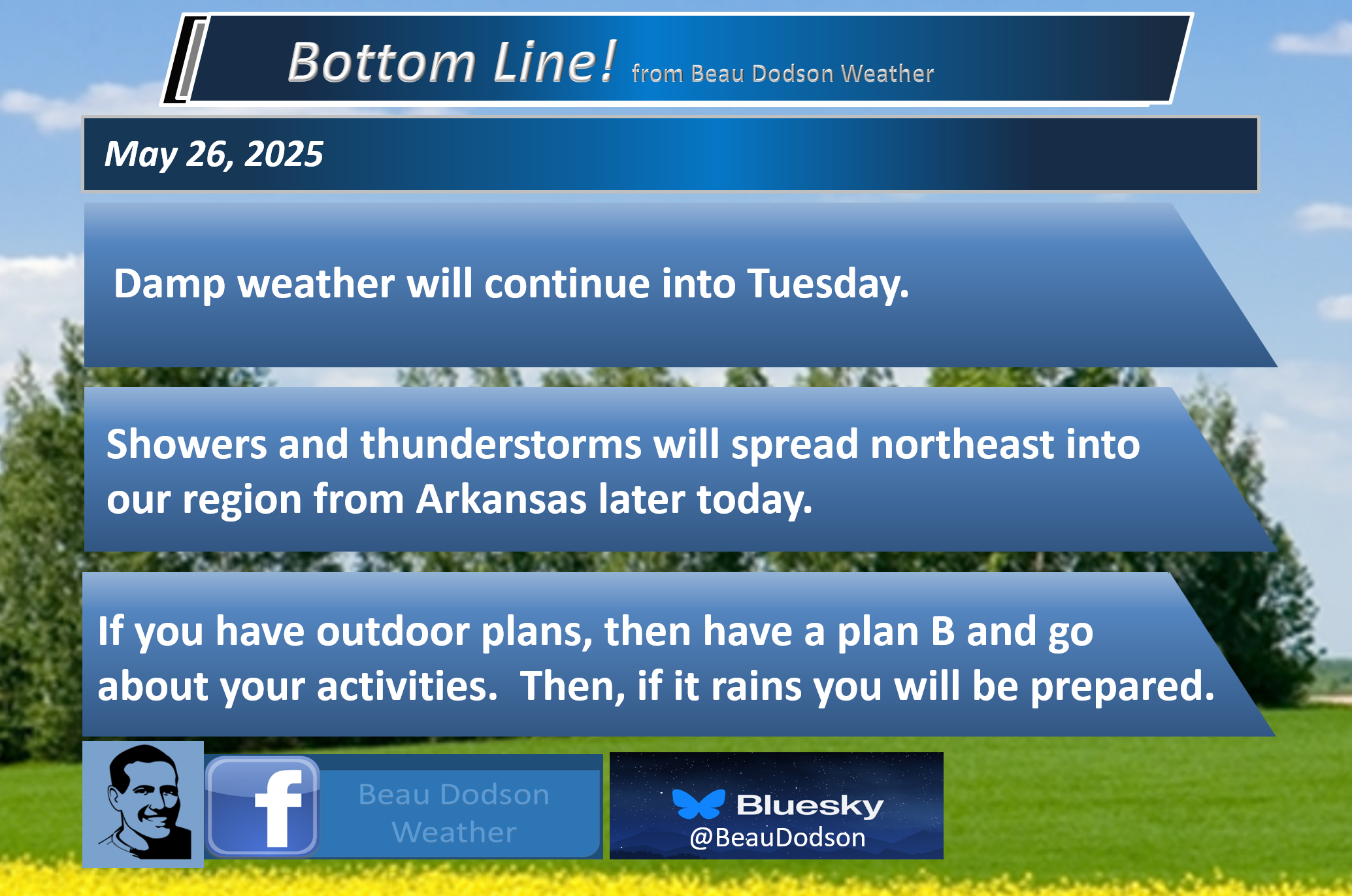
- Cool again today. Rain will overspread the region from the southwest.
- A chance of showers and storms will linger into Tuesday.
- A low-end chance of a few showers Wednedsay, Thursday, and Friday.
- Quite a bit warmer on Saturday and Sunday. The eighties should return.
- For now, I kept Saturday and Sunday dry.
.

Today, we pause to remember and honor the brave men and women who made the ultimate sacrifice in service to our country. Their courage, dedication, and selflessness will never be forgotten.

.
Good day, everyone
I hope you are having a nice weekend. Yes, it has not been the best weather. One of the cooler Memorial Day weekends in over 20 years!
We can’t seem to catch a break when it comes to nice weekends. The year has been made up of stormy, damp, and cool weekends.
Showers and thunderstorms will overspread the region from Arkansas later this morning and afternoon. See the future-cast radars below.
It will take some time to reach portions of the region. Thus, much of today may remain dry across portions of southeast Illinois and portions of western Kentucky.
The faster west-southwest you travel, the greater the odds of rain moving into your area.
By late afternoon, the entire region should be experiencing showers and a few embedded thunderstorms.
The good news is that we do not anticipate severe weather. Let’s count that as a blessing. It has been a rough year.
Showers and thunderstorms will continue on/off into tonight and tomorrow.
I know farmers would like a dry spell. I am watching next week for that.
A slow warming trend will develop by Thursday and Friday. Temperatures should pop back into the 80s by Saturday and Sunday. Finally.
The 6 to 10 day outlook, which takes us into next week, is for below-average precipitation and above-average temperatures. Perhaps we will finally have a break from the wet weather.
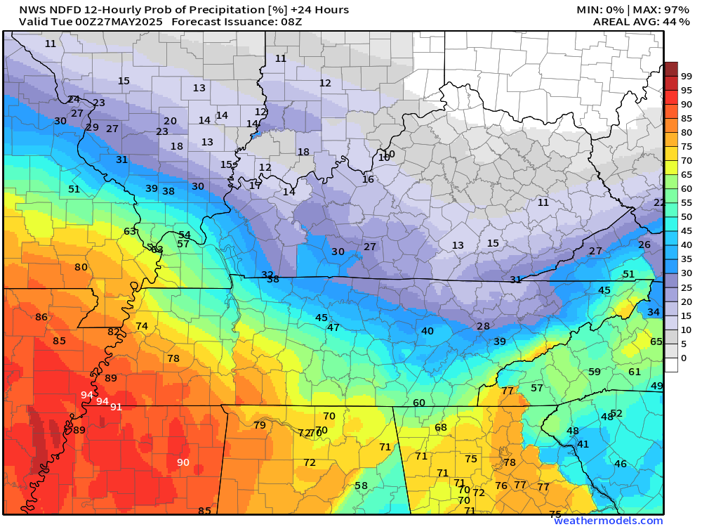
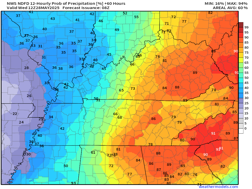
Let’s look at the rain probabilities. This graphic might be a bit low across portions of Illinois/Kentucky. We will have to see just how fast the rain moves into these areas.
Today’s rain probabilities
Tonight’s rain probabilities
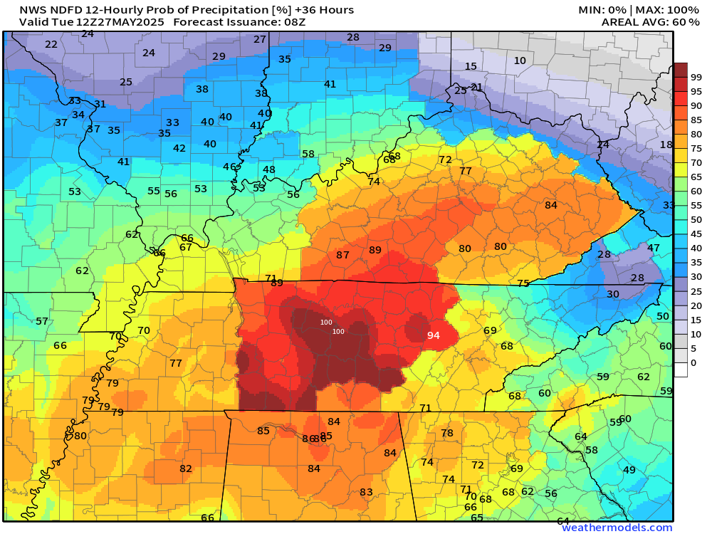
Tuesday’s rain probabilities
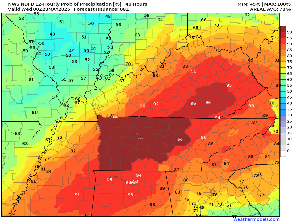
Tuesday night’s rain probabilities
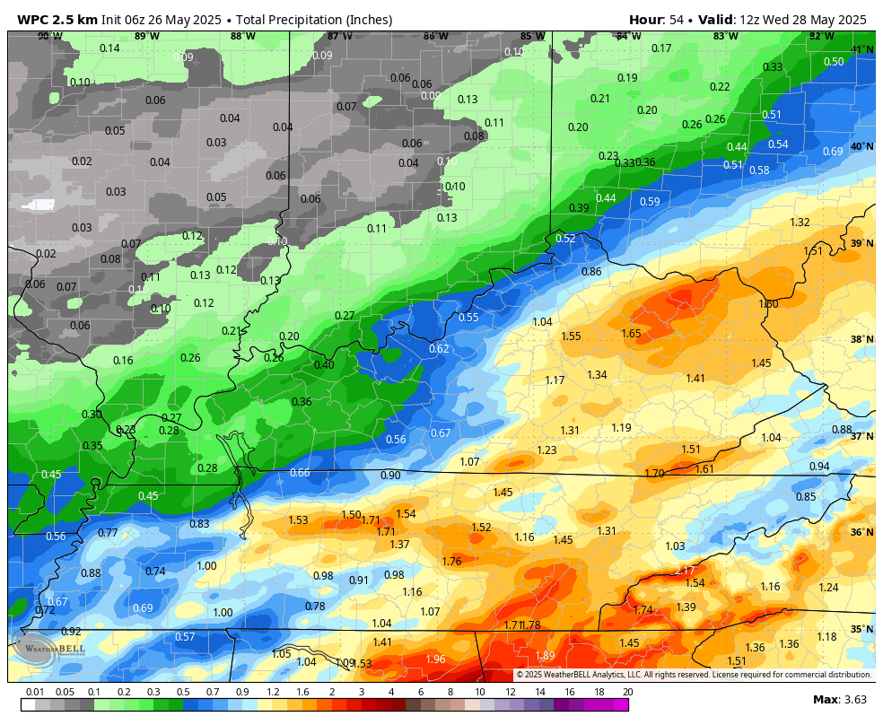
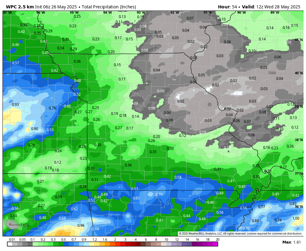
Let’s look at the expected rainfall totals through Tuesday night.
Nothing too crazy.
Double-click on the image to enlarge it.
.
.

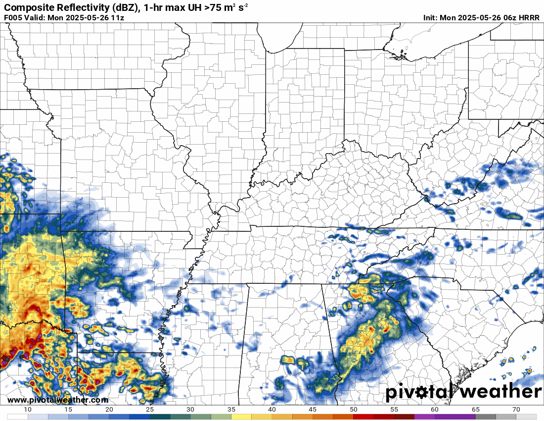
The timestamp (upper left) is in Zulu. 12z=7 am. 18z=1 pm. 00z=7 pm.
Double-click the animation to enlarge it.
Hrrr model.
.
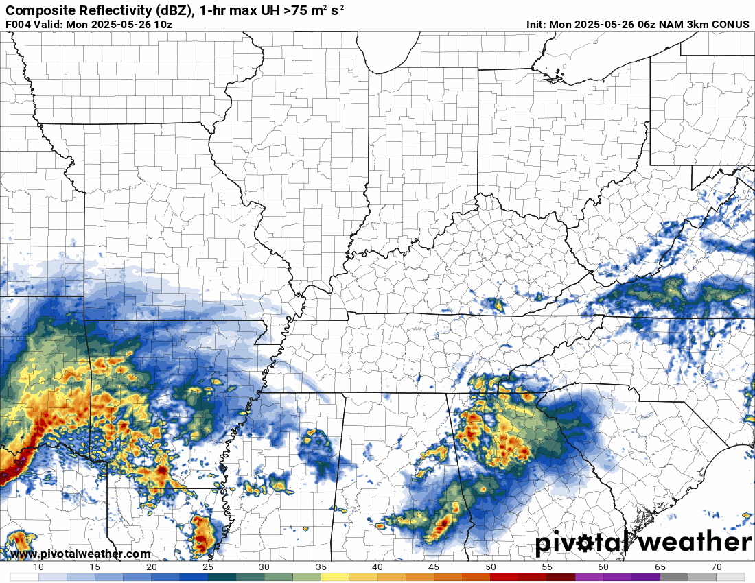
Here is the NAM 3K model
.
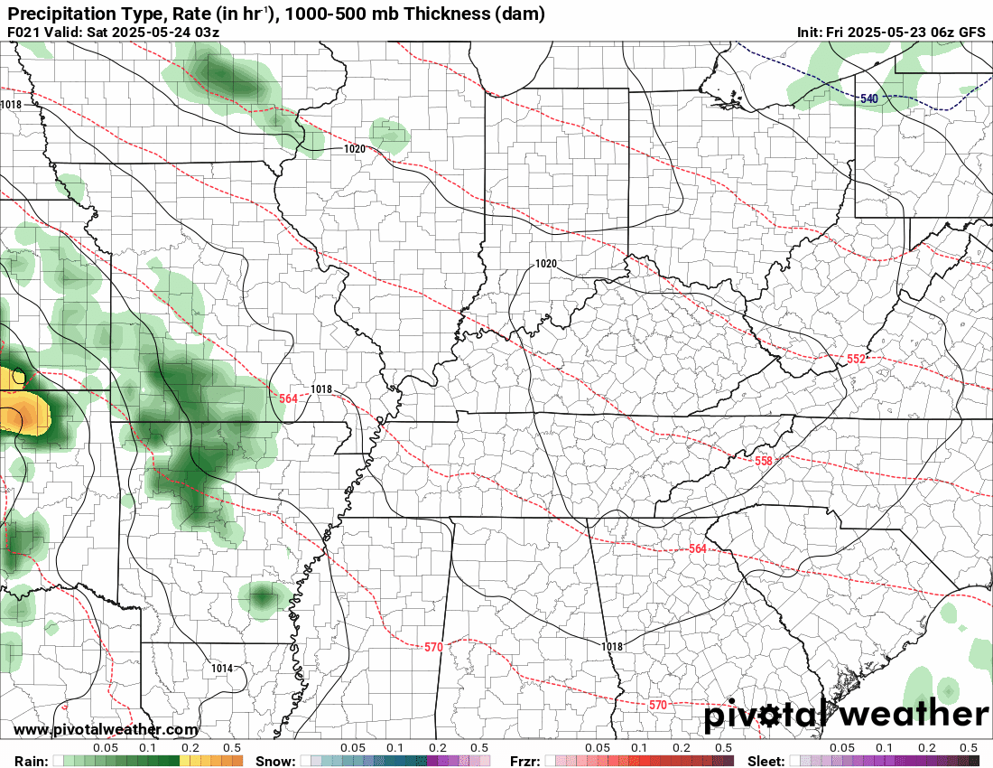
Here is the GFS model
.
.
.
Click here if you would like to return to the top of the page.
.Average high temperatures for this time of the year are around 80 degrees.
Average low temperatures for this time of the year are around 60 degrees.
Average precipitation during this time period ranges from 1.00″ to 1.40″
Six to Ten Day Outlook.
Blue is below average. Red is above average. The no color zone represents equal chances.
Average highs for this time of the year are in the lower 60s. Average lows for this time of the year are in the lower 40s.

Green is above average precipitation. Yellow and brown favors below average precipitation. Average precipitation for this time of the year is around one inch per week.

.

Average low temperatures for this time of the year are around 60 degrees.
Average precipitation during this time period ranges from 1.20″ to 1.50″
.
Eight to Fourteen Day Outlook.
Blue is below average. Red is above average. The no color zone represents equal chances.

Green is above average precipitation. Yellow and brown favors below average precipitation. Average precipitation for this time of the year is around one inch per week.

.
.
.
We have a new service to complement your www.weathertalk.com subscription. This does NOTreplace www.weathertalk.com It is simply another tool for you to receive severe weather information.
.


.

Radars and Lightning Data
Interactive-city-view radars. Clickable watches and warnings.
https://wtalk.co/B3XHASFZ
Old legacy radar site (some of you like it better)
https://weatherobservatory.com/weather-radar.htm
If the radar is not updating then try another one. If a radar does not appear to be refreshing then hit Ctrl F5. You may also try restarting your browser.
Backup radar site in case the above one is not working.
https://weathertalk.com/morani
Regional Radar
https://imagery.weathertalk.com/prx/RadarLoop.mp4
** NEW ** Zoom radar with chaser tracking abilities!
ZoomRadar
If the radar is not working, then email me: Email me at beaudodson@usawx.com
.
We do have some sponsors! Check them out.
Roof damage from recent storms? Link – Click here
INTEGRITY ROOFING AND EXTERIORS!
⛈️ Roof or gutter damage from recent storms? Today’s weather is sponsored by Integrity Roofing. Check out their website at this link https://www.ourintegritymatters.com/

![]()
![]()
![]()
Make sure you have three to five ways of receiving your severe weather information.
Weather Talk is one of those ways! Now, I have another product for you and your family.

.
Want to add more products to your Beau Dodson Weather App?
Receive daily videos, weather blog updates on normal weather days and severe weather and winter storm days, your county by county weather forecast, and more!
Here is how to do add those additional products to your app notification settings!
Here is a video on how to update your Beau Dodson Weather payment.
The app is for subscribers. Subscribe at www.weathertalk.com/welcome then go to your app store and search for WeatherTalk
Subscribers, PLEASE USE THE APP. ATT and Verizon are not reliable during severe weather. They are delaying text messages.
The app is under WeatherTalk in the app store.

Apple users click here

Android users click here
.
Radars and Lightning Data
Interactive-city-view radars. Clickable watches and warnings.
https://wtalk.co/B3XHASFZ
Old legacy radar site (some of you like it better)
https://weatherobservatory.com/weather-radar.htm
If the radar is not updating then try another one. If a radar does not appear to be refreshing then hit Ctrl F5. You may also try restarting your browser.
Backup radar site in case the above one is not working.
https://weathertalk.com/morani
Regional Radar
https://imagery.weathertalk.com/prx/RadarLoop.mp4
** NEW ** Zoom radar with chaser tracking abilities!
ZoomRadar
Lightning Data (zoom in and out of your local area)
https://wtalk.co/WJ3SN5UZ
Not working? Email me at beaudodson@usawx.com
National map of weather watches and warnings. Click here.
Storm Prediction Center. Click here.
Weather Prediction Center. Click here.
.

Live lightning data: Click here.
Real time lightning data (another one) https://map.blitzortung.org/#5.02/37.95/-86.99
Our new Zoom radar with storm chases
.
.

Interactive GOES R satellite. Track clouds. Click here.
GOES 16 slider tool. Click here.
College of DuPage satellites. Click here
.

Here are the latest local river stage forecast numbers Click Here.
Here are the latest lake stage forecast numbers for Kentucky Lake and Lake Barkley Click Here.
.
.
Find Beau on Facebook! Click the banner.


 .
.