

.
I have some question-and-answer threads over on the Facebook page. Link to those threads CLICK HERE
Or email me at beaudodsonweather@gmail.com
.

🌪️ Seven-Day Tornado Outlook ⛈️
May 19th through May 25th
Current risk: Tornadoes are possible.
Current confidence level: Medium confidence in the forecast.
Comment: There is a low-end risk of severe weather before 3 PM today. The primary concern would be isolated damaging wind gusts and hail.
There is a risk of severe thunderstorms late this afternoon and tonight. The primary concern will be damaging wind gusts, quarter to half-dollar-sized hail, and a tornado.
There is a risk of severe weather on Tuesday morning and afternoon. There remain questions about Tuesday afternoon.
What happens on Tuesday morning will impact what happens on Tuesday afternoon. If clouds and precipitation linger on Tuesday morning, the risk will be lower during the PM hours.
It seems almost every severe weather event is this way. Questions about morning clouds impacting afternoon activity. Not uncommon.
The risk will likely be higher on Tuesday afternoon across Kentucky and Tennessee. Monitor updates.
Here is a National Weather Service
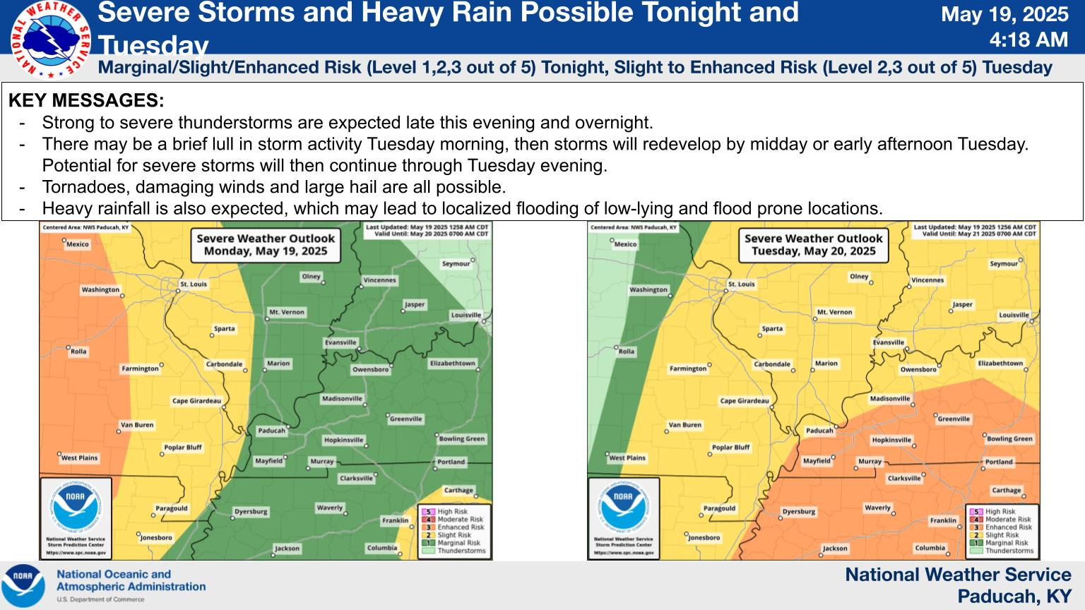
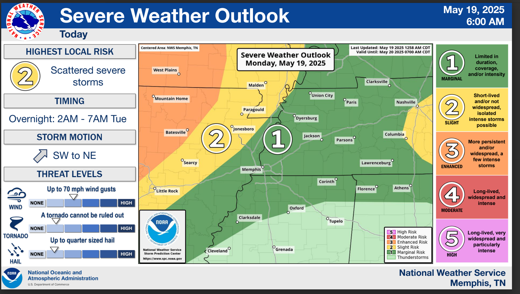
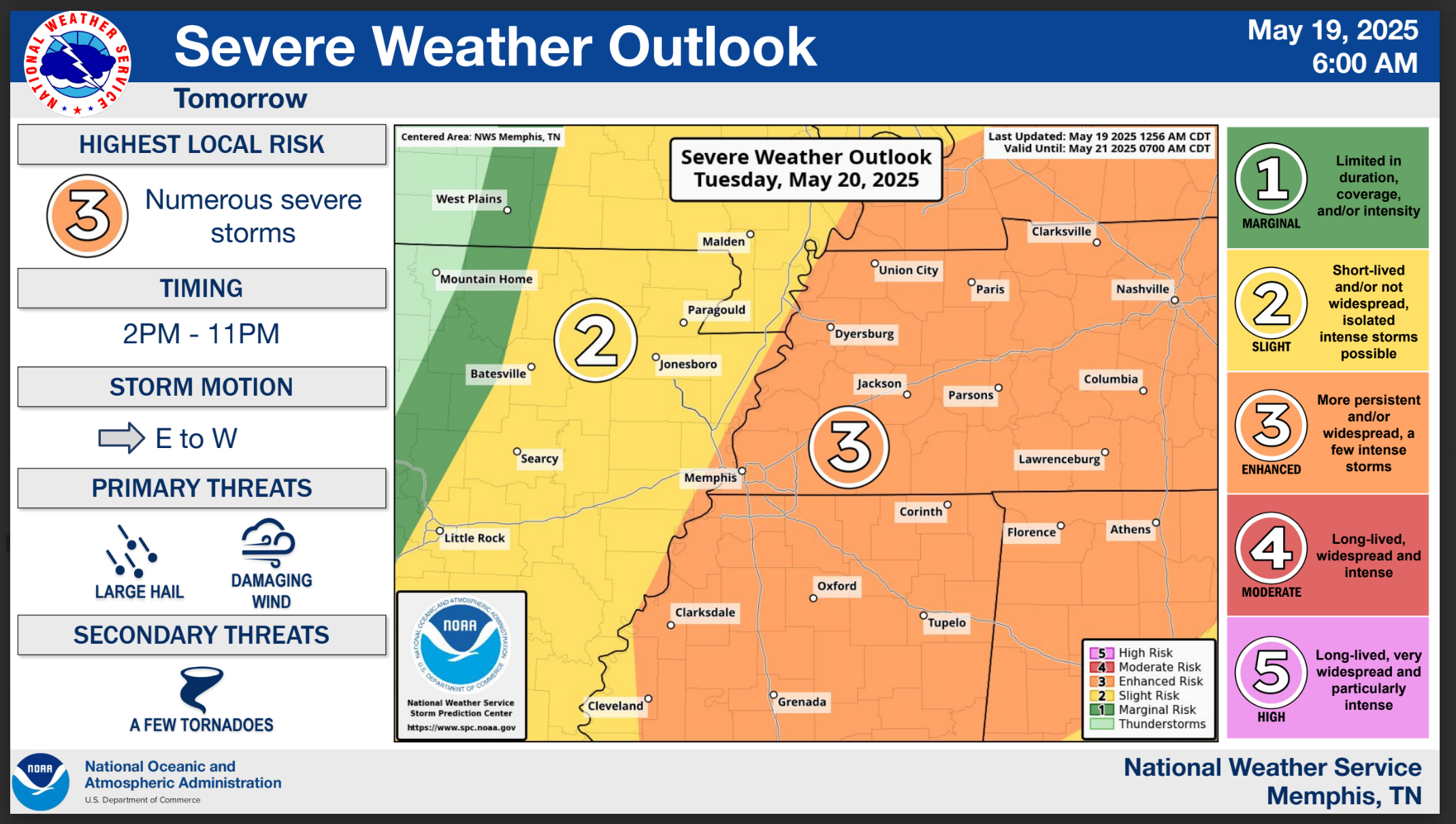
Here are two graphics from the Memphis, TN, NWS
Today and tonight
Tomorrow
.
Monitor your app notifications.
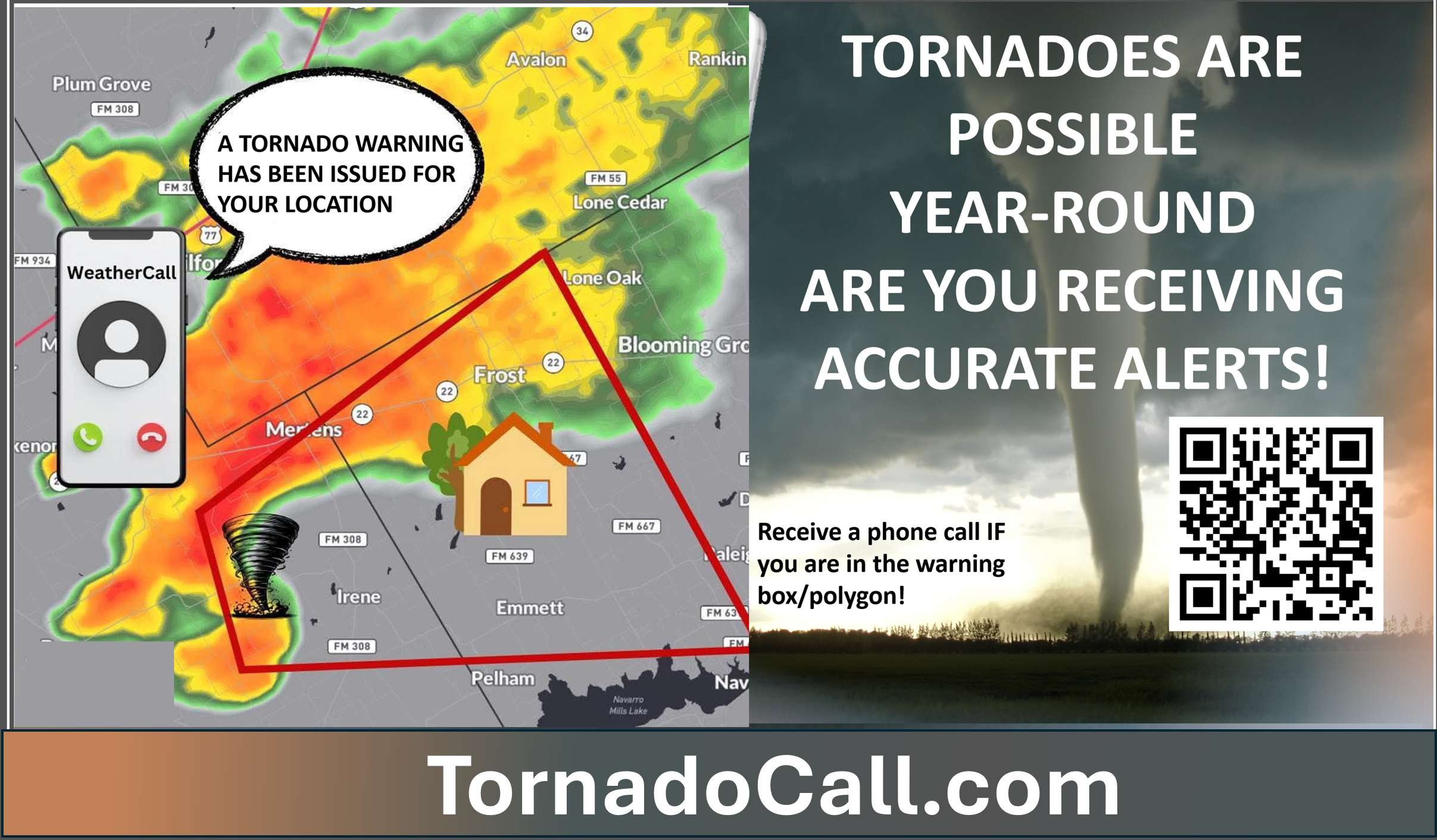
Don’t forget that I have partnered with a company that will call you in case of a tornado or severe thunderstorm warning. I use it myself. This does not replace WeatherTalk, but it is an added layer of protection.
Here is more information on the service
YouTube Video
https://www.youtube.com/watch?v=ve2UY2mAkEI
What the tornado warning sounds like
https://www.youtube.com/watch?v=MXBc03tW_N0
.

Seven-Day Hazardous Weather Outlook
1. Is lightning in the forecast? YES. Lightning is possible today into Tuesday evening. Lightning is possible on Saturday and Sunday.
2. Are severe thunderstorms in the forecast? YES. Severe weather is possible today, tonight, and on Tuesday. I will monitor Saturday and Sunday.
3. Is flash flooding in the forecast? SCATTERED RISK. Heavy storms could briefly flood ditches and roadways. There will be plenty of moisture in the atmosphere for storms to tap into.
4. Will non-thunderstorm winds top 40 mph? NO.
5. Will temperatures rise above 90 degrees? NO.
6. Will the heat index rise above 100 degrees? NO.
.
A quick forecast glance. Your 48-hour forecast Graphics


.

.


Forecast discussion.
- Monitor weather updates today and tomorrow. Some severe weather will be possible.
- Mild today and tomorrow.
- Much cooler weather mid to late week.
- Some additional rain chances this weekend.
.

.
Well, we are not quite finished with the threat of severe thunderstorms.
Numerous hailstorms and tornadoes impacted the region on Friday. The Marion, Illinois, tornado was rated as an EF4.
Some of the hail was the size of DVD’s. Incredible for our local region. Rare.
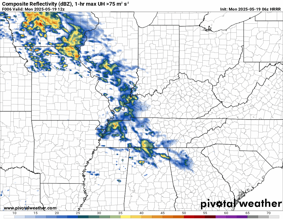
This morning, a cold front and warm front were positioned over the central United States.
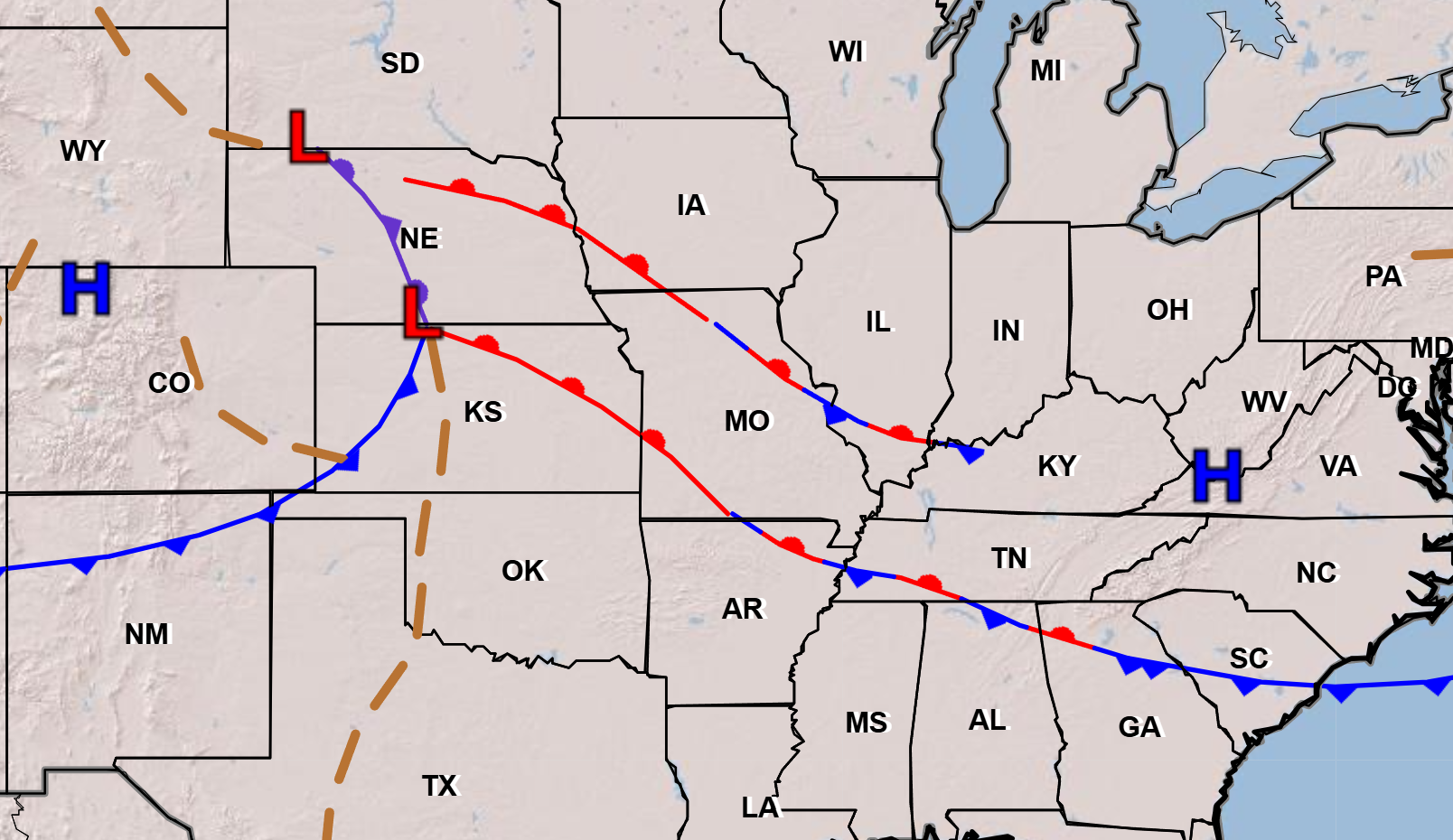
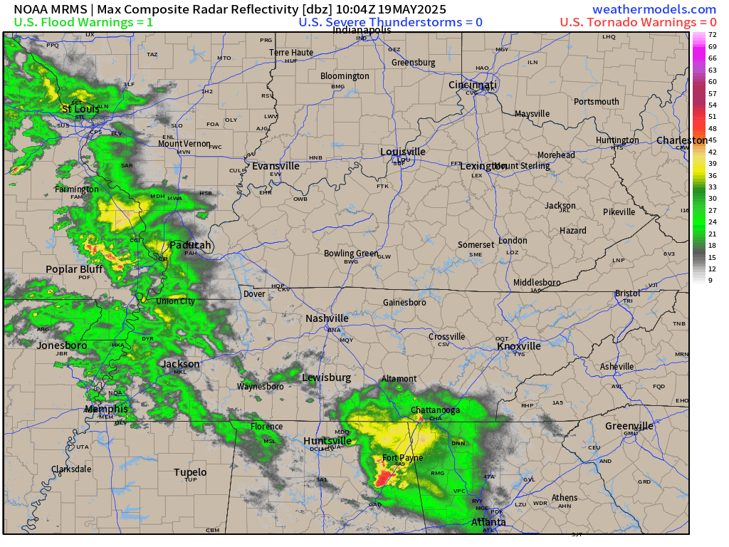
The warm front was moving northward through our region. Radar showed showers and thunderstorms moving northeast.
6 AM radar
.
None of these were severe, as of this typing.
The atmosphere will become unstable this afternoon and tonight.
We should see a decent lull in activity today. It won’t rain all day.
Scattered thunderstorms will be possible this afternoon and evening. I can’t rule out some of those becoming severe.
Here is what the Hrrr model shows for this evening. It won’t be exact, but some storms are possible.
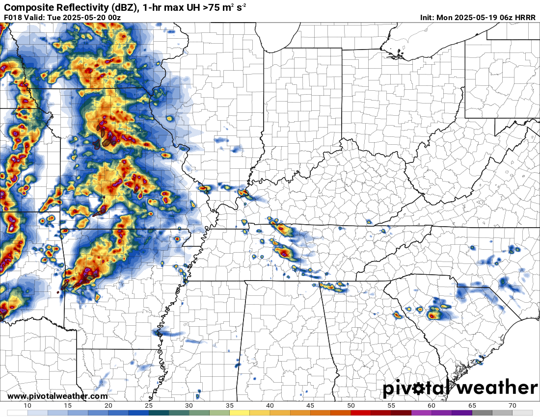
Then, a line of thunderstorms will advance west to east across the region late tonight and early Tuesday morning.
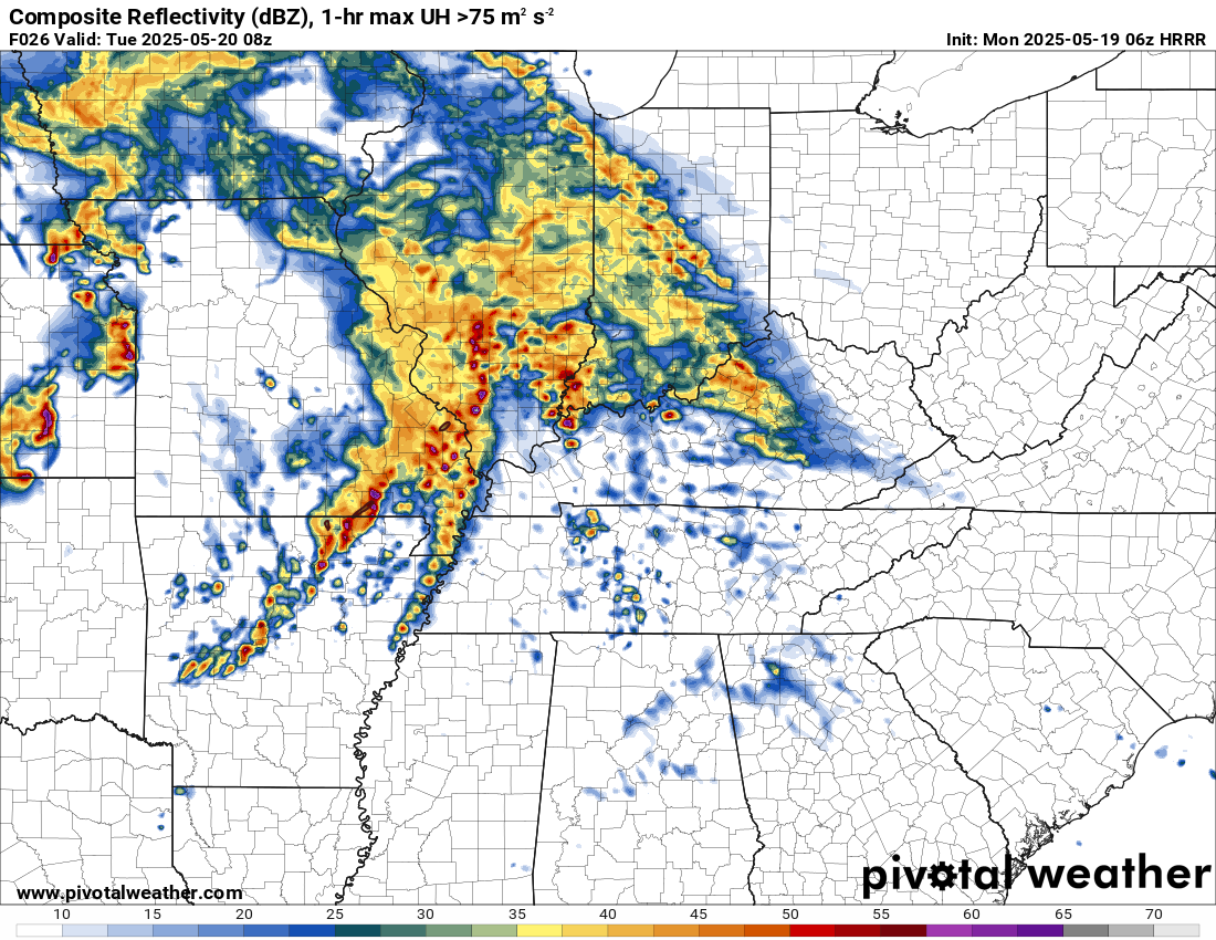
Some of those thunderstorms could be severe with damaging wind, large hail, and even a tornado.
The primary concern tonight will be damaging wind. Especially, if it is a solid line of thunderstorms or if it bows outward.
The risk of severe weather is a bit higher tonight over southeast Missouri and southwest Illinois. A bit lower over the rest of the region.
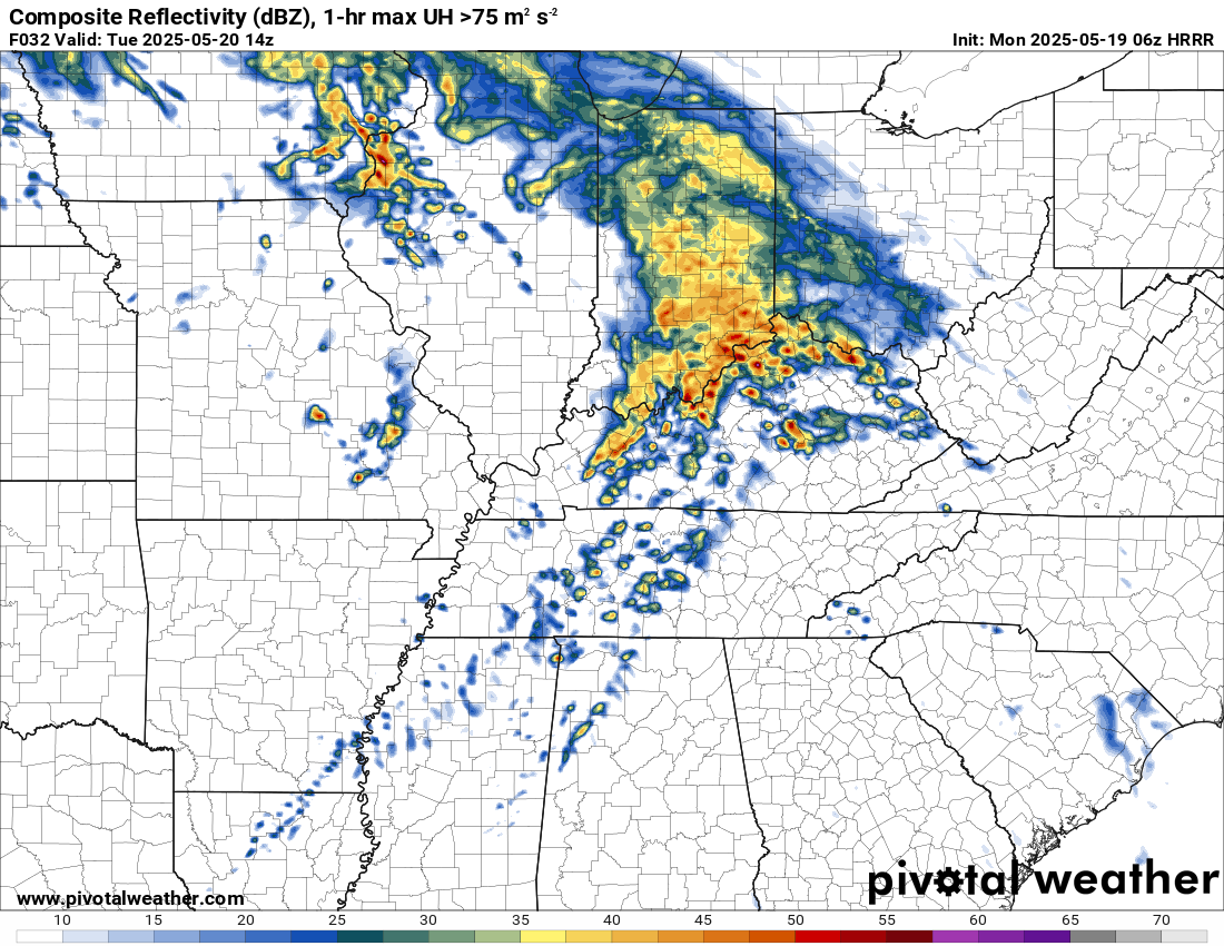
Tuesday’s severe weather outbreak will depend on what happens on Tuesday morning.
This is what the Hrrr shows behind that morning line. It shows a lull in activity.
.
If clouds and precipitation linger, then the atmosphere may not be able to recharge. If that happens, then the risk of severe weather will be lower on Tuesday afternoon and evening.
If, on the other hand, the atmosphere can recharge, then all modes of severe weather will be possible. That includes 70+ mph winds, golf ball size hail or larger, and/or a tornado.
Monitor your app alerts.
The cold front will push eastward by Tuesday night.
There is a small chance of showers on Wednesday and Thursday. Mostly dry. Cooler.
Some nights will dip into the 40s! Chilly air for late May. No frost concerns.
I am monitoring Saturday and Sunday for additional showers and thunderstorm chances.
.

The timestamp (upper left) is in Zulu. 12z=7 am. 18z=1 pm. 00z=7 pm.
Double-click the animation to enlarge it.
Hrrr model.
.
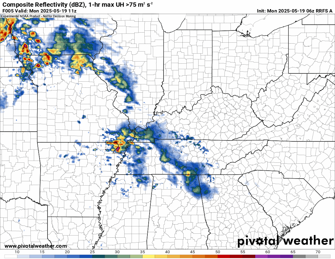
Here is the RRFS model for Thursday through Friday night.
.
.
.
Click here if you would like to return to the top of the page.
.Average high temperatures for this time of the year are around 73 degrees.
Average low temperatures for this time of the year are around 52 degrees.
Average precipitation during this time period ranges from 1.00″ to 1.40″
Six to Ten Day Outlook.
Blue is below average. Red is above average. The no color zone represents equal chances.
Average highs for this time of the year are in the lower 60s. Average lows for this time of the year are in the lower 40s.

Green is above average precipitation. Yellow and brown favors below average precipitation. Average precipitation for this time of the year is around one inch per week.

.

Average low temperatures for this time of the year are around 55 degrees.
Average precipitation during this time period ranges from 1.20″ to 1.50″
.
Eight to Fourteen Day Outlook.
Blue is below average. Red is above average. The no color zone represents equal chances.

Green is above average precipitation. Yellow and brown favors below average precipitation. Average precipitation for this time of the year is around one inch per week.

.
.
.
We have a new service to complement your www.weathertalk.com subscription. This does NOTreplace www.weathertalk.com It is simply another tool for you to receive severe weather information.
.


.

Radars and Lightning Data
Interactive-city-view radars. Clickable watches and warnings.
https://wtalk.co/B3XHASFZ
Old legacy radar site (some of you like it better)
https://weatherobservatory.com/weather-radar.htm
If the radar is not updating then try another one. If a radar does not appear to be refreshing then hit Ctrl F5. You may also try restarting your browser.
Backup radar site in case the above one is not working.
https://weathertalk.com/morani
Regional Radar
https://imagery.weathertalk.com/prx/RadarLoop.mp4
** NEW ** Zoom radar with chaser tracking abilities!
ZoomRadar
If the radar is not working, then email me: Email me at beaudodson@usawx.com
.
We do have some sponsors! Check them out.
Roof damage from recent storms? Link – Click here
INTEGRITY ROOFING AND EXTERIORS!
⛈️ Roof or gutter damage from recent storms? Today’s weather is sponsored by Integrity Roofing. Check out their website at this link https://www.ourintegritymatters.com/

![]()
![]()
![]()
Make sure you have three to five ways of receiving your severe weather information.
Weather Talk is one of those ways! Now, I have another product for you and your family.

.
Want to add more products to your Beau Dodson Weather App?
Receive daily videos, weather blog updates on normal weather days and severe weather and winter storm days, your county by county weather forecast, and more!
Here is how to do add those additional products to your app notification settings!
Here is a video on how to update your Beau Dodson Weather payment.
The app is for subscribers. Subscribe at www.weathertalk.com/welcome then go to your app store and search for WeatherTalk
Subscribers, PLEASE USE THE APP. ATT and Verizon are not reliable during severe weather. They are delaying text messages.
The app is under WeatherTalk in the app store.

Apple users click here

Android users click here
.
Radars and Lightning Data
Interactive-city-view radars. Clickable watches and warnings.
https://wtalk.co/B3XHASFZ
Old legacy radar site (some of you like it better)
https://weatherobservatory.com/weather-radar.htm
If the radar is not updating then try another one. If a radar does not appear to be refreshing then hit Ctrl F5. You may also try restarting your browser.
Backup radar site in case the above one is not working.
https://weathertalk.com/morani
Regional Radar
https://imagery.weathertalk.com/prx/RadarLoop.mp4
** NEW ** Zoom radar with chaser tracking abilities!
ZoomRadar
Lightning Data (zoom in and out of your local area)
https://wtalk.co/WJ3SN5UZ
Not working? Email me at beaudodson@usawx.com
National map of weather watches and warnings. Click here.
Storm Prediction Center. Click here.
Weather Prediction Center. Click here.
.

Live lightning data: Click here.
Real time lightning data (another one) https://map.blitzortung.org/#5.02/37.95/-86.99
Our new Zoom radar with storm chases
.
.

Interactive GOES R satellite. Track clouds. Click here.
GOES 16 slider tool. Click here.
College of DuPage satellites. Click here
.

Here are the latest local river stage forecast numbers Click Here.
Here are the latest lake stage forecast numbers for Kentucky Lake and Lake Barkley Click Here.
.
.
Find Beau on Facebook! Click the banner.


 .
.