

.
I have some question-and-answer threads over on the Facebook page. Link to those threads CLICK HERE
Or email me at beaudodsonweather@gmail.com
I will be participating in this year’s Dancing With The Stars in Paducah.
I am looking for donations and sponsorships.
You can buy a table at this link and/or donate (you don’t need to buy a table to donate).
More information at this link. CLICK HERE
.

🌪️ Seven-Day Tornado Outlook ⛈️
March 4th through March 11th
Current risk: MONITOR.
Current confidence level: LOW confidence that there will be tornadoes.
Comments: A few of the storms this afternoon and tonight could be intense. There is a low risk of a tornado. I am watching Friday and Saturday, as well. Additional storms are likely. I am watching next Tuesday, as well.
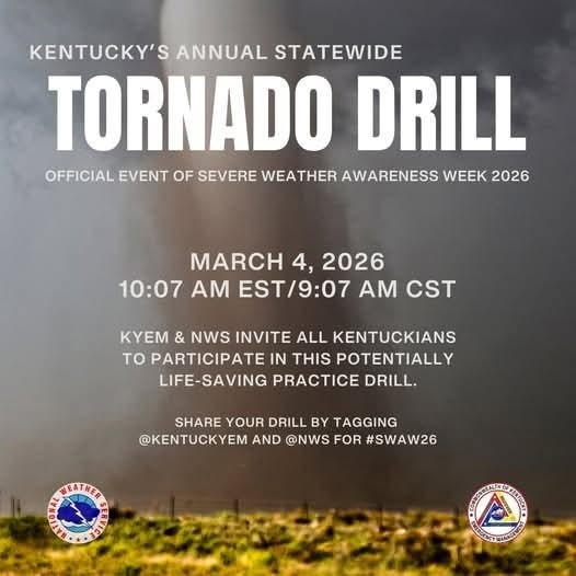
There will be a tornado drill today in Kentucky.
.

Seven-Day Hazardous Weather Outlook
1. Is lightning in the forecast? YES. On-and-off lightning chances through at least Saturday. I will monitor Sunday through Tuesday.
2. Are organized severe thunderstorms. POSSIBLE. A few of the thunderstorms this afternoon and tonight could produce hail and high winds. The tornado risk is low, but not zero.
See the severe weather outlook graphics below.
..3. Is significant or widespread flash flooding in the forecast? LOW-END RISK. Locally heavy rain is possible in some areas (see graphics below) over the next seven days. We are in a drought. It would take quite a bit of rain to cause flash flooding. If training of showers and thunderstorms occurs, then enhanced rainfall totals will be possible. That could cause some localized issues.
4. Will non-thunderstorm winds top 40 mph? NO.
5. Will the temperature fall below 20 degrees? No.
6. Is the wind chill forecast to drop below ten degrees? No.
7. Is accumulating snow (one inch or more of snow) or ice in the forecast? NO.
.
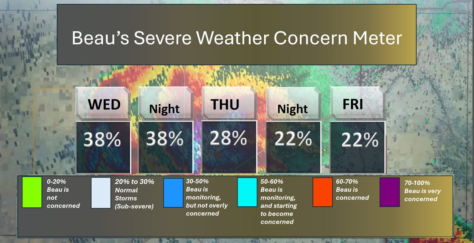
⛈️ Here is the short-range thunderstorm concern meter.
A few storms this afternoon and tonight could become severe, with damaging winds and hail. The tornado risk is low, but not zero.
.
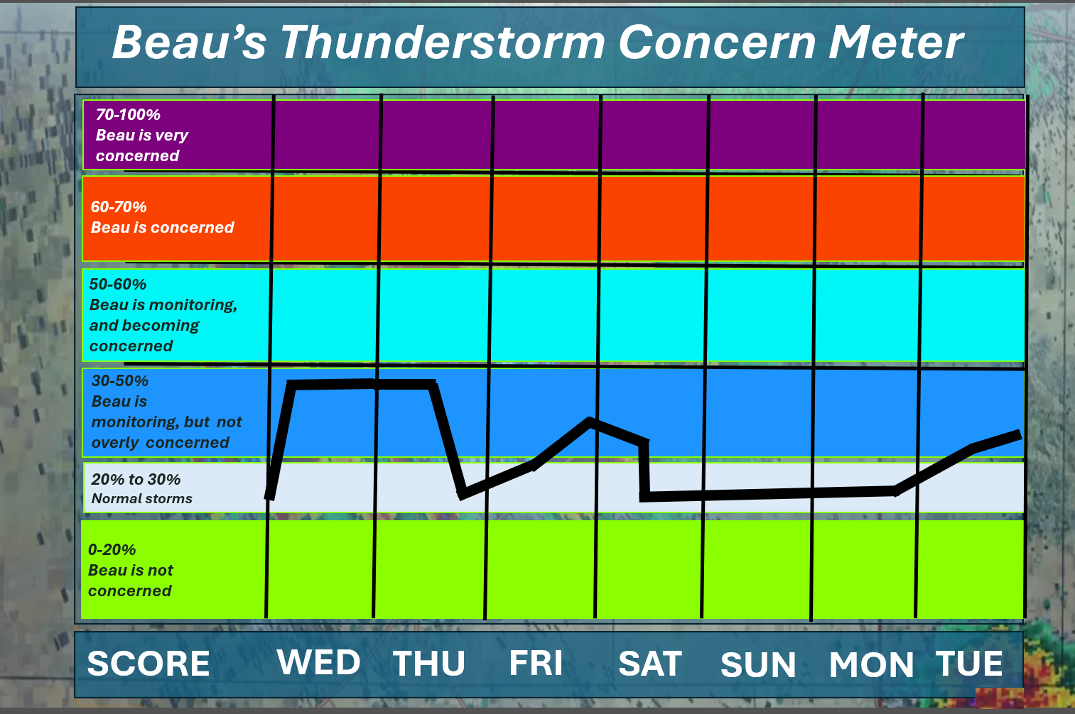
⛈️ Here is the extended thunderstorm concern meter.
At this time, there is a low-end level one and two risk this afternoon and tonight. The primary concern would be a few reports of strong wind gusts and nickel-sized hail.
See the graphic below.
Monitor your Beau Dodson Weather App.
We pop into the dark blue zone this afternoon and tonight. We pop back into the dark blue on Friday afternoon and night. I am watching next Tuesday.
.


.
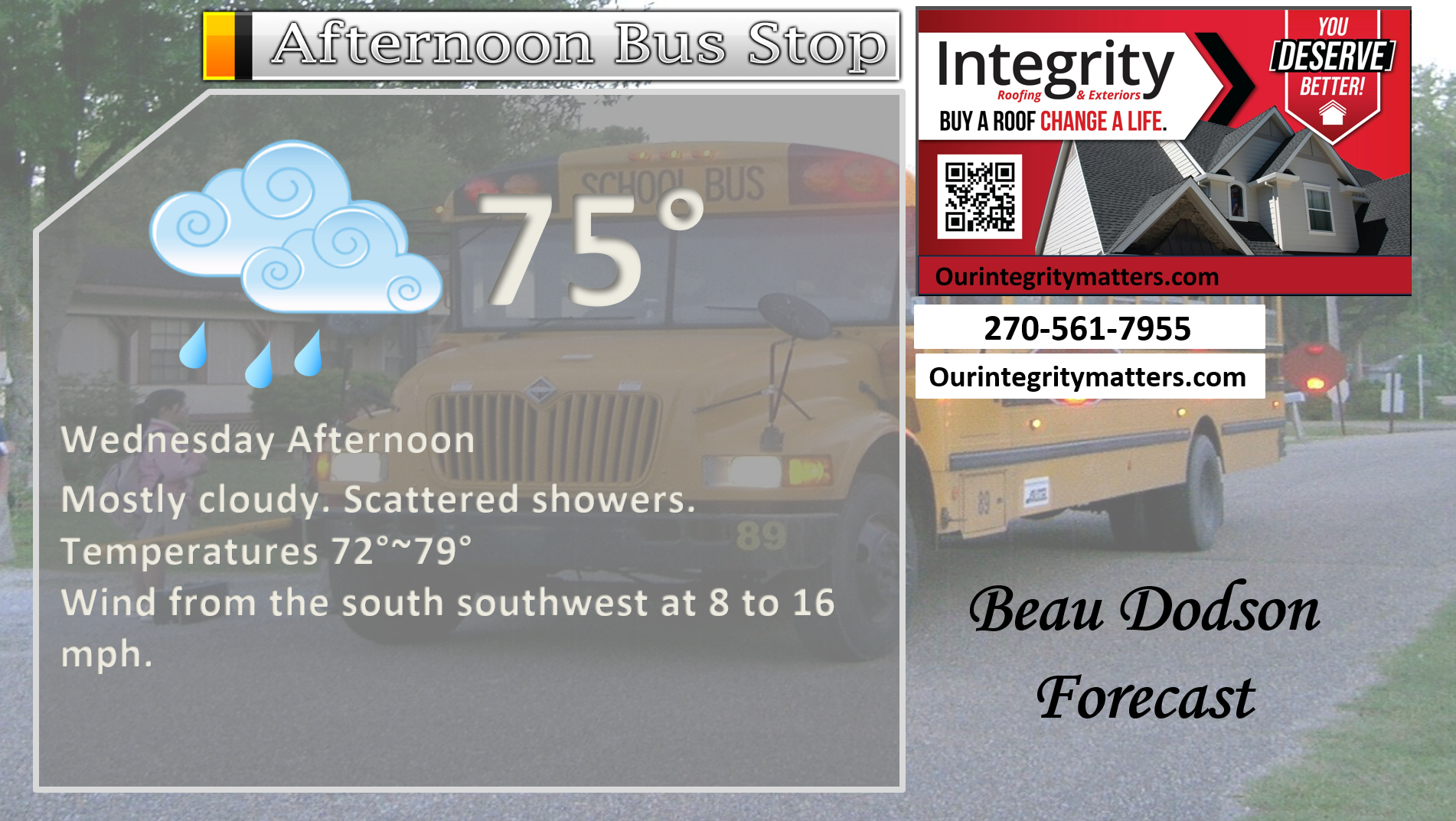
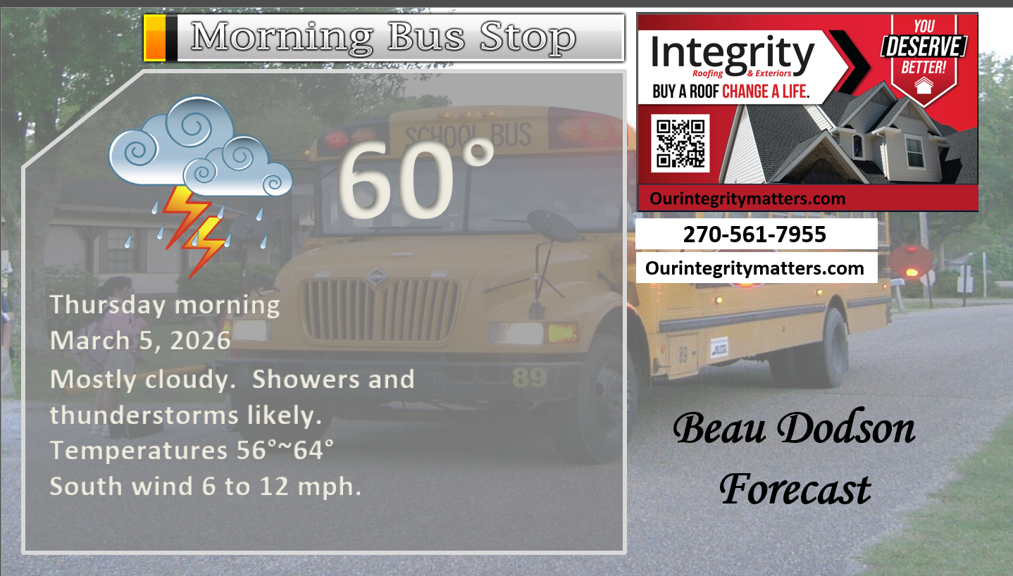
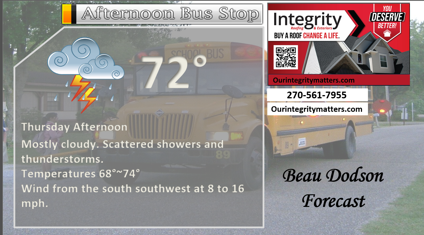
Here is your bus stop forecast
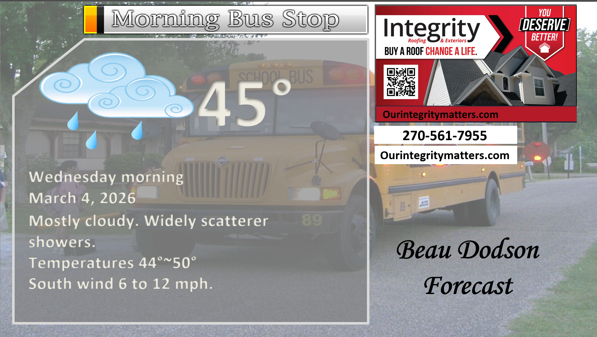
.
This afternoon
.
Thursday’s bus stop forecast.
.
.


Forecast discussion
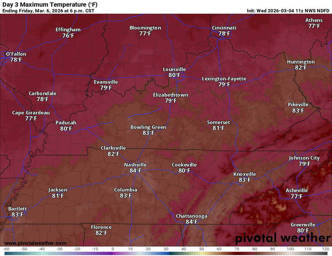
- Mild weather into next week. Friday may end up the warmest day with some locations hitting 80 degrees!
- Multiple systems today through early next week. Several rounds of showers and thunderstorms.
- Rain probabilities will vary GREATLY. Please see the graphics below for each 12-hour period.
- I am monitoring the risk of a few heavier thunderstorms from Wednesday into Saturday. A few storms could be severe with high winds and hail. The short-lived tornado risk is low, but not zero.
- I am watching next Tuesday, as well. A few of the thunderstorms could be intense. Confidence in the Tuesday forecast is low (it is in the long range).
.
 .
.
.
What is the primary weather concern?
Showers and thunderstorms are likely today into tomorrow. Locally heavy rain is likely in some counties. Additional storms after that time-period.
There is a low-end threat of severe weather this afternoon and tonight. The primary concern will be damaging wind and hail. The tornado risk is low, but not zero.
Live radar links
Interactive-city-view radars. Clickable watches and warnings.
https://wtalk.co/B3XHASFZ
Old legacy radar site (some of you like it better)
https://weatherobservatory.com/weather-radar.htm
.
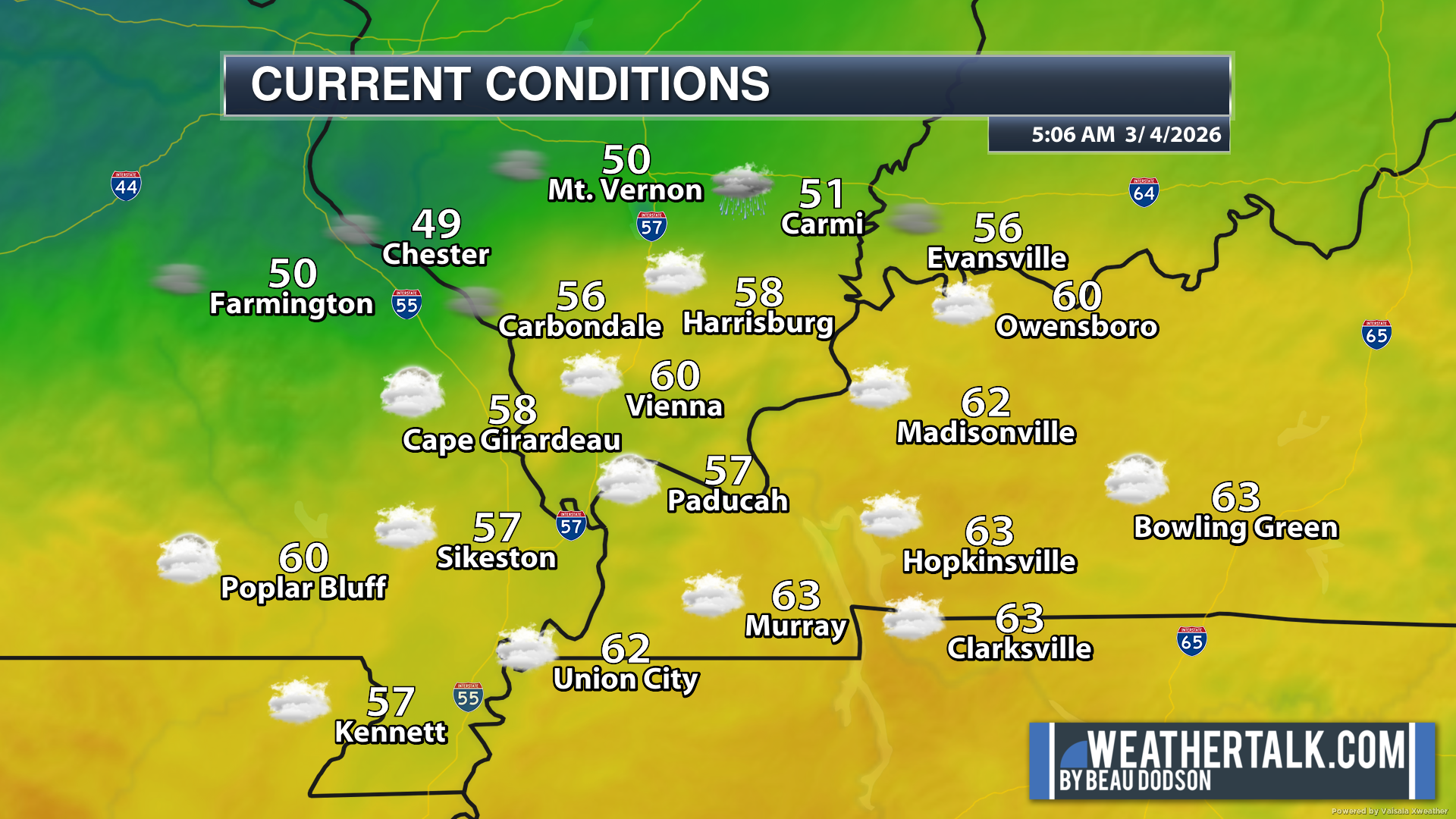
These were the 5 am temperatures this morning.
A mild morning.
.
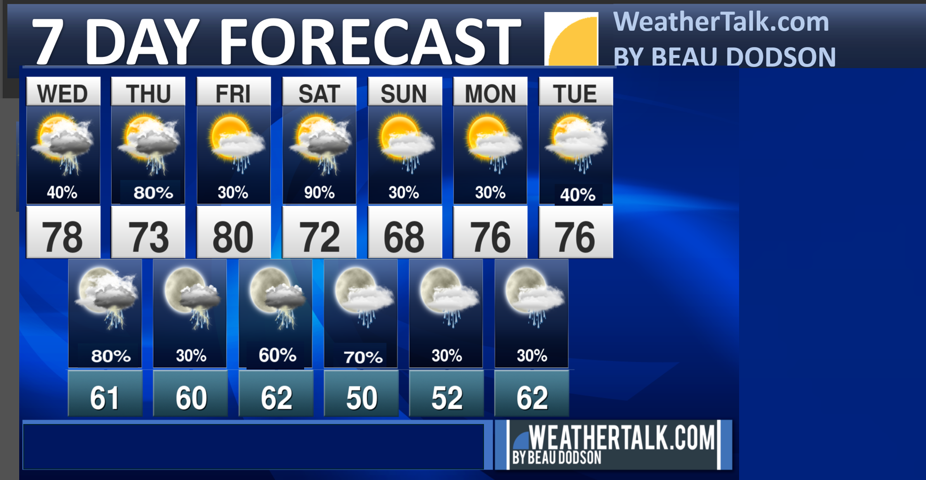
Seven-day outlook graphic.
See the video and graphics below for more details specific to your county. This is a broad-brush overview of the entire region.
.
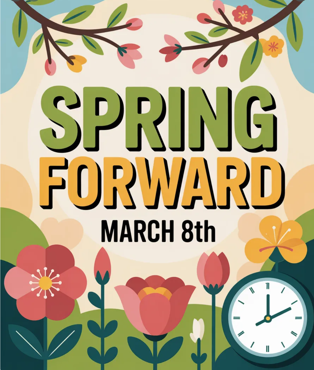
We do push our clocks forward this weekend.
.
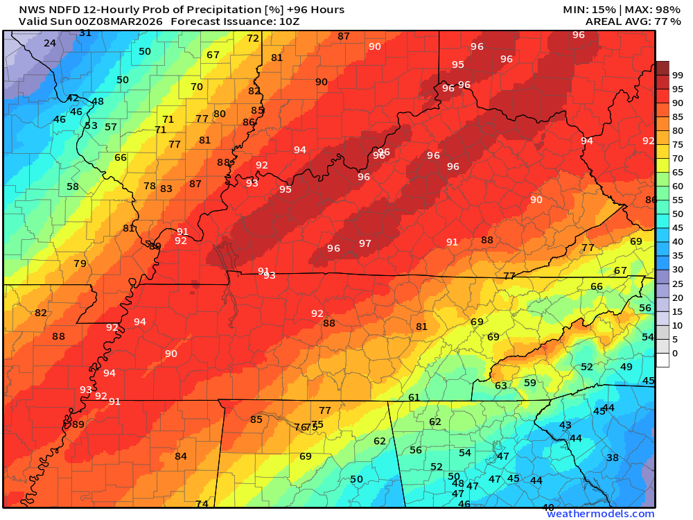
Today through Sunday
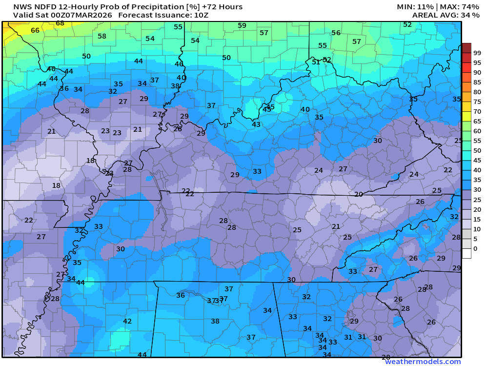
Rounds of showers and thunderstorms will be in the forecast through the entire week. The chances will rise and fall during each 12 hour time-period. See the graphics below for probabilities.
There will also be a chance of rain next week. An active pattern.
Let’s look at rainfall totals today through Thursday evening.
Double-click on the image to enlarge it.
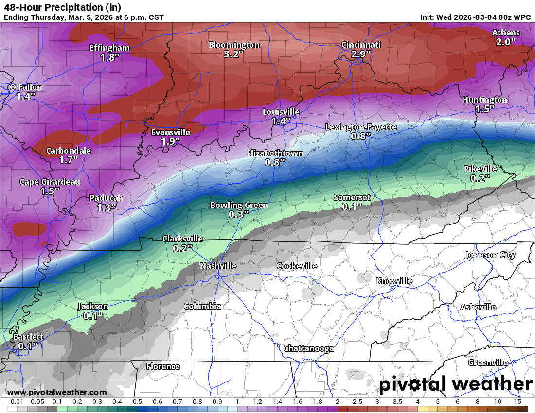
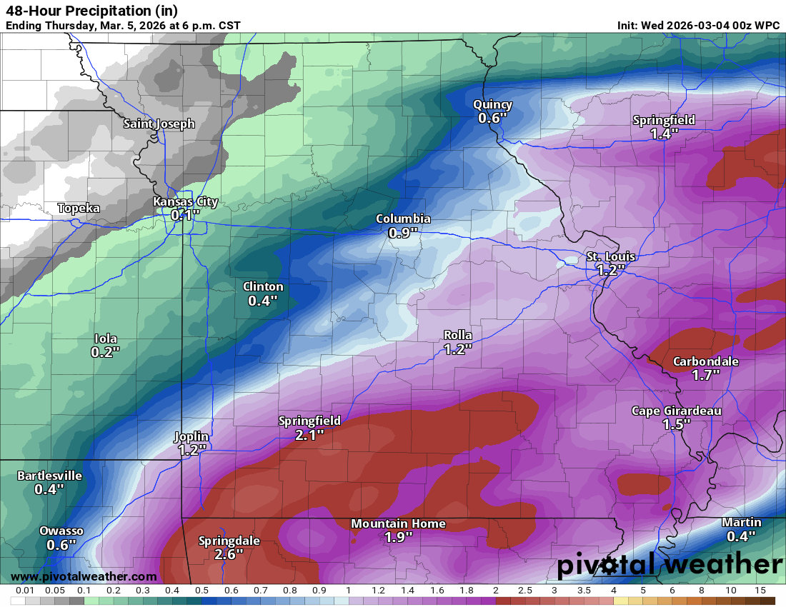
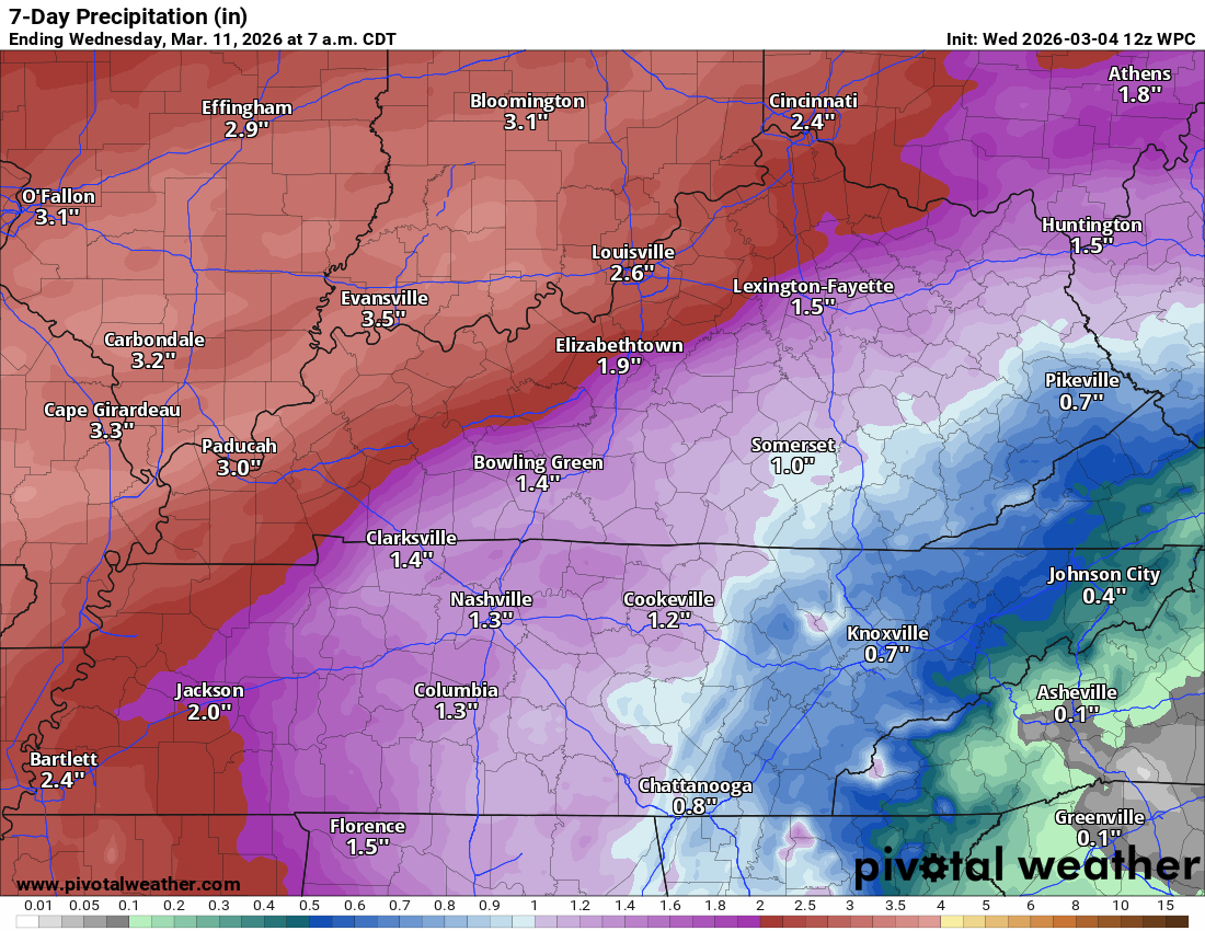
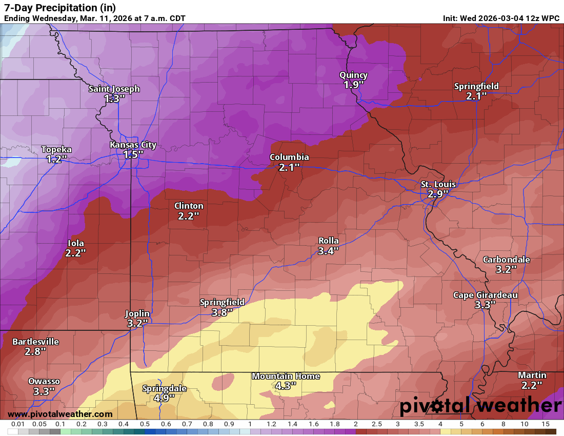
Generally, a widespread 1.5 to 2.5″ of rain is anticipated over the next seven days.
There can certainly be higher totals where showers and thunderstorms repeatedly train over the same counties.
As always, thunderstorms can also enhance rain totals.
This is a complicated forecast from north to south. The probabilities for rain will be higher north northwest on some days vs areas south southeast.
Again, the easiest way for me to show you that is to walk you through each 12-hour time period.
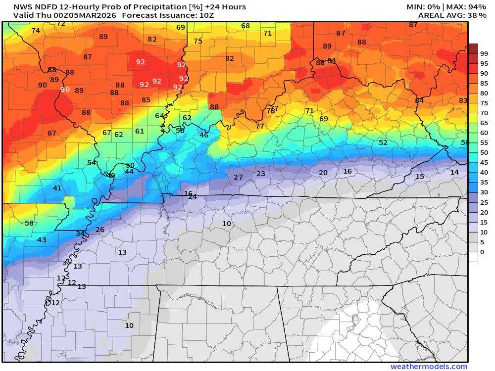
These graphics show the % chance of rain for each 12-hour period.
The daytime graphics will run from 6 AM to 6 PM.
The nighttime graphics will run from 6 PM to 6 AM.
.
Today 6 AM through 6 PM
.
Tonight 6 PM to 6 AM

.
THURSDAY 6 AM through 6 PM
.
THURSDAY NIGHT 6 PM to 6 AM
.
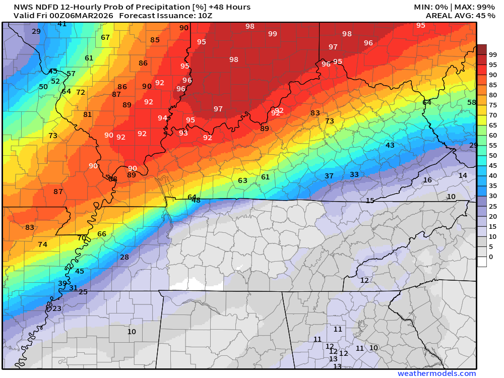
FRIDAY 6 AM through 6 PM
.
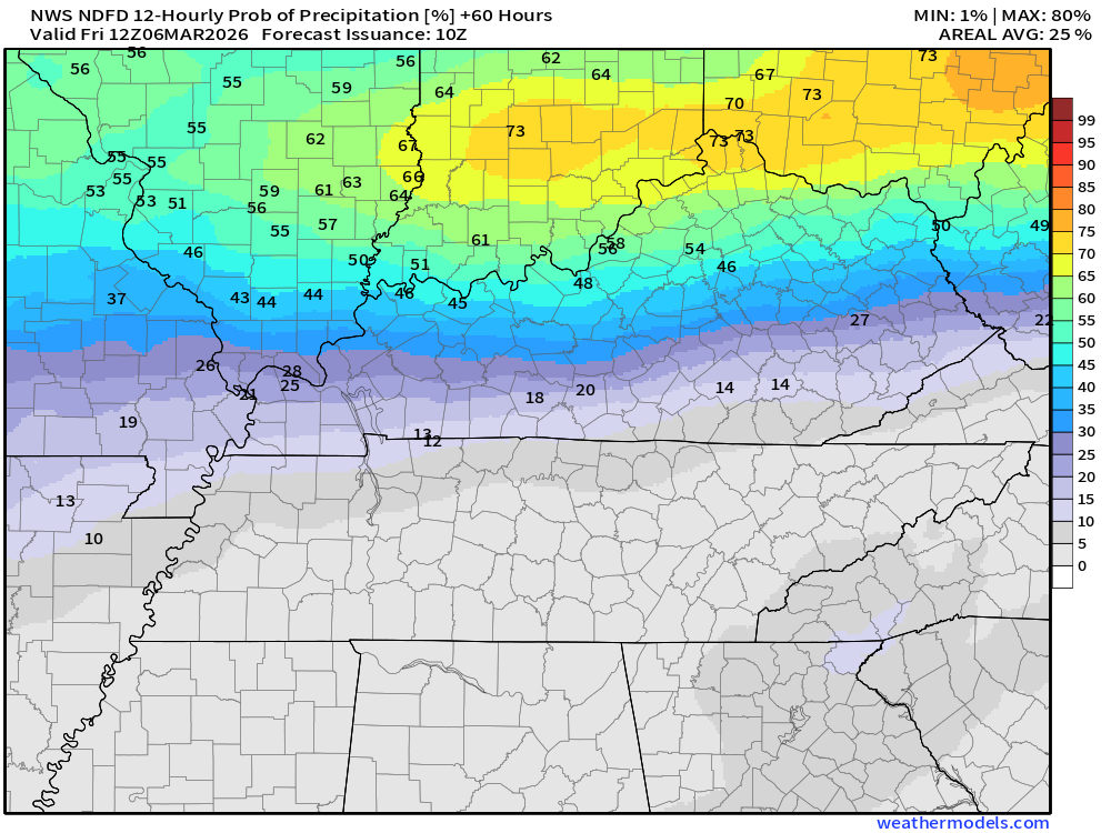
FRIDAY NIGHT 6 PM to 6 AM
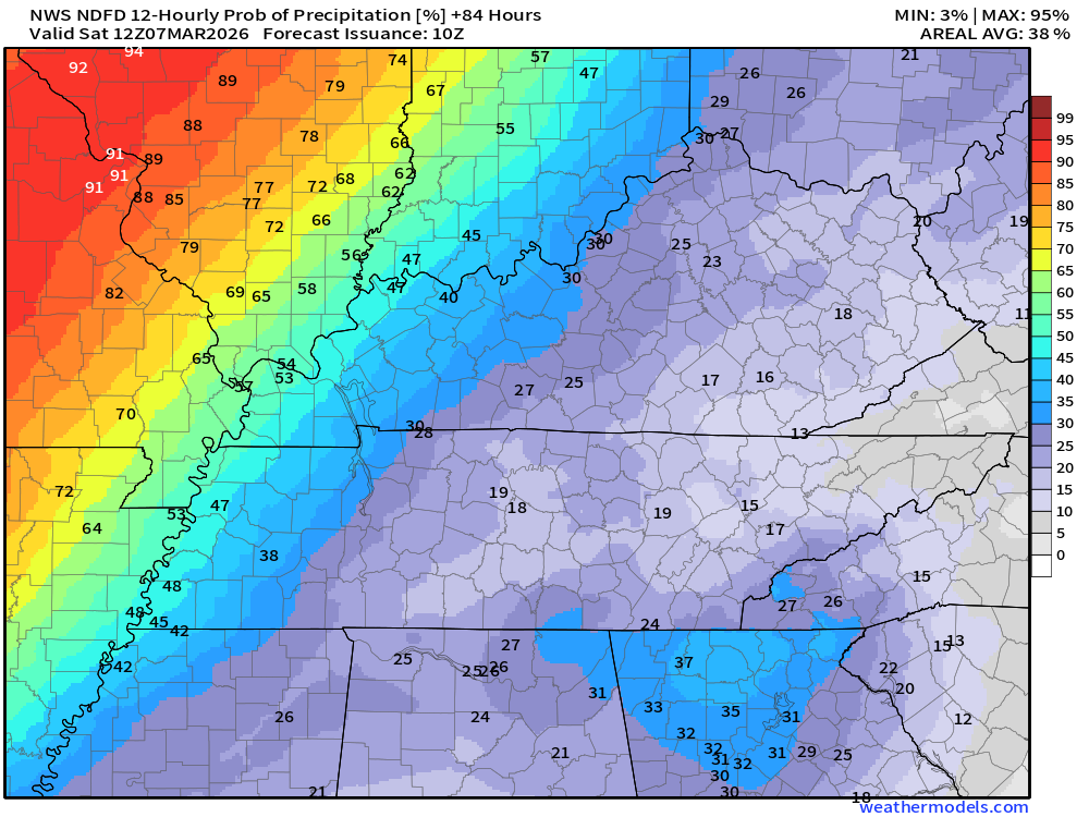
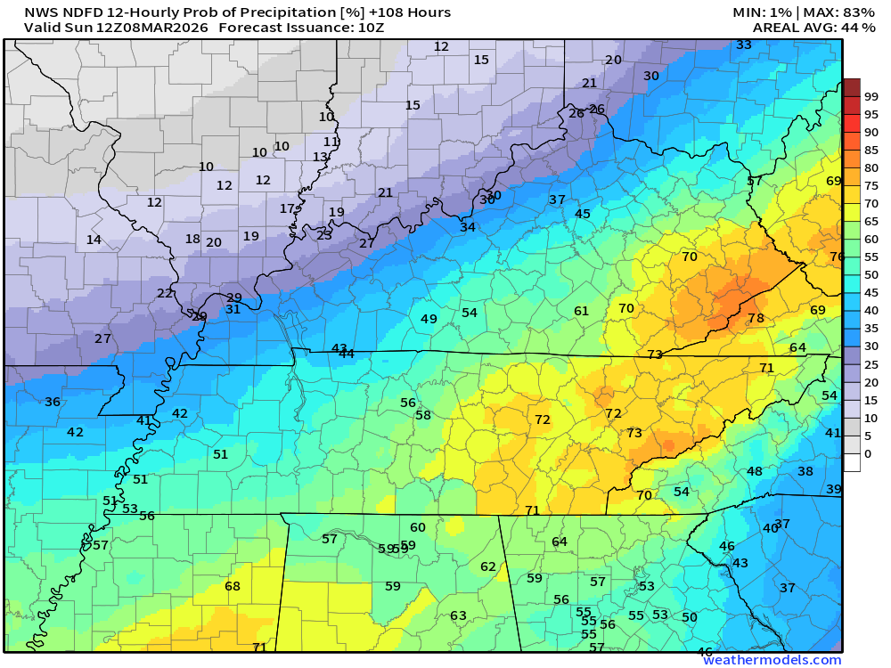
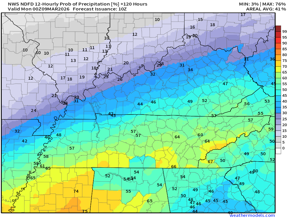

As you can see, this is a complicated forecast for each location in the region for each 12-hour time period. The numbers are going to vary.
Some locations will have high probabilities of rain and some will have lower. The chances will vary based on the placement of the cold front and warm front (at times a stationary front).
It appears that shower and thunderstorm chances will be with us into early next week as well.
As you are aware, we are still in a drought or abnormally dry. That could help mitigate the risk of flash flooding. With that said, if we end up with training showers and thunderstorms, then higher totals are likely, and there could be some issues. That is especially true as we move into the weekend and next week. By that time, some counties will have a soaked ground.
Training is when showers and thunderstorms move over the same location. That enhances rain totals.
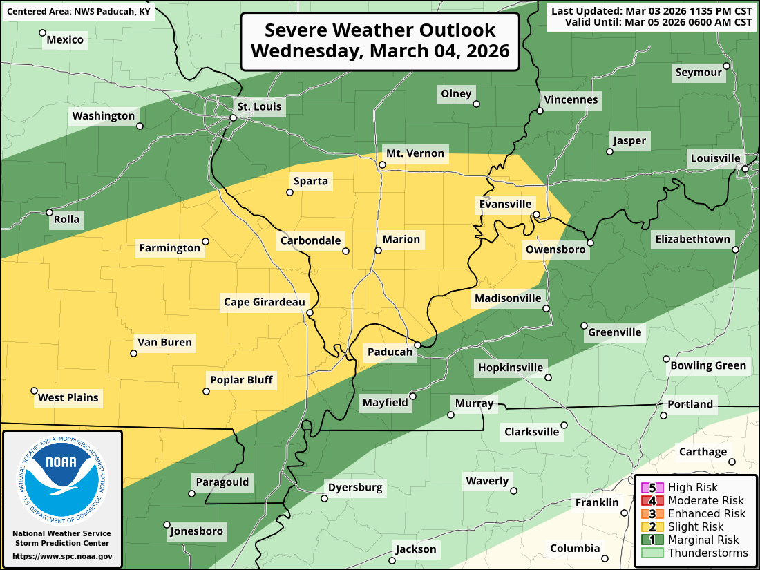
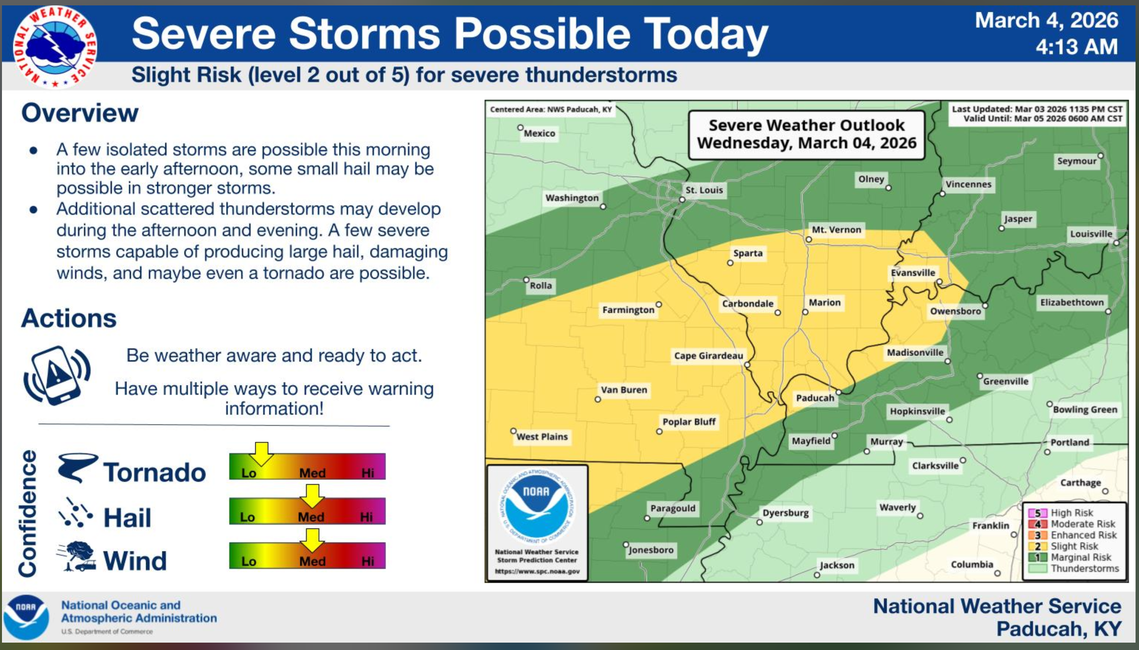
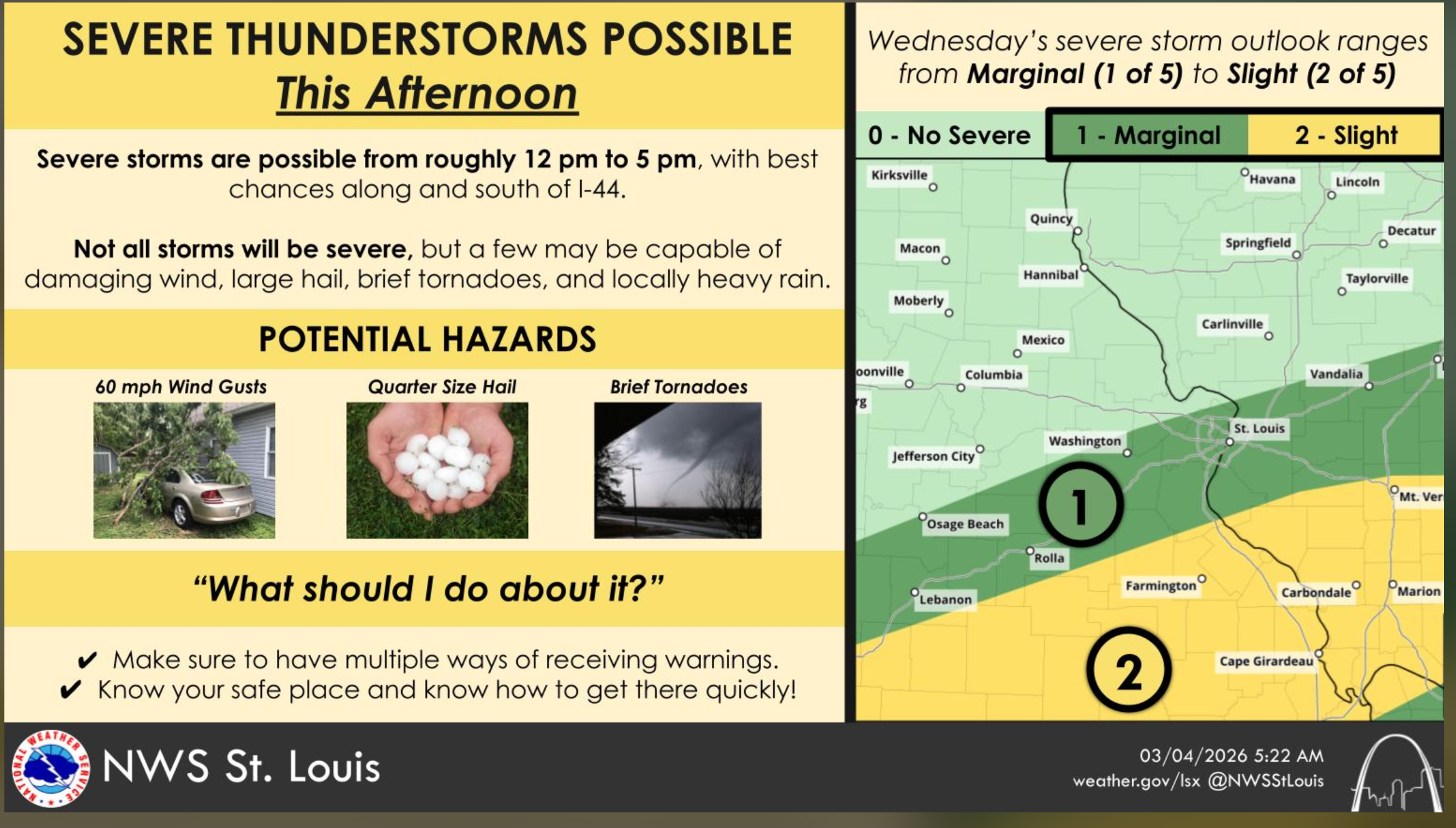
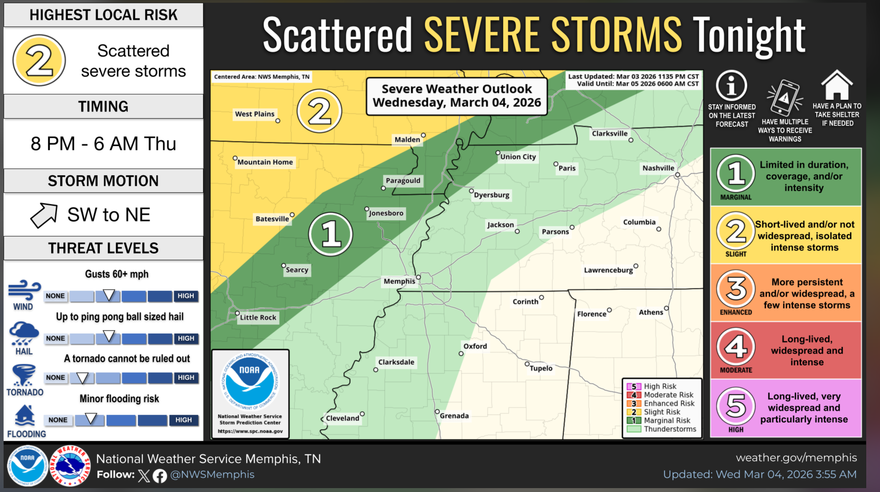
Let me show you the Storm Prediction Center’s severe weather outlooks.
Today.
The light green is where lightning is possible. The dark green is where a few storms could become severe with damaging wind and hail.
The yellow zone is a low-level two severe weather risk. That is the area of greatest concern on this map.
The primary concern will be damaging wind and hail. The tornado risk is low, but not zero. The tornado risk is rarely zero when severe thunderstorms are present.
Any tornadoes will be short-lived.
As always, monitor updated forecasts and the Beau Dodson Weather App.
.
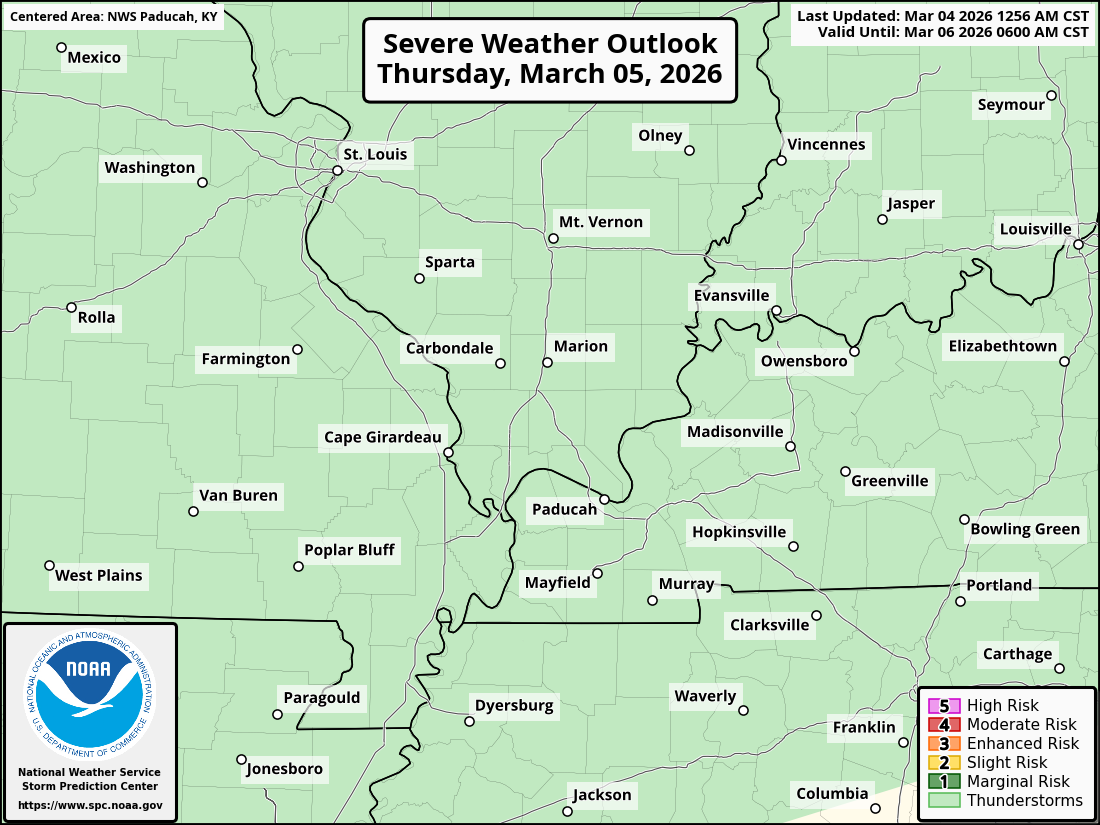
Thursday’s severe weather outlook.
We are in the light green zone. That means lightning is possible, but severe storms are not in the forecast.
.
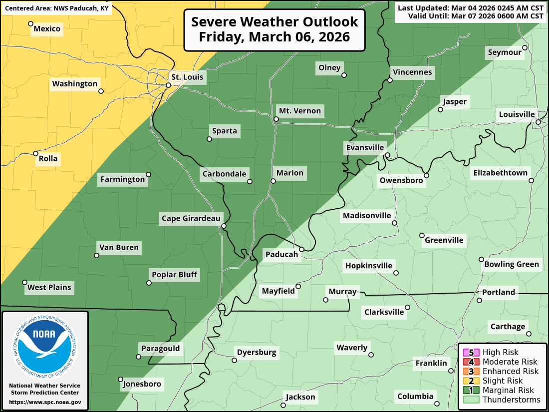
Friday’s severe weather outlook.
The light green is where lightning is possible.
The dark green is where a few storms could become severe with damaging wind and hail.
The yellow zone is a low-level two severe weather risk. That is the area of greatest concern on this map.
As you can see, some storms could become severe on Friday and Friday night. The risk is higher to our west.
.
Here are two graphics from the NWS, as well.
Double-click on the graphics to enlarge them.
From the Paducah, Kentucky, NWS.
.
From the St Louis, Missouri, NWS.
.
This graphic is from the Memphis, Tennessee, NWS.
.
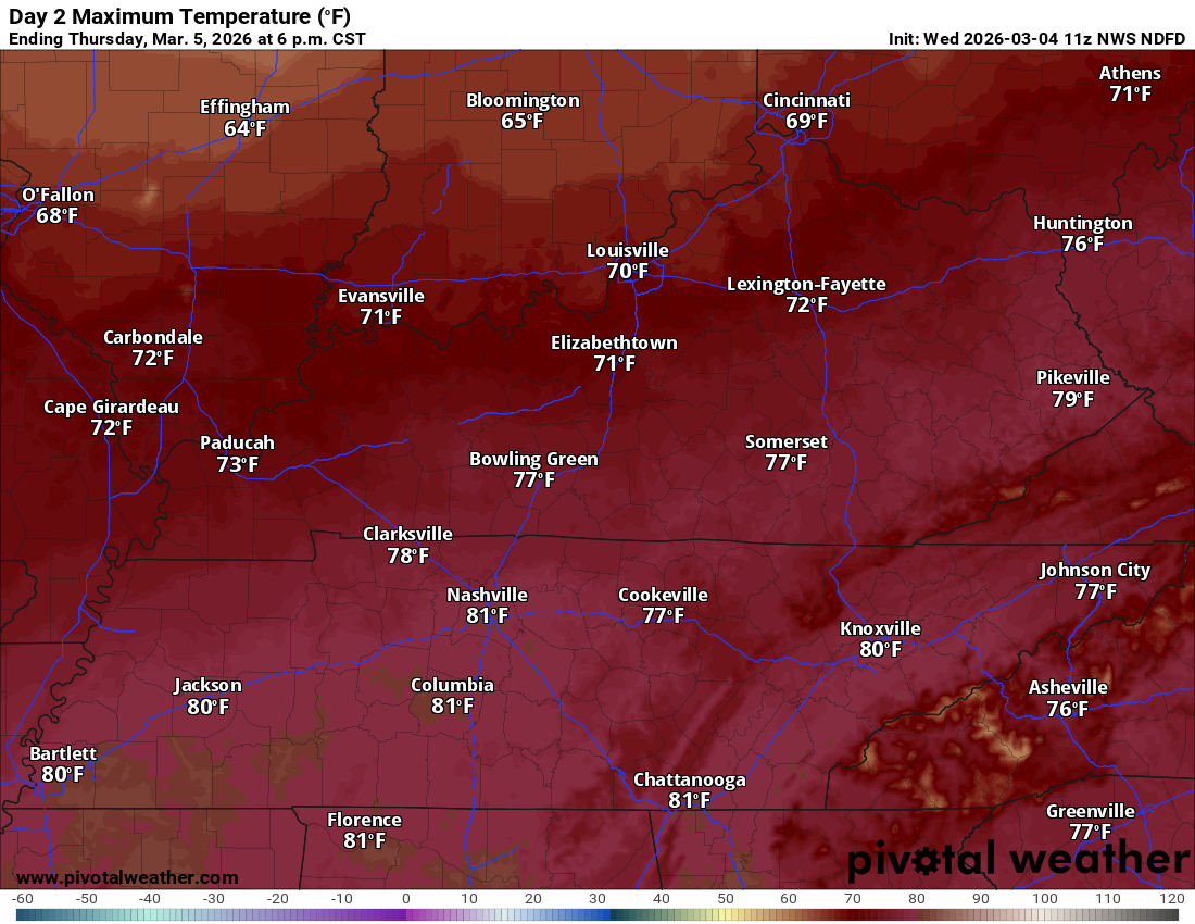
Temperatures will be quite warm over the coming days.
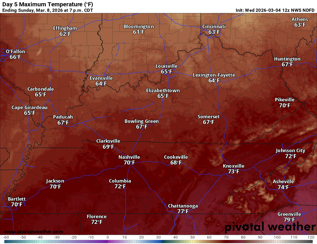
Thursday’s high temperatures.
.
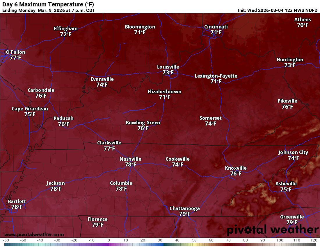
Friday’s high temperatures. Friday may end up the warmest day of the week.
.
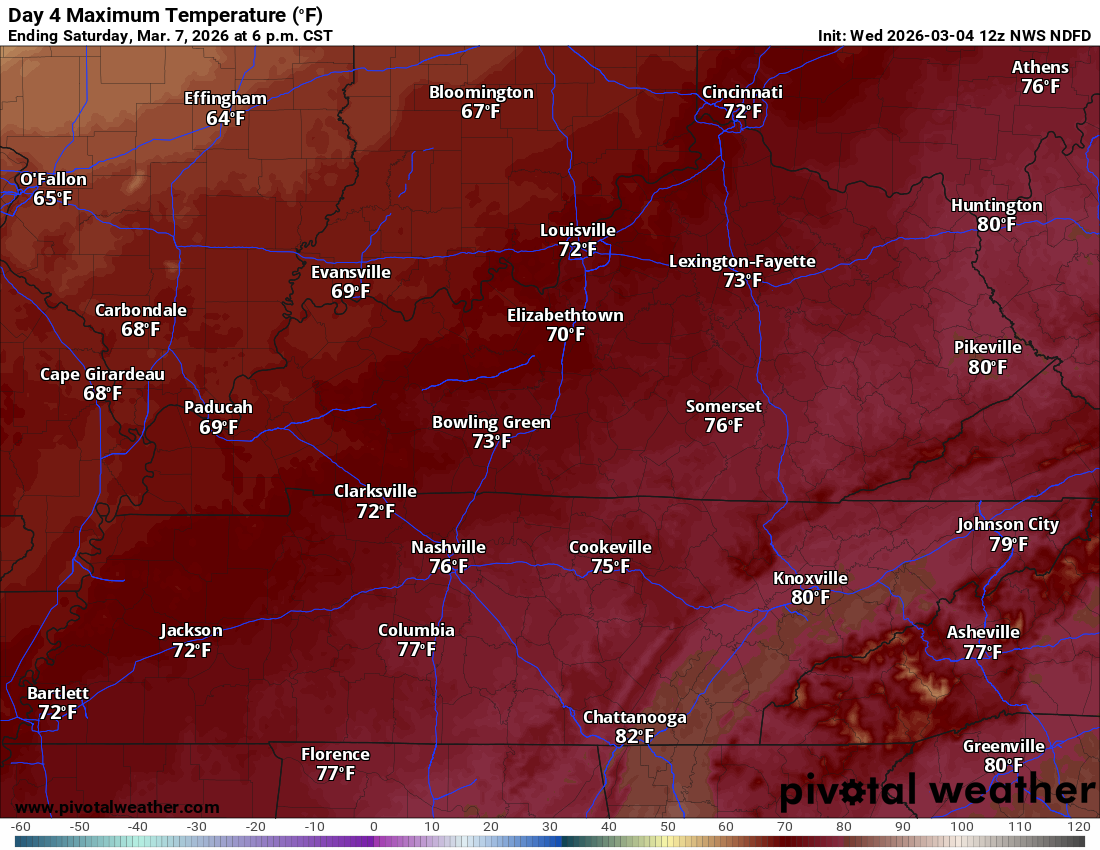
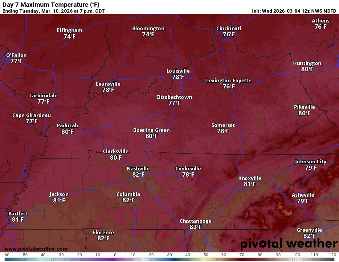
Saturday’s high temperature outlook. Some 80s are possible!
.
Sunday’s high temperatures
.
Monday’s high temperatures
.
Tuesday’s high temperatures
.
I am watching for a few strong storms next Tuesday. Confidence this far out, on the details, is low. Monitor updates.
.

.
The timestamp (upper left) is in Zulu. 12z=6 am. 18z=12 pm. 00z=6 pm.
Double-click the animation to enlarge it.
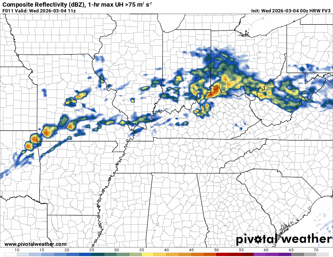
Green is rain. Yellow is moderate rain. Orange indicates locally heavy rain.
This model pops most of the storms east northeast of our region (on Thursday PM)
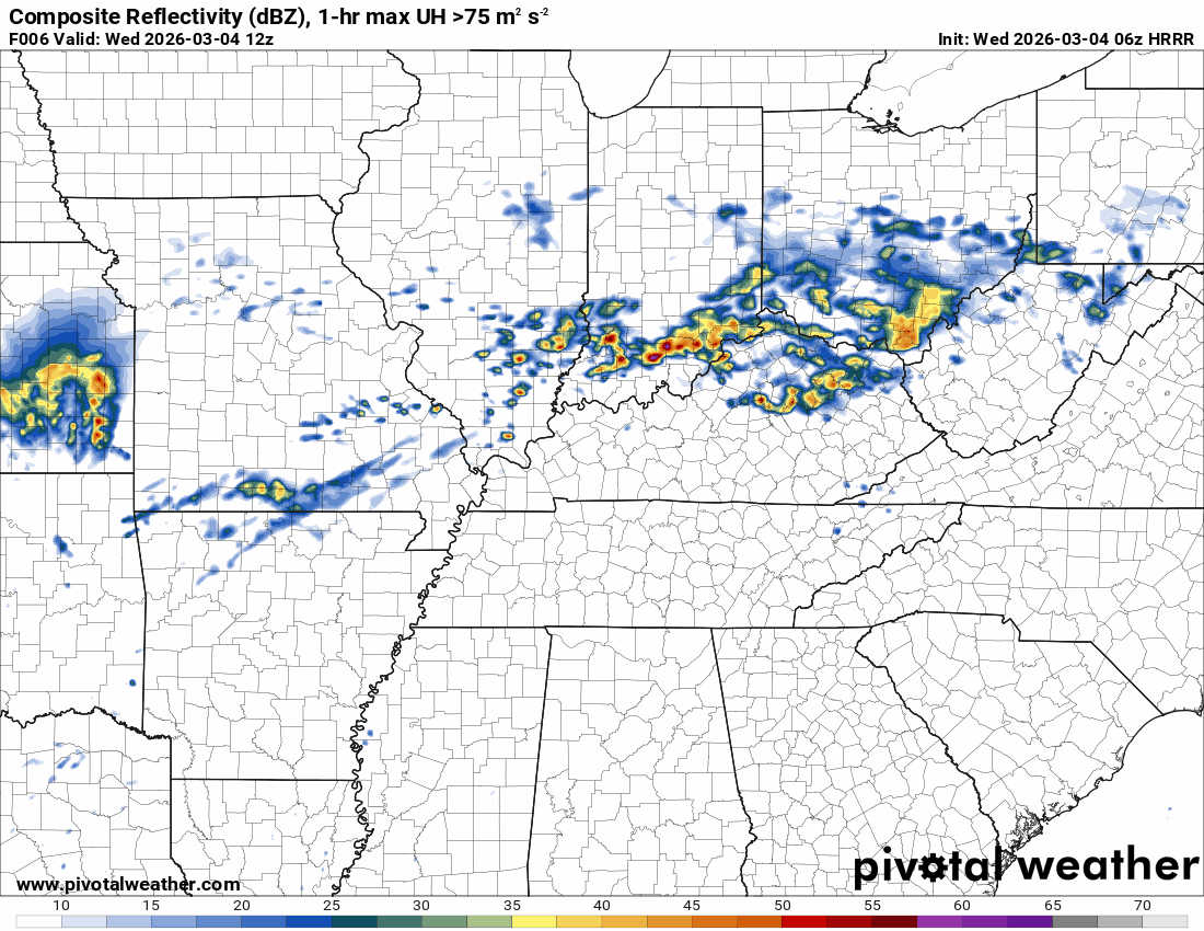
Hrrr Model
.
.
The timestamp (upper left) is in Zulu. 12z=6 am. 18z=12 pm. 00z=6 pm.
Double-click the animation to enlarge it.
Green is rain. Yellow is moderate rain. Orange indicates locally heavy rain.
FV3 model
.
.
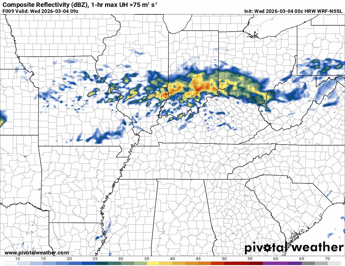
The timestamp (upper left) is in Zulu. 12z=6 am. 18z=12 pm. 00z=6 pm.
Double-click the animation to enlarge it.
Green is rain. Yellow is moderate rain. Orange indicates locally heavy rain.
NSSL model
.
..
.
Click here if you would like to return to the top of the page.
.Average high temperatures for this time of the year are around 54 degrees.
Average low temperatures for this time of the year are around 35 degrees.
Average precipitation during this time period ranges from 0.80″ to 1.20″
Six to Ten Day Outlook.
Blue is below average. Red is above average. The no color zone represents equal chances.
Average highs for this time of the year are in the lower 60s. Average lows for this time of the year are in the lower 40s.

Green is above average precipitation. Yellow and brown favors below-average precipitation. Average precipitation for this time of the year is around one inch per week.

.

Average low temperatures for this time of the year are around 36 degrees.
Average precipitation during this time period ranges from 0.80″ to 1.20″
.
Eight to Fourteen Day Outlook.
Blue is below average. Red is above average. The no color zone represents equal chances.

Green is above average precipitation. Yellow and brown favors below average precipitation. Average precipitation for this time of the year is around one inch per week.

.
.
.
We have a new service to complement your www.weathertalk.com subscription. This does NOT replace www.weathertalk.com It is simply another tool for you to receive severe weather information.
.
https://weathercallservices.com/beau-dodson-weather


Want to receive the daily forecast/other products on your Beau Dodson Weather app?
Did you know you have four options in your www.weathertalk.com account
You will then receive these via your Beau Dodson Weather app.
Just log into your www.weathertalk.com account
Click the NOTIFICATION SETTINGS TAB
Then, turn them on (green) and off (red)
🌪️ Number 1 is the most important one. Severe alerts, tornado alerts, and so on.
Number 2 is the daily video, blog, livestream alerts, and severe weather Facebook threads on severe days or winter storm days.
Number 3 is the daily forecast. I send that out every day during the afternoon hours. It is the seven-day forecast, hazardous weather outlook, fire outlook, and more.
Number 4 is to receive the daily video, blog, and other content on NON-severe weather days (every day without severe threats in other words)
GREEN IS ON
RED IS OFF

I am going to start going live during bigger severe weather events.
Check it out here https://www.youtube.com/user/beaudodson
Click the subscribe button (it’s a free subscription button), and it will alert you when I go live. I will also send out alerts to the app when I go live for an event.

.

Radars and Lightning Data
Interactive-city-view radars. Clickable watches and warnings.
https://wtalk.co/B3XHASFZ
Old legacy radar site (some of you like it better)
https://weatherobservatory.com/weather-radar.htm
If the radar is not updating then try another one. If a radar does not appear to be refreshing then hit Ctrl F5. You may also try restarting your browser.
Backup radar site in case the above one is not working.
https://weathertalk.com/morani
Regional Radar
https://imagery.weathertalk.com/prx/RadarLoop.mp4
** NEW ** Zoom radar with chaser tracking abilities!
ZoomRadar
If the radar is not working, then email me: Email me at beaudodson@usawx.com
.
We do have some sponsors! Check them out.
Roof damage from recent storms? Link – Click here
INTEGRITY ROOFING AND EXTERIORS!
⛈️ Roof or gutter damage from recent storms? Today’s weather is sponsored by Integrity Roofing. Check out their website at this link https://www.ourintegritymatters.com/

![]()
![]()
![]()
Make sure you have three to five ways of receiving your severe weather information.
Weather Talk is one of those ways! Now, I have another product for you and your family.

.
Want to add more products to your Beau Dodson Weather App?
Receive daily videos, weather blog updates on normal weather days and severe weather and winter storm days, your county by county weather forecast, and more!
Here is how to do add those additional products to your app notification settings!
Here is a video on how to update your Beau Dodson Weather payment.
The app is for subscribers. Subscribe at www.weathertalk.com/welcome then go to your app store and search for WeatherTalk
Subscribers, PLEASE USE THE APP. ATT and Verizon are not reliable during severe weather. They are delaying text messages.
The app is under WeatherTalk in the app store.

Apple users click here

Android users click here
.
Radars and Lightning Data
Interactive-city-view radars. Clickable watches and warnings.
https://wtalk.co/B3XHASFZ
Old legacy radar site (some of you like it better)
https://weatherobservatory.com/weather-radar.htm
If the radar is not updating then try another one. If a radar does not appear to be refreshing then hit Ctrl F5. You may also try restarting your browser.
Backup radar site in case the above one is not working.
https://weathertalk.com/morani
Regional Radar
https://imagery.weathertalk.com/prx/RadarLoop.mp4
** NEW ** Zoom radar with chaser tracking abilities!
ZoomRadar
Lightning Data (zoom in and out of your local area)
https://wtalk.co/WJ3SN5UZ
Not working? Email me at beaudodson@usawx.com
National map of weather watches and warnings. Click here.
Storm Prediction Center. Click here.
Weather Prediction Center. Click here.
.

Live lightning data: Click here.
Real time lightning data (another one) https://map.blitzortung.org/#5.02/37.95/-86.99
Our new Zoom radar with storm chases
.
.

Interactive GOES R satellite. Track clouds. Click here.
GOES 16 slider tool. Click here.
College of DuPage satellites. Click here
.

Here are the latest local river stage forecast numbers Click Here.
Here are the latest lake stage forecast numbers for Kentucky Lake and Lake Barkley Click Here.
.
.
Find Beau on Facebook! Click the banner.


 .
.