
.

.
I have some question-and-answer threads over on the Facebook page. Link to those threads CLICK HERE
Or email me at beaudodsonweather@gmail.com
.

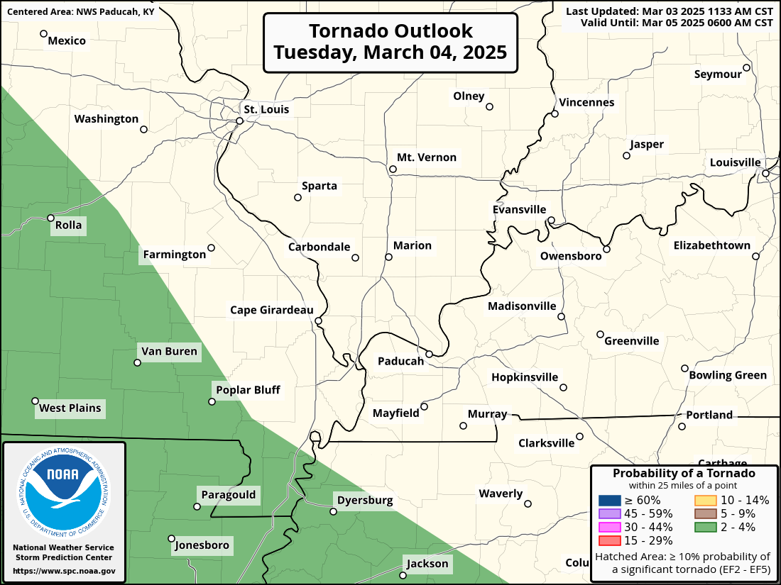
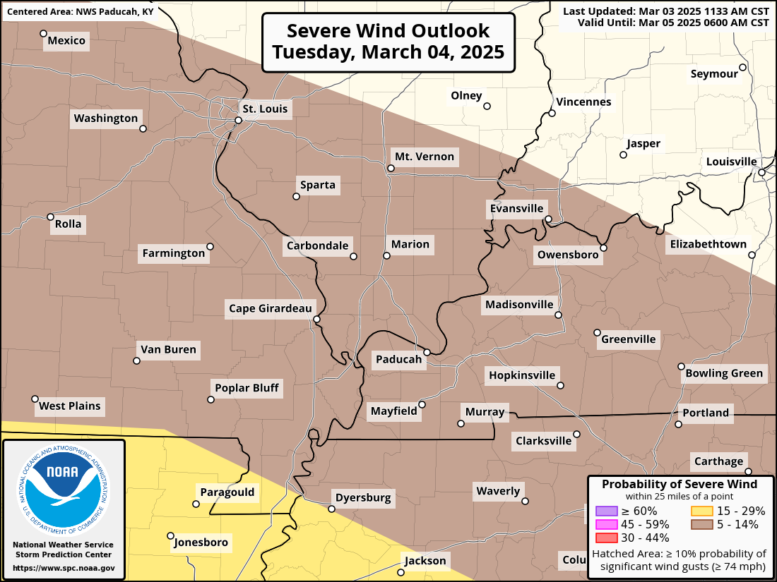
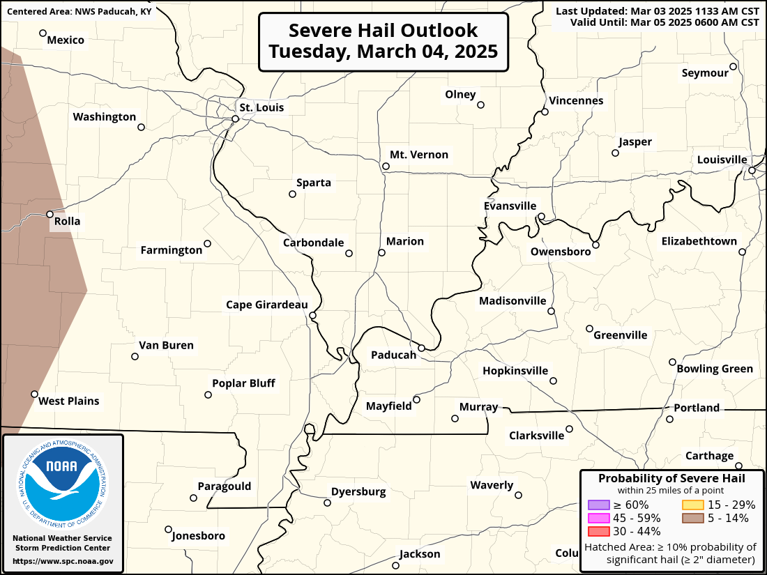
Seven-Day Tornado Outlook ⛈️
March 3rd through March 9th.
RISK LEVEL: A low-level risk on Tuesday.
Confidence: High.
Comment: The Storm Prediction Center has outlined our region for a risk of a few severe thunderstorms on Tuesday. A low-end severe risk. The primary concern will be damaging wind. The tornado threat will be low, but perhaps not zero.
Some severe thunderstorm warnings will be possible on Tuesday.
See my discussion below the graphic.
Tornado risk zone
Damaging wind gust zone
Large hail risk zone
.
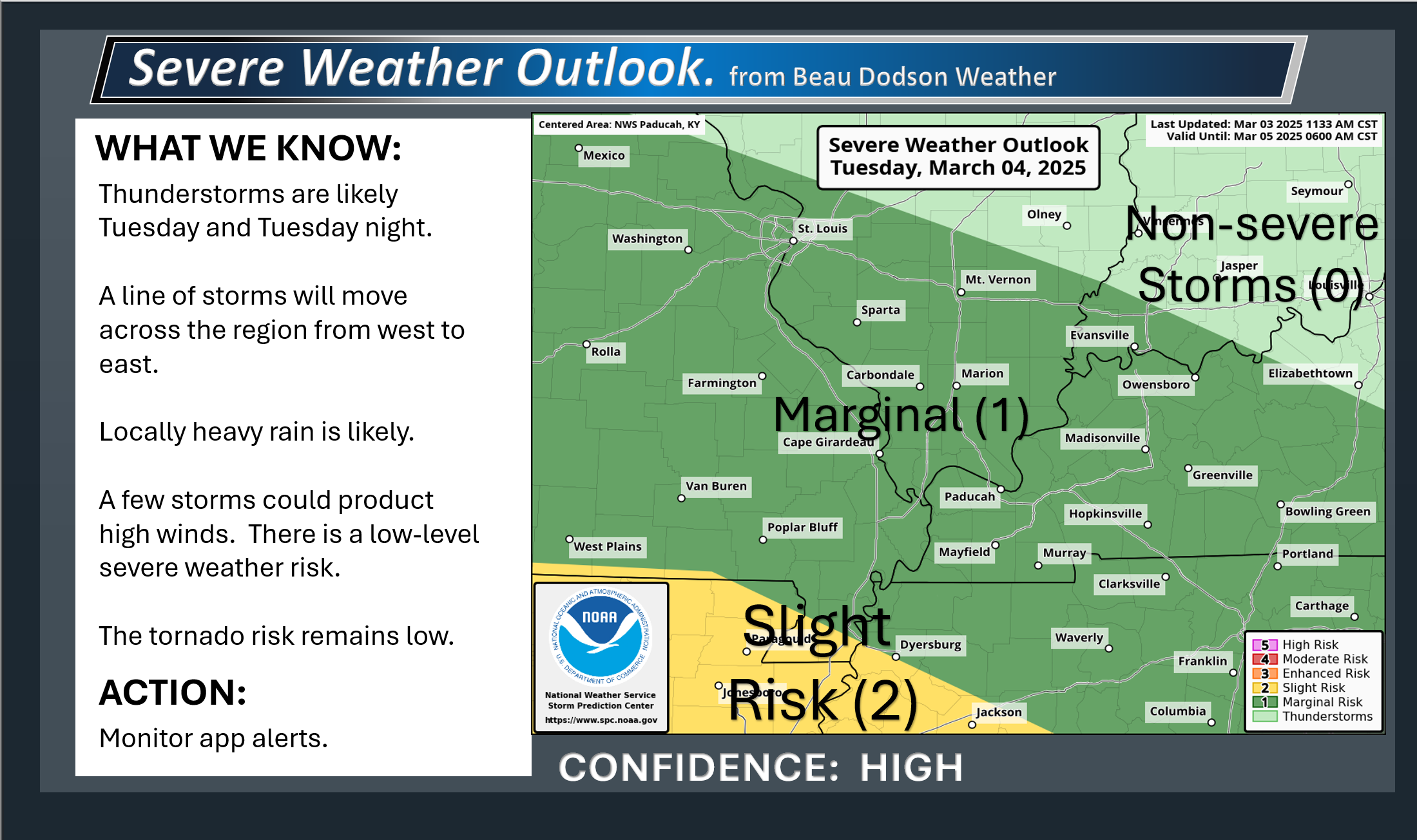
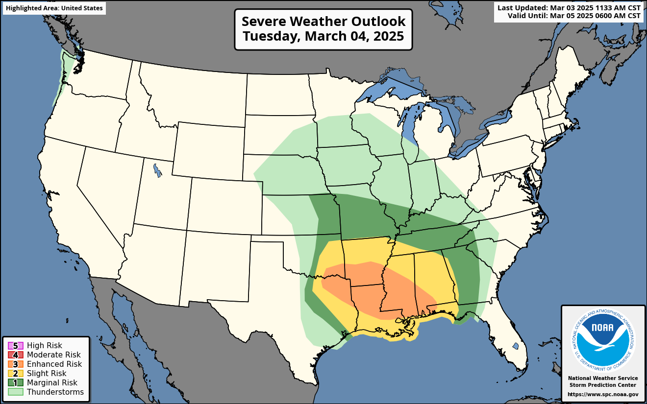
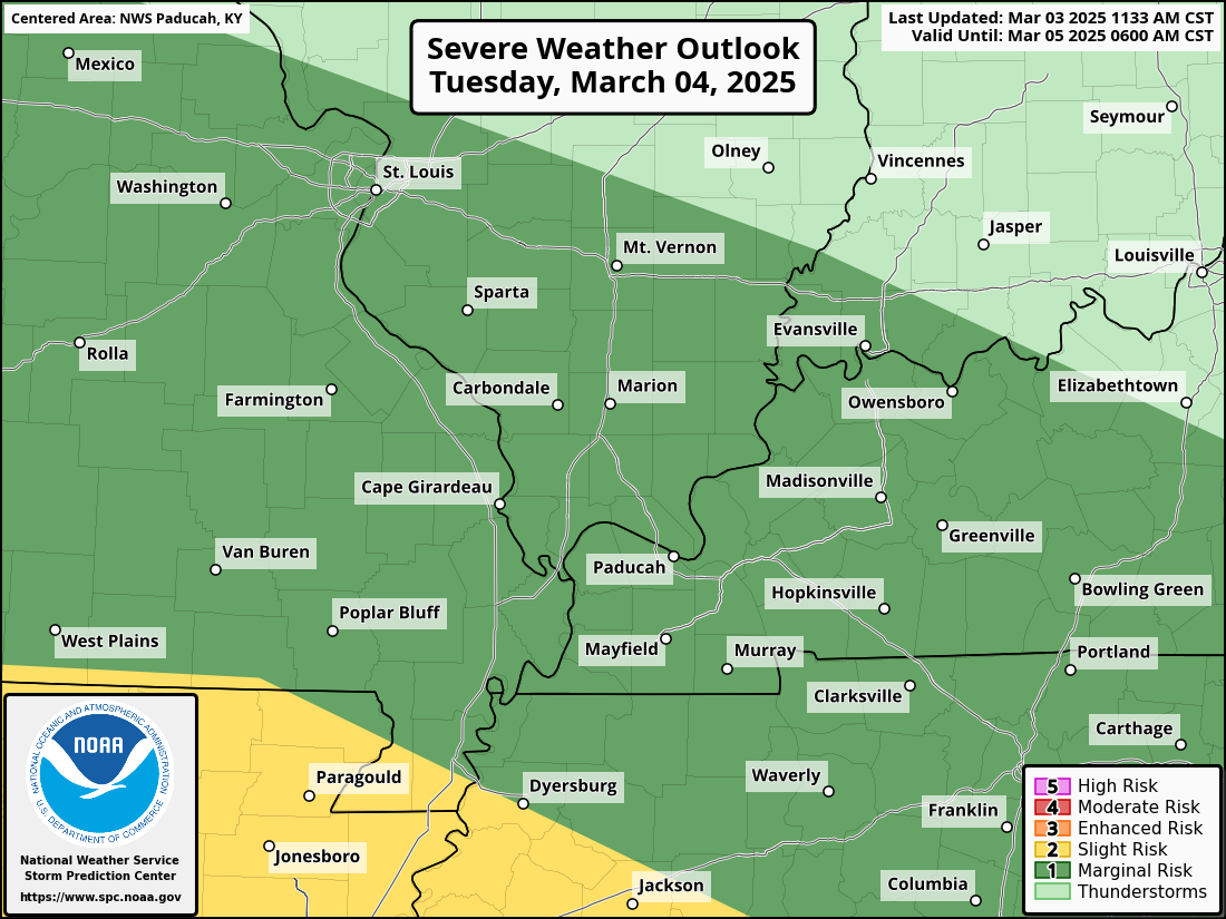
⛈️ Severe Weather Outlook ⛈️
A few severe thunderstorm warnings are possible on Tuesday. Overall, this is a low-level risk.
Confidence in the final forecast continues to increase. As always, I’d like you to continue to monitor updated forecasts. Additional shifts in the outlook are possible.
The Storm Prediction Center/NOAA continues to outline our region for a low-level risk of severe thunderstorms on Tuesday.
No reason to be panicked or overly concerned at this point. This is a typical March thunderstorm setup.
The dark green zone is the lowest level of risk (level one). The yellow zone is a slight risk (level two). The scale goes from one (low) to five (high).
Sub-severe storms are likely in the light green (level 0) zone.
The primary concern will be late Tuesday morning into Tuesday evening. See the future-cast radars farther down in this blog update.
A band of showers and thunderstorms will rapidly move across the region from west to east.
Gusty non-thunderstorm winds will accompany this system, as well. They will range from 25 to 40 mph from tonight into Wednesday. Peak non-thunderstorm winds will likely be on Wednesday.
⚠️ Confidence in the severe weather forecast is now high.
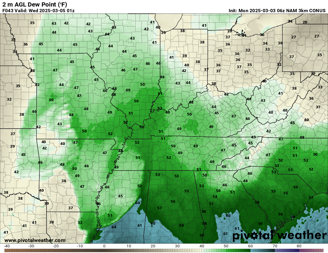
❓ Dew points continue to struggle with this event. No surprise. The area of low pressure occludes over Missouri and cuts off the higher dew points to our south.
The dew point is a measure of moisture. Higher dew points usually mean an increased risk of severe thunderstorms. I usually watch for 58 degrees above.
Most data shows dew points struggling locally. Mainly remaining in the low to middle 50s.
Wind shear is very strong with this event. Wind shear is an increase in wind speed with height. Wind shear is a change of wind direction with height.
Some of those gusty winds aloft could be brought down to the surface by convection (storms). Thus, there is a concern for a few severe thunderstorm warnings.
The tornado risk is low.
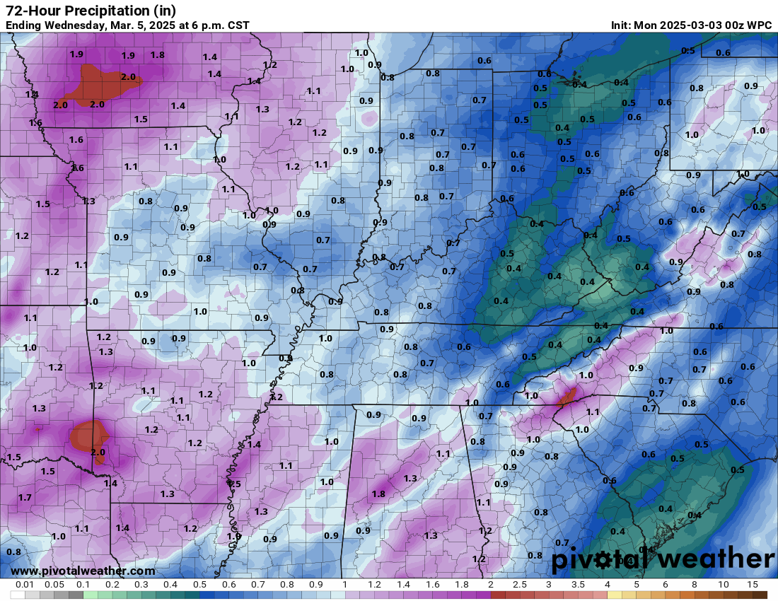
Rainfall totals of 0.50″ to 1.00″ are likely with this event. Locally higher totals are possible.
⚠️ Monitor your Beau Dodson www.weathertalk.com app.
.
.
Seven-Day Hazardous Weather Outlook
1. Is lightning in the forecast? YES. Lightning is possible Monday night into Tuesday evening, mostly on Tuesday and Tuesday night.
2. Are severe thunderstorms in the forecast? POSSIBLE. There is a low-level threat of severe weather on Tuesday. Mainly Tuesday afternoon and evening.
3. Is flash flooding in the forecast? LOW RISK. Locally heavy rain is possible on Tuesday. Commonly flooded roadways could have issues. Widespread flash flooding is not a concern. Localized problems are possible.
4. Will non-thunderstorm winds top 40 mph? POSSIBLE. Gusty winds are possible on Tuesday and Wednesday.
5. Will temperatures drop below 10 degrees? NO.
6. Will the wind chill dip below 0 degrees? NO.
7. Is measurable snow and/or sleet in the forecast? NO.
8. Is freezing rain/ice in the forecast? NO.
.
A quick forecast glance. Your 48-hour forecast Graphics


.

.


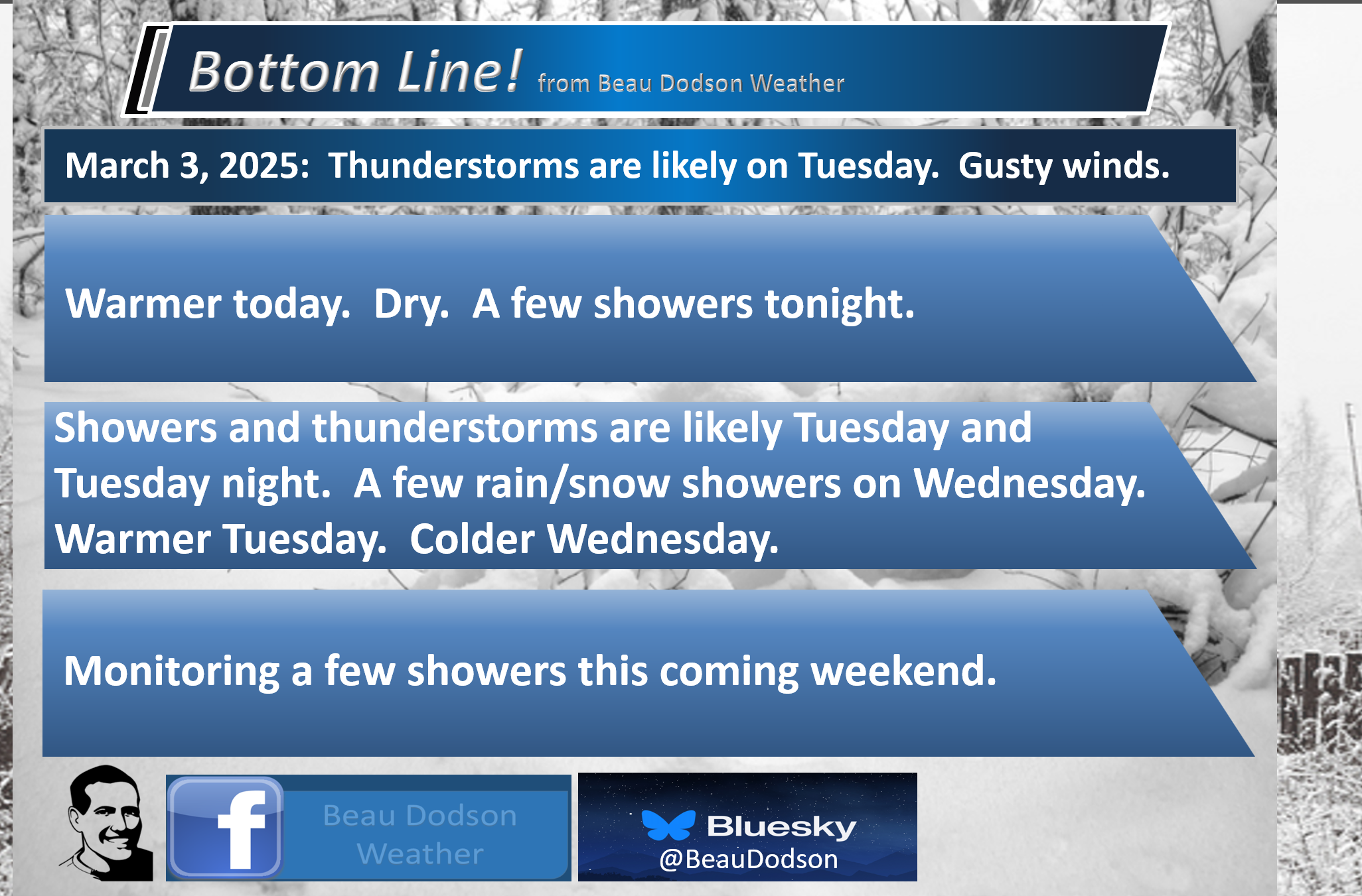
Forecast discussion.
- Warmer today and tomorrow.
- A few showers are possible tonight.
- Showers and thunderstorms are likely on Tuesday and Tuesday night. Locally heavy downpours. A low-level risk of severe weather. Damaging wind is the primary concern. The tornado risk is low.
- A few rain and snow showers are possible Wednesday.
.

.
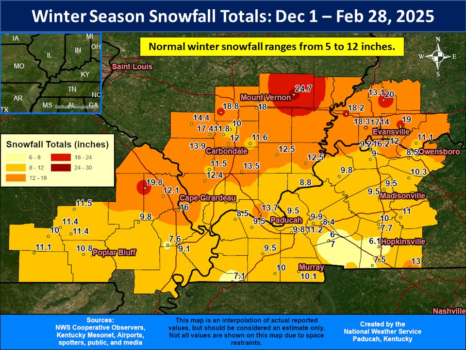
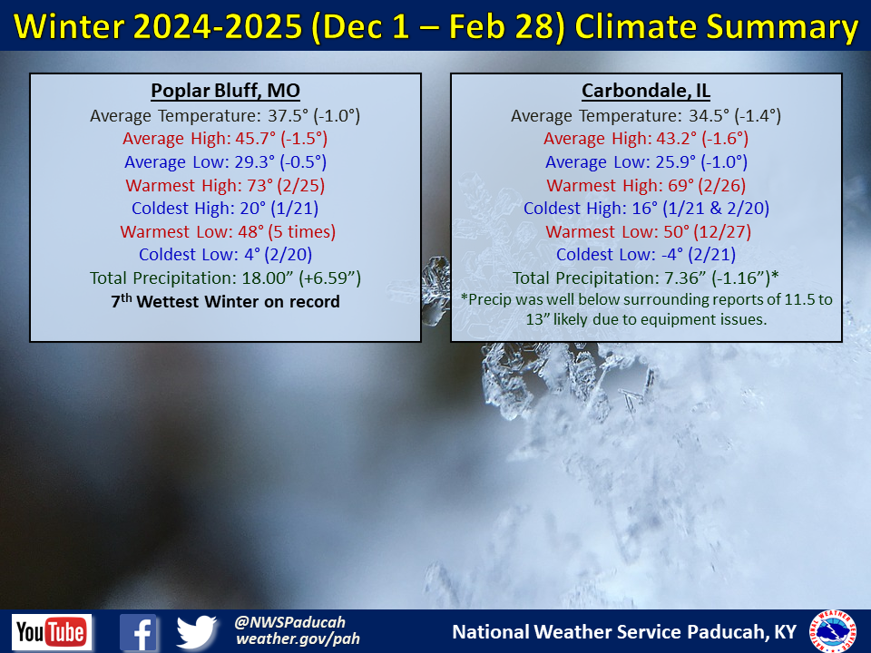
The winter statistics are in.
It was a very snowy winter for portions of the region. The average snowfall is around 8 to 10 inches. Some of you doubled those numbers! Many years, we don’t even reached five inches.
Double-click this image to enlarge it.
Ste Genevieve County, Randolph County, the Missouri Bootheel, and northwest Tennessee are omitted because this graphic is from the Paducah, Kentucky, NWS office. The other offices have not made graphics.
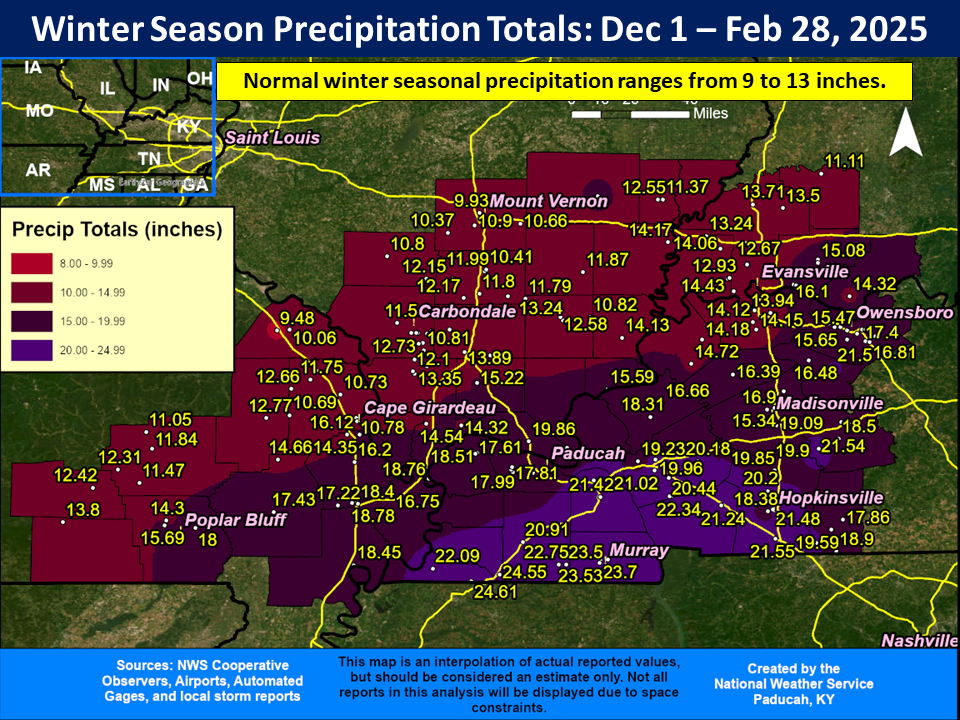
Check out the rainfall totals (and melted snow). Some extreme numbers.

.
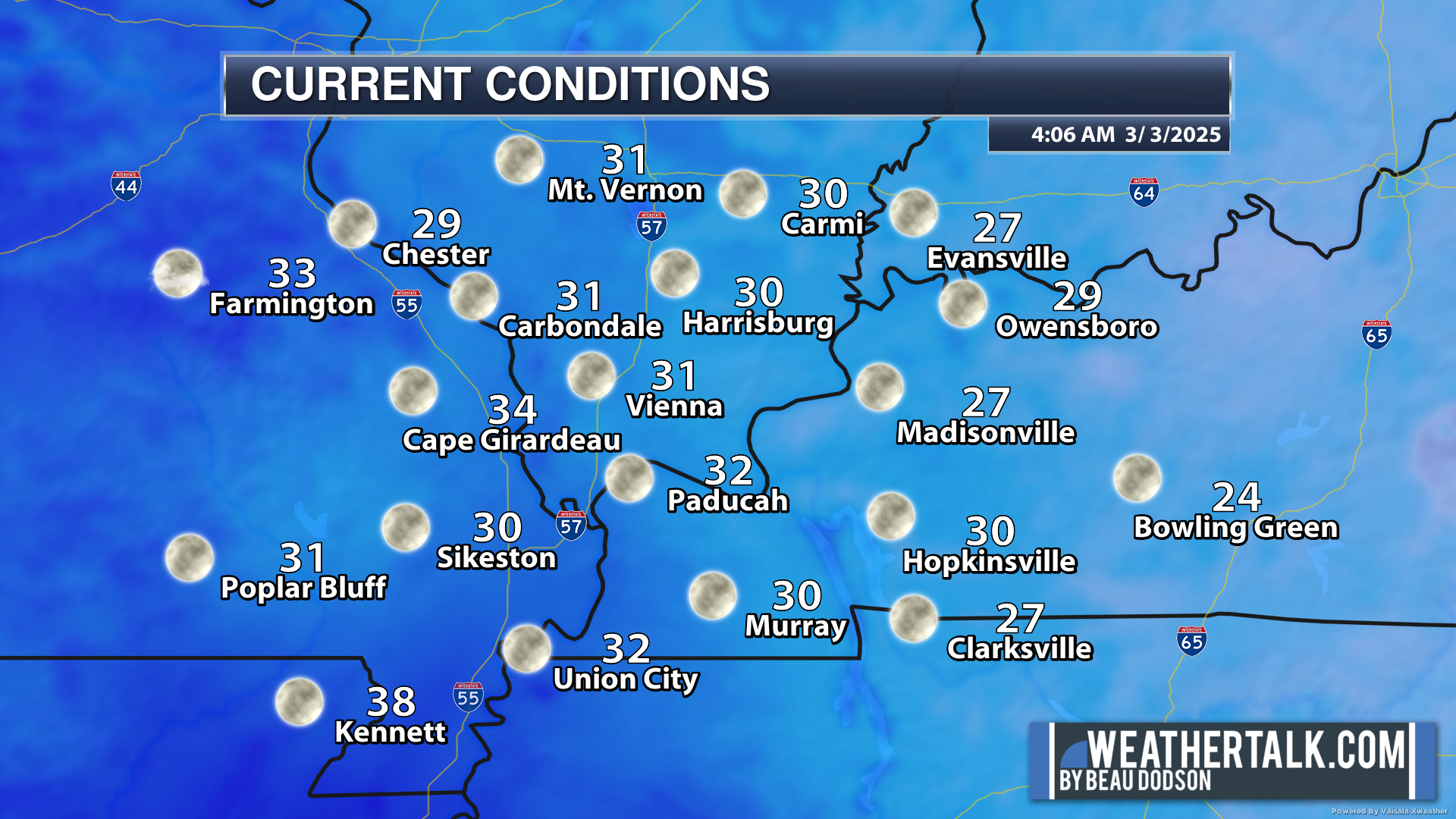
We are waking up to cool temperatures.
.
.
Today will be a bit warmer. Some increase in clouds by this afternoon and evening.
A few light showers are possible tonight. Becoming breezy.
A stronger storm system will push into our region on Tuesday.
First, I wanted to let you know there will be gusty winds with or without thunderstorms Tuesday into Wednesday.
Wind gusts will range from 20 to 35 mph. Higher gusts are possible.
The primary band of showers and thunderstorms will reach southeast Missouri by the late morning or early afternoon hours. Then, it will push eastward through the afternoon and evening hours.
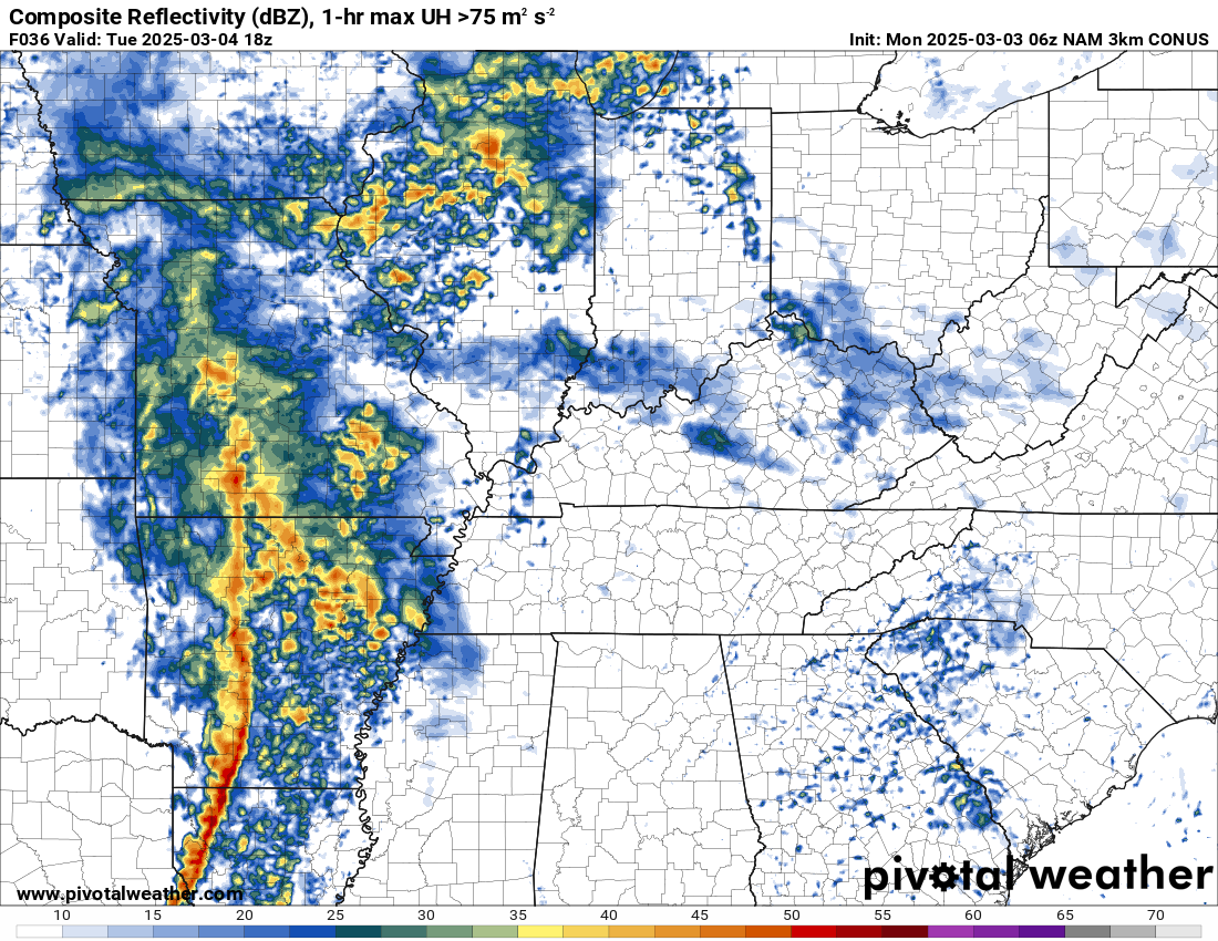
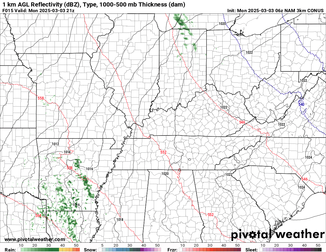
You can see that on the NAM 3K model. This is what radar may look like between 11 am and 1 pm. This band of thunderstorms will be moving east. It will cross the entire region.
.
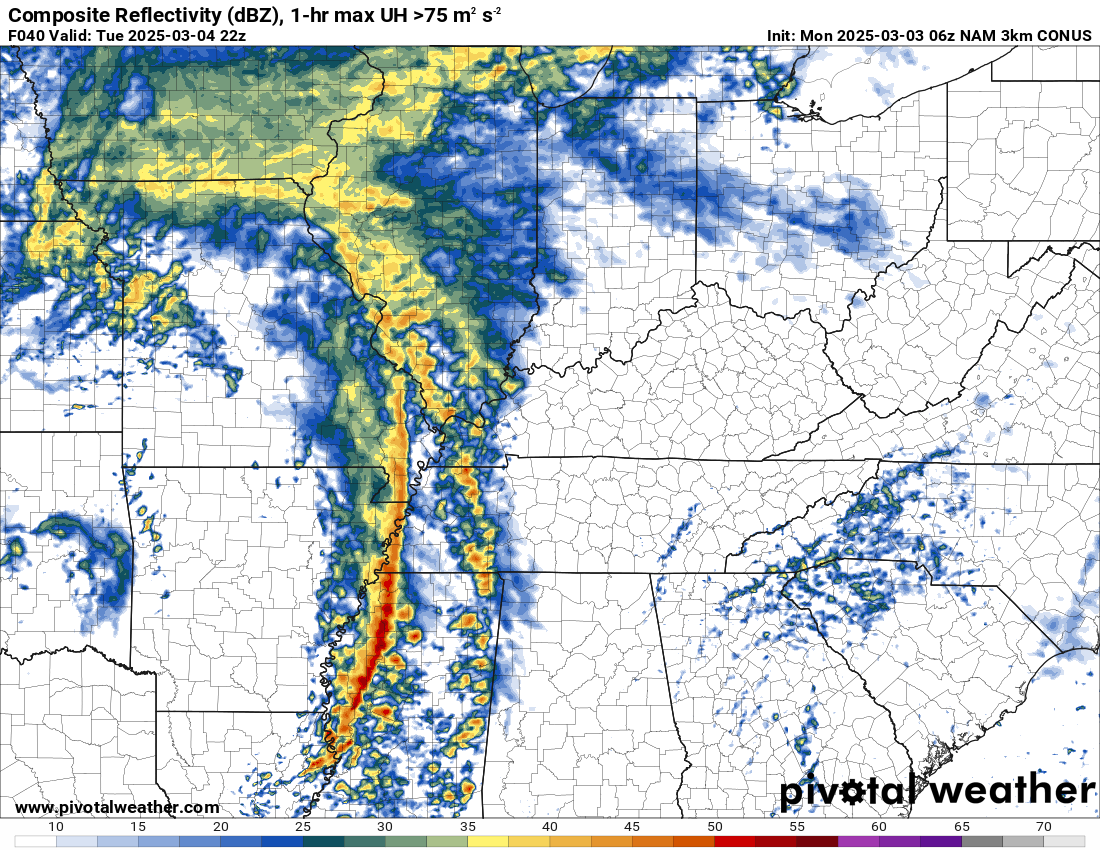
What radar might look like around 4 PM
.
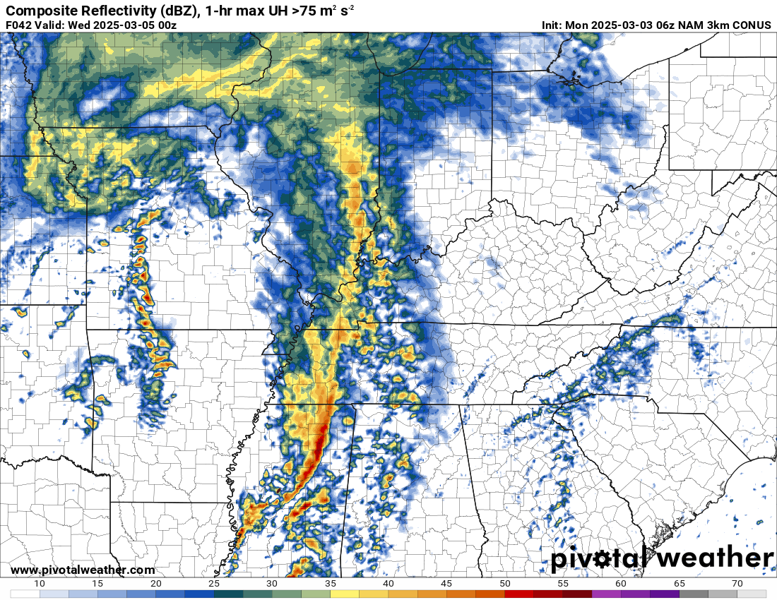
What radar might look like around 6 PM
.
Locally heavy rain and lightning are likely with this band. Gusty winds, as well.
There will be a threat of a few severe thunderstorm warnings with this system. A low-level tornado risk. The higher risk will remain to our south.
Several ingredients are lacking for a more significant severe weather event.
As mentioned above, dew points struggle to reach higher numbers. The dew point is a measure of moisture. Low dew points would inhibit the severe weather threat.
Instability (CAPE) appears limited, as well.
Models show some CAPE. It appears CAPE numbers of 100 to 300 will be possible. That isn’t high, but with very strong wind shear it may be just enough to produce some damaging wind gusts.
The higher severe weather probabilities will remain to our south.
Here is the current severe weather outlook for Tuesday. That orange zone is a level three risk. That extends from Arkansas into Louisiana and Mississippi.
.
Again, our region is in a level one and two risk. The light green zone is where sub-severe storms are possible.
A severe thunderstorm produces quarter-size hail, 58 mph wind gusts, and/or a tornado. That is the definition of a severe thunderstorm.
.
There are several ingredients you need for severe thunderstorms and tornadoes.
- Lift (cold front/warm front).
- Instability (unstable air mass)
- Wind shear. An increase in wind speed with height. A turning of wind direction with height.
- Moisture. Higher dew points.
For severe weather, I usually watch for 58 or above in the dew point department.
For a more significant severe weather outbreak, I usually look for a wider warm sector. The dew points with this system will be minimal in the low to mid-50s.
That blue color represents higher dew points. Notice that they stay to our south.
NBM model. Dew point forecast for Tuesday afternoon.
.
Rainfall totals will likely range from 0.50″ to 1.00″. Locally higher totals.
Most of this will fall on Tuesday.
Double-click this image to enlarge it.
.

Here is the NAM 3K future-cast radar.
Double-click the animation to enlarge it.
The timestamp (upper left) is in Zulu. 12z=6 am. 18z=12 pm. 00z=6 pm.
You can see the line of showers and thunderstorms racing across our region on Tuesday.
 .
.
Some lingering rain and snow showers will be possible on Wednesday. Nothing of significance. It will be windy on Wednesday.
A few showers are possible late in the week. Nothing extreme or severe.
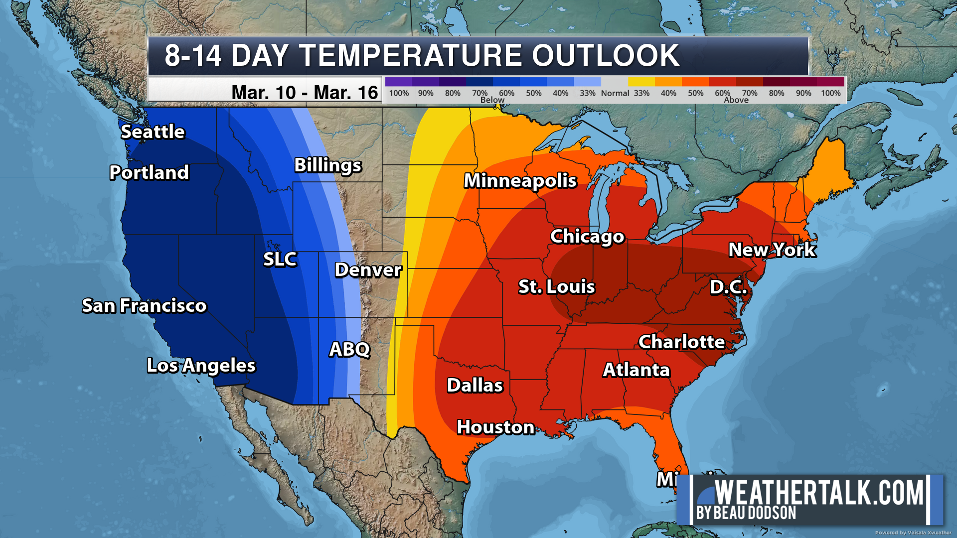
Check out the latest temperature outlook for next week. Warmer than average.
.
.
.
.

Radars and Lightning Data
Interactive-city-view radars. Clickable watches and warnings.
https://wtalk.co/B3XHASFZ
Old legacy radar site (some of you like it better)
https://weatherobservatory.com/weather-radar.htm
If the radar is not updating then try another one. If a radar does not appear to be refreshing then hit Ctrl F5. You may also try restarting your browser.
Backup radar site in case the above one is not working.
https://weathertalk.com/morani
Regional Radar
https://imagery.weathertalk.com/prx/RadarLoop.mp4
** NEW ** Zoom radar with chaser tracking abilities!
ZoomRadar
If the radar is not working, then email me: Email me at beaudodson@usawx.com
.
We do have some sponsors! Check them out.
Connected and Protected.
They Specialize in Audio, Video, Networking, Security, Cameras, Electrical, New Construction, Remodels, and retrofitting Jobs. Experience the future of smart living and unmatched security with Connected & Protected Solutions today.
Link – Click here

.
Roof damage from recent storms? Link – Click here
INTEGRITY ROOFING AND EXTERIORS!
⛈️ Roof or gutter damage from recent storms? Today’s weather is sponsored by Integrity Roofing. Check out their website at this link https://www.ourintegritymatters.com/

![]()
![]()

.
Click here if you would like to return to the top of the page.
.Average high temperatures for this time of the year are around 50 degrees.
Average low temperatures for this time of the year are around 30 degrees.
Average precipitation during this time period ranges from 0.90″ to 1.20″
Six to Ten Day Outlook.
Blue is below average. Red is above average. The no color zone represents equal chances.
Average highs for this time of the year are in the lower 60s. Average lows for this time of the year are in the lower 40s.

Green is above average precipitation. Yellow and brown favors below average precipitation. Average precipitation for this time of the year is around one inch per week.

.

Average low temperatures for this time of the year are around 31degrees.
Average precipitation during this time period ranges from 0.90″ to 1.20″
.
Eight to Fourteen Day Outlook.
Blue is below average. Red is above average. The no color zone represents equal chances.

Green is above average precipitation. Yellow and brown favors below average precipitation. Average precipitation for this time of the year is around one inch per week.

.
![]()
Make sure you have three to five ways of receiving your severe weather information.
Weather Talk is one of those ways! Now, I have another product for you and your family.

.
.
https://weathercallservices.com/beau-dodson-weather


Want to add more products to your Beau Dodson Weather App?
Receive daily videos, weather blog updates on normal weather days and severe weather and winter storm days, your county by county weather forecast, and more!
Here is how to do add those additional products to your app notification settings!
Here is a video on how to update your Beau Dodson Weather payment.
The app is for subscribers. Subscribe at www.weathertalk.com/welcome then go to your app store and search for WeatherTalk
Subscribers, PLEASE USE THE APP. ATT and Verizon are not reliable during severe weather. They are delaying text messages.
The app is under WeatherTalk in the app store.

Apple users click here

Android users click here
.
Radars and Lightning Data
Interactive-city-view radars. Clickable watches and warnings.
https://wtalk.co/B3XHASFZ
Old legacy radar site (some of you like it better)
https://weatherobservatory.com/weather-radar.htm
If the radar is not updating then try another one. If a radar does not appear to be refreshing then hit Ctrl F5. You may also try restarting your browser.
Backup radar site in case the above one is not working.
https://weathertalk.com/morani
Regional Radar
https://imagery.weathertalk.com/prx/RadarLoop.mp4
** NEW ** Zoom radar with chaser tracking abilities!
ZoomRadar
Lightning Data (zoom in and out of your local area)
https://wtalk.co/WJ3SN5UZ
Not working? Email me at beaudodson@usawx.com
National map of weather watches and warnings. Click here.
Storm Prediction Center. Click here.
Weather Prediction Center. Click here.
.

Live lightning data: Click here.
Real time lightning data (another one) https://map.blitzortung.org/#5.02/37.95/-86.99
Our new Zoom radar with storm chases
.
.

Interactive GOES R satellite. Track clouds. Click here.
GOES 16 slider tool. Click here.
College of DuPage satellites. Click here
.

Here are the latest local river stage forecast numbers Click Here.
Here are the latest lake stage forecast numbers for Kentucky Lake and Lake Barkley Click Here.
.
.
Find Beau on Facebook! Click the banner.


 .
.