
.

🌪️ Seven-Day Tornado Outlook ⛈️
March 27th through April 3rd.
Current risk: None
Current confidence level: MEDIUM.
Comments: At this time, tornadoes are not anticipated. Monitor updates. There could be a severe weather threat next week. For now, confidence is low.
.

Seven-Day Hazardous Weather Outlook
1. Is lightning in the forecast? MONITOR. Scattered lightning is possible today. I am watching next Tuesday through Thursday.
2. Are organized severe thunderstorms. MONITOR. I am watching next Tuesday through Thursday. It is a bit too soon to know if severe weather will be a concern.
..3. Is significant or widespread flash flooding in the forecast? NO.
4. Will non-thunderstorm winds top 40 mph? NO.
5. Will the temperature rise above 90 degrees? NO.
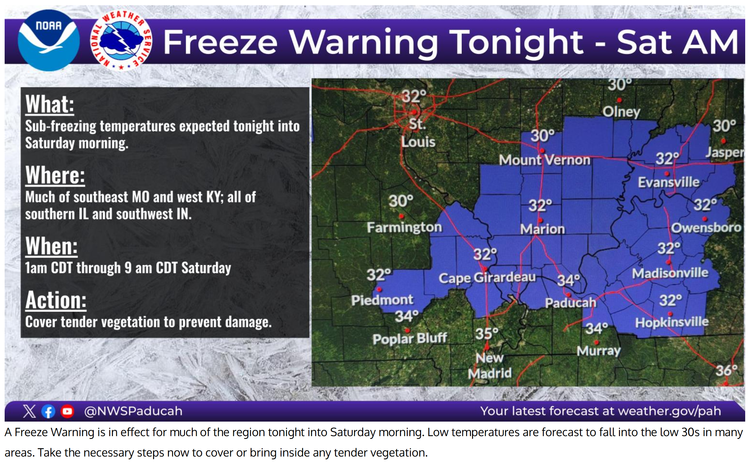
More counties could be added to the frost or freeze warning for tonight/tomorrow morning.
Here was the 5 AM update.
The purple zone is the current freeze warning. Again, keep in mind that counties not included in this could still have frost.
Double-click the image to enlarge it.
6. Is the heat index forecast to rise above 100 degrees? NO.
.
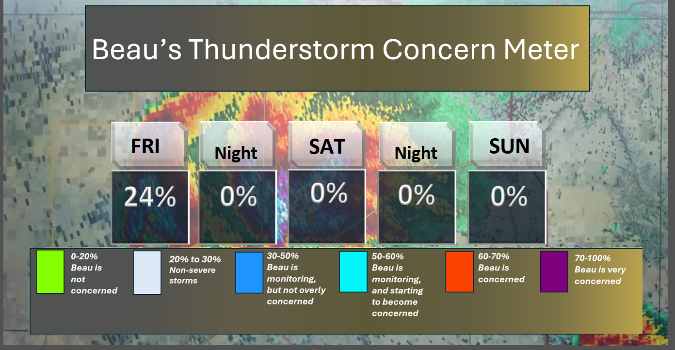
⛈️ Here is the short-range thunderstorm concern meter.
.
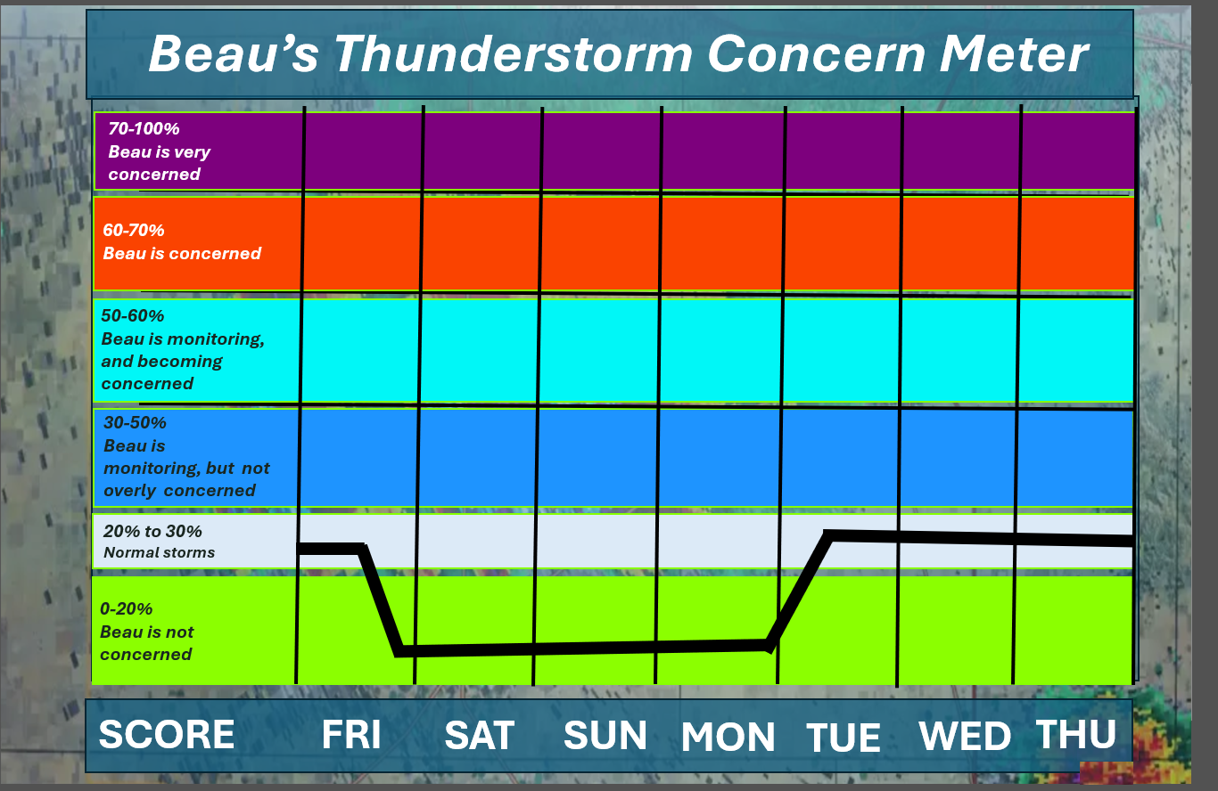
⛈️ Here is the extended thunderstorm concern meter.
Lightning is possible today and next week.
.


.
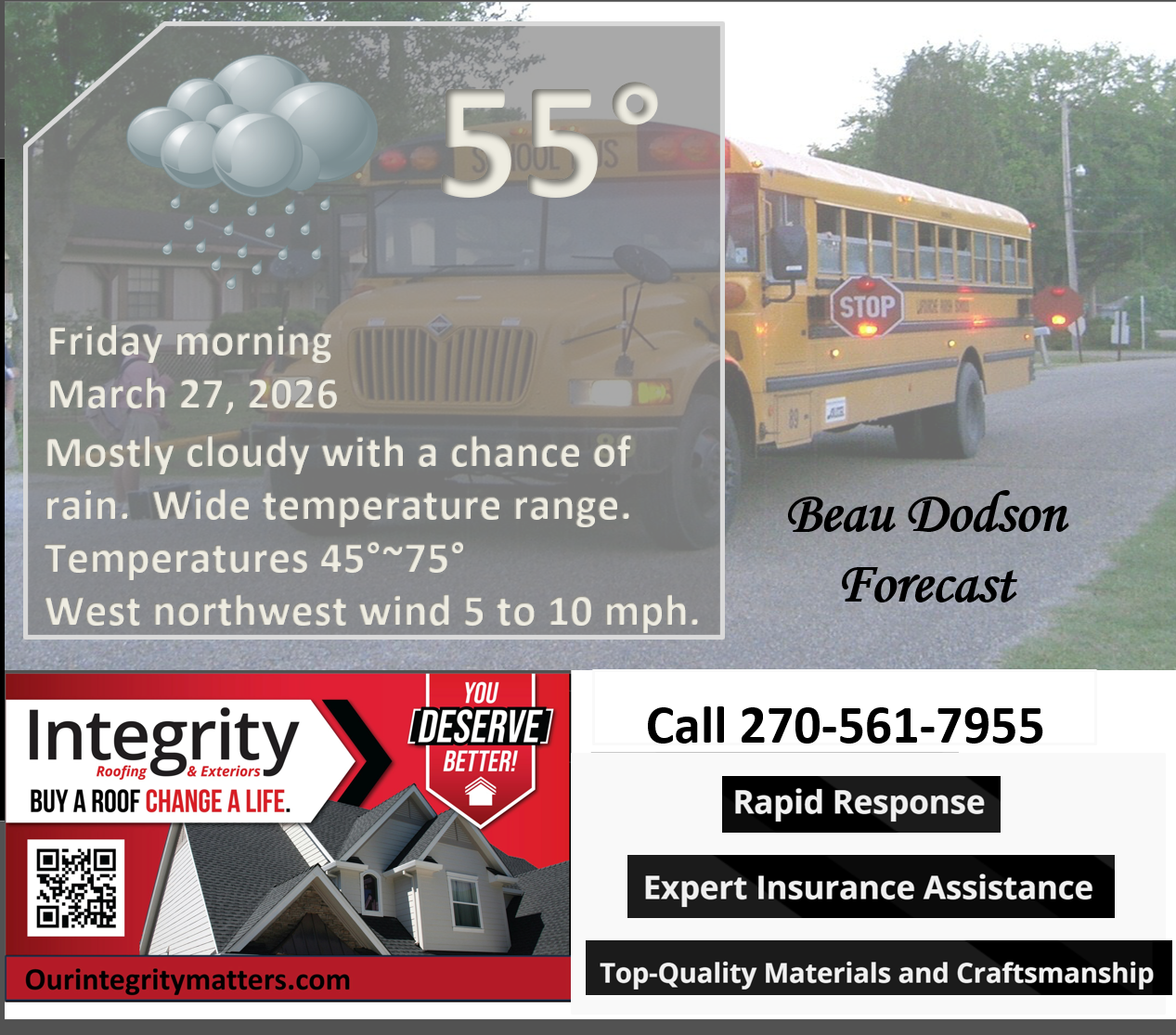
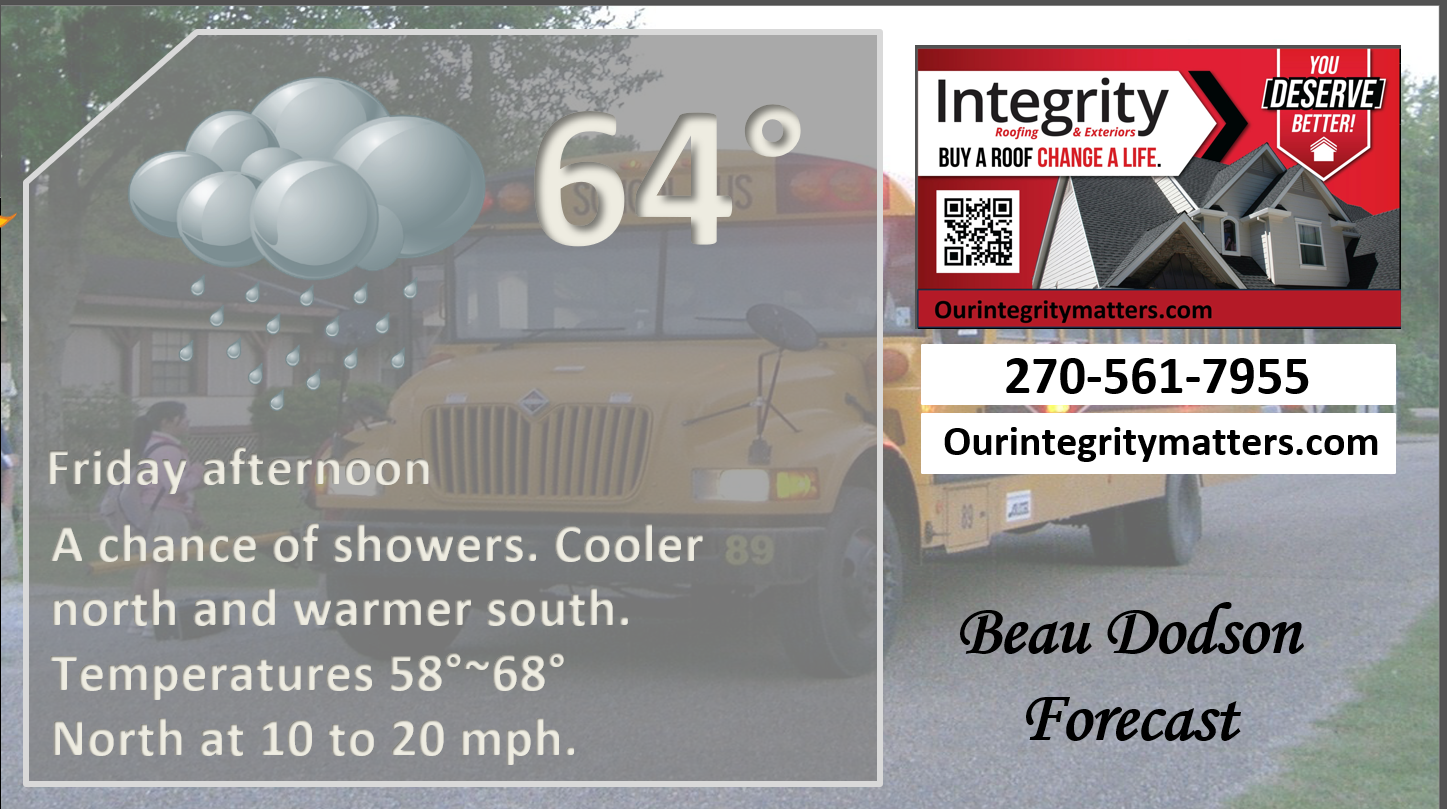
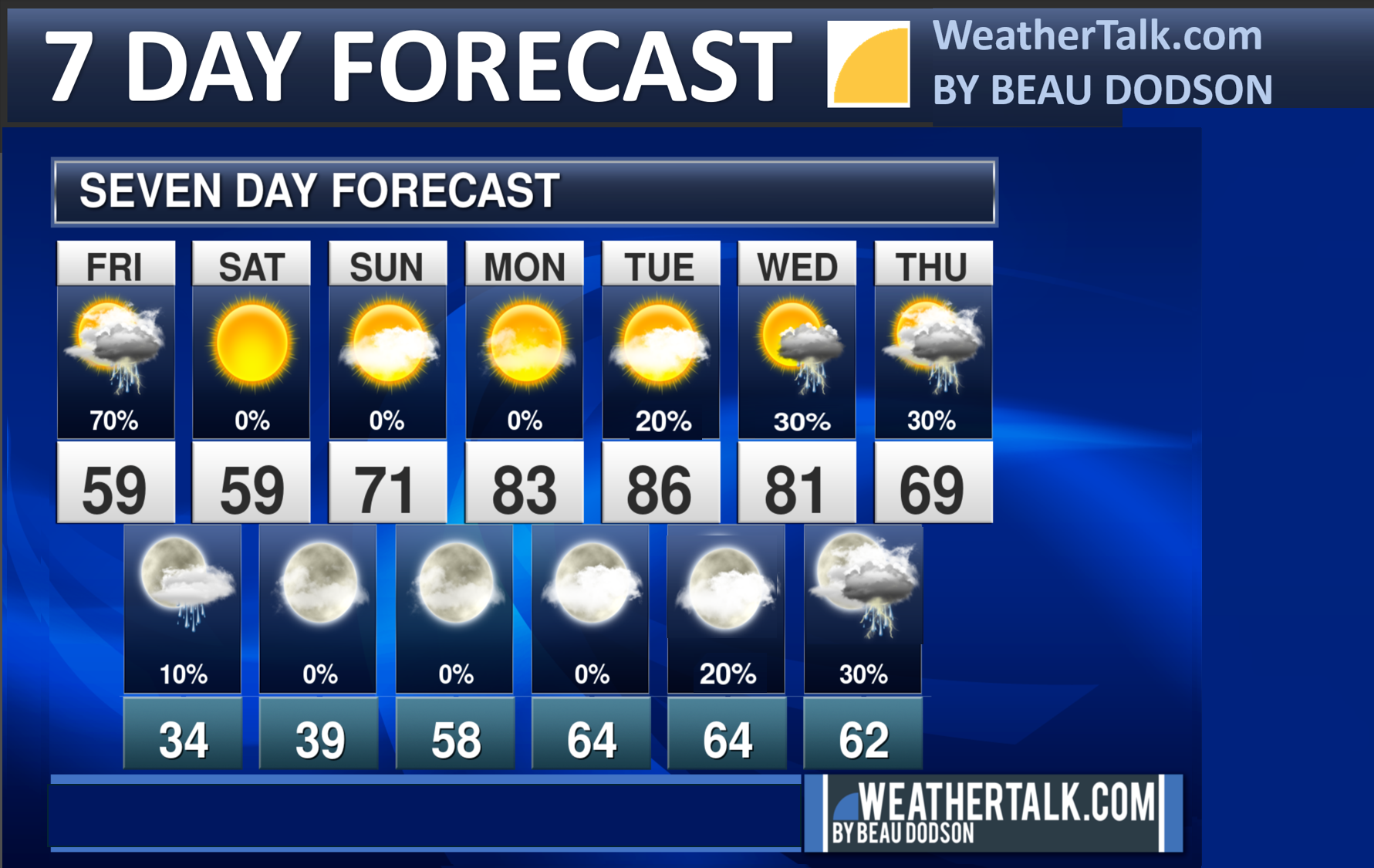
Here is your bus stop forecast
.
This morning
.
This afternoon
.
Tomorrow morning
.
Tomorrow afternoon
.


Forecast discussion
- Cooler today, with temperatures falling from north to south. See animation below.
- A wide range of morning temperatures.
- Scattered showers today. A thunderstorm is possible.
- Frost and freeze conditions tonight and tomorrow morning.
- A warming trend next week.
- Monitoring shower and thunderstorm chances from Tuesday onward. It is too soon to know if severe weather will be a concern.
.
 .
.
.
What is the primary weather concern today and tonight?

Radars and Lightning Data
Interactive-city-view radars. Clickable watches and warnings.
https://wtalk.co/B3XHASFZ
Old legacy radar site (some of you like it better)
https://weatherobservatory.com/weather-radar.htm
Backup radar site in case the above one is not working.
https://weathertalk.com/morani
Regional Radar
https://imagery.weathertalk.com/prx/RadarLoop.mp4
** NEW ** Zoom radar with chaser tracking abilities!
ZoomRadar
Lightning Data (zoom in and out of your local area)
https://wtalk.co/WJ3SN5UZ
FORECAST UPDATE
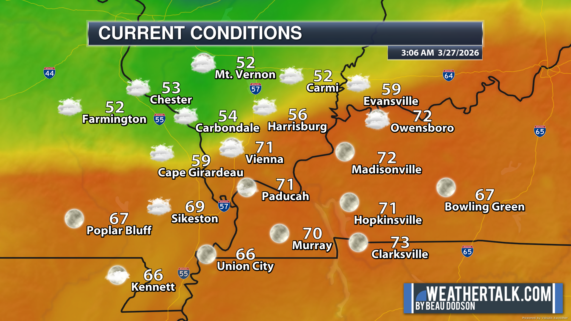
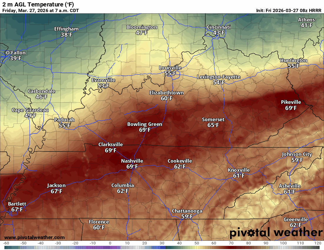
A cold front is moving through the region. Here were the early morning temperatures.
I bet you can find the front! A wide range of temperatures across the region. The front is moving south.
.
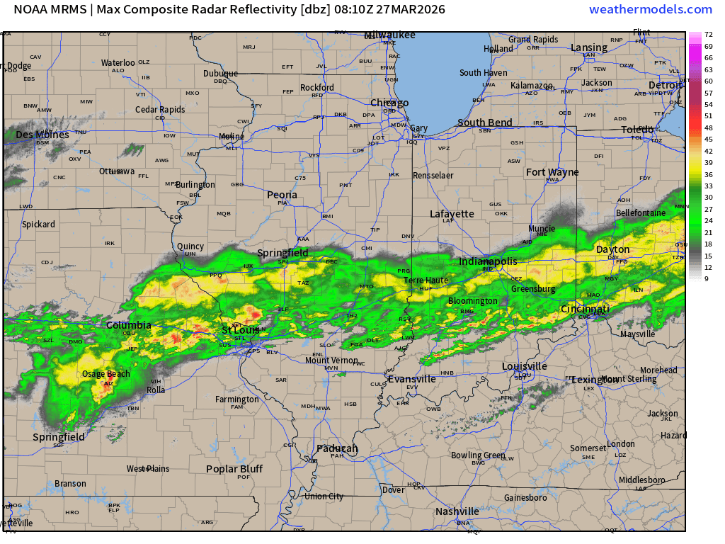
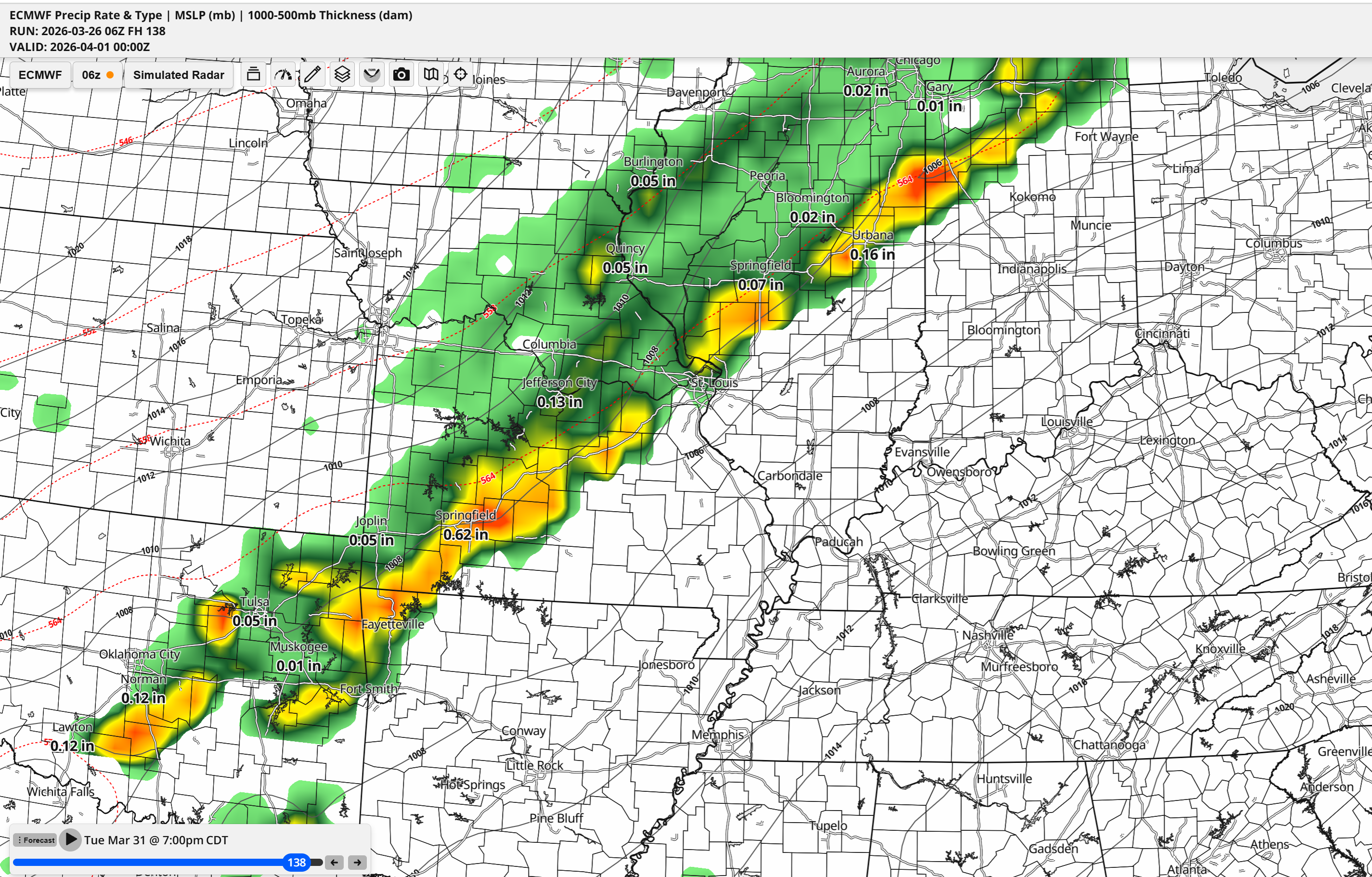
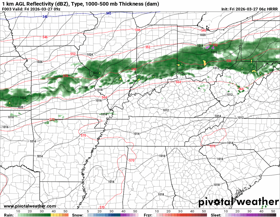
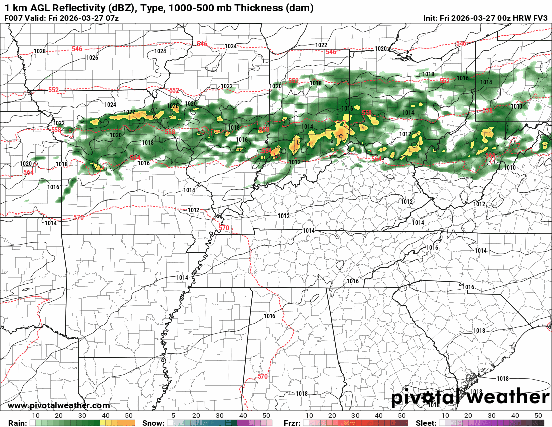
Showers and a few thunderstorms are accompanying the front.
It is possible that some areas miss out on the rain. Rainfall totals have gone down since the last update.
Here was the early morning radar animation. This is from 1 AM to 4 AM. That rain is moving south southeast. It is also weakening.
.
We will have a chance of showers and thunderstorms today. They will taper off from northwest to southeast as we move through the day. Temperatures will also fall as the front moves through your area.
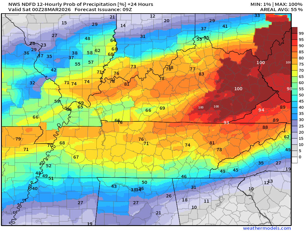
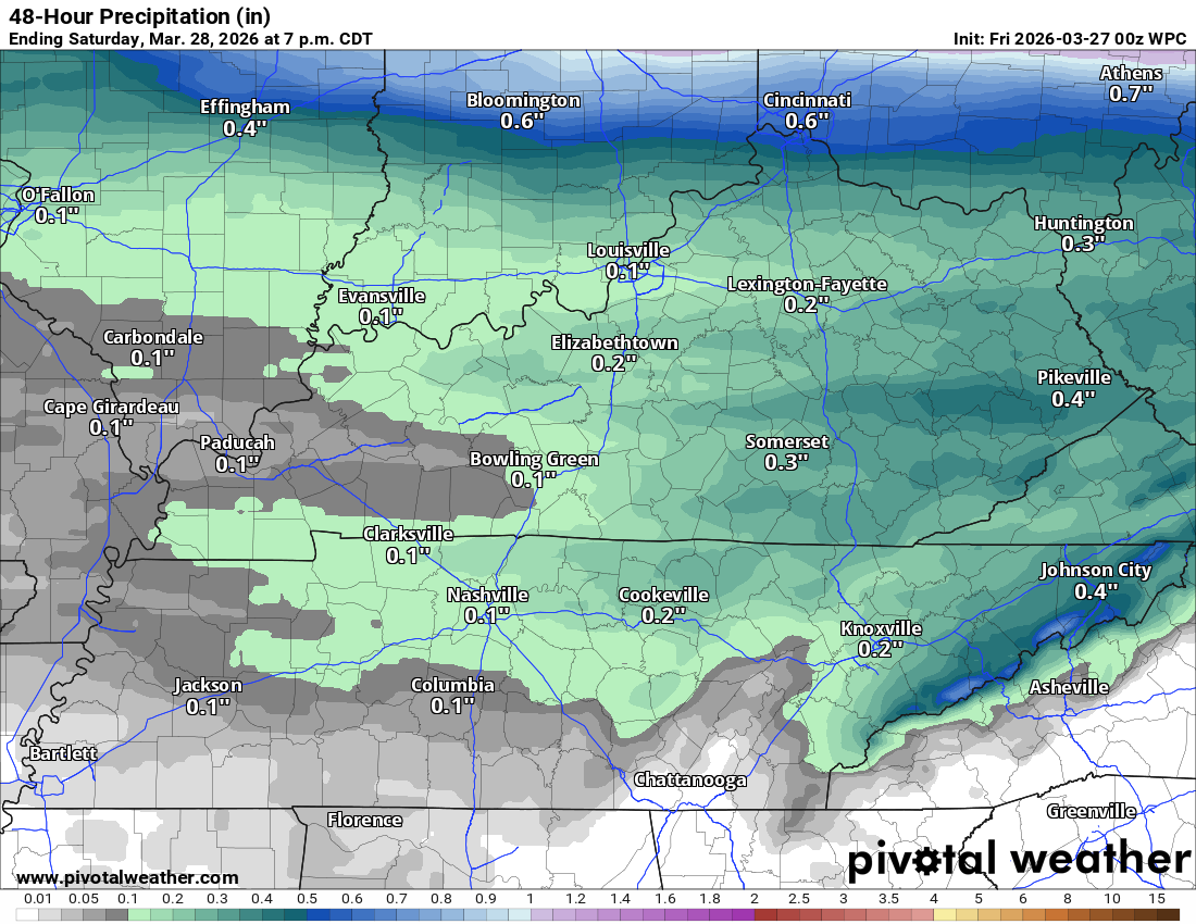
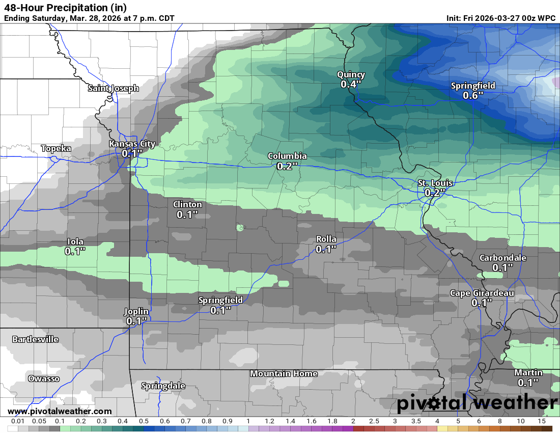
Let’s take a look at the rainfall probabilities. What is the % chance of showers and thunderstorms?
Today from 7 AM to 7 PM
Double-click on images to enlarge them.
.
Here is the latest rainfall totals update for today. Thunderstorms could enhance totals in a few locations. Some areas may miss out on the rain, as well.
These numbers have come down a bit. We need rain.
Double-click on the graphics to enlarge them.
Western view of the region
.
You can watch the temperature drop today in this animated graphic.
Double-click on the animation to enlarge it.
The timestamp is located in the upper-left portion of the animation.
.
Seven-day outlook graphic.
See the video and graphics below for more details specific to your county. This is a broad-brush overview of the entire region.
.
Tonight through next Wednesday
It will turn colder tonight and tomorrow morning.
There is a freeze warning in effect. Additional counties could be added. Either way, a frost is possible across the area. A freeze is possible in the purple zone.
Protect sensitive plants.

.
Dry conditions are anticipated for tonight through Monday afternoon.
A slow warming trend will begin on Saturday and Sunday. It will be mild again next week.
A series of systems will impact the region next week.
There remain questions about the timing and the intensity.
I have shower and thunderstorm chances as early as Tuesday and Tuesday night.
And that will continue into Thursday and perhaps Friday.
It is a bit too soon to know if severe weather will be a concern. There are some signals for some severe weather, but placement and timing are questionable at best.
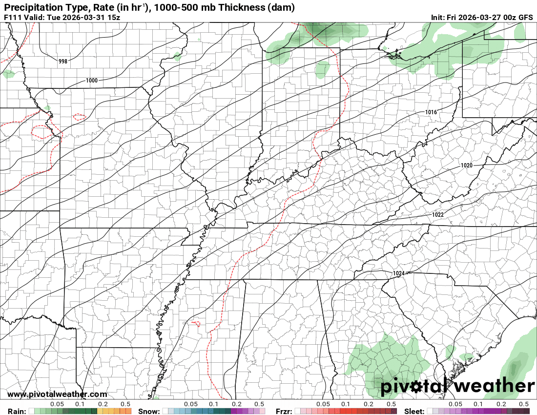
Here is the EC model for next Tuesday evening. It shows a band of showers and thunderstorms pushing eastward into the region.
Other models hold it off a bit longer. See the future-cast radars below.
.
The strongest instability, on the GFS model, is next Friday.
We will see how this trends. This is showing you the CAPE. CAPE is basically energy that thunderstorms tap into.
The higher the CAPE numbers, the higher the chance of intense thunderstorms.
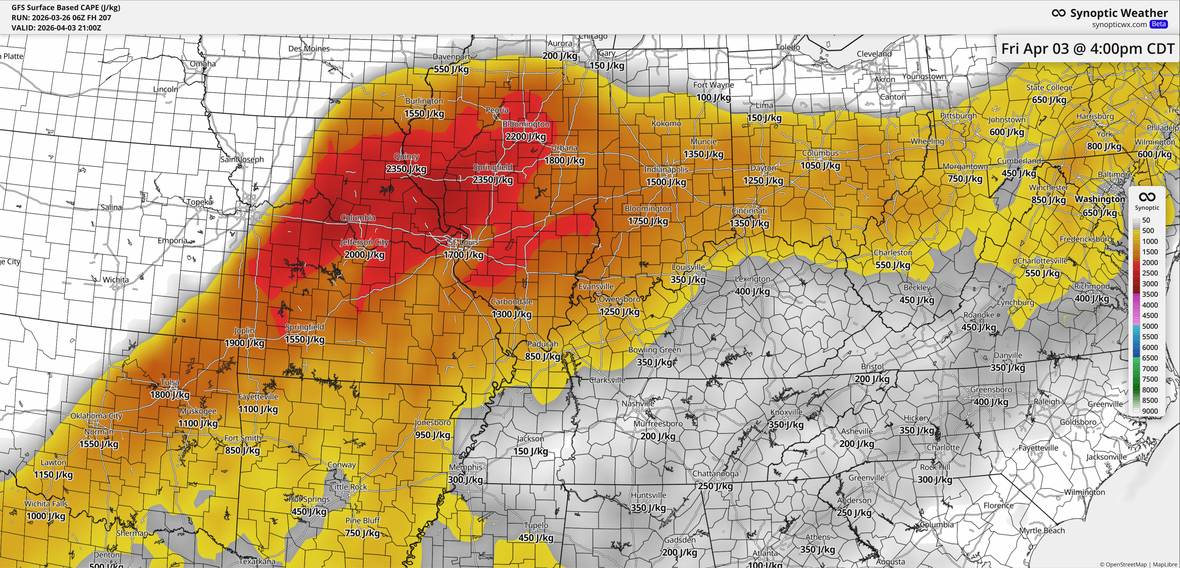
.
Plenty to watch in the long range.
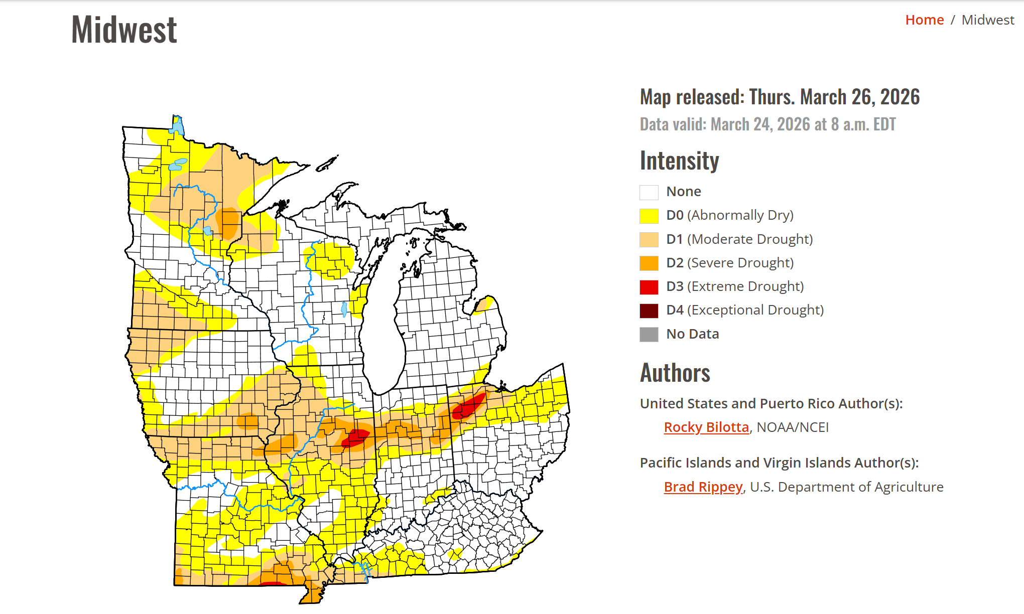
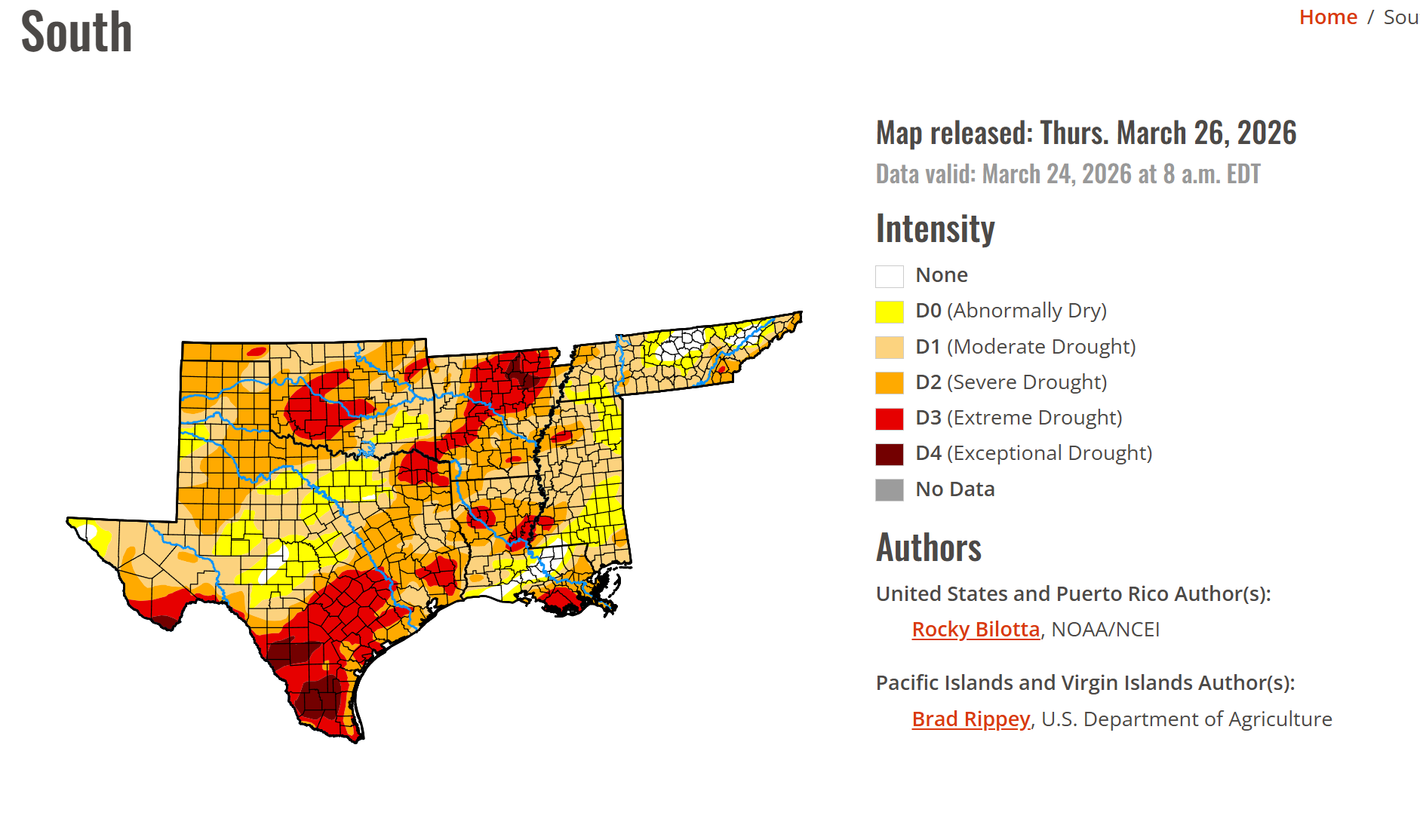
We need rain.
Here are the latest drought monitor numbers. This has improved a little over the last month, but we still need more rain.
Double-click the images to enlarge them.
Portions of the region are in the white zone (none). Others are in abnormally dry to severe drought.
.

.
The timestamp (upper left) is in Zulu. 12z=7 am. 18z=1 pm. 00z=7 pm.
Green is rain. Yellow is moderate rain. Orange indicates locally heavy rain.
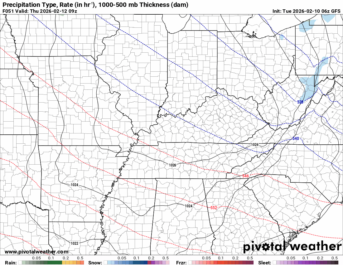
This model pops most of the storms east northeast of our region (on Thursday PM)
Double-click the animation to enlarge it.
The timestamp (upper left) is in Zulu. 12z=7 am. 18z=1 pm. 00z=7 pm.
Green is rain. Yellow is moderate rain. Orange indicates locally heavy rain.
Double-click the animation to enlarge it.
FV3 Model
.
.
The timestamp (upper left) is in Zulu. 12z=7 am. 18z=1 pm. 00z=7 pm.
Green is rain. Yellow is moderate rain. Orange indicates locally heavy rain.
Double-click the animation to enlarge it.
GFS Model
.
..
.
Click here if you would like to return to the top of the page.
.Average high temperatures for this time of the year are around 65 degrees.
Average low temperatures for this time of the year are around 42 degrees.
Average precipitation during this time period ranges from 1.00″ to 1.20″
Six to Ten Day Outlook.
Blue is below average. Red is above average. The no color zone represents equal chances.
Average highs for this time of the year are in the lower 60s. Average lows for this time of the year are in the lower 40s.

Green is above average precipitation. Yellow and brown favors below-average precipitation. Average precipitation for this time of the year is around one inch per week.

.

Average low temperatures for this time of the year are around 63 degrees.
Average precipitation during this time period ranges from 1.00″ to 1.30″
.
Eight to Fourteen Day Outlook.
Blue is below average. Red is above average. The no color zone represents equal chances.

Green is above average precipitation. Yellow and brown favors below average precipitation. Average precipitation for this time of the year is around one inch per week.

.
.
.
We have a new service to complement your www.weathertalk.com subscription. This does NOT replace www.weathertalk.com It is simply another tool for you to receive severe weather information.
.
https://weathercallservices.com/beau-dodson-weather


Want to receive the daily forecast/other products on your Beau Dodson Weather app?
Did you know you have four options in your www.weathertalk.com account
You will then receive these via your Beau Dodson Weather app.
Just log into your www.weathertalk.com account
Click the NOTIFICATION SETTINGS TAB
Then, turn them on (green) and off (red)
🌪️ Number 1 is the most important one. Severe alerts, tornado alerts, and so on.
Number 2 is the daily video, blog, livestream alerts, and severe weather Facebook threads on severe days or winter storm days.
Number 3 is the daily forecast. I send that out every day during the afternoon hours. It is the seven-day forecast, hazardous weather outlook, fire outlook, and more.
Number 4 is to receive the daily video, blog, and other content on NON-severe weather days (every day without severe threats in other words)
GREEN IS ON
RED IS OFF

I am going to start going live during bigger severe weather events.
Check it out here https://www.youtube.com/user/beaudodson
Click the subscribe button (it’s a free subscription button), and it will alert you when I go live. I will also send out alerts to the app when I go live for an event.

.
Radars and Lightning Data
Interactive-city-view radars. Clickable watches and warnings.
https://wtalk.co/B3XHASFZ
Old legacy radar site (some of you like it better)
https://weatherobservatory.com/weather-radar.htm
If the radar is not updating then try another one. If a radar does not appear to be refreshing then hit Ctrl F5. You may also try restarting your browser.
Backup radar site in case the above one is not working.
https://weathertalk.com/morani
Regional Radar
https://imagery.weathertalk.com/prx/RadarLoop.mp4
** NEW ** Zoom radar with chaser tracking abilities!
ZoomRadar
If the radar is not working, then email me: Email me at beaudodson@usawx.com
.
We do have some sponsors! Check them out.
Roof damage from recent storms? Link – Click here
INTEGRITY ROOFING AND EXTERIORS!
⛈️ Roof or gutter damage from recent storms? Today’s weather is sponsored by Integrity Roofing. Check out their website at this link https://www.ourintegritymatters.com/

![]()
![]()
![]()
Make sure you have three to five ways of receiving your severe weather information.
Weather Talk is one of those ways! Now, I have another product for you and your family.

.
Want to add more products to your Beau Dodson Weather App?
Receive daily videos, weather blog updates on normal weather days and severe weather and winter storm days, your county by county weather forecast, and more!
Here is how to do add those additional products to your app notification settings!
Here is a video on how to update your Beau Dodson Weather payment.
The app is for subscribers. Subscribe at www.weathertalk.com/welcome then go to your app store and search for WeatherTalk
Subscribers, PLEASE USE THE APP. ATT and Verizon are not reliable during severe weather. They are delaying text messages.
The app is under WeatherTalk in the app store.

Apple users click here

Android users click here
.
Radars and Lightning Data
Interactive-city-view radars. Clickable watches and warnings.
https://wtalk.co/B3XHASFZ
Old legacy radar site (some of you like it better)
https://weatherobservatory.com/weather-radar.htm
If the radar is not updating then try another one. If a radar does not appear to be refreshing then hit Ctrl F5. You may also try restarting your browser.
Backup radar site in case the above one is not working.
https://weathertalk.com/morani
Regional Radar
https://imagery.weathertalk.com/prx/RadarLoop.mp4
** NEW ** Zoom radar with chaser tracking abilities!
ZoomRadar
Lightning Data (zoom in and out of your local area)
https://wtalk.co/WJ3SN5UZ
Not working? Email me at beaudodson@usawx.com
National map of weather watches and warnings. Click here.
Storm Prediction Center. Click here.
Weather Prediction Center. Click here.
.

Live lightning data: Click here.
Real time lightning data (another one) https://map.blitzortung.org/#5.02/37.95/-86.99
Our new Zoom radar with storm chases
.
.

Interactive GOES R satellite. Track clouds. Click here.
GOES 16 slider tool. Click here.
College of DuPage satellites. Click here
.

Here are the latest local river stage forecast numbers Click Here.
Here are the latest lake stage forecast numbers for Kentucky Lake and Lake Barkley Click Here.
.
.
Find Beau on Facebook! Click the banner.


 .
.