

Radars and Lightning Data
Interactive-city-view radars. Clickable watches and warnings.
https://wtalk.co/B3XHASFZ
Old legacy radar site (some of you like it better)
https://weatherobservatory.com/weather-radar.htm
If the radar is not updating then try another one. If a radar does not appear to be refreshing then hit Ctrl F5. You may also try restarting your browser.
Backup radar site in case the above one is not working.
https://weathertalk.com/morani
Regional Radar
https://imagery.weathertalk.com/prx/RadarLoop.mp4
** NEW ** Zoom radar with chaser tracking abilities!
ZoomRadar
.
.

.
I have some question-and-answer threads over on the Facebook page. Link to those threads CLICK HERE
Or email me at beaudodsonweather@gmail.com
.

🌪️ Seven-Day Tornado Outlook ⛈️
March 27th through April 3rd
Current risk: MONITOR. I am monitoring Sunday afternoon and Sunday night. Confidence remains low.
Several ingredients are coming together for severe storms. However, there are also some missing ingredients. There is a strong CAP to overcome. A CAP acts as a lid to prevent storms from forming. I do believe the CAP will break, but where it breaks is in question.
Wind fields are not extreme, but they do show some turning with height. That is called wind shear.
I hoped to know more this morning, but overnight data did not add confidence to the forecast.
I will know more tomorrow and Saturday. We will begin to be in the high-resolution model range.
For now, monitor updated forecasts over the coming days.
Current confidence level: LOW.
Comment: Data continues to point towards a risk of severe weather on Sunday afternoon and Sunday night. What we don’t know is the extent/size of this event. That remains a question.
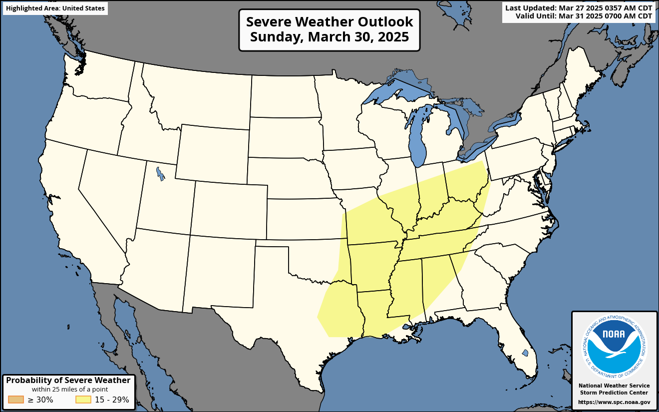
The Storm Prediction Center has outlined a large low-level risk area for Sunday.
If you have outdoor plans on Sunday, then monitor the latest forecasts.
.

Seven-Day Hazardous Weather Outlook
1. Is lightning in the forecast? YES. Scattered lightning is possible today and tonight, mainly over southern Illinois and northwest Kentucky. Lightning is possible on Friday night. Lightning is likely on Saturday and Sunday.
2. Are severe thunderstorms in the forecast? POSSIBLE. I am monitoring Sunday afternoon and Sunday night. Monitor updates.
3. Is flash flooding in the forecast? NOT AT THIS TIME.
4. Will non-thunderstorm winds top 40 mph? NO.
5. Will temperatures drop below 10 degrees? NO.
6. Will the wind chill dip below 0 degrees? NO.
7. Is measurable snow and/or sleet in the forecast? NO.
8. Is freezing rain/ice in the forecast? NO.
.
A quick forecast glance. Your 48-hour forecast Graphics


.

.


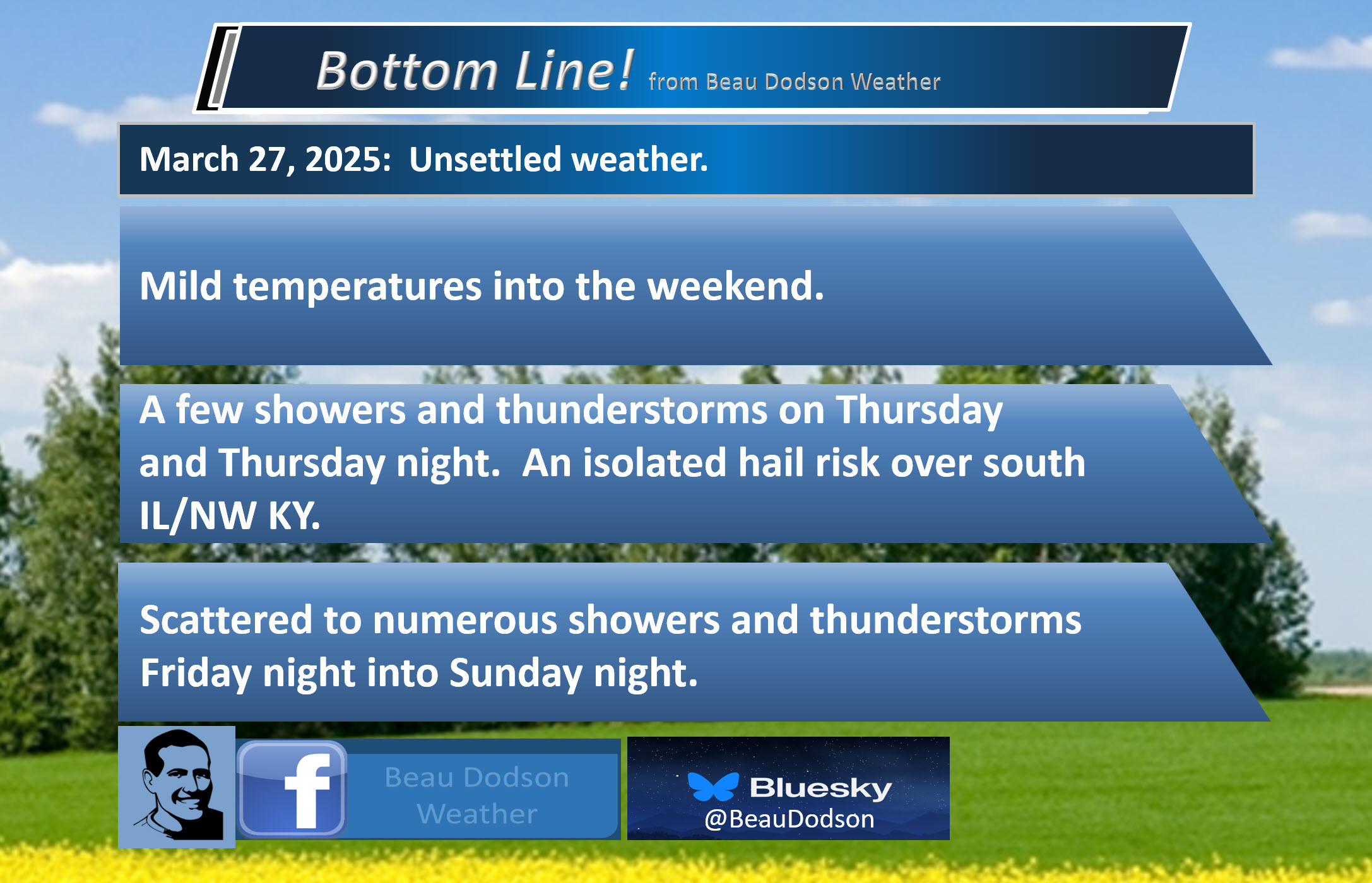
Forecast discussion.
- Mild temperatures through Sunday. Cooler next Monday and Tuesday.
- Scattered showers and storms are likely today and tonight. A couple of those storms could produce nickel-size hail. A small risk of quarter-size hail (mainly in my far northern counties). See the graphics below.
- Friday will be dry. I can’t rule out a stray shower. Windy and warm.
- Additional showers and thunderstorms are likely Friday night into Sunday night. A few remaining showers on Monday. A few storms could be intense on Sunday afternoon and night. I can’t rule out severe weather, but confidence remains low.
.

.
Good morning, everyone. Clouds have been increasing across the region overnight.
Here was the early morning satellite view.
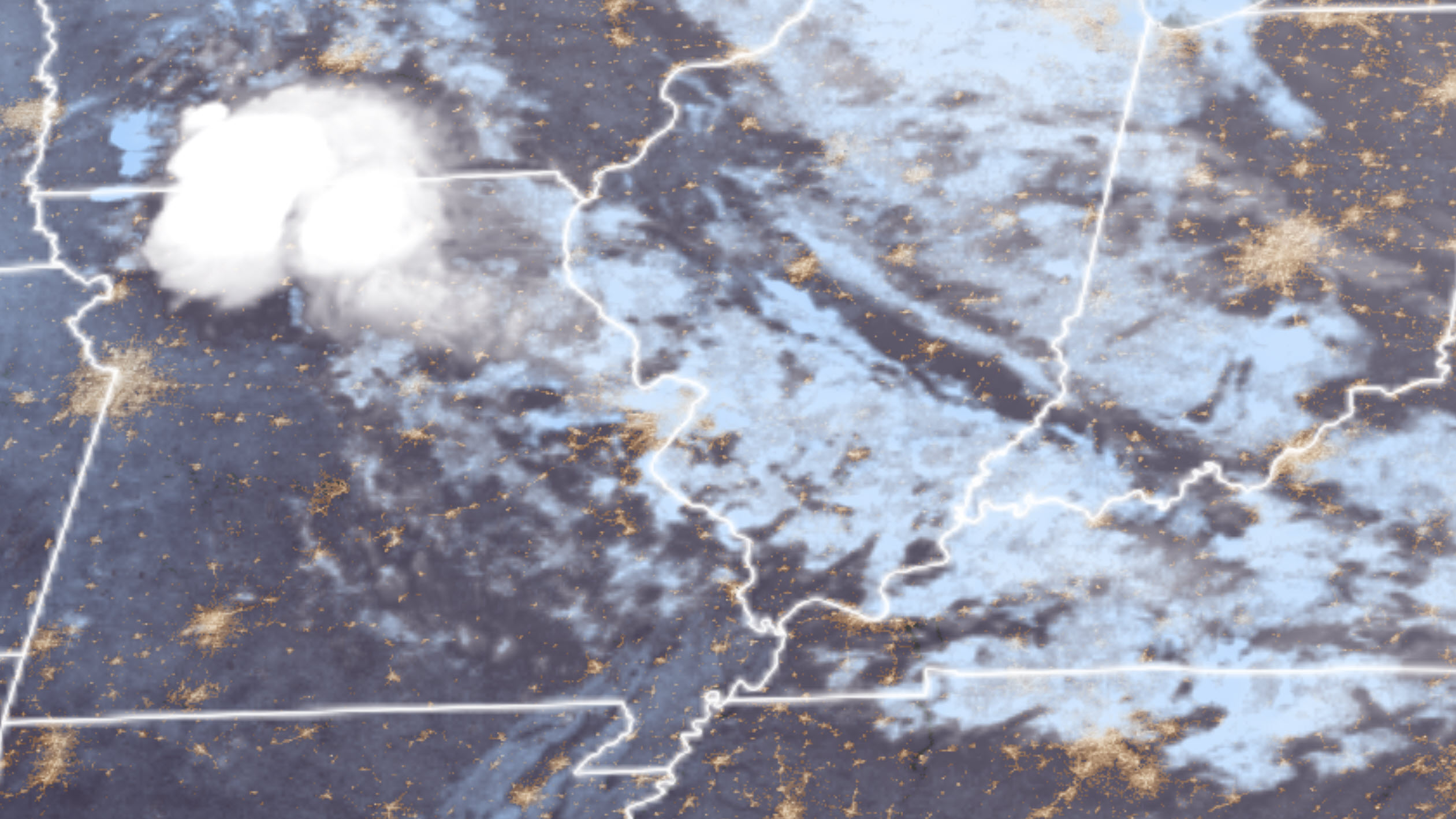
.
A band of showers and thunderstorms extends from northern Missouri into northwest Kentucky. That has developed along a frontal boundary.
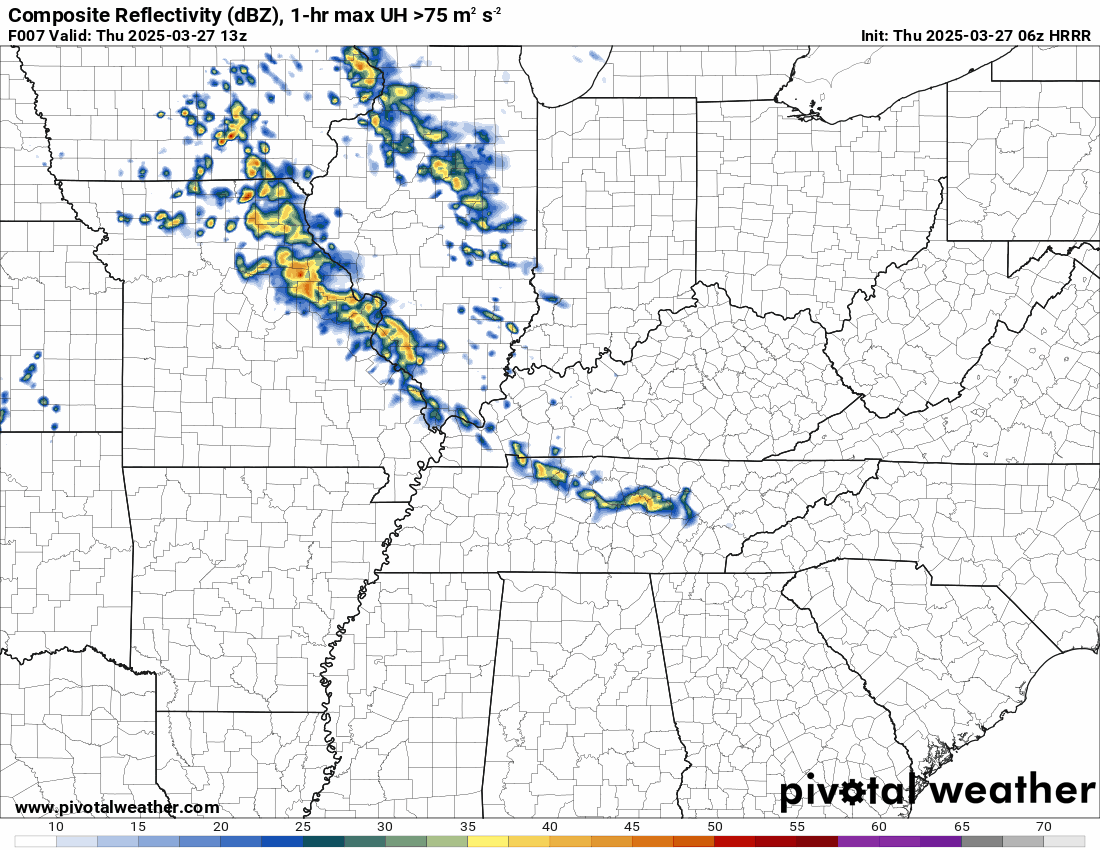
Here is what the 6 am radar showed.
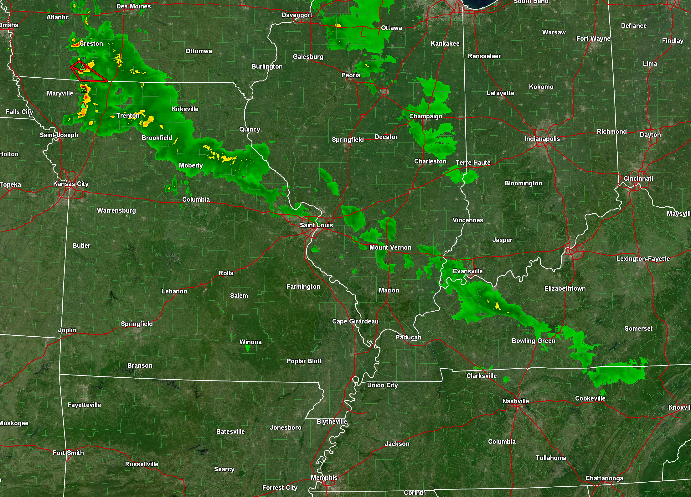
.
This rain is moving southeast. See the local radar links at the top of this blog update.
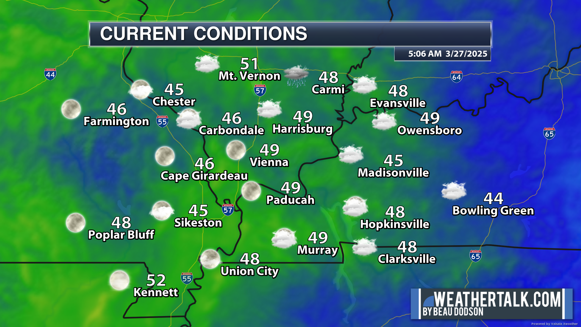
We are waking up to cool temperatures. Nothing extreme.
.
Rain probabilities today will be higher across my northern and northeastern counties.
Today’s rain probabilities.
Higher north northeast. Lower south-southwest.
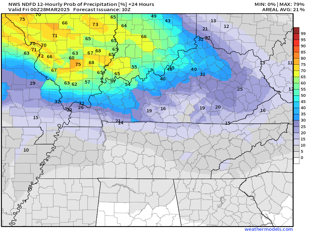
And tonight’s rain chances. Again, they will be higher over southern Illinois and northwest Kentucky.
.
Areas not in the rain today will experience partly sunny sky conditions. Warm temperatures.
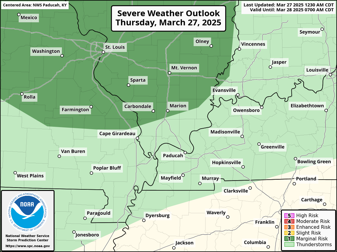
Officially, the Storm Prediction Center has placed portions of our region in a severe weather risk later today and tonight. I have doubts about this. The risk will likely be higher north of St Louis vs south.
I can’t 100% rule out a few storms producing dime to nickel-size hail in the dark green zone (across southeast Missouri and southern Illinois). Overall, however, the risk of actual severe weather is small.
I will keep an eye on it. There is not a wind or tornado threat today or tonight.
.
WEEKEND UNSETTLED WEATHER
Numerous showers and thunderstorms are anticipated with a series of weather systems this weekend.
As mentioned above, questions remain about the threat of severe weather on Sunday afternoon and night.
If you have outdoor plans on Saturday and Sunday, you will want to monitor the Beau Dodson Weather Radars. I do expect numerous showers and thunderstorms on the radars. It won’t rain all day at any given spot, but there will be rain on the radar all day.
If you have outdoor plans, then have a plan B and hope for the best.
The risk of severe weather may increase on Sunday afternoon and night, but significant questions remain about this.
I know there are a TON of hype posts on Facebook. That always seems to be the case. I would caution you about following those pages. If you have storm anxiety, then stick with meteorologists that don’t hype every event.
There remain significant questions about how strong the CAP will be on Sunday. That could help prevent a bigger outbreak. There also remain questions on the placement and extent of the severe weather threat.
My best advice is to remain updated on the latest forecasts. There could be severe weather on Sunday afternoon and night, but confidence remains low.
Have three or more ways of receiving severe weather information. Review your storm safety plans with your family. Then, monitor updates.
Here is where the Storm Prediction Center has outlined for a severe weather risk on Sunday afternoon and night. A broad area.
This will be fine-tuned as we get closer to the event. I can’t rule out a level three somewhere in the region. Not sure we go above that.
There remain many questions about the severe weather portion of the forecast.
.
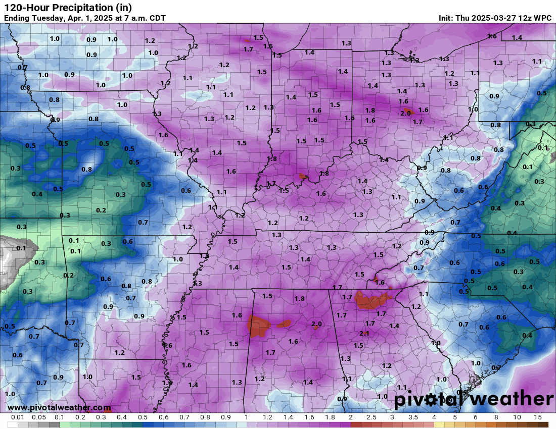
Rainfall totals through Monday. Thunderstorms can enhance rain totals.
.

The timestamp (upper left) is in Zulu. 12z=6 am. 18z=12 pm. 00z=6 pm.
Double-click the animation to enlarge it.
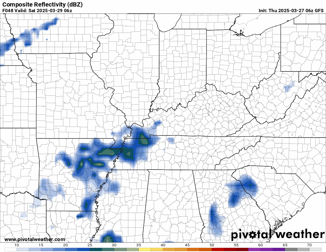
This is the Hrrr model. This shows you today into Friday night.
Double-click the animation to enlarge it.
The timestamp (upper left) is in Zulu. 12z=6 am. 18z=12 pm. 00z=6 pm.
Double-click the animation to enlarge it.

.
Click here if you would like to return to the top of the page.
.Average high temperatures for this time of the year are around 62 degrees.
Average low temperatures for this time of the year are around 40 degrees.
Average precipitation during this time period ranges from 0.90″ to 1.20″
Six to Ten Day Outlook.
Blue is below average. Red is above average. The no color zone represents equal chances.
Average highs for this time of the year are in the lower 60s. Average lows for this time of the year are in the lower 40s.

Green is above average precipitation. Yellow and brown favors below average precipitation. Average precipitation for this time of the year is around one inch per week.

.

Average low temperatures for this time of the year are around 42 degrees.
Average precipitation during this time period ranges from 0.90″ to 1.20″
.
Eight to Fourteen Day Outlook.
Blue is below average. Red is above average. The no color zone represents equal chances.

Green is above average precipitation. Yellow and brown favors below average precipitation. Average precipitation for this time of the year is around one inch per week.

.
.
.
We have a new service to complement your www.weathertalk.com subscription. This does NOT replace www.weathertalk.com It is simply another tool for you to receive severe weather information.
.


.
Radars and Lightning Data
Interactive-city-view radars. Clickable watches and warnings.
https://wtalk.co/B3XHASFZ
Old legacy radar site (some of you like it better)
https://weatherobservatory.com/weather-radar.htm
If the radar is not updating then try another one. If a radar does not appear to be refreshing then hit Ctrl F5. You may also try restarting your browser.
Backup radar site in case the above one is not working.
https://weathertalk.com/morani
Regional Radar
https://imagery.weathertalk.com/prx/RadarLoop.mp4
** NEW ** Zoom radar with chaser tracking abilities!
ZoomRadar
If the radar is not working, then email me: Email me at beaudodson@usawx.com
.
We do have some sponsors! Check them out.
Roof damage from recent storms? Link – Click here
INTEGRITY ROOFING AND EXTERIORS!
⛈️ Roof or gutter damage from recent storms? Today’s weather is sponsored by Integrity Roofing. Check out their website at this link https://www.ourintegritymatters.com/

![]()
![]()
![]()
Make sure you have three to five ways of receiving your severe weather information.
Weather Talk is one of those ways! Now, I have another product for you and your family.

.
Want to add more products to your Beau Dodson Weather App?
Receive daily videos, weather blog updates on normal weather days and severe weather and winter storm days, your county by county weather forecast, and more!
Here is how to do add those additional products to your app notification settings!
Here is a video on how to update your Beau Dodson Weather payment.
The app is for subscribers. Subscribe at www.weathertalk.com/welcome then go to your app store and search for WeatherTalk
Subscribers, PLEASE USE THE APP. ATT and Verizon are not reliable during severe weather. They are delaying text messages.
The app is under WeatherTalk in the app store.

Apple users click here

Android users click here
.
Radars and Lightning Data
Interactive-city-view radars. Clickable watches and warnings.
https://wtalk.co/B3XHASFZ
Old legacy radar site (some of you like it better)
https://weatherobservatory.com/weather-radar.htm
If the radar is not updating then try another one. If a radar does not appear to be refreshing then hit Ctrl F5. You may also try restarting your browser.
Backup radar site in case the above one is not working.
https://weathertalk.com/morani
Regional Radar
https://imagery.weathertalk.com/prx/RadarLoop.mp4
** NEW ** Zoom radar with chaser tracking abilities!
ZoomRadar
Lightning Data (zoom in and out of your local area)
https://wtalk.co/WJ3SN5UZ
Not working? Email me at beaudodson@usawx.com
National map of weather watches and warnings. Click here.
Storm Prediction Center. Click here.
Weather Prediction Center. Click here.
.

Live lightning data: Click here.
Real time lightning data (another one) https://map.blitzortung.org/#5.02/37.95/-86.99
Our new Zoom radar with storm chases
.
.

Interactive GOES R satellite. Track clouds. Click here.
GOES 16 slider tool. Click here.
College of DuPage satellites. Click here
.

Here are the latest local river stage forecast numbers Click Here.
Here are the latest lake stage forecast numbers for Kentucky Lake and Lake Barkley Click Here.
.
.
Find Beau on Facebook! Click the banner.


 .
.