
.

.
I have some question-and-answer threads over on the Facebook page. Link to those threads CLICK HERE
Or email me at beaudodsonweather@gmail.com
.

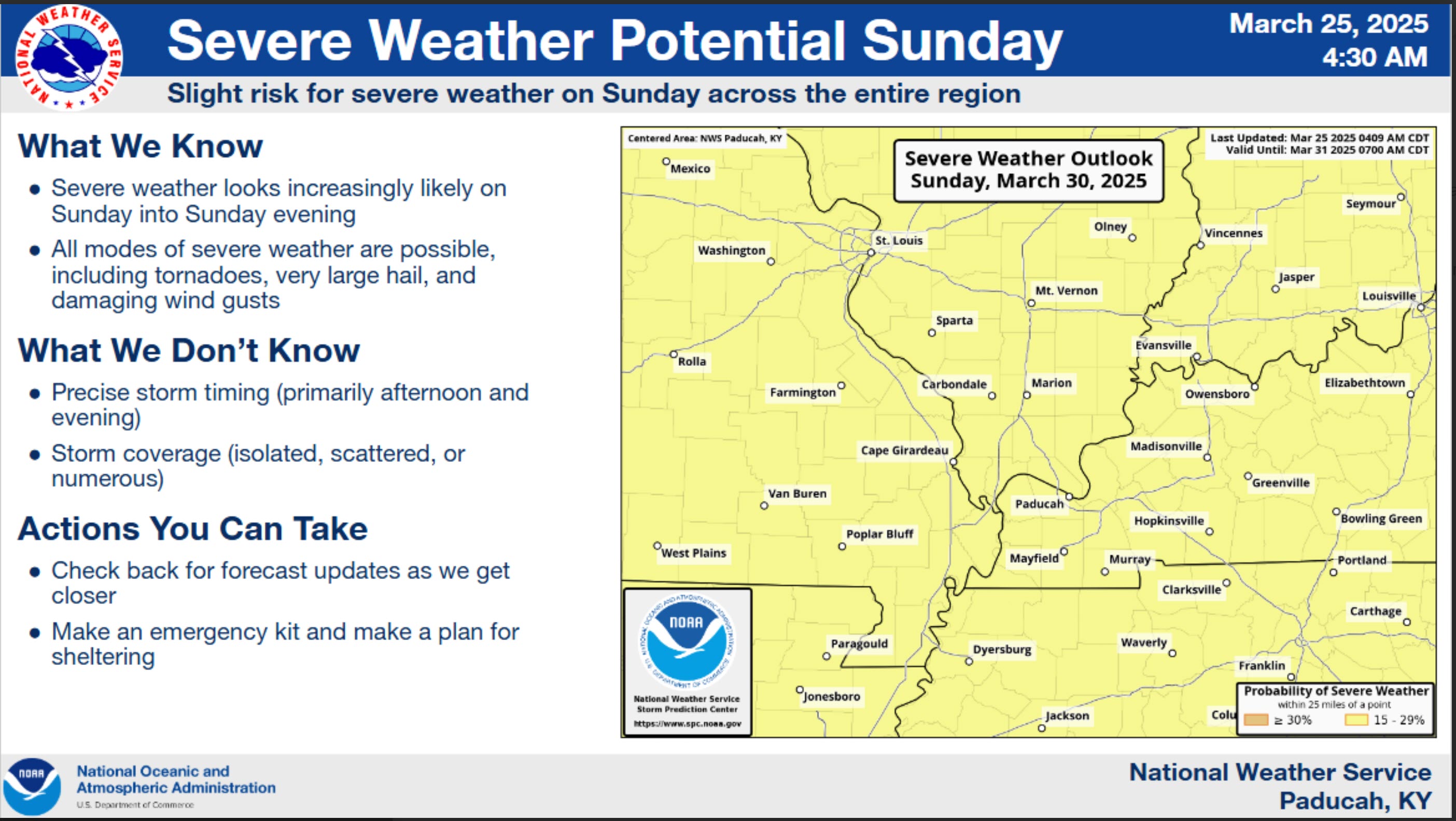
🌪️ Seven-Day Tornado Outlook ⛈️
March 25th through April 1st
Current risk: MONITOR. I am monitoring Saturday night into Sunday night. Perhaps the primary concern will be Sunday/Sunday night. This is still six days out. Thus, confidence is low. Monitor updates.
Current confidence level: LOW.
Comment: A storm system will move into our region this Friday into Sunday. The ingredients for severe weather may come together on Saturday night into Sunday night, with the primary concern being Sunday afternoon and evening.
Monitor updates over the coming days.
The Paducah, Kentucky, NWS posted this.
Again, it is way too soon for certainties. I will begin to ramp up tomorrow and Thursday if everything comes together for a severe weather threat on Sunday.
.

Seven-Day Hazardous Weather Outlook
1. Is lightning in the forecast? YES. Isolated lightning is possible on Thursday afternoon and Thursday night. Lightning is likely Friday afternoon into Sunday night.
2. Are severe thunderstorms in the forecast? POSSIBLE. I am monitoring Saturday night into Sunday night. Perhaps the primary risk will be on Sunday afternoon and Sunday night. This is still six days away. Monitor updates.
The Storm Prediction Center has already outlined our region for a risk of severe storms on Sunday.
This is still in the long range. I expect these outlooks to be adjusted with each passing day. Monitor updates.
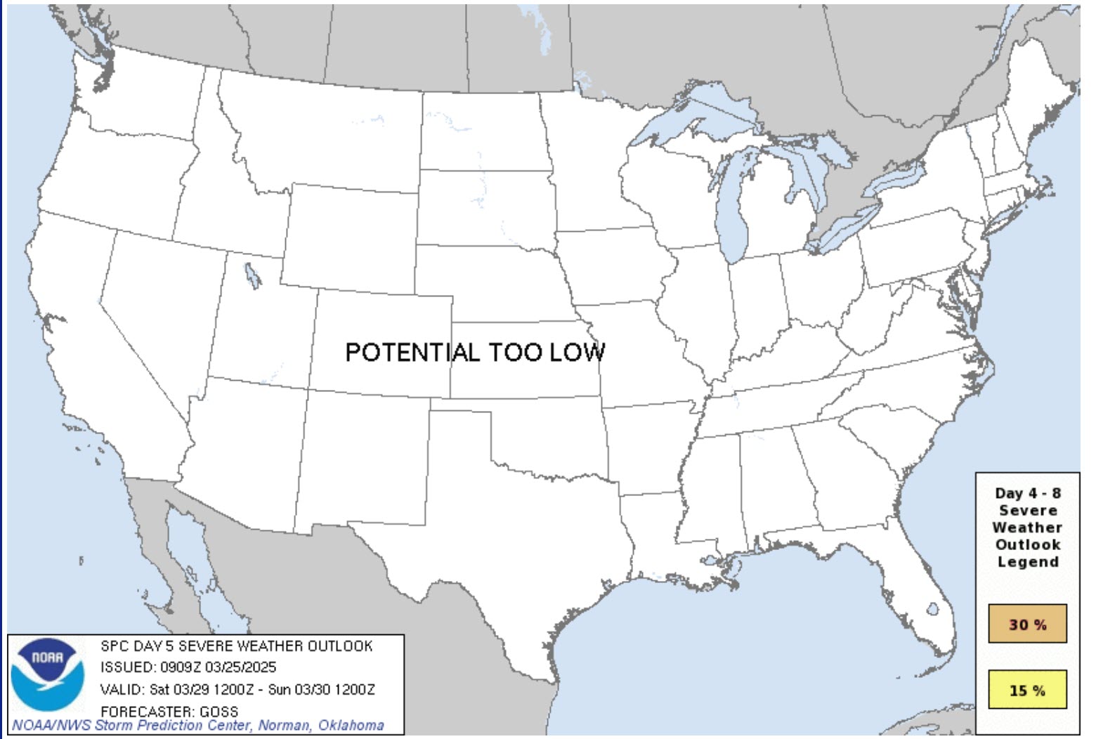
Saturday’s severe weather outlook.
The SPC has removed the risk. I would not be surprised to see a low-level risk over portions of the Missouri Valley on Saturday. Monitor updates.
.
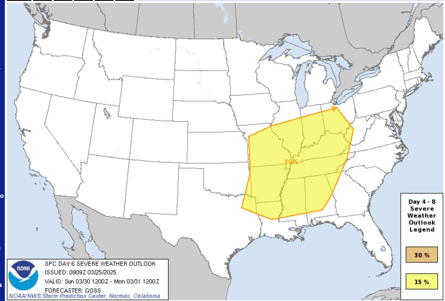
Sunday’s severe weather outlook
The size of their severe weather outlook has nothing to do with the system’s intensity.
.
3. Is flash flooding in the forecast? NOT AT THIS TIME.
4. Will non-thunderstorm winds top 40 mph? NO.
5. Will temperatures drop below 10 degrees? NO.
6. Will the wind chill dip below 0 degrees? NO.
7. Is measurable snow and/or sleet in the forecast? NO.
8. Is freezing rain/ice in the forecast? NO.
.
A quick forecast glance. Your 48-hour forecast Graphics


.

.


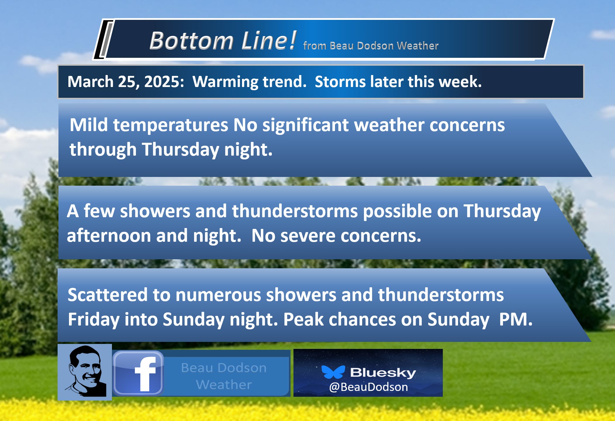
Forecast discussion.
- Mostly sunny today. Mild temperatures today through Sunday. A bit cooler by Monday.
- A few showers and storms are possible on Thursday and Thursday night. No severe concerns.
- Avoid burning brush and fields over the coming days. We remain in an enhanced field fire risk.
- Additional showers and thunderstorms are likely this coming weekend. Some storms could be intense. Monitor updated forecasts if you have outdoor plans.
.

.
Good morning, everyone. No significant weather concerns today or tomorrow.
A few passing clouds at times. A slight chance of sprinkles where clouds develop.
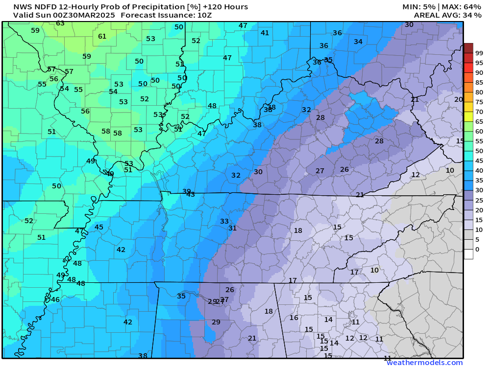
Let’s look at some of those rain probabilities.
Tuesday night
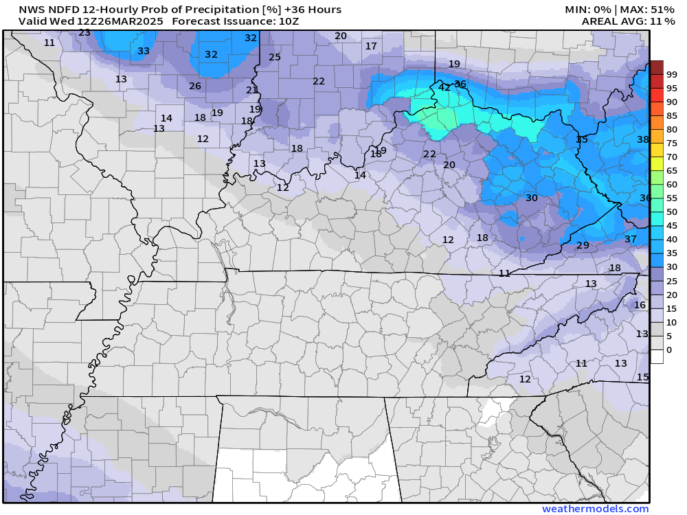
Wednesday
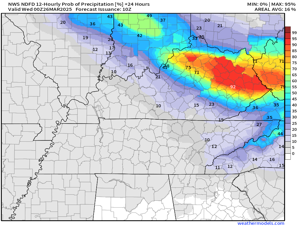
Thursday
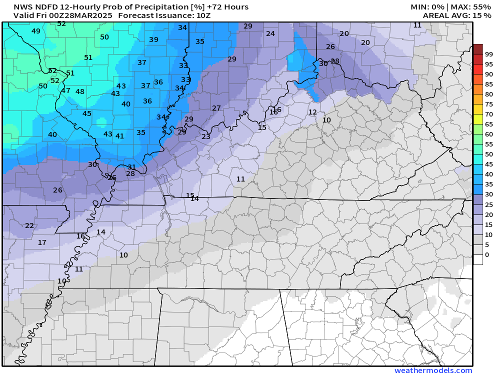
Thursday night
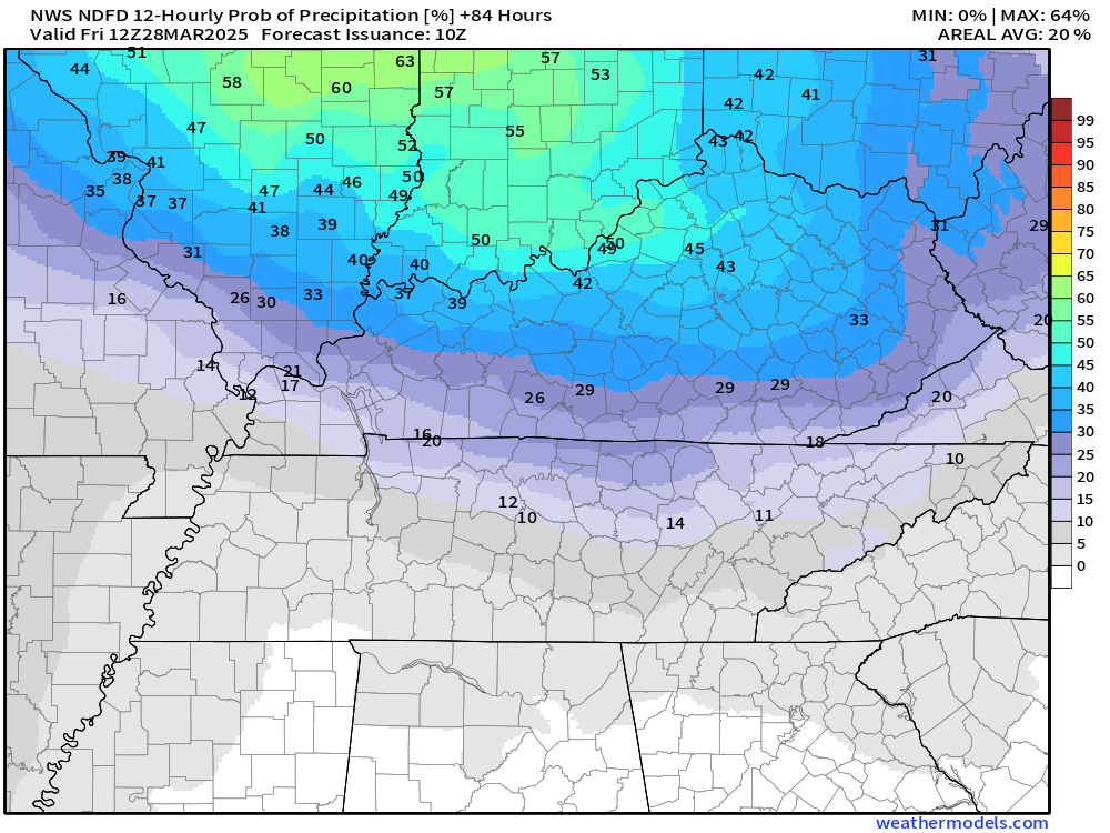
Friday
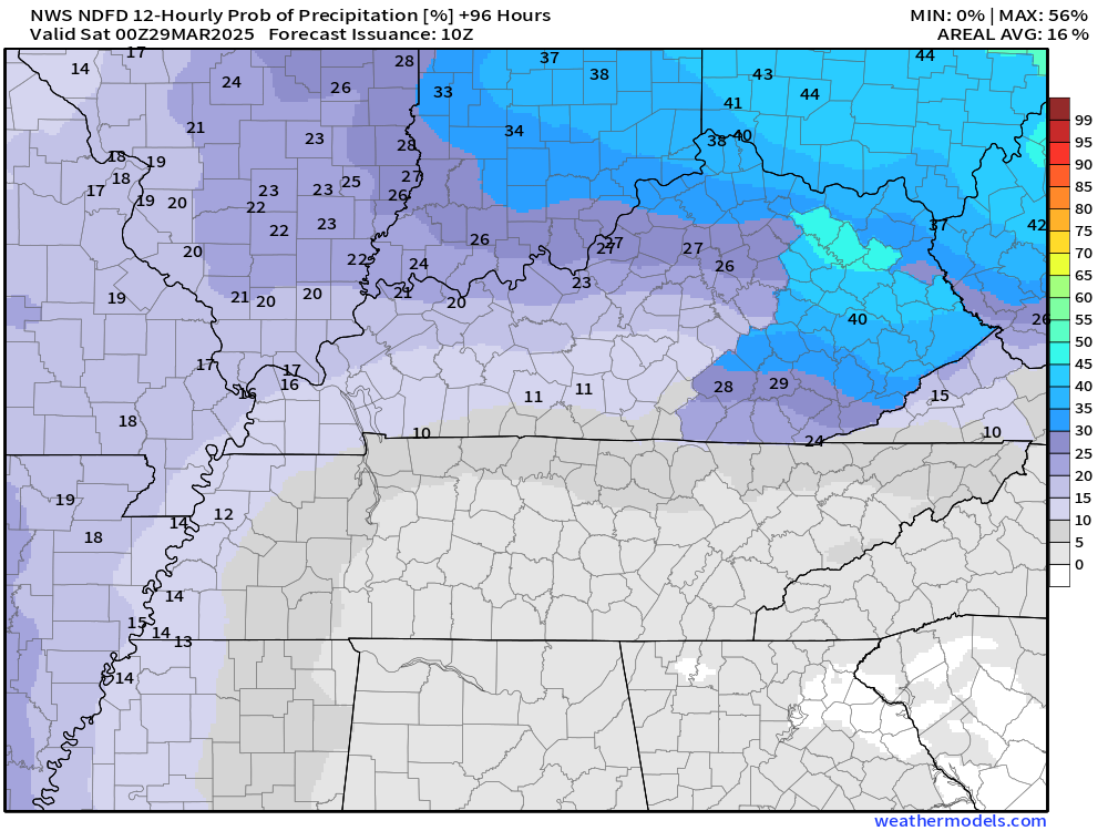
Friday night
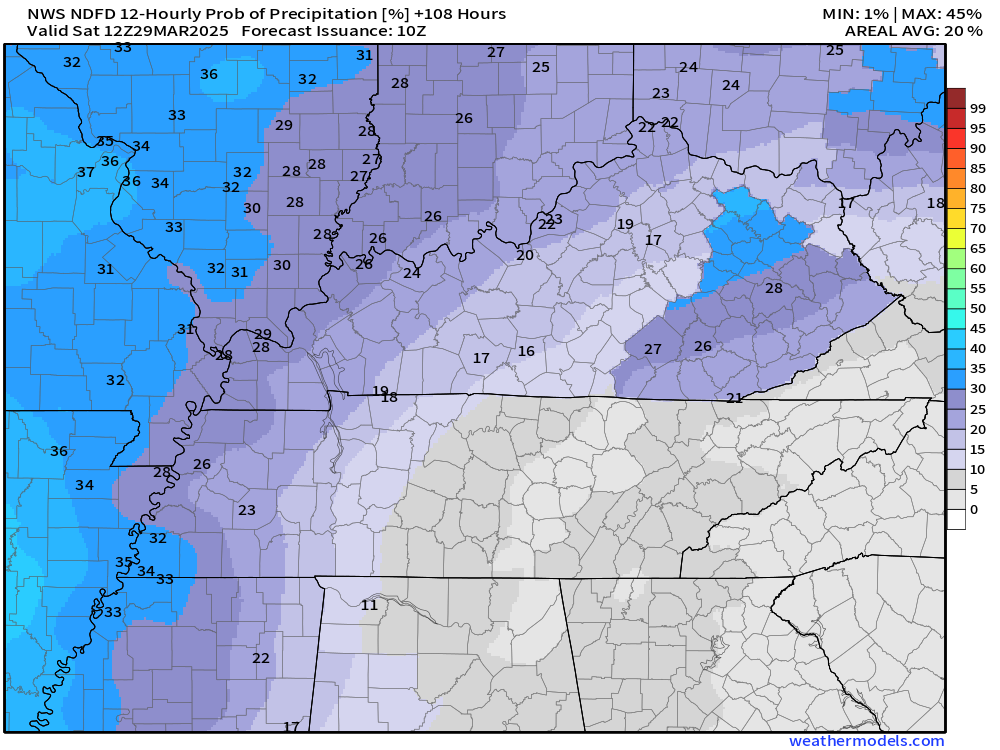
Saturday
.
Shower and thunderstorm chances ramp up on Friday through Sunday night. Perhaps a few remaining showers on Monday.
Numerous showers and thunderstorms are anticipated with a series of weather systems this weekend. I can’t rule out severe weather. It’s still a bit early for certainties on that subject.
Monitor updates over the coming days.
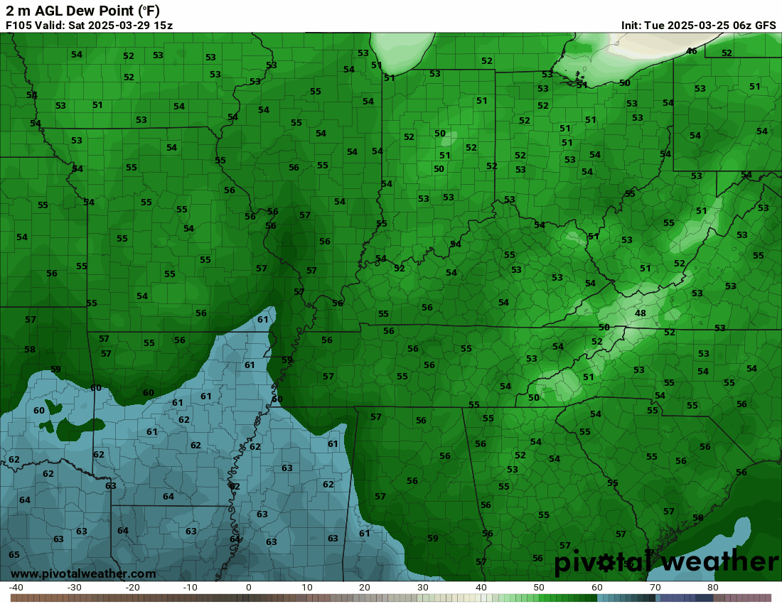
I will be watching dew points. The dew point is a measure of moisture.
Dew points in the sixties would raise severe weather concerns. The GFS does show them rising into the sixties.
.
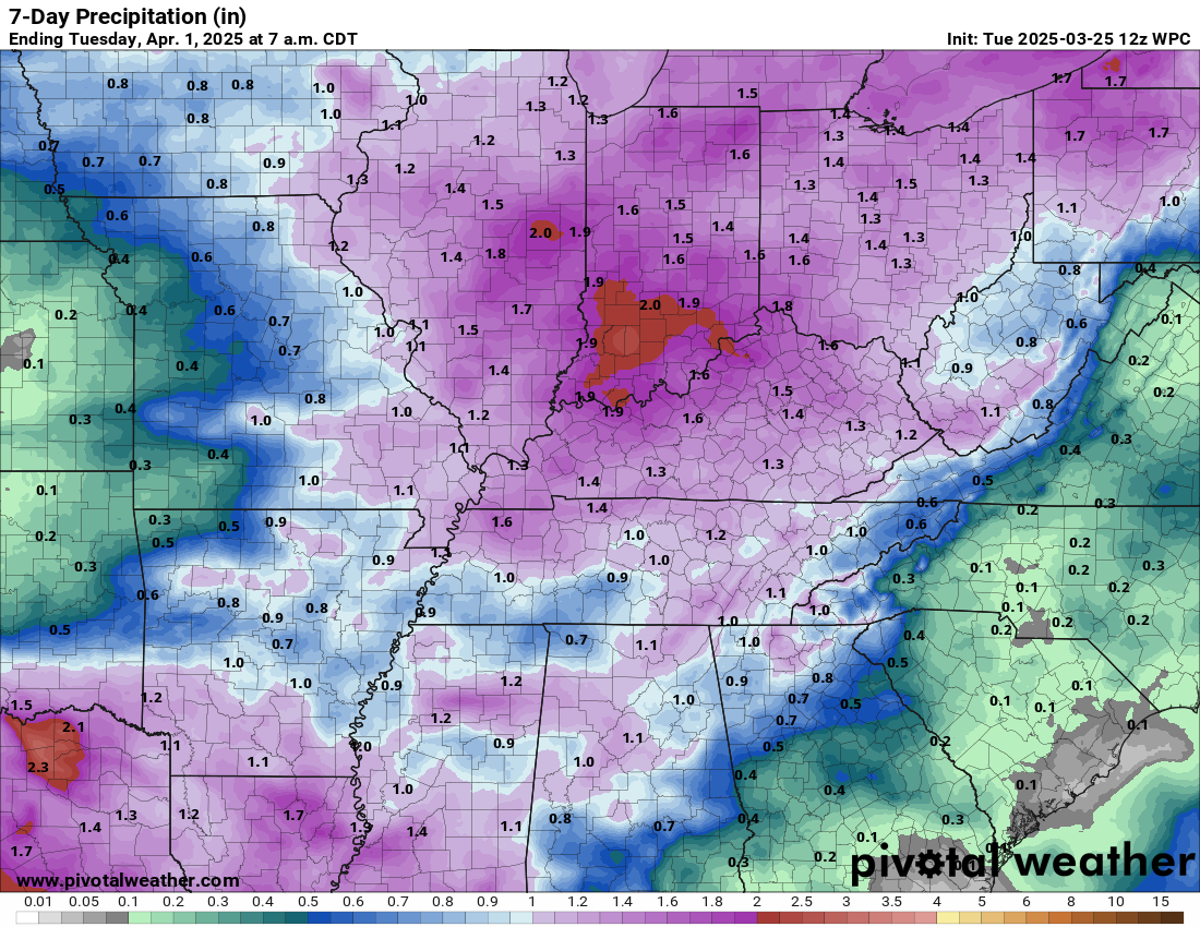
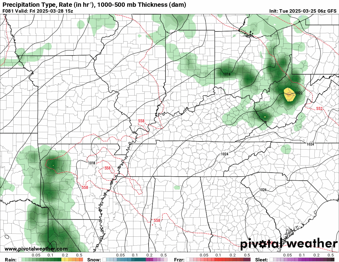
Rainfall totals through next Sunday. Depending on the strength and track of the weekend system, these may still need adjusting.
.

The timestamp (upper left) is in Zulu. 12z=6 am. 18z=12 pm. 00z=6 pm.
Double-click the animation to enlarge it.
This shows you the weekend system from the GFS model.
.
.
.
We have a new service to complement your www.weathertalk.com subscription. This does NOT replace www.weathertalk.com It is simply another tool for you to receive severe weather information.
.
Here is the future-cast radar.
Double-click the animation to enlarge it.
The timestamp (upper left) is in Zulu. 12z=6 am. 18z=12 pm. 00z=6 pm.
\
.
.
.
.

Radars and Lightning Data
Interactive-city-view radars. Clickable watches and warnings.
https://wtalk.co/B3XHASFZ
Old legacy radar site (some of you like it better)
https://weatherobservatory.com/weather-radar.htm
If the radar is not updating then try another one. If a radar does not appear to be refreshing then hit Ctrl F5. You may also try restarting your browser.
Backup radar site in case the above one is not working.
https://weathertalk.com/morani
Regional Radar
https://imagery.weathertalk.com/prx/RadarLoop.mp4
** NEW ** Zoom radar with chaser tracking abilities!
ZoomRadar
If the radar is not working, then email me: Email me at beaudodson@usawx.com
.
We do have some sponsors! Check them out.
Connected and Protected.
They Specialize in Audio, Video, Networking, Security, Cameras, Electrical, New Construction, Remodels, and retrofitting Jobs. Experience the future of smart living and unmatched security with Connected & Protected Solutions today.
Link – Click here

.
Roof damage from recent storms? Link – Click here
INTEGRITY ROOFING AND EXTERIORS!
⛈️ Roof or gutter damage from recent storms? Today’s weather is sponsored by Integrity Roofing. Check out their website at this link https://www.ourintegritymatters.com/

![]()
![]()

.
Click here if you would like to return to the top of the page.
.Average high temperatures for this time of the year are around 60 degrees.
Average low temperatures for this time of the year are around 38 degrees.
Average precipitation during this time period ranges from 0.90″ to 1.20″
Six to Ten Day Outlook.
Blue is below average. Red is above average. The no color zone represents equal chances.
Average highs for this time of the year are in the lower 60s. Average lows for this time of the year are in the lower 40s.

Green is above average precipitation. Yellow and brown favors below average precipitation. Average precipitation for this time of the year is around one inch per week.

.

Average low temperatures for this time of the year are around 39 degrees.
Average precipitation during this time period ranges from 0.90″ to 1.20″
.
Eight to Fourteen Day Outlook.
Blue is below average. Red is above average. The no color zone represents equal chances.

Green is above average precipitation. Yellow and brown favors below average precipitation. Average precipitation for this time of the year is around one inch per week.

.
![]()
Make sure you have three to five ways of receiving your severe weather information.
Weather Talk is one of those ways! Now, I have another product for you and your family.

.
.
https://weathercallservices.com/beau-dodson-weather


Want to add more products to your Beau Dodson Weather App?
Receive daily videos, weather blog updates on normal weather days and severe weather and winter storm days, your county by county weather forecast, and more!
Here is how to do add those additional products to your app notification settings!
Here is a video on how to update your Beau Dodson Weather payment.
The app is for subscribers. Subscribe at www.weathertalk.com/welcome then go to your app store and search for WeatherTalk
Subscribers, PLEASE USE THE APP. ATT and Verizon are not reliable during severe weather. They are delaying text messages.
The app is under WeatherTalk in the app store.

Apple users click here

Android users click here
.
Radars and Lightning Data
Interactive-city-view radars. Clickable watches and warnings.
https://wtalk.co/B3XHASFZ
Old legacy radar site (some of you like it better)
https://weatherobservatory.com/weather-radar.htm
If the radar is not updating then try another one. If a radar does not appear to be refreshing then hit Ctrl F5. You may also try restarting your browser.
Backup radar site in case the above one is not working.
https://weathertalk.com/morani
Regional Radar
https://imagery.weathertalk.com/prx/RadarLoop.mp4
** NEW ** Zoom radar with chaser tracking abilities!
ZoomRadar
Lightning Data (zoom in and out of your local area)
https://wtalk.co/WJ3SN5UZ
Not working? Email me at beaudodson@usawx.com
National map of weather watches and warnings. Click here.
Storm Prediction Center. Click here.
Weather Prediction Center. Click here.
.

Live lightning data: Click here.
Real time lightning data (another one) https://map.blitzortung.org/#5.02/37.95/-86.99
Our new Zoom radar with storm chases
.
.

Interactive GOES R satellite. Track clouds. Click here.
GOES 16 slider tool. Click here.
College of DuPage satellites. Click here
.

Here are the latest local river stage forecast numbers Click Here.
Here are the latest lake stage forecast numbers for Kentucky Lake and Lake Barkley Click Here.
.
.
Find Beau on Facebook! Click the banner.


 .
.