The latest update will be posted here at the top of Beau’s severe weather blog. I may delete old posts if it helps speed up the page.
Click on the words below to subscribe
.
March 25, 2021
7:25 PM
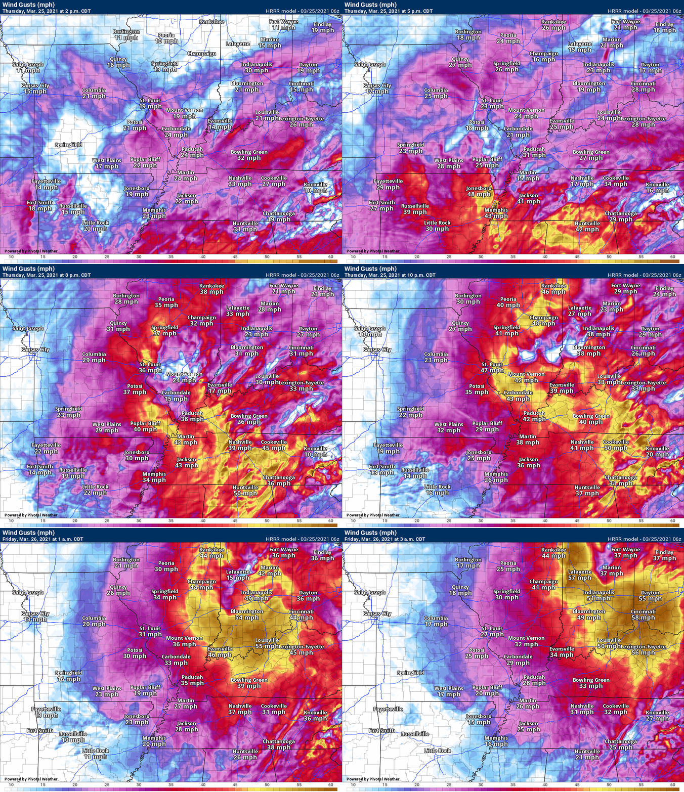
This is a reminder, that gradient winds tonight could top 45 mph. These are considered non-thunderstorm winds. They are because of a deepening area of low pressure. A tight pressure gradient.
The winds will pick up overnight as the low deepens and moves into Indiana.
I just wanted to remind everyone that there could still be some strong winds tonight. Even though the storms will push off to the east.
.
7:15 PM
Henry County, Tennessee.
Calloway, Marshall, Livingston, Lyon, Crittenden, and Union Counties in western Kentucky.
The severe weather threat has ended in the counties above.
I am watching Saturday afternoon and evening for some intense thunderstorms along a cold front.
.
7 PM
Henderson, Webster, Caldwell, Christian, Todd, Hopkins, Muhlenberg, McLean, and Daviess
A line of storms is moving through western KY. See the radars.
Some of the storms are intense.
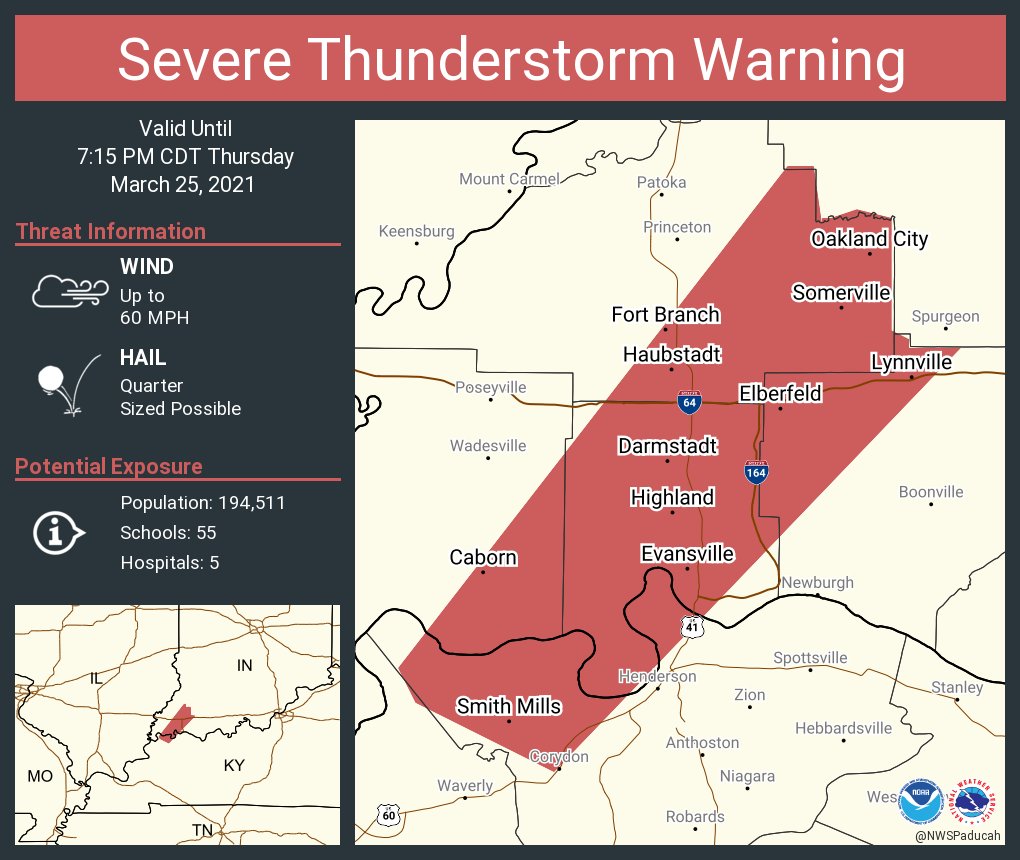
I can’t rule out a storm pulsing up to severe levels. The main concern would be quarter size hail and 60 mph wind gusts.
There is a tornado watch. The risk of a tornado is low, but not zero.
Once this line passes, the threat of severe weather will end.
I am watching Saturday afternoon and night for some intense storms.
.
6:50 PM
All of southern Illinois. Ballard, McCracken, Carlisle, Hickman, Fulton, and Graves Counties in western Kentucky. Lake, Obion, and Weakley Counties in northwest Tennessee.
The threat of severe weather has ended for tonight.
I am watching Saturday afternoon and evening. A cold front will push in from the west. A few intense storms can’t be ruled out.
.
6:38 PM
.
.
6:35 PM
6:18 PM
Weakley and Henry Counties.
Eastern Graves, Marshall, Calloway, Lyon, Caldwell, and Trigg Counties.
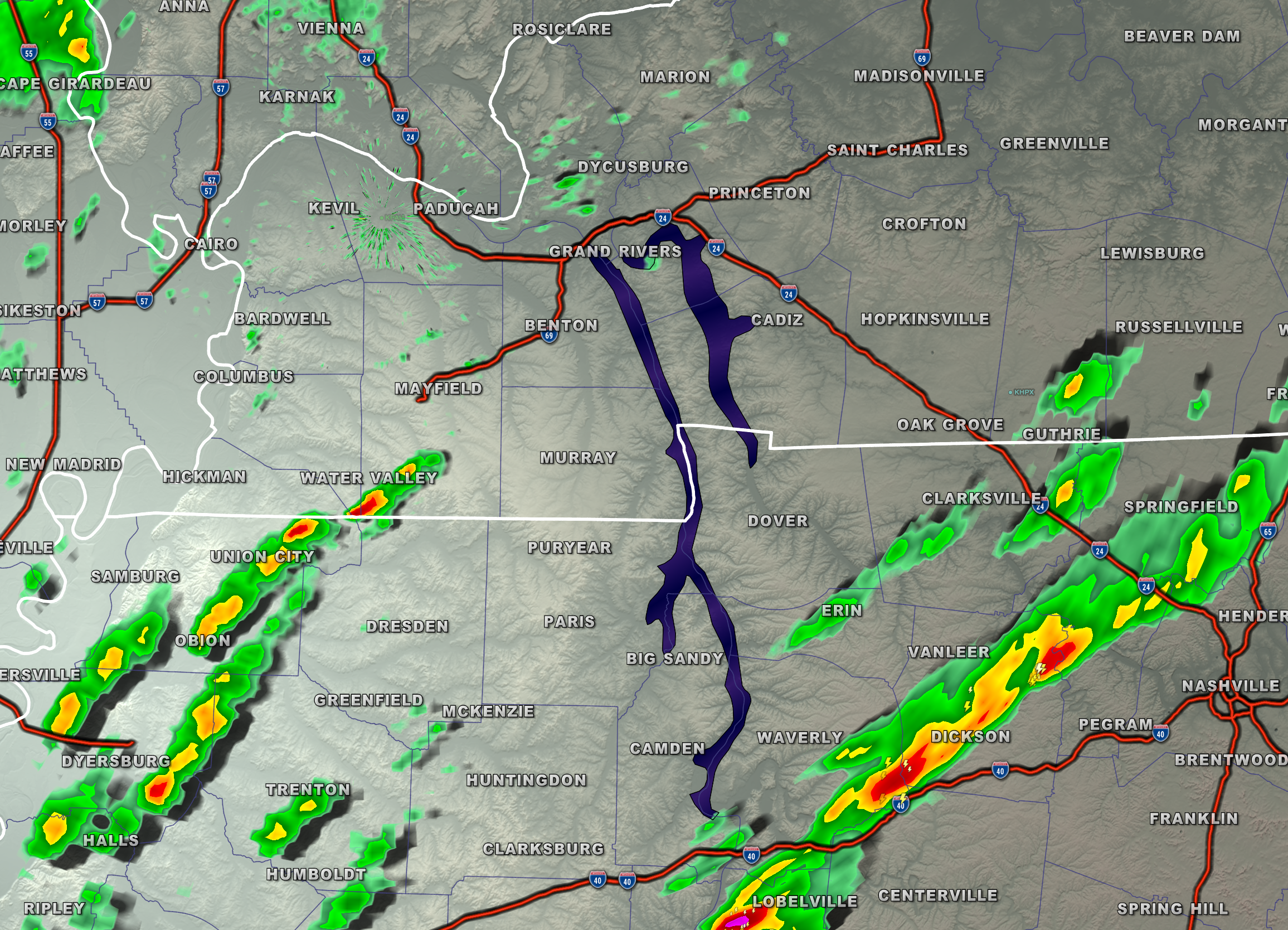
I am tracking a line of thunderstorms that extended from Eddyville, Kentucky, southwest to Dresden, Tennessee.
Some of these storms are producing torrential rain, small hail, lightning, and gusty wind.
Occasionally, radar is showing some rotation with the storms. There are currently on warnings.
I am closely monitoring the storms as they are intensifying. Storms are moving E NE at 45 to 50 mph.
Let’s stay weather aware as these storms develop and move through the area.
.
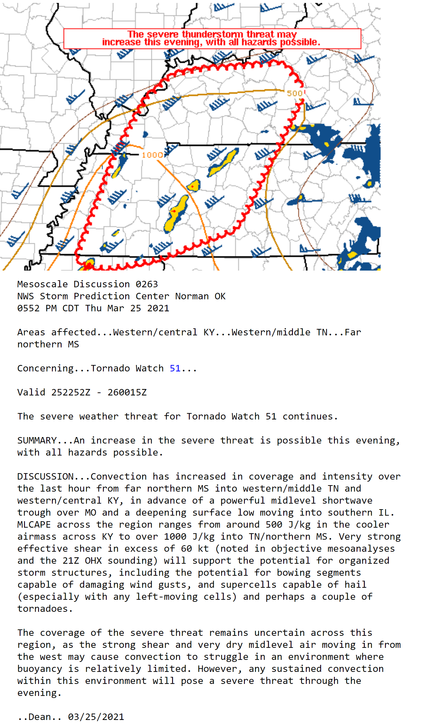
SPC update
.
March 25, 2021
Storms forming in NW TN entering west KY. Atmosphere in west KY is unstable so let’s watch these develop.
.
March 25, 2021
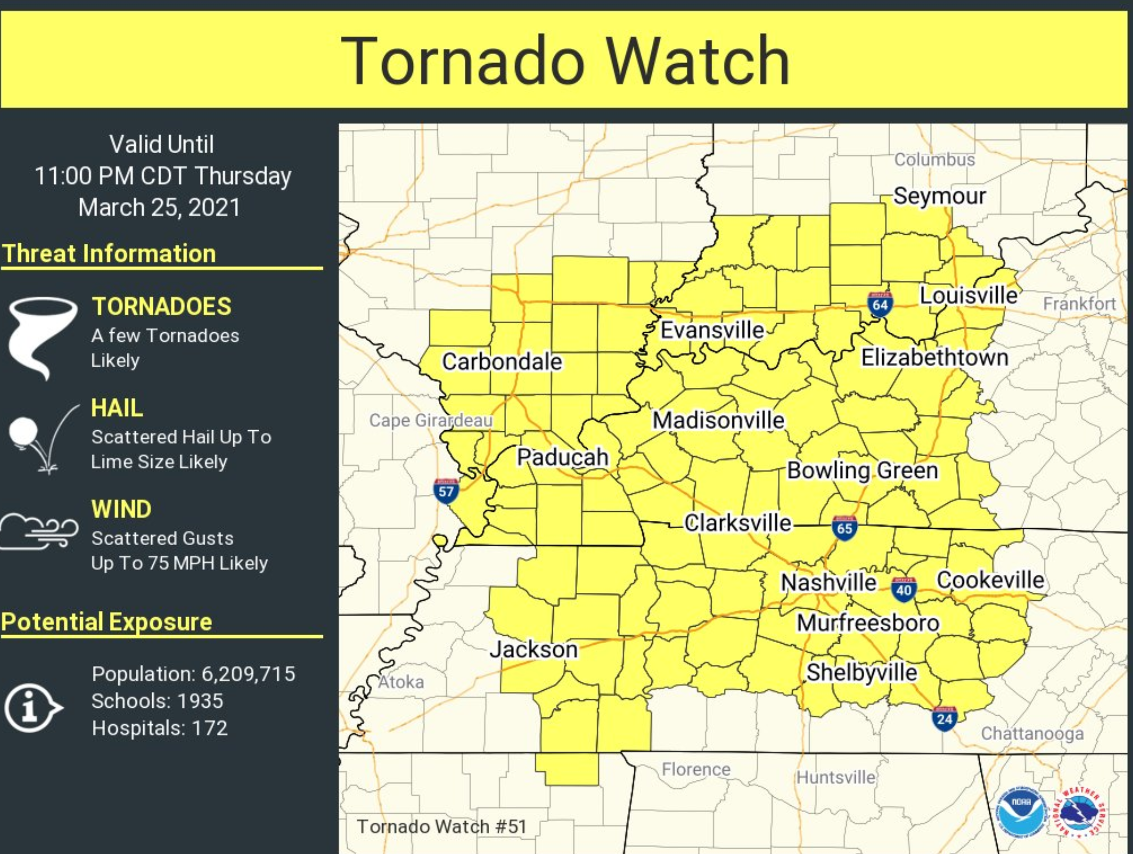
A tornado watch has been issued. A watch means to monitor updates.
A warning means to seek shelter.
.
March 25, 2021
The only question that I have left is the surface low.
It is forecast to rapidly deepen this afternoon, but it has been slow to do so, thus far.
The forecast was for it to begin to deepen from now forward.
I am monitoring that.
I am expected a tornado watch to be issued for portions of the region, shortly. Waiting to see what SPC does.
.
March 25, 2021
I am watching on a tornado watch from the SPC. Everything is set for tornadic supercells and a squall line.
There are some questions on the track and strength of the low, but it appears severe storms are likely late this afternoon into evening.
Zeroing in on 3:30 PM to 8:30 PM
.
March 25, 2021
.
March 25, 2021
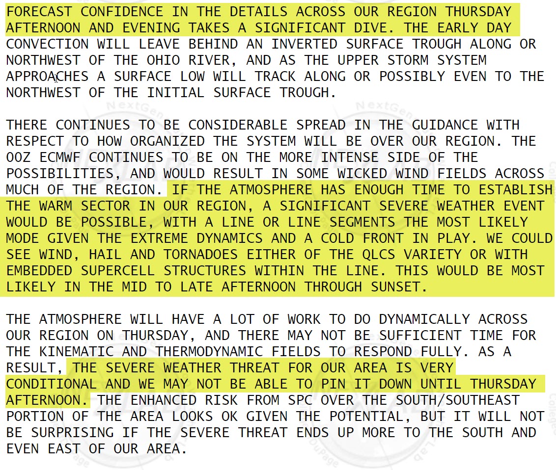
NWS Update. Paducah, Kentucky.
.
.
March 25, 2021
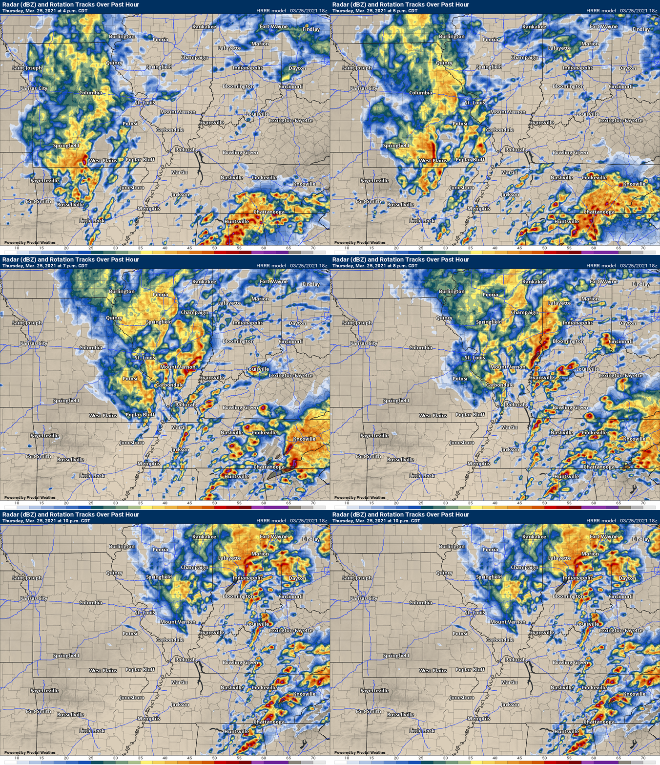
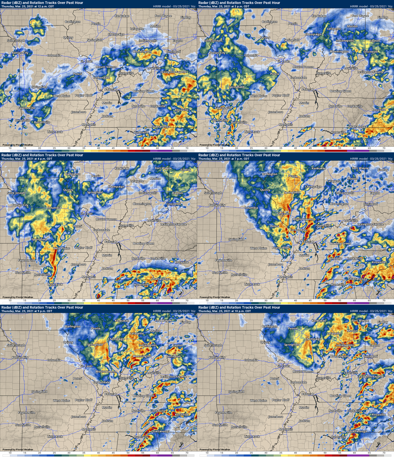
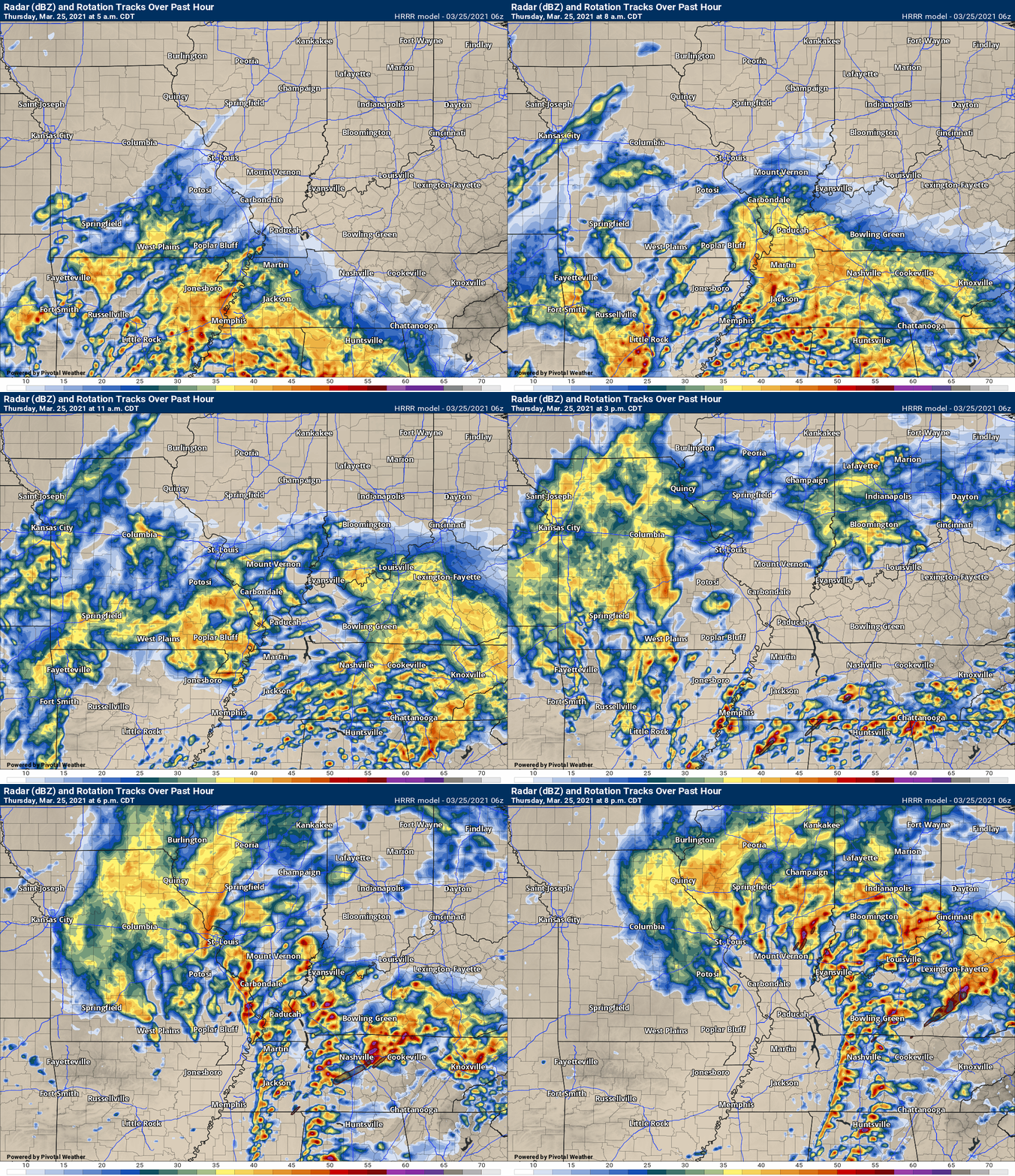
The latest Hrrr model shows a line of storms and a broken line of storms forming later today.
.
March 25, 2021
11:45 AM
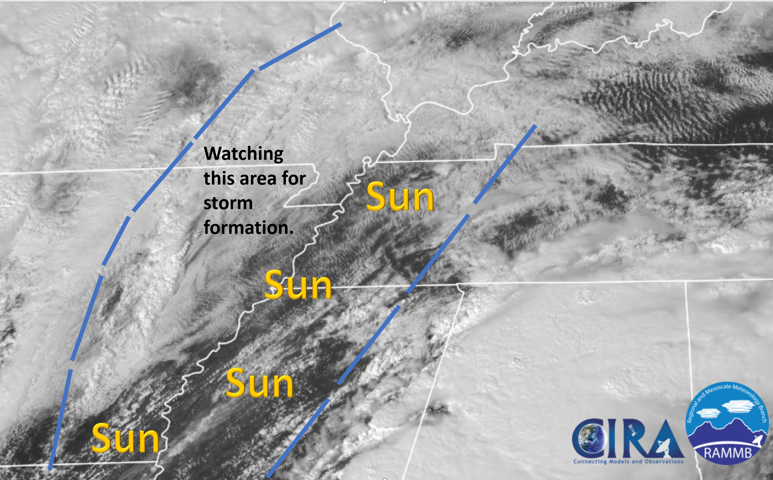
Just monitoring. I am watching the area of low pressure that is forming in Missouri and Arkansas. I am watching a warm front to our south.
The track of the low and warm front is key to severe storms.
We have quite a bit of sun across portions of the region. So, it is heating a bit.
Now, it is up to the low pressure and warm front.
.
March 25, 2021
11AM
No changes.
I am monitoring clouds and rain. The longer they stick around the better off we are.
March 25, 2021
10 AM
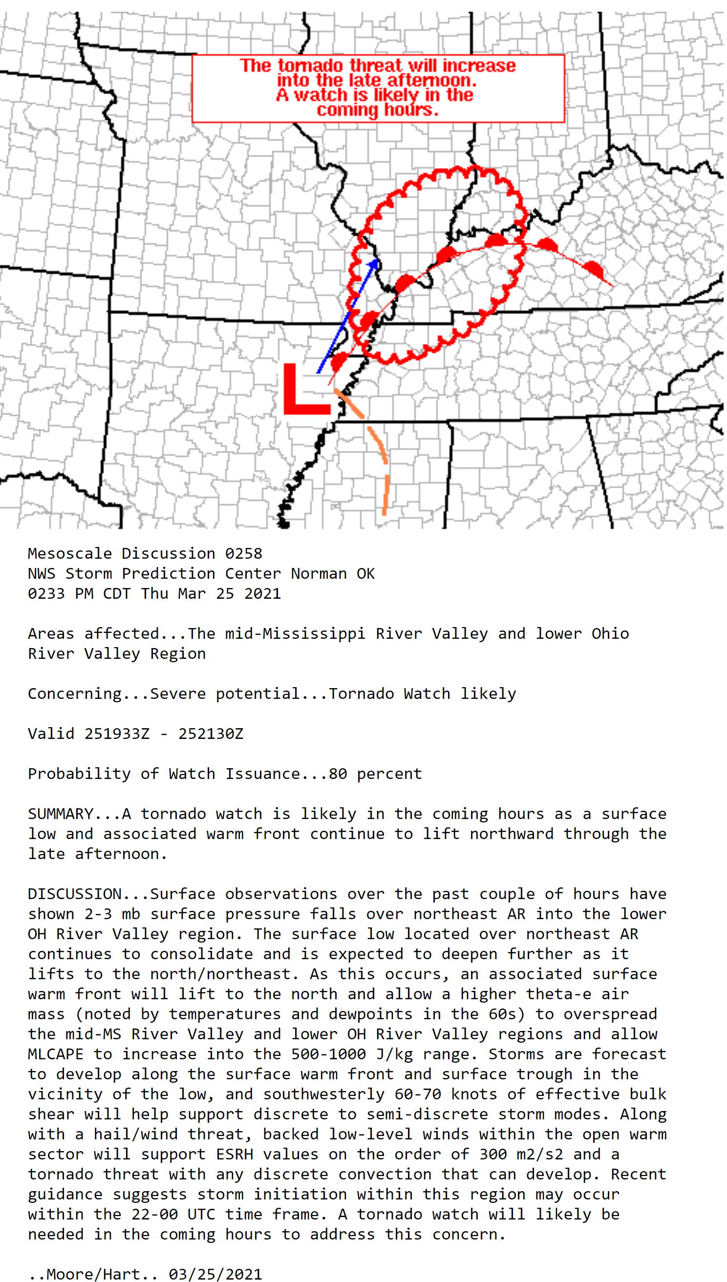
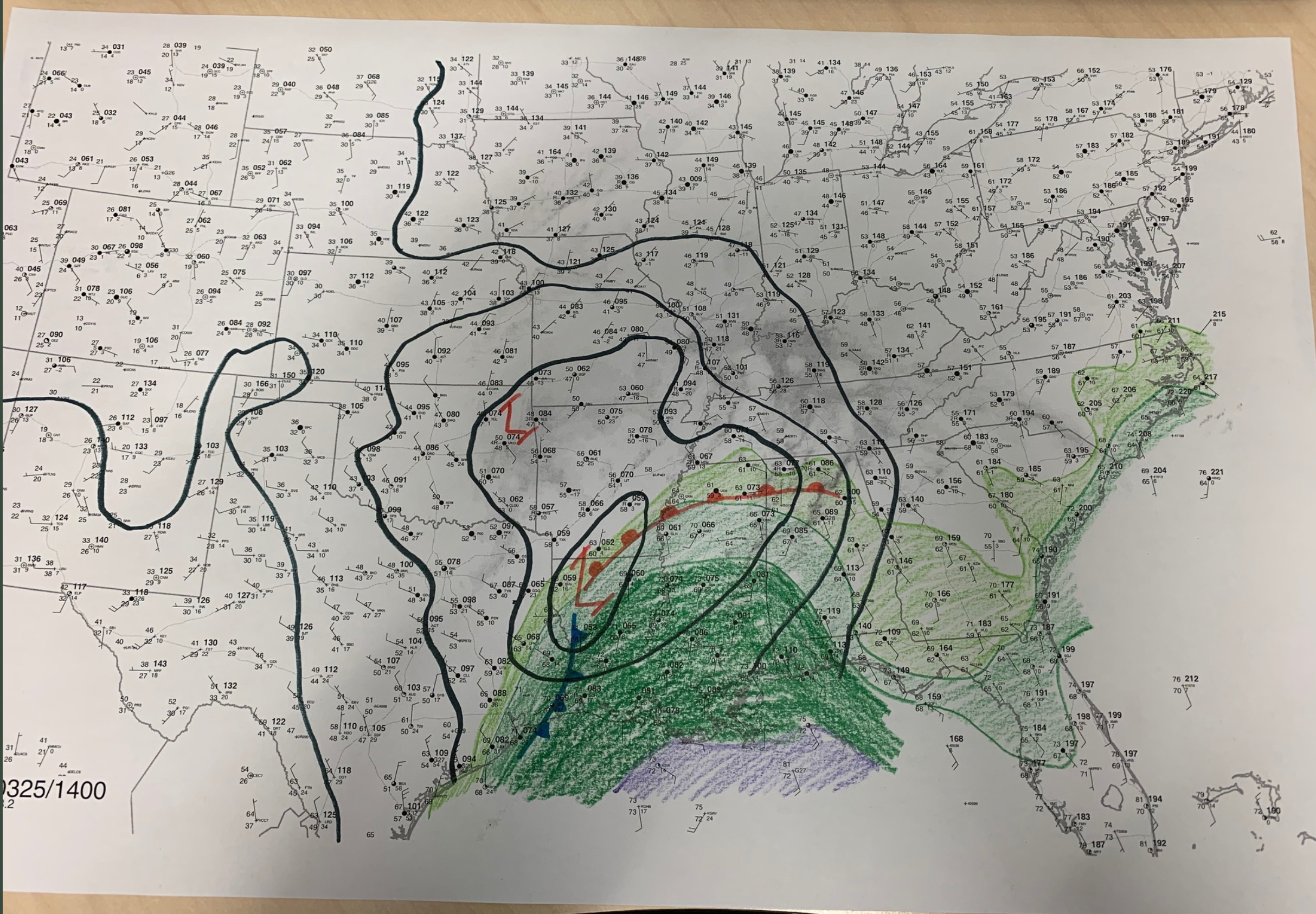
Surface map. Low is forming. It will rapidly deepen over the coming hours and move into southern Illinois.
SPC map. You can see the L. The low.
Watch that warm front to our south. The red lines with half moons. It will move north with higher moisture levels. One ingredient in severe weather.
The SREF model tornado ingredients. You can see the bullseye in northern Mississippi and Tennessee.
.
March 25, 2021
9 AM
Keep your phones charged today.
Have a back-up charger, as well.
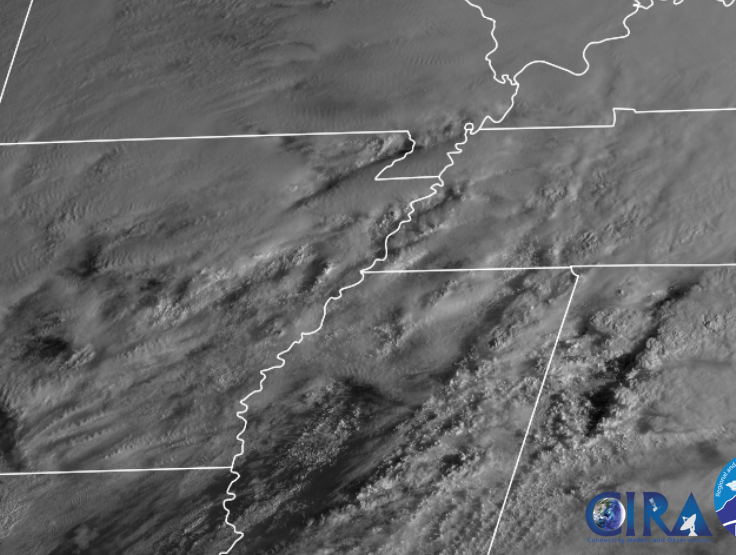
Satellite shows clearing to our south.
This is a concern. Let’s pay attention today.
.
March 25, 2021
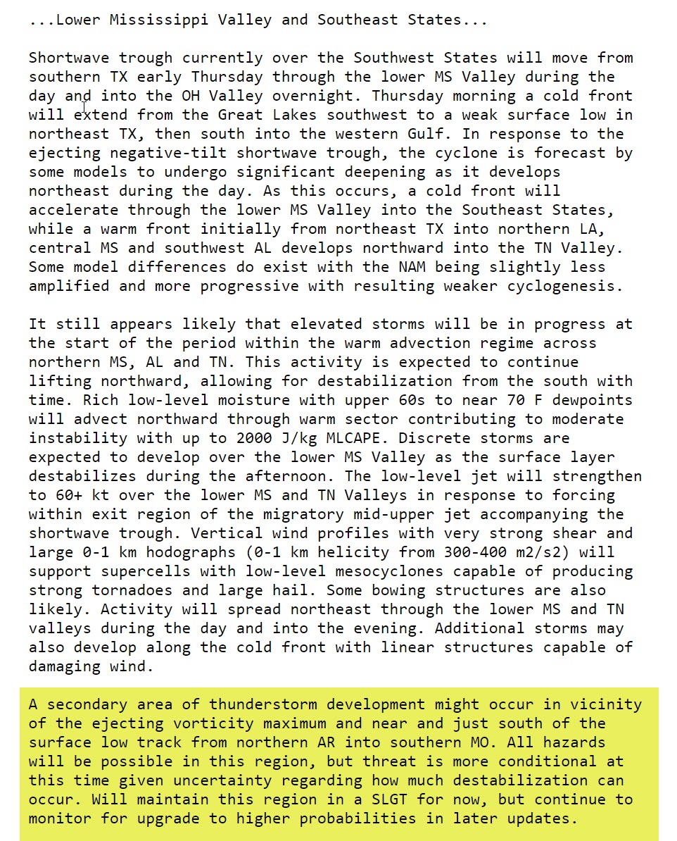
8 AM Update from the Storm Prediction Center.
A strongly worded statement.
.
.
March 25, 2021
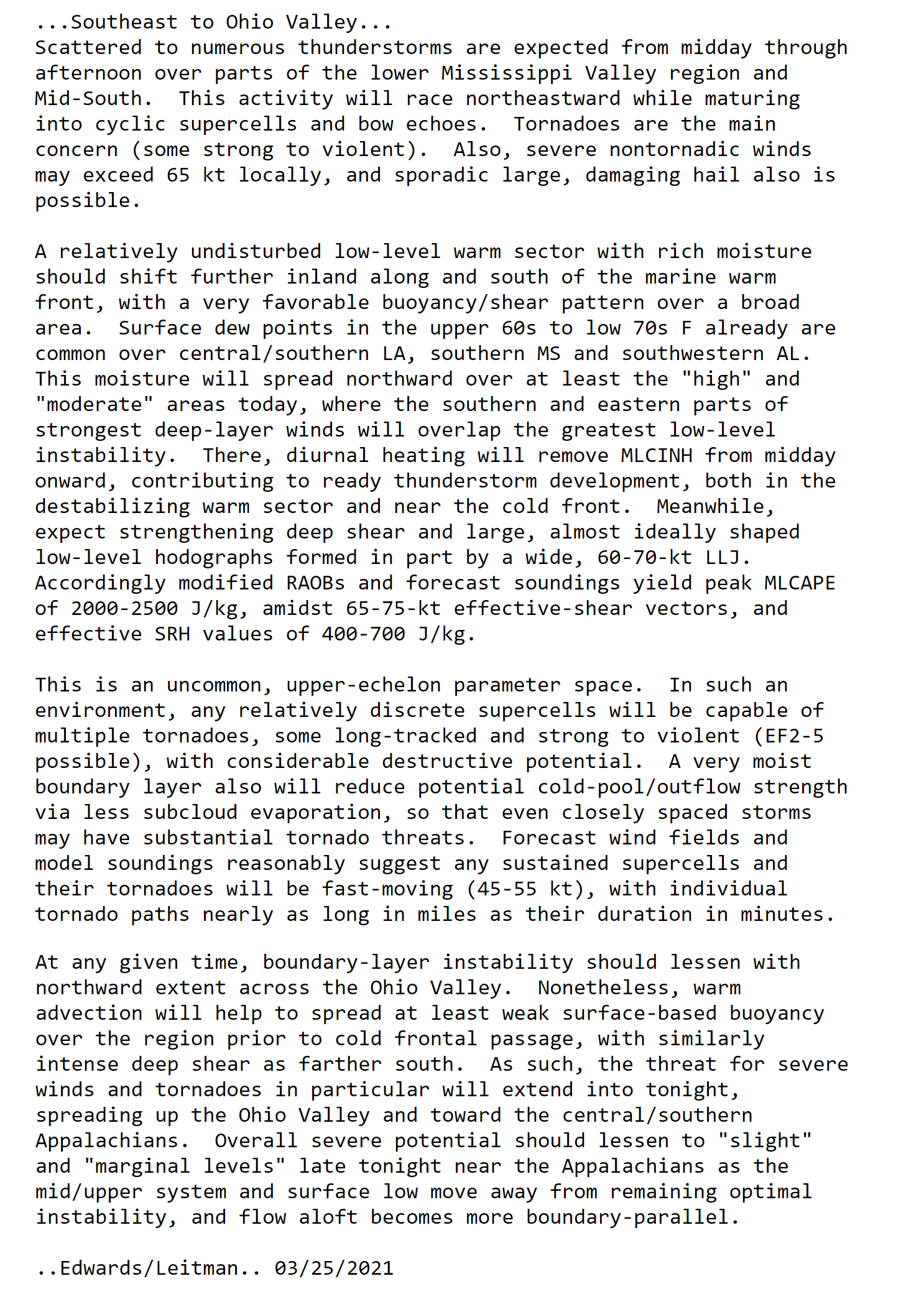
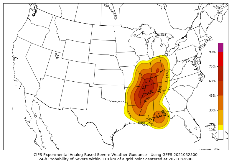
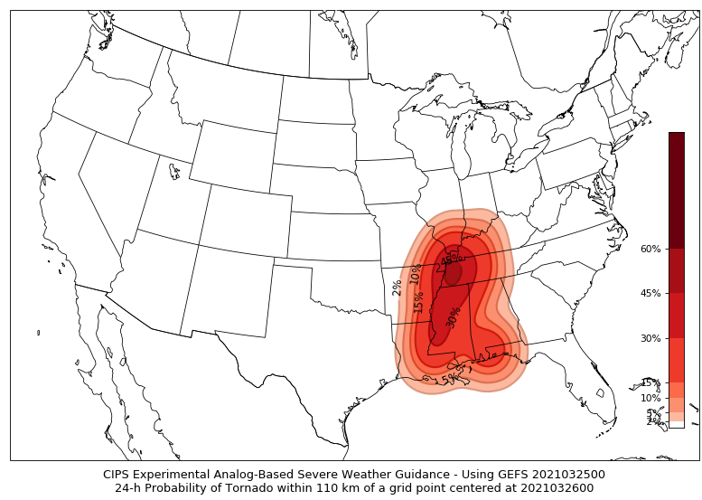
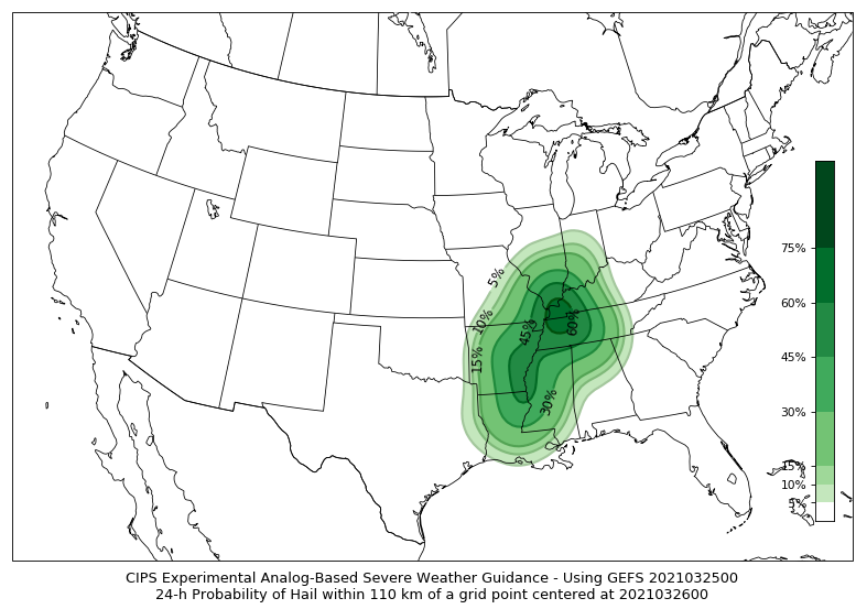
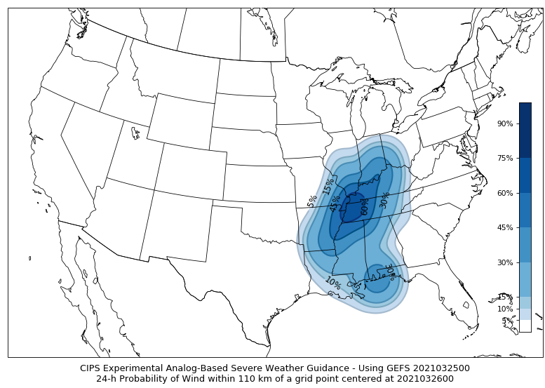
Analogs are showing a high probability of severe storms.
Analogs use back events to compare to the current event. Then, it makes a forecast.
Overall severe
Tornado risk
Large hail
Damaging wind
.
March 25, 2021
SPC Video Update
https://www.spc.noaa.gov/products/outlook/pwo.mp4
.
March 25, 2021
7 AM update
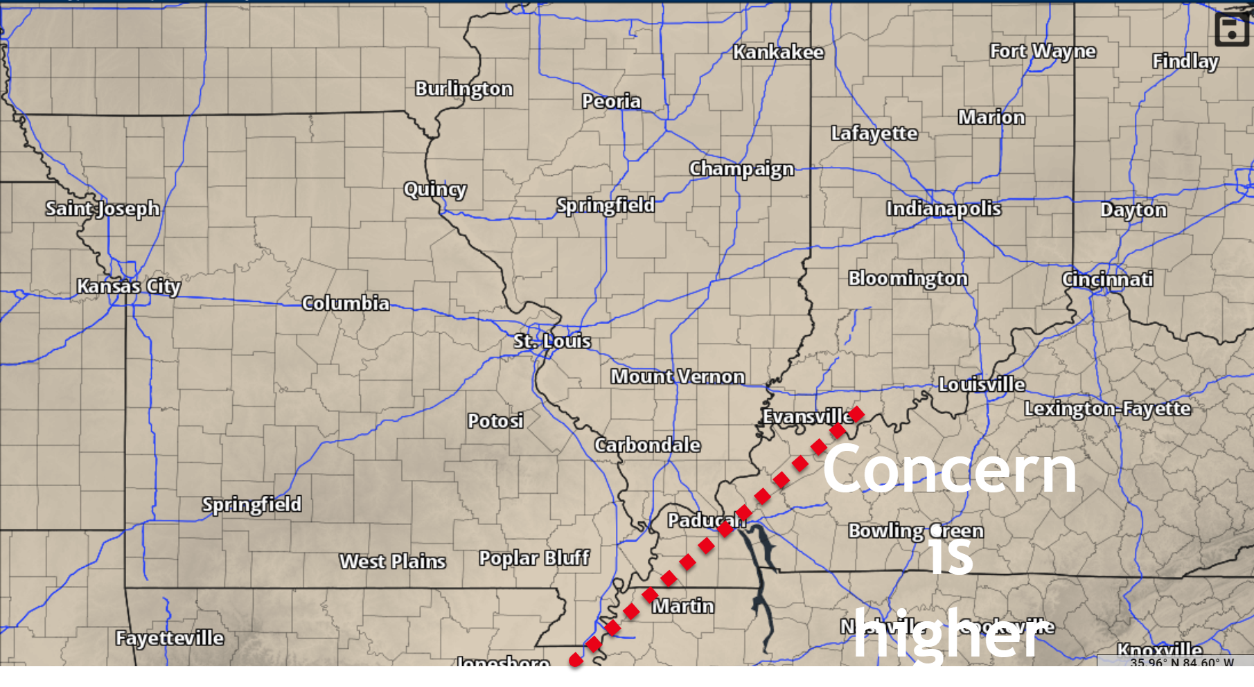
Concerns are higher to the right of this red line. That does not mean areas to the left are out of the woods.
It just means that I am forecasting higher severe probabilities along and east of the line.
.
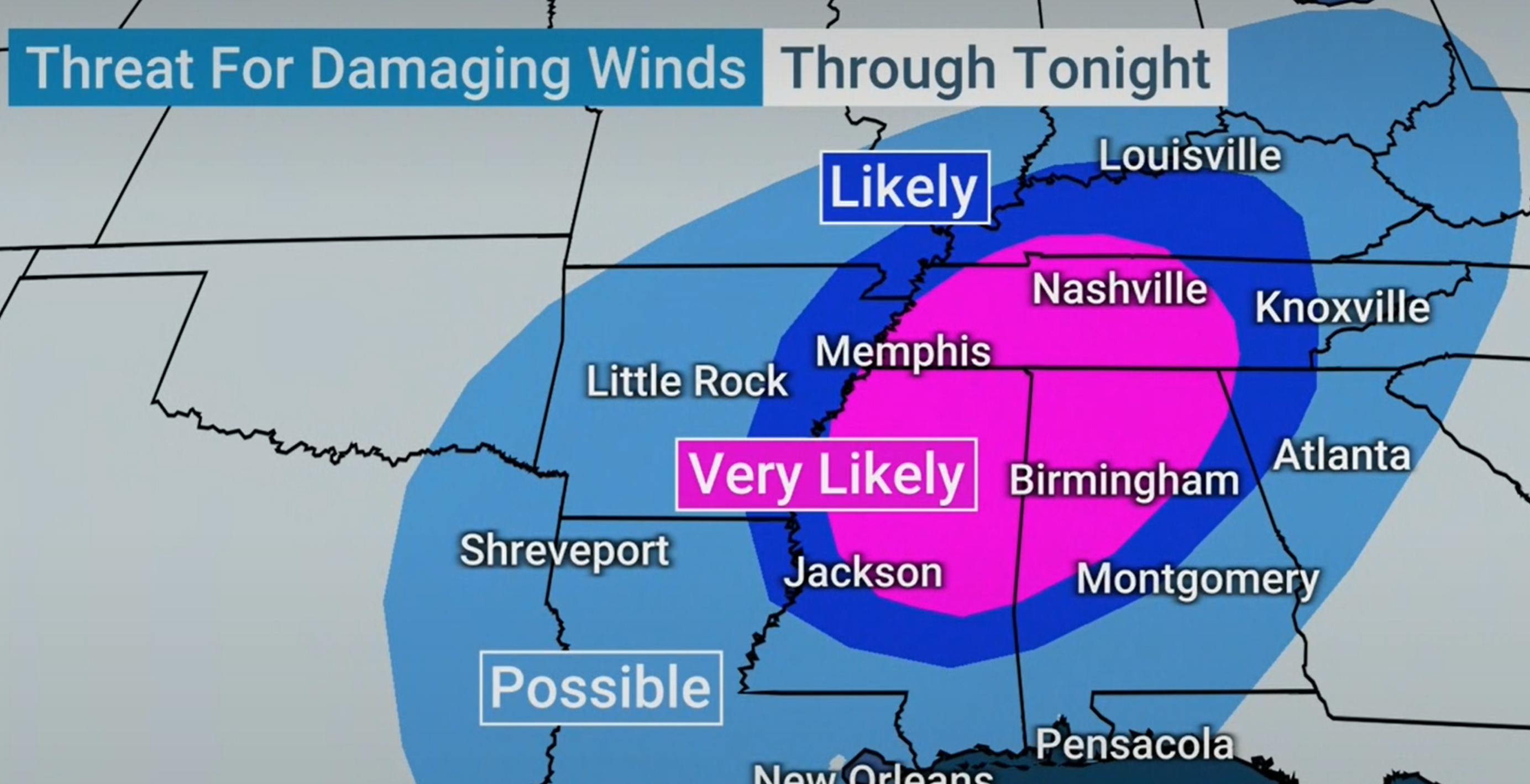
The weather channel posted this forecast.
.
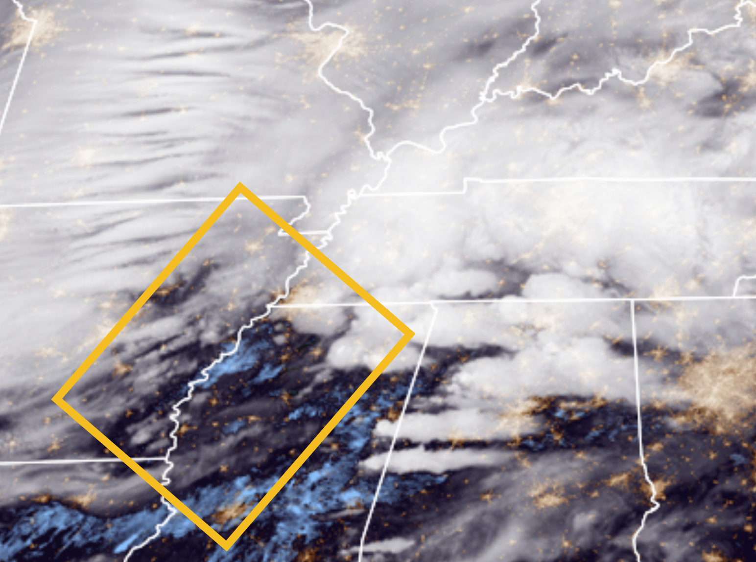
Early morning satellite shows clearing over Arkansas and Mississippi. This is a concern, of course.
We don’t want clearing today. That would make the atmosphere unstable.
March 25, 2021
We will have strong and gusty wind today and tonight. These winds will not be thunderstorm winds. Just plain old windy day. Very windy, at times.
Thunderstorms could produce higher winds.
I am just showing you the gradient wind forecast. Again, your regular winds today/tonight will be strong and gusty.
.
March 25, 2021
5:30 AM update
Typically, severe thunderstorms are found near the area of low pressure and then south and east of it.
The low should track through southern Illinois later today. Your barometers will be falling rapidly.
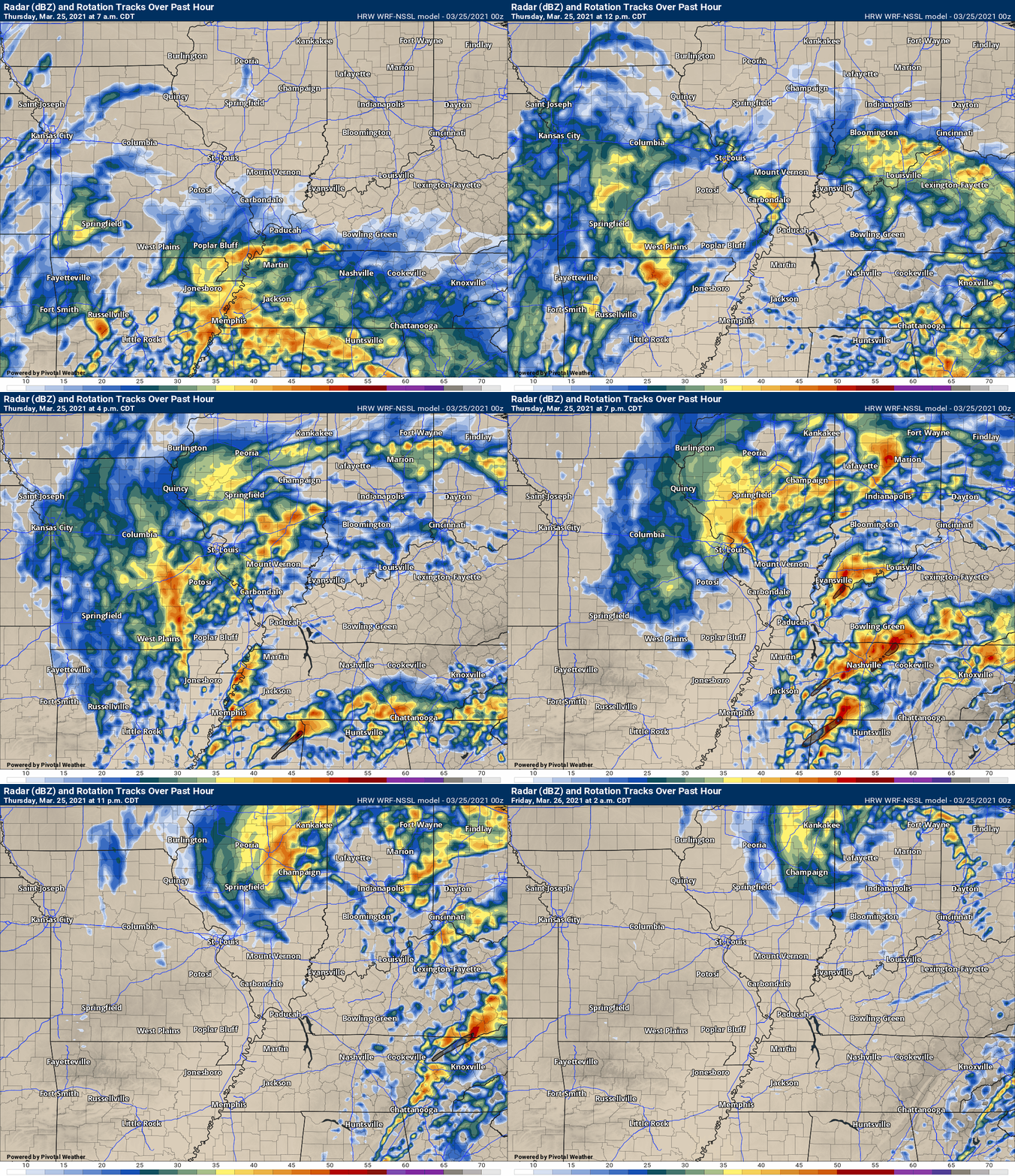
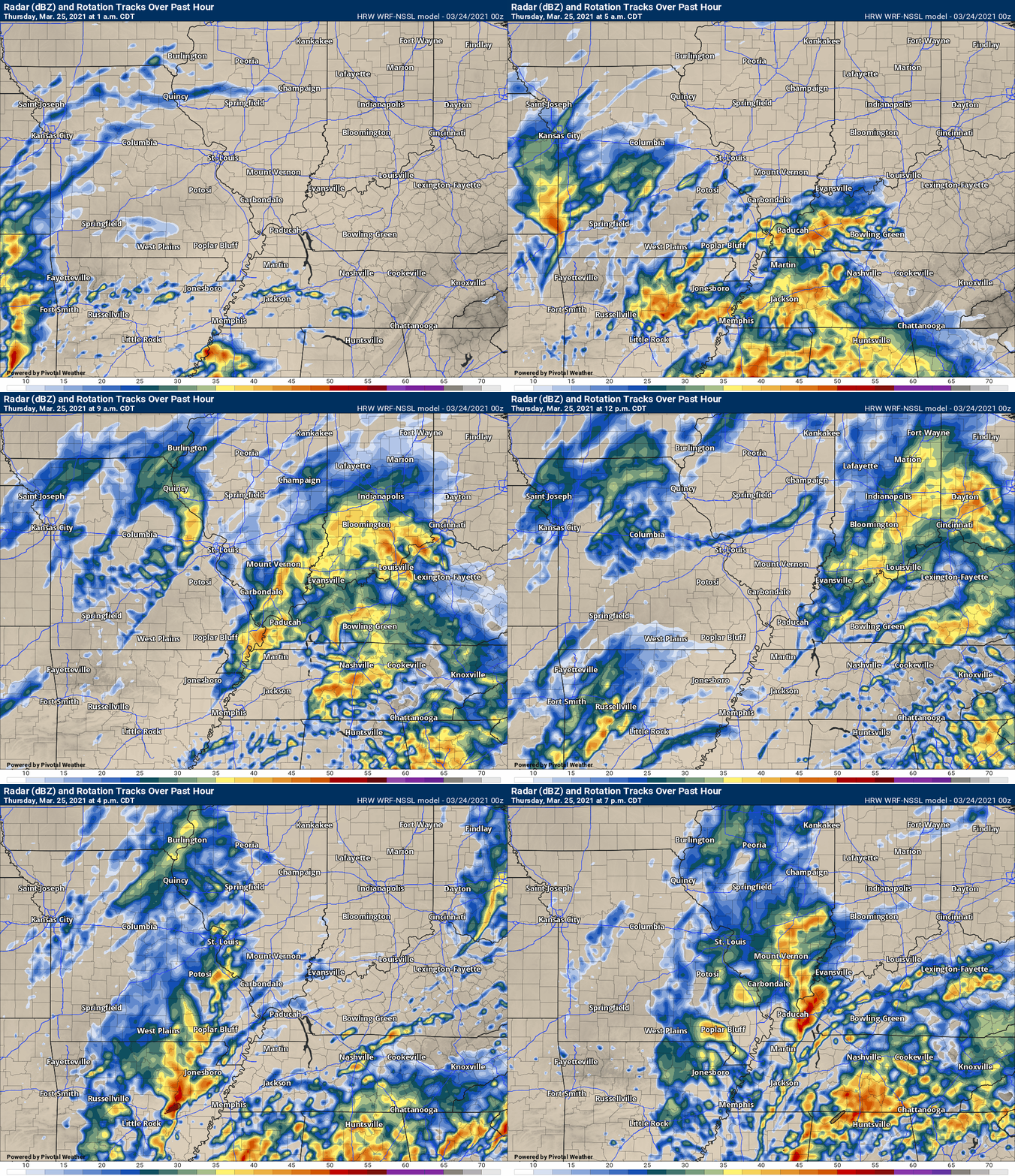
Here are the latest future-cast radars. What radar might look like today.
Notice, the first round of AM storms. A lull. Then, the severe storms later today.
This animation is the Storm Prediction Center WRF model.
This animation shows you what radar might look like as the next system pulls through the region. It is a future-cast radar.
Time-stamp upper left. Click the animation to enlarge it.
.
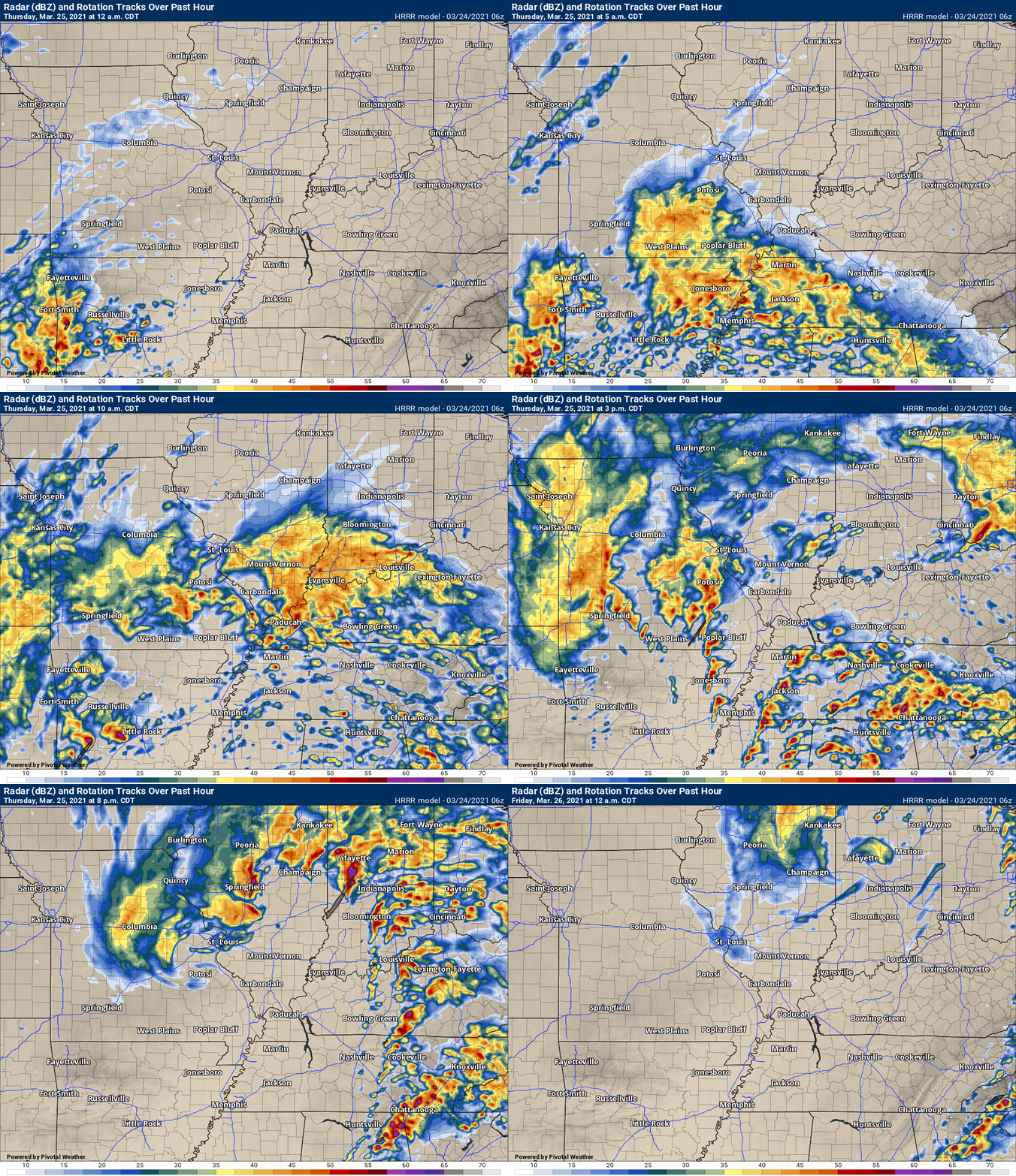
This animation is the Hrrr short-range model.
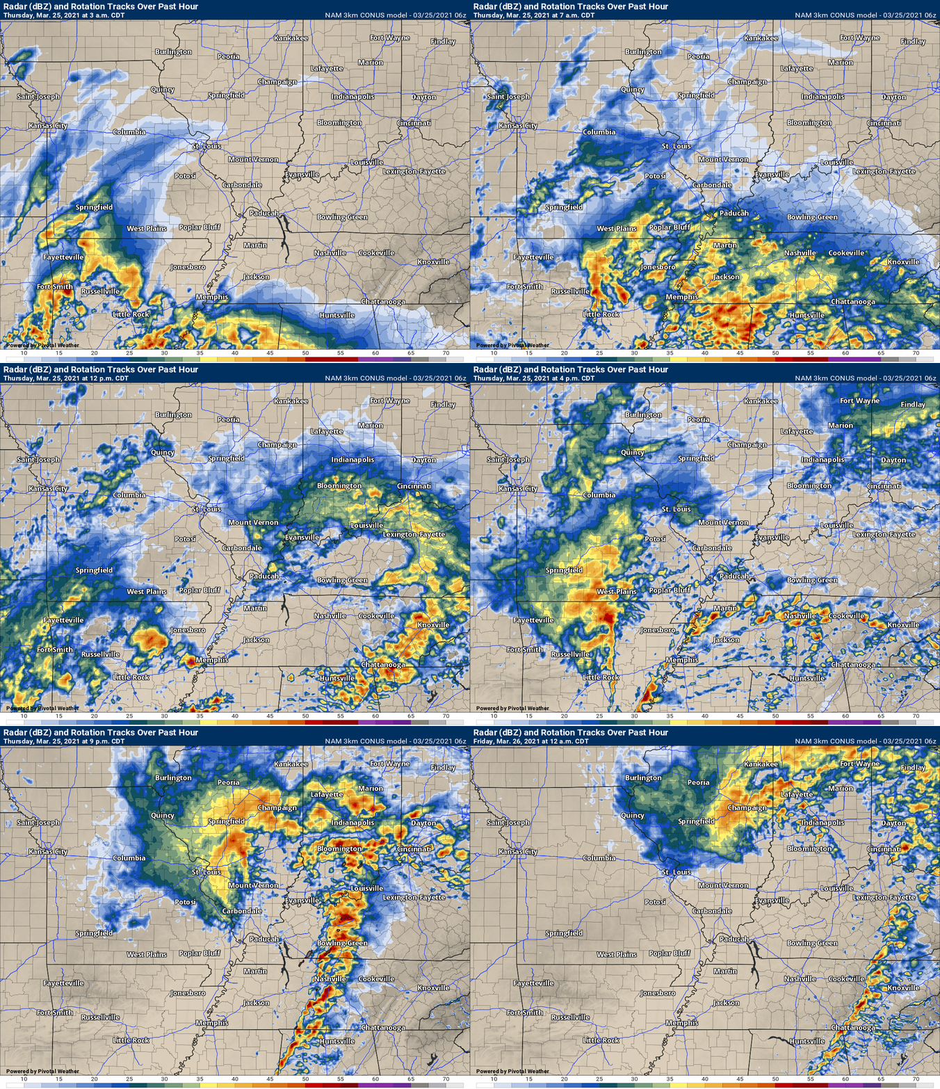
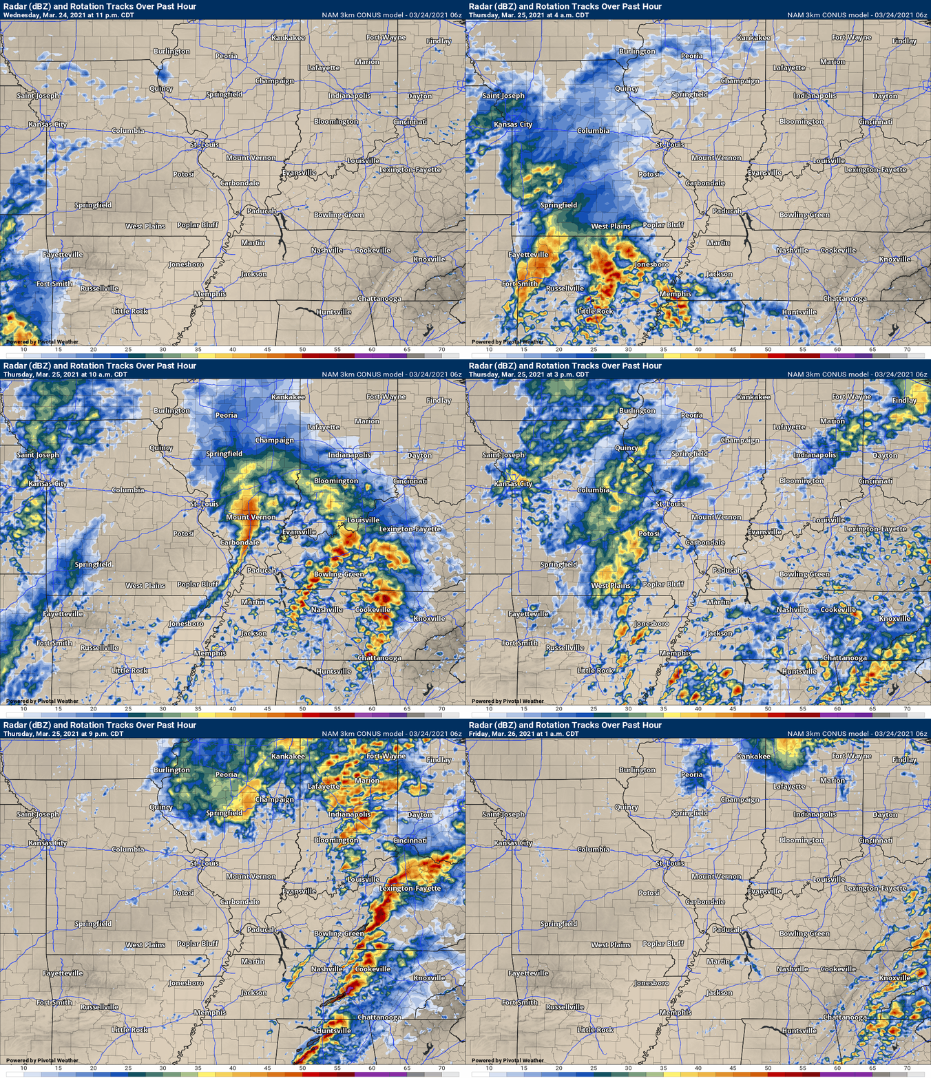
.This animation is the 3K NAM American Model.
This animation shows you what radar might look like as the next system pulls through the region. It is a future-cast radar.
Time-stamp upper left. Click the animation to enlarge it.
.
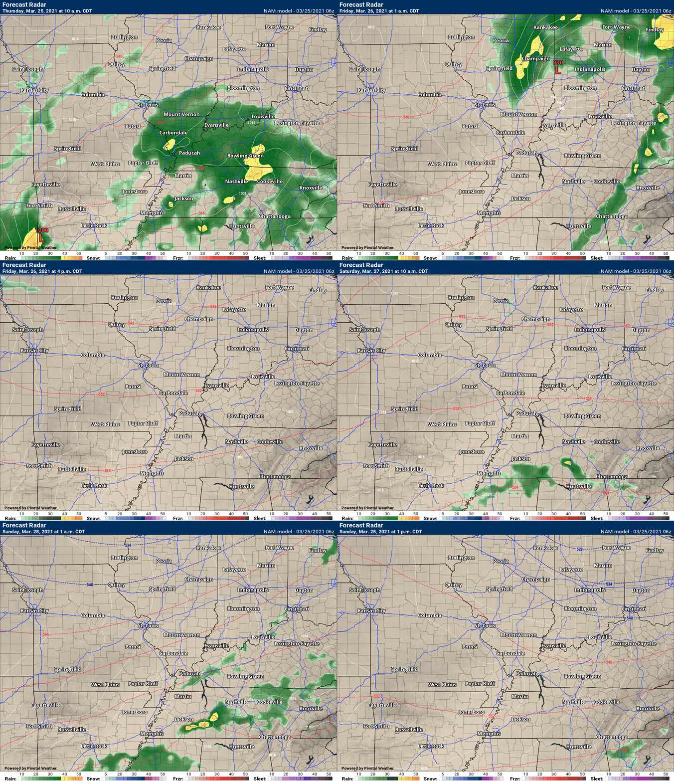
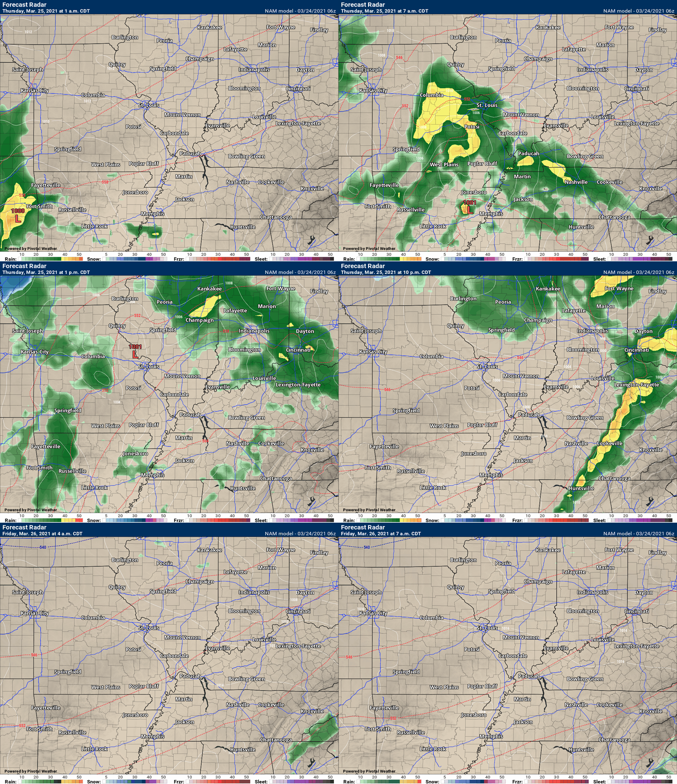
This next animation is the lower-resolution NAM American Model.
This animation shows you what radar might look like as the system pulls through the region. It is a future-cast radar.
Time-stamp upper left. Click the animation to enlarge it.
.
March 25, 2021
2 AM update
Here is the latest future-cast radar. I am concerned about this afternoon and evening. Storms will be moving at speeds in excess of 70 mph. This will leave little time for action.
Have an action plan today.
.
8 PM Wednesday
No changes.
I continue to monitor Thursday afternoon.
Storms are likely late tonight into tomorrow morning. IF the atmosphere can recover from the morning storms then all modes of severe weather will occur tomorrow afternoon.
We still don’t know if that will happen.
What does recover mean?
Morning clouds and rain will help stabilize the morning atmosphere. If the sun comes out or if there is a break in between the morning storms and afternoon storms, then it is possible the atmosphere can become unstable, again.
Monitor updates.
BOTTOM LINE
Timing.
The most intense storms would be between 12 PM and 7 PM Thursday. A few storms late tonight could also produce hail, but the main event would be Thursday afternoon and evening.
Concerns.
A conditional risk of severe thunderstorms late tonight into Thursday evening. All modes of severe weather will be possible. Damaging wind, large hail, and tornadoes.
The risk is conditional. That means that the atmosphere needs to re-charge after tomorrow morning’s clouds and precipitation. If that does not happen then the risk will be lower. Monitor updates.
Also, gradient winds (because of the deep area of low pressure) could top 40 mph Thursday into Thursday night. Gusty winds are possible today, as well (Wednesday).
Monitor your Beau Dodson Weather app. Make sure it is on.
Here is what the Storm Prediction Center is saying
.
Here is what the Paducah, Kentucky, NWS is saying
.
Here is what the St Louis, Missouri, NWS is saying
.
A significant storm system will develop over the next 24 to 48 hours.
This system will come out of the southwest United States and move into our region late tonight into Thursday night.
Models have all trended towards a deeper/strong area of low pressure. Models have trended north with the track of the low.
This means that the warm sector of the system will likely push into portions of our region.
The warm sector is where severe weather may occur. This is another conditional severe weather risk. Meaning, that if clouds and rain don’t clear out (Thursday) then the severe weather risk is lower.
If the atmosphere can re-charge then severe thunderstorms will almost certainly occur. As always, monitor updates. We may not know until late Thursday morning how the afternoon and evening will unfold.
Storms will be racing east/northeast at speeds above 50 mph. Fast movers.
If severe weather does develop, then you won’t have much time to seek shelter. Let’s be prepared for whatever happens.
Our region will once again have a conditional risk of severe thunderstorms. What does conditional mean? It means that a few ingredients are certain.
The SPC has us in a level one, two, and three risk. Five is the highest risk.
Light green means non-severe storms. Dark green is a level one risk. Perhaps a few severe storms. Level two is a higher risk. It means severe storms could have higher coverage. The orange is a level three threat. The red is a level four threat. Three and four is where severe thunderstorms could be widespread.
Do not focus on the colors. It only takes one tornado to ruin the day. I have witnessed significant severe weather in all threat zone colors.
The entire region is included in the severe weather threat zone. This will be updated later today.

.
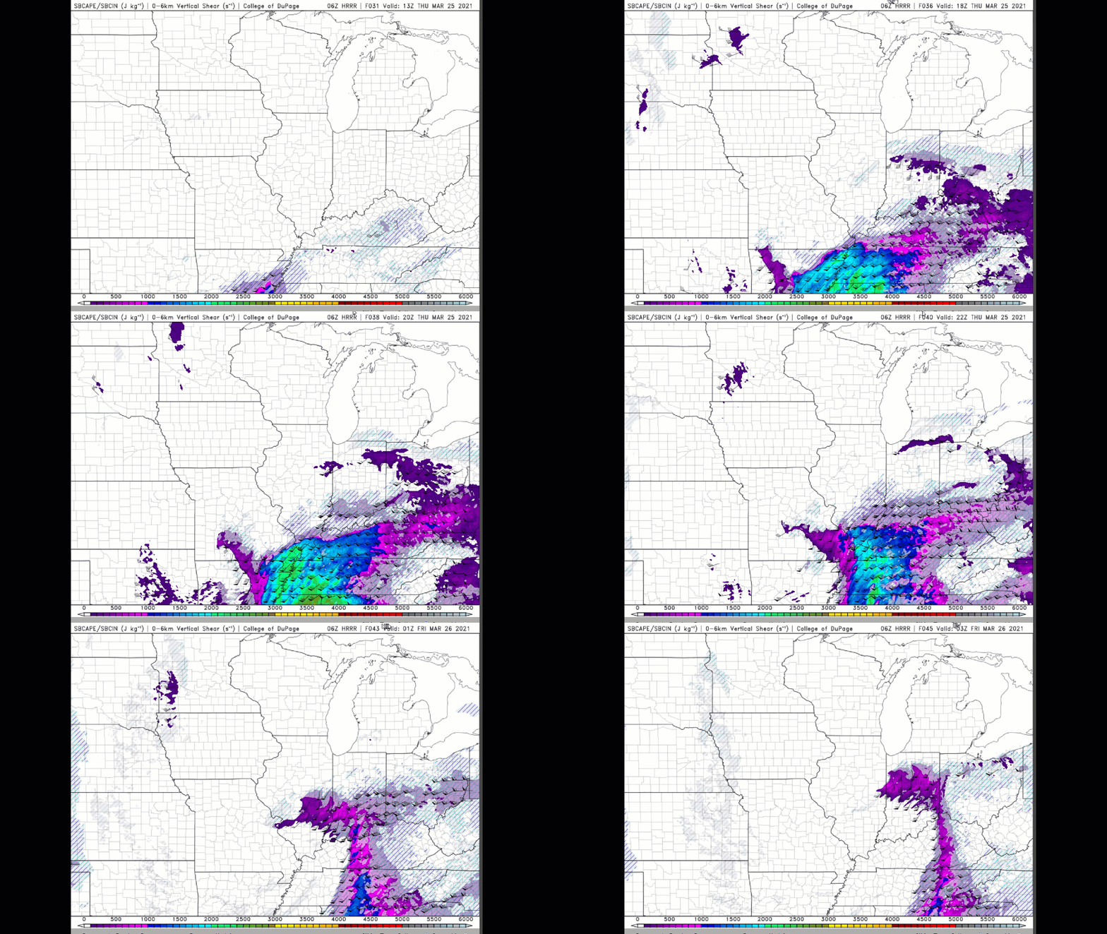
I will be monitoring CAPE levels.
Here is the Hrrr model CAPE values. This will be Thursday late morning into afternoon.
See the definition of CAPE below this animation.
Double click on the animation to enlarge it.
This is showing CAPE values above 1000. More than enough fuel to cause issues over at least portions of the region.
.
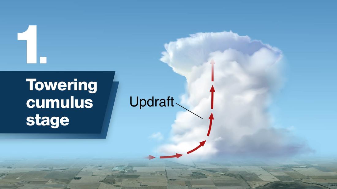
Remember, those towering cauliflower looking storms in the summer? Those are thunderstorms.
Of course, they can occur year-round.
Updrafts are what make thunderstorms so tall. That is also what gives it that cauliflower look.
Storms also have downdrafts.
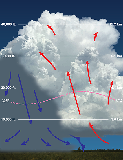
Without updrafts, you can not have thunderstorms.
CAPE helps increase updrafts. Higher CAPE values usually mean larger/faster updraft speeds. Thus, severe storms can occur.
If CAPE levels are lower then the risk of severe weather is lower.
Let me show you what the models are thinking.
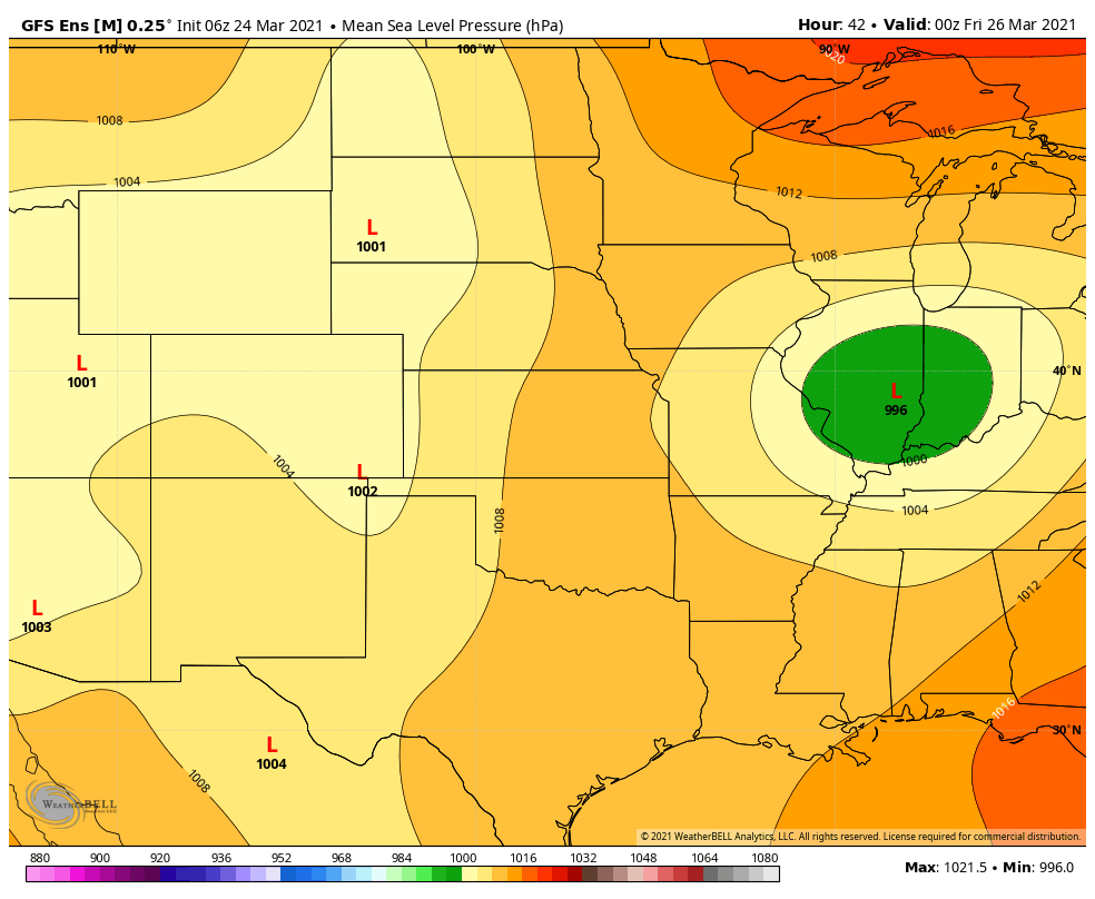
Two camps. The EC camp and the GFS camp. Both of these models have different ideas.
The EC is farther north than the GFS model. The further away they are, the less confidence in the forecast.
The good news is that there is a Mean on the EC and GFS. See that below. They are very close to agreement.
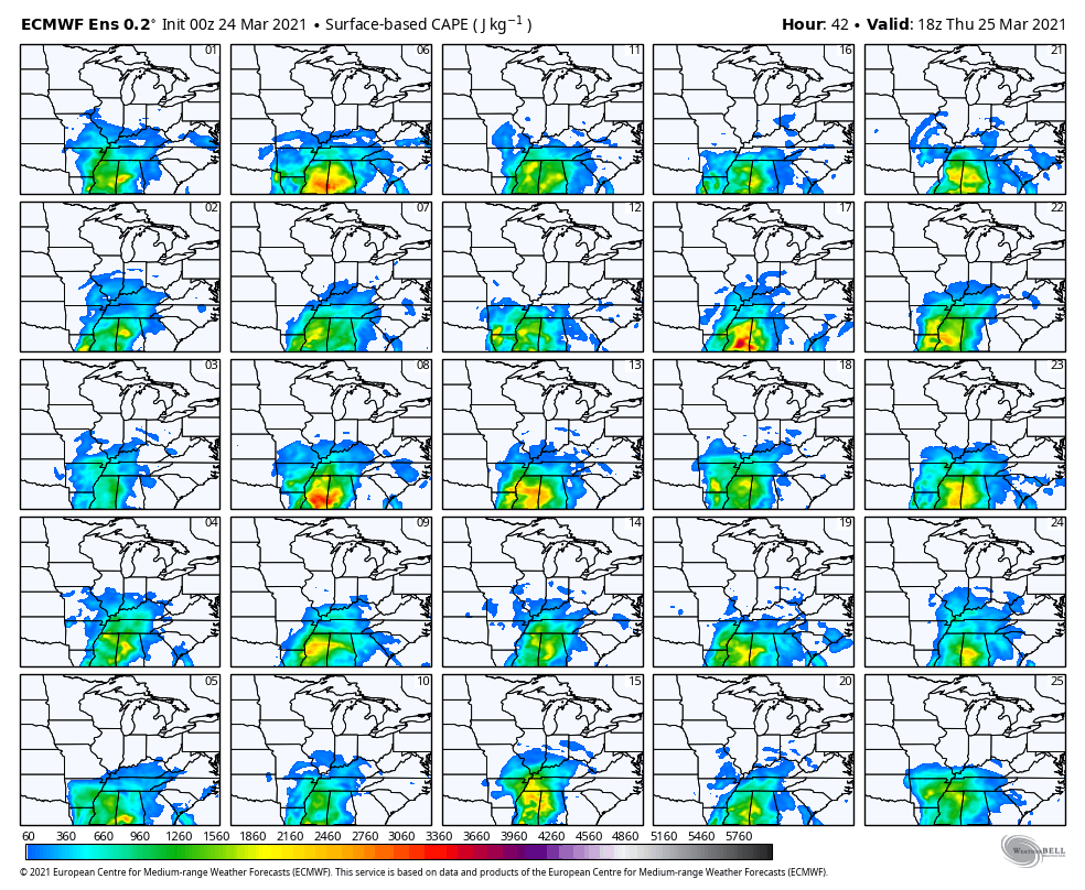
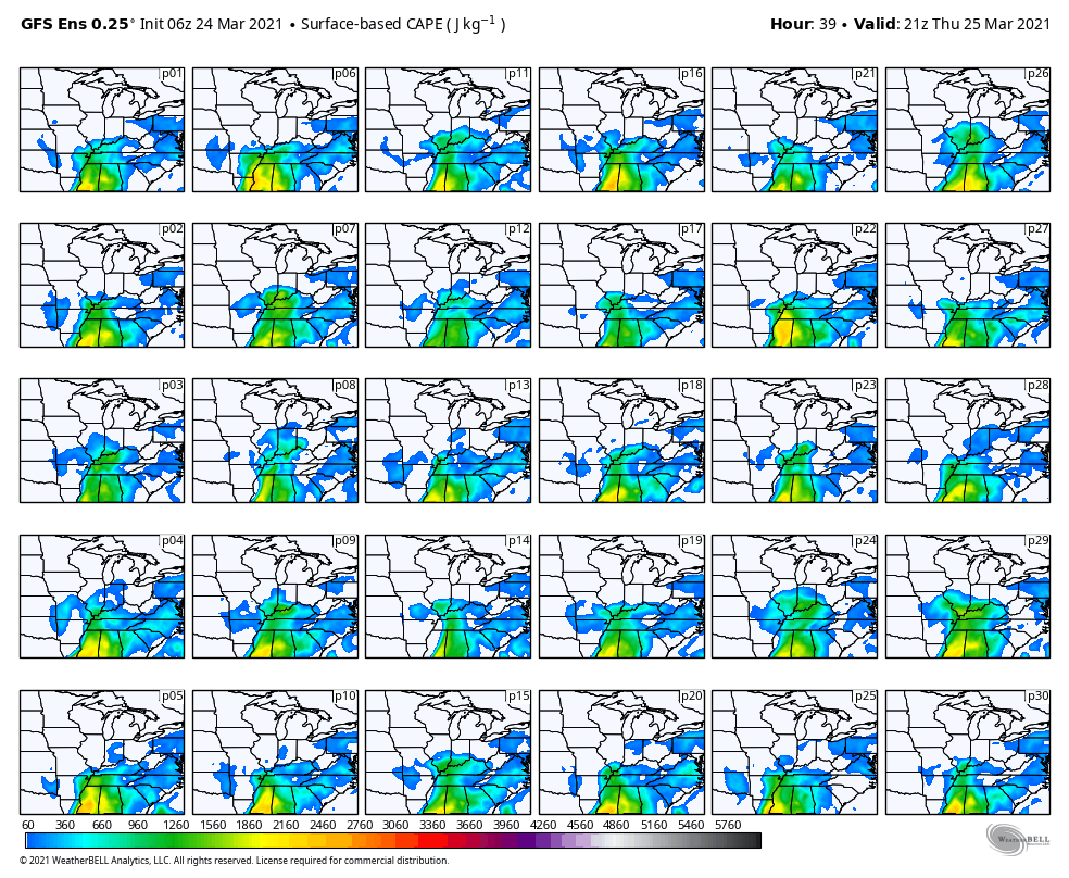
CAPE values on the ensembles.
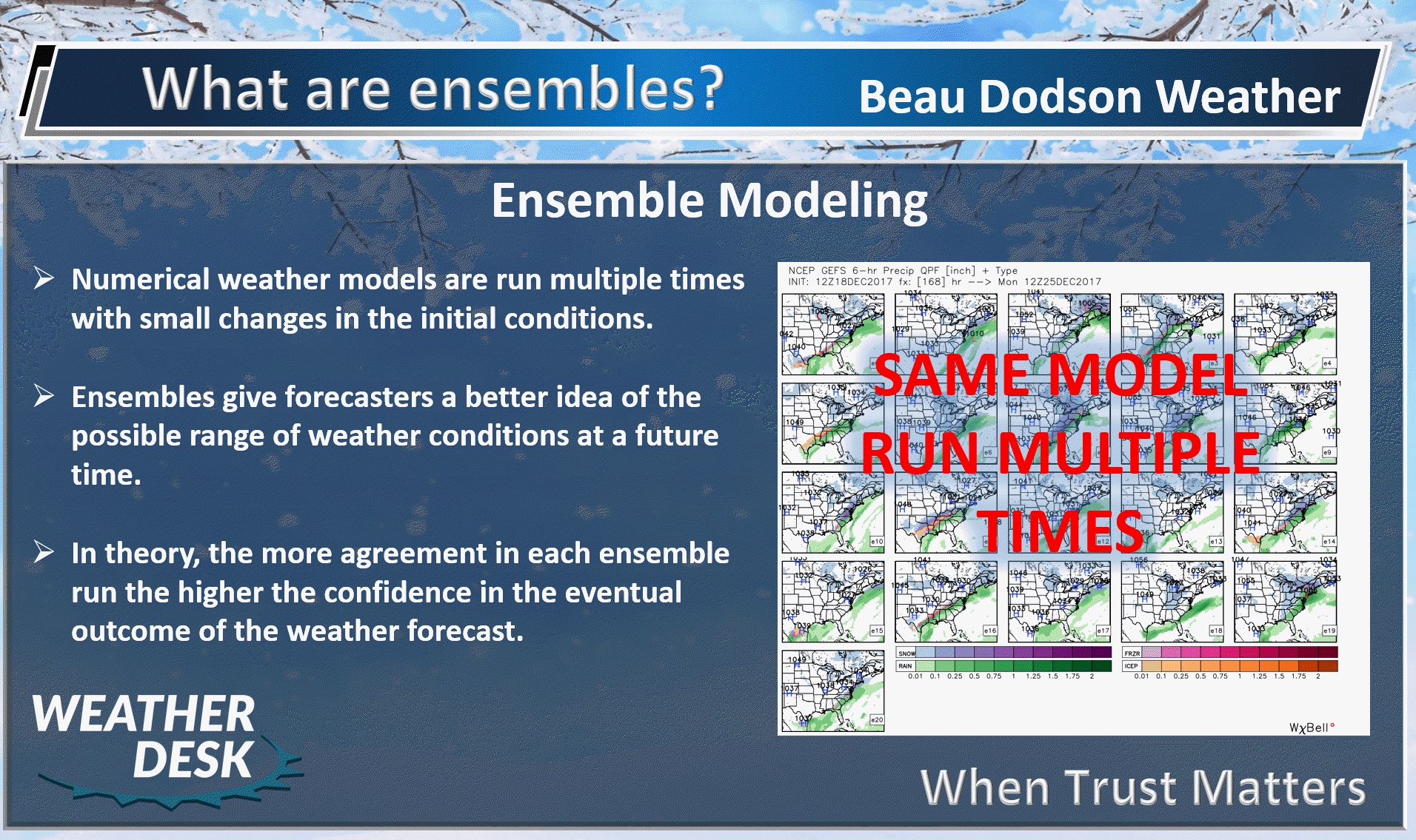
Again, remember, each square is one run of the ensemble.
The colors represent CAPE. For now, we are not paying attention to “how much” CAPE, but rather whether we have any CAPE to work with.
The EC model shows some CAPE Thursday afternoon and evening in our region.
.
GEFS (GFS model)
Thursday afternoon
.
So there is some CAPE in the models. Let’s keep an eye on it.
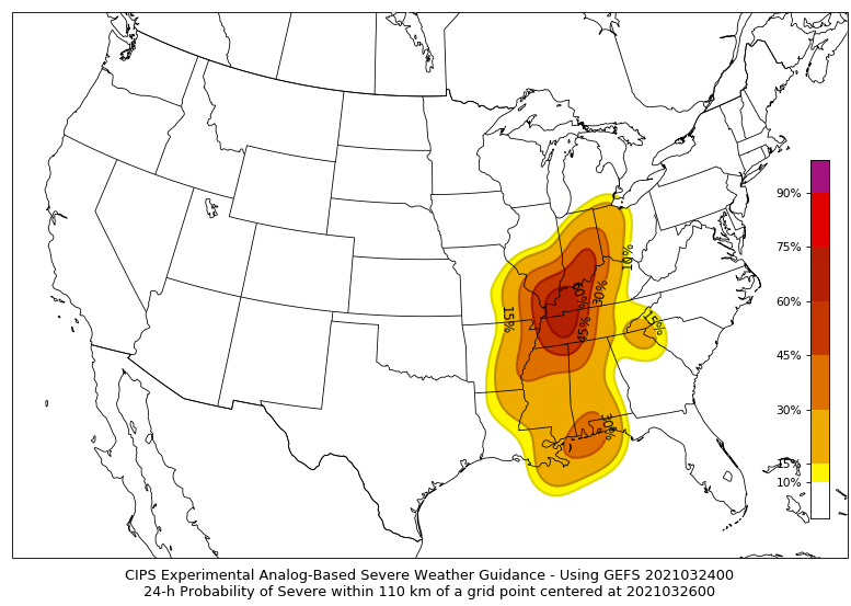
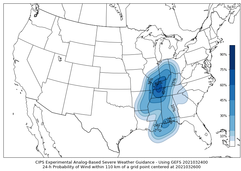
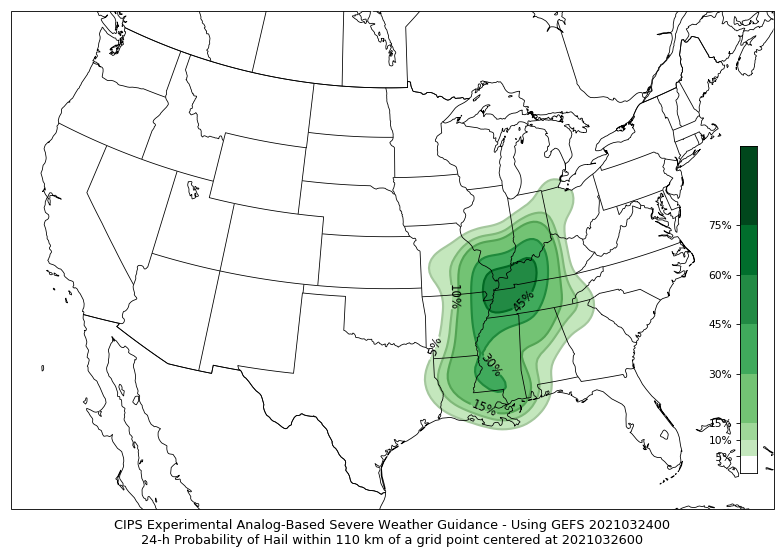
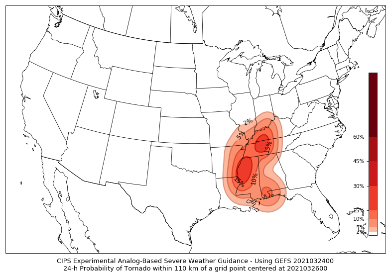
The CIPS analog severe weather forecast is showing some potential, as well.
CIPS runs past events and compares them with upcoming events. Sometimes, you can find potential by looking at past events.
All severe
.
Wind threat
.
Hail threat
.
Tornado threat
.
The SREF model is another one that I watch trends on. These contours are showing you tornado ingredients.
.
I am forecasting a conditional risk of severe thunderstorms. Conditional means that everything needs to come together in order to have severe storms.
Clouds and rain could interfere with that. That is what happened last Wednesday. We had an outbreak of tornadoes to our south and southeast. Clouds and rain kept our CAPE levels low. We ended up with no severe reports.
Will that happen again? It is possible, but we have to monitor it.
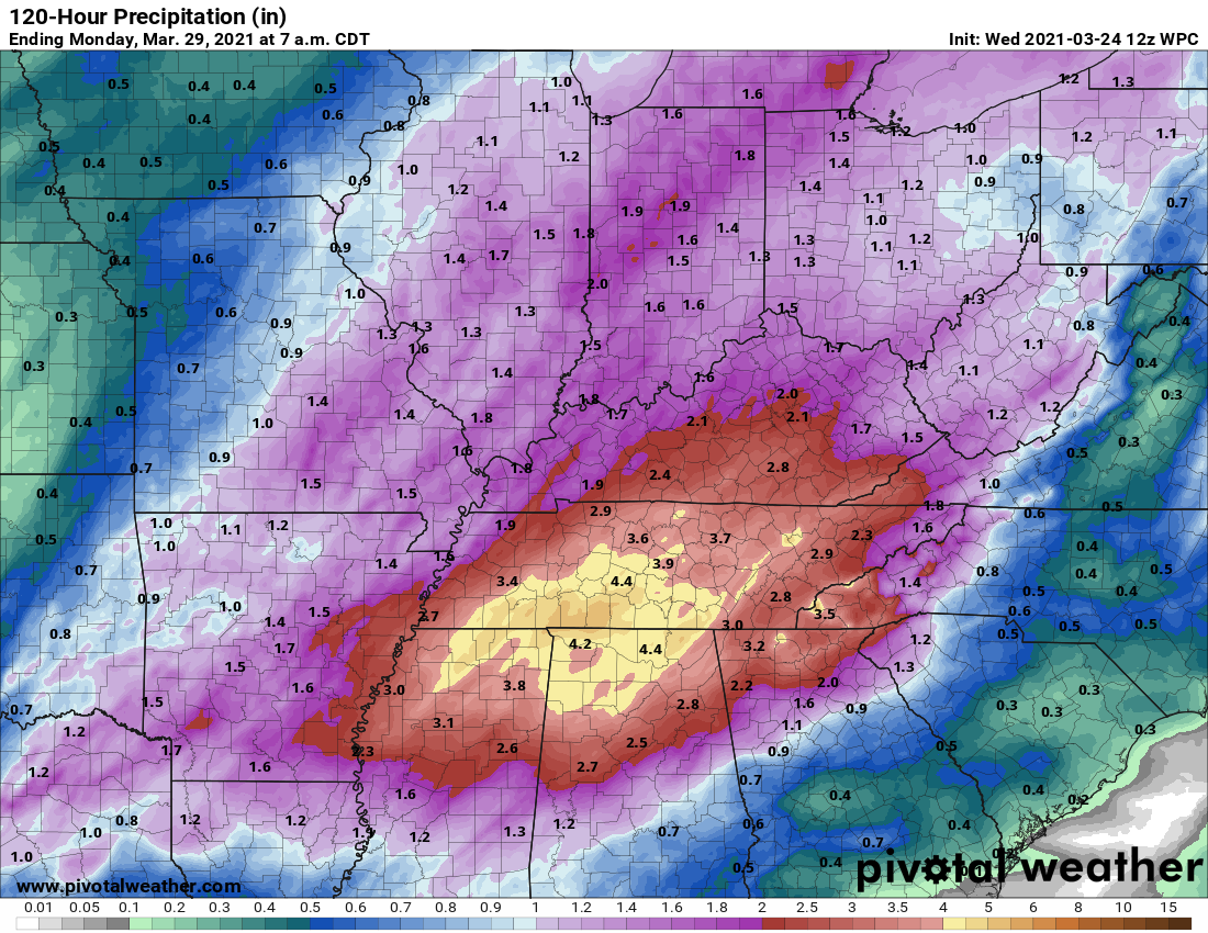
That rain event could produce pockets of one to two inches of rain. Perhaps more. We will need to monitor this since rivers and streams are high.
The area will dry out Friday into Saturday.
A fast moving system may bring some showers late Saturday afternoon and Saturday night For now, I have low-end rain chances during that time period. Confidence in the last weekend system is still rather low.
As we head into spring, we will be talking about low pressure centers, warm fronts, and cold fronts. Quite often!
To dig deeper, we use ensembles. Ensembles help smooth out the differences in the data/different models. In theory, at least.
Now, let me show you some ensemble data.
.
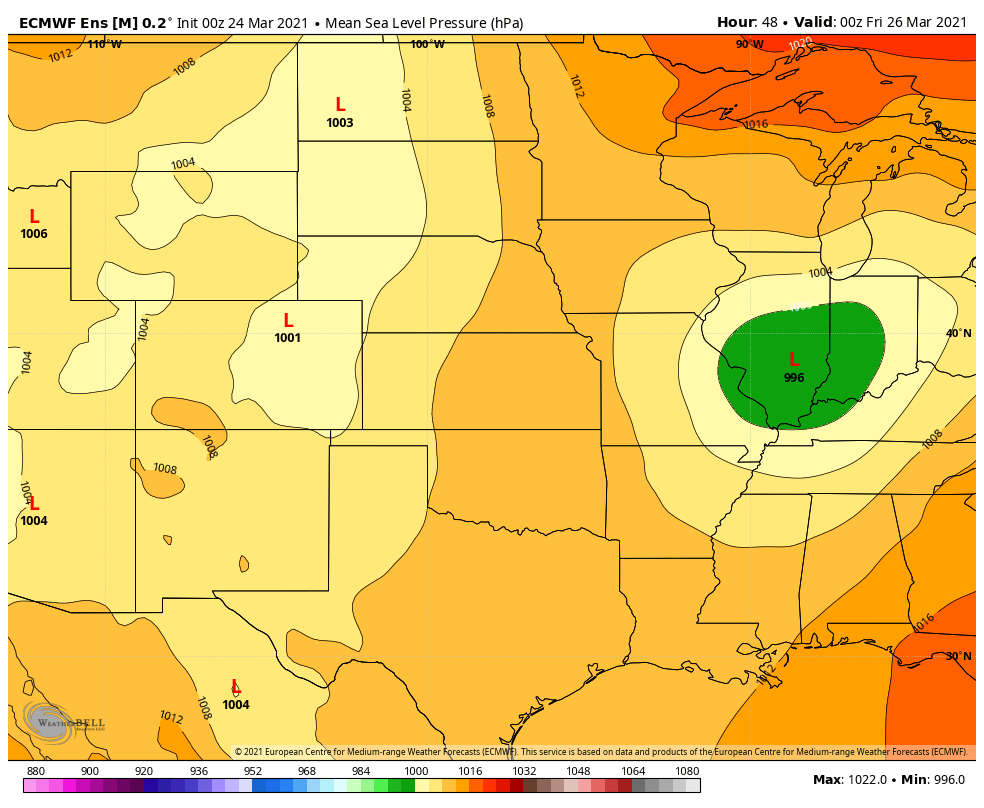
First the MEAN from the EC and GFS models. The Mean would be from all the model runs (put together).
EC model
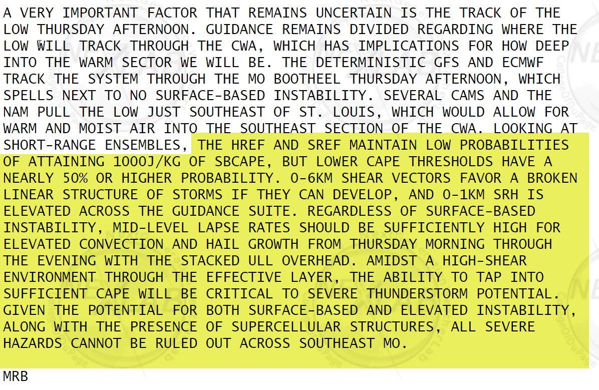
We are looking at the track of the low pressure center. If the low tracks to our north then that places us in the warm sector. That is where severe weather is more likely.
Thursday evening
Then it moves into southern Illinois and deepens.
GEFS model
The GEFS shifted north and now looks more like the EC model. That means there is not agreement between the two models. Confidence is increasing that the low will track further north than some models showed over the past few days.
The EC and GEFS seem to agree on the Mean.
.
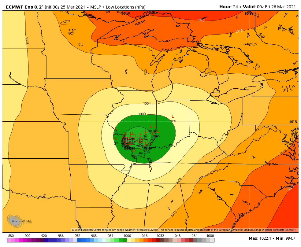
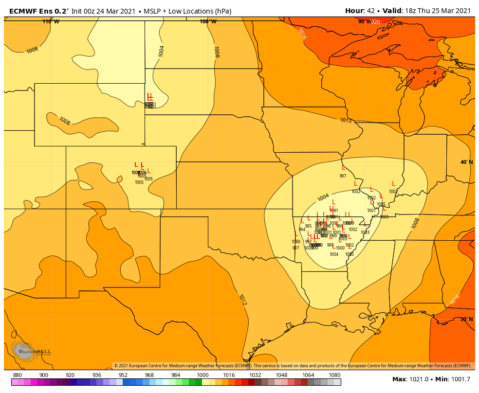
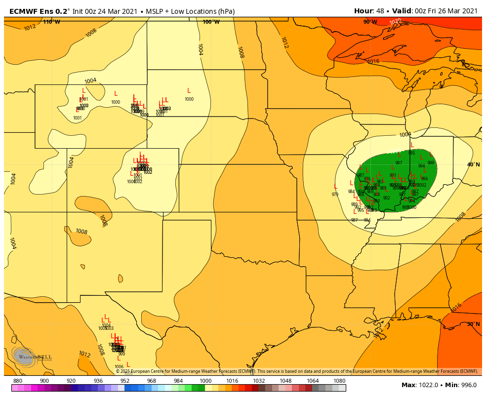
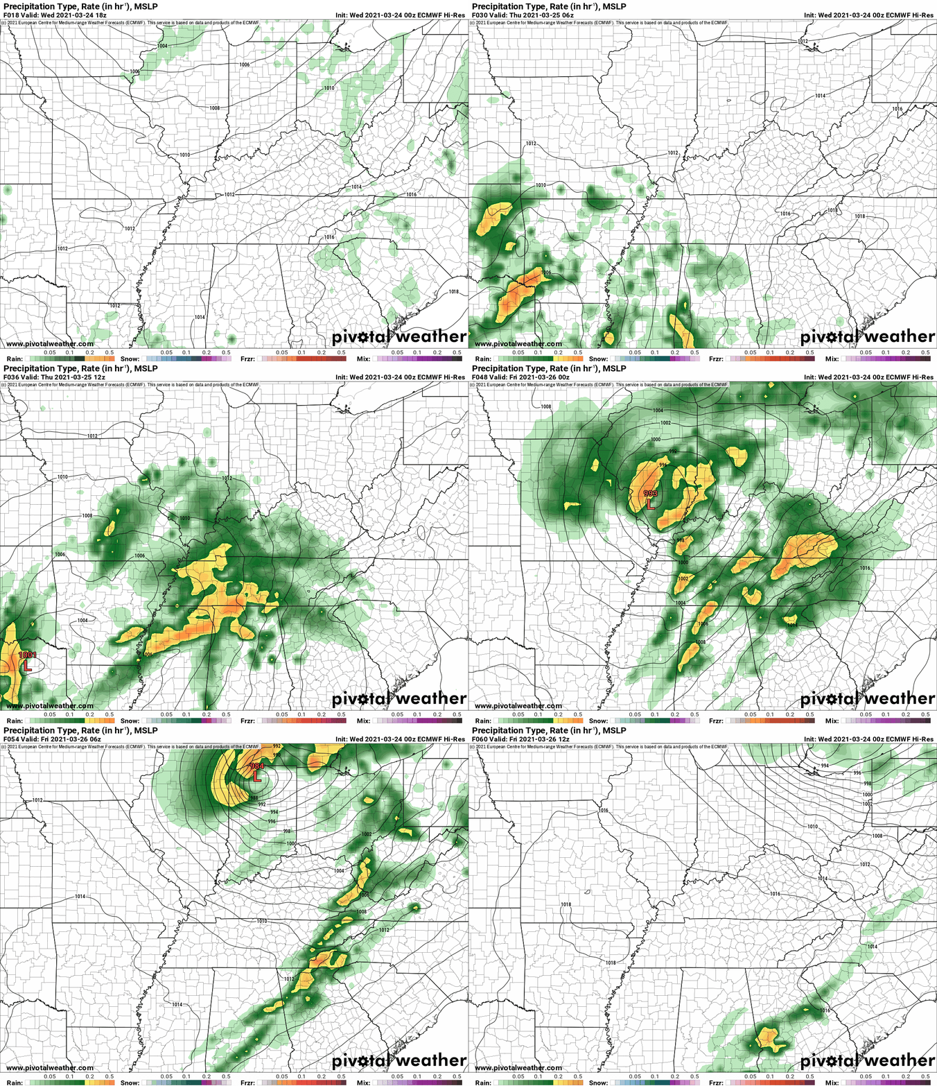
This is the EC model.
Over the past 24 hours, the EC and GFS models have come into better agreement as to where the low will track.
This is increasing forecast confidence in the final outcome.
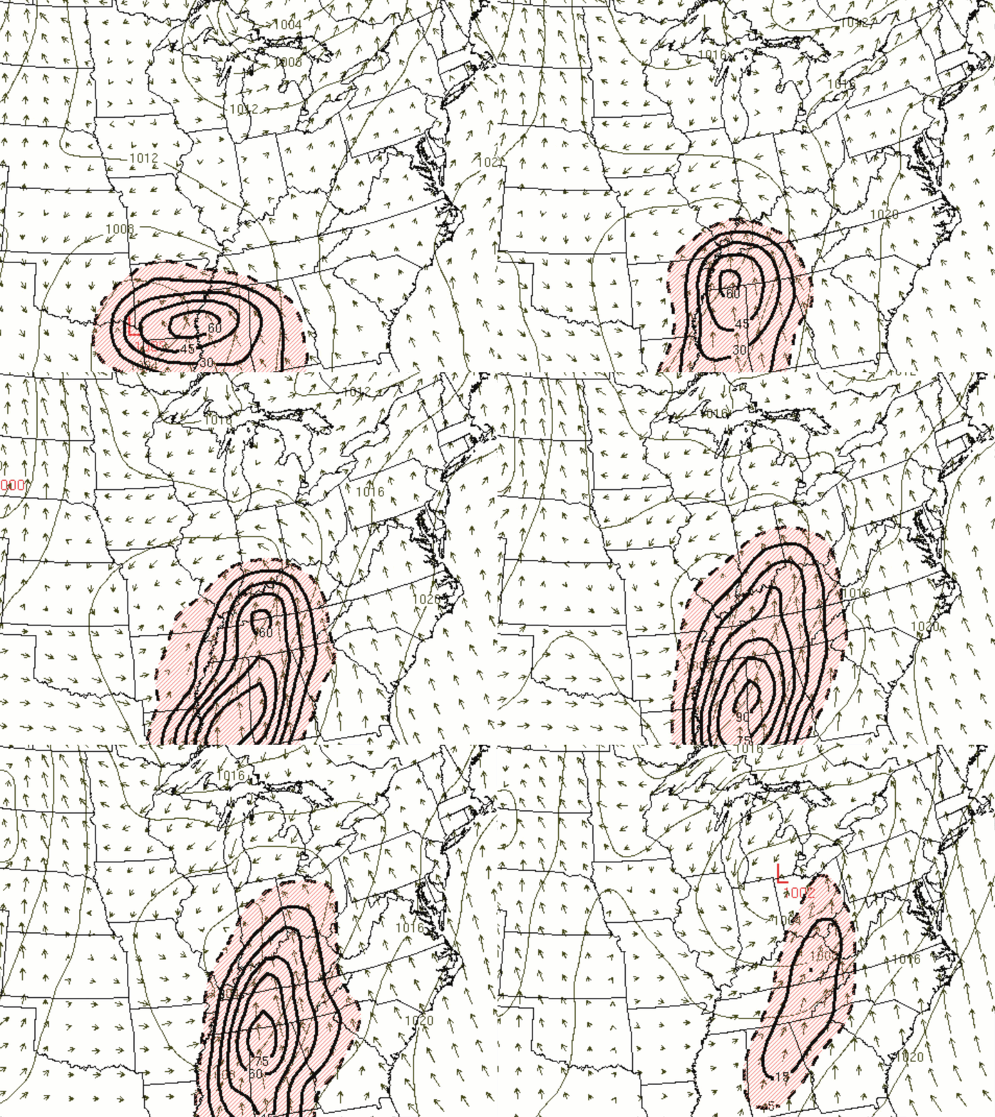
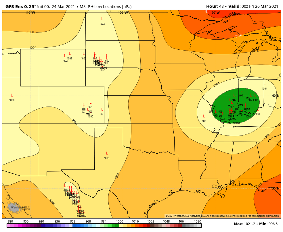
This is Thursday afternoon. Those L’s represent the area of low pressure. Each L is one run of the model. There are dozens of EC ensemble members.
Each L represents one member. The more they agree (tightly clustered) the higher the confidence in the forecast.
Clustered over northern Arkansas (but some spread). 1 PM Thursday.
.
Thursday evening. Clustered over Illinois and Indiana.
.
Early Friday morning. Clustered to our northeast.
.
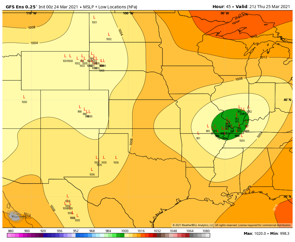
Let’s look at the GEFS (GFS model ensembles)
Thursday afternoon.
Remember, each L represents one run of the GEFS ensembles. The more L’s that are located in close proximity means the higher the confidence on the track.
.
Thursday night
.
For the entire week. WPC/NOAA rainfall forecast.
.
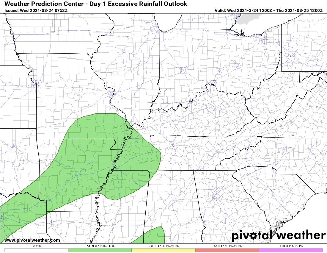
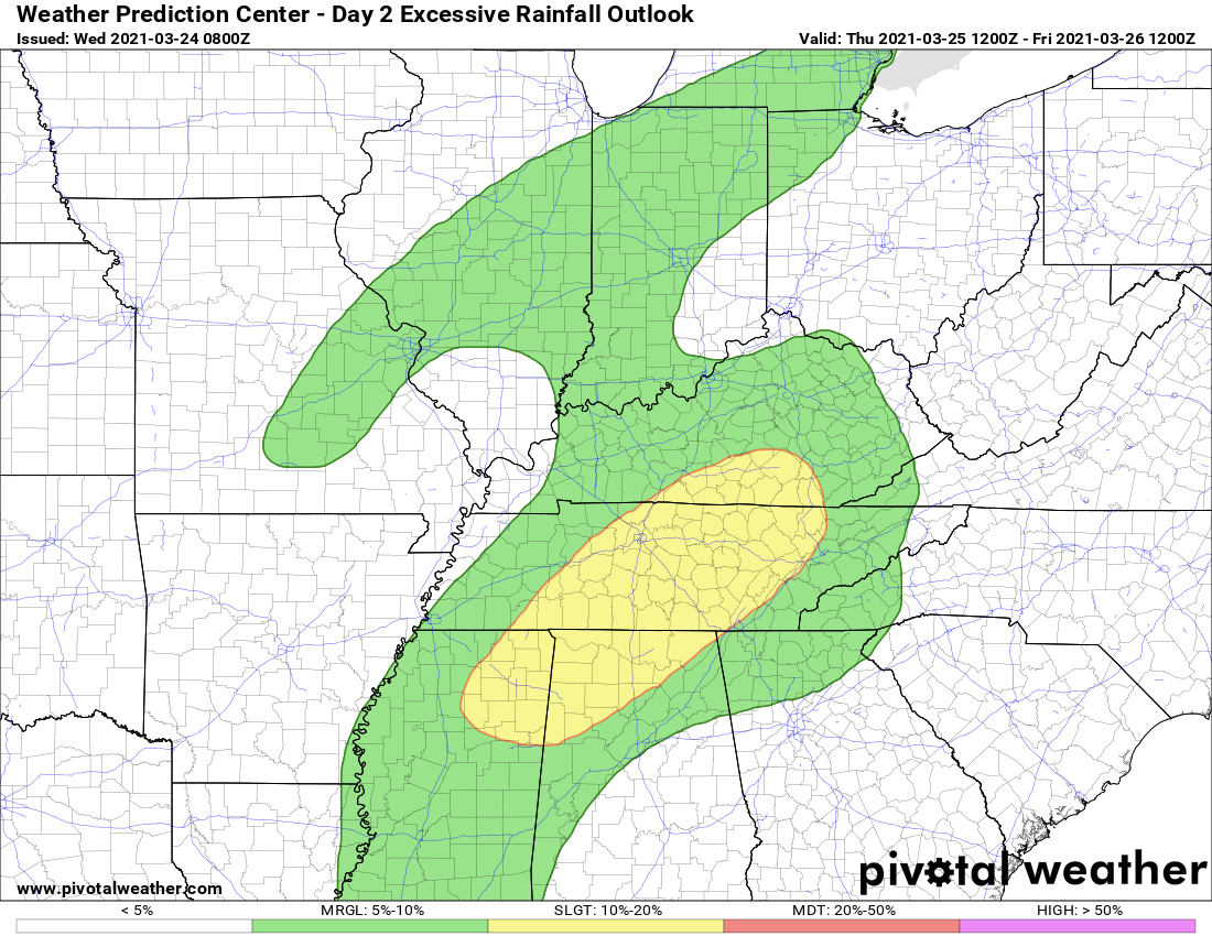
There is a low-end risk of flash flooding Thursday and Thursday night, as well. This is the WPC/NOAA map for excessive rainfall.
.
.
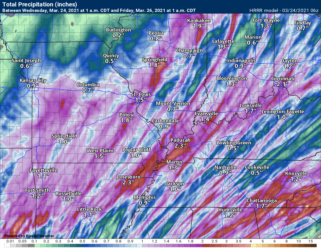
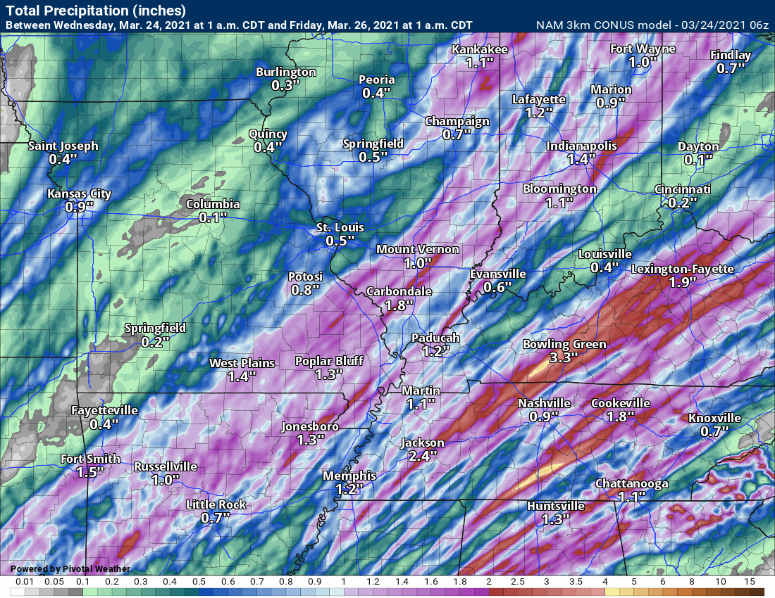
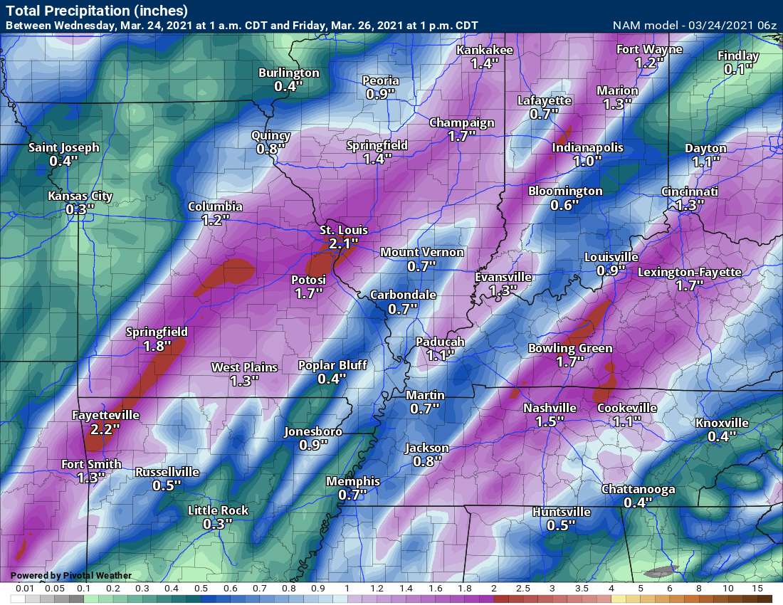
Let us look at some more rain total forecasts from the different models.
Hrrr model
NAM 3K model through Thursday 1 PM
The NAM model through Friday
.
The GFS (new version) model through Friday night.
![]()
.

Again, as a reminder, these are models. They are never 100% accurate. Take the general idea from them.
What should I take from these?
- The general idea and not specifics. Models usually do well with the generalities.
- The time-stamp is located in the upper left corner.
- The EC European weather model is in Zulu time.
.
What am I looking at?
You are looking at different models. Meteorologists use many different models to forecast the weather. All models are wrong. Some are more wrong than others. Meteorologists have to make a forecast based on the guidance/models.
I show you these so you can see what the different models are showing as far as precipitation. If most of the models agree, then the confidence in the final weather forecast increases.
You can see my final forecast at the top of the page.
.
This animation is the Storm Prediction Center WRF model.
This animation shows you what radar might look like as the next system pulls through the region. It is a future-cast radar.
Time-stamp upper left. Click the animation to enlarge it.
.
This animation is the Hrrr short-range model.
.This animation is the 3K NAM American Model.
This animation shows you what radar might look like as the next system pulls through the region. It is a future-cast radar.
Time-stamp upper left. Click the animation to enlarge it.
.
This next animation is the lower-resolution NAM American Model.
This animation shows you what radar might look like as the system pulls through the region. It is a future-cast radar.
Time-stamp upper left. Click the animation to enlarge it.
.
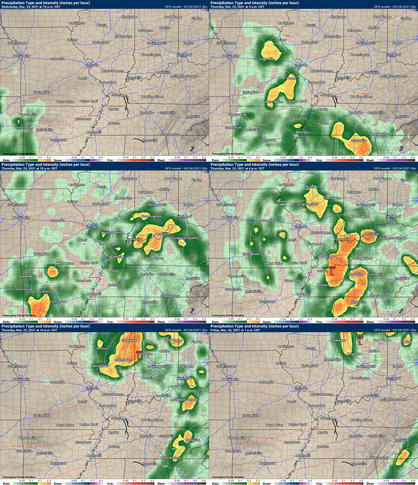
This next animation is the GFS American Model.
This animation shows you what radar might look like as the system pulls through the region. It is a future-cast radar.
Time-stamp upper left. Click the animation to enlarge it.
.
This next animation is the EC European Weather model.
This animation shows you what radar might look like as the system pulls through the region. It is a future-cast radar.
Time-stamp upper left. Click the animation to enlarge it.
What you need to know.
Severe thunderstorms are likely today and this evening. Peak chances will be during the afternoon and evening.
This is a highly conditional severe weather risk. The atmosphere must recharge from Thursday morning’s clouds and rain. If that does not happen, then the severe weather risk will be lower.
The SPC/NOAA has us in a level one, two, three, and four risk. Five is the highest risk.
Light green means non-severe storms. Dark green is a level one risk. Perhaps a few severe storms. Level two is a higher risk. It means severe storms could have higher coverage. The orange is a level three threat. The red is a level four threat. Three and four is where severe thunderstorms could be widespread.
Do not focus on the colors. It only takes one tornado to ruin the day. I have witnessed significant severe weather in all threat zone colors.
The entire region is included in the severe weather threat zone.

.
Key Points
- Thunderstorms this morning could produce nickel size hail and gusty wind. Lightning, of course.
- Severe thunderstorms will be possible this afternoon and evening. Mainly between 12 PM and 7 PM.
- This is a conditional severe weather risk. Meaning, all the ingredients will need to come together in order for the forecast to verify. If they don’t then severe storms won’t form. If rain and clouds linger then the risk is lower.
- Have your Beau Dodson Weather app on. Check it. Make sure you have not logged out of the app.
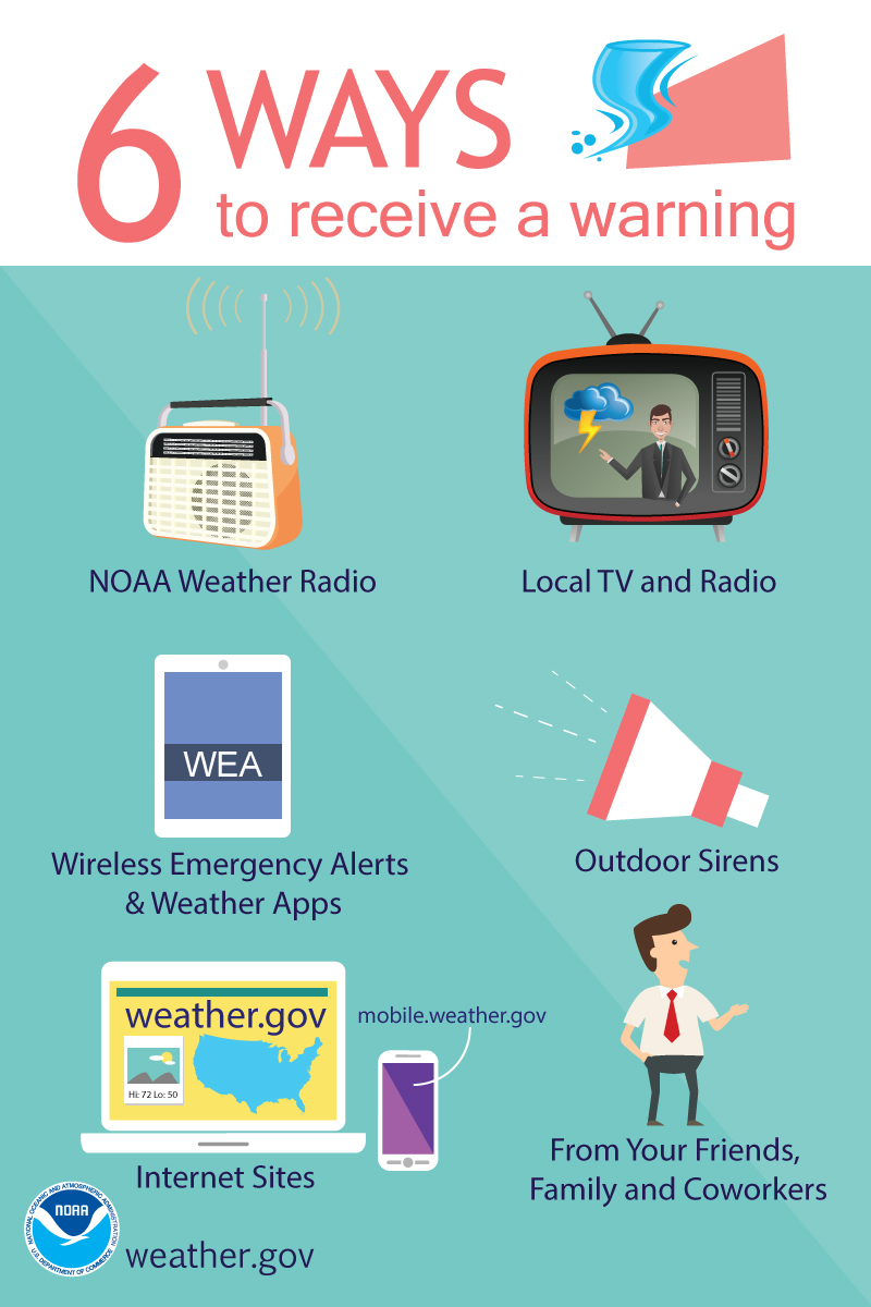
- Remember, a watch means to monitor updates. A warning means to seek shelter. A warning is a higher threat.
.
Call to action.
Monitor updated weather forecasts.
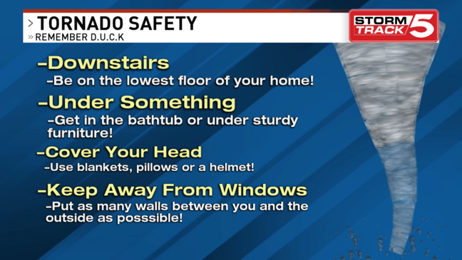
Have a safety plan. Storms will be moving fast. Be prepared to seek shelter.
Make sure you are using the Beau Dodson Weather Talk app. Download it from the app store. It is under Weather Talk.
The app is for subscribers (please log into your account and make sure your payment has been updated. We have a large number of declined cards and PayPal payments.
Subscribe at www.weathertalk.com/welcome then go to your app store and search for WeatherTalk. Apple users click here. Android users click here
.

Radar Link: Interactive local city-view radars & regional radars.
You will find clickable warning and advisory buttons on the local city-view radars.
If the radar is not updating then try another one. If a radar does not appear to be refreshing then hit Ctrl F5. You may also try restarting your browser.
Not working? Email me at beaudodson@usawx.com
Backup radar site in case the above one is not working.
https://weathertalk.com/morani
Regional Radar
https://imagery.weathertalk.com/prx/RadarLoop.mp4
Lightning Data (zoom in and out of your local area)
https://wtalk.co/WJ3SN5UZ
Satellite Data
Computers and tablets. These two satellite links may not work well on cell phones.
Visible Satellite. This one is to be used during daylight only. Be sure and hit refresh once you are on the satellite page. Otherwise, the data will be old.
https://col.st/a5A0e
IR Satellite. This one shows cloud temperatures. Bright colors represent cold cloud tops. That could mean thunderstorms. Be sure and hit refresh once you are on the satellite page. Otherwise, the data will be old.
https://col.st/R2fw1
Water Vapor Satellite. This one shows mid-level moisture in the atmosphere. Be sure and hit refresh once you are on the satellite page. Otherwise, the data will be old.
https://col.st/xFVwx
.

Live lightning data: Click here.
Not receiving app/text messages?
USE THE APP. ATT and Verizon are slowing or stopping the text messages.
Make sure you have the correct app/text options turned on. Find those under the personal notification settings tab at www.weathertalk.com. Red is off. Green is on.
Subscribers, PLEASE USE THE APP. ATT and Verizon are not reliable during severe weather. They are delaying text messages.
The app is under WeatherTalk in the app store.
Apple users click here
Android users click here
.


