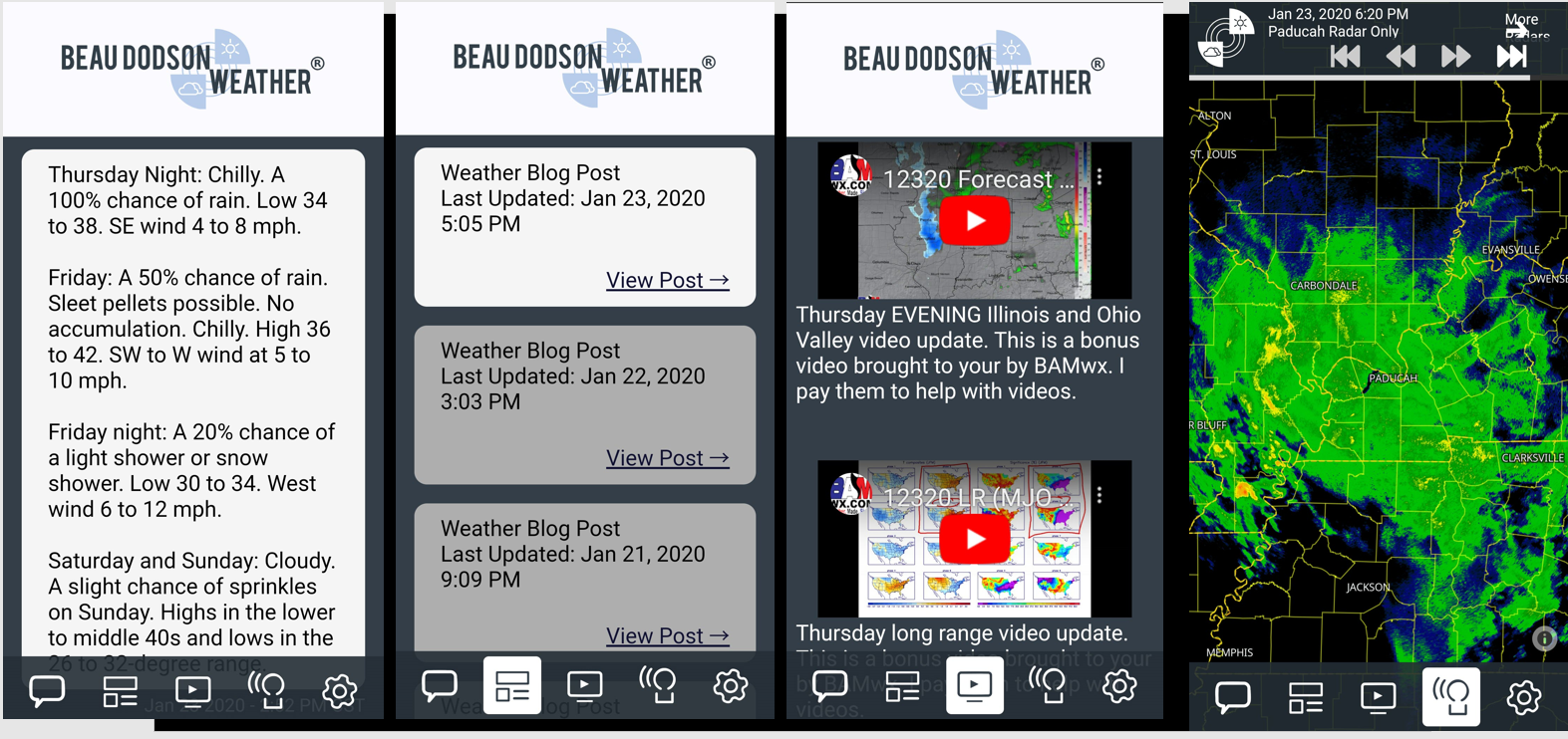
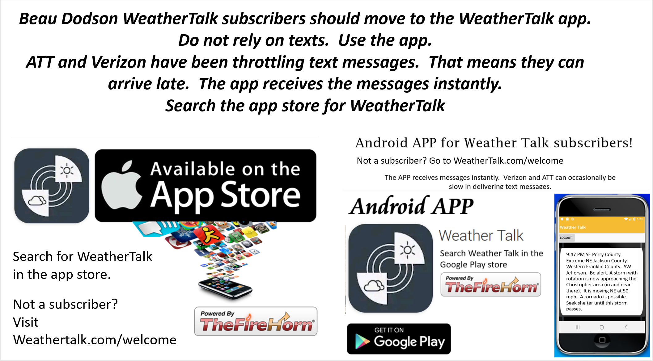
Not a subscriber? Go to www.weathertalk.com/welcome
Subscribe to Weather Talk. Then go to the app store and download it. Search for Weather Talk or Beau Dodson Weather. Apple users click here. Android users click here
To make this page smaller, I have moved older posts onto another page. That helps this page load faster.
Posts from over two hours ago have been moved to another page.
CLICK HERE TO VIEW THE ENTIRE EVENT
.
What you need to know.
Key Points
- Severe weather is likely this afternoon into Friday morning (early)
- This could be an all-night event. Have three to five ways of receiving your severe weather information. That includes my Beau Dodson Weather Talk app and a NOAA Weather Radio.
- Tornadoes at night tend to cause more deaths. This is mainly because people are sleeping.
.
Call to action.
Monitor updated weather forecasts.
Remember, a watch means that conditions are favorable for severe thunderstorms to form.
A warning means to take action. Seek shelter. A warning is more serious than a watch.
Make sure you are using the Weather Talk app. Download it from the app store. It is under Weather Talk.
TURN IT ON. Make sure it is on. Make sure you have not accidentally logged out of the app.
The app is for subscribers (please log into your account and make sure your payment has been updated. We have a large number of declined cards and PayPal payments). Subscribe at www.weathertalk.com/welcome then go to your app store and search for WeatherTalk. Apple users click here. Android users click here
.
Thursday and Friday. March 19th and 20th.
5:12 AM
This event is over.
4:49 AM
Southern Christian and central and southern Todd Counties. An area of severe thunderstorms was moving across southern Christian County.
Isolated wind damage is possible with this area of storms. It is moving E at 55 mph.
There is some rotation with this storm. A tornado can’t be ruled out. Seek shelter.
Radar http://weatherobservatory.com/radar_paducah.htm
.
4:02 AM
Trigg County. A storm is approaching from Calloway County. It is moving NE at 55 mph. The storm could produce wind gusts of 60 mph. It also has some rotation. Seek shelter if you are in the path of this storm. It will mainly impact the southern half of the county.
.
3:56 AM
Radar showed rotation entering southeast Calloway County near Hazel. The rotation was moving out of north Henry County.
It is moving northeast at 50 mph. Seek shelter until this storm passes.
Radar http://weatherobservatory.com/radar_paducah.htm
.
3:08 AM
McLean and Daviess Counties. The tornado warned storm will soon exit McLean County. There is still some weak rotation. The storm will enter Daviess County. Be prepared for isolated wind damage.
The storm is moving NE at 55 mph.
Radar http://weatherobservatory.com/radar_evans.htm
.
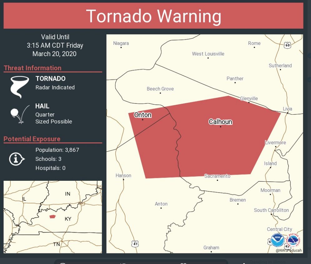
2:54 AM
2:54 AM Tornado Warning for…
Central McLean County in northwestern Kentucky…
Northeastern Hopkins County in northwestern Kentucky…
East central Webster County in northwestern Kentucky…
* Until 315 AM CDT.
* At 254 AM CDT, a severe thunderstorm capable of producing a tornado
was located near Calhoun, moving east at 55 mph.
.
2:53 AM
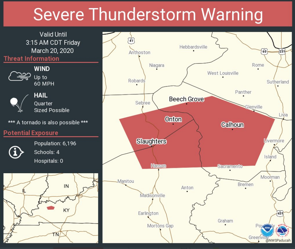
Muhlenberg County. Storms moving through your county have increased in intensity and could produce pockets of 55 to 60 mph wind gusts. Storms are moving NE at 55 mph.
Radar http://weatherobservatory.com/radar_hoptown.htm
Also, eastern Trigg, Christian, and Todd Counties. Storms moving through these counties could produce pockets of wind damage.
.
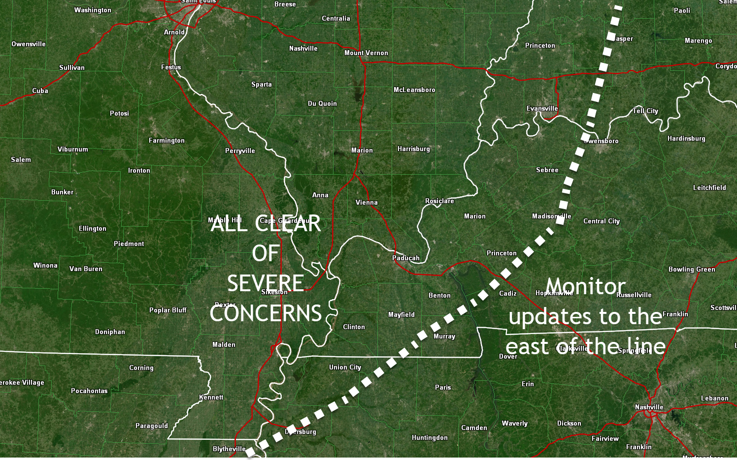
2:44 AM
Zone that is all clear of severe concerns. Left of the white line. Click to enlarge.
.
2:29 AM
..
2:25 AM
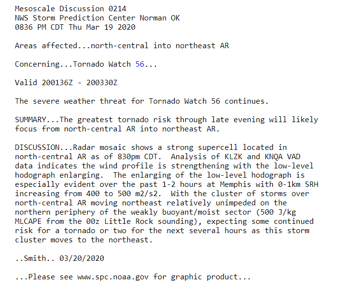
I am still tracking storms in NW TN. They are moving NE at 50 mph.
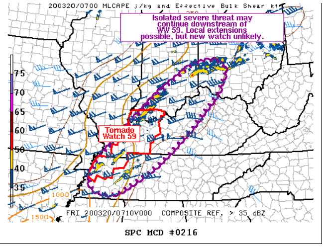
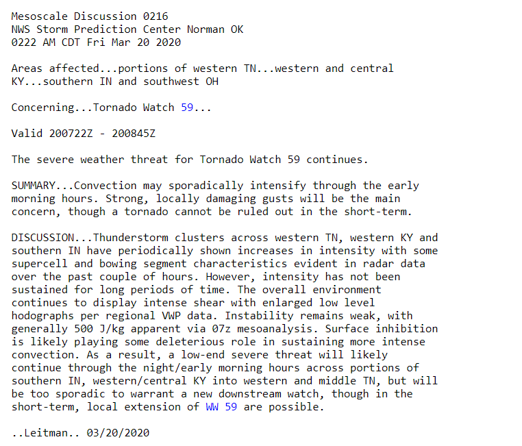
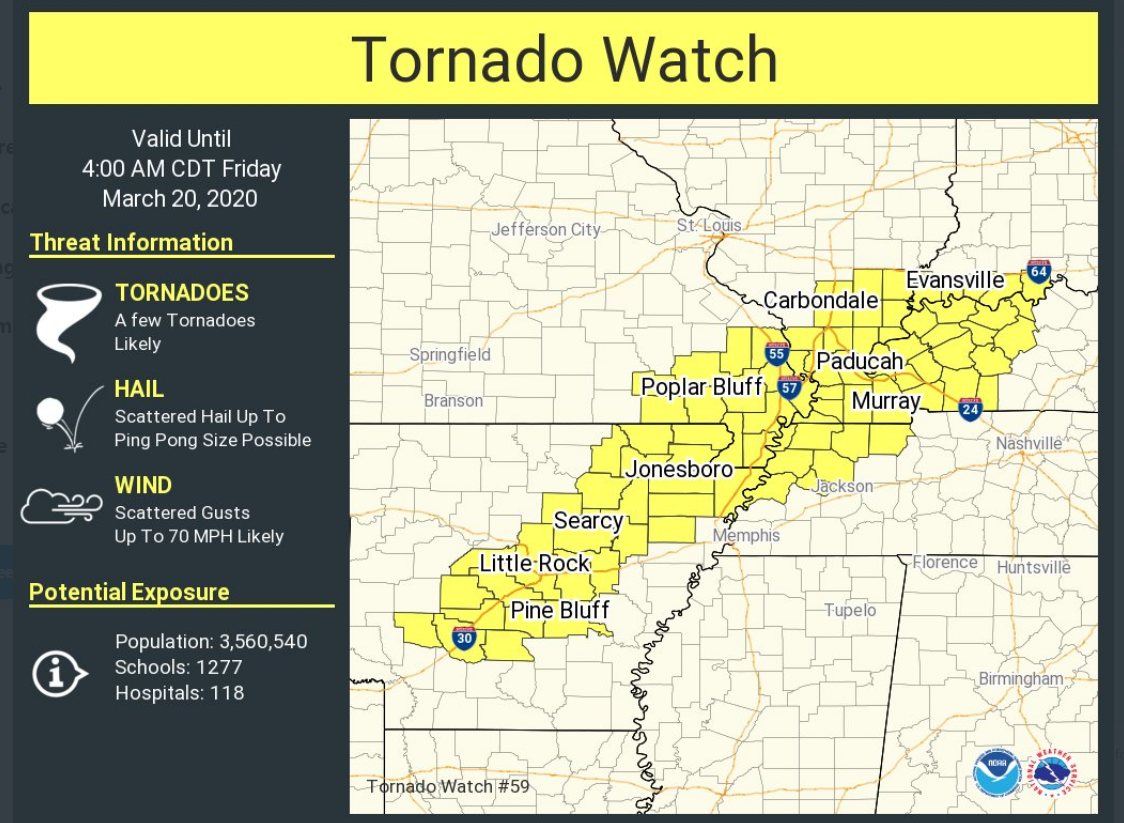
The other storms, in west KY, are currently not severe. A tornado watch continues for areas where storms are ongoing.
Live radars http://weatherobservatory.com/weather-radar.htm
.
2:00 AM
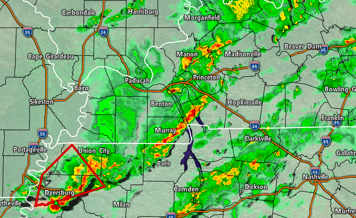
Obion and Weakley. Severe storms are approaching from the south. This storm is moving northeast at 55 mph. The storm also has some rotation, thus be prepared to seek shelter.
Radar http://weatherobservatory.com/radar_dyers.htm
.
1:52 AM
The NWS issued a tornado warning for a portion of McCracken County (south part) and extreme northern Graves. The storm has weak rotation. It is moving E NE at 50 mph. Concerns have ended in northern Graves County. The storm will soon exit McCracken County.
When this storm exits, the concerns will end for McCracken County and northern Graves County. No additional concerns overnight.

.
12:51 AM
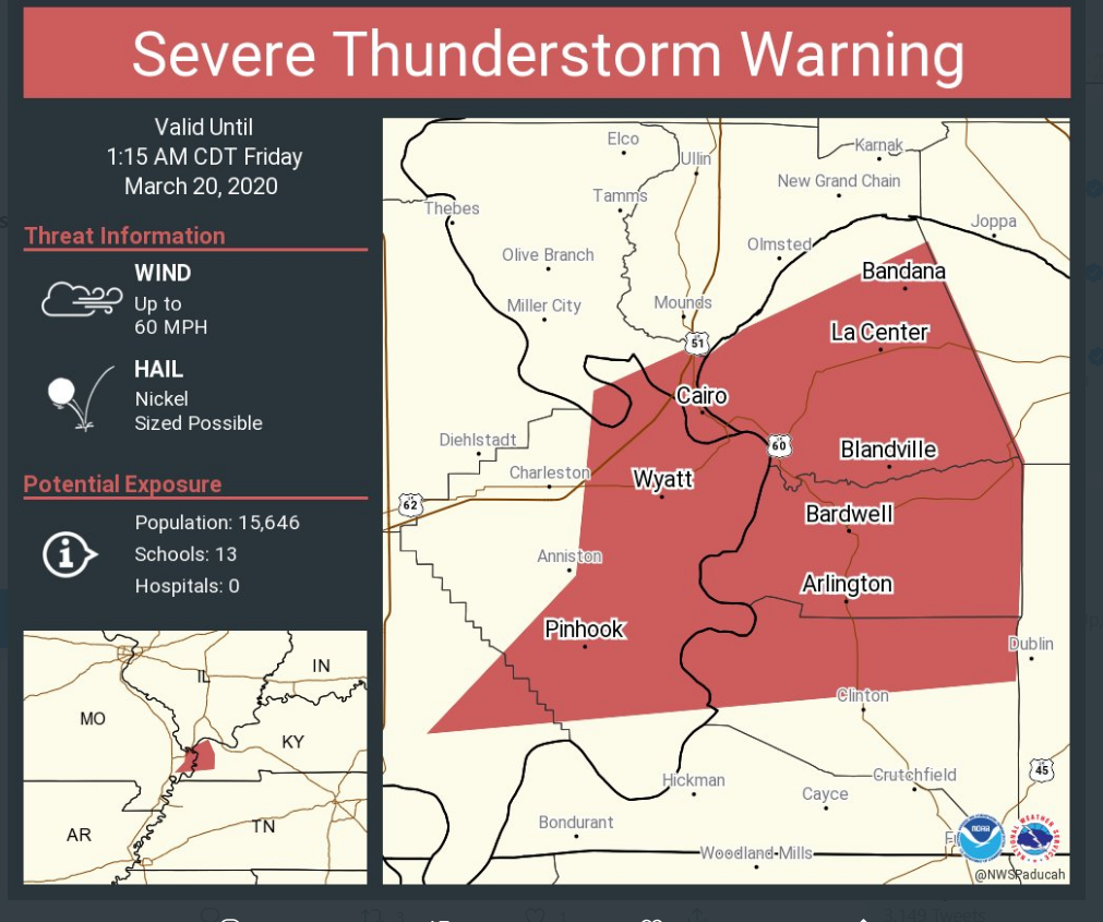
12:51 AM Ballard, Carlisle, Hickman, and Graves Counties. A line of severe thunderstorms is approaching from SE MO. This line is moving E NE at 55 mph.
There have been reports of 50+ mph winds with the line. Isolated gusts above 60 mph are possible.
There is also a tornado watch. A watch means to monitor updates. Occasionally, storms like this can produce short-lived tornadoes. Be storm aware until this line passes.
.
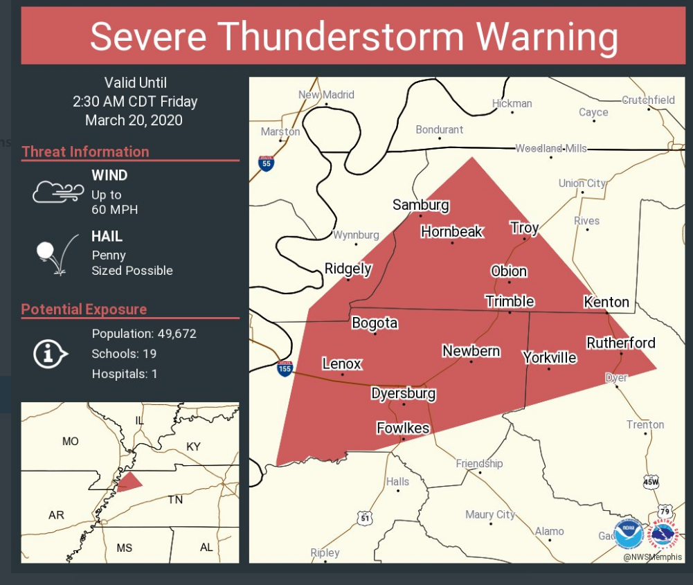
12:17 AM
Storm moving through northern Dunklin County could produce 60 mph wind gusts. It is moving NE at 55 mph and will exit the county within the next 15 minutes.
.
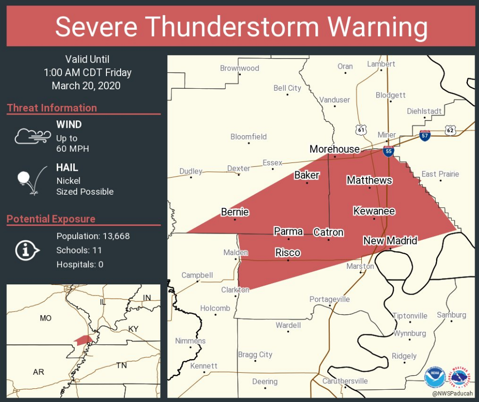
12:08 AM
Southern Stoddard, eastern Stoddard, New Madrid, southern Scott, Mississippi. Storms moving into Stoddard and New Madrid County have become severe.
Wind gusts above 60 mph are possible. Hail, as well.
There is a tornado watch so let’s be alert as these storms race off to the NE at 55 mph.
Radar http://weatherobservatory.com/radar_pbluff.htm
.
12:01 AM

.
11:55 PM
Live radar link http://weatherobservatory.com/radar_pbluff.htm
.
10:07 PM
.
.
9:52 PM
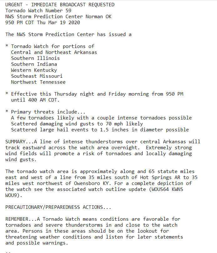
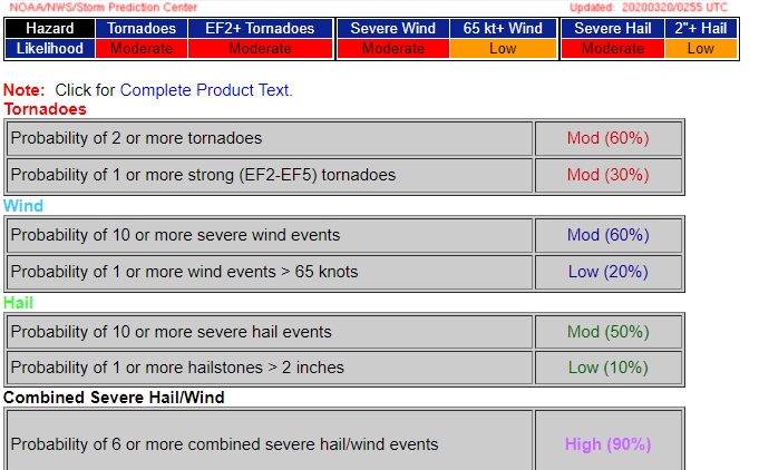
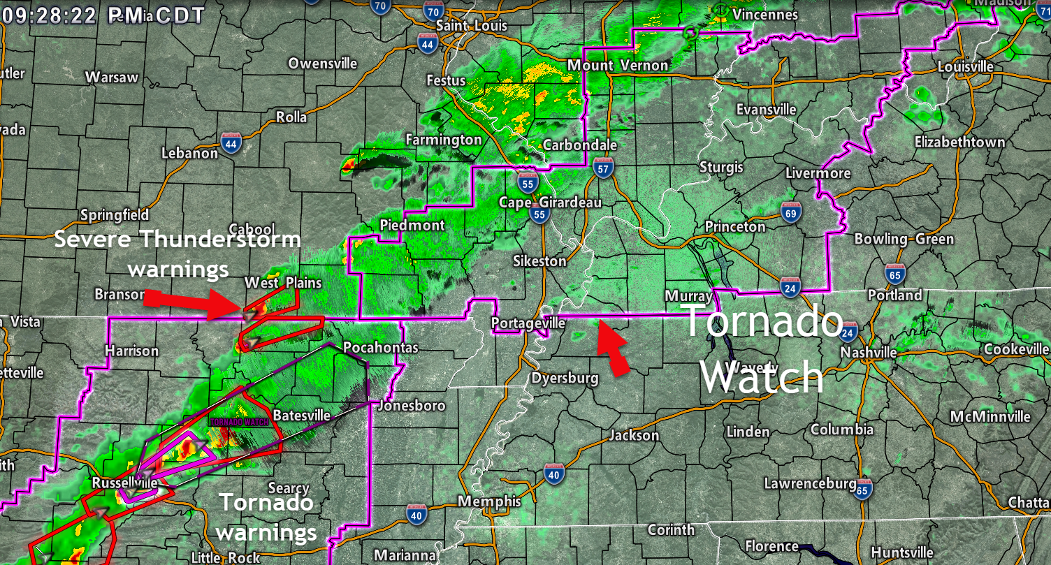
A new tornado watch has been issued until 4 am.
..
.
9:30 PM
Severe thunderstorms are moving northeast out of Arkansas and southern Missouri.
These are the storms to watch over the coming three to six hours.
8:43 PM
These storms will continue to move northeast through the overnight hours.

.
PREVIOUS POSTS HAVE BEEN MOVED TO ANOTHER PAGE
CLICK HERE TO VIEW THE ENTIRE EVENT
.
Radars
Interactive city-view radars
http://weatherobservatory.com/weather-radar.htm
A third backup radar
https://weathertalk.com/morani
Clickable watches and warnings can be viewed on the local city-view interactive radars (link above). Be sure and turn on the warnings above the local radars.
A new regional radar we offer
https://imagery.weathertalk.com/prx/RadarLoop.mp4
Lightning data
https://wtalk.co/7QT7WHKU
Not receiving app/text messages?
USE THE APP. ATT and Verizon are slowing or stopping the text messages.
Make sure you have the correct app/text options turned on. Find those under the personal notification settings tab at www.weathertalk.com. Red is off. Green is on.
Subscribers, PLEASE USE THE APP. ATT and Verizon are not reliable during severe weather. They are delaying text messages.
The app is under WeatherTalk in the app store.

Apple users click here

Android users click here
.

Live lightning data: Click here.