

.
I have some question-and-answer threads over on the Facebook page. Link to those threads CLICK HERE
Or email me at beaudodsonweather@gmail.com
I will be participating in this year’s Dancing With The Stars in Paducah.
I am looking for donations and sponsorships.
You can buy a table at this link and/or donate (you don’t need to buy a table to donate).
More information at this link. CLICK HERE

.

🌪️ Seven-Day Tornado Outlook ⛈️
March 10th through March 16th
Current risk: ISOLATED RISK
Current confidence level: LOW confidence that there will be tornadoes.
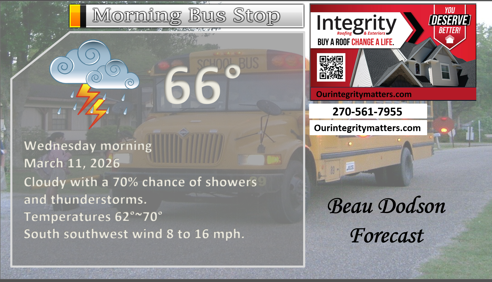
Comments: A few of the thunderstorms tonight and on Wednesday could be intense with strong winds, hail, and perhaps a tornado or two. The threat will likely peak late tonight into Wednesday.
At this time, the overall threat appears low, but not zero. A few severe weather warnings are certainly possible. Widespread severe weather is not anticipated at this time.
There will be some spin in the atmosphere. I will need to watch for an isolated quick spin-up of a tornado.
As always, monitor the most up-to-date information on your Beau Dodson Weather App.
.

Seven-Day Hazardous Weather Outlook
1. Is lightning in the forecast? YES. A chance of lightning today into tomorrow.
2. Are organized severe thunderstorms. POSSIBLE. A few of the storms could be intense today through Wednesday. Peak chances will be Tuesday night into Wednesday.
..3. Is significant or widespread flash flooding in the forecast? LOCALIZED. Locally heavy rain is likely in some areas. Some localized/isolated issues are possible.
4. Will non-thunderstorm winds top 40 mph? NO.
5. Will the temperature fall below 20 degrees? No.
6. Is the wind chill forecast to drop below ten degrees? No.
7. Is accumulating snow (one inch or more of snow) or ice in the forecast? NO.
.
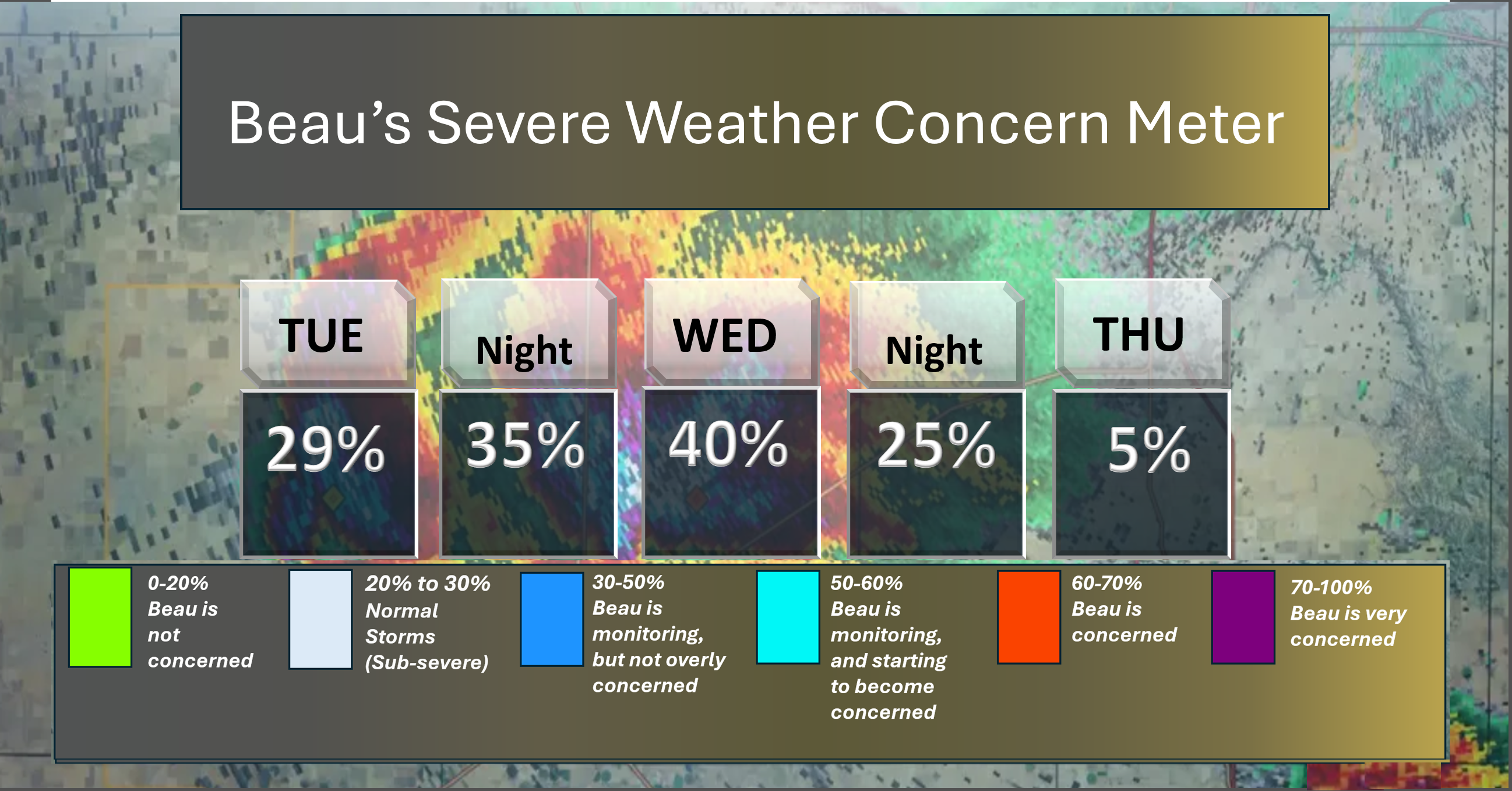
⛈️ Here is the short-range thunderstorm concern meter.
I am watching tonight and Wednesday for the threat of strong thunderstorms. Some storms could reach severe levels. Monitor updates.
.
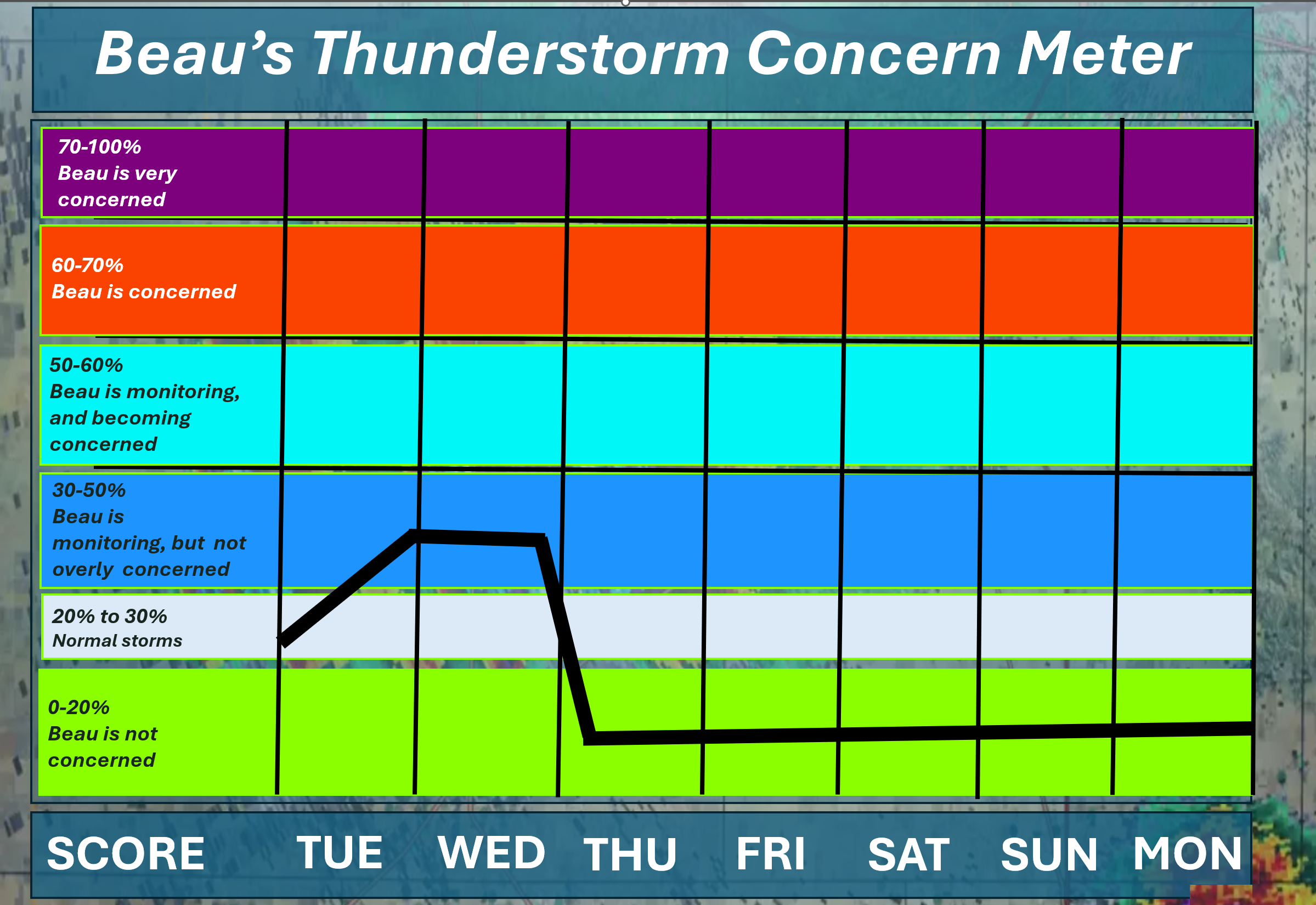
⛈️ Here is the extended thunderstorm concern meter.
I am monitoring tonight and tomorrow.
Overall, the risk is low at any given location. Not a zero risk. The main concern will be damaging wind and hail. A small chance of a tornado.
As always, monitor updates.
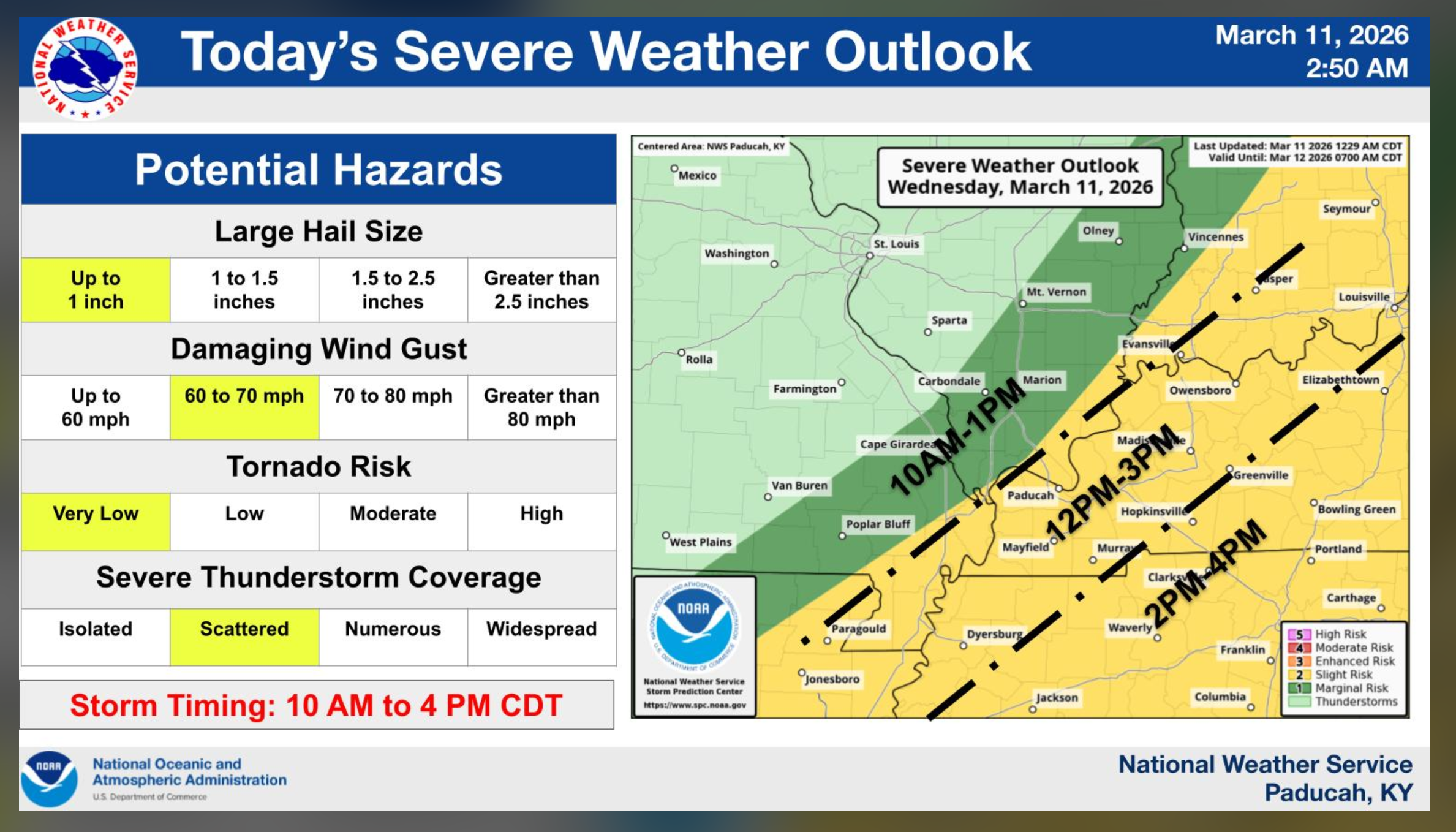
Severe Weather Outlook Graphics
This covers my far northwest counties of Ste Genevieve and Randolph.
See the next map for the rest of our region.
.
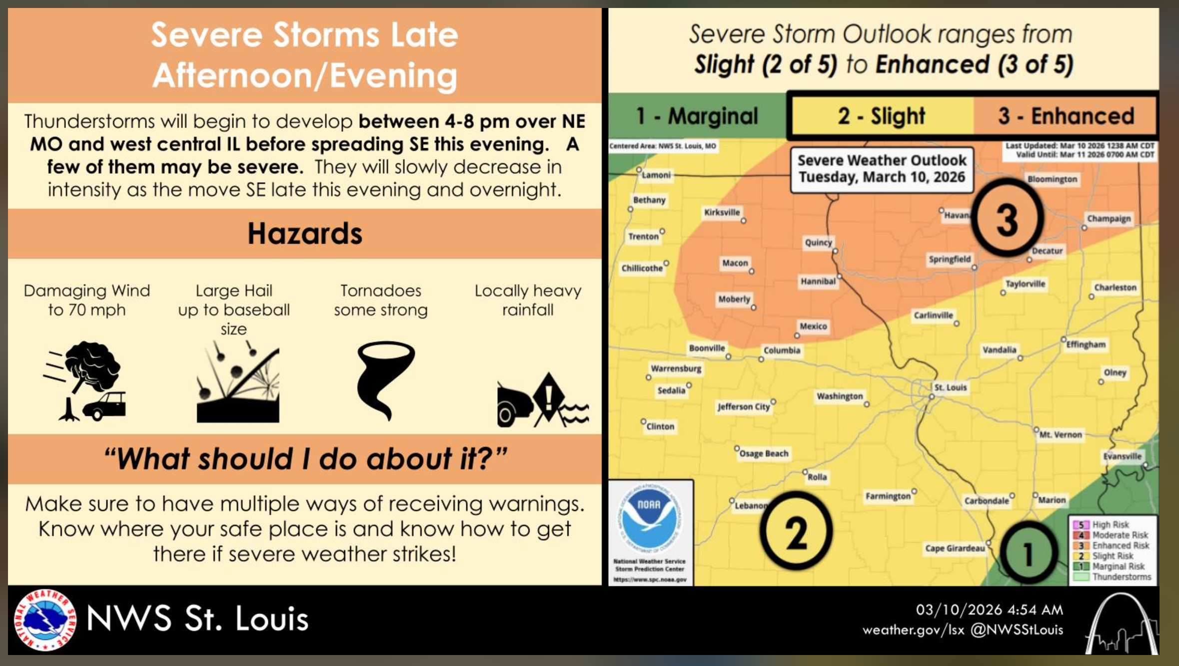
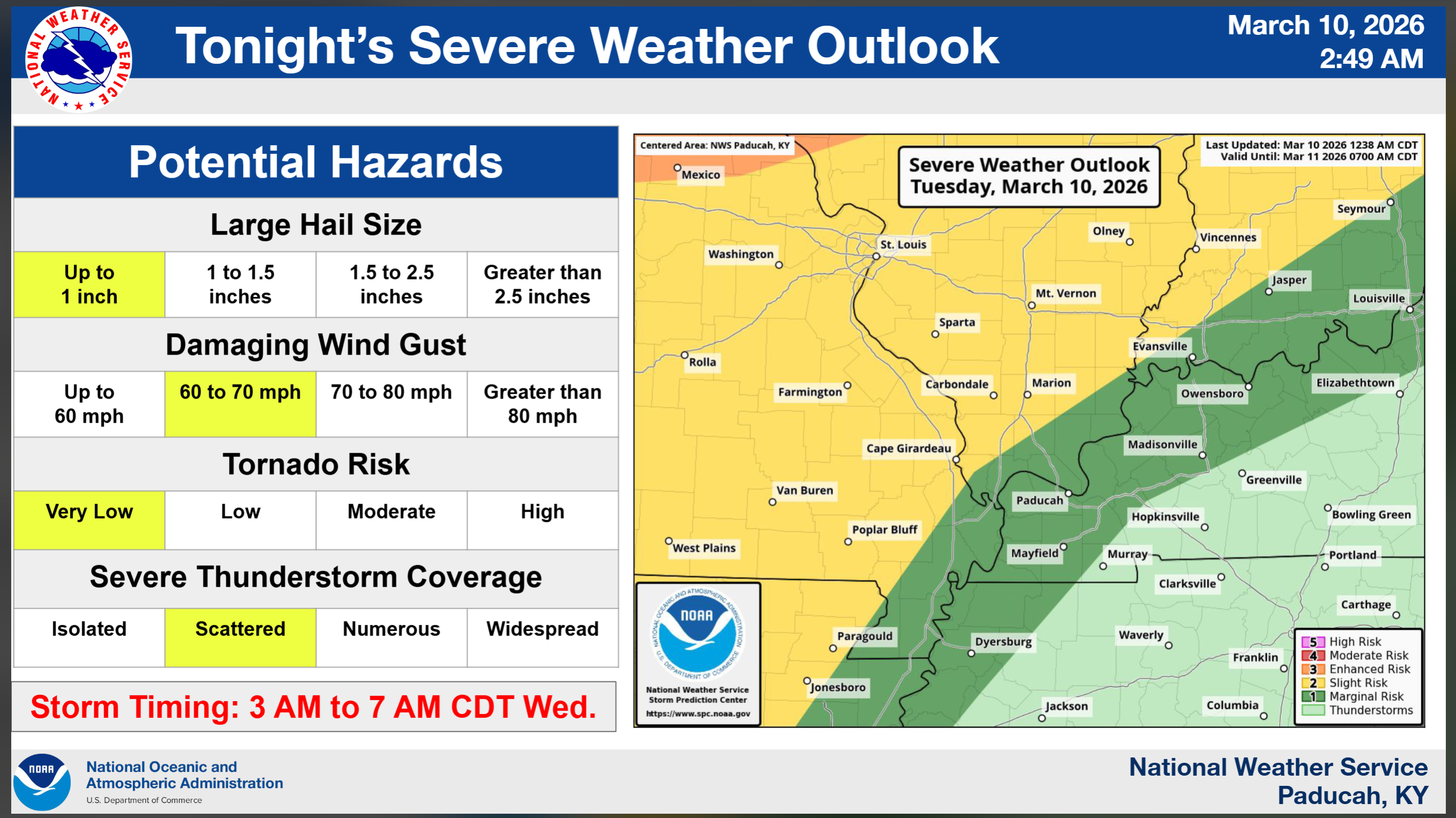
Tonight (Tuesday night)
.
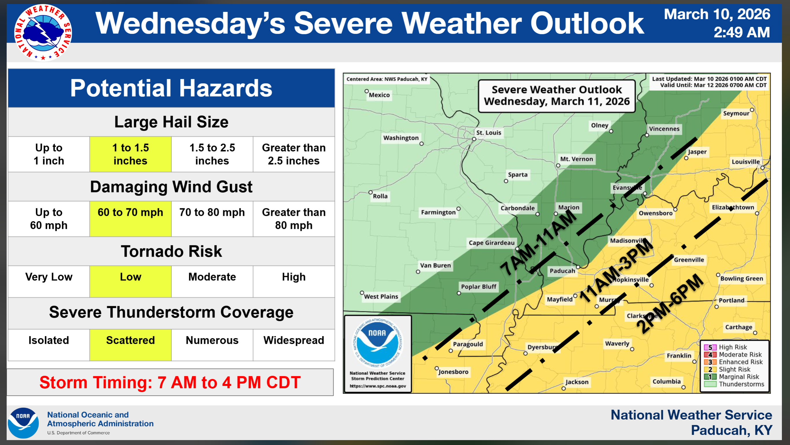
Wednesday’s threat zone.
.
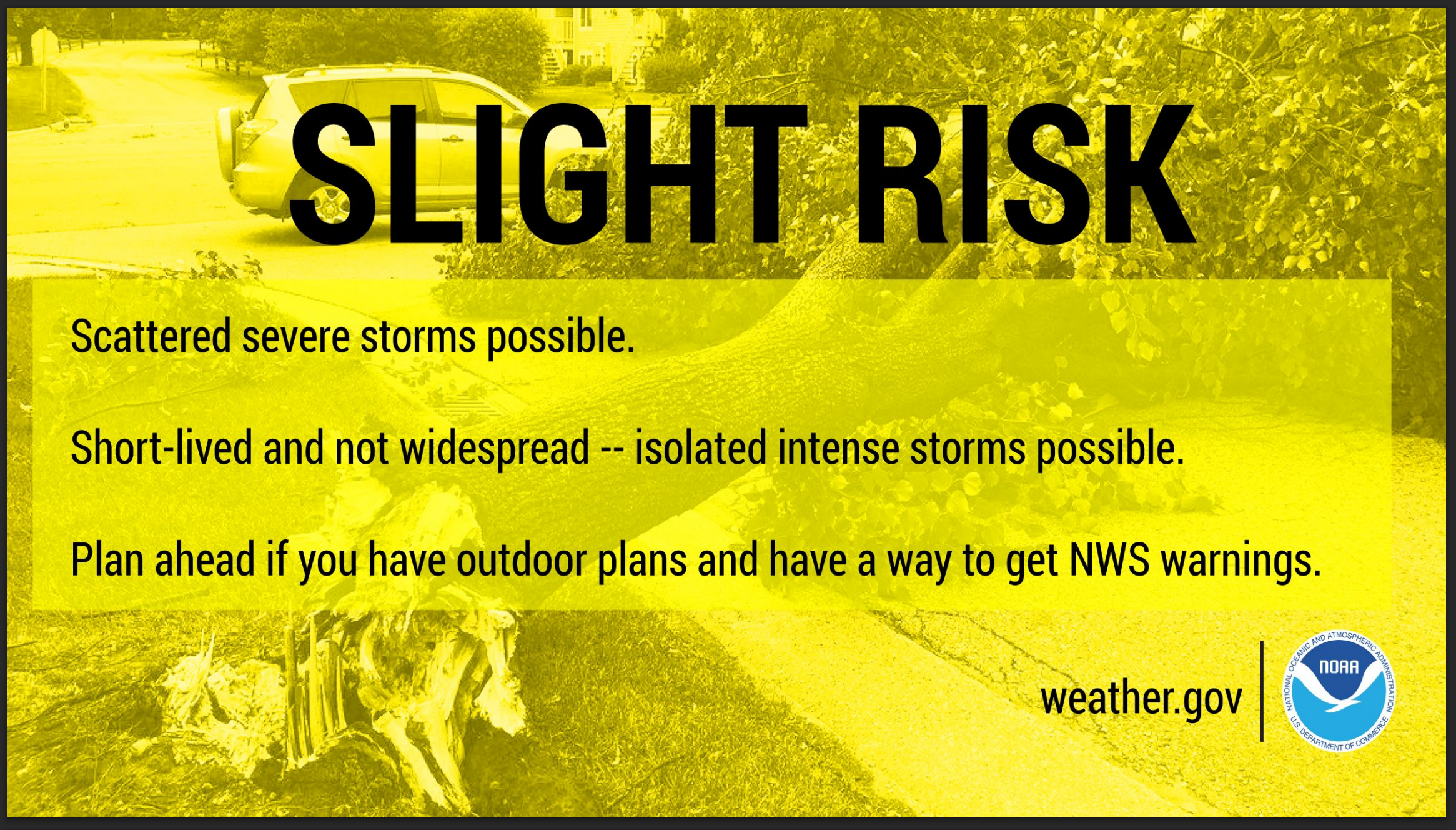
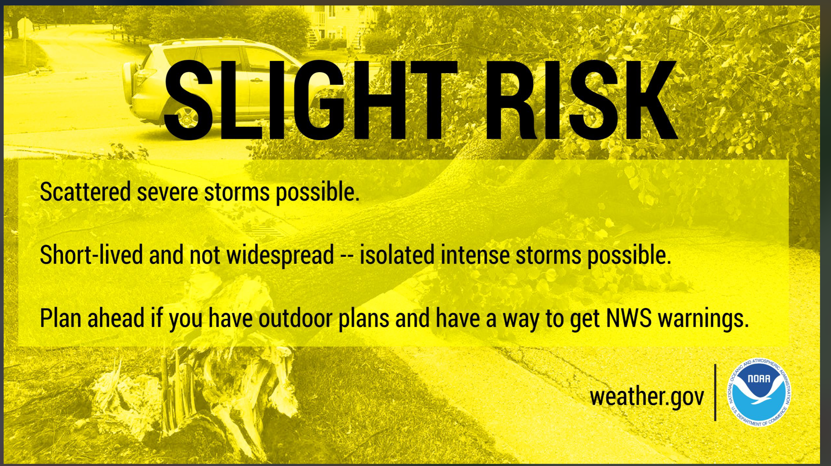
What does a slight risk mean?
.


.
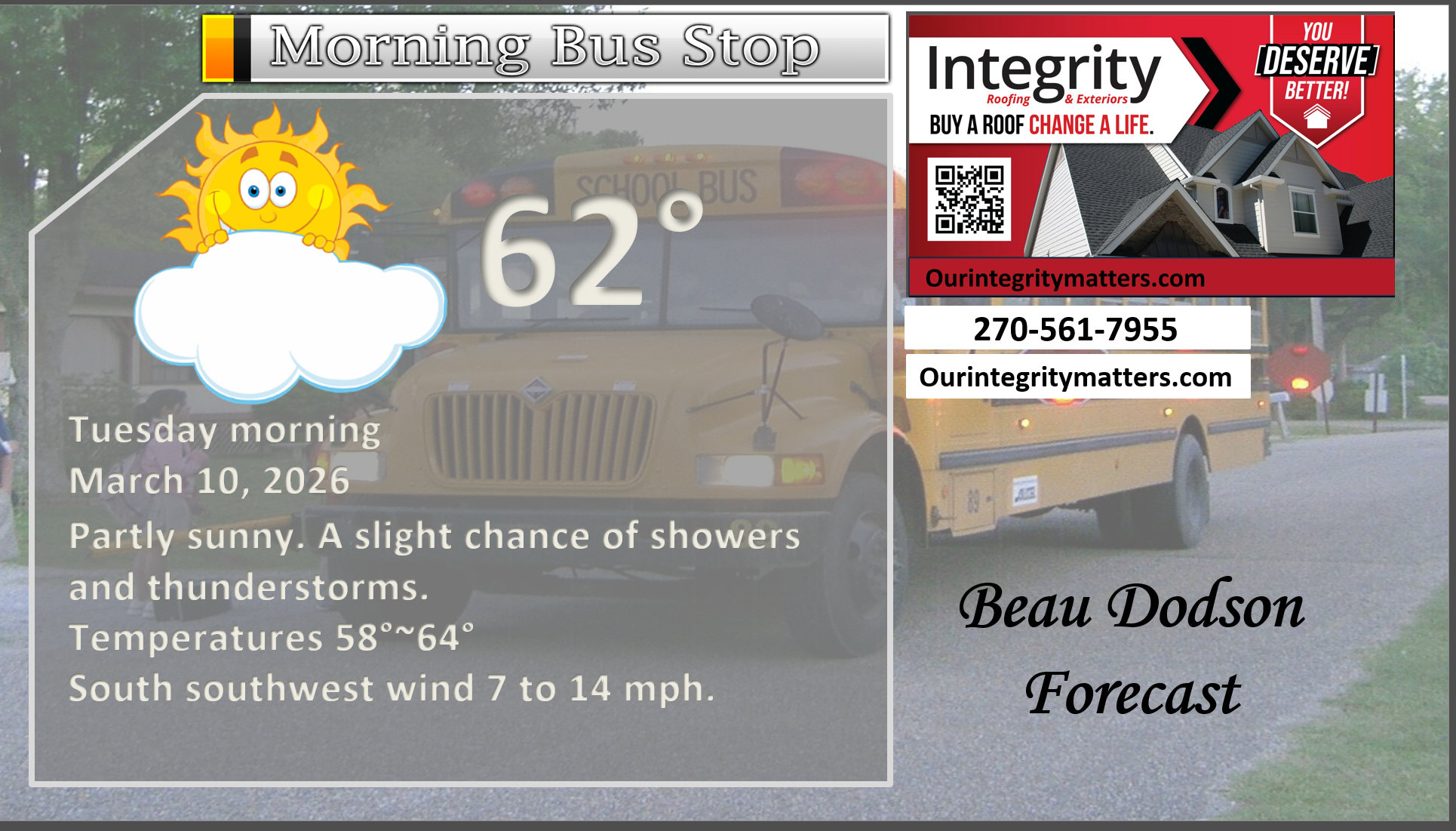
Here is your bus stop forecast
.
.
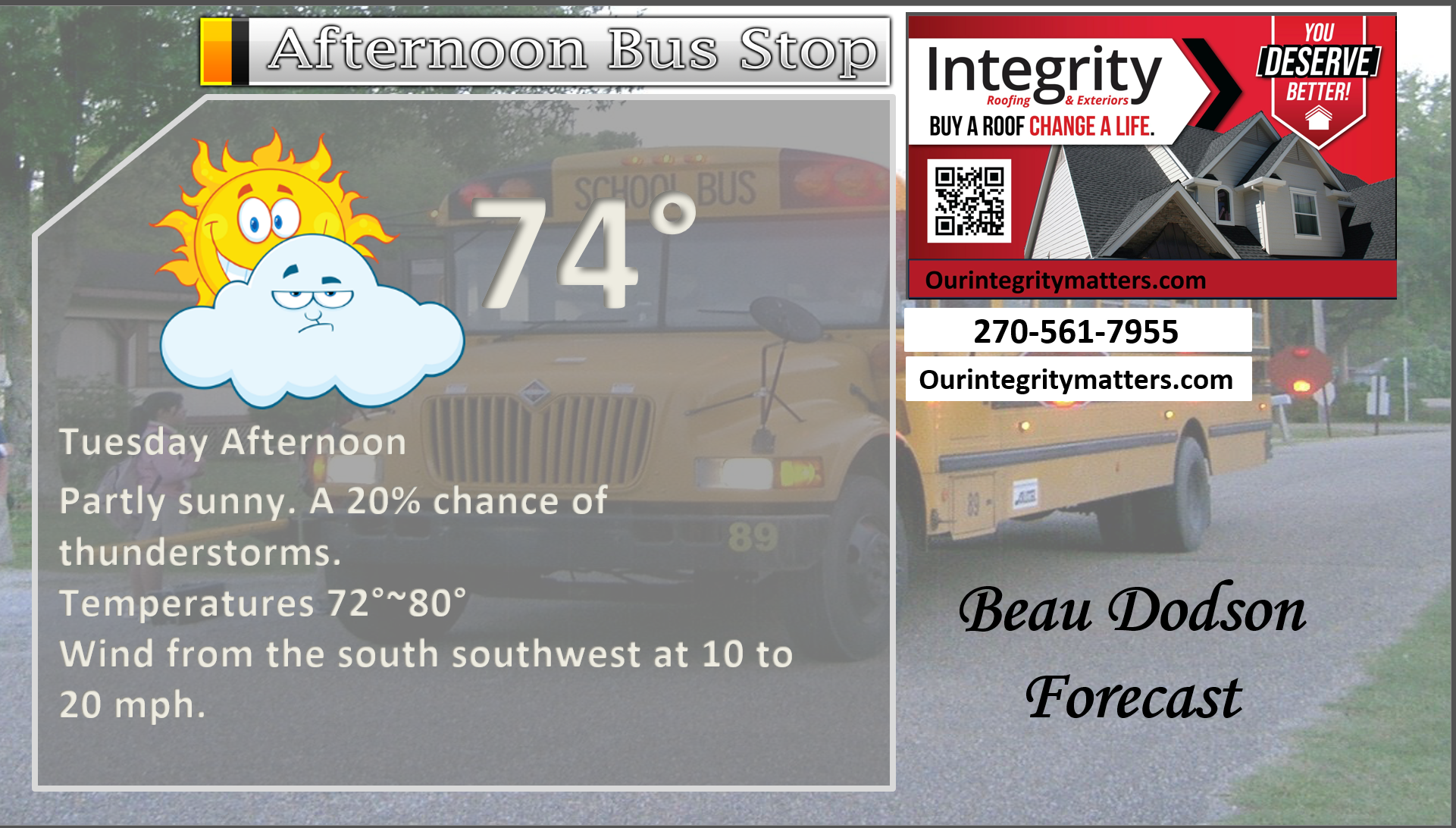
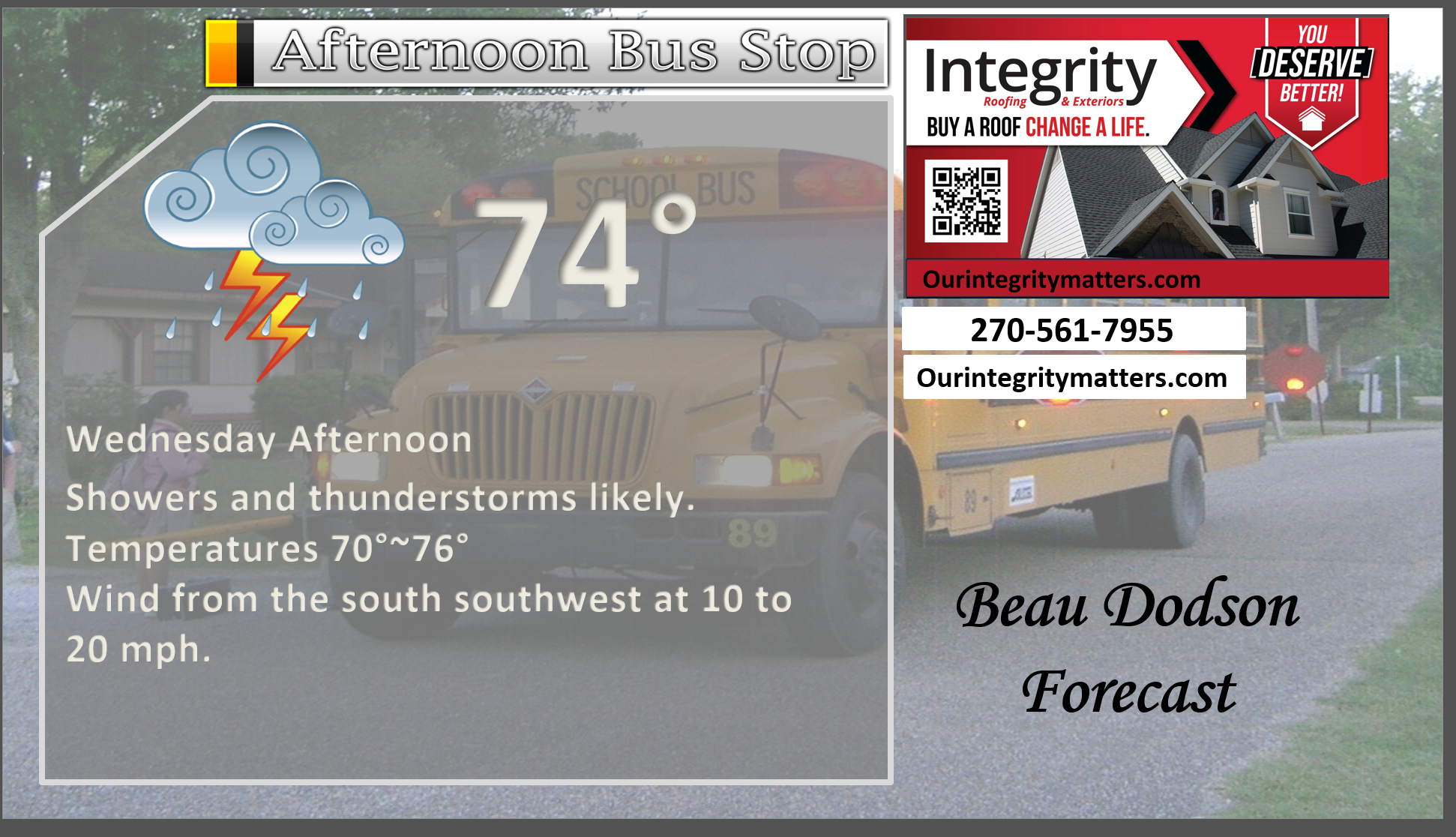
This afternoon
.
Tomorrow morning
Tomorrow afternoon
.


Forecast discussion
- A warm day ahead of us. Breezy, at times.
- A windy week ahead of us.
- Today will be mild.
- Storms are likely tonight into Wednesday. Coverage may be higher on Wednesday vs tonight.
- A few of the storms could be severe on tonight into Wednesday. Monitor updates.
- Cooler by the weekend.
.
 .
.
.
What is the primary weather concern today and tonight?
Showers and thunderstorms will return to the forecast tonight and tomorrow.
A small chance of thunderstorms this afternoon. There is a strong CAP, so storms may not form this afternoon. If so, they would hold off until late tonight and Wednesday.
Storms could be intense tonight and tomorrow. We are in a risk for a few of the thunderstorms to become severe with high wind gusts and hail. A low end isolated tornado threat.
Monitor your Beau Dodson Weather App.
Live radar links
Interactive-city-view radars. Clickable watches and warnings.
https://wtalk.co/B3XHASFZ
Old legacy radar site (some of you like it better)
https://weatherobservatory.com/weather-radar.htm
.
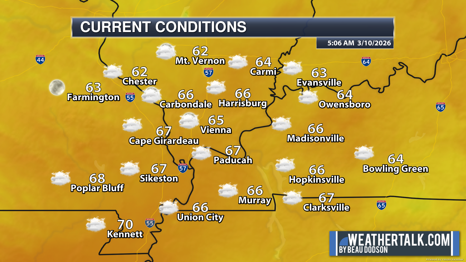
These were the 5 am temperatures this morning.
A mild morning.
.
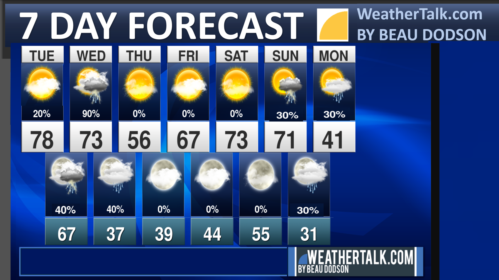
Seven-day outlook graphic.
See the video and graphics below for more details specific to your county. This is a broad-brush overview of the entire region.
.
Today through Thursday
Today will be mild. Isolated thunderstorms are possible this afternoon. There is a warm layer of air aloft. This is called a CAP. Think of a CAP as a lid on the atmosphere. Air parcels can’t rise. They attempt to rise and fall back to Earth. This lid can prevent thunderstorms from forming. At least until a strong lift arrives.
That strong lift would be the cold front. Cold fronts act like bulldozers, pushing the air ahead of them. This push is rising air. That can break the CAP.
More likely will be increasing chances for thunderstorms late tonight and on Wednesday.
These storms could produce locally heavy downpours and lightning.
Chances of thunderstorms will increase tonight and on Wednesday. This is when the peak chances for thunderstorms arrive.
If storms do form, then the atmosphere will be somewhat unstable. This unstable atmosphere will offer up a chance for a few of the thunderstorms to become severe with high winds and hail. An isolated tornado risk, as well.
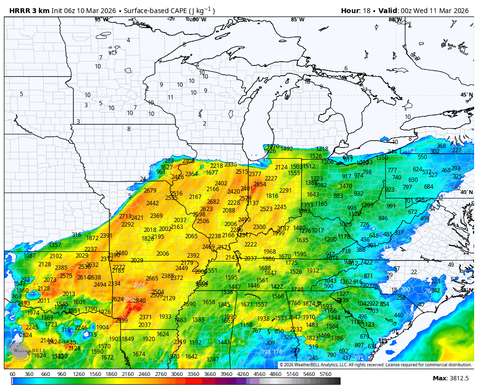
You can see the CAPE on this graphic. Think of CAPE as energy that thunderstorms tap into. The higher the CAPE, the higher the chance of severe weather.
This is the CAPE late Tuesday afternoon. Those are high numbers. There is a CAP, however. That will likely keep storms from forming during the time of peak CAPE values.
There will be some spin in the atmosphere over portions of this region.
Conditions are more favorable for supercells over central and northern Illinois. The CAP will be a bit lower there.
.
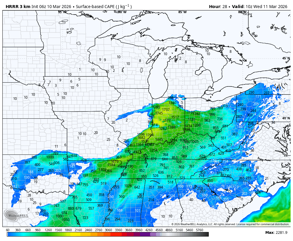
Now look at the CAPE for tomorrow morning. Notice how it wanes.
With that said, there is still enough CAPE to warrant some concern for severe weather.
.
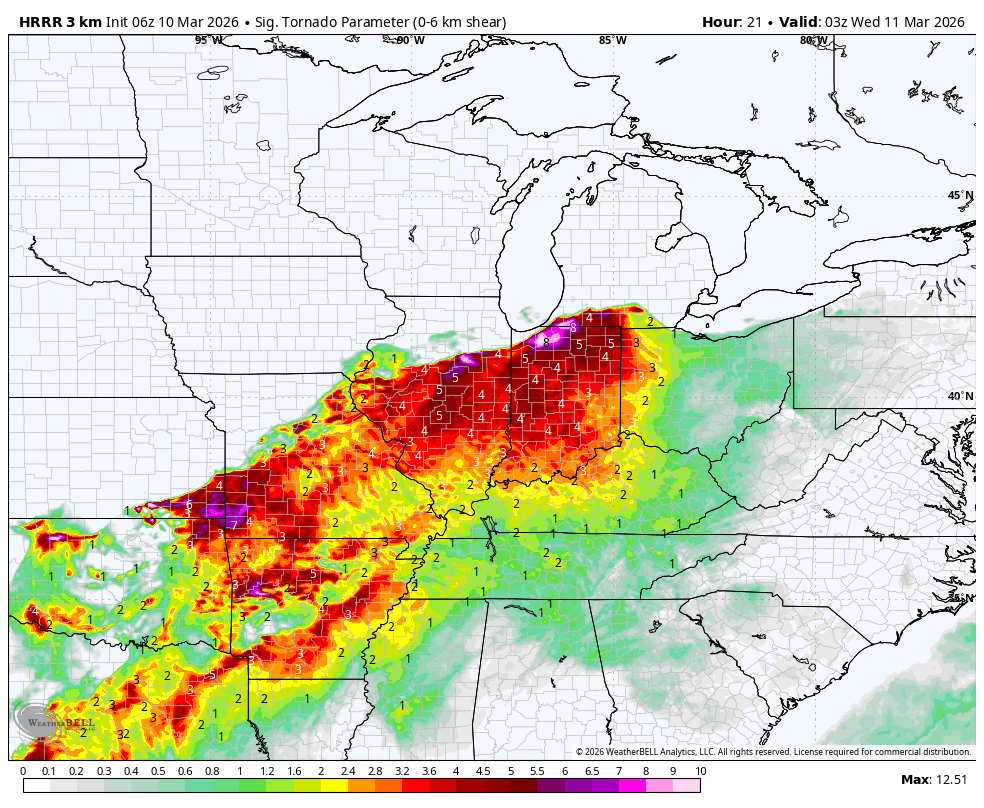
Here is the tornado parameter for Tuesday evening. Notice the high numbers near the warm front to our north.
That sharp color cutoff marks the location of the warm front. Northern Illinois.
These bright colors indicate where the atmospheric spin will be higher.
That is where the tornado risk will be higher. I will monitor our region.
.
Here is one of the high-resolution models for Tuesday afternoon. As you can see, it is dry in our local region.
Some supercells across northern Illinois. I bet there will be a lot of storm chasers up north.
.
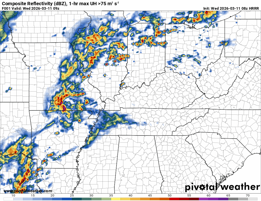
As we move into Wednesday morning (3 AM) there will be a line of thunderstorms moving into our region.
.
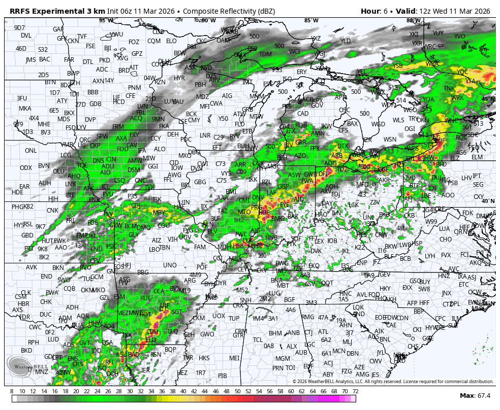
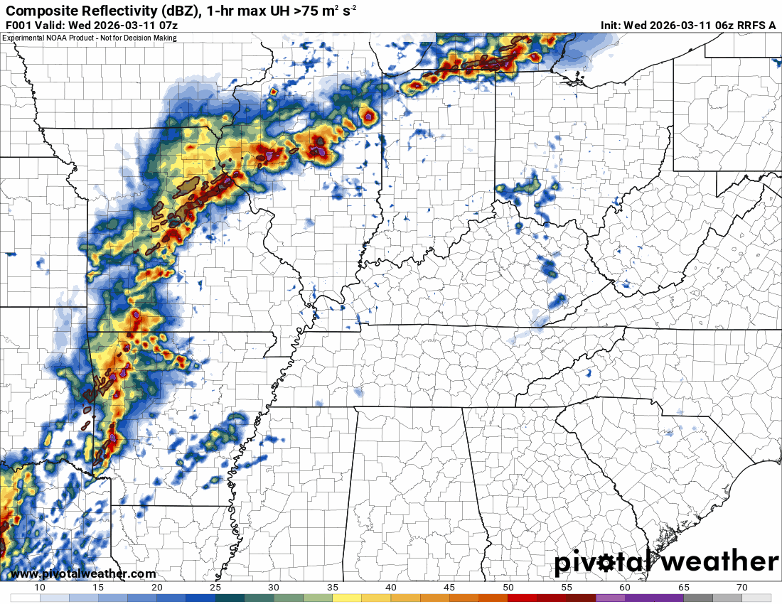
This next graphic is what the model believes the radar will look like at 6 AM tomorrow morning (Wednesday)
.
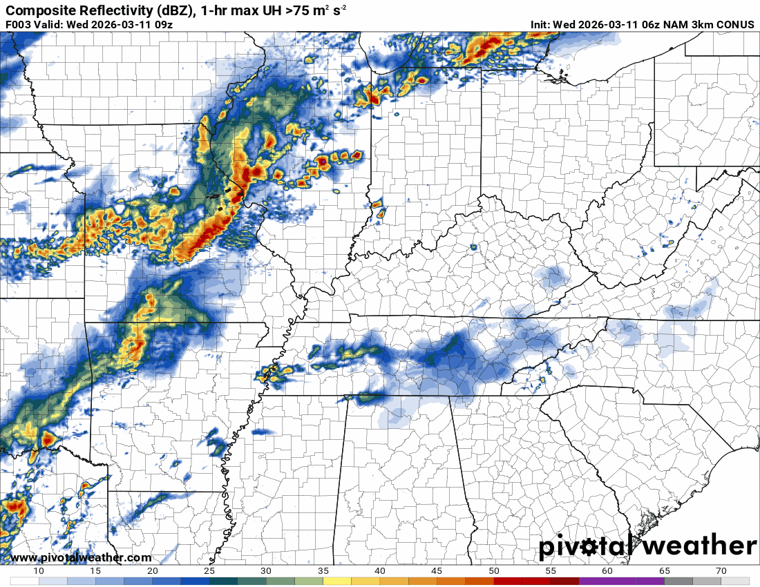
This next radar image is for 1 PM on Wednesday. You can see another line trying to form right on the cold front.
I will need to monitor Wednesday for the threat of a few of the thunderstorms becoming severe.
.
.
.
.
You can see where that model tracks the rotation. Check out the area to our north. That is concerning. Several tornadoes will be possible up there.
That is along the warm front.
As you can see, the spin tracks are fewer in our region.
.
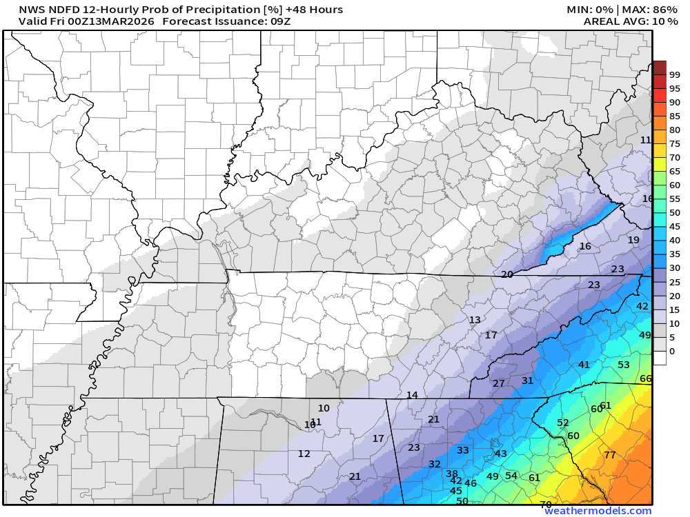
These graphics show the % chance of rain for each 12-hour period.
The daytime graphics will run from 7 AM to 7 PM.
The nighttime graphics will run from 7 PM to 7 AM.
.
Double-click on the images to enlarge them.
.
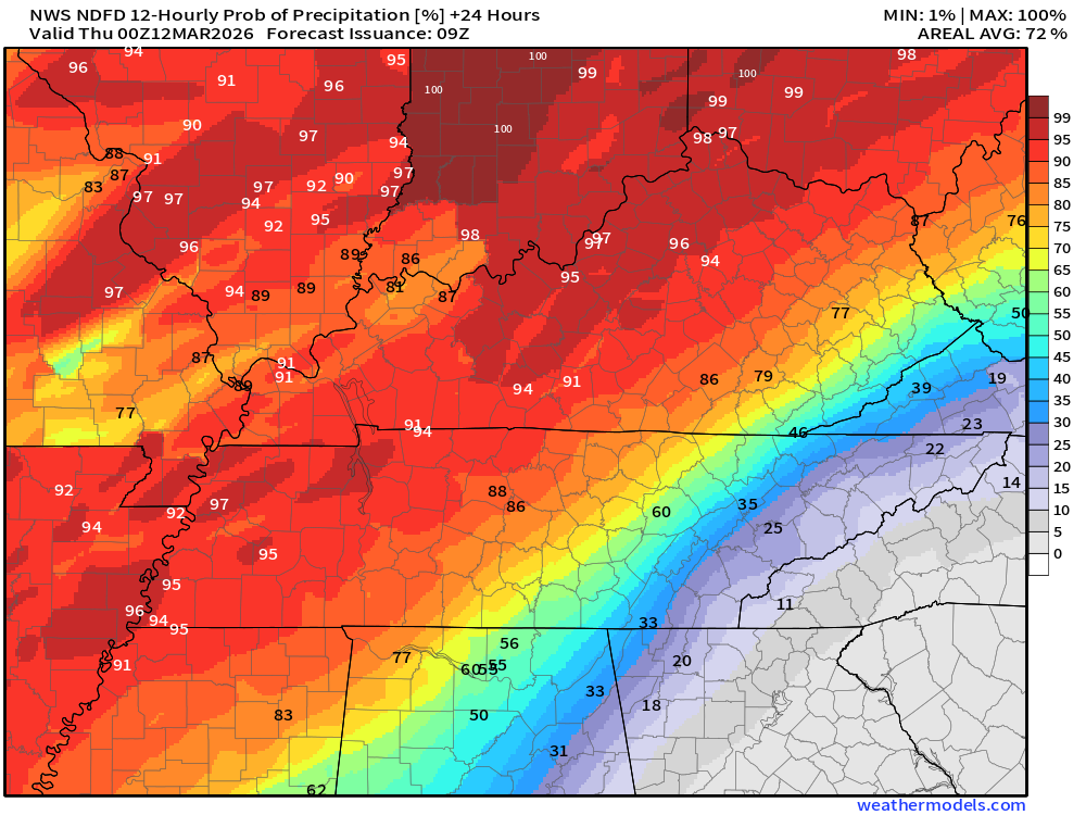
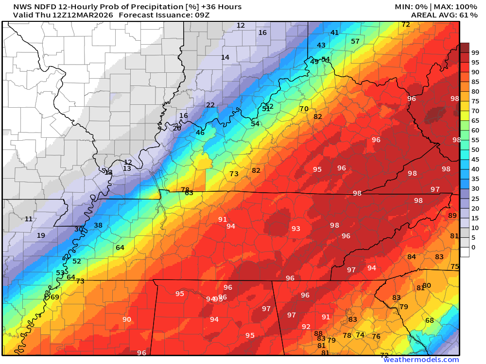
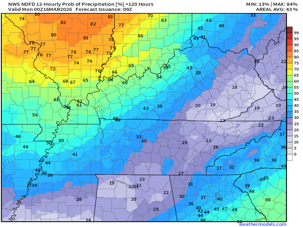
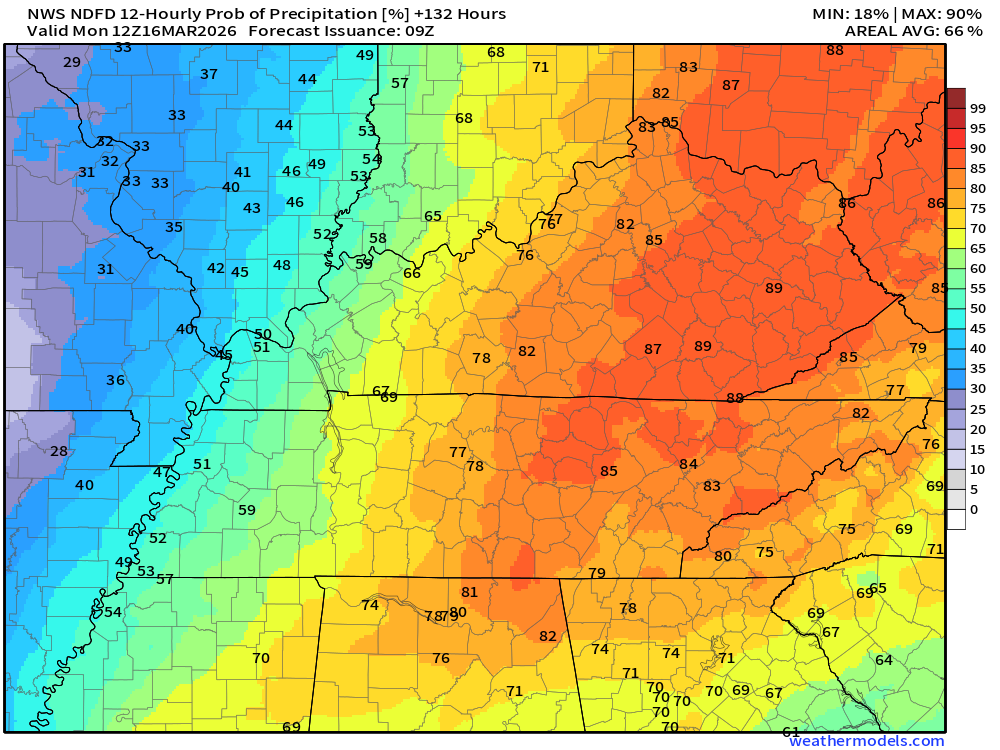
As you can see, the peak chances will be on tonight into Wednesday night.
Locally heavy rain will be possible in thunderstorms. Many areas will receive 0.40″ to 0.80″ of rain. Then, pockets of higher totals.
..
The rest of the region
.
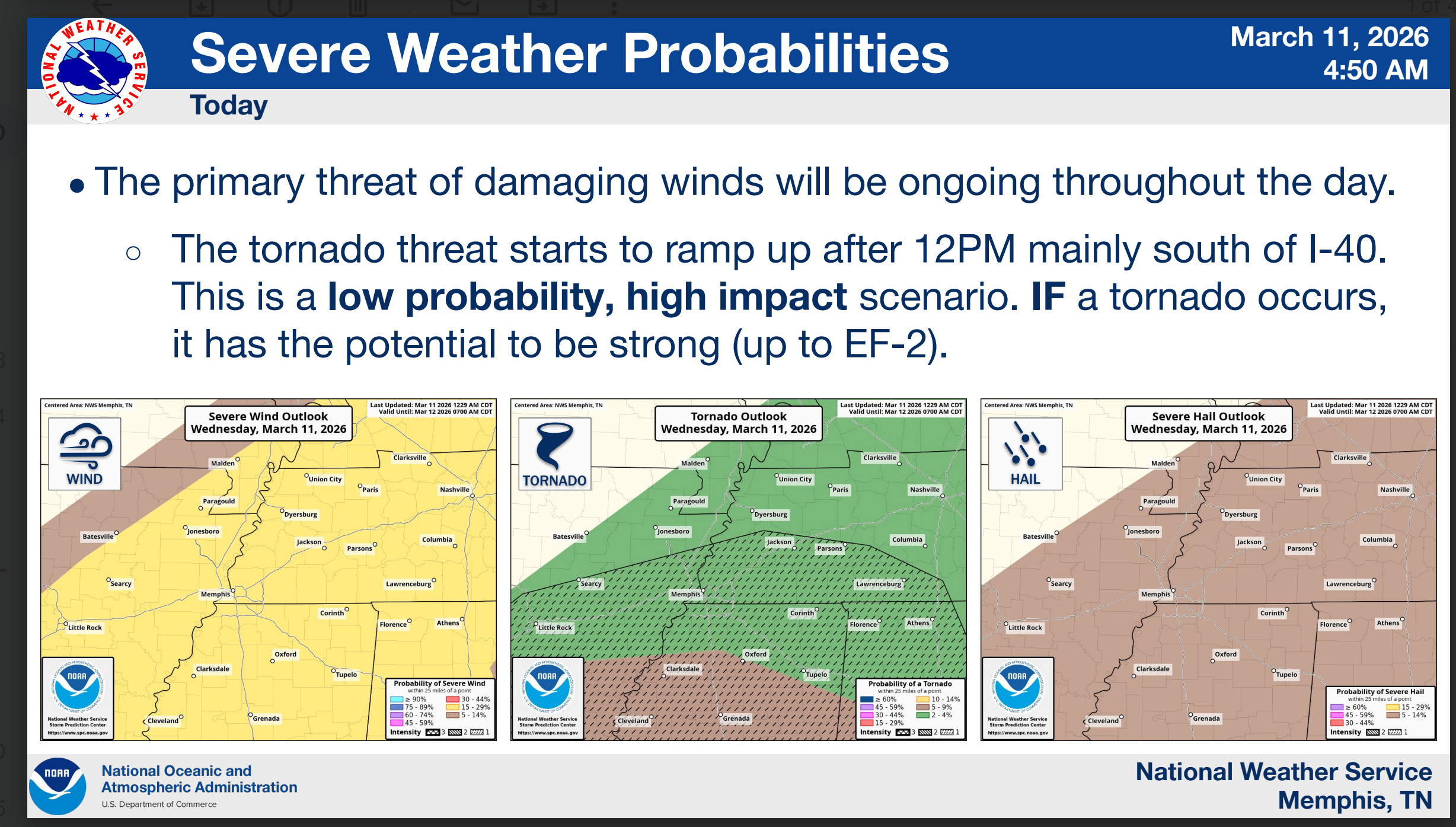
Let me show you the Storm Prediction Center’s (NOAA/NWS) severe weather outlooks.
Wednesday’s severe weather outlook.
The light green is where lightning is possible. The dark green is where a few storms could become severe with damaging wind and hail.
The yellow zone is a level two out of five risk. A slight risk of severe thunderstorms.
Remember, slight does not mean there won’t be severe storms. It means the severe activity is likely to be sporadic.
Southern Counties
.

.
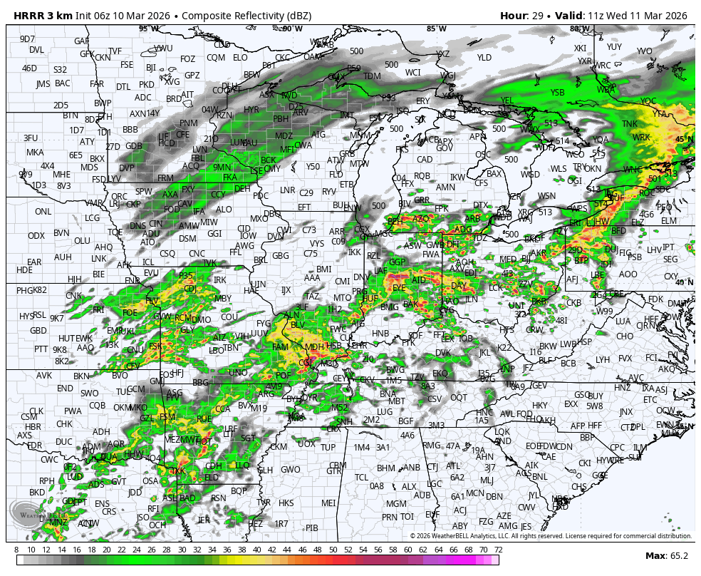
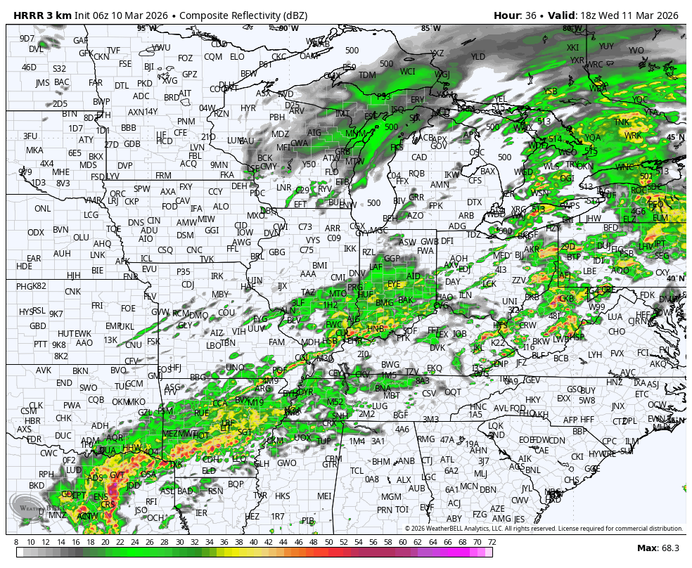
The timestamp (upper left) is in Zulu. 12z=7 am. 18z=1 pm. 00z=7 pm.
Double-click the animation to enlarge it.
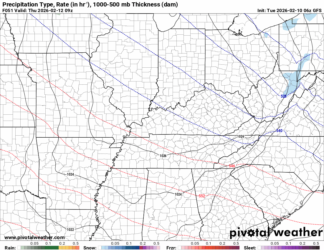
Green is rain. Yellow is moderate rain. Orange indicates locally heavy rain.
This model pops most of the storms east northeast of our region (on Thursday PM)
HRRR Model
.
.
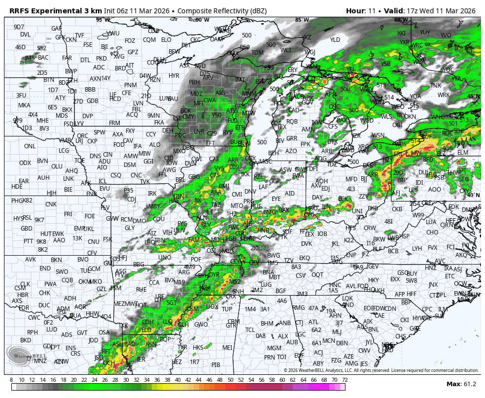
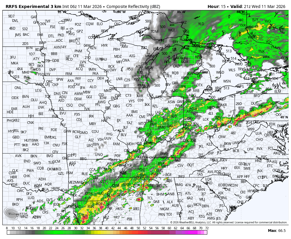
The timestamp (upper left) is in Zulu. 12z=7 am. 18z=1 pm. 00z=7 pm.
Double-click the animation to enlarge it.
Green is rain. Yellow is moderate rain. Orange indicates locally heavy rain.
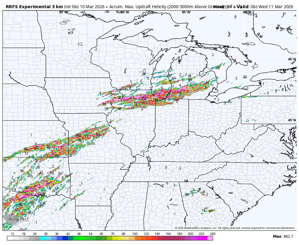
RRFSmodel
.
.
The timestamp (upper left) is in Zulu. 12z=7 am. 18z=1 pm. 00z=7 pm.
Double-click the animation to enlarge it.
Green is rain. Yellow is moderate rain. Orange indicates locally heavy rain.
NAM 3K model
.
..
.
Click here if you would like to return to the top of the page.
.Average high temperatures for this time of the year are around 54 degrees.
Average low temperatures for this time of the year are around 35 degrees.
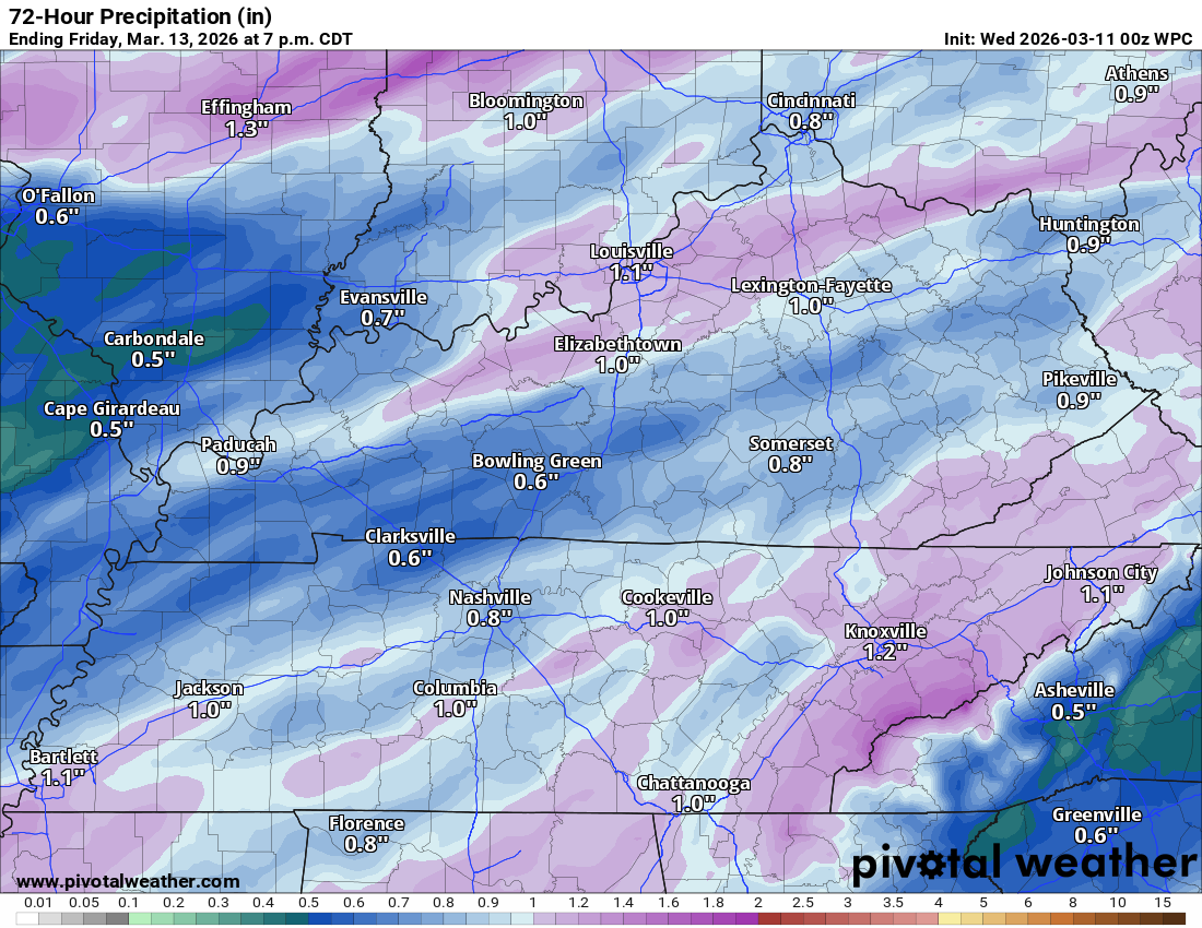
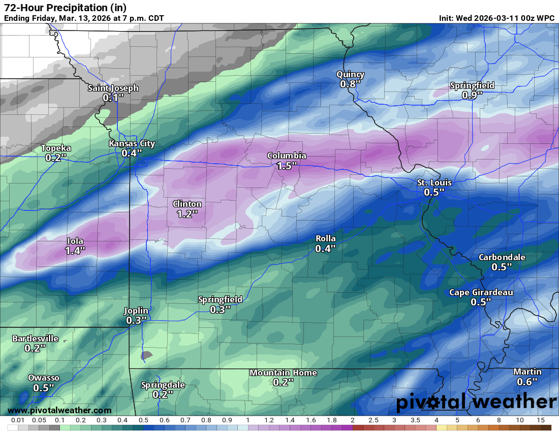
Average precipitation during this time period ranges from 0.80″ to 1.20″
Six to Ten Day Outlook.
Blue is below average. Red is above average. The no color zone represents equal chances.
Average highs for this time of the year are in the lower 60s. Average lows for this time of the year are in the lower 40s.

Green is above average precipitation. Yellow and brown favors below-average precipitation. Average precipitation for this time of the year is around one inch per week.

.

Average low temperatures for this time of the year are around 36 degrees.
Average precipitation during this time period ranges from 0.80″ to 1.20″
.
Eight to Fourteen Day Outlook.
Blue is below average. Red is above average. The no color zone represents equal chances.

Green is above average precipitation. Yellow and brown favors below average precipitation. Average precipitation for this time of the year is around one inch per week.

.
.
.
We have a new service to complement your www.weathertalk.com subscription. This does NOT replace www.weathertalk.com It is simply another tool for you to receive severe weather information.
.
https://weathercallservices.com/beau-dodson-weather


Want to receive the daily forecast/other products on your Beau Dodson Weather app?
Did you know you have four options in your www.weathertalk.com account
You will then receive these via your Beau Dodson Weather app.
Just log into your www.weathertalk.com account
Click the NOTIFICATION SETTINGS TAB
Then, turn them on (green) and off (red)
🌪️ Number 1 is the most important one. Severe alerts, tornado alerts, and so on.
Number 2 is the daily video, blog, livestream alerts, and severe weather Facebook threads on severe days or winter storm days.
Number 3 is the daily forecast. I send that out every day during the afternoon hours. It is the seven-day forecast, hazardous weather outlook, fire outlook, and more.
Number 4 is to receive the daily video, blog, and other content on NON-severe weather days (every day without severe threats in other words)
GREEN IS ON
RED IS OFF

I am going to start going live during bigger severe weather events.
Check it out here https://www.youtube.com/user/beaudodson
Click the subscribe button (it’s a free subscription button), and it will alert you when I go live. I will also send out alerts to the app when I go live for an event.

.

Radars and Lightning Data
Interactive-city-view radars. Clickable watches and warnings.
https://wtalk.co/B3XHASFZ
Old legacy radar site (some of you like it better)
https://weatherobservatory.com/weather-radar.htm
If the radar is not updating then try another one. If a radar does not appear to be refreshing then hit Ctrl F5. You may also try restarting your browser.
Backup radar site in case the above one is not working.
https://weathertalk.com/morani
Regional Radar
https://imagery.weathertalk.com/prx/RadarLoop.mp4
** NEW ** Zoom radar with chaser tracking abilities!
ZoomRadar
If the radar is not working, then email me: Email me at beaudodson@usawx.com
.
We do have some sponsors! Check them out.
Roof damage from recent storms? Link – Click here
INTEGRITY ROOFING AND EXTERIORS!
⛈️ Roof or gutter damage from recent storms? Today’s weather is sponsored by Integrity Roofing. Check out their website at this link https://www.ourintegritymatters.com/

![]()
![]()
![]()
Make sure you have three to five ways of receiving your severe weather information.
Weather Talk is one of those ways! Now, I have another product for you and your family.

.
Want to add more products to your Beau Dodson Weather App?
Receive daily videos, weather blog updates on normal weather days and severe weather and winter storm days, your county by county weather forecast, and more!
Here is how to do add those additional products to your app notification settings!
Here is a video on how to update your Beau Dodson Weather payment.
The app is for subscribers. Subscribe at www.weathertalk.com/welcome then go to your app store and search for WeatherTalk
Subscribers, PLEASE USE THE APP. ATT and Verizon are not reliable during severe weather. They are delaying text messages.
The app is under WeatherTalk in the app store.

Apple users click here

Android users click here
.
Radars and Lightning Data
Interactive-city-view radars. Clickable watches and warnings.
https://wtalk.co/B3XHASFZ
Old legacy radar site (some of you like it better)
https://weatherobservatory.com/weather-radar.htm
If the radar is not updating then try another one. If a radar does not appear to be refreshing then hit Ctrl F5. You may also try restarting your browser.
Backup radar site in case the above one is not working.
https://weathertalk.com/morani
Regional Radar
https://imagery.weathertalk.com/prx/RadarLoop.mp4
** NEW ** Zoom radar with chaser tracking abilities!
ZoomRadar
Lightning Data (zoom in and out of your local area)
https://wtalk.co/WJ3SN5UZ
Not working? Email me at beaudodson@usawx.com
National map of weather watches and warnings. Click here.
Storm Prediction Center. Click here.
Weather Prediction Center. Click here.
.

Live lightning data: Click here.
Real time lightning data (another one) https://map.blitzortung.org/#5.02/37.95/-86.99
Our new Zoom radar with storm chases
.
.

Interactive GOES R satellite. Track clouds. Click here.
GOES 16 slider tool. Click here.
College of DuPage satellites. Click here
.

Here are the latest local river stage forecast numbers Click Here.
Here are the latest lake stage forecast numbers for Kentucky Lake and Lake Barkley Click Here.
.
.
Find Beau on Facebook! Click the banner.


 .
.